Precision farming robots offer the potential to reduce the amount of used agrochemicals through targeted interventions and thus are a promising step towards sustainable agriculture. A prerequisite for such systems is a robust plant classification system that can identify crops and weeds in various agricultural fields. Most vision-based systems train convolutional neural networks (CNNs) on a given dataset, i.e., the source domain, to perform semantic segmentation of images. However, deploying these models on unseen fields, i.e., in the target domain, often shows a low generalization capability. Enhancing the generalization capability of CNNs is critical to increasing their performance on target domains with different operational conditions. In this letter, we present a domain generalized semantic segmentation approach for robust crop and weed detection by effectively extending and diversifying the source domain to achieve high performance across different agricultural field conditions. We propose to leverage unlabeled images captured from various agricultural fields during training in a two-step framework. First, we suggest a method to automatically compute sparse annotations and use them to present the model more plant varieties and growth stages to enhance its generalization capability. Among others, we exploit unlabeled images from fields containing crops sown in rows. Second, we propose a style transfer method that renders the source domain images in the style of images from various fields to achieve increased diversification. We conduct extensive experiments and show that we achieve superior performance in crop-weed segmentation across various fields compared to state-of-the-art methods.
Monitoring plants and fruits at high resolution play a key role in the future of agriculture. Accurate 3D information can pave the way to a diverse number of robotic applications in agriculture ranging from autonomous harvesting to precise yield estimation. Obtaining such 3D information is non-trivial as agricultural environments are often repetitive and cluttered, and one has to account for the partial observability of fruit and plants. In this paper, we address the problem of jointly estimating complete 3D shapes of fruit and their pose in a 3D multi-resolution map built by a mobile robot. To this end, we propose an online multi-resolution panoptic mapping system where regions of interest are represented with a higher resolution. We exploit data to learn a general fruit shape representation that we use at inference time together with an occlusion-aware differentiable rendering pipeline to complete partial fruit observations and estimate the 7 DoF pose of each fruit in the map. The experiments presented in this paper, evaluated both in the controlled environment and in a commercial greenhouse, show that our novel algorithm yields higher completion and pose estimation accuracy than existing methods, with an improvement of 41 % in completion accuracy and 52 % in pose estimation accuracy while keeping a low inference time of 0.6 s in average.
Robust localization in a given map is a crucial component of most autonomous robots. In this paper, we address the problem of localizing in an indoor environment that changes and where prominent structures have no correspondence in the map built at a different point in time. To overcome the discrepancy between the map and the observed environment caused by such changes, we exploit human-readable localization cues to assist localization. These cues are readily available in most facilities and can be detected using RGB camera images by utilizing text spotting. We integrate these cues into a Monte Carlo localization framework using a particle filter that operates on 2D LiDAR scans and camera data. By this, we provide a robust localization solution for environments with structural changes and dynamics by humans walking. We evaluate our localization framework on multiple challenging indoor scenarios in an office environment. The experiments suggest that our approach is robust to structural changes and can run on an onboard computer. We release an open source implementation of our approach 1 1 https://github.com/PRBonn/tmcl, which uses off-the-shelf text spotting, written in C++ with a ROS wrapper.
Simultaneous localization and mapping (SLAM) is a fundamental capability required by most autonomous systems. In this paper, we address the problem of loop closing for SLAM based on 3D laser scans recorded by autonomous cars. Our approach utilizes a deep neural network exploiting different cues generated from LiDAR data for finding loop closures. It estimates an image overlap generalized to range images and provides a relative yaw angle estimate between pairs of scans. Based on such predictions, we tackle loop closure detection and integrate our approach into an existing SLAM system to improve its mapping results. We evaluate our approach on sequences of the KITTI odometry benchmark and the Ford campus dataset. We show that our method can effectively detect loop closures surpassing the detection performance of state-of-the-art methods. To highlight the generalization capabilities of our approach, we evaluate our model on the Ford campus dataset while using only KITTI for training. The experiments show that the learned representation is able to provide reliable loop closure candidates, also in unseen environments.
Localization is a crucial capability for mobile robots and autonomous cars. In this paper, we address learning an observation model for Monte-Carlo localization using 3D LiDAR data. We propose a novel, neural network-based observation model that computes the expected overlap of two 3D LiDAR scans. The model predicts the overlap and yaw angle offset between the current sensor reading and virtual frames generated from a pre-built map. We integrate this observation model into a Monte-Carlo localization framework and tested it on urban datasets collected with a car in different seasons. The experiments presented in this paper illustrate that our method can reliably localize a vehicle in typical urban environments. We furthermore provide comparisons to a beam-endpoint and a histogram-based method indicating a superior global localization performance of our method with fewer particles.
Pose estimation and map building are central ingredients of autonomous robots and typically rely on the registration of sensor data. In this paper, we investigate a new metric for registering images that builds upon on the idea of the photometric error. Our approach combines a gradient orientation-based metric with a magnitude-dependent scaling term. We integrate both into stereo estimation as well as visual odometry systems and show clear benefits for typical disparity and direct image registration tasks when using our proposed metric. Our experimental evaluation indicats that our metric leads to more robust and more accurate estimates of the scene depth as well as camera trajectory. Thus, the metric improves camera pose estimation and in turn the mapping capabilities of mobile robots. We believe that a series of existing visual odometry and visual SLAM systems can benefit from the findings reported in this paper.
Localization is a pre-requisite for most autonomous robots. For example, to carry out precision agriculture tasks effectively, a robot must be able to localize itself accurately in crop fields. The crop field environment presents unique challenges such as the highly repetitive structure of the crops leading to visual aliasing as well as the continuously changing appearance of the field, which makes it difficult to localize over time. In this paper, we present a localization system, which uses an aerial map of the field and exploits the semantic information of the crops, weeds, and their stem positions to resolve the visual ambiguity problem and to enable robot localization over extended periods of time. We evaluate our approach on a real field over multiple sessions spanning several weeks. Experiments suggest that our approach provides the necessary accuracy required by precision agriculture applications and works in cases where current techniques using typical visual features tend to fail.
Continuous crop monitoring is an important aspect of precision agriculture and requires the registration of sensor data over longer periods of time. Often, fields are monitored using cameras mounted on unmanned aerial vehicles (UAVs) but strong changes in the visual appearance of the growing crops and the field itself poses serious challenges to conventional image registration methods. In this letter, we present a method for registering images of agricultural fields taken by an UAV over the crop season and present a complete pipeline for computing temporally aligned three-dimensional (3-D) point clouds of the field. Our approach exploits the inherent geometry of the crop arrangement in the field, which remains mostly static over time. This allows us to register the images even in the presence of strong visual changes. To this end, we propose a scale invariant, geometric feature descriptor that encodes the local plant arrangement geometry. The experiments suggest that we are able to register images taken over the crop season, including situations where matching with an off-the-shelf visual descriptor fails. We evaluate the accuracy of our matching system with respect to manually labeled ground truth. We furthermore illustrate that the reconstructed 3-D models are qualitatively correct and the registration results allow for monitoring growth parameters at a per plant level.
In grapevine research the acquisition of phenotypic data is largely restricted to the field due to its perennial nature and size. The methodologies used to assess morphological traits and phenology are mainly limited to visual scoring. Some measurements for biotic and abiotic stress, as well as for quality assessments, are done by invasive measures. The new evolving sensor technologies provide the opportunity to perform non-destructive evaluations of phenotypic traits using different field phenotyping platforms. One of the biggest technical challenges for field phenotyping of grapevines are the varying light conditions and the background. In the present study the Phenoliner is presented, which represents a novel type of a robust field phenotyping platform. The vehicle is based on a grape harvester following the concept of a moveable tunnel. The tunnel it is equipped with different sensor systems (RGB and NIR camera system, hyperspectral camera, RTK-GPS, orientation sensor) and an artificial broadband light source. It is independent from external light conditions and in combination with artificial background, the Phenoliner enables standardised acquisition of high-quality, geo-referenced sensor data.
We present a novel approach for dense 3-D cloud reconstruction above an area of 10 × 10 km2 using two hemispheric sky imagers with fisheye lenses in a stereo setup. We examine an epipolar rectification model designed for fisheye cameras, which allows the use of efficient out-of-the-box dense matching algorithms designed for classical pinhole-type cameras to search for correspondence information at every pixel. The resulting dense point cloud allows to recover a detailed and more complete cloud morphology compared to previous approaches that employed sparse feature-based stereo or assumed geometric constraints on the cloud field. Our approach is very efficient and can be fully automated. From the obtained 3-D shapes, cloud dynamics, size, motion, type and spacing can be derived, and used for radiation closure under cloudy conditions, for example. Fisheye lenses follow a different projection function than classical pinhole-type cameras and provide a large field of view with a single image. However, the computation of dense 3-D information is more complicated and standard implementations for dense 3-D stereo reconstruction cannot be easily applied. Together with an appropriate camera calibration, which includes internal camera geometry, global position and orientation of the stereo camera pair, we use the correspondence information from the stereo matching for dense 3-D stereo reconstruction of clouds located around the cameras. We implement and evaluate the proposed approach using real world data and present two case studies. In the first case, we validate the quality and accuracy of the method by comparing the stereo reconstruction of a stratocumulus layer with reflectivity observations measured by a cloud radar and the cloud-base height estimated from a Lidar-ceilometer. The second case analyzes a rapid cumulus evolution in the presence of strong wind shear.
This paper presents a concept and first experiments on a keyframe-based incremental bundle adjustment for real-time structure and motion estimation in an unknown scene. In order to avoid periodic batch steps, we use the software iSAM2 for sparse nonlinear incremental optimization, which is highly efficient through incremental variable reordering and fluid relinearization. We adapted the software to allow for (1) multi-view cameras by taking the rigid transformation between the cameras into account, (2) omnidirectional cameras as it can handle arbitrary bundles of rays and (3) scene points at infinity, which improve the estimation of the camera orientation as points at the horizon can be observed over long periods of time. The real-time bundle adjustment refers to sets of keyframes, consisting of frames, one per camera, taken in a synchronized way, that are initiated if a minimal geometric distance to the last keyframe set is exceeded. It uses interest points in the keyframes as observations, which are tracked in the synchronized video streams of the individual cameras and matched across the cameras, if possible. First experiments show the potential of the incremental bundle adjustment w.r.t. time requirements. Our experiments are based on a multi-camera system with four fisheye cameras, which are mounted on a UAV as two stereo pairs, one looking ahead and one looking backwards, providing a large field of view.
Reliably perceiving obstacles and avoiding collisions is key for the fully autonomous application of micro aerial vehicles (MAVs), Limiting factors for increasing autonomy and complexity of MAVs are limited onboard sensing and limited onboard processing power. In this paper, we propose a complete system with a multimodal sensor setup for omnidirectional obstacle perception. We developed a lightweight 3D laser scanner and visual obstacle detection using wide-angle stereo cameras. Detected obstacles are aggregated in egocentric grid maps. We implemented a fast reactive collision avoidance approach for safe operation in the vicinity of structures like buildings or vegetation.
 Cyrill Stachniss合作论文数Photogrammetry & Robotics Lab, Institute of Geodesy and Geoinformation, University of Bonn;Pheno-Inspect GmbH9
 Jens Behley合作论文数Photogrammetry & Robotics Lab, University of Bonn5
 Johannes Schneider合作论文数3
 Federico Magistri合作论文数Photogrammetry and Robotics Lab, University of Bonn2
 Nived Chebrolu合作论文数University of Bonn2
 Xieyuanli Chen (陈谢沅澧)合作论文数College of Intelligence Science and Technology, National University of Defense Technology2
 Sven Behnke合作论文数Institute for Computer Science, University of Bonn2
 Louis Wiesmann合作论文数Photogrammetry Lab, University of Bonn1
 Elias Marks合作论文数Photogrammetry Lab, Rheinische Friedrich-Wilhelms-Universität Bonn1
 Martin Lennefer合作论文数1Christoph Beekmans合作论文数1
 Jan Weyler合作论文数1Alexandre Haag合作论文数Argo.ai,Munich,Germany1
 Claus G. Smitt合作论文数AgRobotics Lab, Institute of Agriculture, University of Bonn1
 Nicky Zimmerman合作论文数Faculty of Informatics, Università Della Svizzera Italiana;University of Lugano1
 Tiziano Guadagnino合作论文数Outrider1
 Philipp Lottes合作论文数Pheno-Inspect1
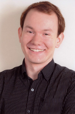 Jan Quenzel合作论文数Institute for Computer Sciences, University of Bonn1
 Lorenzo Nardi合作论文数University of Bonn1
 Andres Milioto合作论文数Finite Systems Corporation1
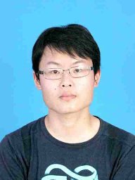 Yue Pan合作论文数Carnegie Mellon University1
 Matthias Nieuwenhuisen合作论文数Institute for Computer Science VI, University of Bonn1
 Clemens Simmer合作论文数Meteorological Institute, University of Bonn1
 Olga Vysotska合作论文数ETH Zürich1
 Chris Mccool合作论文数Image and Video Research Laboratory;Queensland University of Technology;Image and Video Research Laboratory, Queensland University of Technology1
 Dirk Holz合作论文数University of Bonn1
 Timo Röhling合作论文数Department of Unmanned Systems, Fraunhofer-Institute FKIE1
 Radu Alexandru Rosu合作论文数Institute for Computer Science, University of Bonn1
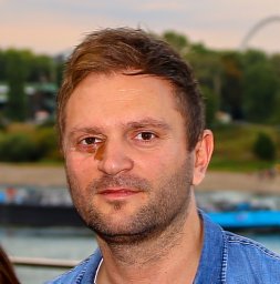 David Droeschel合作论文数Fraunhofer Insitute for Intelligent Analysis and Information Systems1




