The Svalbard archipelago (76-81N) is undergoing increased warming compared to the global mean, which has major implications for freshwater runoff into the oceans from seasonal snow and glaciers. Quantifying changes of freshwater runoff requires close integration of observations and process-based models.Here, we use land-surface and ice-flow modelling in combination with satellite and in-situ observations, to simulate runoff from the Bayelva catchment, Svalbard (~30 km2, ~54% glacier cover), for the period 1991–2100. Runoff from seasonal snow and glaciers is simulated using the land surface model CRYOGRID, which includes a coupled energy balance-snow/firn model. Historical simulations (1991–2024) are forced by downscaled CARRA reanalysis data and evaluated against in situ measurements and geodetic mass balance observations. Future simulations (2024–2100) are driven by temperature and precipitation trends derived from CORDEX projections under the RCP4.5 and RCP8.5 scenarios.To account for feedbacks between surface mass balance and glacier geometry, the runoff simulations are coupled to the 3D glacier evolution model IGM. Sentinel-1 surface velocity observations are used to constrain glacier sliding, while observed surface elevation changes are used to evaluate simulated thickness changes and in situ ice-thickness measurements to evaluate the initial glacier geometry.For continued warming, glacier melt will intensify, thus increasing runoff, but at a later stage, the reduction of glacier area due to retreat will offset this effect, giving rise to a peak in glacier runoff. The simulations indicate that runoff from the Bayelva catchment is likely to peak within the next two decades. Under the RCP8.5 scenario, both glaciers within the Bayelva catchment, Austre and Vestre Brøggerbreen, are projected to largely disappear by 2100, resulting in a transition from glacier-dominated to snow-dominated runoff.
Abstract Global warming is amplified in the Arctic, accelerating glacier melt and freshwater runoff. At tidewater glaciers, runoff typically enters fjords at depth and generates buoyancy‐driven circulation that enhances glacier‐ocean exchanges of energy and matter, influencing macronutrient delivery and marine primary production. However, most studies lack the temporal resolution to capture low‐frequency, high‐magnitude events, leaving their impacts poorly understood. Here, we combine glacier observations with high‐frequency fjord and glacier‐lake sampling to examine the 2021 glacier lake outburst flood (GLOF) from Lake Setevatnet into Kongsfjorden (Svalbard). We show how evolving subglacial conditions before and during the GLOF shaped macronutrient supply to the inner fjord through both direct runoff and entrainment of bottom waters. Early in summer, nutrient delivery was dominated by direct runoff, supplying nitrate (NO 3 − ) and silicate via an inefficient drainage system. As the melt increased, an efficient system formed, generating a subglacial plume and initiating buoyancy‐driven circulation that entrained nutrient‐rich deep water. Despite high NO 3 − lake concentrations, the flood barely affected fjord NO 3 − levels. Instead, it produced a seasonal maximum in nitrite (NO 2 − ). Comparisons with conservative mixing estimates and nitrogen budget analyses reveal a non‐conservative nutrient signal. Although sedimentary sources cannot be excluded, the timing and spatial pattern of the NO 2 − anomaly suggest subglacial modification during floodwater transit. These findings indicate that Kongsfjorden functions as a summer nitrogen sink, partly shaped by subglacial transformations. Overall, nutrient delivery from tidewater glaciers depends not only on runoff volume but also on the subglacial drainage system characteristics, which evolve during high‐magnitude events such as GLOFs.
Accurate simulation of glacier surface mass balance is essential for predicting sea level rise and freshwater resources, but it is constrained by uncertainties in meteorological forcing and model parameters. Here, we deploy glacier data assimilation strategies to assess the value of observations for improving surface mass balance simulation, focusing on observation quantity, quality, and timing. We perform synthetic twin experiments on Kongsvegen glacier, Svalbard, using a Particle Batch Smoother with 1000 ensemble members. Synthetic observations of albedo, snow depth, and surface temperature are assimilated at two quality levels, under two climatic scenarios, and over 12 years. Assimilation benefit is measured as the percentage improvement in the continuous ranked probability score of the posterior glacier surface mass balance relative to the prior. A single optimally timed high quality observation yields mean improvements of up to 80%. Larger numbers of low quality observations partially compensate for lower improvement. In the accumulation zone, however, additional snow depth observations degrade performance through particle degeneracy. Optimal timing is governed by the seasonal transitions of the truth trajectory rather than by prior ensemble spread alone. The optimal windows shift by up to six weeks between early and late melting years. Joint assimilation adds value through temporal diversity rather than observational diversity, while independently timed observations outperform same day combinations. The asynchronously optimally timed combined assimilation of three variables sustains improvements of 85 to 97% across all years in the ablation zone. These findings provide guidelines for adaptive observation scheduling in glacier monitoring and reanalysis.
Glacier flow variations are predominantly due to changes at the ice-bed interface, where basal slip and sediment deformation drive basal glacier motion. Determining subglacial conditions and their responses to hydraulic forcing remains challenging due to the difficulty of accessing the glacier bed. In this study, we analyze data series from instruments placed at the base of Kongsvegen glacier (Svalbard) thanks to a 350 m borehole.The borehole was instrumented witha pressure sensor, seismometers, and a ploughmeter to monitor the interplay between surface runoff and hydro-mechanical conditions. Covering the two ablation seasons of 2021 and 2022, , we measured point-scale subglacial water pressure and till strength, and we derived at a kilometre scale the subglacial hydraulic gradient and radius from seismic observations.. Across seasonal, multi-day, and diurnal time scales, we compared these measurements to characterize the variations in subglacial conditions caused by changes in surface runoff. We discuss our results in light of existing theories of subglacial hydrology and till mechanics. We find that during the short, low intensity melt season of 2021, the subglacial drainage system evolves to accommodate runoff variations, increasing its capacity as the melt season progressed. In contrast, during the long and high intensity melt season of 2022, the subglacial drainage system evolved transiently to respond to the abrupt and large water supply. We suggest that in this configuration, the drainage capacity of the hydraulically active part of the subglacial drainage system is exceeded, promoting the expansion of hydraulically connected regions and local weakening of ice-bed coupling, thus enhancing sliding. Our in-situ, multi-method approach provides a unique insight into conditions at the ice-bed interface.
Numerical modeling is crucial for quantifying the evolution of cryospheric processes. At the same time, uncertainties hamper process understanding and predictive accuracy. Here, we suggest improving glacier surface mass balance simulations for the Kongsvegen glacier in Svalbard through the application of Bayesian data assimilation techniques in a set of large ensemble twin experiments. Noisy synthetic observations of albedo and snow depth, generated using the multilayer CryoGrid community model with a full energy balance, are assimilated using two ensemble-based data assimilation schemes: the particle batch smoother and the ensemble smoother. A comprehensive evaluation exercise demonstrates that the joint assimilation of albedo and snow depth improves the simulation skill by up to 86% relative to the prior in specific glacier regions. The particle batch smoother excels in representing albedo dynamics, while the ensemble smoother is marginally more effective for snow depth under low snowfall conditions in the ablation area. By combining the strengths of both observations, the joint assimilation achieves improved surface mass balance simulations across different glacier zones using either assimilation scheme. This work underscores the potential of ensemble-based data assimilation methods for refining glacier models by offering a robust framework to enhance predictive accuracy and reduce uncertainties in cryospheric simulations. Further advances in glacier data assimilation research with both synthetic and real observations will be critical to better understanding the fate and role of Arctic glaciers in a changing climate
Meltwater ponding along the margins of Antarctica poses a threat to ice shelf stability, increasing the risk of accelerated inland ice mass loss. Understanding the key drivers of supraglacial lake formation is therefore essential for assessing the vulnerability and future stability of Antarctic ice shelves. In this study, we combine high-resolution simulation from the regional climate model Mode`le Atmospherique Regional (MAR) with satellitederived records of supraglacial lakes in coastal Dronning Maud Land to investigate the role of topographic downslope winds on spatial lake distribution. We find that persistent katabatic winds and episodic foehn winds are key controls on the observed regional patterns of lakes. Katabatic winds, most persistent in eastern Dronning Maud Land, exert a sustained impact near grounding zones through snow erosion, scouring and sublimation. Foehn winds predominantly affect ice shelves on the lee (western) side of large ice rises and promontories, causing considerable surface warming. While these downslope winds directly contribute to surface melt and ponding during summer, they also precondition the surface year-round through wind-driven warming and sublimation. Statistical analysis of downslope wind exposure further allows us to identify other Antarctic ice shelves that may become vulnerable to future ponding as firn retention capacity is diminished.
Sudden glacier acceleration and instability, e.g. surges, strongly influence glacier ice loss. However, lack of in-situ observations of the involved processes hampers our ability to understand, quantify and model such a role. We present an analysis of the initiation of a surge (Kongsvegen glacier, Svalbard), focusing on the interplay between climatic and glacier-specific drivers. We integrate two decades of in-situ observations (GNSS, borehole and surface seismometers) with runoff simulations, and remotely sensed surface-elevation changes. We show that initial glacier thinning led to localized acceleration and crevassing. Then, we show that stronger surface melt enabled meltwater to reach the glacier bed. This input promotes high basal water pressure and glacier sliding, and in turn further surface crevassing. Our observations suggest that this positive feedback leads to the expansion of the initially localized instability. Our findings highlight mechanisms that could trigger glacier instabilities under a warming atmosphere beyond the High Arctic.
The accurate quantification of glacier mass balance is of vital importance for the evaluation of climate change impact and the management of hydrological resources. However, traditional modeling methodologies on a regional scale are frequently plagued by uncertainties in forcing data, model structure, and parameters. Data assimilation emerges as an effective technique to incorporate observations into modeling, thereby reducing the uncertainty of results. In this study, we evaluate the performance of different ensemble-based schemes, including the Ensemble Smoother (ES) and the Ensemble Smoother-Multiple Data Assimilation (ES-MDA), to incorporate albedo derived from MODIS satellite observations and in-situ mass-balance measurements vis stakes into the full energy balance model CryoGrid applied to Svalbard glaciers. Our primary aim is to enhance the accuracy of both the reconstruction and prediction of glacier mass balance in the Svalbard region through the synergistic use of observational data and model. In a range of experiments, we analyze the performance of different assimilation methods and different observation products. The implementation of ES-MDA has demonstrated marked improvements, while the variations in parameter dynamics have varied effects on the results. We compare the prior and posterior states to help disentangle which process or forcing has the most impact on the uncertainty of the model’s results.
In this study, we investigate the relationship between subglacial conditions and the presence of ribbed moraines in Norway. Ribbed moraines are low-lying subglacially formed ridges, transverse to glacial flow and numerous processes have been proposed to explain their formation. So far there is no agreement about the formation process but most of them are linked to the presence of subglacial water. We therefore hypothesise that there is a relationship between hydrological conditions at the bed of the Fennoscandian Ice Sheet, and the presence of ribbed moraines. To test this, we extract subglacial conditions from a numerical model of the Fennoscandian Ice Sheet and derive further modelled hydrological conditions using a MATLAB-based hydrological toolbox. Our conditions include: (i) subglacial hydrological sinks, (ii) subglacial hydraulic head, (iii) flow accumulation, (iv) ice thickness, (v) ice-flow velocity, and (vi) basal temperature. We use these data in a presence-absence generalised linear modelling approach, to evaluate the coexistence of ribbed moraines and specific conditions. From this we can infer whether they have a consistent series of conditions which determine their presence. We focus on two areas, a training dataset in Vinstre, South-Central Norway, and a validation dataset in Femunden, Central-Eastern Norway. These sites cover known and well mapped areas of ribbed moraines, which are used as ground truth data. Comparison is possible through superimposing presence-absence predictions on the ground truth data in GIS as a pair of gridded, spatially referenced datasets. In comparing the model output to ground truth data, we aim to provide new assessments of the validity of the many ribbed moraine formation theories. For example, if hydrological conditions prove a poor predictor, then we can consider the presence of water as less likely a prerequisite for the formation of ribbed moraines.
Refreezing is a critical component of the mass balance of glaciers in Svalbard, yet the processes and changes under a warming climate are not fully understood. Here, we investigate changes in firn properties of the Austfonna ice cap, Svalbard, using a combination of observations and model simulations. We analyze firn stratigraphy and density from five newly retrieved and 11 previously retrieved firn cores, collected at elevations ranging from 506 m a.s.l. to 791 m a.s.l. between 1958 and 2022. All cores exhibit frequent ice layers that indicate persistent refreezing of meltwater; however, no ice slabs (layers exceeding 1 m) were observed. A 13-year-long firn temperature time series from a site near the summit (773 m a.s.l.) shows that annual water percolation reaches depths of 7 m to over 13 m. A notable transition in the firn thermal regime occurred in 2013, transitioning from cold to temperate conditions above the firn-ice interface despite the seasonal cooling occurring in the upper firn layers. Simulations using the CryoGrid community model from 2009 to 2022 corroborate this thermal shift and suggest the development of a firn aquifer multiple times since 2013, with increasing duration and thickness over time.
Ongoing glacier retreat is causing the loss of a critical water resource in mountain regions, with wide-ranging downstream impacts. These include shifts in streamflow seasonality, change in water availability, and changes to low-flow conditions, either exacerbating or alleviating them. To date, most hydrological impact studies have relied on model simulations for specific regions or catchments, often driven by future climate change scenarios. However, evidence on the hydrological impact of glacier retreat based on direct observational data is scarce due to the limited accessibility of in-situ data. To address this, we have assembled a comprehensive dataset of streamflow observations from approximately 600 glacierized catchments (10–1000 km²) around the world. By integrating this dataset with geodetic estimates of glacier mass change for each individual glacier globally, we quantify the contribution of net glacier mass loss to streamflow across diverse mountain regions. Our study identifies where decadal glacier mass losses (2000–2010 and 2010–2019) align with observed streamflow trends in both magnitude and direction, and where other hydrological processes are more dominant. Streamflow trends and variations are analyzed both at an annual and seasonal scale with a specific focus on hydrograph characteristics such as high flows, low flows, and the melt season. Our results highlight the spatial heterogeneity of glacier retreat impacts across mountain regions and their downstream implications.
Glacial lake outburst floods (GLOFs) from ice-dammed lakes are frequent in Svalbard, impacting local ice dynamics, and subglacial hydrological systems, causing geomorphological changes, and posing flooding hazards. Additionally, GLOFs can influence nutrient dynamics in the fjord of tidewater glaciers, affecting the local ecosystem. In this study, we use high-resolution topographic data to monitor the formation of an ice-dammed lake and identify the drainage mechanisms of a GLOF that occurred in the summer of 2021 on the Kongsvegen glacier, a surge-type tidewater glacier located in Kongsfjorden (Svalbard). Additionally, seismometers were deployed to monitor the subglacial dynamics at the kilometre scale. Over the 2.5-month-long process starting in early June, terrestrial laser scanning (TLS) data and drone images were acquired at nearly daily intervals to monitor the ice-dammed lake formation and drainage. A time-lapse camera and pressure logger installed at the border of the ice-dammed lake allowed us to estimate the drainage timing, occurring from July 23 to July 26, resulting in a total drainage duration of 77 hours. To reconstruct the lake volume, the lake extension was manually digitized from the TLS data and drone orthophotos. Elevation information of the corresponding lake outlines was extracted from a 1 m resolution Digital Elevation Model (DEM) generated from Pléiades stereo satellite images acquired on 20 September 2020, at the end of the thaw season. This DEM serves as bathymetric data, representing the lake bottom. The extracted water level was used to calculate the stage-volume curve. The lake's maximum volume reached approximately 7.17 million m3 with an average discharge rate of 26 m3/s. Analyzing seismic data allowed for monitoring of the development of the subglacial drainage, assessing the transition from an inefficient to an efficient system. This study highlights the importance of very high spatial and temporal resolution data for accurate lake volume quantification and a better understanding of the link between GLOF and subglacial system.
The Arctic is undergoing increased warming compared to the global mean, with major implications for the mass balance of glaciers. Direct observations of mass balance in the Russian Arctic are sparse and remotely sensed volume changes do not provide information about climatic drivers. Here, we present simulations of the climatic mass balance and meltwater runoff from glaciers in Franz Josef Land and Novaya Zemlya from 1991 to 2022. Based on simulations of glacier climatic mass balance over the period 1991-2022, we present a first detailed view of mass balance evolution in Franz Josef Land and Novaya Zemlya. The simulations are conducted at a 2.5 km resolution using the CryoGrid model forced by the Copernicus Arctic Regional ReAnalysis (CARRA) product. Over the 30 year simulation period, the climatic mass balance of both Franz Josef Land (0.21 m w.e. a-1) and Novaya Zemlya (0.07 m w.e. a-1) is positive on average without a significant trend in annual climatic mass balance. There is still a tendency towards more frequent high-melt years after 2010 and the associated glacier runoff has intensified with record melt years occurring during the model period.
Stronger and more widespread surface melt may alter the flow of glaciers and ice sheets and trigger instability. However, observational deficiencies hamper our ability to better understand and thus predict such responses. We deployed surface and borehole seismometers along the centerline of a High Arctic glacier in Svalbard. The records span over six years and are analyzed in relation to the measured increase of surface velocity. We complement our seismic analysis (icequakes and seismic noise) with long-term measurements of glacier-surface velocity, surface-elevation changes, and runoff modeling. Since 2000, we observe glacier thinning and steepening, coinciding with acceleration of up to 1000%. In response, new crevasses have opened and provide access pathways for surface melt water to the base of the glacier, affecting the ice-bed coupling. This mechanism represents a positive hydro-mechanical feedback that fuels further acceleration and crevassing. This feedback may have wider implications for triggering of glacier-wide instabilities, increasing short-term sea-level rise and local hazards. Beyond the Arctic, we suggest that, under a warming atmosphere, glaciers may transition from stable to unstable flow through such a mechanism.
The Svalbard archipelago is particularly sensitive to climate change due to the relatively low altitude of its main ice fields and its geographical location in the higher North Atlantic, where the effect of Arctic amplification is more significant. The largest temperature increases have been observed during winter, but increasing summer temperatures, above the melting point, have led to increased glacier melt. Here, we evaluate the impact of this increased melt on the preservation of the oxygen isotope (δ18O) signal in firn records. δ18O is commonly used as a proxy for past atmospheric temperature reconstructions, and, when preserved, it is a crucial parameter to date and align ice cores. By comparing four different firn cores collected in 2012, 2015, 2017 and 2019 at the top of the Holtedahlfonna ice field (1100 m a.s.l.), we show a progressive deterioration of the isotope signal, and we link its degradation to the increased occurrence and intensity of melt events. Our findings indicate that, starting from 2015, there has been an escalation in melting and percolation resulting from changes in the overall atmospheric conditions. This has led to the deterioration of the climate signal preserved within the firn or ice. Our observations correspond with the model's calculations, demonstrating an increase in water percolation since 2014, potentially reaching deeper layers of the firn. Although the δ18O signal still reflects the interannual temperature trend, more frequent melting events may in the future affect the interpretation of the isotopic signal, compromising the use of Svalbard ice cores. Our findings highlight the impact and the speed at which Arctic amplification is affecting Svalbard's cryosphere.
Machine learning is a powerful yet underutilised tool in geomorphology, commonly used for image-based pattern recognition. Analysing new high-resolution (1–10 m) elevation datasets, we investigate its usefulness for detecting discrete geomorphological features. This study develops a machine-learning-based method for identifying ribbed moraines in digital elevation data and progresses to test its performance versus time-consuming, manual methods. Ribbed moraines share geomorphometric characteristics with other glacial landforms, hence representing a valuable test of our new methodology in terms of differentiating between similar features, and for detecting landforms with similar characteristics. Furthermore, mapping ribbed moraines may provide valuable indications of their origin, a topic of debate within glacial geomorphology. To automatically detect ribbed moraines, we extract simple morphometrics from high-resolution digital elevation model data and mask regions where ribbed moraines are unlikely to form. We then test several machine learning algorithms before examining the best performer (K-means clustering) for three study areas of 15 km2 in Norway. Our results demonstrate a balanced accuracy of 65 %–75 % when validating versus ground-truthing. The performance depends on the availability of high-resolution elevation data in Norway that are needed to resolve the spatial scale of the target (10–100 m). We find the method effective at detecting both fields of ribbed moraines, as well as individual ribbed moraines. We propose pathways for the future implementation of this method on a large scale and for increasing the detail of information gained about detected landforms. In conclusion, we demonstrate K-means clustering as a promising method for detecting ribbed moraines, with great potential to reduce the time needed to produce landform maps.
Supraglacial lakes on Antarctic ice shelves can have far-reaching implications for ice-sheet stability, highlighting the need to understand their dynamics, controls and role in the ice-sheet mass budget. We combine a detailed satellite-based record of seasonal lake evolution in Dronning Maud Land with a high-resolution simulation from the regional climate model Mod & egrave;le Atmosph & eacute;rique R & eacute;gional to identify drivers of lake variability between 2014 and 2021. Correlations between summer lake extents and climate parameters reveal complex relationships that vary both in space and time. Shortwave radiation contributes positively to the energy budget during summer melt seasons, but summers with enhanced longwave radiation are more prone to surface melting and ponding, which is further enhanced by advected heat from summer precipitation. In contrast, previous winter precipitation has a negative effect on summer lake extents, presumably by increasing albedo and pore space, delaying the accumulation of meltwater. Downslope katabatic or f & ouml;hn winds promote ponding around the grounding zones of some ice shelves. At a larger scale, we find that summers during periods of negative southern annular mode are associated with increased ponding in Dronning Maud Land. The high variability in seasonal lake extents indicates that these ice shelves are highly sensitive to future warming or intensified extreme events.
This repository contains the model and scripts to reproduce the results presented in "Glacier surges controlled by the close interplay between subglacial friction and drainage" and submitted to the Journal of Geophysical Research - Earth Surface. It provides the running model files associated with each result figure of the manuscript as well as the Python script to generate them from the simulation output. The model is also described and updated at: https://github.com/kjetilthogersen/pyGlacier.
The flow of glaciers is largely controlled by changes at the ice–bed interface, where basal slip and sediment deformation drive basal glacier motion. Determining subglacial conditions and their responses to hydraulic forcing remains challenging due to the difficulty of accessing the glacier bed. Here, we monitor the interplay between surface runoff and hydro-mechanical conditions at the base of the Kongsvegen glacier in Svalbard. From July 2021 to August 2022, we measured both subglacial water pressure and till strength. Additionally, we derived median values of subglacial hydraulic gradient and radius of channelized subglacial drainage system from seismic power, recorded at the glacier surface. To characterize the variations in the subglacial conditions caused by changes in surface runoff, we investigate the variations of the following hydro-mechanical properties: measured water pressure, measured sediment ploughing forces, and derived hydraulic gradient and radius, over seasonal, multi-day, and diurnal timescales. We discuss our results in light of existing theories of subglacial hydrology and till mechanics to describe subglacial conditions. We find that during the short, low-melt-rate season in 2021, the subglacial drainage system evolved at equilibrium with runoff, increasing its capacity as the melt season progressed. In contrast, during the long and high-melt-rate season in 2022, the subglacial drainage system evolved transiently to respond to the abrupt and large water supply. We suggest that in the latter configuration, the drainage capacity of the preferential drainage axis was exceeded, promoting the expansion of hydraulically connected regions and local weakening of ice–bed coupling and, hence, enhanced sliding.
 Sebastian Westermann合作论文数Periglacial Section, Alfred Wegener Institute for Polar and Marine Research38Bernd Etzelmuller合作论文数Department of Geoscience, University of Oslo35
 Jack Kohler合作论文数Polar Environmental Center, Norwegian Polar Institute33
 Jon Ove Hagen合作论文数Department of Geosciences;University of Oslo;Department of Geosciences, University of Oslo26
 Thorben Dunse合作论文数20Geir Moholdt合作论文数Fram Ctr, Norwegian Polar Res Inst18
 Kjersti Gisnas合作论文数Norwegian Geotechnical Institute17
 Bartłomiej Luks合作论文数Institute of Geophysics, Polish Academy of Sciences16Herman Farbrot合作论文数15
 Ketil Isaksen合作论文数Norwegian Meteorological Institute15
 Torbjørn I. Østby合作论文数14
 Andreas Max Kääb (Andreas Kääb)合作论文数Department of Geosciences, The Faculty of Mathematics and Natural Sciences, University of Oslo14
 Louise Steffensen Schmidt合作论文数Dept Geosci, Univ Oslo13
 Julia Boike合作论文数Alfred Wegener Institute13
 Ward J. J. van Pelt合作论文数Dept Earth Sci, Uppsala Univ12
 Trond Eiken合作论文数12
 C. H. Reijmer合作论文数Institute for Marine;Atmospheric Research Utrecht;Utrecht University;Institute for Marine, Utrecht University12
 Regine Hock合作论文数University of Alaska Fairbanks, Uppsala University12
 Jean-Charles Gallet合作论文数Norsk Polarinstitutt, Norsk Polarinstitutt10
 Kjetil Melvold合作论文数Norwegian Water Resources and Energy Directorate10Simon Filhol合作论文数9
 Terje Koren Berntsen合作论文数Department of Geosciences, The Faculty of Mathematics and Natural Sciences, University of Oslo9t dunse合作论文数8
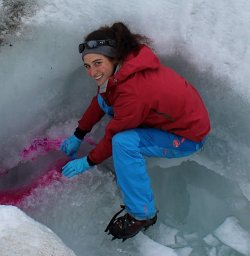 C. Bouchayer合作论文数8
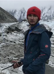 Ugo Nanni合作论文数Department of Earth Sciences, The University of Hong Kong, Pokfulam Road, Hong Kong8
 Christopher Nuth合作论文数8
 Adrien Gilbert合作论文数7
 Kjetil S. Aas合作论文数Dept Geosci, Univ Oslo7
 Spolaor Andrea合作论文数Institute of Polar Science, ISP-CNR/Department of Environmental Sciences, Informatics and Statistics, Ca’ Foscari University of Venice7
 Kjetil Thøgersen合作论文数Department of Physics, University of Oslo;Department of Physics, University of Oslo7Veijo Pohjola合作论文数Department of Earth Sciences, Uppsala University7Catherine Larose合作论文数Laboratoire de Glaciologie et Géophysique de l’Environnement (LGGE), Université Joseph Fourier7
 Hanne Hvidtfeldt Christiansen合作论文数Department of Arctic Geology, University Centre in Svalbard7
 Moritz Langer合作论文数Alfred Wegener Inst Polar & Marine Res7Andreas Alexander合作论文数Dept Geosci, Univ Oslo6
 Kristoffer Aalstad合作论文数Department of Geosciences, University of Oslo6
 Rasmus E. Benestad合作论文数Norwegian Meteorological Institute6
 Mats P. Björkman合作论文数Department of Plant and Environmental Sciences, Göteborg University6Christian Zdanowicz合作论文数6Rickard Pettersson合作论文数6
 Liss Marie Andreassen合作论文数Norwegian Water Resources and Energy Directorate6
 Anirudha Mahagaonkar合作论文数5
 markus engelhardt合作论文数Dept Geosci, Univ Oslo5
 Tonu Martma合作论文数Dept Geol, Tallinn Univ Technol5
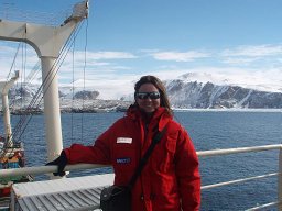 Barbaro Elena合作论文数Department of Environmental Sciences, Informatics and Statistics, University of Venice5
 Thomas Schellenberger合作论文数5Jan Köhler合作论文数Institute of Freshwater Ecology and Inland Fisheries5
 John F. Burkhart合作论文数Physics Department;University of Colorado-Colorado;Physics Department, University of Colorado-Colorado5Urs H. Fischer合作论文数5




