With biodiversity loss escalating globally, a step change is needed in our capacity to accurately monitor species populations across ecosystems. Robotic and autonomous systems (RAS) offer technological solutions that may substantially advance terrestrial biodiversity monitoring, but this potential is yet to be considered systematically. We used a modified Delphi technique to synthesize knowledge from 98 biodiversity experts and 31 RAS experts, who identified the major methodological barriers that currently hinder monitoring, and explored the opportunities and challenges that RAS offer in overcoming these barriers. Biodiversity experts identified four barrier categories: site access, species and individual identification, data handling and storage, and power and network availability. Robotics experts highlighted technologies that could overcome these barriers and identified the developments needed to facilitate RAS-based autonomous biodiversity monitoring. Some existing RAS could be optimized relatively easily to survey species but would require development to be suitable for monitoring of more 'difficult' taxa and robust enough to work under uncontrolled conditions within ecosystems. Other nascent technologies (for instance, new sensors and biodegradable robots) need accelerated research. Overall, it was felt that RAS could lead to major progress in monitoring of terrestrial biodiversity by supplementing rather than supplanting existing methods. Transdisciplinarity needs to be fostered between biodiversity and RAS experts so that future ideas and technologies can be codeveloped effectively.
Compositional observations are an increasingly prevalent data source in spatial statistics. Analysis of such data is typically done on log-ratio transformations or via Dirichlet regression. However, these approaches often make unnecessarily strong assumptions (e.g., strictly positive components, exclusively negative correlations). An alternative approach uses square-root transformed compositions and directional distributions. Such distributions naturally allow for zero-valued components and positive correlations, yet they may include support outside the non-negative orthant and are not generative for compositional data. To overcome this challenge, we truncate the elliptically symmetric angular Gaussian (ESAG) distribution to the non-negative orthant. Additionally, we propose a spatial hyperspheric regression model that contains fixed and random multivariate spatial effects. The proposed model also contains a term that can be used to propagate uncertainty that may arise from precursory stochastic models (i.e., machine learning classification). We used our model in a simulation study and for a spatial analysis of classified bioacoustic signals of the Dryobates pubescens (downy woodpecker).
Empirical work suggests that spatial sorting, a mechanism of evolutionary change fueled by phenotype-dependent dispersal, may lead to phenotypic shifts on ecological timescales. However, we currently lack a quantitative framework to measure the strength of spatial sorting. To address this gap, we present a quantitative genetics model of spatial sorting and identify an evolutionary parameter in the model to measure the strength of spatial sorting. This parameter, referred to as the standardized sorting gradient, is structurally akin to the standardized selection gradient, which is commonly used to measure the strength of natural selection. To show the utility of our approach, we analyzed binary wing-morphology data of soapberry bugs (Jadera haematoloma) recolonizing flooded habitats extirpated by a hurricane. We found that non-random recolonization resulted in a standardized sorting gradient of 0.90 ± 0.08, which ranked in the top 5 percentile compared to standardized selection gradients documented in the scientific literature. Genetic crosses further revealed that the binary trait, short and long-wing forms, is heritable h2 = 0.65 ± 0.13) and yielded a standardized evolutionary response of 0.58 ± 0.13. Our results underscore that, like natural selection, spatial sorting, too, can yield rapid evolution, providing quantitative evidence that non-random dispersal may produce novel eco-evolutionary dynamics. ### Competing Interest Statement The authors have declared no competing interest.
The rising introduction of invasive species through trade networks threatens biodiversity and ecosystem services. Yet, we have a limited understanding of how transportation networks determine patterns of range expansion. This is partly because current analytical models fail to integrate the invader's life-history dynamics with heterogeneity in human-mediated dispersal patterns. And partly because classical statistical methods often fail to provide reliable estimates of model parameters due to spatial biases in the presence-only records and lack of informative demographic data. To address these gaps, we first formulate an age-structured metapopulation model that uses a probability matrix to emulate human-mediated dispersal patterns. The model reveals that an invader spreads along the shortest network path, such that the inter-patch network distances decrease with increasing traffic volume and reproductive value of hitchhikers. Next, we propose a Bayesian statistical method to estimate model parameters using presence-only data and prior demographic knowledge. To show the utility of the statistical approach, we analyze zebra mussel (Dreissena polymorpha) expansion in North America through the commercial shipping network. Our analysis underscores the importance of correcting spatial biases and leveraging priors to answer questions, such as where and when the zebra mussels were introduced and what life-history characteristics make these mollusks successful invaders.
Cycling can improve health, yet cyclists in cities may be exposed to hazardous conditions and have limited exposure to nature and its benefits. The purpose of this study was to measure and compare environmental exposures of urban cyclists on a vegetated, gravel trail route separated from cars and a fully paved route on local roads. In September 2021 in Austin, Texas, US, we cycled on the trail and road routes from 7:30-8:30 and 17:30-18:30 on one weekday and weekend day. While cycling, we wore sensors that measured fine particulate matter (PM2.5), total volatile organic compounds (VOCs), sounds, air temperature, relative humidity, light intensity, and geographic location. We used a neural network to distinguish anthropogenic and natural sounds. After time-matching all sensor data, we specified linear mixed effects models to test the association between route type and each environmental exposure, adjusting for afternoons and weekdays. We also used inverse distance weighting in GIS to map spatially continuous estimates of environmental exposures for each cycling trip. Compared to the road route, the trail was associated with higher levels of PM2.5, total VOCs, natural sounds, and relative humidity, and lower levels of anthropogenic sounds, temperature, and light intensity (p < 0.05). Mapping illustrated differences in environmental exposures within and between routes by time of day and day of week. Assessing exposures on existing and planned cycling routes may help inform the design of health interventions (e.g., tree planting along routes) in the face of increasing climate-related hazards.
Shifts in species' ranges are creating novel ecosystems and previously unobserved species interactions. Documenting and understanding these novel interactions between species is an emergent priority of global ecological importance. We report a wild hybridization resulting from recent range expansion: a hybrid between Green Jay (Cyanocorax yncas) and Blue Jay (Cyanocitta cristata), charismatic and historically allopatric species whose ranges newly overlap in Texas. Morphological and genetic evidence indicate the hybrid individual resulted from the pairing of a female Green Jay and a male Blue Jay. Hybridization between these species is remarkable across vertebrate species, as such events typically occur between recently diverged populations, whereas the most recent common ancestor to Blue and Green Jays is estimated to have lived at least 7 million years ago. We believe this hybridization event joins a growing list of increasingly unexpected outcomes of contemporaneous range expansions fueled by anthropogenic global change. As birds are keystone species in ecological webs and reservoirs for zoonotic diseases, the creation of unique genomic contexts resulting from climate-driven hybridization is a phenomenon of both scientific and practical importance.
Automated remote sensing has revolutionized the fields of wildlife ecology and environmental science. Yet, a cost-effective and flexible approach for large scale monitoring has not been fully developed, resulting in a limited collection of high-resolution data. Here, we describe BioSense, a low-cost and fully programmable automated sensing platform for applications in bioacoustics and environmental studies. Our design offers customization and flexibility to address a broad array of research goals and field conditions. Each BioSense is programmed through an integrated Raspberry Pi computer board and designed to collect and analyze avian vocalizations while simultaneously collecting temperature humidity, and soil moisture data. We illustrate the different steps involved in manufacturing this sensor including hardware and software design and present the results of our laboratory and field testing in southwestern United States.
Characterizing spatial patterns in allele frequencies is fundamental to evolutionary biology because these patterns contain evidence of underlying processes. However, the spatial scales at which gene flow, changing selection, and drift act are often unknown. Many of these processes can operate inconsistently across space, causing nonstationary patterns. We present a wavelet approach to characterize spatial pattern in allele frequency that helps solve these problems. We show how our approach can characterize spatial patterns in relatedness at multiple spatial scales, i.e. a multilocus wavelet genetic dissimilarity. We also develop wavelet tests of spatial differentiation in allele frequency and quantitative trait loci (QTL). With simulation, we illustrate these methods under different scenarios. We also apply our approach to natural populations of Arabidopsis thaliana to characterize population structure and identify locally adapted loci across scales. We find, for example, that Arabidopsis flowering time QTL show significantly elevated genetic differentiation at 300-1,300 km scales. Wavelet transforms of allele frequencies offer a flexible way to reveal geographic patterns and underlying evolutionary processes.
Ashe juniper (Juniperus ashei Buchholz) and escarpment live oak (Quercus fusiformis Small) are two of the most common woody species of the Edwards Plateau, an arid‐to‐semi‐arid region of nearly 100,000 km2 in central Texas. They have very different hydraulic strategies, yet they experienced similar mortality rates during an extreme drought in 2011. We measured J. ashei and Q. fusiformis sap flow velocities during summer dry periods of 2016 and 2017 at six micro‐sites. Although these were years with more‐or‐less average summer conditions, both included significant dry periods. To estimate the relative rate of decrease in sap velocity for each species during the dry periods, we fit a Bayesian exponential decay model to the sap velocity time series for each tree. We found that Q. fusiformis trees were better able to maintain transpiration than J. ashei during dry periods at five micro‐sites and were comparable at the sixth micro‐site. We conclude that it is likely that Q. fusiformis can better maintain transpiration during dry periods than J. ashei, on average, and that in the case of these two species, greater cavitation resistance may not translate to greater drought resistance.
Characterizing spatial patterns in allele frequencies is fundamental to evolutionary biology because these patterns contain evidence of underlying processes. However, the spatial scales at which gene flow, changing selection, and drift act are often unknown. Many of these processes can operate inconsistently across space, causing non-stationary patterns. We present a wavelet approach to characterize spatial pattern in allele frequency that helps solve these problems. We show how our approach can characterize spatial patterns in relatedness at multiple spatial scales, i.e. a multi-locus wavelet genetic dissimilarity. We also develop wavelet tests of spatial differentiation in allele frequency and quantitative trait loci (QTL). With simulation we illustrate these methods under different scenarios. We also apply our approach to natural populations of Arabidopsis thaliana to characterize population structure and identify locally-adapted loci across scales. We find, for example, that Arabidopsis flowering time QTL show significantly elevated genetic differentiation at 300 to 1300 km scales. Wavelet transforms of allele frequencies offer a flexible way to reveal geographic patterns and underlying evolutionary processes.
Amazonian rivers are only partial barriers to the dispersal of most species, but they still form the limits between the distributions of many similar species. We show that two competitively-identical species may remain allopatric for hundreds of generations when a river only reduces the chance of a species crossing it. To illustrate this, we developed a two-dimensional cellular automata for two allopatric species under neutral-theory dynamics and recorded the time required for the first extinction of a species and the frequency with which it occurred across replicate simulations. Our results indicate that neutral processes associated with reduced dispersal across rivers can maintain competitively-identical species allopatric for hundreds of generations despite repeated river crossings. These cross-river incursions were rarely successful owing to the low likelihood of a rare invader outcompeting resident populations. This process provides a plausible mechanism for the maintenance of Amazonian biodiversity and may explain the spatial-distribution limits of species caused by large rivers in the Amazon that are not absolute barriers to dispersal.
Species distribution models assume that at broad spatial scales, environmental conditions determine species ranges and, as such, source-sink dynamics can be ignored. A rationale behind this assumption is that source-sink dynamics manifest at length scales comparable to species mean dispersal distance, which is much smaller than length scales of species distribution and variation in climate. Using a two-dimensional reaction-diffusion model, we show that species can use sink habitats near the niche limit as stepping-stones to occupy sink habitats much further than the mean dispersal distance, thereby extending the distribution far beyond the environmental niche limit. This mismatch between range and niche limits is mediated by the shape (local curvature) of the niche limit. These curvature effects may be significant for a highly dispersive species with low per capita growth rate sensitivity to changes in the environment. These findings underscore the potential importance of stepping-stone dispersal in determining range limits.
Technology is revolutionizing the study of organisms in their natural environment
Although many large mammals currently face significant threats that could lead to their extinction, resources for conservation are often scarce, resulting in the need to develop efficient plans to prioritize conservation actions. We combined several methods in spatial ecology to identify the distribution of the endangered Baird's tapir across its range from southern Mexico to northern Colombia. Twenty-eight habitat patches covering 23% of the study area were identified, harboring potentially 62% or more of the total population for this flagship species. Roughly half of the total area is under some form of protection, while most of the remaining habitat (~70%) occurs in indigenous/local communities. The network with maximum connectivity created from these patches contains at least one complete break (in Mexico between Selva El Ocote and Selva Lacandona) even when considering the most generous dispersal scenario. The connectivity analysis also highlighted a probable break at the Panama Canal and high habitat fragmentation in Honduras. In light of these findings, we recommend the following actions to facilitate the conservation of Baird's tapir: 1) protect existing habitat by strengthening enforcement in areas already under protection, 2) work with indigenous territories to preserve and enforce their land rights, and help local communities maintain traditional practices; 3) re-establish connections between habitat patches that will allow for connectivity across the species' distribution; 4) conduct additional noninvasive surveys in patches with little or no species data; and 5) collect more telemetry and genetic data on the species to estimate home range size, dispersal capabilities, and meta-population structure.
Bioclimatic models assume that at broad spatial scales, climate is the primary determinant of species distribution. Meanwhile, processes such as source-sink dynamics can be ignored because they are thought to manifest at length scales comparable to species mean dispersal distance. We present a reaction-diffusion model to show species can use sink patches near the bioclimatic (or niche) limit as stepping-stones to occupy sinks much further than the mean dispersal distance, thereby extending the distribution far beyond the bioclimatic envelope. This mismatch between geographical and bioclimatic limits is mediated by the shape of the bioclimatic limit and may be significant for low growth sensitivity and fast dispersal life strategy. These findings challenge one of the core assumptions of the bioclimatic models. Therefore, we advocate that biogeographers consider the role of dispersal when using bioclimatic models to generate inferences about the ecological and evolutionary processes that determine the distribution of biota.
Despite the enormous negative consequences of biological invasions, we have a limited understanding of how spatial demography during invasions creates population patterns observed at different spatial scales. Early stages of invasions, arrival and establishment, are considered distinct from the later stage of spread, but the processes of population growth and dispersal underlie all invasion phases. Here, we argue that the spread of invading species, to a first approximation, exhibits scale invariant spatial-dynamic patterns that transcend multiple spatial scales. Dispersal from a source population creates smaller satellite colonies, which in turn act as sources for secondary invasions; the scale invariant pattern of coalescing colonies can be seen at multiple scales. This self-similar pattern is referred to as “stratified diffusion” at landscape scales and the “bridgehead effect” at the global scale. The extent to which invasions exhibit such scale-invariant spatial dynamics may be limited by the form of the organisms’ dispersal kernel and by the connectivity of the habitat. Recognition of this self-similar pattern suggests that certain concepts for understanding and managing invasions might be widely transferable across spatial scales.
The degree to which interspecific competition structures diverse communities is an oft-debated topic. An approach to answering this question is to examine spatial patterns of coexistence among putatively competing species. The degree to which interspecies competition predominates in a community can have important effects on our ability predict the response of that community to perturbations, most notably climate change, when shifting species’ ranges may result in novel species assemblages. We present a study on the avifauna of the Eastern Himalayas. We hypothesize that in a community where competitive interactions predominate, there will be a relationship between pairwise altitudinal overlaps and morphological differences between species. Moreover, we hypothesize that both morphological traits and altitudinal traits depart from a Brownian motion evolution model, resulting in species trait covariances having a phylogenetic component. We find a significant relationship between morphological dissimilarity and altitudinal overlaps of species pairs. We also find that closely related species are significantly more altitudinally stratified than a null model would predict. However, as more distantly related species pairs are included in the analysis, this pattern disappears, indicating that competitive interactions predominate only in closely related species. This is further suggested by the fact that altitudinal ranges themselves are phylogenetically overdispersed at the genus level, as are morphological traits. This effect disappears when the entire phylogeny is examined, with morphology and altitude being phylogenetically underdispersed. Model fitting suggests that individual clades have evolved towards local clade-specific fitness peaks, while within-clade results show evidence of niche partitioning. We interpret these results as a tension between competition on shorter time scales and selection on longer time scales, where competition forces closely-related species away from fitness peaks in order to allow for niche separation and hence coexistence, suggesting that this effect is partially responsible for the recent diversification of Eastern Himalayan avifauna.
Two foundational questions about sustainability are "How are ecosystems and the services they provide going to change in the future?" and "How do human decisions affect these trajectories?" Answering these questions requires an ability to forecast ecological processes. Unfortunately, most ecological forecasts focus on centennial-scale climate responses, therefore neither meeting the needs of near-term (daily to decadal) environmental decision-making nor allowing comparison of specific, quantitative predictions to new observational data, one of the strongest tests of scientific theory. Near-term forecasts provide the opportunity to iteratively cycle between performing analyses and updating predictions in light of new evidence. This iterative process of gaining feedback, building experience, and correcting models and methods is critical for improving forecasts. Iterative, near-term forecasting will accelerate ecological research, make it more relevant to society, and inform sustainable decision-making under high uncertainty and adaptive management. Here, we identify the immediate scientific and societal needs, opportunities, and challenges for iterative near-term ecological forecasting. Over the past decade, data volume, variety, and accessibility have greatly increased, but challenges remain in interoperability, latency, and uncertainty quantification. Similarly, ecologists have made considerable advances in applying computational, informatic, and statistical methods, but opportunities exist for improving forecast-specific theory, methods, and cyberinfrastructure. Effective forecasting will also require changes in scientific training, culture, and institutions. The need to start forecasting is now; the time for making ecology more predictive is here, and learning by doing is the fastest route to drive the science forward.
 Jesse R. Lasky合作论文数Penn State Univ, University Pk12
 Thomas E. Juenger合作论文数Department of Integrative Biology, College of Natural Sciences, The University of Texas at Austin;Department of Integrative Biology, College of Natural Sciences, University of Texas at Austin7
 Dean L. Urban (Dean Urban)合作论文数Nicholas School of the Environment, Duke University6
 Robert D. Holt合作论文数Department of Biology, College of Liberal Arts and Sciences, University of Florida6
 Lauren Buckley合作论文数Department of Biology, University of Washington6
 Nikunj Goel合作论文数Dept Integrat Biol, Univ Texas Austin5
 Levy Ofir合作论文数5
 Mevin Hooten合作论文数Department of Statistics and Data Sciences, College of Natural Sciences, University of Texas at Austin4
 Behrman Kathrine D合作论文数4
 Rodrigo Vargas合作论文数School of Life Sciences, Arizona State University;Department of Plant and Soil Sciences, University of Delaware4Andria K. Salas合作论文数4
 Michael Angilletta合作论文数College of Liberal Arts and Sciences, Arizona State University;School of Life Sciences, Arizona State University;Global Institute of Sustainability and Innovation, Arizona State University;Julie Ann Wrigley Global Futures Laboratory, Arizona State University4
 Naiara Pinto合作论文数Section of Integrative Biology;Univ . of Texas;Jet Propulsion Lab;Jet Propulsion Lab, Univ . of Texas4James R. Kiniry合作论文数3
 Preston Wilson合作论文数Walker Department of Mechanical Engineering, Cockrell School of Engineering, University of Texas at Austin3
 Andrew H Altieri合作论文数Smithsonian Trop Res Inst, Balboa, Ancon, Panama3
 Ottar Bjornstad合作论文数Department of Entomology, College of Agricultural Sciences, The Pennsylvania State University3
 H. Eugene Stanley合作论文数Department of Physics, College of Engineering, Boston University3Kreakie Betty J合作论文数3
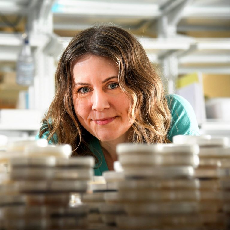 Christine Hawkes合作论文数Department of Plant and Microbial Biology, NC State University;Hawkes Lab, Department of Mechanical Engineering, NC State University3
 James R. Kellner合作论文数Institute at Brown for Environment and Society, Brown University;Department of Ecology, Evolution and Organismal Biology, Brown University3
 Kathleen C. Weathers合作论文数Cary Institute of Ecosystem Studies3
 Andrew Richardson合作论文数School of Informatics, Computing, and Cyber Systems, Northern Arizona University3
 Barry Rowlingson合作论文数Dept Med, Univ Lancaster3
 Evan P. Economo合作论文数Okinawa Inst Sci & Technol, Grad Univ3
 Jingfeng Xiao合作论文数Earth Systems Research Center, Institute for the Study of Earth, Oceans, and Space, University of New Hampshire;Department of Sustainability & Environment, University of South Dakota3
 Bruce T. Milne合作论文数Department of Biology, University of New Mexico3Ba Maurer合作论文数2
 David K. Tcheng合作论文数2Claire Lunch合作论文数2
 Diana Gamba合作论文数2
 michael toomey合作论文数2Eric S. Abelson合作论文数Integrat Biol, Univ Texas Austin2
 Christine Laney合作论文数Natl Ecol Observ Network, Battelle Mem Inst2
 Luis A.N. Amaral合作论文数Department of Chemical and Biological Engineering, Robert R. McCormick School of Engineering and Applied Science, Northwestern University;Northwestern Institute on Complex Systems, Northwestern University;Department of Physics and Astronomy, Weinberg College of Arts & Sciences, Northwestern University2
 Laurel Larsen合作论文数Department of Civil and Environmental Engineering, University of California, Berkeley2
 Lowry David B合作论文数Duke University Medical Center, Duke University Medical Center2
 William Fagan合作论文数Department of Biology, University of Maryland2
 Viral B. Shah合作论文数JuliaHub;The Julia Language2
 Cleo Bertelsmeier合作论文数Dept Ecol & Evolut, Univ Lausanne2James H Richards合作论文数Department of Land, Air and Water Resources, University of California, Davis2James W. Voordeckers合作论文数University of Oklahoma, Univ of Oklahoma2
 Read Emily K合作论文数2
 Tredennick Andrew T合作论文数Natural Resource Ecology Laboratory and Graduate Degree Program in Ecology, Colorado State University2
 Alan Knapp合作论文数Department of Biology, Colorado State University2
 Jordi Bascompte合作论文数Department of Evolutionary Biology and Environmental Studies, University of Zurich2
 Surangi W. Punyasena合作论文数Department of Plant Biology, School of Integrative Biology, College of Liberal Arts and Sciences, University of Illinois at Urbana-Champaign2
 Christopher T. Filstrup合作论文数Center for Reservoir and Aquatic Systems Research;Department of Biology;Department of Biology, Center for Reservoir and Aquatic Systems Research2
 James T Randerson合作论文数Department of Earth System Science, School of Physical Sciences, University of California, Irvine2




