Contingent valuation is applied to study Swedish households’ preferences to avoid experiencing adverse consequences caused by outages and restrictions in the municipal drinking water supply. There is an international need for increased knowledge of such preferences; the frequency of drinking water supply disturbances is increasing globally due to, e.g. climate change and deteriorating water supply infrastructure, calling for preventive measures. Using a nationally representative sample, we estimate the willingness to pay (WTP) for investments that would help avoid a one-time occurrence of three situations: (A) a total outage of tap water delivery; (B) tap water must be boiled to be fit for drinking; and (C) restrictions against particular uses of tap water. Three different duration times for each situation are considered. Mean WTP estimates are robust to the estimation method choice – parametric or non-parametric – but show scope insensitivity for the longest duration times of situations A and B, and all duration times of situation C. Household income has an expected positive and significant effect on the WTP for all situations, and a test of budget sequence sensitivity does not indicate overestimation of adding up WTP estimates for two or three situations. Implications for decision-makers are discussed, including efficiency and equity trade-offs, and the use of the WTP estimates in cost-benefit analyses of investments to avoid situations like those studied.
The wastewater system is an essential part of our infrastructure as it prevents flooding and protects public health and the environment. Infiltration and inflow into wastewater systems (I/I-water) is a significant problem for water utilities and should be managed so that investments maximise benefits to society. This paper presents a decision-support model based on cost-benefit analysis, with the novelty of including and monetising 14 effects of I/I-water measures which either affect the water utility or other parts of society and considering various uncertainties by assigning probability distributions to the input variables and performing Monte Carlo simulations. Currently, no such model is available to quantify the total value to society from measures to handle I/I-water. The proposed model is illustrated in a case study in Gothenburg, Sweden. In the case study, a reference alternative is compared to three conceptual project alternatives: total separation of the combined system, relining of the entire separate sanitary sewer system, and remediation at private properties. The case study highlights an imbalance in the distribution of costs and benefits for the water utility and society and shows the significance of including externalities to avoid underestimating the social benefits of removing I/I-water. Using the presented novel model facilitates a transparent and structured decision-making process for handling I/I-water in the manner most effective to society.
Urban climate resilience planning often overlooks the subsurface, despite its potential to mitigate flooding, heat stress, and drought. To demonstrate these potentials, we developed thematic Geosystem Service (GS) maps for Malmo & uml;, Sweden, to support the integration of the subsurface into climate adaptation strategies. This study identifies GS relevant to the local context, proposes indicators for mapping these services, suggests a methodology for developing GS potential maps and tests the usability of these maps with municipal planners. Six GS related to the subsurface were identified: 1) regulation of coastal erosion, 2) extraction of heat and cold from the subsurface, 3) infiltration and retention of stormwater, 4) provision of subsurface space, 5) provision of groundwater, and 6) provision of construction materials. The findings indicate that GS potential mapping can reveal opportunities to utilise subsurface functions important for climate adaptation, but also show that this capacity is highly uneven across space and often constrained by land use, contamination risks, and technical or legal limitations. Usability testing with planners suggests that the developed GS potential maps may serve more effectively as communicative instruments than as direct planning tools. By illustrating how subsurface services can be systematically incorporated into planning, this research provides a foundation for enhancing the operability of GS in future climate adaptation practices.
Geosystem services (GS) can be defined as the contributions humans derive from the subsurface: the use of the subsurface to build and construct within and on top, groundwater, energy and material extraction, storing of e.g. water, energy and carbon dioxide, providing habitats for diverse species and support for surface life, and serving as an archive of cultural and geological heritage. Sectorial management and lack of consequent consideration of subsurface geosystem services and competing or complementary subsurface uses promote the first-come-first-served principle, potentially hindering a sustainable management of the subsurface and compromising inter- and intra-generational equity. The research project “UNDER: Geosystem services underneath for sustainable communities and improved spatial planning practices” has the overall goal to develop a framework for systematic and structured consideration of geosystem services in Swedish planning practices that can support a path towards sustainable cities and communities. The specific objectives of the UNDER project are to: i) advance the concept of GS by identifying and mapping associated societal values (social, environmental and economic), ii) identify methods to assess societal values and investigate possibilities for integration in existing tools, iii) identify structures of governance and develop a broader and practice-informed understanding of the different societal actors in subsurface planning, and iv) create a participative learning environment, extended beyond the project implementation period leading to transformative processes in planning practice. The project is case study driven and works in collaboration with Swedish municipalities. Four ongoing spatial planning processes in Swedish municipalities have been selected as case studies, which will provide a variety of spatial planning contexts and objectives. The project is a multi-disciplinary, international project with funding from the Swedish research council Formas, running during 2021 - 2025. The presentation of the project will focus on the project activities, preliminary results, and future work.
In this study, a literature review was conducted to identify indicators that can be utilised to assess and visualise the potential of the geophysical environment to deliver geosystem services. The literature review identified 24 studies and 22 technical reports, resulting in a list of 75 geosystem services indicators for 23 geosystem services associated with the subsurface. Building upon these findings, a country-specific set of 21 indicators pertinent to the geological setting of Sweden was developed. Each developed indicator was further subdivided into different ‘capacity classes’ to denote the potential of the geophysical environment to deliver a specific geosystem service. Most of these proposed indicators can be directly applied (19 out of 21), as there is readily available information in open-access maps and databases. However, some of the assigned capacity classes need to be adjusted according to the spatial scale of application. Furthermore, to convey the benefit or value of a given geosystem service, the proposed indicators must also be complemented with estimates of accessibility and societal importance of said service. Nonetheless, the proposed set of indicators represents an initial step towards a comprehensive mapping of geosystem services that can be used to highlight the multitude of ways the subsurface contributes to society.
The study examines the governance of low trophic species mariculture (LTM) using Sweden as a case study. LTM, involving species such as seaweeds and mollusks, offers ecosystem services and nutritious foods. Despite its potential to contribute to blue growth and Sustainable Development Goals, LTM development in the EU and OECD countries has stagnated. A framework for mapping governance elements (institutions, structures, and processes) and analyzing governance objective (effective, equitable, responsive, and robust) was combined with surveys addressed to the private entrepreneurs in the sector. Analysis reveals ineffective institutions due to lack of updated legislation and guidance, resulting in ambiguous interpretations. Governance structures include multiple decision-making bodies without a clear coordination agency. Licensing processes were lengthy and costly for the private entrepreneurs, and the outcomes were uncertain. To support Sweden's blue bioeconomy, LTM governance requires policy integration, clearer direction, coordinated decision-making, and mechanisms for conflict resolution and learning.
Awareness of the subsurface and its multitude of resources is generally low and decisions on access to subsurface resources are often guided by a 'first come, first served principle'. Although not yet fully developed, the concept of geosystem services has been put forward to make subsurface resources more visible and acknowledged in decision-making. This study (1) illustrates a systematic mapping of effects on geosystem services using a process-oriented perspective in two conceptual case studies; (2) translates the mapped effects into costs and benefits items in a qualitative cost-benefit analysis (CBA) context; and (3) presents a systematic review of economic valuation studies of geosystem services to investigate the available support for a quantitative CBA. The findings suggest that systematic mapping of effects on multiple geosystem services can inform different types of assessment methods and decision-makers on trade-offs and provide a basis for well-informed and responsible decisions on subsurface use. Combining such mapping with a CBA can further strengthen decision support through indications of the net effects on human well-being. However, although economic valuation of non-market geosystem services is possible using established valuation methods, such studies are scarce in scientific literature. Thus, although a CBA can provide a basis for supporting decisions on subsurface use from a consequentialist perspective, full quantification of all effects may require great efforts, and it needs to be complemented with other methods to capture the full range of values the subsurface can provide. This study also highlights that depending on the context, supporting and regulating geosystem services can be either intermediate or final services. Therefore, if geosystem services are to be included in the abiotic extension of CICES, in which supporting services by definition are excluded, reclassification of the supporting geosystem services should be considered not to risk being overlooked in economic valuation and CBA.
Recent research projects have targeted the hitherto limited inclusion of the subsurface and its geo-resources in spatial planning in Sweden. The UNDER project focuses on the societal implications of using the concept of geosystem services to support planning practices. The concept of geosystem services has been described as the contributions to human well-being from the abiotic world or from the subsurface, and although not yet fully defined, the concept has the potential to communicate the many services provided by the subsurface. The project is a case study-driven project and works in collaboration with Swedish municipalities to understand how governance structures support the identification and assessment of geosystem services. Four ongoing spatial planning processes in Swedish municipalities have been selected as case studies, which will provide a variety of spatial planning contexts and objectives. This paper will discuss our methodology and engagement with the different cases. The cases will help us investigate how the concept of geosystem services supports planning processes by mapping these services, exploring how different geosystem services are valued and to develop tools for identification and evaluation. The outcome of the project will provide a robust foundation for advancing spatial planning processes, with the inclusion of geosystem services.
Being a complement to ecosystem services (ES), geosystem services (GS) is a novel concept that helps identify and understand the contributions of the diversity of geological structures and processes of nature to human wellbeing. A pilot survey was carried out to Swedish municipalities in order to: (i) in a systematic way investigate if and how they currently approach GS in their spatial planning processes, and (ii) analyze and follow up responses for further improvement of the questionnaire for a Sweden-wide survey. None of the ten out of 26 responding municipalities currently use the term GS in their spatial planning processes. Some GS are already considered in municipal spatial planning processes in Sweden, though the term GS is currently not used. No clear patterns of including GS in spatial planning were however observed, except for three out of twenty GS. Social and child impact assessments and the Swedish standard on Biodiversity survey, which were the most frequently used methods for including ES in the municipal spatial planning processes in Sweden, could potentially be extended to GS.
Water from infiltration and inflow to wastewater systems is an extensive problem causing costs to society in various ways. Comprehensive methods for supporting decisions on how to efficiently mitigate the problems in a sustainable manner are, however, missing today. This paper presents a novel risk-based model to assess the cost to society from infiltration and inflow to wastewater systems by monetising effects related to treatment of wastewater, pumping, combined sewer overflows, and basement flooding. The present value is calculated for a specified time horizon and discount rate, using a cost-benefit analysis approach. To acknowledge the various uncertainties, a probabilistic approach is applied where probability distributions represent the input variables. The model is shown to be applicable by illustrating its use in a case study area in Gothenburg, Sweden. Main results from the case study show that most of the costs are related to investments at the wastewater treatment plant and restoration due to basement flooding events. Sensitivity analyses show that the result is highly dependent on factors such as the volume of infiltration and inflow water, the share of basement flooding, and the discount rate. Using expert elicitation to quantify input data is also illustrated and shown to be a valuable method. The presented model fills an important research knowledge gap and will facilitate a more sustainable and comprehensive handling of water from infiltration and inflow.
Contamination of soil and water systems by per-and polyfluoroalkyl substances (PFAS) due to uncontrolled use of aqueous film-forming foams (AFFFs) at firefighting training sites at civilian and military airports is a universal issue and can lead to significant human health and environmental impacts. Remediation of these sites is often complex but necessary to alleviate the PFAS burden and minimise the risks of exposure by eliminating the hotspot/source from which the PFAS spreads. This study presents a probabilistic cost-benefit analysis (CBA) for evaluating PFAS reme-diation alternatives, which includes monetisation of both direct costs and benefits as well as externalities. The method is applied for a case study to compare five remediation alternatives for managing PFAS contaminated soil at Stockholm Arlanda Airport in Sweden. The social profitability, or the net present value (NPV), of each remediation alternative was calculated in comparison to two reference alternatives - 'total excavation' of the site (Alt 0) or 'do nothing'. Sensitivity analyses and model scenarios were tested to account for uncertainties, including small or large PFAS spreading and simulating different values for the magnitude of annual avoided cost of inaction (i.e., aggregate benefit) from PFAS re-mediation. In comparison to total excavation, four of the five studied remediation alternatives resulted in a positive mean NPV. Excavation and stabilization/solidification of the hotspot on-site combined with stabilization using acti-vated carbon for the rest of site (Alt 2) had the highest NPV for both spreading scenarios, i.e., Alt 2 was the most so-cially profitable alternative. Simulations of the annual avoided cost of inaction enabled estimation of the breakeven point at which a remediation alternative becomes socially profitable (NPV > 0) compared to 'do nothing'. Alt 2 had the lowest breakeven point: 7.5 and 5.75 millions of SEK/year for large and small spreading, respectively.
Water protection is a widely supported goal in society, but competing interests often complicate the implementation of water protection measures. Moreover, the benefits of protection efforts are typically underestimated as risk assessments focus on the provision of drinking water and neglect the additional services provided by a clean drinking water source. We developed a list of water system services (WSS) that allows assessment of all biotic and abiotic services provided by a drinking water source. The WSS were derived from the Common International Classification of Ecosystem Services (CICES). The objectives of this paper are to (i) introduce the concept of WSS, (ii) describe a procedure on how to develop a region-specific list of WSS and present a list of WSS specifically tailored to Sweden, (iii) present how to integrate WSS into a risk assessment for drinking water, and (iv) illustrate a practical application on a Swedish case study. The results, presented as an assessment matrix, show the provided services and contrast the hazard sources with their impact on all services. The WSS assessment can be used to communicate and negotiate the extent of water protection measures with relevant stakeholders and illustrate synergies and trade-offs of protective measures beyond drinking water protection.
Kustekosystemen är mycket viktiga för både biologisk mångfald och ekosystemtjänster, men påverkas samtidigt negativt av ett kontinuerligt ökat nyttjande av kustzonen för boende och olika verksamheter. Ekologisk kompensation är ett förvaltningsverktyg som syftar till att gottgöra oundviklig skada på naturmiljöer, exempelvis arter, naturtyper, ekosystemfunktioner och upplevelsevärden, i samband med mänsklig verksamhet. Verktyget har dock hittills använts i mycket begränsad omfattning i grunda kustmiljöer. Inom projektet ECOCOA, finansierat av Naturvårdsverket, har vi fokuserat på att utvärdera förutsättningarna för ökad användning av ekologisk kompensation i kustområden, som ett av flera verktyg som kan stöda miljövården. Projektets slutrapport (Bergström m.fl. 2021) ger en övergripande bild av samtliga resultat, medan vi i föreliggande rapport ger en fördjupning av de mer konkreta problem som kan uppstå vid handläggning av miljöärenden i förvaltningen, och möjliga lösningar på kort och lång sikt. Rapporten riktar sig i första hand till handläggare som vill utveckla tillämpningen av ekologisk kompensation vid vattenverksamhetsärenden, till tekniska råd vid markoch miljödomstolar, samt miljökonsulter och andra som kan behöva insyn i hur ekologisk kompensation kan användas och vidareutvecklas inom svensk kustmiljöförvaltning. I rapporten återger vi hur man hanterar ekologisk kompensation i svenska kustområden idag, till exempel hur handläggare arbetar med att mäta skada och bedöma omfattningen av kompensationsbehov. Vi beskriver även problematiken med småskaliga anmälningspliktiga ärenden, där den sammanlagda påverkan från många små exploateringar ger upphov till betydande förluster av biologisk mångfald och ekosystemtjänster. Slutligen beskriver vi hur den så kallade särskilda fiskeavgiften, som syftar till att tillvarata fiskeintresset i samband med vattenverksamhetsfrågor, tillämpas idag, samt analyserar hur beräkningsgrunderna skulle kunna utvecklas för att stärka användningen av ekologisk kompensationen som verktyg. Vår sammanställning och utvärdering utgår från ett generellt ramverk som utvecklats inom ECOCOA för att skatta skada och identifiera kompensationsbehov. Ramverket baseras på en kaskadmodell, som visar kopplingar mellan ekosystemets struktur, funktion, ekosystemtjänster och nyttigheter för människor. Modellen kan användas för att synliggöra hur verksamheter påverkar arter och livsmiljöer och vilka kostnader och förluster detta medför. Ramverket kan även användas för att bedöma i vilken omfattning en föreslagen åtgärd faktiskt kompenserar för de förluster som verksamheten innebär. Här följer en kort sammanfattning av resultaten som presenteras i rapporten: • En enkätundersökning riktad till aktörer inom kustförvaltningen visar att ekologisk kompensation i praktiken tillämpas mycket sällan inom kustmiljöförvaltningen idag, och att det finns ett stort behov av att ta fram riktlinjer för dess tillämpning, som stöd till handläggare, konsulter, domstolar och andra aktörer. På en mer generell nivå omfattar detta även ett behov av att förbättra kunskapen om restaureringsmetoder samt att ta fram metoder för värdering av skador på naturvärden. Det finns även ett behov av resurser för Sammanfattning 6 handläggare i form av tid och stöd för att tillämpa ekologisk kompensation i kustförvaltningen. • En utvärdering av befintliga domslut för ett antal tillståndspliktiga (dvs. storskaliga) vattenverksamhetsärenden visar att biologisk mångfald och ekosystemtjänster mycket sällan beaktas på ett sätt som är i linje med Sveriges åtaganden inom till exempel konventionen för biologisk mångfald och EU:s biodiversitetstrategi, där en bärande princip är att ingen nettoförlust ska ske. Det finns ett förbättringsutrymme som borde kunna mötas direkt genom en ökad kunskapsdelning mellan aktörer, och en förbättrad praxis gällande tillämpning av ekologisk kompensation. Samtidigt uppstår flera mer komplexa frågor som berör till exempel behovet av en gemensam fysisk planering och identifiering av lämpliga kompensationsåtgärder, där ett kunskapsbyggande behövs. • Småskalig kustexploatering, exempelvis bryggbyggen och små muddringar, är en särskilt utmanande fråga. Enskilda små ingrepp är anmälningspliktiga (dvs. sällan tillståndspliktiga), och trots att det vid handläggningen av dessa ärenden ställs krav på miljöhänsyn kan det ofta inte bedömas som skäligt att kräva att exploatören själv utför ekologisk kompensation. Den sammanlagda påverkan av dessa många små ingrepp är dock betydande, och det är angeläget att utforma ett system där även småskalig vattenverksamhet kompenserar för sina miljökostnader. Vi undersöker hur ett system för ekologisk kompensation som även omfattar småskalig exploatering skulle kunna se ut, i relation till konceptet habitatbanker eller kompensationspooler, där exploatören kan bidra ekonomiskt till habitatrestaureringar i stället för att själv utföra dem. • Den särskilda fiskeavgiften syftar till att kompensera för skador från vattenverksamheter på fisket och skulle kunna betraktas som ett förvaltningsverktyg för kompensation av en viss typ av förlust. I rapporten utvärderar vi hur det rådande fiskeavgiftssystemet fungerar och utforskar hur det kan fungera ur ett kompensationsperspektiv, samt ger förslag på hur beräkningsmodellen kan utvecklas. Sammantaget finns det ett stort behov av att utveckla ekologisk kompensation som ett av de verktyg som kan bidra till att motverka den allt snabbare förlusten av biologisk mångfald och ekosystemfunktioner. Parallellt behövs ytterligare åtgärder för att stärka skyddet av de känsligaste livsmiljöerna i kustzonen, eftersom bevarande av fungerande livsmiljöer är att föredra som ett mer kostnadseffektivt verktyg än restaurering av störda miljöer.
Environmental governance requires in-depth understanding of system elements, and effective strategies need to include the perceptions of stakeholders. In this study, we researched the governance system for beachcast (biomass consisting of wracked algae and seaweed) management on Gotland, Sweden, which has come to connect stakeholders of various governance levels (top and ground-level planning, and execution level) and societal interests (e.g. maritime, agrarian, and tourism related). Firstly, by describing the system’s elements in form of institutions, structures and processes. Secondly, through applying a structural analysis tool (the matrix method) to disclose the multi-level perceptions of the beachcast management system (BMS). The findings showed that a sustainable BMS was perceived to be dependent on (1) the social capital built on stakeholders’ self-organization and networking across levels (2), the need to engage stakeholders at execution level, e.g. incorporating the agricultural domain in governance (3) successfully combinging central and local governance strengths . We concluded that sustainable beachcast management on Gotland, Sweden, like other cases of bio-resource management, needs to recognize the diversity in perceptions and embrace diverging interests in beachcast within the governance system; forming synergies between institutions to create structures that facilitates the processes of moving this nutrient rich biomass from sea to land, creating a circular and sustainable resource flow.
Anthropogenic consumption of nitrogen (N) and phosphorus (P) has pushed their respective planetary boundaries beyond a safe operating space causing environmental problems, and simultaneously, the depletion of finite mineral P resources is of growing concern. Previous research has found that marine biomass such as kelp, reed and mussels have a high potential for taking up N and P, which could potentially contribute both to alleviating environmental problems and recirculating P from marine environments back to human consumption systems. This paper thus examines these nutrient flows and the extent to which marine biomass can contribute to close the loop. The study utilizes an element flow analysis (EFA) to establish the mapping of N and P flows and explore plausible scenarios of biomass utilisation by 2030 and 2050 for P loop closure in Sweden. The current uptake of P and N through the seven marine biomass cases (mariculture of mussels on both the Swedish east and west coasts, kelp and ascidians and the harvest of wild oysters, beach-cast and reed) contributes to 1.1% and 0.3% respectively of the full loop closure (relative to 2016 loading). Approximately 22% of the total P (and 23% N) uptake (in the biomasses) is currently being used in products, while the rest remains unused. The plausible future scenario for 2050 expects to contribute to around 10% P and 2.8% N loop closure (relative to 2016) if all nutrients in the uptake are used.
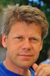 Lars Rosen合作论文数Chalmers University of Technology31
 Jenny Norrman合作论文数Chalmers Vasa, Swedish Geotechnical Institute31
 Yevheniya Volchko合作论文数Department of Civil and Environmental Engineering, Chalmers University of Technology18
 Linus Hasselström合作论文数Division for Water and Environmental Engineering, Department of Sustainable Development, Environmental Science and Engineering, School of Architecture and the Built Environment, KTH Royal Institute of Technology18
 Åsa Soutukorva合作论文数17Frida Franzen合作论文数16
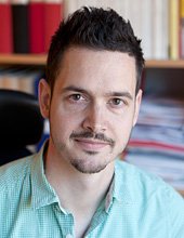 Andreas Lindhe合作论文数Department of Civil and Environmental Engineering;Chalmers University of Technology;Department of Civil and Environmental Engineering, Chalmers University of Technology11
 Par-Erik Back合作论文数10
 R. Kerry Turner合作论文数Centre for Social & Economic Research on the Global Environment, School of Environmental Sciences, University of East Anglia8gerda kinell合作论文数7Emrik Lundin frisk合作论文数7
 Janne Artell合作论文数MTT Agrifood Research Finland6
 Paul R. Ehrlich合作论文数Center for Conservation Biology, Stanford University;Department of Biology, Stanford University6
 Karl-Göran Mäler合作论文数Beijer Institute of Ecological Economics6
 Tommy Norberg合作论文数6
 Olof Sandstrom合作论文数University Hospital Section for Gastroenterology and Hepatology, Umea Sweden6Fredrik Mossmark合作论文数6
 Fredrik Gröndahl合作论文数Division for Water and Environmental Engineering, Department of Sustainable Development, Environmental Science and Engineering, School of Architecture and the Built Environment, KTH Royal Institute of Technology6Lorena Melgaco合作论文数5
 Marian Stuiver合作论文数5
 Mark de Bel合作论文数5
 Karin Sjostrand合作论文数5
 Phoebe Koundouri合作论文数Research Laboratory on Socio-Economic and Environmental Sustainability, Athens University of Economics and Business;Department of Technology, Management and Economics, Technical University of Denmark5
 Leif Pihl合作论文数Department of Biology and Environmental Sciences,University of Gothenburg;Institutionen for marin ekologi, Goteborgs universitet5
 Scott Cole合作论文数Pharmacokinetics Laboratory, Fred Hutchinson Cancer Research Center5
 Henrik Scharin合作论文数5
 Heini Ahtiainen合作论文数MTT Economic Research5Therese Lindahl合作论文数The Beijer Institute of Ecological Economics, The Royal Swedish Academy of Sciences5
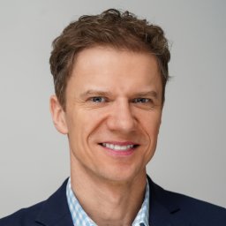 Mikołaj Czajkowski合作论文数Warsaw Ecological Economics Center, University of Warsaw5
 Raul Guanche合作论文数4Sara Aniyar合作论文数4E. Lindblom合作论文数4
 Asa Strand合作论文数Unit Water Resource Management, IVL Swedish Environm Res Inst4
 Simon Levin合作论文数Center for Policy Research on Energy and the Environment, Princeton University;Department of Ecology & Evolutionary Biology, Princeton University4Brinkhoff Petra合作论文数4
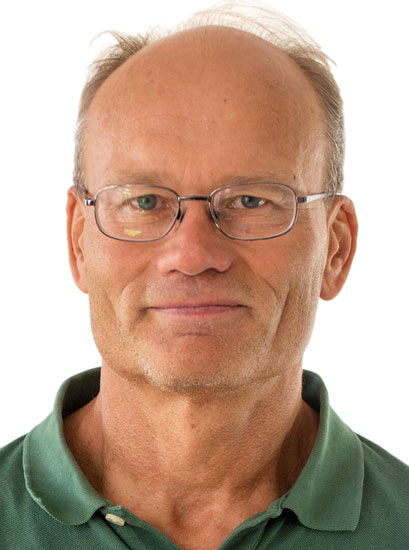 Max Troell合作论文数Beijer Institute for Ecological Economics, The Royal Swedish Academy of Sciences;Stockholm Resilience Centre, Stockholm University4
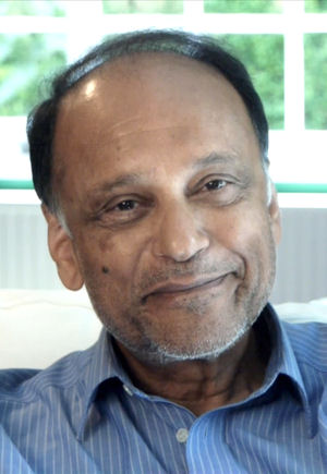 Partha Dasgupta合作论文数Faculty of Economics, University of Cambridge4
 Gretchen C. Daily合作论文数Center for Conservation Biology, Stanford University;Department of Biology, Stanford University;Woods Institute for the Environment, Stanford University4
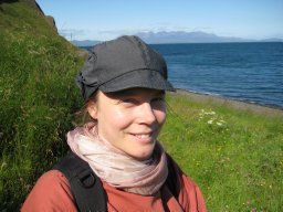 Paula Lindgren合作论文数Department of Geographical and Earth Sciences, University of Glasgow4
 Rajib Sinha合作论文数Division of Resources, Energy and Infrastructure, Department of Sustainable Development, Environmental Science and Engineering, School of Architecture and the Built Environment, KTH Royal Institute of Technology4
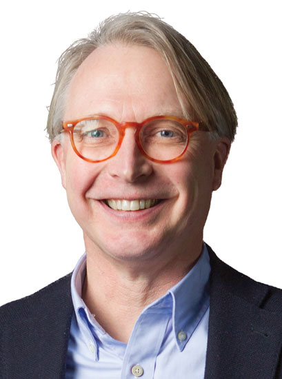 Carl Folke合作论文数Beijer Institute of Ecological Economics, Royal Swedish Academy of Sciences;Stockholm Resilience Centre, Stockholm University4
 Nils Kautsky合作论文数Department of Ecology, Environment and Plant Sciences, Stockholm University4
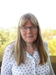 Berit Hasler合作论文数National Environmental Research Institute, Aarhus University4Magnus Bergknut合作论文数4
 Ing-Marie Gren合作论文数Department of Economics, SLU4
 Hakan Wennhage合作论文数Kristineberg Marine Research Station, University of Göteborg4
 Patrik Ronnback合作论文数Department of System Ecology, Stockholm University4Jean-Baptiste Thomas合作论文数Division for Water and Environmental Engineering, Department of Sustainable Development, Environmental Science and Engineering, School of Architecture and the Built Environment, KTH Royal Institute of Technology4
) Anastasios Xepapadeas合作论文数Department of Economics, University of Bologna;Department of International and European Economic Studies, Athens University of Economics and Business4
Anastasios Xepapadeas合作论文数Department of Economics, University of Bologna;Department of International and European Economic Studies, Athens University of Economics and Business4




