Multi-view clustering (MVC), as an important machine learning task, aims to group data into distinct groups by leveraging complementary and consistent information across multiple views. During the last two decades, it has been widely studied, and many methods have been proposed, which has brought incredible development to this field. However, few works comprehensively summarize existing methods and point out the potential challenges in this field for the next decades. To this end, our survey thoroughly reviews existing MVC methods according to three taxonomies, i.e., techniques, fusion strategies, and scenarios. Specifically, seven typical techniques, four fusion strategies, and five typical scenarios are included. Besides, we also collect the commonly used datasets and analyze the performance of typical MVC methods. Moreover, we summarize six application scenarios of existing MVC methods ranging from computer vision, and information retrieval tasks to medical diagnosis and bio-informatics. In particular, we point out seven interesting future directions in this field, which will definitely enlighten the readers.
The comprehensive use of high-resolution remote sensing (HRS) images and deep learning (DL) methods can be used to further accurate urban green space (UGS) mapping. However, in the process of UGS segmentation, most of the current DL methods focus on the improvement of the model structure and ignore the spectral information of HRS images. In this paper, a multiscale attention feature aggregation network (MAFANet) incorporating feature engineering was proposed to achieve segmentation of UGS from HRS images (GaoFen-2, GF-2). By constructing a new decoder block, a bilateral feature extraction module, and a multiscale pooling attention module, MAFANet enhanced the edge feature extraction of UGS and improved segmentation accuracy. By incorporating feature engineering, including false color image and the Normalized Difference Vegetation Index (NDVI), MAFANet further distinguished UGS boundaries. The UGS labeled datasets, i.e., UGS-1 and UGS-2, were built using GF-2. Meanwhile, comparison experiments with other DL methods are conducted on UGS-1 and UGS-2 to test the robustness of the MAFANet network. We found the mean Intersection over Union (MIOU) of the MAFANet network on the UGS-1 and UGS-2 datasets was 72.15% and 74.64%, respectively; outperforming other existing DL methods. In addition, by incorporating false color image in UGS-1, the MIOU of MAFANet was improved from 72.15% to 74.64%; by incorporating vegetation index (NDVI) in UGS-1, the MIOU of MAFANet was improved from 72.15% to 74.09%; and by incorporating false color image and the vegetation index (NDVI) in UGS-1, the MIOU of MAFANet was improved from 72.15% to 74.73%. Our experimental results demonstrated that the proposed MAFANet incorporating feature engineering (false color image and NDVI) outperforms the state-of-the-art (SOTA) methods in UGS segmentation, and the false color image feature is better than the vegetation index (NDVI) for enhancing green space information representation. This study provided a practical solution for UGS segmentation and promoted UGS mapping.
Accurate extraction of urban green space is critical for preserving urban ecological balance and enhancing urban life quality. However, due to the complex urban green space morphology (e.g., different sizes and shapes), it is still challenging to extract green space effectively from high-resolution image. To address this issue, we proposed a novel hybrid method, Multi-scale Feature Fusion and Transformer Network (MFFTNet), as a new deep learning approach for extracting urban green space from high-resolution (GF-2) image. Our method was characterized by two aspects: (1) a multi-scale feature fusion module and transformer network that enhanced the recovery of green space edge information and (2) vegetation feature (NDVI) that highlighted vegetation information and enhanced vegetation boundaries identification. The GF-2 image was utilized to build two urban green space labeled datasets, namely Greenfield and Greenfield2. We compared the proposed MFFTNet with the existing popular deep learning models (like PSPNet, DensASPP, etc.) to evaluate the effectiveness of MFFTNet by the Mean Intersection Over Union (MIOU) benchmark on Greenfield, Greenfield2, and a public dataset (WHDLD). Experiments on Greenfield2 showed that MFFTNet can achieve a high MIOU (86.50%), which outperformed deep learning networks like PSPNet and DensASPP by 0.86% and 3.28%, respectively. Meanwhile, the MIOU of MFFTNet incorporating vegetation feature (NDVI) was further achieved to 86.76% on Greenfield2. Our experimental results demonstrate that the proposed MFFTNet with vegetation feature (NDVI) outperforms the state-of-the-art methods in urban green space segmentation.
BACKGROUND:Oesophageal squamous cell carcinoma and adenocarcinoma of the oesophagogastric junction have a dismal prognosis, and early detection is key to reduce mortality. However, early detection depends on upper gastrointestinal endoscopy, which is not feasible to implement at a population level. We aimed to develop and validate a fully automated machine learning-based prediction tool integrating a minimally invasive sponge cytology test and epidemiological risk factors for screening of oesophageal squamous cell carcinoma and adenocarcinoma of the oesophagogastric junction before endoscopy. METHODS:For this multicohort prospective study, we enrolled participants aged 40-75 years undergoing upper gastrointestinal endoscopy screening at 39 tertiary or secondary hospitals in China for model training and testing, and included community-based screening participants for further validation. All participants underwent questionnaire surveys, sponge cytology testing, and endoscopy in a sequential manner. We trained machine learning models to predict a composite outcome of high-grade lesions, defined as histology-confirmed high-grade intraepithelial neoplasia and carcinoma of the oesophagus and oesophagogastric junction. The predictive features included 105 cytological and 15 epidemiological features. Model performance was primarily measured with the area under the receiver operating characteristic curve (AUROC) and average precision. The performance measures for cytologists with AI assistance was also assessed. FINDINGS:Between Jan 1, 2021, and June 30, 2022, 17 498 eligible participants were involved in model training and validation. In the testing set, the AUROC of the final model was 0·960 (95% CI 0·937 to 0·977) and the average precision was 0·482 (0·470 to 0·494). The model achieved similar performance to consensus of cytologists with AI assistance (AUROC 0·955 [95% CI 0·933 to 0·975]; p=0·749; difference 0·005, 95% CI, -0·011 to 0·020). If the model-defined moderate-risk and high-risk groups were referred for endoscopy, the sensitivity was 94·5% (95% CI 88·8 to 97·5), specificity was 91·9% (91·2 to 92·5), and the predictive positive value was 18·4% (15·6 to 21·6), and 90·3% of endoscopies could be avoided. Further validation in community-based screening showed that the AUROC of the model was 0·964 (95% CI 0·920 to 0·990), and 92·8% of endoscopies could be avoided after risk stratification. INTERPRETATION:We developed a prediction tool with favourable performance for screening of oesophageal squamous cell carcinoma and adenocarcinoma of the oesophagogastric junction. This approach could prevent the need for endoscopy screening in many low-risk individuals and ensure resource optimisation by prioritising high-risk individuals. FUNDING:Science and Technology Commission of Shanghai Municipality.
Accurate multi-scale object detection in remote sensing images poses a challenge due to the complexity of transferring deep features to shallow features among multi-scale objects. Therefore, this study developed a multi-feature fusion and attention network (MFANet) based on YOLOX. By reparameterizing the backbone, fusing multi-branch convolution and attention mechanisms, and optimizing the loss function, the MFANet strengthened the feature extraction of objects at different sizes and increased the detection accuracy. The ablation experiment was carried out on the NWPU VHR-10 dataset. Our results showed that the overall performance of the improved network was around 2.94% higher than the average performance of every single module. Based on the comparison experiments, the improved MFANet demonstrated a high mean average precision of 98.78% for 9 classes of objects in the NWPU VHR-10 10-class detection dataset and 94.91% for 11 classes in the DIOR 20-class detection dataset. Overall, MFANet achieved an mAP of 96.63% and 87.88% acting on the NWPU VHR-10 and DIOR datasets, respectively. This method can promote the development of multi-scale object detection in remote sensing images and has the potential to serve and expand intelligent system research in related fields such as object tracking, semantic segmentation, and scene understanding.
With the development and popularization of unmanned aerial vehicle (UAV) technology, the UAV devices have been widely used in practice. Aiming at the problems of low accuracy and slow speed in detecting UAV objects, this paper constructs a UAV object dataset and proposes an efficient UAV object detection method based on Mobile-YOLO Network (MYN). Firstly, a UAV data set was constructed, including 3,698 UAV images, in which the proportion of large, medium and small-scale objects was about 3:1:1, providing a data basis for algorithm research and experimental verification. Secondly, we construct a Mobile-YOLO network model for UAV object detection based on YOLOv4, enhancing the detection speed to 51FPS under the premise of high precision. The results show that the Mobile-YOLO network has fewer parameters, faster operation speed and better comprehensive performance.
Object detection is one of the most important and challenging branches of computer vision, which has been widely applied in people s life, such as monitoring security, autonomous driving and so on, with the purpose of locating instances of semantic objects of a certain class. With the rapid development of deep learning algorithms for detection tasks, the performance of object detectors has been greatly improved. In order to understand the main development status of target detection, a comprehensive literature review of target detection and an overall discussion of the works closely related to it are presented in this paper. This paper various object detection methods, including one-stage and two-stage detectors, are systematically summarized, and the datasets and evaluation criteria used in object detection are introduced. In addition, the development of object detection technology is reviewed. Finally, based on the understanding of the current development of target detection, we discuss the main research directions in the future.
The measurement of radar performance parameters is the basic work of radar support forces, and the development of simulation training platform has a very good role in promoting this work. This paper describes the current situation of radar parameter measurement, introduces the development of equipment simulation training platform, and combs the development process of radar performance parameter measurement simulation training platform. At last, the practical requirements of the simulation training platform for radar performance parameter measurement are put forward, that is, by building the simulation training platform for radar main parameter measurement, to meet the requirements of the new two-level maintenance system for the parameter measurement of military maintenance personnel.
To solve the problems in current co-saliency detection algorithms, a novel co-saliency detection algorithm is proposed which applies fully convolution neural network and global optimization model. First, a fully convolution saliency detection network is built based on VGG16Net. The network can simulate the human visual attention mechanism and extract the saliency region in an image from the semantic level. Second, based on the traditional saliency optimization model, the global co-saliency optimization model is constructed, which realizes the transmission and sharing of the current superpixel saliency value in inter-images and intra-image through superpixel matching, making the final saliency map has better co-saliency value. Third, the inter-image saliency value propagation constraint parameter is innovatively introduced to overcome the disadvantages of superpixel mismatching. Experimental results on public test datasets show that the proposed algorithm is superior over current state-of-the-art methods in terms of detection accuracy and detection efficiency, and has strong robustness.
With the development of complex system simulation techniques, computational capabilities, and data management capabilities, the simulation results tend to be big data. There are also high-dimension, high-redundancy, and high-correlation issues among indexes. Based on the above background, a two-layer Autoencoder neural network is used for feature extraction and dimensionality reduction. Then, 10 deep neural network models are established for index learning. The experimental results show that the 32-layer Resent network works best for low-dimensional data effectiveness evaluation.
The aim of this work is to propose a fusion procedure based on lidar and camera to solve the pedestrian detection problem in autonomous driving. Current pedestrian detection algorithms have focused on improving the discriminability of 2D features that capture the pedestrian appearance, and on using various classifier architectures. However, less focus on exploiting the 3D structure of object has limited the pedestrian detection performance and practicality. To tackle these issues, a lidar subsystem is applied here in order to extract object structure features and train a SVM classifier, reducing the number of candidate windows that are tested by a state-of-the-art pedestrian appearance classifier. Additionally, we propose a probabilistic framework to fuse pedestrian detection given by both subsystems. With the proposed framework, we have achieved state-of-the-art performance at 20 fps on our own pedestrian dataset gathered in a challenging urban scenario.
随着物联网应用的快速发展,传感信息日益多元化,传感器网络规模广域化,底层传感器网络构成异构化,传感信息数量大数据化,相应地,这也使得底层传感信息中所蕴含的不一致性、不完整性、不准确性等影响信息质量的因素大大增加.而传统的上下文感知技术没有充分考虑上下文质量对感知过程的影响,因此,在现有的上下文感知系统框架的基础上,充分研究不一致性、不完整性、不准确性等低质量传感器上下文的消除问题,通过上下文质量因子分类配置、不准确与不一致上下文丢弃、不完整上下文填充等方法实现了不同层次的控制机制,降低了信息的不确定性,从而有效提高了物联网应用的上下文处理质量.
Pedestrian detection is a key technology in autonomous driving perception system. Although the current vision-based pedestrian detection has obtained very good detection performance, the camera is sensitive to light and shadow. In addition, it is unable to provide precise location information, which is difficult to address autonomous driving problem. To tackle these issues, a LIDAR subsystem is applied here in order to extract object structure features and train an SVM classifier. Additionally, the association of object detections can be solved in the 3D world coordinates by the LIDAR system. In the proposed fusion framework, LIDAR-based pedestrian segmentation is regarded as weak classifier, vision-based pedestrian classifier as strong classifier, and the final detection is given by fusing multiple sensor information in multiple frames together with a voting strategy. Experimental results highlight the performance of the proposed pedestrian detection and tracking system as well as the related sensor data combination strategies.
With rapid development of IOT (Internet of Things), the computing mode of the 21st century is undergoing profound reform. IOT's final goal is fusing the information space composed of computers with the physical space in which the people are working and living in. By this fusion, people can get information service transparently according to their personal needs whenever and wherever they are. However, it will lead to more multiple-dimensional and more numerous information with wide-area and heterogeneous sensor networks. Accordingly, the information from these kinds of networks may be more uncertain, incomplete, inconsistent and inaccurate. Therefore, we propose a context management framework based on research of how to eliminate incomplete, inconsistent and inaccurate contexts. In this framework, we have used quality factors configuration for contexts, regarding methods for inconsistent and inaccurate contexts as well as filling methods for incomplete contexts. Results shows, we can reduce the uncertainty of the contexts and improve the quality of these wireless sensor networks based applications efficiently.
With rapid development of computer technology, adaptive objects have been changed to distributed components and services. Furthermore, though distributed applications have been larger and more complex, all the system can be regarded as the connection of different components by the rules from the point of software architecture. In pervasive environment, there are lots of computing and communication devices which connect the thinking and the activities. The applications in this kind of environment are usually context-aware and can provide more flexible services based on the affection of the contexts. Traditional component-based middleware are almost lack of support for pervasive computing. So we extend traditional component adaptation methods and put forward a context-aware component adaptation model CACAM as well as according algorithm named CACA. Results show this model can support the context-aware component adaptation efficiently.
By RFID (Radio Frequency Identification Technology) technology and internet, IOV (Internet of Vehicles) can extract and use kinds of static or dynamic information from all the vehicles. In addition, it can manage vehicles as well as supporting comprehensive services according to different application demands. Nowadays, IOV needs more composite information including not only basic RFID info but also location info or OBD(On-Board Diagnostics) info and the types of IOV are also be extended to composite management systems for example the system which are in charge of off-gas management and so on. Therefore, to realize the goal of precise location, adaptive reasoning and reliable fusion in these more unstructured, heterogeneous, wide-area and massive WSN based systems, we should sense the changes of the system context efficiently and accurately in real time. Therefore, we propose a uncertain context fusion framework that supports QoC(Quality of Contexts) management in various layers. By this framework, we can use threshold management, quality factor management and inconsistent context management to protect and provide QoS-enriched context fusion efficiently for context-aware applications and services.
In order to reduce the acoustics material loss caused by the temperature and humidity varying of theatre environment as well as monitoring the noise changes, we have built a ZigBee technology based wireless sensor network. By using the temperature sensor, humidity sensor and the noise sensor we can get the environment information efficiently. Moreover, with the help of the context-aware concept in pervasive computing we build up the noise and temperature humidity cognitive management system. Experimental results show that, the system can effectively locate and recognize the noise source. At the same time it can complete effective early warning and propose according to different materials temperature and humidity characters so as to prolong the service life of the materials and improve their performance effectively.
With the rapid development of information technology , it is inevitable that the distributed mobile computing has been gradually evolving to the pervasive computing , whose final goal is fusing the information space composed of computers with the physical space where the people are working and living.To achieve this objective , one of the problems is how to continuously monitor / capture and interpret the environment related information efficiently so as to assure high context awareness.Many attentions have been paid to the research of the context-aware pervasive applications.However , most of them just use the raw context directly or take just some aspects of the Quality of Context ( QoC ) into account. Therefore , proposes an agent based context-aware framework that support QoC management in various layers.By this framework , we can use threshold Agent , quality factor configuration Agent , duplicate and inconsistent management Agent to implement control mechanisms for various layers , thus providing context-aware services and application users with efficient and reliable context information.
To shield heterogeneous and distribution of system and improve the efficiency of development, middleware technology has been successfully applied to the traditional distributed system. But in the wireless sensor network environment, traditional middleware technology is facing enormous challenges such as dynamic environment, network asymmetry, frequent disconnection, limited resources, and wide diversity of context. Therefore, it is important to design the universal middleware for massively heterogeneous wireless sensors. It can improve the system performance and efficiency and provide effective extension and expansion for traditional middleware. In this paper, we introduce the system structure of the universal wireless middleware platform, which is divided into infrastructure middleware and application service middleware. Meanwhile the key technologies of the middleware platform for wireless computing environment are analyzed.
 Di Zheng (郑笛)合作论文数海军工程大学计算机工程系28
 Quanyuan Wu (吴泉源)合作论文数School of Computer, National University of Defense Technology7
 Kerong Ben (贲可荣)合作论文数Department of Computer Engineering,Naval University of Engineering6
 Yan Jia (贾焰)合作论文数College of Computer, National University of Defense Technology5
 Jiaxin He合作论文数3
 Yi Ren合作论文数3
 Peng Zou (邹鹏)合作论文数School of Computer Science and Technology, Harbin Institute of Technology (Shenzhen);Peng Cheng Laboratory3Yakang Gu合作论文数2Yingfen Zhao合作论文数2Wei WANG (王伟)合作论文数2Cheng Yong合作论文数2
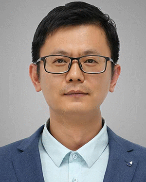 Wenjie Zhang合作论文数State Key Laboratory of Resources and Environmental Information System Institute, of Geographic Sciences and Natural Resources Research Chinese Academy of Sciences2Zhoupeng Ren合作论文数Institute of Geographic Science and Natural Resource Research, Chinese Academy of Sciences;University of Chinese Academy of Sciences;Key Laboratory of Surveillance and Early Warning on Infectious Disease, Chinese Center for Disease Control and Prevention;University of Chinese Academy of Sciences, Chinese Academy of Sciences2LI Zheng-mao (李正茂)合作论文数2
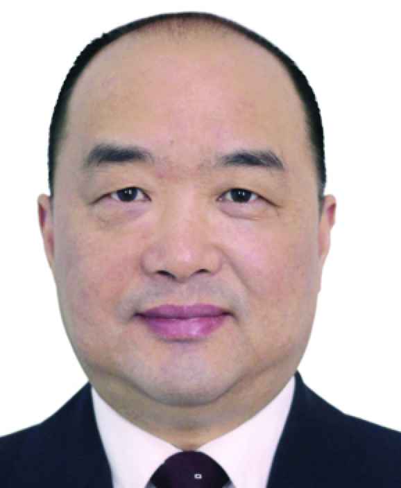 Huai-Min Wang (王怀民)合作论文数National University of Defense Technology2
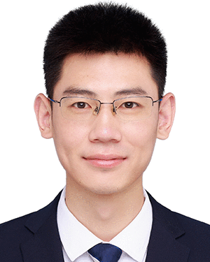 Tao Wu合作论文数2
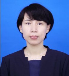 Weihong Han合作论文数School of Computer Science, National University of Defence Technology2Juncai Zang合作论文数1Tingjuan Zhang合作论文数1Xin-Wu Hu合作论文数1
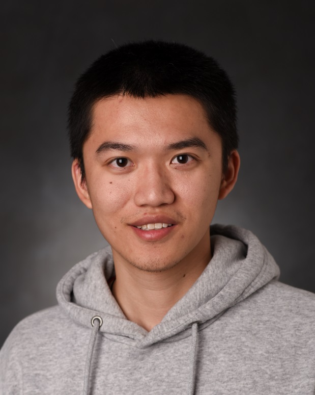 Ke Liang合作论文数College of Computer Science and Technology, National University of Defense Technology1Guan Tingzhao合作论文数1Chuanqi Li合作论文数1Huifang Pang合作论文数1Chang Sun合作论文数1Yong Cheng合作论文数1Xie Yong合作论文数1Wang Jianhua (王建华)合作论文数1Wei Wang合作论文数1Hongjun Wang合作论文数1
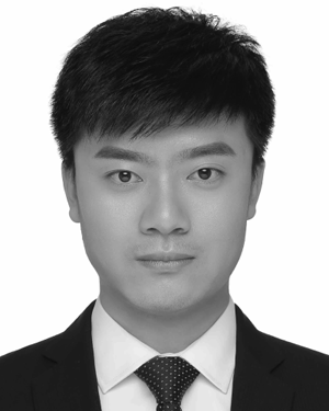 NI Huan (倪欢)合作论文数1Han Lin合作论文数1Min ZHAO (赵敏)合作论文数1Tianren Zhou (周天任)合作论文数1Yu-wang WANG (王余旺)合作论文数1Aijun Zhou合作论文数1Hu Liang合作论文数1Jianwen Chen合作论文数1Shu Huang合作论文数1Chao Xie合作论文数1Lihong Shi合作论文数1Jun-Ping Wang合作论文数1Lin Du合作论文数1Bin Yao合作论文数1
 Yixuan Wang合作论文数1Bin Deng合作论文数1Yongliang Wang合作论文数1
 Ye Gao合作论文数1




