The wild yak (Bos mutus) is a cold-tolerant herbivore native to the Tibetan Plateau and has been categorized as vulnerable by the International Union for Conservation of Nature and Natural Resources. Low population densities within currently fragmented habitats and unclear landscape conservation priorities warrant attention. Herein, we employed the maximum entropy (MaxEnt) model using over 900 wild yak occurrence records to model wild yak habitat suitability. Our analysis revealed unprotected wild yak landscapes covering 30.79 % of the habitat area, indicating a conservation gap between protected areas (PAs) and wild yak habitats. To protect metapopulation dynamics and mitigate high risks of poaching, habitat degradation and fragmentation, resource competition, and degenerated genetic characterization of wild yaks in fragmented and degraded habitat, we identified eight habitat patches as landscape conservation units (LCUs) and 14 linkages among the LCUs, enhancing the connectivity between LCUs to decrease negative effects of genetic threats. A centrality analysis demonstrated that Changtang, Arjinshan, and Hoh Xil national nature reserves and their linkages are all critical for the maintenance of habitat connectivity. Here, we suggest that habitat- and LCU-specific conservation strategies should be highlighted during the establishment of PAs and transboundary cooperation. Ultimately, our results can assist conservationists and land managers in comprehending wild yak distribution, movement, and habitat requirements, as well as for the development of effective protection strategies. Furthermore, the combined modeling method (MaxEnt-Zonation-InVEST) could be utilized as a component for identifying conservation priorities and linkages between core patches for species and assessing the efficiency of PAs, core habitats, and corridors in achieving conservation goals. Our study can provide a framework in identifying priority conservation and connectivity between habitat patches to facilitate effectively conservation and genetic resilience for endangered species in fragmented habitats.
区域协调发展空间布局及耦合效应是国土空间治理现代化、区域生态保护和高质量发展绕不开的重要命题.本研究利用146户牧户访谈和21次管理部门调研资料,结合卫星遥感数据和文献资料,从"三生"(生产、生活、生态)视角爬梳祁连山草地畜牧业、河西走廊饲草种植业、牧户生计路径策略的历史源起和发展历程.在生态系统服务流理论指导下深入刻画了祁连山与河西走廊农牧耦合系统的空间联系,诠释了祁连山-河西走廊"共轭型"生态牧场概念框架与发展模式.研究认为:(1)2011年"草原生态奖补政策"实施以来祁连山地区植被覆盖度增加显著(P<0.05);传统牧业户、生态移民户的生计多样化指数分别是2.22和2.69,生计能力脆弱;外购草料、舍饲养殖、人工种草、异地借牧(秸秆补饲)、流转草原等是牧户落实草畜动态平衡的基础性生计策略,实现了祁连山草地畜牧业由超载过牧到"超载不过牧"的跨越式转型;(2)祁连山山地系统将生态系统服务(淡水资源供给)外溢至河西走廊绿洲系统以支撑饲草种植业发展,河西走廊饲草种植业提供优质饲草"反哺"祁连山草地畜牧业发展,二者构成了山地-绿洲"共轭空间";借助外界物质能量输入路径的"虚拟草场"模式将祁连山牧业系统和河西走廊农业系统有机链接起来,既发挥了祁连山草地生态功能,又提升了祁连山牧区牧户维持可持续生计的能力,通过重构"生态-生产-生活"多功能协同权衡机制维持了祁连山生态畜牧业的高质量发展;(3)山地-绿洲"共轭型"生态牧场包括草地畜牧业、饲草种植业、"虚拟草场"三个子系统,通过构建子系统间的多维耦合、虚实交融和同生共存,实现了祁连山-河西走廊"共轭空间"农牧耦合系统的资源共享、优势互补和效益联动,是一种依据自然规律和经济规律探索出的迭代创新式生态牧场发展模式.
生态空间分区识别是支撑自然保护地生态资产管理的前提性和基础性工作.以祁连山国家公园青海片区(以下简称为"园区")为例,集成遥感技术、地理信息模型方法、景观生态学方法、GIS格网法,分析了园区1998-2018年土地利用、生态系统服务价值、景观生态风险的时空演变特征,选用Z-score标准化构建了四类生态分区.结果表明:(1)草地占园区面积的55.00%以上,30年间(1998-2018年)园区土地利用之间转移总面积为102.49 km2.(2)3个时期(1998年、2008年、2018年)园区生态系统服务价值(ESV)约为274亿元/a,单位面积ESV为172.94万元/km2.不同ESV等级呈现"大分散、小集聚"的镶嵌交错分布格局,高寒河源湿地区和寒温带针叶林区为ESV的高值区.(3)3个时期园区景观生态风险指数(ERI)分别为0.2287、0.2286和0.2310,生态安全状态整体较好,景观生态风险以低生态风险等级和较低生态风险等级占主导地位,占园区面积的90.00%左右.人工牧草地、旱地、建设用地的景观生态风险等级较高.(4)结合生态系统服务价值和景观生态风险两个维度将园区划分为生态保障型生境修复区(Ⅰ)、生态脆弱型特别保护区(Ⅱ)、生态改良型发展利用区(Ⅲ)和生态预防型保育涵养区(Ⅳ)四类生态分区,并提出差异化管控方案.
Significant heterogeneity has been observed among different ecosystem services (ES). Understanding the trade-offs and synergies among ES and delineating ecological functional zones is crucial for formulating regional management policies that improve human well-being and sustainably develop and maintain ecosystems. In this study, we used the Integrated Valuation of Ecosystem Services and Trade-offs (InVEST) and Carnegie–Ames–Stanford Approach (CASA) models to evaluate the spatial distribution patterns of nine ES (food supply, raw material supply, water resource supply, water connotation, climate regulation, soil conservation, water purification, habitat quality, and entertainment tourism) in the Qilian Mountains from 2000 to 2018. We also investigated the trade-offs and synergistic relationships among ES through Spearman correlation analysis, identified ES hotspots through exploratory spatial data analysis, and identified ES bundles (ESB) using K-means clustering. Our results revealed that water purification and habitat quality remained relatively stable, while food supply, raw material supply, water resource supply, water conservation, climate regulation, soil conservation, and entertainment tourism increased by 1038.83 Yuan·ha−1, 448.21 Yuan·ha−1, 55.45 mm, 7.80 mm, 0.60 tc·ha−1, 40.01 t·ha−1 and 4.82, respectively. High-value areas for water resource supply were mainly concentrated in the high-altitude mountainous area, whereas high-value areas for soil conservation were found in the western and eastern parts of the study area. The low-value areas of water purification were primarily located in the east, while the remaining six services were highly distributed in the east and were less common in the west. Correlation analysis showed that water resource supply, water conservation, and soil conservation exhibited a synergistic relationship in the Qilian Mountains. Moreover, food supply, raw material supply, climate regulation, habitat quality, and entertainment tourism showed synergistic relationships. However, there were trade-offs between food supply and water purification as well as water resource supply, and habitat quality showed a tradeoff with water resource supply, water conservation, and soil conservation. We identified four ESB. The food supply bundle consisted mainly of farmland ecosystems, while the windbreak and sand fixation and ecological coordination bundles were dominant in the Qilian Mountains. Notably, the area of the water conservation bundle increased significantly. Our comprehensive findings on ES and ESB can provide a theoretical foundation for the formulation of ecological management policies and the sustainable development of ecosystems in the Qilian Mountains.
Cultural diffusion is one of the core issues among researchers in the field of cultural geography. This study aimed to examine the spatial diffusion patterns of the Qijia culture (QJC) to clarify the origin and formation process of Chinese field model-based cultural diffusion patterns (FM-CDP) and geographic information system (GIS) spatial analysis methods. It used the point data of Qijia cultural sites without time information and combined them with the relevant records of Qijia cultural and historical documents, as well as archaeological excavation materials. Starting with the spatial location information of cultural distribution, it comprehensively analysed the cultural hearth, regions, diffusion patterns, and diffusion paths. The results indicated the following. (1) The QJC’s heart is in the southeast of Gansu Province, where the Shizhaocun and Xishanping sites are distributed. (2) Five different levels of cultural regions were formed, which demonstrated different diffusion patterns at different regional scales. On a large regional scale, many cultural regions belong to relocation diffusion patterns. Meanwhile, at the small regional scale (in the Gansu–Qinghai region), there are two patterns of diffusion: expansion diffusion and relocation diffusion; however, the expansion diffusion pattern is the main one. (3) Based on the relationship between the QJC, altitude, and the water system, the culture also has the characteristics of diffusion to low altitude areas and a pattern of diffusion along water systems. (4) There is a circular structure of the core, periphery, and fringe regions of the QJC. Finally, (5) the dry and cold climate around 4000a B.P., the cultural exchange between Europe and the Asian continent (the introduction of barley, wheat, livestock and sheep, and copper smelting technology), and the war in the late Neolithic period were important factors affecting the diffusion of the QJC.
Groundwater is the main source of water and salt recharge for to lakes in arid regions. Quantifying the groundwater discharge and its nutrient input is important in the evolution of lake environments in the Badain Jaran Desert (BJD), Northwest China. In this study, ten BJD lakes were sampled for 222Rn in April and September 2021, and the 222Rn mass balance model was used to quantify the groundwater discharge rates and derived nutrient fluxes to these lakes. The results showed that the 222Rn activity and the groundwater recharge rate of lake water both present a positively correlated with lake water depth. The hot points of high 222Rn activity in the lake water were consistent with the locations of groundwater discharge areas. According to the 222Rn temporal and spatial distributions, the mean groundwater recharge rates for the ten lakes in April and September were 5.4 ± 0.6 and 7.7 ± 1 mm/d, respectively, and the annual mean groundwater discharge rates varied between 1.1 ± 0.2 and 14.6 ± 1.6 mm/d, with a mean of 7 ± 0.9 mm/d. Given that all the perennial lakes in the BJD have the same groundwater recharge rate as the mean recharge rate of the ten studied lakes, the annual mean groundwater recharge amount received by the lakes in the entire BJD is (5.6 ± 0.7) × 107 m3/a. According to the groundwater recharge amount, the inputs of dissolved inorganic nitrogen, dissolved inorganic phosphorus, dissolved inorganic silicon, total nitrogen, and total phosphorus to the BJD lakes from groundwater were (4.7 ± 0.6) × 105, (3.8 ± 0.5) × 104, (7.9 ± 1) × 105, (7.2 ± 0.9) × 105, (2.5 ± 0.3) × 104 kg/a, respectively. This study provides a reference for quantifying of groundwater discharge rates into salt lakes in other arid regions.
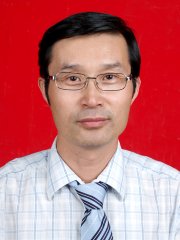 Nai-Ang Wang (王乃昂)合作论文数College of Earth and Environmental Sciences, Lanzhou University5
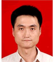 Hongyi Cheng (程弘毅)合作论文数4
 Yuanyuan Wang合作论文数2Xiao Liu合作论文数1Yixin Wang合作论文数1
 Chenao Lu合作论文数1Wen Penghui合作论文数1Jiang Liu合作论文数1
 Xianbao Su合作论文数1Kaili Zhang合作论文数1Xueran Liang合作论文数1SUN Dehao (孙德浩)合作论文数1Meng Li合作论文数1Xiaoyun CAO (曹晓云)合作论文数1CunXiong Zhu (祝存兄)合作论文数1Bingrong Zhou (周秉荣)合作论文数青海省气象科学研究所1Bin Qiao (乔斌)合作论文数1Liqiang Zhao (赵力强)合作论文数College of Earth and Environmental Sciences, Lanzhou University1Naiang Wang (王乃昂)合作论文数College of Earth and Environmental Sciences, Lanzhou University1
 Hang Zhao合作论文数1




