First posted April 23, 2018 For additional information, contact: Contact Information, Menlo Park, Calif. Office—Earthquake Science Center U.S. Geological Survey 345 Middlefield Road, MS 977 Menlo Park, CA 94025 https://earthquake.usgs.gov/ Seismic hazard assessments that are based on a variety of data and the best available science, coupled with rapid synthesis of real-time information from continuous monitoring networks to guide post-earthquake response, form a solid foundation for effective earthquake loss reduction. With this in mind, the Earthquake Hazards Program (EHP) of the U.S. Geological Survey (USGS) Natural Hazards Mission Area (NHMA) engages in a variety of undertakings, both established and emergent, in order to provide high quality products that enable stakeholders to take action in advance of and in response to earthquakes. Examples include the National Seismic Hazard Model (NSHM), development of tools for improved situational awareness such as earthquake early warning (EEW) and operational earthquake forecasting (OEF), research about induced seismicity, and new efforts to advance comprehensive subduction zone science and monitoring. Geodetic observations provide unique and complementary information directly relevant to advancing many aspects of these efforts (fig. 1). EHP scientists have long leveraged geodetic data for a range of influential studies, and they continue to develop innovative observation and analysis methods that push the boundaries of the field of geodesy as applied to natural hazards research. Given the ongoing, rapid improvement in availability, variety, and precision of geodetic measurements, considering ways to fully utilize this observational resource for earthquake loss reduction is timely and essential. This report presents strategies, and the underlying scientific rationale, by which the EHP could achieve the following outcomes: The EHP is an authoritative source for the interpretation of geodetic data and its use for earthquake loss reduction throughout the United States and its territories.The USGS consistently provides timely, high quality geodetic data to stakeholders.Significant earthquakes are better characterized by incorporating geodetic data into USGS event response products and by expanded use of geodetic imaging data to assess fault rupture and source parameters.Uncertainties in the NSHM, and in regional earthquake models, are reduced by fully incorporating geodetic data into earthquake probability calculations.Geodetic networks and data are integrated into the operations and earthquake information products of the Advanced National Seismic System (ANSS).Earthquake early warnings are improved by more rapidly assessing ground displacement and the dynamic faulting process for the largest earthquakes using real-time geodetic data.Methodology for probabilistic earthquake forecasting is refined by including geodetic data when calculating evolving moment release during aftershock sequences and by better understanding the implications of transient deformation for earthquake likelihood.A geodesy program that encompasses a balanced mix of activities to sustain missioncritical capabilities, grows new competencies through the continuum of fundamental to applied research, and ensures sufficient resources for these endeavors provides a foundation by which the EHP can be a leader in the application of geodesy to earthquake science. With this in mind the following objectives provide a framework to guide EHP efforts:Fully utilize geodetic information to improve key products, such as the NSHM and EEW, and to address new ventures like the USGS Subduction Zone Science Plan.Expand the variety, accuracy, and timeliness of post-earthquake information products, such as PAGER (Prompt Assessment of Global Earthquakes for Response), through incorporation of geodetic observations.Determine if geodetic measurements of transient deformation can significantly improve estimates of earthquake probability.Maintain an observational strategy aligned with the target outcomes of this document that includes continuous monitoring, recording of ephemeral observations, focused data collection for use in research, and application-driven data processing and analysis systems.Collaborate on research, development, and operation of affordable, high-precision seafloor geodetic methods that improve earthquake forecasting and event response.Advance computational techniques and instrumentation to enable use of strategies like repeat-pass imagery and low-cost geodetic sensors for earthquake response, monitoring, and research.Engage stakeholders and collaborate with partner institutions to foster operational and research objectives and to safeguard the continued health of geodetic infrastructure upon which we mutually depend.Maintaining a vibrant internal research program provides the foundation by which the EHP can remain an effective and trusted source for earthquake science. Exploiting abundant new data sources, evaluating and assimilating the latest science, and pursuing novel avenues of investigation are means to fulfilling the EHP’s core responsibilities and realizing the important scientific advances envisioned by its scientists. Central to the success of such a research program is engaging personnel with a breadth of competencies and a willingness and ability to adapt these to the program’s evolving priorities, enabling current staff to expand their skills and responsibilities, and planning holistically to meet shared workforce needs. In parallel, collaboration with external partners to support scientific investigations that complement ongoing internal research enables the EHP to strengthen earthquake information products by incorporating alternative perspectives and approaches and to study topics and geographic regions that cannot be adequately covered internally.With commensurate support from technical staff who possess diverse skills, including engineering, information technology, and proficiency in quantitative analysis combined with basic geophysical knowledge, the EHP can achieve the geodetic outcomes identified in this document.
Probabilistic forecasting of earthquake-producing fault ruptures informs all major decisions aimed at reducing seismic risk and improving earthquake resilience. Earthquake forecasting models rely on two scales of hazard evolution: long-term (decades to centuries) probabilities of fault rupture, constrained by stress renewal statistics, and short-term (hours to years) probabilities of distributed seismicity, constrained by earthquake-clustering statistics. Comprehensive datasets on both hazard scales have been integrated into the Uniform California Earthquake Rupture Forecast, Version 3 (UCERF3). UCERF3 is the first model to provide self-consistent rupture probabilities over forecasting intervals from less than an hour to more than a century, and it is the first capable of evaluating the short-term hazards that result from multievent sequences of complex faulting. This article gives an overview of UCERF3, illustrates the short-term probabilities with aftershock scenarios, and draws some valuable scientific conclusions from the modeling results. In particular, seismic, geologic, and geodetic data, when combined in the UCERF3 framework, reject two types of fault-based models: long-term forecasts constrained to have local Gutenberg-Richter scaling, and short-term forecasts that lack stress relaxation by elastic rebound.
Cluster analysis offers an agnostic way to organize and explore features of the current GPS velocity field without reference to geologic information or physical models using information only contained in the velocity field itself. We have used cluster analysis of the Southern California Global Positioning System (GPS) velocity field to determine the partitioning of Pacific-North America relative motion onto major regional faults. Our results indicate the large-scale kinematics of the region is best described with two boundaries of high velocity gradient, one centered on the Coachella section of the San Andreas Fault and the Eastern California Shear Zone and the other defined by the San Jacinto Fault south of Cajon Pass and the San Andreas Fault farther north. The similar to 120km long strand of the San Andreas between Cajon Pass and Coachella Valley (often termed the San Bernardino and San Gorgonio sections) is thus currently of secondary importance and carries lesser amounts of slip over most or all of its length. We show these first order results are present inmaps of the smoothed GPS velocity field itself. They are also generally consistent with currently available, loosely bounded geologic and geodetic fault slip rate estimates that alone do not provide useful constraints on the large-scale partitioning we show here. Our analysis does not preclude the existence of smaller blocks and more block boundaries in Southern California. However, attempts to identify smaller blocks along and adjacent to the San Gorgonio section were not successful.
We have developed a suite of earthquake cycle models for strike-slip faults to investigate how finite ruptures and lithosphere-scale viscous shear zones affect interseismic deformation. In particular, we assess whether localized and stationary interseismic deformation and large-scale, rapidly decaying postseismic transients may be explained with models incorporating either or both of these features. Models incorporating viscous shear zones give more stationary interseismic deformation than layered half-space, Maxwell viscoelastic models producing similar early postseismic deformation in the near field. This tendency is accentuated when the effective viscosity per unit width of the shear zone increases either with depth or with interseismic time. Models with finite (200km long) ruptures produce time-dependent deformation similar to that from models with infinitely long ruptures, though with smaller-magnitude and somewhat more localized surface velocity fluctuations. Models incorporating a stiff lithosphere, a low-viscosity mantle asthenosphere, and a crust- to lithosphere-scale viscous shear zone can replicate postseismic and interseismic deformation typical of large, strike-slip earthquakes. Such models require depth-dependent, power law, or transient rheologies for the viscous shear zone material in the crust, as long as the effective viscosity per unit shear zone width is approximately 10(15)Pas/m at crustal depths during the postseismic interval. Below the Moho, the shear zone effective viscosity per unit width must be higher throughout the seismic cycle, at least over a short depth interval. For example, if shear zone viscosity per unit width is 5x10(16)Pas/m in the mantle lithosphere, a model with a 50km thick lithosphere and asthenosphere effective viscosities of 1 to 5x10(18)Pas can reproduce reference velocity profiles for both postseismic and later interseismic deformation.
The 2014 Working Group on California Earthquake Probabilities (WGCEP14) present the time-independent component of the Uniform California Earthquake Rupture Forecast, Version 3 (UCERF3), which provides authoritative estimates of the magnitude, location, and time-averaged frequency of potentially damaging earthquakes in California. The primary achievements have been to relax fault segmentation and include multifault ruptures, both limitations of UCERF2. The rates of all earthquakes are solved for simultaneously and from a broader range of data, using a system-level inversion that is both conceptually simple and extensible. The inverse problem is large and underdetermined, so a range of models is sampled using an efficient simulated annealing algorithm. The approach is more derivative than prescriptive (e.g., magnitude-frequency distributions are no longer assumed), so new analysis tools were developed for exploring solutions. Epistemic uncertainties were also accounted for using 1440 alternative logic-tree branches, necessitating access to supercomputers. The most influential uncertainties include alternative deformation models (fault slip rates), a new smoothed seismicity algorithm, alternative values for the total rate of M-w >= 5 events, and different scaling relationships, virtually all of which are new. As a notable first, three deformation models are based on kinematically consistent inversions of geodetic and geologic data, also providing slip-rate constraints on faults previously excluded due to lack of geologic data. The grand inversion constitutes a system-level framework for testing hypotheses and balancing the influence of different experts. For example, we demonstrate serious challenges with the Gutenberg-Richter hypothesis for individual faults. UCERF3 is still an approximation of the system, however, and the range of models is limited (e.g., constrained to stay close to UCERF2). Nevertheless, UCERF3 removes the apparent UCERF2 overprediction of M 6.5-7 earthquake rates and also includes types of multifault ruptures seen in nature. Although UCERF3 fits the data better than UCERF2 overall, there may be areas that warrant further site-specific investigation. Supporting products may be of general interest, and we list key assumptions and avenues for future model improvements.
In this study, we investigate the extent to which viscoelastic velocity perturbations (or “ghost transients”) from individual fault segments can affect elastic block model‐based inferences of fault slip rates from GPS velocity fields. We focus on the southern California GPS velocity field, exploring the effects of known, large earthquakes for two end‐member rheological structures. Our approach is to compute, at each GPS site, the velocity perturbation relative to a cycle average for earthquake cycles on particular fault segments. We then correct the SCEC CMM4.0 velocity field for this perturbation and invert the corrected field for fault slip rates. We find that if asthenosphere viscosities are low (3 × 10 18 Pa s), the current GPS velocity field is significantly perturbed by viscoelastic earthquake cycle effects associated with the San Andreas Fault segment that last ruptured in 1857 (M w = 7.9). Correcting the GPS velocity field for this perturbation (or “ghost transient”) adds about 5 mm/a to the SAF slip rate along the Mojave and San Bernardino segments. The GPS velocity perturbations due to large earthquakes on the Garlock Fault (most recently, events in the early 1600s) and the White Wolf Fault (most recently, the M w = 7.3 1952 Kern County earthquake) are smaller and do not influence block‐model inverted fault slip rates. This suggests that either the large discrepancy between geodetic and geologic slip rates for the Garlock Fault is not due to a ghost transient or that un‐modeled transients from recent Mojave earthquakes may influence the GPS velocity field.
During the last similar to 100 years, tectonic geodesy has evolved from sparse field-based measurements of crustal deformation to the use of space geodetic techniques involving observations of satellites and from satellites orbiting Earth, which reveal a variety of tectonic processes acting over a wide range of spatial and temporal scales. Early terrestrial measurements using triangulation and leveling techniques characterized large displacements associated with great earthquakes and led to the recognition of the fundamental mechanics of seismic faulting and the earthquake cycle. More precise measurements using ground-based laser ranging allowed for the characterization and modeling of interseismic strain buildup and determination of slip rates on major faults. Continuous and highly accurate point measurements of strain, tilt, and fault creep have captured intriguing deformation transients associated with slow slip events on active faults. The greatly improved precision, spatial and temporal resolution, global coverage, and relatively low cost of space geodetic measurements led to a revolution in crustal deformation measurements of a range of tectonic processes. Very Long Baseline Interferometry, the Global Positioning System, Interferometric Synthetic Aperture Radar, and space-based image geodesy complement each other to comprehensively capture tectonics in action at scales ranging from meters to global and seconds to decades. Space geodetic measurements allow for the precise measurement of global plate motions, the determination of strain rate fields and fault slip rates in distributed plate-boundary deformation zones, and characterization of subtle intra-plate deformation. These measurements provide increasingly important constraints for earthquake hazard studies. Space geodesy also allows for the recognition and detailed model exploration of a number of transient deformation processes during the post-earthquake deformation phase of the earthquake cycle. Measurements of postseismic deformation transients provide important insights into the mechanisms, rheological properties, and dynamics of crustal deformation. Increasingly, seafloor geodetic measurements provide information about deformation on the 70% of the Earth's surface that were previously inaccessible. Future improvements of modern geodetic techniques promise to further illuminate details of crustal deformation at all spatial and temporal scales, leading to an improved understanding of the dynamics of active tectonics.
This chapter contains sections titled: Introduction Geologic and Tectonic setting 1899 Deformation A Revised Deformation Model Paleoseismology Earthquake Seismograms and Seismic Moment Crustal Deformation and Faulting Models Earthquake Hazards and Seismic Gaps Summary and Conclusions
Major intracontinental strike‐slip faults tend to mark boundaries between lithospheric blocks of contrasting mechanical properties along much of their length. Both crustal and mantle heterogeneities can form such boundaries, but the role of crustal versus mantle strength contrasts for localizing strain sufficiently to generate major faults remains unclear. Using the crustal velocity field observed through the Global Positioning System (GPS) in the epicentral area of the M7.2 2010 El Mayor‐Cucapah earthquake, Baja California, we find that transient deformation observed after the event is anomalously small in areas of relatively high seismic velocity in the shallow upper mantle (∼50 km depth). This pattern is best explained with a laterally heterogeneous viscoelastic structure that mimics the seismic structure. The mantle of the Southern Colorado River Desert (SCRD) and Peninsular Ranges (PR), which bound the fault system to its east and west, respectively, have anomalously high viscosity and seismic velocity. We hypothesize that compared with the rest of the San Andreas fault (SAF) system to its north, the strike‐slip fault system in northern Baja California is narrow because of the presence of the PR and SCRD high‐viscosity regions which bound it.
Geodetic measurements tell us that the eastern part of the Basin and Range Province expands in an east-west direction relative to stable North America, whereas the western part of the province moves to the northwest. We develop three-dimensional finite element representations of the western United States lithosphere in an effort to understand the global positioning system (GPS) signal. The models are constrained by known bounding-block velocities and topography, and Basin and Range Province deformation is represented by simple plastic (thermal creep) rheology. We show that active Basin and Range spreading by gravity collapse is expected to have a strong southward component that does not match the GPS signal. We can reconcile the gravitational component of displacement with observed velocity vectors if the Pacific plate applies northwest-directed shear stress to the Basin and Range via the Sierra Nevada block. This effect reaches at least 1000 km east of the San Andreas fault in our models.
 Fred Pollitz合作论文数United States Geological Survey18
 Charles Wicks合作论文数U.S. Geological Survey17
 Daniel Dzurisin合作论文数11
 Marleen Nyst合作论文数10
 Ross Stein合作论文数Temblor, Inc.8Thomas C. Hanks合作论文数United States Geological Survey8
 Elizabeth Harding Hearn合作论文数Department of Geological Sciences;University of Oregon;Department of Geological Sciences, University of Oregon7
 Zhong Lu (路中)合作论文数Roy M. Huffington Department of Earth Sciences, Southern Methodist University5James N. Brune合作论文数4
 Takuya Nishimura (西村卓也)合作论文数Research Center for Earthquake Hazards, Disaster Prevention Research Institute, Kyoto University4
 Roland Bürgmann合作论文数Department of Earth and Planetary Sciences, University of California, Berkeley3
 Tom Jordan合作论文数Department of Earth Sciences, College of Letters, Arts and Sciences, University of Southern California3
 Tom Parsons合作论文数Pacific Coastal and Marine Science Center, United States Geological Survey3Sandford R. Holdahl合作论文数3Charles T. Whalen合作论文数3Tokihiko Matsuda合作论文数3
 Kaj M. Johnson合作论文数Department of Geological Sciences, Indiana University3Sarah E. Minson合作论文数US Geol Survey3
 William Hammond合作论文数Nevada Bureau of Mines;Nevada Seismological Laboratory;University of Nevada;Nevada Seismological Laboratory, University of Nevada3WE STRANGE合作论文数2M. H. Murray合作论文数2Dp Hill合作论文数2Timothy Dawson合作论文数2tsunehiko nishimura合作论文数2J. C. Savage合作论文数2Peter M Powers合作论文数2Jessica R. Murray合作论文数2
 John Rundle合作论文数Department of Physics and Astronomy, University of California, Davis;The Santa Fe Institute2
 Sean C. Solomon合作论文数Lamont-Doherty Earth Observatory, Columbia Climate School, Columbia University2
 Michael Lisowski合作论文数2
 Morgan T. Page合作论文数US Geol Survey2John Langbein合作论文数United States Geological Survey2Ray J. Weldon合作论文数Department of Geological Sciences, University of Oregon2
 Bruce E Shaw合作论文数Lamont-Doherty Earth Observatory;Columbia University;Lamont-Doherty Earth Observatory, Columbia University2
 William Ellsworth合作论文数School of Earth, Energy & Environmental Sciences, Stanford University2Malcolm J Johnston合作论文数2Jerry Svarc合作论文数2Karen Felzer合作论文数2Christopher Madden合作论文数2Evelyn Roeloffs合作论文数United States Geological Survey2
 Jeanne Sauber合作论文数NASA, Goddard Space Flight Center2Tim J. Wright合作论文数2
 Edward H. Field合作论文数Southern California Earthquake Center, University of Southern California2
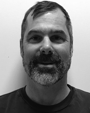 Benjamin A. Brooks合作论文数2
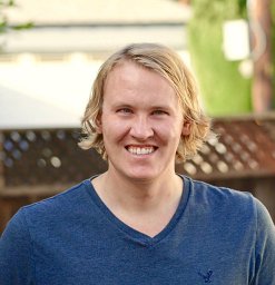 Kevin Milner合作论文数University of Southern California2Jerry L. Svarc合作论文数U. S. Geological Survey2Colin F. Williams合作论文数2James A. Hileman合作论文数2John A. Power合作论文数From the National Institutes of Health2




