Early perception of sudden traffic targets in urban road blind spots is a key challenge for autonomous driving. This paper innovatively fuses the multipath effect of millimeterwave radar (MMWR) with LiDAR point clouds and proposes an improved extended Kalman filter (EKF) tracking framework to achieve cross-regional cooperative tracking of non-line-of-sight (NLoS) blind spot targets. Through multi-source sensing data spatiotemporal synchronization, improved E-DBSCAN clustering, and a data association strategy based on Bayesian velocity likelihood, the system effectively solves the problems of target loss and false tracking under occlusion conditions. Field experiments verify that compared with a single sensor, the fusion scheme proposed in this paper improves the average positioning accuracy in NLoS scenarios by more than 21.5% and extends the effective tracking duration by 55.6%, providing an effective technical approach for achieving safe and reliable blind spot warning.
With the rapid development of wireless communication technologies, high-precision channel parameter estimation has become increasingly significant for applications, such as positioning and sensing. To address the limitations of traditional binary encoding genetic algorithm (GA), including discontinuous hamming distances and low coding efficiency, this letter proposes M-Ary encoding genetic algorithm (MGA). Through comprehensive comparison of binary, quaternary, octal, and decimal encoding schemes, the simulation results demonstrate that quaternary encoding achieves an optimal balance between estimation accuracy and computational complexity. This letter reveals the impact of MGA on channel parameter estimation and the quaternary GA outperforms alternative encoding schemes, demonstrating enhanced adaptability, and improved accuracy in complex channel environments.
Dynamic tasks or resources localization in distributed edge computing systems with inaccuracies in node positioning represent a critical research direction. Existing closed-form methods often introduce auxiliary variables to pseudo-linearize the performance models, followed by parameter estimation via weighted least squares (WLS). Although such a procedure is frequently refined in a subsequent step, the inclusion of extra variables tends to amplify estimation errors, causing the results to deviate from the Cramér–Rao lower bound (CRLB) under high-noise scenarios. To address this limitation, we propose a two-phase closed-form algorithm. In the first phase, extra variables are eliminated using an orthogonal projection matrix, and an initial solution is derived via least squares (LS). Since the omitted terms contain relevant information about task location and dynamics, this preliminary estimate remains suboptimal. A second phase is therefore designed to enhance its accuracy. The proposed estimator has potential for real-time implementation, because it avoids iterative convergence and provides deterministic computational steps. Both theoretical analysis and numerical simulations demonstrate that the proposed estimator achieves the CRLB under moderate Gaussian noise conditions. Simulation results further confirm the computational efficiency of the method and its superiority over existing closed-form alternatives.
Uncrewed aerial vehicle (UAV) air-to-ground radar sensing channels are critical for 6G integrated sensing and communication systems, yet their geometric characteristics and multipath behavior remain insufficiently characterized. This letter presents a comprehensive measurement campaign utilizing a 77 GHz frequency modulated continuous wave radar mounted on a lightweight UAV platform (2.6 kg) in a cluttered campus environment. Multipath components are extracted via the space-alternating generalized expectation-maximization algorithm, and a novel trajectory association framework integrating density-based spatial clustering of applications with noise clustering with fuzzy C-means and Kuhn-Munkres algorithms enables robust multipath tracking. Furthermore, this letter proposes a hyperbolic geometric model. By analyzing range-time domain signatures, the model distinguishes real targets from multipath-induced ghost targets, providing crucial insights for UAV-based perception systems and advancing radar channel modeling in high-frequency bands.
Accurate small-scale fading prediction in unmanned aerial vehicle (UAV) air-to-ground (A2G) channels is essential for adaptive transmission and reliable sixth-generation (6 G) non-terrestrial links, yet altitude-dependent channel statistics hinder cross-altitude generalization. This letter proposes the temporal altitude-conditioned fading network (TAF-Net), an altitude-conditioned envelope prediction framework that combines feature-wise linear modulation (FiLM), cross-altitude Mixup, and multi-task learning to learn a smooth mapping from altitude to fading statistics. Tests on measured UAV flight data show high leave-one-altitude-out accuracy and effective generalization to unseen altitudes, with clear advantages over pure convolutional neural network (CNN) and temporal convolutional network (TCN) baselines in challenging cross-altitude cases.
Unmanned Aerial Vehicle (UAV)-enabled Mobile Edge Computing (MEC) has emerged as a promising paradigm for future wireless communication systems by providing flexible and efficient computation offloading services to resource-limited ground User Devices (UDs). However, the non-uniform user distribution and mobility, heterogeneous computation demands, and scarce UAV resources pose significant challenges in simultaneously achieving high system performance and long-term service fairness. To address these challenges, this paper proposes a fairness-driven joint optimization framework that integrates UAV Three-Dimensional (3D) deployment, task scheduling, offloading ratio and resource allocation. First, the original Mixed-Integer-NonLinear-Programming (MINLP) problem is decomposed into two tractable sub-problems, namely UAV deployment sub-problem and task scheduling sub-problem. Based on this decomposition, a Fairness-Driven UAV Deployment Optimization and Task Scheduling (FUDOTS) algorithm is developed to maximize fairness-based system throughput. Extensive simulation results demonstrate that the effectiveness of proposed FUDOTS algorithm, which consistently outperforming other existing benchmark schemes in terms of Jain’s Fairness Index (JFI) and fairness-based system throughput.
Distance-based localization using Time-of-Arrival (ToA) estimation is fundamentally constrained by the accuracy of channel parameter tracking in non-stationary, high-mobility environments. In such scenarios, the estimation landscape becomes highly non-convex and multi-modal, rendering conventional gradient-driven trackers inadequate. This paper proposes a Gated Recurrent Unit (GRU)-enhanced Whale Optimization-based Tracking Algorithm (WoTA), a robust framework that synergistically fuses meta-heuristic global optimization with recursive filtering. Specifically, an Opposition-based Learning Whale Optimization Algorithm (OBL-WOA) is integrated to adaptively explore the complex cost function surface, effectively initializing the tracker and preventing local optima entrapment in multi-modal distributions. To overcome the limitations of manual parameter tuning in traditional WOA and Kalman Filters (KF), a GRU-based adaptive mechanism is introduced. This mechanism learns the temporal dependencies of optimization residuals to dynamically recalibrate the filter’s noise covariance and optimization hyperparameters, thereby enhancing resilience against model uncertainties. By coupling OBL-WOA’s global exploration with the KF’s exploitation of temporal kinematics, WoTA achieves smoothed and precise state transitions. Comprehensive simulations and real-world channel sounding measurements demonstrate that WoTA consistently outperforms state-of-the-art methods, such as SAGE and KEST. These results demonstrate that the proposed integration of heuristic exploration and recursive refinement offers a scalable and accurate framework for channel parameter tracking in dynamic multipath environments, thereby supporting reliable 6G wireless systems.
Mobile Edge Computing (MEC) empowered by Unmanned Aerial Vehicles (UAVs) has emerged as an effective approach for handling the substantial data-processing tasks generated by widely distributed User Devices (UDs). By exploiting flexible mobility and favorable air-to-ground communication links, UAVs can act as aerial edge servers to improve task processing efficiency. However, practical deployments are constrained by the need to properly schedule UAV movements and by limited onboard computing resources, which together may lead to excessive latency for real-time services. In this paper, we study a UAV-assisted MEC system with the objective of minimizing overall delay, where the delay metric incorporates both queueing and computation delays under an energy constraint. We jointly optimize UAV flight trajectories and computation offloading decisions to reduce service time. Due to the strong coupling between continuous trajectory variables and offloading decisions, the resulting problem is difficult to solve using standard convex optimization techniques. To obtain a scalable solution, a joint design is formulated as a Markov Decision Process (MDP) and a cooperative multi-agent deep reinforcement learning framework is provided. A Twin Delayed Deep Deterministic (TD3) policy gradient scheme is employed to better handle large-scale continuous state–action spaces and to enhance learning stability. Simulation results indicate that the proposed approach attains a reduced average latency compared to the deep deterministic policy gradient baseline.
In recent years, unmanned aerial vehicles (UAVs) have been widely used as aerial base stations in emergency rescue and environmental monitoring. However, air-to-ground (A2G) links are susceptible to large-scale fading. This paper investigates channel characteristics through measurements of fixed-wing UAVs at 300-800 meters altitudes in suburban scenarios, focusing on shadow fading and connectivity. Based on measurement data, the Gamma distribution is selected to model shadow fading via hypothesis tests and information criterion. A connectivity probability model incorporating path loss exponent and Gamma parameters is derived. Simulations show the effects of key parameters and altitude on connectivity, revealing that higher altitudes accelerate the decline in link stability.
Understanding and modeling of the characteristics of multipath transmission of unmanned aerial vehicle air-to-ground (A2G) wireless signal in complex environment play pivotal roles in the development of A2G communication and positioning applications. Traditional geometry-based stochastic channel model (GSCM) simulates the birth-death process of individual multipath components (MPCs) via the concept of visible region, which is complex in parameterization. In this letter, we present an extended A2G channel model by combining the GSCM with four-state Markov model by which the birth-death process of MPCs is controlled. Time-variant channel parameters are tracked by combining space-alternating generalized expectation-maximization method with the autoregressive moving average filter. The proposed model is validated by comparing the channel characteristics based on simulation results with the measurement data.
To address the growing demand for continuous, wide-area vehicle motion monitoring in IoT-driven intelligent transportation systems, optical fiber-based distributed acoustic sensing (DAS) has emerged as a promising sensing solution. However, vehicle-induced acoustic vibrations are often obscured by ambient noise and near-field interference, degrading DAS detection performance. To overcome this, we propose an IoT-oriented DAS framework for individual vehicle trajectory tracking, targeting sensing scenarios in which acoustic signals remain sufficiently separable along the fiber. First, we model vehicle-generated acoustic signals and analyze raw DAS data characteristics, then apply the Hilbert–Huang Transform (HHT) for denoising and feature extraction. A dual-threshold method based on power and zero-crossing rate is used to detect vehicle passage times incoherently. Subsequently, a multi-model Bayesian estimation approach estimates vehicle speed, and a space-domain Kalman filter enables continuous trajectory tracking along the optical fiber. Simulations and experiments demonstrate the robustness and accuracy of the proposed method, indicating its potential for IoT-based traffic monitoring systems.
Uncrewed Aerial Vehicle (UAV)-assisted Mobile Edge Computing (MEC) has emerged as a promising paradigm for supporting computation-intensive applications of ground User Equipments (UEs). However, with the growing computational demands for UEs, it becomes crucial and extremely challenging to jointly optimize the Three-Dimensional (3D) UAV trajectory and task scheduling decision, given UAVs' limited coverage and scarce resources. To address these challenges, we develop a Multi-UAV Trajectory Optimization and Task Scheduling (MUTOTS) algorithm based on Multi-Agent Deep Reinforcement Learning (MADRL). The proposed MUTOTS framework jointly optimizes multi-UAV 3D trajectories and task scheduling decisions, with the objective of maximizing total system throughput under strict flight-safety constraints. To further improve training stability and convergence, MUTOTS integrates prioritized experience replay and L-2 regularization technologies. Moreover, MUTOTS can adapt to different take-off locations, and effectively guide UAVs approach near-optimal deployment locations during the execution stage. Extensive simulation results demonstrate that the effectiveness, convergence and stability of the MUTOTS algorithm, and it significantly improves the system throughput compared with the other existing benchmark schemes.
In the BR-BRR based underwater multi base positioning system for moving targets, we have derived a measurement model equation considering SME to address the problem of traditional model being difficult to accurately locate targets without considering motion effects. We propose a hybrid method (TSWLS-HHO) that combines two-step weighted least squares and Harris Hawk optimization. In the first stage, auxiliary variables are introduced to establish a pseudo linear system based on BR and BRR, and rough estimates are obtained through TSWLS. In the second stage, HHO uses a cost function to refine the result deviation between the measured values and the theoretical BR-BRR values. The simulation results show that it can approach CRLB under both large and small noise conditions, which is superior to other comparative algorithms.
In variational inference-based tensor channel estimation, high order singular value decomposition (HOSVD) initialization effectively captures the latent features of factor matrices, and accelerates convergence speed. However, HOSVD-based initialization further exacerbates the overfitting issue of the tensor variation Bayesian (TVB) method on each factor matrix element, leading to inaccurate rank estimation, and then significantly degrading channel parameter estimation performance. To prevent overfitting, we propose a new TVB method based on array spatial prior (ASP), which incorporates space correlations in tensor data, without introducing additional hierarchical probabilistic models. By analyzing the inferred posterior distribution and the non-decreasing property of the evidence lower bound (ELBO), we confirm the favorable convergence characteristics and global search capability of the proposed algorithm. Through simulations and experiments, we observe that compared to traditional TVB, the proposed algorithm achieves accurate automatic rank determination (ARD) in just a few iterations, significantly reducing convergence time. Meanwhile, it demonstrates superior parameter estimation accuracy with fewer iterations than the compared method.
This paper investigates the delay-doppler characteristics of UAV A2G channels at 2.7 GHz, focusing on straight-line flight trajectories. Based on measured channel data, the doppler shift of the LoS path is estimated and verified, using UAV flight coordinate data. The normalized average doppler spectra under different trajectories are analyzed, and models for each channel tap are established. Comparative studies show that the Bell spectrum model outperforms the Jakes and Gaussian spectra in fitting the doppler characteristics, with lower RMSE. These findings provide theoretical support for channel modeling in 6G airborne networks, laying a foundation for improving wireless communication performance in UAV applications.
Computer simulated sea clutter generation cuts the high costs and long cycles of field collected sea clutter data. Traditional statistical modeling with real data lacks realism and generalization. GAN and VAE simulation methods struggle to capture global sea clutter features and generate complex sea clutter. To solve these problems, this paper proposes a sea clutter generation method based on DiffWave. We build a one dimensional sea clutter DiffWave model and train it with real data. We analyze the generated clutter’s temporal domain and frequency domain characteristics, as well as its temporal and spatial autocorrelation. The model is compared with existing ones using MMD metrics. Real data validation shows that it can generate more realistic sea clutter data.
Radio map is a promising technology that connects the user equipment (UE) location and its channel state information (CSI). By applying a radio map, the beamforming vector can be generated based solely on the location of the UE, thereby significantly saving pilot effort. However, the effectiveness of radio map-based beamforming is influenced by several factors, such as positioning errors and channel dynamics. To improve the adaptability and performance of radio map-based beamforming, in this paper we consider integrating location information with reduced pilots and examine the trade-off between pilot overhead and beamforming performance. In particular, an end-to-end method for joint extrapolation, denoising and performing beamforming with reduced pilots is proposed. Subsequently, the beamforming vector obtained from reduced pilots is integrated with that generated by the radio map. Considering the overhead caused by pilots, the support vector machine (SVM) is applied to determine whether it is worth introducing pilots for integration. According to the numerical simulations, the proposed end-to-end method with reduced pilots is superior to that with full pilots in terms of spectral efficiency (SE) and can be improved by integrating with the radio map. In addition, the application of SVM can effectively identify the integration needs, further reducing unnecessary pilot effort and thereby increasing SE.
Fixed-wing unmanned aerial vehicle (UAV) is widely considered as a vital candidate of aerial base station in beyond 5th-Generation (B5G) system due to its longer flight endurance and higher cruise altitude. Investigating and modeling the air-to-ground (A2G) wireless channel for fixed-wing UAV can better promote its development in various applications. In this article, we present a wideband A2G channel measurement campaign for fixed-wing UAV with a maximum altitude of 700 m. A comprehensive investigation of channel fading characteristics and channel modeling including path loss, shadow fading, spatial correlation, and small-scale fading is provided. Particularly, unlike terrestrial channels, a strong dependence of shadow fading and small-scale fading on UAV altitude is found. We propose to adopt Gamma distribution for modeling the shadow fading effect that has a similar fitting performance with traditional Log-normal distribution but is more robust for theoretical analysis. Spatial correlation characteristics and modeling are presented. Results reveal that the decorrelation distance of shadow fading increases with the UAV altitude. We propose to use a model combining the exponential and sinusoidal functions that fit well with the autocorrelation function for shadow fading. Further, by using Kolmogorov-Smirnov (KS) test, Cramer-von Mises (CVM) test, and Akaike information criterion (AIC) methods, the Rician distribution is found to be the best candidate for modeling small-scale fading for UAV with altitudes above 300 m. The Rician K-factor is found to be strongly depending not only on the direct distance but also on the UAV altitude. We finally propose a full-dimension empirical K-factor prediction model.
Real-time, accurate, and robust positioning system plays a crucial role in many vehicular applications for automatic driving system and Vehicular Ad-hoc Network (VANET). In the tunnel, the positioning accuracy of Global Navigation Satellite System (GNSS) decreases due to blocked satellite signals. In order to estimate the exact location of vehicles in tunnel environments, many positioning systems have been presented. However, there is a lack of effort in systematically comparing, organizing and analyzing these existing positioning systems, and identifying the strengths and weaknesses of different technologies and applicable scenarios. Therefore, this paper undertakes a thorough investigation into current vehicle localization technologies and methods for tunnel scenarios. The analysis starts with discussing various application scenarios for vehicle positioning system. Then, various vehicle positioning technologies are investigated, the advantages and drawbacks of each technology are illustrated. Thereafter, we discuss some widely used positioning methods in terms of range-based localization method, range-free localization method, multi-sensor fusion localization method, and cooperative positioning (CP) method. Finally, we discuss some challenges faced in vehicle positioning for tunnel environments, and propose some potential research topics for future research work.
 Thomas Jost合作论文数53
 Ronald Raulefs合作论文数German Aerospace Center;Institute of Communications and Navigation;German Aerospace Center, Institute of Communications and Navigation30
 Uwe-Carsten Fiebig合作论文数Institute for Communication and Navigation25
 Armin Dammann合作论文数German Aerospace Center;Institute of Communications and Navigation;German Aerospace Center, Institute of Communications and Navigation19
 Gerhard Steinböck合作论文数17
 Bernard Henri Fleury合作论文数16
 Suying Jiang合作论文数15Yuzhe Sun合作论文数14
 Xinyi Liu (刘鑫一)合作论文数School of Information Engineering, Chang'an University14
 Troels Pedersen合作论文数Section Navigation and Communications;Department of Electronic Systems;Aalborg University;Department of Electronic Systems, Aalborg University14
 Ibrahim Rashdan合作论文数(German Aerospace Center): Institute of Communications and Navigation, Wessling, Germany12
 Charles A. Czeisler合作论文数Division of Sleep Medicine, Harvard Medical School;Division of Sleep and Circadian Disorders, Departments of Medicine and Neurology, Brigham and Women's Hospital12Yue Lyu合作论文数11
 Jun Hou (侯俊)合作论文数School of Information Engineering, Chang'an University11
 Michael Walter合作论文数10
 Fernando Pérez-Fontán合作论文数University of Vigo10
 Yun Meng (孟芸)合作论文数长安大学电子与控制工程学院9
 Peng Chen (陈鹏)合作论文数School of Information Science and Engineering, Southeast University9
 Jeanne F. Duffy合作论文数Division of Sleep Medicine, Harvard Medical School9
 Ting Sun合作论文数8
 Yang Zhang合作论文数8
 Ruisi He (何睿斯)合作论文数State Key Laboratory of Rail Traffic Control and Safety, Beijing Jiaotong University;School of Electronic and Information Engineering, Beijing Jiaotong University8
 Christian Gentner合作论文数Inst. of Commun. & Navig., German Aerosp. Center (DLR), Wessling, Germany;c;Inst. of Commun. & Navig., German Aerosp. Center (DLR), Wessling, Germany|c|8
 Jingjie Gao (高婧洁)合作论文数School of Information Engineering, Chang'an University8
 Christian Mensing合作论文数8
 Xiangmo Zhao (赵祥模)合作论文数School of Information Engineering, Chang’an University;Xi'an University of Architecture and Technology7Jiahui Chai合作论文数6
 Stephan Sand合作论文数German Aerosp. Center (DLR),, Inst. of Commun. & Navig.;c;German Aerosp. Center (DLR),, Inst. of Commun. & Navig.6
 Orfeu M Buxton合作论文数Penn State Univ, University Pk6
 Siwei Zhang (张思维)合作论文数5
 Jingli Xie合作论文数5Tiantian Chang合作论文数5
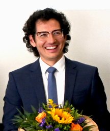 Paul Unterhuber合作论文数German Aerosp Ctr DLR, Inst Vehicle Concepts5
 Robert Wang (王宇)合作论文数Bureau of Strategic High-tech Development, Chinese Academy of Sciences;University of Chinese Academy of Sciences5
 Yang Mi (米阳)合作论文数School of Electrical Engineering, Shanghai University of Electric Power5Kirsimarja Zitting合作论文数5
 Yves Lostanlen合作论文数SIRADEL North Amer, Toronto, ON, Canada5
 Elizabeth B Klerman合作论文数Dept. of Medicine, Brigham & Women's Hospital5Haochuan Yue合作论文数4Jiting Song合作论文数4Yue Lv合作论文数4Yuan Robin K合作论文数4
 Simon Plass合作论文数German Aerospace Center;Institute of Communications and Navigation;German Aerospace Center, Institute of Communications and Navigation4
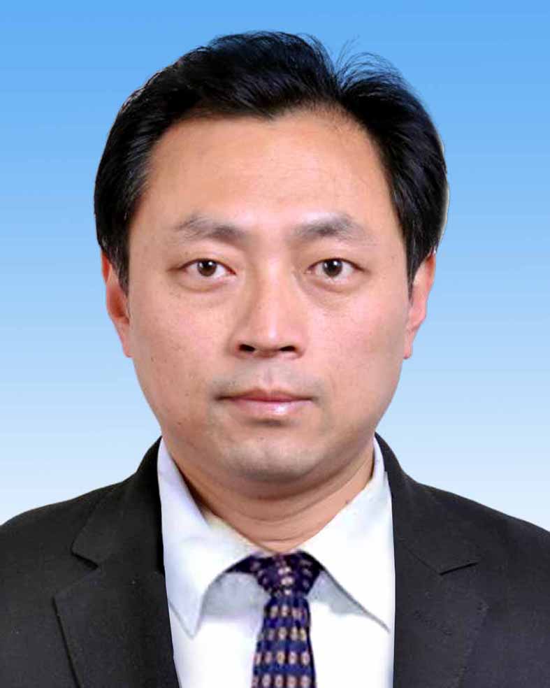 Bo Ai (艾渤)合作论文数State Key Laboratory of Rail Traffic Control and Safety, Beijing Jiaotong Unviersity4Joseph M. Ronda合作论文数4
 Miao Yang合作论文数Beijing Institute of Technology Beijing Institute of Technology Beijing Inst of Technol4Julien Stephan合作论文数4
 Xu Zhilin (徐志麟)合作论文数3
 Xu Zhang合作论文数3




