In July 2018, the University of Oklahoma deployed three CopterSonde remotely piloted aircraft systems (RPASs) to take measurements of the evolving thermodynamic and kinematic state of the atmospheric boundary layer (ABL) over complex terrain in the San Luis Valley, Colorado. A total of 180 flights were completed over 5 d, with teams operating simultaneously at two different sites in the northern half of the valley. A total of 2 d of operations focused on convection initiation studies, 1 d focused on ABL diurnal transition studies, 1 d focused on internal comparison flights, and the last day of operations focused on cold air drainage flows. The data from these coordinated flights provide insight into the horizontal heterogeneity of the atmospheric state over complex terrain. This dataset, along with others collected by other universities and institutions as a part of the LAPSE-RATE campaign, have been submitted to Zenodo (Greene et al., 2020) for free and open access (https://doi.org/10.5281/zenodo.3737087).
The CopterSonde is an unmanned aircraft system (UAS) developed in house by a team of engineers and meteorologists at the University of Oklahoma. The CopterSonde is an ambitious attempt by the Center for Autonomous Sensing and Sampling to address the challenge of filling the observational gap present in the lower atmosphere among the currently used meteorological instruments such as towers and radiosondes. The CopterSonde is a unique and highly flexible platform for in situ atmospheric boundary layer measurements with high spatial and temporal resolution, suitable for meteorological applications and research. Custom autopilot algorithms and hardware features were developed as solutions to problems identified throughout several field experiments carried out since 2017. In these field experiments, the CopterSonde has been proven capable of safely operating at wind speeds up to 22 m s−1, flying at 3050 m above mean sea level, and operating in extreme temperatures: nearly −20 ∘C in Finland and 40 ∘C in Oklahoma, United States. Leveraging the open-source ArduPilot autopilot code has allowed for seamless integration of custom functions and protocols for the acquisition, storage, and distribution of atmospheric data alongside the flight control data. This led to the development of features such as the “wind vane mode” algorithm, which commands the CopterSonde to always face into the wind. It also inspired the design of an asymmetric airframe for the CopterSonde, which is shown to provide more suitable locations for weather sensor placement, in addition to allowing for improvements in the overall aerodynamic characteristics of the CopterSonde. Moreover, it has also allowed the team to design and create a modular shell where the sensor package is attached and which can run independently of the CopterSonde's main body. The CopterSonde is on the trend towards becoming a smart UAS tool with a wide possibility of creating new adaptive and optimized atmospheric sampling strategies.
The deployment of small unmanned aircraft systems (UAS) to collect routine in situ vertical profiles of the thermodynamic and kinematic state of the atmosphere in conjunction with other weather observations could significantly improve weather forecasting skill and resolution. High-resolution vertical measurements of pressure, temperature, humidity, wind speed and wind direction are critical to the understanding of atmospheric boundary layer processes integral to air–surface (land, ocean and sea ice) exchanges of energy, momentum, and moisture; how these are affected by climate variability; and how they impact weather forecasts and air quality simulations. We explore the potential value of collecting coordinated atmospheric profiles at fixed surface observing sites at designated times using instrumented UAS. We refer to such a network of autonomous weather UAS designed for atmospheric profiling and capable of operating in most weather conditions as a 3D Mesonet. We outline some of the fundamental and high-impact science questions and sampling needs driving the development of the 3D Mesonet and offer an overview of the general concept of operations. Preliminary measurements from profiling UAS are presented and we discuss how measurements from an operational network could be realized to better characterize the atmospheric boundary layer, improve weather forecasts, and help to identify threats of severe weather.
A self-driving car must always have a plan for safely coming to a halt. Often, finding these safe plans is treated as an afterthought. In this paper, we demonstrate that techniques explicitly designed for safety can yield higher quality plans and lower latency than conventional planners in an urban driving setting. We adopt ideas from a previously-proposed safe online real-time heuristic search method to the spatiotemporal state lattices used when planning for autonomous driving. We experimentally compare our proof-of-concept implementation to conventional methods and find significantly improved performance while still maintaining passenger com-
Suboptimal search algorithms can often solve much larger problems than optimal search algorithms, and thus have broad practical use. This paper returns to early algorithms like WA*, A*_e and Optimistic search. It studies the commonalities between these approaches in order to build a new bounded-suboptimal algorithm. Combined with recent research on avoiding node re-expansions in bounded-optimal search, a new solution quality bound is developed, which often provides proof of the solution bound much earlier during the search. Put together, these ideas provide a new state-of-the-art in bounded-optimal search.
Many systems, such as mobile robots, need to be controlled in real time. Real-time heuristic search is a popular on-line planning paradigm that supports concurrent planning and execution. However,existing methods do not incorporate a notion of safety and we show that they can perform poorly in domains that contain dead-end states from which a goal cannot be reached. We introduce new real-time heuristic search methods that can guarantee safety if the domain obeys certain properties. We test these new methods on two different simulated domains that contain dead ends, one that obeys the properties and one that does not. We find that empirically the new methods provide good performance. We hope this work encourages further efforts to widen the applicability of real-time planning.
This paper presents a new concept for using an Unmanned Aircraft System (UAS) for in-situ antenna characterization, radome inspection and radar calibration. A commercial multirotor platform integrated with a sensor suite composed of an HD camera and an RF probe were used to prove the concept. Preliminary results were obtained using two different flight modes that were used to characterize an Antenna Under Test (AUT) and calibrate a radar in X-band. This new technique enables a full characterization of the antenna patterns in a radar system, including the external degradation introduced by factors such as ground clutter, the radome, temperature and other artifacts that are difficult to characterize during the design and development process. Preliminary results show that this technique has the potential for improving the characterization and the calibration process of an operational radar. This paper also presents a new UAS platform architecture that will be used for the same missions from S- to Ka-band in conventional and active phased array radar systems.
HistoryVolume 97, Issue 326 p. 329-331 A Natural History of Revolution: Violence and Nature in the French Revolutionary Imagination, 1789–1794 – By Mary Ashburn Miller WILLIAM DOYLE, WILLIAM DOYLE University of BristolSearch for more papers by this author WILLIAM DOYLE, WILLIAM DOYLE University of BristolSearch for more papers by this author First published: 17 April 2012 https://doi.org/10.1111/j.1468-229X.2012.00554_26.xRead the full textAboutPDF ToolsRequest permissionExport citationAdd to favoritesTrack citation ShareShare Give accessShare full text accessShare full-text accessPlease review our Terms and Conditions of Use and check box below to share full-text version of article.I have read and accept the Wiley Online Library Terms and Conditions of UseShareable LinkUse the link below to share a full-text version of this article with your friends and colleagues. Learn more.Copy URL Share a linkShare onFacebookTwitterLinked InRedditWechat Volume97, Issue326April 2012Pages 329-331 RelatedInformation
Introduction: The geometry of the adult human mastoid air cell system has not previously been described over a large range of mastoid air cell volumes. Methods: Twenty subjects with a wide range of mastoid air cell pneumatised areas, as determined by X-ray, underwent computed tomography scanning of the middle ear. Mastoid air cell surface areas and volumes were then reconstructed from serial imaging sections, using Image J software. Results: Mastoid air cell volumes varied from 0.7 to 21.4 ml, and were linearly related to the pneumatised area. Right and left mastoid air cell volumes and surface areas were highly correlated. The mastoid air cell surface area was a linear function of volume. Conclusion: The relationship between mastoid air cell surface area and volume is similar over a wide range of volumes. Given that the rate of gas exchange across the mastoid air cell mucosa is related to the mastoid air cell surface area, that rate will thus also be a direct linear function of the mastoid air cell volume.
No wonder you activities are, reading will be always needed. It is not only to fulfil the duties that you need to finish in deadline time. Reading will encourage your mind and thoughts. Of course, reading will greatly develop your experiences about everything. Reading informed consent language and parents willingness to enroll their children in research report is also a way as one of the collective books that gives many advantages. The advantages are not only for you, but for the other peoples with those meaningful benefits.
Several proprietary industrial symbiosis software tools have been developed, however, without long term financial commitments these endeavors fall short of creating generalizable and sustainable tools.The recent development of virtual globes such as Google Earth (GE), an information service that provides imagery and three dimensional data depicting the entire physical earth, provides an opportunity to use a new sustainable method of navigating information to save energy and use materials more efficiently in the real world.To test this open source methodology, a data set was used from the Department of Environmental Protection in Pennsylvania, which has mandated reporting the location of disposal and type of residual waste from sources producing more than one ton per month.This data set was integrated into the GE interface to identify and quantify opportunities for materials and energy efficiency improvements.This investigation found that virtual globes coupled with open source waste information can be used to: 1) reduce embodied transport energy by reducing distances to recycling facilities, 2) choose end of life at recycling facilities rather than landfills, and 3) establish industrial symbiosis and eco-industrial parks on known by-product synergies.For one waste category, a potential 70% reduction in ton-kilometers was identified by simply observing closer disposal locations than currently utilized; similar reductions are achievable in other categories.It is concluded that the open source sharing of information in virtual globes provide a means to identify economically and environmentally beneficial opportunities for waste management if the data have been made available.
Focus on GeographyVolume 52, Issue 2 p. 38-39 Amazonian Oil Exploration: A Report on the Historical Facts of Texaco's Operations William Doyle, William Doyle Dr. William Doyle is a former President of the American Geographical Society and a retired Vice President of Texaco. At Texaco he had executive oversight responsibility for international oil/gas production and development for various areas from 1986 through 1996. His e-mail address is: williamdoylel@cox.netSearch for more papers by this author William Doyle, William Doyle Dr. William Doyle is a former President of the American Geographical Society and a retired Vice President of Texaco. At Texaco he had executive oversight responsibility for international oil/gas production and development for various areas from 1986 through 1996. His e-mail address is: williamdoylel@cox.netSearch for more papers by this author First published: 10 June 2010 https://doi.org/10.1111/j.1949-8535.2009.tb00246.x AboutPDF ToolsRequest permissionExport citationAdd to favoritesTrack citation ShareShare Give accessShare full text accessShare full-text accessPlease review our Terms and Conditions of Use and check box below to share full-text version of article.I have read and accept the Wiley Online Library Terms and Conditions of UseShareable LinkUse the link below to share a full-text version of this article with your friends and colleagues. Learn more.Copy URL Share a linkShare onFacebookTwitterLinkedInRedditWechat No abstract is available for this article. Volume52, Issue2September 2009Pages 38-39 RelatedInformation
 David P Skoner合作论文数24Philip Fireman合作论文数24D. Gentile合作论文数7James T Seroky合作论文数7naomi moriyama合作论文数5Asha Patel合作论文数5
 Charles Bluestone合作论文数Department of Otolaryngology, School of Medicine, University of Pittsburgh;Division of Pediatric Otolaryngology, Childrens Hospital of Pittsburgh5
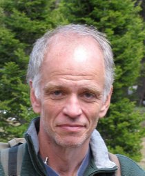 Phillip B. Chilson合作论文数School of Meteorology;University of Oklahoma;School of Meteorology, University of Oklahoma5S R Rood合作论文数4Kuldip S. Dhindsa合作论文数4B Angelini合作论文数4
 Antonio R. Segales合作论文数Ctr Autonomous Sensing & Sampling, Univ Oklahoma4E TANNER合作论文数4Tj Fria合作论文数3DA Gentile合作论文数3EI CANTEKIN合作论文数3Gustavo Britto Hupsel de Azevedo合作论文数3
 Elizabeth A. Pillar-Little合作论文数Sch Meteorol, Univ Oklahoma3
 Tyler Bell合作论文数Oar Natl Severe Storms Lab, NOAA3
 Brian R. Greene合作论文数University of Oklahoma3
 David P. Skoner合作论文数Department of Pediatrics, School of Medicine, West Virginia University3
 Frederick G. Hayden合作论文数School of Medicine, University of Virginia3
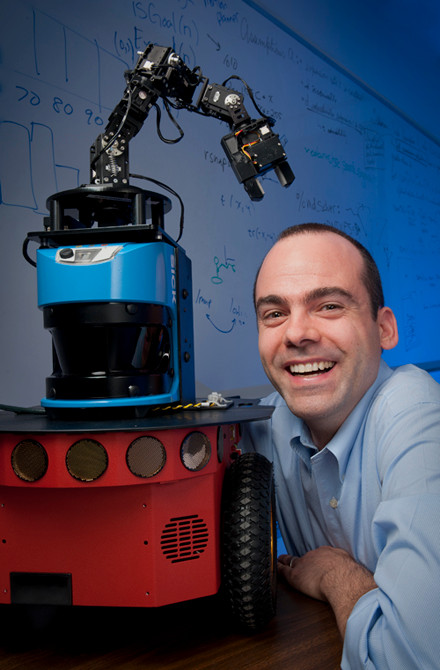 Wheeler Ruml合作论文数Department of Computer Science, University of New Hampshire3Theresa L Whiteside合作论文数3Paul Stillwagon合作论文数3J L Cowell合作论文数2Kyle R. Kimes合作论文数2Ramzy Shehata合作论文数2Fehim Ovcina合作论文数2Hildegard E. Enesco合作论文数2Wf Diven合作论文数2Jd Swarts合作论文数2H Hadziselimović合作论文数2AM ZAKARIA合作论文数2JW WAGNER合作论文数2R Coleman合作论文数2S BOEHM合作论文数2
 Sai Teja Kanneganti合作论文数Sch Comp Sci, Univ Oklahoma2
 Jorge L. Salazar合作论文数University of Oklahoma2Bence Cserna合作论文数University of New Hampshire2Dilberović Faruk合作论文数2Green B A合作论文数2Frasca P合作论文数2
 Asher Ornoy合作论文数Department of Medical Neurobiology, Faculty of Medicine, Hebrew University of Jerusalem;Autism Center, Hebrew University of Jerusalem2
 Eugene David Shapiro合作论文数Department of Pediatrics, Yale University School of Medicine;Yale Center for Clinical Investigation, Yale University School of Medicine2
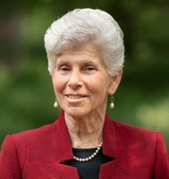 Ellen Wald合作论文数Division of Infectious Diseases, Department of Pediatrics, School of Medicine and Public Health, University of Wisconsin–Madison2Dale D. Rohn合作论文数2H. Richards合作论文数2
 Adriana Zeevi合作论文数Department of Pathology, University of Pittsburgh;Tissue Typing Laboratory, University of Pittsburgh2




