Addressing sea-level rise and coastal flooding requires adaptation strategies tailored to specific coastal environments. However, a lack of detailed geomorphological data on global coasts impedes effective strategy development. This research maps seven coastal environments worldwide, and for each environment analyzes the effect of coastal changes on coastal populations by including sea-level change, extreme sea-level events with varying return periods and population growth from 1950 to 2050. It identifies the historical exposure of low-lying deltaic and estuarine flood areas (>48% of total population) and reveals that flood exposure will significantly increase for barrier islands and strandplains by 2050 (with over a 40% rise in exposure), particularly along African coastlines. Population growth emerges as the primary factor behind the increased exposure. While sea-level rise is projected to contribute between 26% and 65% of the increased inundated area by 2050 compared to a 10-year extreme sea-level event, varying by coastal environment. The findings highlight the critical need for mitigation measures that account for the distinct responses of different coastal types to sea-level rise, posing various risks over varying timescales.
Predicting the impact of the present-day global warming on the world’s shorelines is crucial for mapping future coastal hazards. Coastal environments are particularly sensitive to climate change, because the balance in the accumulation, distribution and erosion of nearshore sediments is controlled by various climate-forced parameters, including global eustatic sea level, regional source-to-sink routes, and local storms and floods. Simultaneously, coastal geomorphology and shoreline position are closely linked with local hydrology and vegetation distribution, such as peatlands, which are extremely sensitive to climate, humidity and precipitation. As a result, climate change may cause widespread coastal response in the form of shifting shoreline positions, changing landscapes and habitat modification of ecosystems. However, it remains uncertain how, and how much, coastal environments change with changing climate and temperatures in both time and space. Since the impact of global warming on the world’s shorelines remains to be seen, analyses of ancient sedimentary archives are vital for understanding climate-forced coastal changes. The Paleocene sedimentary succession in Arctic Svalbard is ideal for this purpose, because it: (i) forms a paralic sedimentary archive that was deposited in climates with characterized by atmospheric CO2 concentrations and global temperatures higher than, but comparable to, the present day; (ii) contains abundant fossil peat (coal) seams; (iii) represents various coastal landscapes, including beaches, lagoons, barriers, estuaries, deltas, wetlands and forests; (iv) records frequent shifts in relative sea level and corresponding nearshore hydrology and peat accumulation; and (v) was deposited near the pole, where signals of climate change are amplified. We present detailed facies-architectural reconstruction of the Paleocene strata in Svalbard, which delineates shoreline shifts controlled by sea-level changes, and we evaluate how coastal processes, environments and landscapes shift in response to temperature evolution, and aridity and humidity trends. Furthermore, we identify changes in shoreline geomorphology in response to shifts in paleotopography and vegetation build-up.
Sedimentary rocks can provide information about the Earth paleoenvironment and are studied extensively to understand the causes and consequences of global climate changes in deep time. They facilitate long-time perspectives that constrain climate models and provide analogues for how Earth systems may respond to, and recover from, intervals of profound environmental change, including projected anthropogenic change. The Norwegian Svalbard archipelago offers an extensive Phanerozoic stratigraphic record that reflects the geological evolution of the northern flanks of continental assemblages that include Laurentia, Eurasia, and Pangea. Svalbard's Phanerozoic sedimentary and paleoclimatic archive is controlled largely by Svalbard's overall northward plate-tectonic motion from equatorial to high latitudes but also by regional to local formation of topography and basins in response to long-term plate reorganization, as well as the near- and far-field influence of large igneous province activity on the tectono-stratigraphic and paleoclimatic development. Various sedimentary and geochemical proxies, such as bentonite beds and carbon isotope excursions associated with the far-reaching environmental effects of the Siberian Traps, the High Arctic Large Igneous Province, and the North Atlantic Igneous Province, are present in Svalbard's near complete geological record. As such, Svalbard is unique in that these and numerous other global environmental perturbations are recorded within a relatively restricted study area, with most of the key events preserved and recorded in easily accessible drill cores and well-exposed outcrop sections. Here we review deep-time paleoenvironmental and paleoclimate research in Svalbard by summarizing 148 peer-reviewed scientific articles. The review builds on the well-established tectono-stratigraphic and lithostratigraphic framework, as well as state-of-the art environmental reconstructions, to provide insights into the Earth system during the Phanerozoic northward drift of Svalbard and the many major biotic crises in the geological past. We focus on globally significant events including (i) the expansion of Devonian vegetation, (ii) the Carboniferous–Permian response to icehouse conditions during the Late Paleozoic Ice Age (LPIA), (iii) the End-Permian Mass Extinction (EPME) and the subsequent Triassic recovery, the (iv) Carnian Pluvial Episode, (v) Jurassic–Early Cretaceous climate perturbations including the Volgian Isotopic Carbon Excursion (VOICE) and the Aptian Ocean Anoxic Event 1a (OAE1a), and (vi) the Paleocene–Eocene Thermal Maximum (PETM). We present and synthesize existing core and outcrop data that preserve biological and geochemical proxies and climate-sensitive sedimentary facies that reflect environmental change in terrestrial and marine settings. Finally, we discuss the Phanerozoic climate recorded in Svalbard and its role in providing high-latitude calibration points for several global paleoclimate events to provide a higher-latitude perspective to complement the dominance of mid- and low-latitude locations and datasets in the literature.
land på Realfagbygget.Den faglige utviklingen har gått parallelt med
Understanding how sedimentary rocks represent time is one of the significant challenges in sedimentology. Sedimentation rates retrieved from vertical sections are strongly timescale dependent, which means that we cannot use empirical rate data derived from vertical sections in modern environments to interpret the temporal structure of ancient sedimentary deposits. We use the Lower to Middle Campanian Blackhawk Formation deposits in eastern Utah and western Colorado as a natural laboratory to test a source-to-sink methodology circumventing this timescale dependence by relating modern progradation rates to the deltaic shoreline progradation of ancient siliciclastic rocks. Our objective is to quantify how much time is needed to account for the observed cumulative deltaic shoreline progradation recorded by the shallow-marine sandstone bodies of the Blackhawk Formation in terms of progradation rates derived from comparable modern deltaic systems. By making the simplifying assumption that the Blackhawk Formation rocks were deposited along a linear coastline that only grew by aggradation and progradation, it is possible to argue that the stratigraphic completeness of two-dimensional dip-oriented stratigraphic cross-sections through these deposits should be high. Furthermore, we hypothesise that delta progradation estimates capture a significant portion of the biostratigraphically and radiometrically constrained duration of the succession. By comparing the recorded progradation with modern progradation rates, we estimate that we need ca. 20% (median value, with minimum and maximum estimates of 2% and 300%) of the time available from biostratigraphic and radiometric dating to account for the progradation recorded by the sedimentary deposits. This indicates that long-term progradation rates averaged over the entire duration of the Blackhawk Formation were only a factor of five times slower than the modern progradation rates derived from observations over periods that are five to six orders of magnitude shorter. We conclude that a significant amount of time is represented by prograding deltaic shoreline deposits and that by considering the cumulative shoreline progradation, we could limit the effects of timescale dependence on the rate estimates used in our analysis.
Flood‐generated hyperpycnal flows are dense, sediment‐laden, turbulent flows that can form long‐lived, bottom‐hugging turbidity currents, which undoubtedly transport large volumes of fine‐grained sediments into the ocean. However, their ability in transferring sand into deep‐water basins is debated. This study presents sedimentological evidence of sandy hyperpycnal flow deposits (hyperpycnites) in a series of basin floor lobe complexes associated with a progradational shelf margin in the Eocene of Spitsbergen, Arctic Norway. Four coexisting types of sediment gravity flow deposits are recognized: (i) sandy hyperpycnites deposited by quasi‐steady hyperpycnal flows; (ii) turbidites deposited by waning, surge‐type turbidity currents; (iii) hybrid event beds deposited by transitional flows; and (iv) mass transport deposits emplaced during rare slope failures. The abundance of thick‐bedded massive sandstones, frequent bed amalgamation, the distribution of hyperpycnites across the lobes and the abundance and systematic occurrence of plant‐rich hybrid event beds and associated climbing ripple cross‐laminated beds in the lobe fringes, suggest that hyperpycnal flow was the most important mechanism driving lobe progradation. Shelf‐edge positioned fluvial channels linked to the basin floor lobe complexes via deeply incised, sandstone‐filled slope channels, suggest that rivers fed directly onto the slopes where their dense, sand‐laden discharges readily generated quasi‐steady hyperpycnal flows that regularly reached the basin floor. The composite architecture and complex waxing–waning flow facies configuration of the hyperpycnites is consistent with sustained and concomitant suspension and traction deposition under fluctuating subcritical to supercritical conditions. Similar sandstone beds occur on the clinoform slopes, indicating that the hyperpycnal flows operated likewise on the slope. Plant‐rich hybrid event beds indicate transformation of initially turbulent flows by relative enrichment of clay and plant material via progressive sand deposition to such an extent that it suppressed turbulence. The multi‐faceted character of the hyperpycnites reported here, challenges traditional beliefs that hyperpycnites assumingly preserve the waxing–waning signal of single‐peaked floods.
An appraisal of ancient Earth’s climate dynamics is crucial for understanding the modern climate system and predicting how this might change in the future. Major climate-shift events in the Earth’s past demonstrate the scale, duration and response of the climate system to various global and local climate stressors. More than 650 million years of deep-time paleoclimate changes are archived in the sedimentary succession of Svalbard; an archipelago located in the Norwegian High Arctic. The excellently outcropping geological successions of Svalbard date back to the Proterozoic, and record both temporal and spatial changing climatic and environmental conditions strongly linked to the northward continental drift of the archipelago from southern hemisphere in Precambrian to its present-day Polar latitudes. The oldest deposits that record major climatic events and associated environmental perturbations in Svalbard include tillites related to several Cryogenian glacial events and the overlying Ediacaran carbonates. The Lower Paleozoic succession documents episodes of marine biodiversification, including the Great Ordovician Biodiversification Event (GOBE), which is linked to cooling of previously warm tropical oceans. The arid to semi-arid climate of the Devonian promoted a terrestrial plant diversification. The Lower Carboniferous coal-bearing strata were deposited in humid and tropical climate settings prevailing in northern Pangea. The Upper Carboniferous-Lower Permian succession consists of interbedded carbonates, evaporites and red siliciclastics, including remains of paleokarst. The continued northward drift into subtropical latitudes promoted a change back to arid to semi-arid climates, occurring during the overall global icehouse conditions. During the Late Permian, marine sponges were occupying most of the ecological niches, leading to the deposition of weathering-resistant spiculites. But these ecosystems were rapidly and dramatically impacted by the End Permian Mass Extinction (EPME), which lasted well into the Early Triassic. By the Mesozoic, Svalbard was approaching mid-latitudes. The exposed in Svalbard deposits of Triassic mega-delta features evidence for a temperate or humid climate, indicated by thick coal beds that transitioned to an arid climatic environment at the end of the Triassic and Early Jurassic succession with caliche and calcareous soil profiles. The Lower Cretaceous strata (deposited at c. 66 °N) record several cold snaps despite the overall greenhouse climate characterizing the period and most notably the global crisis associated with the Aptian oceanic anoxic event 1a (OAE1a). By the Paleogene, Svalbard had reached Arctic latitudes, and as characterised by overall moderate to warm temperate climate, punctuated by warming episodes, including the Palaeocene–Eocene Thermal maximum (PETM). The Neogene cooling is missing from onshore records, but high-resolution glacial climate evidence exists offshore and from geomorphology and unconsolidated strata of Late Quaternary-Holocene age. In this contribution, we synthesize former and ongoing studies of deep-time paleoclimate in Svalbard and provide knowledge gaps to optimize the use of Svalbard as an archive for deep-time paleoclimate research. The exceptional exposures, accessibility, and completeness of the 650 million long sedimentary records makes Svalbard unique archive for deep-time paleoclimate research. In addition to Svalbard’s excellent outcrops, fully cored research and coal exploration boreholes provide an excellent foundation for further research with minimal environmental consequences.
A synthesis has been undertaken based on regionally compiled data from the post early Eocene foreland basin succession of Svalbard. The aim has been to generate an updated depositional model and link this to controlling factors. The more than kilometer thick progradational succession includes the offshore shales of the Gilsonryggen Member of the Frysjaodden Formation, the shallow marine sandstones of the Battfjellet Formation and the predominantly heterolithic Aspelintoppen Formation, together recording the progressive eastwards infill of the foredeep flanking the West Spitsbergen fold‐and‐thrust belt. Here we present a summary of the paleo‐environmental depositional systems across the basin, their facies and regional distribution and link these together in an updated depositional model. The basin‐margin system prograded with an ascending shelf‐edge trajectory in the order of 1°. The basin fill was bipartite, with offset stacked shelf and shelf‐edge deltas, slope clinothems and basin floor fans in the western and deepest part and a simpler architecture of stacked shelf‐deltas in the shallower eastern part. We suggest a foredeep setting governed by flexural loading, likely influenced by buckling, and potentially developing into a wedge top basin in the mature stage of basin filling. High‐subsidence rates probably counteracted eustatic falls with the result that relative sea‐level falls were uncommon. Distance to the source terrain was small and sedimentation rates was temporarily high. Time‐equivalent deposits can be found outbound of Stappen High in the Vestbakken Volcanic Province and the Sørvestsnaget Basin 300 km further south on the Barents Shelf margin. We cannot see any direct evidence of coupling between these more southerly systems and the studied one; southerly diversion of the sediment‐routing, if any, may have taken place beyond the limit of the preserved deposits.
Constraining the timing and volume of sediment dispersal in an ancient sedimentary system is vital to understand a basin's infill history. One preferred method for a first‐order approximation of ancient sediment load estimates, the BQART model, is based on empirical observations of modern river systems relating basin morphology, topography, climate, run‐off and bedrock characteristics. Despite the popularity of such methods, a comprehensive assessment on the validity of using modern river observations to measure sediment load on geological timescales is lacking. Here, we investigate the uncertainties, sensitivities and practicalities surrounding the use of modern empirical observations in general and the BQART model in particular, to evaluate ancient sediment river loads. Although catchment area and relief are the least constrained parameters in an ancient sedimentary system, the temperature parameter may have an even more significant impact in the range of predicted sediment load estimates using a BQART approach. The applicability of BQART is most suitable for regional to continental scale source‐to‐sink systems that are based on robust paleogeographic and paleoclimatic models of cold (<2°C) or warm temperate (>8°C) climates. One further needs to consider the high amplitude discharge events that can dominate the stratigraphic record which are not captured by historical observations of sediment load over a 30‐year period. In addition, our limited understanding of bedload material transport and an unknown pristine environment in the Anthropocene reduce the reliability of modern sediment load estimates for the ancient. Mass budget estimates in deep time based on empirical relationships of modern river systems can thus provide first‐order estimates within an order of magnitude but need to consider the limitations imposed by extrapolating the modern to the ancient. Here, we present a framework to consider the suitability of the BQART method for ancient source‐to‐sink mass budget analyses.
Western Norwegian fjord-valley systems represent archives of changes in sedimentary processes, and typically exhibit a pronounced change in depositional environment related to the transition from glacial to interglacial conditions. During a glacial situation, the fjord-valley system is emptied of its sediments, indicating that most sediments present in the fjord today, was deposited during and after the retreat of the last deglaciation. The purpose of our investigations is to gain a better understanding of the volumes and frequencies of mass transport deposits (subaquatic mass movements such as mass flows, debris flows, slides, slumps, and turbidites) in a recently glaciated fjord-valley system since the deglaciation (approx. 11 700 years BP) by looking at Fjærlandsfjorden, a tributary fjord of Sognefjorden in western Norway. The fjord-valley system consists of steep hillslopes and deep fjord basins with reliefs of up to 1600 meters. Jostedalsbreen, the largest glacier on mainland Europe (ca. 473 km2), currently feeds into the catchment of the fjord basin. Here we present results from a cruise with R/V G.O. Sars in 2018, where sediment cores, TOPAS seismic profiles and bathymetric data were collected from Fjærlandsfjorden. The integration of high-resolution seismic (<30 cm vertical resolution) and bathymetry (3-5 m resolution) allows us to estimate the total volume of sediments within a fjord setting. By revealing when and how the sediments are deposited, we can establish sedimentation rates with a high spatial and temporal resolution within the fjord basin. X-ray Computed Tomography (CT-scanning) has been particularly useful to characterize sedimentary deposits as it allows for 3D visualization and analysis with ultra-high-resolution (50 μm voxel size) allowing us to see individual silt-sized grains in the sediment cores. Seismic data reveal that the Fjærlandsfjorden basin infill consists of basal till, overlain by a thick, acoustically well-laminated glacimarine unit (up to a maximum thickness of ~105 meters thickness), occasionally disrupted by acoustically transparent lenses interpreted to be mass transport deposits (rock avalanches and debris flows). A 2-3 m thick hemipelagic unit drapes the glacimarine unit. Results reveal that ~90 % of the total sediment volume within the fjord basins was deposited as meltwater plumes during the retreat (mainly calving along the fjord) of the margin of the last glacial ice sheet. The retreat began at the mouth of Sognefjorden at the termination of the Younger Dryas Chronozone around 11 700 cal. yrs BP, to a frontal position at the head of Fjærlandsfjorden around 10 700 cal. yrs BP. The remaining volume of sediments are divided into mass transport deposits (MTDs) such as avalanches, debris flows, and flood-related turbidites as well as hemipelagic sedimentation. The largest MTD is a massive rock avalanche measuring up to 5 million m3 that most likely caused a large tsunami when it occurred.
This special issue dealing with the recent advances on modern and ancient clinoform-stratified sedimentary successions arises from a European Geoscience Union (EGU) session "Clinoform drivers and stratigraphic products in siliciclastic and carbonate successions", Vienna, April 2018. Clinoforms and clinothems represent a dominant architectural style of strata in many sedimentary environments, including deltaic and nondeltaic shorelines in both marine and lacustrine settings, and are one of the key building blocks of the sedimentary record. This Special Issue in Basin Research aspires to represent a step forward in understanding formation and preservation of these fundamental stratigraphic elements. As this Special Issue documents, a comprehensive understanding of clinoformal strata requires a multidisciplinary and multi-scale approach. Sixteen papers present case studies from a variety of tectonic settings worldwide, investigated with an array of methods, including seismo-stratigraphy, well logs, cores, high-resolution biostratigraphy, outcrop studies and modern bathymetric data. While observations document sedimentary processes and products in sedimentary basins, numerical models are necessary to provide a quantitative basis for the extrapolation of these processes and strata at different temporal and spatial scales. The papers highlight at least five main research avenues that we briefly introduce and discuss below: (a) clinoforms and clinothems as sedimentary archives; (b) the nested nature of clinoformal strata and implications for the trajectory of the rollover point(s); (c) quantitative clinoform parameters and dynamic indices; (d) architecture, growth and sequence stratigraphy of marine versus lacustrine clinoformal strata; and (e) clinoforms and geological time. This introduction also contains brief descriptions of each paper of the Special Issue.
The hydrodynamic mechanisms responsible for the genesis and facies variability of shallow‐marine sandstone storm deposits (tempestites) have been intensely debated, with particular focus on hummocky cross‐stratification. Despite being ubiquitously utilized as diagnostic elements of high‐energy storm events, the full formative process spectrum of tempestites and hummocky cross‐stratification is still to be determined. In this study, detailed sedimentological investigations of more than 950 discrete tempestites within the Lower Cretaceous Rurikfjellet Formation on Spitsbergen, Svalbard, shed new light on the formation and environmental significance of hummocky cross‐stratification, and provide a reference for evaluation of tempestite facies models. Three generic types of tempestites are recognized, representing deposition from: (i) relatively steady and (ii) highly unsteady storm‐wave‐generated oscillatory flows or oscillatory‐dominated combined‐flows; and (iii) various storm‐wave‐modified hyperpycnal flows (including waxing–waning flows) generated directly from plunging rivers. A low‐gradient ramp physiography enhanced both distally progressive deceleration of the hyperpycnal flows and the spatial extent and relative magnitude of wave‐added turbulence. Sandstone beds display a wide range of simple and complex configurations of hummocky cross‐stratification. Features include ripple cross‐lamination and ‘compound’ stratification, soft‐sediment deformation structures, local shifts to quasi‐planar lamination, double draping, metre‐scale channelized bed architectures, gravel‐rich intervals, inverse‐to‐normal grading, and vertical alternation of sedimentary structures. A polygenetic model is presented to account for the various configurations of hummocky cross‐stratification that may commonly be produced during storms by wave oscillations, hyperpycnal flows and downwelling flows. Inherent storm‐wave unsteadiness probably facilitates the generation of a wide range of hummocky cross‐stratification configurations due to: (i) changes in near‐bed oscillatory shear stresses related to passing wave groups or tidal water‐level variations; (ii) multidirectional combined‐flows related to polymodal and time‐varying orientations of wave oscillations; and (iii) syndepositional liquefaction related to cyclic wave stress. Previous proximal–distal tempestite facies models may only be applicable to relatively high‐gradient shelves, and new models are necessary for low‐gradient settings.
Clinoforms are basinward‐dipping and accreting palaeo‐bathymetric profiles that record palaeo‐environmental conditions and processes; thus, clinothems represent natural palaeo‐archives. Here, we document shelf‐edge scale clinoform sets which prograded through the entire width of an epicontinental marine basin (ca. 400 km), eventually encroaching onto the opposite basin flank, where they started to prograde upslope and landward, in defiance of gravity (“upslope‐climbing clinoforms”). The giant westward‐prograding Eridanos muddy shelf‐edge clinothem originated from the Baltic hinterland in the Oligocene and achieved maximum regression in the Early Pleistocene, on the UK Central Graben (CG) and Mid North Sea High (MNSH), after crossing the whole North Sea mesopelagic depocentre and causing near complete basin infill. Here we integrate well and seismic data through the MNSH and CG and examine the Eridanos final heyday and demise, identifying five clinothem complexes (A1, A2, A3, B and C) and six depositional sequence boundaries (SB1 to SB6) in the Miocene‐Recent section. Tectonic and climatic events drove the recent evolution of this system. Early Pleistocene climate cooling, in particular, resulted in a stepwise increase in sediment supply. This climaxed in the earliest Calabrian, following a likely Eburonian eustatic fall (=SB3) when the Eridanos clastic wedge was restructured from a 100–300 m thick compound shelf‐edge and delta system to a “hybrid” shelf‐edge delta at sequence boundary SB3 (ca. 1.75 Ma). In the ca. 40 kyr that followed SB3, a progradation rate peak (>1,000 m/kyr) is associated with clinoforms starting to accrete upslope, onto the east‐dipping slope between CG and MNSH. This “upslope‐climbing clinoform” phase was quickly followed by the maximum regression and final retreat of the Eridanos system in the Early Calabrian (=SB4), likely as the result of climate‐driven changes in the Baltic hinterland and/or delta auto‐retreat. To our knowledge, this contributions represents the first documentation of “upslope‐climbing clinoforms” recorded in the stratigraphic record.
EDITORIAL article Front. Earth Sci., 11 September 2020Sec. Sedimentology, Stratigraphy and Diagenesis Volume 8 - 2020 | https://doi.org/10.3389/feart.2020.591420
 Tore Grane Klausen合作论文数17
 Snorre Olaussen合作论文数Norsk Hydro Research Centre13
 Reidar Müller合作论文数9
 Christian Haug Eide合作论文数Dept Earth Sci, Univ Bergen9
 Ole J. Martinsen合作论文数StatoilHydroResearch Centre9Bjarte Rismyhr合作论文数8
 Sten-Andreas Grundvåg合作论文数The University Centre in Svalbard7
 Björn Nyberg合作论文数Bjerknes Ctr Climate Res7Erik P Johannessen合作论文数7
 Tor Oftedal Sømme合作论文数6
 Mads E. Jelby合作论文数Department of Geosciences and Natural Resource Management, University of Copenhagen5
 Madeleine L. Vickers合作论文数Univ Plymouth, Sch Geog Earth & Environm Sci, Plymouth PL4 8AA, Devon, England4
 Robert L. Gawthorpe合作论文数Department of Earth, University of Bergen4
 Maria Ansine Jensen合作论文数4
 Peter Betlem合作论文数Dept Arctic Geol, Univ Ctr Svalbard3
 Valentina Marzia Rossi合作论文数Inst Geosci & Georesources, Italian Natl Res Council3Tore Aadland合作论文数Earth Science, University of Bergen3
 Gareth Lord合作论文数3Valentin Zuchuat合作论文数3
 Aleksandra Smyrak-Sikora合作论文数Dept Arctic Geol, Univ Ctr Svalbard3
 Stefano Patruno合作论文数School of Sciences and Engineering, University of Nicosia3
 Kasia K Sliwinska合作论文数Dept Geoenergy & Storage, Geol Survey Denmark & Greenland GEUS3
 Sverre Planke合作论文数3John G. Gjelberg合作论文数3Alf Ryseth合作论文数3
 Ronald J. Steel (Ron Steel)合作论文数Department of Geological Sciences, Jackson School of Geosciences, University of Texas at Austin3
 Lars Eivind Augland合作论文数Department of Geosciences, University of Oslo3Sverre Henriksen合作论文数3
 Gregory D. Price (Gregory Price)合作论文数School of Geography, Earth and Environmental Sciences, University of Plymouth3
 Niall W. Paterson合作论文数3
 Morgan T. Jones合作论文数School of Ocean and Earth Science, University of Southampton3Tereza Mosočiová合作论文数2a ryseth合作论文数2Ron J. Steel合作论文数2Arvid Nøttvedt合作论文数2inger laursen合作论文数2
 Jiri Slama合作论文数2
 Albina Gilmullina合作论文数Dept Earth Sci, Univ Bergen2Grace E. Shephard合作论文数2
 Claudio Pellegrini合作论文数Institute of Marine Science (ISMAR),, National Research Council (CNR),2
 Lars Stemmerik合作论文数2
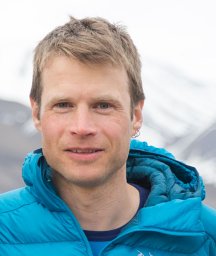 Malte Jochmann合作论文数Store Norske Spitsbergen Grubekompani2
 Gary Hampson合作论文数Department of Earth Science and Engineering, Imperial College London, South Kensington Campus2Pål T. Sandbakken合作论文数2
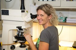 Denise K. Kulhanek合作论文数Department of Geological Sciences;Florida State University;Department of Geological Sciences, Florida State University2
 Kim Senger合作论文数2S. A. Bullimore合作论文数2
 John B. Thurmond合作论文数Department of Psychology, University of Louisville2




