Autonomous off-road navigation faces challenges due to diverse, unstructured environments, requiring robust perception with both geometric and semantic understanding. However, scarce densely labeled semantic data limits generalization across domains. Simulated data helps, but introduces domain adaptation issues. We propose COARSE, a semi-supervised domain adaptation framework for off-road semantic segmentation, leveraging sparse, coarse in-domain labels and densely labeled out-of-domain data. Using pretrained vision transformers, we bridge domain gaps with complementary pixel-level and patch-level decoders, enhanced by a collaborative pseudo-labeling strategy on unlabeled data. Evaluations on RUGD and Rellis-3D datasets show significant improvements of 9.7% and 8.4% respectively, versus only using coarse data. Tests on real-world off-road vehicle data in a multi-biome setting further demonstrate COARSE's applicability.
This paper presents an appendix to the original NeBula autonomy solution developed by the TEAM CoSTAR (Collaborative SubTerranean Autonomous Robots), participating in the DARPA Subterranean Challenge. Specifically, this paper presents extensions to NeBula's hardware, software, and algorithmic components that focus on increasing the range and scale of the exploration environment. From the algorithmic perspective, we discuss the following extensions to the original NeBula framework: (i) large-scale geometric and semantic environment mapping; (ii) an adaptive positioning system; (iii) probabilistic traversability analysis and local planning; (iv) large-scale POMDP-based global motion planning and exploration behavior; (v) large-scale networking and decentralized reasoning; (vi) communication-aware mission planning; and (vii) multi-modal ground-aerial exploration solutions. We demonstrate the application and deployment of the presented systems and solutions in various large-scale underground environments, including limestone mine exploration scenarios as well as deployment in the DARPA Subterranean challenge.
Caves on Mars are a tantalizing target for exploration, as they could harbor evidence of extinct or extant life, clues to the planet’s geological history, and even potential future human habitation. However, the inherent challenges of navigating unknown and challenging terrain, coupled with limited communication capabilities, pose significant obstacles for robotic exploration in these caves. This paper presents the results of an effort to evaluate different operational concepts for a mission dedicated to exploration of caves on Mars. We conducted a series of analog exploration experiments in lava tubes on Earth, testing two hypotheses: (1) that two robots are more effective than one, and (2) that high levels of autonomy are more effective than low levels of autonomy. Our findings suggest that two robots are indeed more effective, except in low autonomy cases, where more operational resources are required. We also found that full autonomy is more efficient than low autonomy, as it enables quicker exploration and detection of targets of interest. However, the low autonomy cases benefited from the operator input to acquire higher quality data, an area of autonomy requiring further development. This paper provides insight into the design of our experiments, as well as detailing the results and implications for the design of future missions to explore caves on Mars. By shedding light on the operational concepts tested and their corresponding outcomes, we contribute to the knowledge base required to formulate optimal strategies for the realization of successful cave exploration missions on the Red Planet.
Off-road environments pose significant perception challenges for high-speed autonomous navigation due to unstructured terrain, degraded sensing conditions, and domain-shifts among biomes. Learning semantic information across these conditions and biomes can be challenging when a large amount of ground truth data is required. In this work, we propose an approach that leverages a pre-trained Vision Transformer (ViT) with fine-tuning on a small (<500 images), sparse and coarsely labeled (<30 semantic segmentation classes. These classes are fused over time via a novel range-based metric and aggregated into a 3D semantic voxel map. We demonstrate zero-shot out-of-biome 2D semantic segmentation on the Yamaha (52.9 mIoU) and Rellis (55.5 mIoU) datasets along with few-shot coarse sparse labeling with existing data for improved segmentation performance on Yamaha (66.6 mIoU) and Rellis (67.2 mIoU). We further illustrate the feasibility of using a voxel map with a range-based semantic fusion approach to handle common off-road hazards like pop-up hazards, overhangs, and water features.
This paper presents and discusses algorithms, hardware, and software architecture developed by the TEAM CoSTAR (Collaborative SubTerranean Autonomous Robots), competing in the DARPA Subterranean Challenge. Specifically, it presents the techniques utilized within the Tunnel (2019) and Urban (2020) competitions, where CoSTAR achieved second and first place, respectively. We also discuss CoSTAR’s demonstrations in Martian-analog surface and subsurface (lava tubes) exploration. The paper introduces our autonomy solution, referred to as NeBula (Networked Belief-aware Perceptual Autonomy). NeBula is an uncertainty-aware framework that aims at enabling resilient and modular autonomy solutions by performing reasoning and decision making in the belief space (space of probability distributions over the robot and world states). We discuss various components of the NeBula framework, including (i) geometric and semantic environment mapping, (ii) a multi-modal positioning system, (iii) traversability analysis and local planning, (iv) global motion planning and exploration behavior, (v) risk-aware mission planning, (vi) networking and decentralized reasoning, and (vii) learning-enabled adaptation. We discuss the performance of NeBula on several robot types (e.g., wheeled, legged, flying), in various environments. We discuss the specific results and lessons learned from fielding this solution in the challenging courses of the DARPA Subterranean Challenge competition.
Semantic object mapping in uncertain, perceptually degraded environments during long-range multi-robot autonomous exploration tasks such as search-and-rescue is important and challenging. During such missions, high recall is desirable to avoid missing true target objects and high precision is also critical to avoid wasting valuable operational time on false positives. Given recent advancements in visual perception algorithms, the former is largely solvable autonomously, but the latter is difficult to address without the supervision of a human operator. However, operational constraints such as mission time, computational requirements and mesh network bandwidth can make the operator's task infeasible unless properly managed. We propose the Early Recall, Late Precision (EaRLaP) semantic object mapping pipeline to solve this problem. EaRLaP was used by Team CoSTAR in DARPA Subterranean Challenge, where it successfully detected all the artifacts encountered by the team of robots. We will discuss these results and the performance of the EaRLaP on various datasets.
This paper presents and discusses algorithms, hardware, and software architecture developed by the TEAM CoSTAR (Collaborative SubTerranean Autonomous Robots), competing in the DARPA Subterranean Challenge. Specifically, it presents the techniques utilized within the Tunnel (2019) and Urban (2020) competitions, where CoSTAR achieved 2nd and 1st place, respectively. We also discuss CoSTAR's demonstrations in Martian-analog surface and subsurface (lava tubes) exploration. The paper introduces our autonomy solution, referred to as NeBula (Networked Belief-aware Perceptual Autonomy). NeBula is an uncertainty-aware framework that aims at enabling resilient and modular autonomy solutions by performing reasoning and decision making in the belief space (space of probability distributions over the robot and world states). We discuss various components of the NeBula framework, including: (i) geometric and semantic environment mapping; (ii) a multi-modal positioning system; (iii) traversability analysis and local planning; (iv) global motion planning and exploration behavior; (i) risk-aware mission planning; (vi) networking and decentralized reasoning; and (vii) learning-enabled adaptation. We discuss the performance of NeBula on several robot types (e.g. wheeled, legged, flying), in various environments. We discuss the specific results and lessons learned from fielding this solution in the challenging courses of the DARPA Subterranean Challenge competition.
In exploration-oriented robotic missions for disaster relief in unknown environments, it is of prime importance for a human supervisor to rapidly gain situational awareness of salient objects within the environment. In this paper, we present a cascaded and modular pipeline for the detection, localization and visualization of objects of interest that is adaptable to heterogeneous robots with arbitrary sensor configurations. We apply this pipeline for static objects which may be seen with the human eye as well as invisible spatially-diffuse phenomena such as gas and WiFi signals. We present results from its deployment in time-critical scenarios with multiple collaborative robots in a variety of harsh underground environments. For visually-observable objects, detections are made in both the color and thermal spectra using a state-of-the-art machine learning framework for object detection. We fine-tune a pretrained convolutional neural network for a specific set of objects; in this case we use around 1000 images covering a range of poses and contexts for each object class. Once detected, a robust architecture for localization is used with outlier rejection and a hierarchy of fall-back distance measurement methods. Spatially-diffuse phenomena are registered by tracking signal strength over time. A human supervisor can optionally provide input to refine the automatically-generated detections with the help of intuitive map-based visualizations and object thumbnails ranked by classification confidence.
 Benjamin Morrell合作论文数University of Sydney7
 Edward D. Terry合作论文数5
 Thomas Touma合作论文数California Institute of Technology,Division of Engineering and Applied Science,Department of Mechanical and Civil Engineering,Pasadena,CA,USA5Taeyeon Kim合作论文数Department of Electrical Engineering, Korea Advanced Institute of Science and Technology5
 Kyohei Otsu合作论文数5
 Jeffrey A. Edlund合作论文数5
 Yun Chang合作论文数Laboratory for Information and Decision Systems, Massachusetts Institute of Technology4
 Marcel Kaufmann合作论文数4F. Chávez合作论文数4Ali Agha合作论文数4
 Anushri Dixit合作论文数CALTECH, Pasadena, CA 91125 USA4
 Maira Saboia合作论文数SUNY Buffalo, Dept Comp Sci & Engn, Buffalo, NY 14260 USA4
 Muhammad Fadhil Ginting合作论文数Stanford Intelligent System Laboratory, Stanford Artificial Intelligence Laboratory, Stanford University4
 Matteo Palieri合作论文数NASA Jet Propulsion Laboratory, California Institute of Technology4Amanda Bouman合作论文数4
 Brett Lopez合作论文数Mechanical and Aerospace Engineering Department, School of Engineering, University of California, Los Angeles4
 Giovanni Beltrame合作论文数Department of Computer and Software Engineering, Ecole Polytechnique de Montreal4
 Pailevanian Torkom合作论文数4
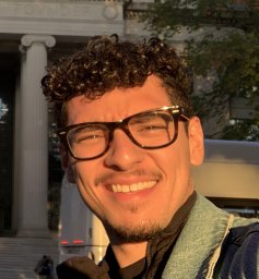 Correa Gustavo合作论文数university of antioquia4
 David D. Fan合作论文数Field AI4
 Tiago Vaquero合作论文数Jet Propulsion Laboratory, California Institute of Technology4
 Luca Carlone合作论文数Laboratory for Information and Decision Systems, Department of Aeronautics and Astronautics, Massachusetts Institute of Technology;SPARK Lab, Massachusetts Institute of Technology4
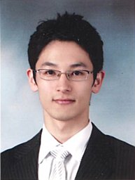 Sung-Kyun Kim合作论文数Department of Human Nutrition, Food and Animal Sciences, University of Hawaii at Manoa4
 George Nikolakopoulos合作论文数University of Patras Patras4
 Angel Santamaria-Navarro合作论文数NASA Jet Propulsion Laboratory, California Institute of Technology4
 Matthew Anderson合作论文数3
 Deegan J. Atha合作论文数3
 Kamak Ebadi合作论文数NASA Jet Propulsion Laboratory -California Institute of Technology, Pasadena, CA3
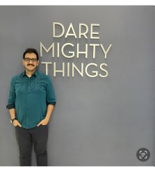 Seyed Abolfazl Fakoorian合作论文数Cleveland State Univ, Dept Elect Engn & Comp Sci, Cleveland, OH 44115 USA3
 Gautam Salhotra合作论文数University of Southern California3
 Jeremy Nash合作论文数california institute of technology3
 Hyunchul Shim合作论文数Unmanned Systems Research Laboratory, Korea Advanced Institute of Science and Technology3
 Christoforos Kanellakis合作论文数Luleå University of Technology3
 Shreyansh Daftry合作论文数Jet Propulsion Laboratory, California Institute of Technology3
 Joel W. Burdick合作论文数Division of Engineering and Applied Science, California Institute of Technology3
 Barry Ridge合作论文数Faculty of Computer and Information Science;University of Ljubljana;Faculty of Computer and Information Science, University of Ljubljana3
 Arash Kalantari合作论文数Adv Robot & Automated Syst Lab, KN Toosi Univ Technol3Nicolas Marchal合作论文数2Michael Wolf合作论文数2Scott Tepsuporn合作论文数2
 Patrick Spieler合作论文数2Hovhannes Melikyan合作论文数2
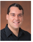 Olivier Toupet合作论文数2Gregory Miles合作论文数2William Walsh合作论文数2Carlyn Lee合作论文数2
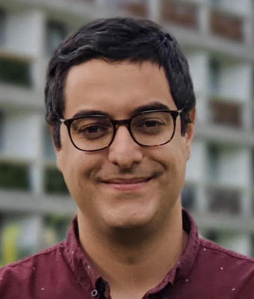 Benjamin Ramtoula合作论文数Mobile Robotics Group, University of Oxford;Department of Engineering Science, University of Oxford;Oxa2
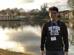 Hanseob Lee合作论文数Dept Aerosp Engn, Korea Adv Inst Sci & Technol2
 Inhwan Wee合作论文数KAIST2




