We investigate an emerging method called surface geometry inversion (SGI) for the inversion of transient electromagnetic (TEM) data. Conventional minimum-structure inversion methods parameterize the earth model with many mesh cells within which the physical properties are constant, and construct a physical property model that is usually smoothly varying as well as fits the observations. With these smooth models, it is difficult to extract the interface between different geologic units, and it can be especially difficult to target drillholes for thin, plate-like targets, which are frequently encountered in mineral exploration. Our SGI parameterizes the model in terms of the coordinates of the nodes (vertices) used to connect together the surfaces that define the geologic interfaces. The algorithm then inverts for the locations of these nodes, which directly provides geometric information about the target. This can be more useful than a fuzzy image of conductivity, especially for an exploration project. A genetic algorithm (GA) is used to solve the nonlinear, overdetermined optimization problem. We use a finite-element solver to solve the TEM forward-modeling problem of each candidate model in the GA population. Because forward modeling is independent for each model, we implement a hybrid message passing interface (MPI) + OpenMP parallel method to improve computational efficiency. We investigate a new parameterization method specifically designed for thin, plate-like structures, which is more efficient and can effectively avoid self- intersection. We first illustrate the effectiveness of our SGI algorithm on a synthetic block model before testing the new parameterization method on a synthetic thin plate model. Finally, we apply our SGI to a real data set collected for the exploration of thin graphitic faults in a uranium exploration project in Canada. The constructed model from our SGI corresponds well with the drilling data.
Late-time negative responses in central-loop transient electromagnetic (TEM) data are often linked to the induced polarization (IP) effect. Early methods for modeling the IP effect in TEM data try to avoid calculating the fractional derivative arising from considering the Cole-Cole model by either using the Fourier transform to convert frequency-domain responses to the time domain or approximating the fractional derivative in the time domain directly. The frequency-to-time conversion method suffer from accuracy issues if the number of frequencies calculated is small. The time-domain approximation method also has accuracy issues because of simplified Cole-Cole models. The Caputo series can approximate fractional derivatives accurately if historic electromagnetic (EM) fields are saved. However, the storage of historic EM fields leads to a significant memory consumption. We introduce the sum-of-exponentials (SOE) method to discretize fractional derivatives, which does not need to store field values from previous times except for the first two time-steps. We discretize the resulting partial differential equations from the SOE discretization using a finite-difference time-domain (FDTD) approach. Additionally, we improve computational efficiency by employing the direct-splitting strategy to transform large sparse matrices into smaller diagonally dominant tridiagonal matrices. We validate the accuracy and efficiency of our algorithm by comparing it with the Caputo approximation method using a chargeable half-space model. Furthermore, we compare our results with existing literature data for a chargeable anomaly in a nonchargeable half space. Finally, we analyze the response characteristics of the IP effect using a block-in-half space model.
In transient electromagnetic surveys, the collected data inevitably contain noise originating from both natural and cultural sources. This noise has the potential to mask transient electromagnetic responses linked to geological features, thereby posing challenges in accurately interpreting subsurface structures. Hence, the implementation of effective noise reduction techniques is crucial in ensuring the accuracy and reliability of inversion outcomes in transient electromagnetic surveys. This study introduces a novel approach that merges k-means clustering with locally weighted linear regression to denoise transient electromagnetic data. The results from synthetic examples illustrate that the k-means locally weighted linear regression method can predict transient electromagnetic data closely resembling true values, similar to the long short-term memory autoencoder. Occam's inversion results derived from denoised data using both the k-means locally weighted linear regression and long short-term memory-autoencoder methods can well reflect the true model. Notably, a key advantage of the k-means locally weighted linear regression method is its independence from labelled data as the sample set. The k-means locally weighted linear regression method was applied to field data collected at the Narenbaolige coalfield in Inner Mongolia, China. Occam's inversion models generated from the denoised field data delineate the boundary between the basaltic body and sedimentary rocks, aligning with drilling data. The inversion models derived from the noisy field data also can capture this boundary, but deep section views reveal the presence of numerous intricate high-resistivity anomalous bodies. These observations highlight the effectiveness of the k-means locally weighted linear regression method in denoising transient electromagnetic data.
In the past four decades, most three-dimensional (3D) modeling and inversion studies on transient electromagnetic (TEM) methods have primarily focused on the time derivative of the magnetic field (abl at), with relatively fewer studies on the magnetic field itself (B -field). Nowadays, with the advancement of the superconducting quantum interference device (SQUID) technique, collecting B -field data in TEM surveys has become more popular. Based on the vector finite-element method, two 3D forward-modeling approaches that are
The presence of complex karst caves poses significant challenges to construction safety and progress in tunnel engineering. Undetected karst caves in front of tunnel faces pose a risks of sudden water influx disasters. We employed an advanced semi-airborne transient electromagnetic method (SATEM) to detect potential karst caves located in areas with undulating karst terrain. Additionally, we utilized a handheld Simultaneous Localization and Mapping (SLAM)-based LiDAR device to accurately and efficiently scan large exposed caves, providing support for the design of karst cave treatment plans. For different karst cave characteristics, we introduce a series of effective comprehensive treatment methods, including sealing, crossing, and filling strategies. We demonstrate, for the first time, the outstanding effectiveness of SATEM surveys in detecting highly resistive caves, with multiple successful predictions of dried-up caves in Linlan tunnel. The proposed SATEM detection and comprehensive treatment technical system not only ensures the safety of the construction of the Tian’e-Bama expressway but also provides profound insights and practical guidance for the field of karst tunnel engineering.
Conventional Occam-style, minimum-structure inversion methods typically do not recover models with distinct boundaries between different geological units. Consequently, the constructed geophysical model can be very different from the true geological model and difficult to interpret in the geological context. This can be especially problematic for geological models with very thin structures that have a large physical property contrast with the background model, and determining the location of which is critical to, e.g., an exploration program. We have developed a new inversion method called surface geometry inversion which can construct geophysical models with distinct interfaces. The algorithm parameterizes the interface between geological units with triangular facets of connected nodes (vertices) and then inverts for the coordinates of these nodes. The algorithm only focuses on the boundary interface of localized anomalies and assumes the background model is known. Consequently, it is useful to have an adequately developed geological model and sufficient physical property data on which to base a background model. After the inversion, a model comprised of the background model and the anomalous region is constructed. We then utilize Markov chain Monte Carlo sampling to obtain statistical information, namely, the mean and standard deviation of the nodal coordinates of the constructed model. The standard deviation of each node is then used as an indicator of model uncertainty. The uncertainty information is useful as it can help us obtain a better understanding about the geological model. When applied to mineral exploration, the uncertainty quantification can also be used to mitigate the risks in drilling activities. We present synthetic transient electromagnetic data inversion examples with thin graphitic fault models. We also present a real-data example where transient electromagnetic data are used to target thin graphitic faults for a uranium exploration project.
<p>DC electrical resistivity surveying has shown much promise for investigating dikes and other earthen flood barriers. We are interested in the applicability of such data for aiding with maintenance and construction efforts in the Tantramar region of New Brunswick and Nova Scotia, Canada, where agricultural dikes form an important part of critical flood prevention infrastructure. Specifically, our goal is to develop efficient field survey and data processing protocols for detecting possible internal issues in the dikes ahead of further, more detailed geophysical surveying. The field survey protocol must be cost and time effective, given the large lengths of dikes that must be surveyed. The Tantramar dikes are expected to exhibit strong subsurface heterogeneity but accurately characterizing their internal structure may be challenging. Dikes have significant 3D geometry and traditional 2D DC surveying, and subsequent 2D inversion, fails to provide reliable and interpretable results. 3D surveying and inversion may be required but this represents significantly higher field costs. We performed a detailed synthetic inverse modelling study to help design our field surveying protocols. We used a representative model of a dike in the Tantramar region and we worked with the specifics of the surveying equipment available to us. We investigated and compared three possible data acquisition layouts proposed by other authors, we thoroughly compared the results of 2D versus 3D inversion on those layouts, and we performed a detailed investigation to assess best practices for 3D inversion mesh design. We are also incorporating joint interpretation with EM data, collected using mobile survey devices such as the Geonics EM31. Results from synthetic forward and inverse modelling are helping us develop future field data collection, processing and modelling protocols.</p>
SUMMARY To effectively and efficiently interpret or invert controlled-source electromagnetic (CSEM) data which are recorded in areas with the kind of complex geological environments and arbitrary topography that are typical, 3-D CSEM forward modelling software that can quickly solve large-scale problems, provide accurate electromagnetic responses for complex geo-electrical models and can be easily incorporated into inversion algorithms are required. We have developed a parallel goal-oriented adaptive mesh refinement finite-element approach for frequency-domain 3-D CSEM forward modelling with hierarchical tetrahedral grids that can offer accurate electromagnetic responses for large-scale complex models and that can efficiently serve for inversion. The approach uses the goal-oriented adaptive vector finite element method to solve the total electric field vector equation. The geo-electrical model is discretized by unstructured tetrahedral grids which can deal with complex underground geological models with arbitrary surface topography. Different from previous adaptive finite element software working on unstructured tetrahedral grids, we have utilized a novel mesh refinement technique named the longest edge bisection method to generate hierarchically refined grids. As the refined grids are nested into the coarse grids, the refinement technique can precisely map the electrical parameters of inversion grids onto the forward modelling grids so that the extra numerical errors generated by the inconsistency of electrical parameters between inversion grids and forward modelling grids are eliminated. In addition, we use the parallel domain-decomposition technique to further accelerate the computations, and the flexible generalized minimum residual solver (FGMRES) with an auxiliary Maxwell solver pre-conditioner to solve the final large-scale system of linear equations. In the end, we validate the performance of the proposed scheme using two synthetic models and one realistic model. We demonstrate that accurate electromagnetic fields can be obtained by comparison with the analytic solutions and that the code is highly scalable for large-scale problems with millions or even hundreds of millions of unknowns. For the synthetic 3-D model and the realistic model with complex geometry, our solutions match well with the results calculated by an existing 3-D CSEM forward modelling code. Both synthetic and realistic examples demonstrate that our newly developed code is an effective, efficient forward modelling engine for interpreting CSEM field data acquired in areas of complex geology and topography.
In the Athabasca Basin, Canada, thin conductive graphitic faults are commonly targeted with transient electromagnetic (TEM) surveys for uranium exploration. Standard minimumstructure methods, when applied to the inversion of these thin conductors, tend to recover smooth models which can indicate anomalies significantly larger than the actual conductor. Surface geometry inversion (SGI) methods parameterize the Earth model in terms of wireframe surfaces, and invert for the coordinates of the nodes defining these surfaces. Therefore, the recovered model of the SGI method provides information on the boundary between different geologic units. We have implemented a SGI method for inverting TEM data targeting thin conductors. We have tested the SGI method with a real dataset and the recovered model corresponds well with drilling data.
Electromagnetic (EM) methods are important geophysical tools for mineral exploration. Forward and inverse computer modeling are commonly used to interpret EM data. Real-life geology can be complex, and our computer modeling tools need to faithfully represent subsurface features to achieve accurate data interpretation. Traditional rectilinear meshes are less flexible and have difficulty conforming to the complex geometries of realistic geologic models, resulting in large numbers of mesh cells. In contrast, unstructured grids can represent complex geologic structures efficiently and accurately. However, building realistic geologic models and discretizing these models with unstructured grids suitable for EM modeling can be difficult and requires significant effort and specialized computer software tools. Therefore, it is important to develop workflows that can be used to facilitate model building and mesh generation. We have developed a procedure that can be used to build arbitrarily complex geologic models with topography using unstructured grids and a finite-volume time-domain code to calculate EM responses. We present an example of a trial-and-error modeling approach applied to a real data set collected at a uranium exploration project in the Athabasca Basin in Canada. The uranium mineralization is closely related to graphitic fault conductors in the basement. The deep burial depth and small thickness of the graphitic fault conductors demand accurate data interpretation results to guide subsequent drill testing. Our trial-and-error modeling approach builds initial realistic geologic models based on known geology and downhole data and creates initial geoelectrical models based on physical property measurements. Then, the initial model is iteratively refined based on the match between modeled and real data. We show that the modeling method can obtain 3D geoelectrical models that conform to known geology while achieving a good match between modeled and real data. The method can also provide guidance of where future drill holes should be directed.
Uranium exploration in the Athabasca Basin, Canada, relies heavily on ground-based transient electromagnetic (TEM) surveys to target thin, steeply dipping graphitic conductors that are often closely related to the uranium ore deposits. The interpretation of TEM data is important in identifying the locations and trends of conductors to guide subsequent drilling campaigns. We develop a trial-and-error modeling approach and demonstrate its application to the interpretation of a data set acquired at the Close Lake in the Athabasca Basin. The modeling process has two key tasks: building geoelectric models and computing their TEM responses. The modeling process is repeated with the geoelectric model being iteratively refined based on the match between three-component calculated and measured data from early to late times. To create geoelectric models, we first build a realistic geologic model and discretize it using an unstructured tetrahedral mesh, with each mesh cell populated with appropriate resistivities. To calculate the TEM responses of the geoelectric model, we use a 3D finite-volume time-domain algorithm. We construct our initial model based on existing geologic information and drilling data. We find that this modeling process is flexible and can easily handle thin, steeply dipping conductive graphitic fault models with variable resistivities in the fault and background and with topography. Our interpretation of the Close Lake data matches well with the trend and location of the main conductor as revealed by drilling data and also confirms the existence of a smaller conductor that only caused noticeable anomalous responses in early-time horizontal-component data. The smaller conductor was suggested by previous electromagnetic data but was missed in a recent interpretation based on the modeling of only late-time vertical -component data with plate-based approximate modeling methods.
Standard minimum-structure inversions normally recover smooth models which do not have distinct boundaries between different geological units. While this works well for geological scenarios with smoothly varying mineralization and hence physical properties, it struggles to recover thin structures with a large physical property contrast with their hosts. We have implemented a surface geometry inversion for time-domain electromagnetic data. This method parameterizes the Earth model in terms of wireframe surfaces, and the inversion solves for the coordinates of the facet vertices in these surfaces while keeping the conductivities of the different units fixed. To compute the electromagnetic data, we discretize the volumes between the wireframe surfaces with unstructured tetrahedral grids and use a finite-element solver. We use a genetic algorithm to minimize the data misfit. We demonstrate the capabilities of this surface geometry inversion here with basic, preliminary examples. Presentation Date: Wednesday, October 14, 2020 Session Start Time: 8:30 AM Presentation Time: 11:25 AM Location: 351D Presentation Type: Oral
Unstructured grids are capable of faithfully representing real-life geologic models and topography with relatively few mesh cells. We have developed a finite-volume solution to the 3D time-domain electromagnetic forward modeling problems using unstructured Delaunay-Voronoï dual meshes. We consider the Helmholtz equation for the electric field and a combination of the Helmholtz equation and the conservation of charge equation for the magnetic vector (A) and electric scalar ([Formula: see text]) potentials. The [Formula: see text] formulation requires initial values for A that can be obtained by solving the magnetostatic problem. We use backward Euler time stepping to advance the electric field and the potentials in the time domain. When using the potential method, the electric and magnetic fields are calculated from [Formula: see text] solutions. To obtain consistent potential solutions at different time steps, we enforce the Coulomb gauge condition, using implicit and explicit methods. We validate the proposed method with a simple 3D conductive block model and with a comparison with other numerical methods. By using [Formula: see text] potentials, it is possible to decompose the electric field into galvanic and inductive parts, which is helpful in understanding the physics behind the behavior of the electromagnetic fields in the ground. We use vector plots to visualize the decomposed electric fields for horizontal and vertical thin conductor models with inductive loop sources. This allows the interplay between inductive and galvanic parts as the electric field and current density develop with time to be visualized.
PreviousNext No AccessInternational Workshop on Gravity, Electrical & Magnetic Methods and Their Applications, Xi'an, China, 19–22 May 20193D finite-volume time-domain electromagnetic modeling of the Close Lake graphitic faults using unstructured gridsAuthors: Xushan Lu*Colin G. FarquharsonJean-Marc MiehéGrant HarrisonXushan Lu*Department of Earth Sciences, Memorial University of Newfoundland, St. John's, NL, CanadaSearch for more papers by this author, Colin G. FarquharsonDepartment of Earth Sciences, Memorial University of Newfoundland, St. John's, NL, CanadaSearch for more papers by this author, Jean-Marc MiehéOrano Canada Inc., Saskatoon, SK, CanadaSearch for more papers by this author, and Grant HarrisonOrano Canada Inc., Saskatoon, SK, CanadaSearch for more papers by this authorhttps://doi.org/10.1190/GEM2019-072.1 SectionsAboutPDF/ePub ToolsAdd to favoritesDownload CitationsTrack CitationsPermissions ShareFacebookTwitterLinked InRedditEmail Abstract Uranium deposits in the Athabasca Basin are normally related to graphitic faults which typically behave like thin conductors. Slingram-style time-domain electromagnetic (TDEM) methods are commonly used in the exploration of the uranium deposits in the Athabasca Basin. A finite-volume time-domain (FVTD) method that is designed to model the Slingram-style electromagnetic (EM) surveys in parallel is presented. A 3D model is built based on the drilling information using unstructured tetrahedral grids. The model contains a steeply dipping conductor which is embedded inside a layered Earth model with topography. The modeled data have a good agreement with the field data for both vertical and in-line component responses. Keywords: 3D, modeling, faultsPermalink: https://doi.org/10.1190/GEM2019-072.1FiguresReferencesRelatedDetails International Workshop on Gravity, Electrical & Magnetic Methods and Their Applications, Xi'an, China, 19–22 May 2019ISSN (online):2159-6832Copyright: 2019 Pages: 471 publication data© 2019 Published in electronic format with permission by the Society of Exploration Geophysicists and the Chinese Geophysical SocietyPublisher:Society of Exploration Geophysicists HistoryPublished Online: 28 Sep 2019 CITATION INFORMATION Xushan Lu*, Colin G. Farquharson, Jean-Marc Miehé, and Grant Harrison, (2019), "3D finite-volume time-domain electromagnetic modeling of the Close Lake graphitic faults using unstructured grids," SEG Global Meeting Abstracts : 284-287. https://doi.org/10.1190/GEM2019-072.1 Plain-Language Summary Keywords3DmodelingfaultsPDF DownloadLoading ...
In transient electromagnetic (TEM) methods, the full transmitting-current waveform, not just the abrupt turn-off, can have effects on the measured responses. A 3D finite-element time-domain forward-modeling solver was used to investigate these effects. This was motivated by an attempt to match, via forward-modeling, real data from the Albany graphite deposit in northern Ontario, Canada. Initial modeling results for homogeneous half-spaces illustrate the effects that a full waveform can have on TEM responses, especially the durations of the steady stage and turn-off time. For the Albany data set, a geophysical conductivity model was developed from a geologic model that itself had been constructed predominantly from drillhole information. The conductivities of the various geologic units in the model were first estimated based on typical conductivity values for the respective rock types, then adjusted to fit the measured TEM data as closely as possible. We found that the TEM responses differed significantly from the pure step-off response and that incorporating the effects of the full waveform (particularly the linear ramp turn-off) greatly improved the match between observed and computed responses, especially for the early measurement times. In addition, this Albany example illustrates the presence of sign changes in TEM data caused primarily by localized conductivity targets.
A finite-element time-domain (FETD) electromagnetic forward solver for a complex-shape loop is presented. Any complex-shape source can be viewed as a combination of electric dipoles (EDs), each of which can be further decomposed into two horizontal EDs along the x- and y-directions, and one vertical ED along the z-direction. This scheme provides a much more intuitive view for the composition of a complex-shape loop than directly using the arbitrarily directed dipole itself. Using this scheme a complex-shape transmitting loop can be easily handled when implementing a finite element method based on an unstructured tetrahedral mesh. This FETD solver was tested by the Ovoid Zone massive sulfide ore body located at Voisey's Bay, Labrador, Canada. For this model 3D forward modeling was performed without and with the real topography. The results of this FETD approach agree well with the ones evaluated by the vector FE method combined with the cosine transform. Presentation Date: Tuesday, September 26, 2017 Start Time: 3:55 PM Location: 362A Presentation Type: ORAL
The transient electromagnetic method is widely used in prediction of water-bearing structures in front of a tunnel face. But its decay curves are easily polluted in the environment with strong interferences, which can cause false abnormal bodies in determination. We take the Tunnel Boring Machine (TBM) as an example to analyze the influence and response characteristics of such a large metal body in tunneling to TEM detection. We obtain the TBM influences on the TEM decay curves. In addition, we establish a method to remove these influences. We use a three-dimensional finite difference time domain modeling algorithm to simulate the complex environment in tunnels. A vertical water-filled fault is designed in front of a tunnel face as the basic model. Models considering different distances between the fault and tunnel face, different resistivity values between the fault and the background, different fault sizes or thicknesses, etc. are calculated and compared with the normal model without the fault and TBM. By analyzing the simulated results, we propose a method to remove the influences from TBM according to superposition principle. The response of TBM is obtained by subtracting an only tunnel model response from a model containing tunnel and TBM responses. We consider this as the TBM influence background. In modeling or potential future field surveys, the TBM influence background can be subtracted from the total decay curves. Then, the TBM influence is removed. We design 8 groups of numerical models to test the efficiency of our method. The method is tested by comparing the decay curves and apparent resistivity between the removed data and the modeling data without TBM inside. By analyzing the modeling results of TBM, we find the following two significant results: (1) The response of TBM in a decay curve is likely a low resistivity target which will of course be a false abnormal body if not corrected in the result. Its influence is mainly in the early time. And (2) the response from the fault is focusing at relatively late time. By this, the responses of the fault and the TBM can be identified for some models with enough size or resistivity differences. We simulate the TEM responses of TBM in tunneling and analyze its characteristics in tunneling. Although the TBM responses pollute the decay curves, the abnormal body responses have different characteristics and can be distinguished from the receiver data. We show a simple method to remove the TBM influences from the total curves by subtracting the simulated responses. The method can be used to remove strong interferences of TEM detection not only in tunneling but also in other application environments including ground, airborne, semi-airborne and marine TEM.
 Colin G. Farquharson合作论文数Department of Earth Sciences, Faculty of Science, Memorial University of Newfoundland13
 Huaifeng Sun (孙怀凤)合作论文数School of Civil Engineering, Shandong University12
 Xiu Li合作论文数9
 Peter Lelievre合作论文数University of British;Geophysical Inversion Facility;Dept . of Earth & Ocean Sciences;Dept . of Earth & Ocean Sciences, University of British6
 Zhipeng Qi合作论文数5
 Shucai Li (李术才)合作论文数School of Qilu Transportation, Shandong University5
 Grant Harrison合作论文数4
 Jianhui Li (李建慧)合作论文数Institute of Geophysics & Geomatics, China University of Geosciences4
 Jean-Marc Miehe合作论文数3
 Yingying Zhang (张莹莹)合作论文数School of Geology and Mining Engineering, Xinjiang University3Kai Li (李凯)合作论文数2Bao-hong REN (任宝宏)合作论文数2
 Shangbin Liu合作论文数2WeiHua Yao (姚伟华)合作论文数2
 Xiangyun Hu (胡祥云)合作论文数School of Geophysics and Geomatics, China University of Geosciences;The Institute of Science and Technology Development, China University of Geoscience2Peter C Wood合作论文数1Sihong Zeng合作论文数1xiu li合作论文数1
 Zhao Qi合作论文数1
 Minghong Liu合作论文数1Jianbo Long合作论文数MEMORIAL UNIVERSITY OF NEWFOUNDLAND1
 Xi-Xian Bai合作论文数1Li Xiu合作论文数1ZHAO Hua-liang (赵华亮)合作论文数1Hongbo Yao (姚鸿波)合作论文数Macau University of Science and Technology1
 Zhengguang Liu (刘争光)合作论文数School of Future Technology, Shandong University1
 Ronghua Peng (彭荣华)合作论文数Institute of Geophysics & Geomatics, China University of Geosciences1
 Dong Liu (刘栋)合作论文数Institute of Frontier and Interdisciplinary Science, Shandong University1Wentao Liu (刘文涛)合作论文数School of Mechatronics Engineering, Harbin Institute of Technology1
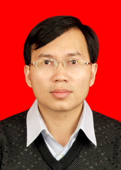 Maoxin Su (苏茂鑫)合作论文数School of Civil Engineering, Shandong University1
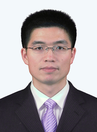 Yiguo Xue (薛翊国)合作论文数Geotechnical and Structural Engineering Center, School of Civil Engineering, Shandong University1
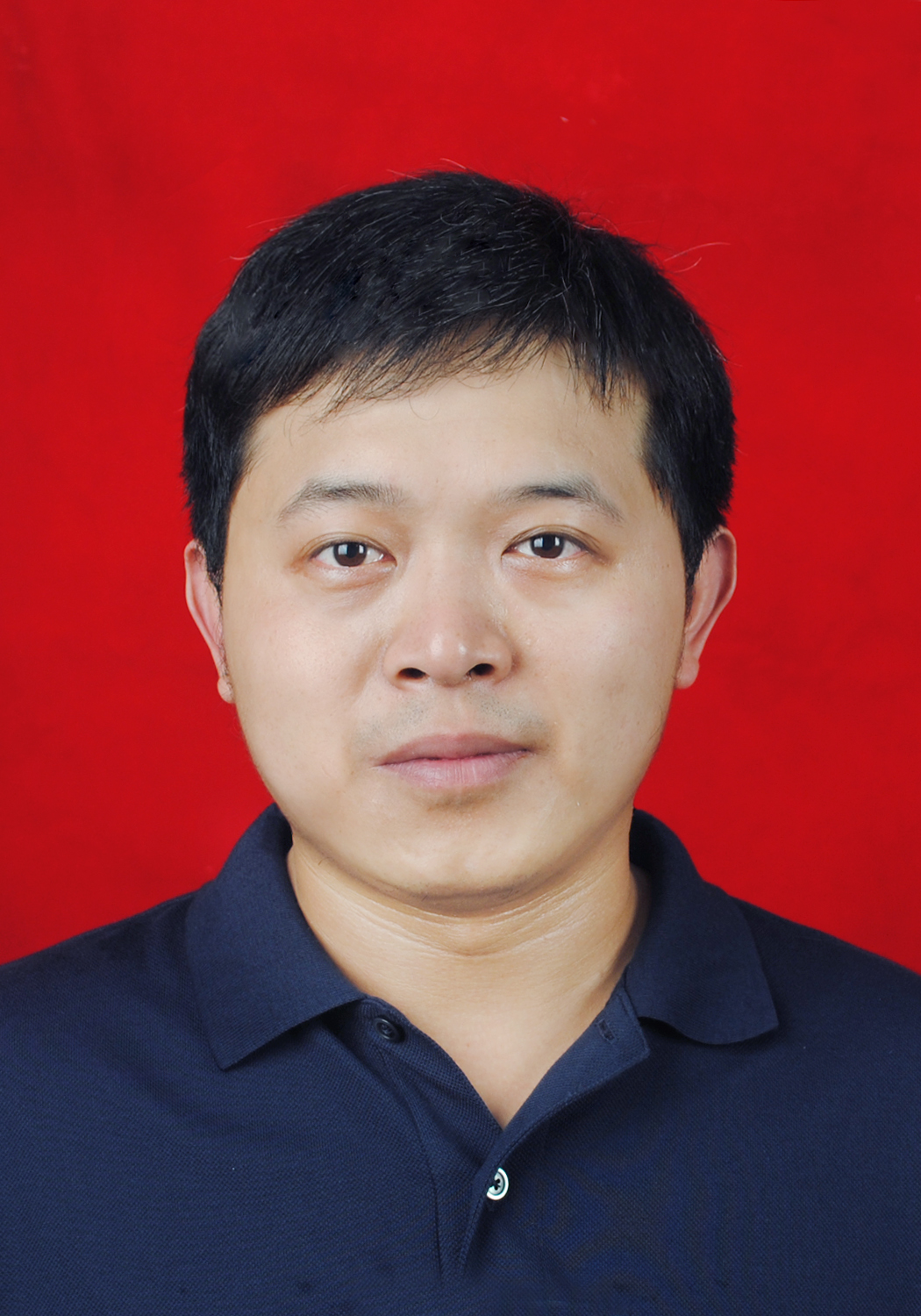 Zhengyong Ren (任政勇)合作论文数School of Geoscience and Info-Physics, Central South University1
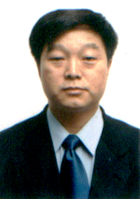 Jingtian Tang (汤井田)合作论文数School of Geosciences and Info-Physics, Central South University1
 Patrick Ledru合作论文数BRGM1
 Karl E. Butler合作论文数Department of Geology, University of New Brunswick1




