The Soil Fertility (SoilFer) project, led by the Land and Water Division at FAO, seeks to enhance agricultural practices and resilience globally, starting with five countries (Guatemala, Honduras, Zambia, Kenya, and Ghana). The project collaborates with governments and relevant national partners to establish comprehensive national monitoring and mapping systems for soil management, catering to the diverse needs of agriculture stakeholders. The Soil and Water Management Laboratory at the Joint FAO/IAEA Center serves as a crucial hub for advancing research and technical expertise in soil and water management using nuclear and related techniques. Through its multifaceted approach in collaboration with the Land and Water Division, the laboratory contributes significantly to the SoilFer project, through the development and implementation of technical training programs for and expert advising on the application of Mid-Infrared Spectroscopy (MIRS), Cosmic Ray Neutron Sensor (CRNS), and Gamma Ray Spectroscopy (GRS) to soil monitoring and mapping.The integration of MIRS, CRNS, and GRS technologies within the SoilFer project forms a robust framework for soil monitoring and mapping, as MIRS has been shown to provide detailed insights into soil composition and carbon content, CRNS offers real-time data on soil moisture dynamics, and GRS contributes to the analysis of radioactive isotopes and elemental composition. Given the integrated nature of landscape processes, the adoption of technological approaches must mirror this complexity. Interconnected ecological, hydrological, and geological processes within landscapes necessitate a holistic and integrated technological framework. This approach ensures that diverse data streams, derived from technologies such as remote sensing, geographic information systems (GIS), and advanced sensor networks, can be harmoniously synthesized. Only through such integration can a comprehensive understanding of landscape dynamics be achieved, facilitating informed decision-making and sustainable management practices across multifaceted environmental systems. The project emphasizes the seamless integration of these advanced technologies with soil monitoring and mapping systems, ensuring a comprehensive and effective approach to soil management practices, while improving national capacity and stakeholder engagement in data-based decision making. The key objectives of the SoilFer project encompass the development of robust national soil information systems, the implementation of decision support systems targeting soil health, and the promotion of sustainable soil management practices. By fostering collaboration and knowledge exchange, the project aspires to build technical, increase agricultural resilience and ensure food security in the participating countries.
Established in 2012 by members of the Food and Agriculture Organisation (FAO), the Global Soil Partnership (GSP) is a global network of stakeholders promoting sound land and soil management practices towards a sustainable world food system. However, soil survey largely remains a local or regional activity, bound to heterogeneous methods and conventions. Recognising the relevance of global and trans-national policies towards sustainable land management practices, the GSP elected data harmonisation and exchange as one of its key lines of action. Building upon international standards and previous work towards a global soil data ontology, an improved domain model was eventually developed within the GSP [54], the basis for a Global Soil Information System (GloSIS). This work also identified the Semantic Web as a possible avenue to operationalise the domain model. This article presents the GloSIS web ontology, an implementation of the GloSIS domain model with the Web Ontology Language (OWL). Thoroughly employing a host of Semantic Web standards (SOSA, SKOS, GeoSPARQL, QUDT), GloSIS lays out not only a soil data ontology but also an extensive set of ready-to-use code-lists for soil description and physio-chemical analysis. Various examples are provided on the provision and use of GloSIS-compliant linked data, showcasing the contribution of this ontology to the discovery, exploration, integration and access of soil data.
Spatial soil databases can help model complex phenomena in which soils are a decisive factor – for example, evaluating agricultural potential or estimating carbon storage capacity. The Latin America and Caribbean Soil Information System, SISLAC, is a regional initiative promoted by the Food and Agriculture Organization's (FAO) Latin America and the Caribbean Soil Partnership to contribute to sustainable management of soil. SISLAC includes data from 49 084 soil profiles distributed unevenly across the continent, making it the region's largest soil database. In addition, there are other soil databases in the region with about 40 000 soil profiles that can be integrated into SISLAC and improve it. However, some problems hinder its usages, such as the quality of the data and their high dimensionality. The objective of this research is evaluate the quality of the SISLAC data and the other available soil databases to generate a new improved version that meets the minimum quality requirements to be used for different purposes or practical applications. The results show that 15 % of the existing soil profiles had an inaccurate description of the diagnostic horizons and 17 % of the additional profiles already existed in SISLAC; therefore, a total of 32 % of profiles were excluded for these two reasons. Further correction of an additional 4.5 % of existing inconsistencies improved overall data quality. The improved database consists of 66 746 profiles and is available for public use at https://doi.org/10.5281/zenodo.7876731 (Díaz-Guadarrama and Guevara, 2023). This revised version of SISLAC data offers the opportunity to generate information that helps decision-making on issues in which soils are a decisive factor. It can also be used to plan future soil surveys in areas with low density or where updated information is required.
Black soils, characterized by their thick, dark horizons enriched with organic matter, epitomize highly fertile soils. However, their fertility precipitates intense land use, engendering challenges such as soil erosion, nutrient depletion, pollution, compaction, salinization, and acidification. Notably, these soils are significant contributors to global greenhouse gas emissions, primarily due to substantial losses in soil organic carbon. Despite these challenges, black soils are pivotal for global food production. This paper delineates the implementation of digital soil mapping for the global cartography of black soils and human interference on these soils. Predominantly distributed in Eastern Europe, Central and Eastern Asia, and North and South America, black soils cover an approximate area of 725 Mha, with the Russian Federation, Kazakhstan, and China collectively have over half of this area. Agriculturally, these soils underpin significant proportions of global crop yields, producing 66% of sunflower, 30% of wheat, and 26% of potato outputs. The organic carbon content in the upper 30 cm of these soils is estimated at 56 Gt. Sustainable management of black soils is imperative for ensuring food security and addressing climate change on a global scale.
In their commentary, Xiao et al. cautioned that the conclusions on the critical role of microbial carbon use efficiency (CUE) in global soil organic carbon (SOC) storage in a paper by Tao et al. (2023) might be too simplistic. They claimed that Tao et al.’s study lacked mechanistic consideration of SOC formation and excluded important datasets. Xiao et al. brought up important points, which can be largely reconciled with our findings by understanding the differences in expressing processes in empirical studies and in models.
Bu çalışmada, Bozcaada topraklarının ayrıntılı toprak etüd haritalaması yapılmış ve 12 adet toprak serisi saptanmıştır. Bu serilere ait tipik toprak profilleri tanımlanarak horizon esasına göre toprak örnekleri alınmış ve seri düzeyinde ayrıntılı toprak haritası hazırlanmıştır. Bozcaada’da saptanan toprak serileri genellikle hafif-orta eğimli yamaç (konglomera, marn, kireç taşı, kum taşı, andezit), alüviyal ve kumul depozitleri üzerinde oluşmuştur. Bu serilerden sığ bir profil yapısına sahip olan Göztepe serisi (769 ha) çalışma alanında saptanan en yaygın toprak serisi, ikincisi ise 492 ha alan ile Tuzburnu serisdir. En dar alanı ise sırasıyla Habbele (142 ha), Çamlık (145 ha) ve Bizan serisi ( 155 ha) toprakları oluşturmaktadır. Göztepe Serisi aynı zamanda çalışma alanında en yüksek ortalama eğime (%12) sahiptir. Fener ve Ova Serisi toprakları ise ortalama %3-5 eğim ile en düşük eğimli arazilerdir. Habbele serisi Ada’nın en yüksek kireç içeriğine sahip topraklarıdır. Kil miktarı en fazla olan seri (% 35-51 kil) Yerebakan serisi, en düşük olanı ise (% 8 den az) Çamlık ve Fener serileri olarak belirlenmiştir. KDK (saptanmıştır. Katyon değişim kapasitesinin (KDK) en yüksek değeri (43.48 cmol kg-1), Ayazma serisisnin yüzey horizonunda belirlenmiştir. Çamlık ve Fener serileri % 90 ve daha fazla kum içermesi nedeniyle KDK değerleri oldukça düşük miktarda (3-5.5 cmol kg-1) belirlenmiştir. Toprak serilerinin yarayışlı potasyum içerikleri Habbele, Saraya ve Ayazma serileri dışındaki diğer serilerde az olarak saptanmıştır. Yarayışlı fosfor miktarı tüm serilerin genellikle yüzey altında az veya çok az olarak saptanırken bazı serilerde yüzeyde yeterli olarak saptanmıştır. Mikroelement içerikleri bakımından ise neredeyse tüm toprak serilerinin yetersiz olduğu belirlenmiştir. Toprak serileri toprak taksonomisinin Entisol ordosuna ait orthents, fluvents ve psamments alt ordoları ile bunlara göre daha ileri ve derin bir profil gelişiminin olduğu Inceptisol ordosuna ait xerepts alt ordosu içerisinde sınıflandırılmıştır. WRB sistemine göre toprak serileri Fluvisols, Leptosols, Cambisols, Arenosols, Calcisols ve Regosols olarak sınıflandırılmıştır.
Soils store more carbon than other terrestrial ecosystems 1 , 2 . How soil organic carbon (SOC) forms and persists remains uncertain 1 , 3 , which makes it challenging to understand how it will respond to climatic change 3 , 4 . It has been suggested that soil microorganisms play an important role in SOC formation, preservation and loss 5 – 7 . Although microorganisms affect the accumulation and loss of soil organic matter through many pathways 4 , 6 , 8 – 11 , microbial carbon use efficiency (CUE) is an integrative metric that can capture the balance of these processes 12 , 13 . Although CUE has the potential to act as a predictor of variation in SOC storage, the role of CUE in SOC persistence remains unresolved 7 , 14 , 15 . Here we examine the relationship between CUE and the preservation of SOC, and interactions with climate, vegetation and edaphic properties, using a combination of global-scale datasets, a microbial-process explicit model, data assimilation, deep learning and meta-analysis. We find that CUE is at least four times as important as other evaluated factors, such as carbon input, decomposition or vertical transport, in determining SOC storage and its spatial variation across the globe. In addition, CUE shows a positive correlation with SOC content. Our findings point to microbial CUE as a major determinant of global SOC storage. Understanding the microbial processes underlying CUE and their environmental dependence may help the prediction of SOC feedback to a changing climate.
Abstract. Spatial soil databases can help model complex phenomena in which soils are decisive, for example, evaluating agricultural potential or estimating carbon storage capacity. The Soil Information System for Latin America and the Caribbean, SISLAC, is a regional initiative promoted by the FAO's South American Soil Partnership to contribute to the sustainable management of soil. SISLAC includes data coming from 49,084 soil profiles distributed unevenly across the continent, making it the region's largest soil database. However, some problems hinder its usages, such as the quality of the data and its high dimensionality. The objective of this research is twofold. First, to evaluate the quality of SISLAC and its data values and generate a new, improved version that meets the minimum quality requirements to be used by different interests or practical applications. Second, to demonstrate the potential of improved soil profile databases to generate more accurate information on soil properties, by conducting a case study to estimate the spatial variability of the percentage of soil organic carbon using 192 profiles in a 1473 km2 region located in the department of Valle del Cauca, Colombia. The findings show that 15 percent of the existing soil profiles had an inaccurate description of the diagnostic horizons. Further correction of an 4.5 additional percent of existing inconsistencies improved overall data quality. The improved database consists of 41,691 profiles and is available for public use at https://doi.org/10.5281/zenodo.6540710 (Díaz-Guadarrama, S. & Guevara, M., 2022). The updated profiles were segmented using algorithms for quantitative pedology to estimate the spatial variability. We generated segments one centimeter thick along with each soil profile data, then the values of these segments were adjusted using a spline-type function to enhance vertical continuity and reliability. Vertical variability was estimated up to 150 cm in-depth, while ordinary kriging predicts horizontal variability at three depth intervals, 0 to 5, 5 to 15, and 15 to 30 cm, at 250 m-spatial resolution, following the standards of the GlobalSoilMap project. Finally, the leave-one-out cross-validation provides information for evaluating the kriging model performance, obtaining values for the RMSE index between 1.77 % and 1.79 % and the R2 index greater than 0.5. The results show the usability of SISLAC database to generate spatial information on soil properties and suggest further efforts to collect a more significant amount of data to guide sustainable soil management.
Soil organic carbon (SOC) is a major driver of the multiple functions of soils in the delivery of ecosystem services. While the spatial prediction and mapping of SOC stocks are of key importance for land managers to understand the synergies between SOC management and soil health, a spatially-explicit map of the distribution of SOC stocks in Ghana is non-existent. Therefore, we quantified the spatial distribution of SOC stocks and associated uncertainties to a target depth of 0-30 cm based on regression-kriging modelling to fill this knowledge gap. The mean error (ME) of the predictions is negligible. The mean absolute error (MAE) shows that the model has prediction errors of about 0.48%. The coefficient of determination (R-2) shows that the model explains 34% of the variation in model predictions of SOC stocks. The RMSE is 0.63% of the prediction errors. The predicted SOC stocks show significant variation in their spatial distribution throughout the country. Generally, a trend of decreasing SOC stocks from the southwest to the northeast is clearly recognized. SOC stocks are highest in the Semi-Deciduous agro-ecological zone (43.5 Mg C ha(-1)) and lowest in the Guinea Savannah agro-ecological zone (0.05 Mg C ha(-1) About 5.4 Tg of SOC stocks is stored in the top 0-30 cm of the soils in Ghana. This preliminary work at a spatial resolution of 30 arc-seconds (similar to 1 km) has been accomplished within the framework and guidelines of the Global Soil Partnership (GSP). To our knowledge, this is the first time ever in Ghana that a soil property map has been produced along with its uncertainties. Thus, this study represents a significant first step towards revolutionizing future soil property mapping in Ghana. Even though there remains the need to improve on the quality and spatial resolution, the SOC stocks map presented herein is a satisfactory first step to guide future research on soil organic carbon management at both national and global scales.
After the publication of the Status of the World’s Soil Resources (SWSR) in 2015, the Intergovernmental Technical Panel of Soils (ITPS) and the Global Soil Partnership (GSP) concluded that the increasing soil organic carbon (SOC) represents an important step and solution to cope with environmental problems such as food security, soil degradation, as well as climate change mitigation and adaptation. In the last 3 years, the GSP has been actively working to incorporate SOC into the global agenda. To this end, a series of activities have been developed to contribute to the know-how required to measure, monitor, manage, maintain, and/or increase SOC stocks in a changing world. This chapter underlines the importance of SOC in relation to climate change, human health, food security, and biodiversity.
Bozcaada baglari ve saraplariyla unlu, Ege denizinin kuzey-dogusunda ve Marmara bolgesinin guney-batisinda yer alan bir Ege adasidir. Turkiye'nin Gokceada ve Marmara adasindan sonra ucuncu buyuk adasidir. Adanin tarimsal ana urununu uzum ve az miktarda tahil, baklagiller ve diger meyve agaclari olusturur. Ada'yi bu kadar ozel kilan terroir'dir. Fransizca bir kelime olan terroir, toprak, iklim ve topografik ozelliklerin, insan etkisi ile birlikte bagciliga ve urun kalitesine etkisini incelemektedir. Yurutulen calisma uc bolumden olusmaktadir. Calismanin I. Bolumunde, Bozcaada’nin sadece iklim, jeoloji ve topografik ozellikleri, II.bolumunde toprak haritalamasi ve toprak ozellikleri, III. bolumunde ise terroir ve bagcilik acisindan degerlendirilmesi incelenmistir. Detayli toprak etud calismasi ile Bozcaada topraklarinin seri duzeyinde ayrintili toprak haritasi hazirlanmistir. Bu calisma, detayli toprak haritasi ve cesitli toprak ozellikleri ile bagciliga yonelik bir uygunluk degerlendirmesi olmak uzere iki ana sonuca sahiptir. Ancak, bu bolumde Bozcaada’nin iklim, jeolojik ve ozellikle topografik ( egim, yukseklik, baki-yoney) ozellikleri ile topografik nemlilik indeksi incelenmistir.
Country-specific soil organic carbon (SOC) estimates are the baseline for the Global SOC Map of the Global Soil Partnership (GSOCmap-GSP). This endeavor is key to explaining the uncertainty of global SOC estimates but requires harmonizing heterogeneous datasets and building country-specific capacities for digital soil mapping (DSM). We identified country-specific predictors for SOC and tested the performance of five predictive algorithms for mapping SOC across Latin America. The algorithms included support vector machines (SVMs), random forest (RF), kernel-weighted nearest neighbors (KK), partial least squares regression (PL), and regression kriging based on stepwise multiple linear models (RK). Country-specific training data and SOC predictors (5 × 5 km pixel resolution) were obtained from ISRIC – World Soil Information. Temperature, soil type, vegetation indices, and topographic constraints were the best predictors for SOC, but country-specific predictors and their respective weights varied across Latin America. We compared a large diversity of country-specific datasets and models, and were able to explain SOC variability in a range between ∼ 1 and ∼ 60 %, with no universal predictive algorithm among countries. A regional (n = 11 268 SOC estimates) ensemble of these five algorithms was able to explain ∼ 39 % of SOC variability from repeated 5-fold cross-validation. We report a combined SOC stock of 77.8 ± 43.6 Pg (uncertainty represented by the full conditional response of independent model residuals) across Latin America. SOC stocks were higher in tropical forests (30 ± 16.5 Pg) and croplands (13 ± 8.1 Pg). Country-specific and regional ensembles revealed spatial discrepancies across geopolitical borders, higher elevations, and coastal plains, but provided similar regional stocks (77.8 ± 42.2 and 76.8 ± 45.1 Pg, respectively). These results are conservative compared to global estimates (e.g., SoilGrids250m 185.8 Pg, the Harmonized World Soil Database 138.4 Pg, or the GSOCmap-GSP 99.7 Pg). Countries with large area (i.e., Brazil, Bolivia, Mexico, Peru) and large spatial SOC heterogeneity had lower SOC stocks per unit area and larger uncertainty in their predictions. We highlight that expert opinion is needed to set boundary prediction limits to avoid unrealistically high modeling estimates. For maximizing explained variance while minimizing prediction bias, the selection of predictive algorithms for SOC mapping should consider density of available data and variability of country-specific environmental gradients. This study highlights the large degree of spatial uncertainty in SOC estimates across Latin America. We provide a framework for improving country-specific mapping efforts and reducing current discrepancy of global, regional, and country-specific SOC estimates.
The chapter discusses a study that predicts the global organic carbon stocks for agricultural soils using European databases with geostatistical analysis and modeling. The overall statistical model consists of two submodels namely donor and donee modules. The donor module uses statistics to quantify the relationships between soil organic carbon (SOC) and environmental covariates. The covariates were selected based on their availability at global scale and their roles as major drivers that affect the carbon cycle in terrestrial ecosystems. Multiple linear regression was used in the donor module with the selected covariates and dense SOC measurements coming from LUCAS soil database (Toth et al., 2013a). The LUCAS soil database has more than 22,000 SOC measurements from European countries and a standardized sampling procedure was used routinely to collect samples of around 0.5 kg of topsoil (0-20 cm) each. The donor module reveals and quantifies the relationships between SOC mass concentration in soil and the predictors to be used in the donee model to extend the prediction at global scale using the same set of predictors. We used the WorldClim dataset (Hijmans et al., 2005), which is comprised of global climate data layers representing long-term conditions for the years from 1950 to 2000. The land cover data were extracted from the GlobCover 2009 (ESA and Universite' Catholique de Louvain, 2010) provided by the European Space Agency (ESA), the terrain parameters were derived from CGIAR-CSI SRTM 90 mDatabase (Jarvis et al., 2008), the soil layers obtained from Harmonized World Soil Database (FAO/ IIASA/ISRIC/ISSCAS/JRC, 2012), and the Normalized Difference Vegetation Index (NDVI) data were obtained from Copernicus Global Land Service Data Portal (Copernicus Global Land Service, 2015). The study yielded promising results which are broadly consistent with similar efforts predicting global agricultural SOC stocks. Our model fits the SOC data well (R-2 = 0.35) and preliminary results suggest a global agricultural SOC estimate of 100.34 Pg (Petagrams) in the first 20 cm. The study predicts the global agricultural SOC stocks using a geostatistical approach and the results are consistent with previous studies that used process-based SOC models.
.............................................................................................................. 2
Soil organic carbon plays an important role in the carbon cycling of terrestrial ecosystems, variations in soil organic carbon stocks are very important for the ecosystem. In this study, a geostatistical model was used for predicting current and future soil organic carbon (SOC) stocks in Europe. The first phase of the study predicts current soil organic carbon content by using stepwise multiple linear regression and ordinary kriging and the second phase of the study projects the soil organic carbon to the near future (2050) by using a set of environmental predictors. We demonstrate here an approach to predict present and future soil organic carbon stocks by using climate, land cover, terrain and soil data and their projections. The covariates were selected for their role in the carbon cycle and their availability for the future model. The regression-kriging as a base model is predicting current SOC stocks in Europe by using a set of covariates and dense SOC measurements coming from LUCAS Soil Database. The base model delivers coefficients for each of the covariates to the future model. The overall model produced soil organic carbon maps which reflect the present and the future predictions (2050) based on climate and land cover projections. The data of the present climate conditions (long-term average (1950–2000)) and the future projections for 2050 were obtained from WorldClim data portal. The future climate projections are the recent climate projections mentioned in the Fifth Assessment IPCC report. These projections were extracted from the global climate models (GCMs) for four representative concentration pathways (RCPs). The results suggest an overall increase in SOC stocks by 2050 in Europe (EU26) under all climate and land cover scenarios, but the extent of the increase varies between the climate model and emissions scenarios.
Because of the increasing pressures exerted on soil, below-ground life is under threat. Knowledge-based rankings of potential threats to different components of soil biodiversity were developed in order to assess the spatial distribution of threats on a European scale. A list of 13 potential threats to soil biodiversity was proposed to experts with different backgrounds in order to assess the potential for three major components of soil biodiversity: soil microorganisms, fauna, and biological functions. This approach allowed us to obtain knowledge-based rankings of threats. These classifications formed the basis for the development of indices through an additive aggregation model that, along with ad-hoc proxies for each pressure, allowed us to preliminarily assess the spatial patterns of potential threats. Intensive exploitation was identified as the highest pressure. In contrast, the use of genetically modified organisms in agriculture was considered as the threat with least potential. The potential impact of climate change showed the highest uncertainty. Fourteen out of the 27 considered countries have more than 40% of their soils with moderate-high to high potential risk for all three components of soil biodiversity. Arable soils are the most exposed to pressures. Soils within the boreal biogeographic region showed the lowest risk potential. The majority of soils at risk are outside the boundaries of protected areas. First maps of risks to three components of soil biodiversity based on the current scientific knowledge were developed. Despite the intrinsic limits of knowledge-based assessments, a remarkable potential risk to soil biodiversity was observed. Guidelines to preliminarily identify and circumscribe soils potentially at risk are provided. This approach may be used in future research to assess threat at both local and global scale and identify areas of possible risk and, subsequently, design appropriate strategies for monitoring and protection of soil biota.
Accuracy in assessing the distribution of soil organic carbon (SOC) is an important issue because of playing key roles in the functions of both natural ecosystems and agricultural systems. There are several studies in the literature with the aim of finding the best method to assess and map the distribution of SOC content for Europe. Therefore this study aims searching for another aspect of this issue by looking to the performances of using aggregated soil samples coming from different studies and land-uses. The total number of the soil samples in this study was 23,835 and they're collected from the "Land Use/Cover Area frame Statistical Survey" (LUCAS) Project (samples from agricultural soil), BioSoil Project (samples from forest soil), and "Soil Transformations in European Catchments" (SoilTrEC) Project (samples from local soil data coming from six different critical zone observatories (CZOs) in Europe). Moreover, 15 spatial indicators (slope, aspect, elevation, compound topographic index (CTI), CORINE land-cover classification, parent material, texture, world reference base (WRB) soil classification, geological formations, annual average temperature, min-max temperature, total precipitation and average precipitation (for years 1960-1990 and 2000-2010)) were used as auxiliary variables in this prediction. One of the most popular geostatistical techniques, Regression-Kriging (RK), was applied to build the model and assess the distribution of SOC. This study showed that, even though RK method was appropriate for successful SOC mapping, using combined databases was not helpful to increase the statistical significance of the method results for assessing the SOC distribution. According to our results; SOC variation was mainly affected by elevation, slope, CTI, average temperature, average and total precipitation, texture, WRB and CORINE variables for Europe scale in our model. Moreover, the highest average SOC contents were found in the wetland areas; agricultural areas have much lower soil organic carbon content than forest and semi natural areas; Ireland, Sweden and Finland has the highest SOC, on the contrary, Portugal, Poland, Hungary, Spain, Italy have the lowest values with the average 3%.
Soil organic carbon, the major component of soil organic matter, is very important in all soil processes. The decline in soil organic carbon (SOC) is recognized as one of the eight soil threats identified in the European Union Thematic Strategy for Soil Protection (COM (2006)231 final) (EC, 2006). The research challenge in this paper is to develop aggregation techniques which can ‘catch’ the variability at local level and being able to transfer this knowledge to larger scales. The latest developments included the research in upscaling modelling techniques which allow transferring the data values from local to regional scale. Digital Soil Mapping (DSM) and in particular regression kriging has been selected as the most appropriate modelling approach for the study. It has been successfully implemented at regional level and a soil organic carbon map was produced for the selected region (Slavkovsky Forest, 2400 km2, Czech Republic) by transferring knowledge from Lysina Critical Zone Observatory (0.40 km2). The Lysina CZO is situated in western Bohemia, the Czech Republic. Using digital soil mapping (DSM), demonstrated that it is possible to upscale the processes that take place at Critical Zone Observatories (CZOs) towards larger regions. According to the prediction results, the soil organic carbon values in the Slavkovsky Forest are ranging between 0% - 35.11%. The results of the linear regression procedure is promising, however, the statistical indicators are relatively low (R2=0.31) in the first step of the two stage model. The results of the study encourage applying similar approach at a wider scale. However, the ground data availability is still the key component to have more robust geostatistical models. The model and its outputs can be improved by using more ground data and high resolution environmental covariates.
 Luca Montanarella合作论文数9
 Panos Panagos合作论文数Joint Research Centre, European Commission8
 Ronald Vargas合作论文数5
 Guillermo Federico Olmedo合作论文数Invest Forestales Bioforest SA5
 Christian Thine Omuto合作论文数Department of Environmental and Biosystems Engineering, University of Nairobi5
 Rafael Rivera合作论文数4Carolina Olivera合作论文数4
 Huseyin Ekinci合作论文数4arnulfo encina合作论文数4
 Mario Guevara合作论文数Univ Delaware, Dept Plant & Soil Sci, Newark, DE 19716 USA4
 Marc Van Liedekerke合作论文数Institute for Environment and Sustainability, Joint Research Centre of the European Commission4
 Ciro Gardi合作论文数Institute for Environment and Sustainability, European Commission Joint Research Centre4Gustavo M. Vasques合作论文数4Fernando Fontes合作论文数3Adriana Bolivar合作论文数3Kostiantyn Viatkin合作论文数3
 Rodrigo Vargas合作论文数School of Life Sciences, Arizona State University;Department of Plant and Soil Sciences, University of Delaware3
 Cristiano Ballabio合作论文数Joint Research Centre3panagos panagiotis合作论文数2Victor Sevilla合作论文数2Nelson Bustamante Cañas合作论文数2Sally Bunning合作论文数2Isabel Luotto合作论文数2Rosa Cuevas-Corona合作论文数2
 Orhan Yuksel合作论文数2Guillermo Peralta合作论文数2Gloria E. Arévalo合作论文数2Martin Dell'Acqua合作论文数2Verónica Loayza合作论文数2Nelson Bustamante合作论文数2
 Yingping Wang合作论文数South China Botanical Garden, Chinese Academy of Sciences;CSIRO Oceans and Atmosphere2
 Luis Moreira De Sousa合作论文数2
 Ashish Malik合作论文数2Daphne Armas合作论文数2
 Cuijuan Liao合作论文数2
 Alexandra Manueles合作论文数2
 Wilmer Jimenez Merino合作论文数2
 Gustavo Alfonso Araujo Carrillo合作论文数AGROSAVIA, Corp Colombiana Invest Agropecuaria2
 José Antonio Hernández-Herrera合作论文数Unidad Saltillo, Univ Autonoma Agr Antonio Narro2Ricardo O. Dart合作论文数2Emma Stell合作论文数Dept Plant & Soil Sci, Univ Delaware2
 Viviana Marcela Varón-Ramírez合作论文数Tibaitata Res Ctr, Colombian Corp Agr Res Agrosavia2
 Marcos Esteban Angelini合作论文数INRAE, Univ Montpellier2Yishuang Liang合作论文数Tsinghua University, China2Feng Tao合作论文数2
 Yuanyuan Huang合作论文数Chinese Academy of Sciences2
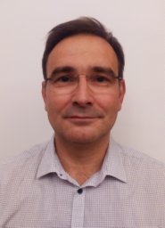 Gergely Toth合作论文数Locus Pharmaceuticals2
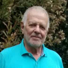 Raul Silvio Lavado合作论文数Universidad de Buenos Aires2Ahrens Bernhard合作论文数Max Planck Institute for Biogeochemistry, Hans-Knöll-Str. 10, 07445, Jena, Germany.2




