Two arrays equipped with broadband sensors were installed for a period of 10 months, in order to study the seismic activity in the area of Santorini (Thira) volcano. During these periods, about 330 earthquakes were recorded and located within a radius of 50 km from the center of the caldera. An iterative damped traveltime inversion procedure yielded a local 1-D Ρ-wave velocity model and improved locations with an accuracy better than 5 Km in both horizontal and vertical components for 135 earthquakes. Those are mainly distributed within a depth range 5-18 Km, in the vicinity of the submarine Kolumbo Reef (NE of Santorini Island). Signal analysis of the recorded volcanic earthquakes including typical Fourier transformations and several operations in the time-frequency domain, allowed their dominant frequency determination and their classification into three groups based on waveform appearance and frequency content: (1) highfrequency events; (2) low-frequency events; and (3) volcanic tremor. Frequencytime analysis of tremor, detected at three stations, revealed two kinds of harmonic tremor with one sharp peak, at 3-5 Hz and 8.5-10 Hz.
Seismic moment tensors are estimated for earthquakes offshore Northern California and Greece using inversion of regionally recorded broadband seismograms. This study includes inversion results for the strongest events that occurred inside the Gorda plate and near the Mendocino triple junction from 1991 to 2005. The regional results are in good agreement with obtained teleseismic results. We finally applied the moment tensor inversion methodology and validation mainly to moderate sized earthquakes, with magnitude greater than M~4.0, in the Aegean area. The focal mechanisms of HI earthquakes that occurred during the time period between June 2003 and March 2007 were estimated using this procedure.
Anelasticity of the Earth crucially affects the propagation of seismic waves especially, in the long period range. However, even though the elastic properties of the Aegean deep lithosphère and upper mantle have been thoroughly investigated, their quantitative anelastic properties that influence the long period wavefield are still largely unknown. This work is towards contributing to the better knowledge of the deep structure of the Aegean by introducing experimental anelastic parameters via the study of long period Rayleigh waves attenuation. For this scope, fundamental mode attenuation coefficients (γ%) have been obtained for different two-station great-circle paths across the Aegean. The data used were provided by a broadband array installed in the area for 6 months in 1997. More than 1100 seismograms were analyzed in the 10-100 s range to obtain 17 sets of path average γR(T) functions. The attenuation coefficients are in the range 2.5*10~3 — 0.15 x 10' km' and correlate sufficiently with both experimental measurements in active tectonic regions elsewhere and synthetics generated with the use of an attenuation reference model inferred from other sources. By applying a stochastic uncoupled causal inversion method an average joint Qß'1 and shear velocity model representative of the under study area was obtained. Furthermore, path average JR(T) functions were combined in a continuous regionalization tomographic scheme to obtain local yR(T) and tomograms were constructed in the range 10-60 s. The most prominent feature in the tomograms is a high attenuation region in the central and north Aegean. This region is located south of the North Anatolian Trough and correlates well with a low shear velocity zone inferred from surface wave phase velocities. Moreover, it is associated with observed intense extensional deformation rates, mantle olivine anisotropy, recent volcanism and high heat flow.
The Gulf of Corinth is one of the most active tectonic rifts around the world. Data used in the present study are obtained by the four digital stations of the Cornet Network which was installed in 1995 around the Eastern Gulf of Corinth. A velocity model was calculated, while the majority of local events were located within the Gulf of Corinth. Main scope of the study is the determination of a reliable earthquake magnitude. Concerning the duration magnitude Mo, a multiple linear regression technique was developed for the determination of the constants α, β and γ with very satisfactory values of errors. The coefficient of determination (goodness of fit) R2 was found equal to 0.99. Following, the moment magnitude Mw, which is considered to be the most reliable magnitude scale, was determined. Spectral analysis was applied for the calculation of the seismic moment M0 and a seismic catalogue was created. After the determination of the moment magnitude Mw and of the duration magnitude MD for the same dataset, a relationship between them was obtained, according to which Mw is systematically larger than Mjy Relationships between these magnitudes, the local magnitude ML and the body wave magnitude mb were also obtained.
Body wave inversion methodology is developed to determine the earthquake source parameters in teleseismic distances. The generalized inversion technique, based on the singular value decomposition method, is applied to determine the deviatone moment tensor which is decomposed in two parts. The first one is related to the pure Double Couple (DC) and the second one to the compensated linear vector dipoles (CLVD). The best solution of the overdetermined problem is obtained by minimizing the misfit between observed and synthetic seismograms. The proposed methodology is applied for the four strongest earthquakes that occurred recently in Greece (2001-2006)
The Western Gulf of Corinth, located in Central Greece, is an active neotectonic graben that features intense seismicity. Events recorded by dense local networks during 2014 (including those belonging to an offshore swarm between Nafpaktos and Psathopyrgos) were used to perform a shear-wave splitting study, with recordings that fulfill strict criteria. The splitting parameters, determined by visually inspecting polarigrams and hodograms, are the polarization direction of the fast shear-wave and the time-delay between the two-split shear waves. Over 960 observations were obtained for 13 stations in the area. Temporal variations of normalized time delays were investigated to extract patterns that indicate stress accumulation and release. Such patterns were identified in 5 stations, where linear trends of increase, followed by a decrease a couple of weeks before the M-w = 5.0 7th November 2014 earthquake, were identified. These observations highlight similarities with behavior of time-delays before the occurrence of earthquakes in other areas. Nevertheless, scattering of measurements poses a significant challenge in interpreting these variations. The mean polarization direction of the fast shear-wave in each station is consistent with the known regional maximum horizontal stress component (i.e. WNW-ESE), except for three stations located in the northern shore of the gulf, which present a general NE-SW polarization direction. The former is interpreted with the Anisotropic Poro-Elasticity model, where fluids within microcracks, aligned with the regional stress regime, affect shear-wave splitting. The latter are located in an area where faults of similar direction have been mapped, which could indicate the presence of secondary local stress states.
In this study a new waveform inversion methodology was developed to determine the source parameters of an earthquake. This technique is based on analyzing data recorded both at teleseismic and regional distances. To apply the inversion three different methods, which are the normal equations, the QR-decomposition and the singular value decomposition (SVD), were successfully tested, similar results were obtained and the SVD method was selected. The proposed inversion methodology was applied to large, as well as to earthquakes of moderate magnitude. Analysis of moderate events is crucial for seismogenic volumes, where an important number of such earthquakes occur which allow the calculation of their source parameters. Thus, the seismotectonic characteristics of the study area can be determined. The proposed methodology is successfully applied to events located in Greece and its surrounding regions in near real time.
The Gulf of Corinth, located in central Greece, is characterized by normal faulting and by high seismicity since the antiquity. On 4 February 2008 a seismic swarm burst in NW Peloponnesus characterized by the occurrence of two moderate-size earthquakes of moment magnitudes 4.7 and 4.5, respectively. Analysis of the data revealed the existence of shear-wave splitting. The events that were chosen for the anisotropy study fit the selection criteria, having clear and impulsive S wave arrival phases on the horizontal components. In addition, the amplitude of the S wave phase on the vertical component was smaller than on the horizontal ones. The representations that were used to determine the polarization direction of the fast split shear wave, the time delay between the two split shear waves and the polarization direction of the source were the polarigram and the hodogram. The uniform fast shear wave polarizations, irrespective of the azimuth of each event, are consistent with the general NNE-SSW direction of extension in the Gulf and, therefore, in agreement with the extensive dilatancy anisotropy (EDA) model. Finally, a decrease of the time delay values was observed after the occurrence of the first moderate earthquake, implying changes of the medium’s properties.
Ground motion prediction equations, widely known as attenuation relations, are common input for probabilistic and deterministic seismic hazard studies. The construction of a ground motion model to describe such a complex phenomenon as the effects of seismic wave propagation is highly dependable on a number of parameters. The quality and the distribution of strong motion data, which is the original input for the calculation of any ground motion model, can be thought as one of the main parameters that heavily influence the form of ground motion prediction equations. The selected processing scheme, involving significant choices about a series of adjustments and filter specifications, implemented to remove low and high frequency noise, is related with the credibility of the calculated ground motion parameters such as the spectral ordinates. Once a set of response variables for a number of predictors is available, the researcher’s interest is related with the mathematical definition of the ground motion model, in terms of selecting the appropriate parameters and the determination of their coefficients of the equation. Another significant part involves the selection of the optimum solver in order to achieve high confidence level coefficients and a computationally inexpensive solution. Each method should be evaluated through statistics but the researcher should bear in mind that residual analysis and statistical errors, although they can adequately represent the efficiency of the mathematical equations, do not always provide information about where our efforts should lie in terms of further improvement. The scope of this paper is to point out the multi-parametric nature of the construction of ground motion prediction equations and how each of the aforementioned development stages influences the credibility of the proposed attenuation relations.
The National Observatory of Athens has begun installing permanent GPS stations on February 2006 including a EUREF permanent station in Attica, NOA1. Currently the National Observatory of Athens operates 20 continuous GPS stations around Greece all sampling at 1-s and transmitting real-time data to Athens. Several stations also sample at 0.2-s (5 Hz) and record the data in the ring buffer for a period of 1-2 days. Their location is carefully selected so that both geological and seismotectonic criteria are fulfilled. All stations are situated close to major seismogenic structures of Greece such as the Cephalonia Transform Fault (CTF) in the Ionian Sea (VLSM, PONT, SPAN, KIPO), and the two North Anatolian Fault branches in the North Aegean Sea (PRKV, LEMN ). We describe the CGPS data archiving and processing procedures, used to combine into a uniform velocity solution the observations of all the NOANET stations, accounting for the seasonal (annual and semiannual) signals, and considering the off-sets in the coordinate time-series.
Local seismological networks provide data that allow the location of microearthquakes which otherwise would be dismissed due to low magnitudes and low signal-to-noise ratios of their seismic signals. The Corinth Rift Laboratory (CRL) network, installed in the western Corinth rift, has been providing digital waveform data since 2000. In this work, a semi-automatic picking technique has been applied which exploits the similarity between waveforms of events that have occurred in approximately the same area of an active fault. Similarity is measured by the crosscorrelation maxi-mum of full signals. Events with similar waveforms are grouped in multiplet clusters using the nearest-neighbour linkage algorithm. Manually located events act as masters, while automatically located events of each multiplet cluster act as slaves. By cross-correlating the P-wave or S-wave segments of a master event with the corresponding segments of each of its slave events, after appropriately aligning their offsets, the measured time-lag at the cross-correlation maximum can be subtracted from the arrival-time of the slave event. After the correction of the arrival-times, a double-difference technique is applied to the modified catalogue to further improve the locations of clusters and distinguish the active seismogenic structures in the tectonically complex Western Corinth rift.
Strong motion data recorded during the 15-year operation of the CORinth Gulf Soft Soil Array (CORSSA) in the highly seismic region of Aegion have been homogenized and organized in a MySQL database. In the present work we describe the contents of the database and the web portal through which these data are publicly accessible. CORSSA comprises one surface and four downhole 3-D broadband accelerometric stations. It was installed in 2002, in the framework of European project CORSEIS, aiming at gathering data for studying site effects, liquefaction, and non-linear behaviour of soils, as well as earthquake source properties. To date, the array has recorded 549 local and regional events with magnitudes ranging from 1.1 to 6.5. Although the vast majority of the recorded events caused weak ground motion at the CORSSA site, the scientific value of the data set pertains to the sparsity of this kind of infrastructure in most parts of the world.
The source parameters of all the moderate and strong events that occurred in the broader area of Zakynthos Island for the period 1997–2009 are determined using two different techniques depending on epicentral distance. For the strong events we employed teleseismic body-wave modeling between 30° and 90°, while for moderate events a regional moment tensor inversion approach was used. In both cases we used broadband waveform data with a good signal-to-noise ratio. The calculated focal mechanisms are representative of the displacement and strain fields of the broader area. Those associated with the Cephalonia transform fault are consistent with dextral strike-slip motion. The area between the island of Zakynthos and the Western coast of Peloponnese is also characterized by strike–slip faulting, while reverse faulting is mainly observed south of Zakynthos Island. Using both techniques, we also retrieved the source parameters of the biggest events of the seismic sequence of April 2006 near the southern coast of Zakynthos Island. The depths of the located events of the sequence vary mainly between 10 and 25 km. The fault plane solutions revealed thrust type faulting in all cases, something which can be related with upward motions in the southern part of the Island observed by DGPS measurements.
During 2013, the Western Gulf of Corinth (WGoC, Central Greece) experienced a period of increased seismicity, with a total of over 4700 earthquakes. This fact in combination with the existence of dense seismological networks provided an excellent opportunity for the study of crustal seismic anisotropy. Of special note is the seismic crisis period of May-October, during which the main feature was the occurrence of the Helike seismic swarm. Polarigrams and hodograms were employed to analyze local waveforms. This method resulted in 659 measurements of shear-wave splitting parameters, namely the direction of the fast shear-wave (S-fast), the time-delay (T-d) between the two split shear-waves and the source polarization direction. A pattern of a general WNW-ESE anisotropy direction, parallel to the GoC's fault systems' strike, is established, with the exception of two stations located in adjacent areas at the north. This is in agreement with the existence of fluid-filled microcracks, oriented according to the regional stress field. The obtained splitting parameters are compared to the results of other anisotropy studies performed in the WGoC. A detailed analysis of the temporal evolution of the normalized time-delay (T-n) was performed to associate temporal stress changes to seismicity fluctuations. Increase in normalized time-delays and drop before the occurrence of the first significant event belonging to the "July Cluster", which occurred between the 13th and the 16th of the same month, was observed for most of the analyzed stations. (C) 2017 Elsevier B.V. All rights reserved.
The most important natural hazard in Greece is earthquake. The earthquake phenomenon can be explained using the theory of Plate Tectonics. Greece lies in the middle of the collision between two major tectonic plates, the Eurasian and the African, resulting in a very fragmented geotectonic regime. From the point of energy released, half of the European seismic energy is released within the Greek territory. Thus, the ways and means of reducing the seismic risk, that is the consequences from an earthquake, is for Greece of vital importance. The seismic risk is the convolution of the seismic hazard and the vulnerability of the specific area. From those factors, the vulnerability, which expresses the weakness or the sensitivity of the system and the value at risk during an earthquake, is the only parameter that can and should be minimized. The accomplishment of such an important task requires a combination of top-down and bottom-up approaches. In terms of the top-down approach, the Earthquake Planning and Protection Organisation’s, (E.P.P.O.), main target is to plan the national policy for earthquake protection, as well as to coordinate the public and private resources for the implementation of this policy, through issuing regulations, guidelines for emergency situation or for strengthening existing buildings including monuments of cultural heritage value e.t.c. EPPO also has a strong educational/training focus, targeting inter alia schools and hospitals. Of importance are also bottom up approaches, often at the personal level, which include useful measures concerning the proper behaviour before, during and after a destructive earthquake. These approaches are also part of the EPPO mandate and focus.
The Upper Messinia basin (Peloponnese, Greece) hosted a seismic swarm during the second half of 2011. The geological evidence (surface breaks striking N160°E), the seismological data (distribution of relocated earthquakes and T-axis orientation) and severe damage distribution are aligned along the eastern margin of the basin, so as they are attributed to reactivation of the bordering NNW-SSE normal fault. In particular, the rupture of the 14 August 2011 M=4.8 event is associated to the surface breaks inside the village Siamo. The length of the reactivated fault is estimated as 7 ±1 km based on the longest dimension (NW-SE) of the swarm epicentres (June to October 2011). The mode of rupture of the Siamo fault is probably related to a) the change in stress field orientation from south to north inside the basin (from E-W extension in the Siamo – Katsaro area to N-S extension in the north of Oichalia area) and/or b) to the occurrence of magmatic fluids due to the proximity of Messinia to the Hellenic subduction.
The spatial-temporal evolution of seismicity is examined, during the initial impoundment of Pournari reservoir located on Arachthos River (Western Greece), as well as for the next 30 years. The results show that, despite the relatively moderate-to-high seismicity from west to east, there is no remarkable earthquake in the vicinity before the first reservoir impoundment. Immediately after the impoundment (January 1981), and during the first 4 months, a considerable number of low-magnitude seismic events were recorded in the broader area of the dam. Moreover, two independent major events occurred on March 10, 1981 (M L = 5.6) and April 10, 1981 (M L = 4.7) with focal depths 13 and 10 km, respectively. The detailed analysis of the two corresponding aftershock sequences shows that they present different behaviors (e.g., larger b-value and lower magnitude of the main aftershock) than that of other aftershock sequences in Greece. This seismicity is probably due to triggering, via the water loading mechanism and the undrained response due to a flysch appearance on the reservoir basement. The activation of the thrust fault may be attributed to the bulging of evaporites that characterize the disordered structure of W. Greece, via possible water intake. The detailed processing of the recorded seismicity during the period 1982–2010, in comparison with the variations of Pournari Dam water level, shows an increase of shallow seismicity (h ≤ 5 km) in the vicinity of the reservoir up to a 10-km distance—in contrast to the initial period, characterized by a number of deeper events due to the background response change from undrained to drained status.
The Aegean Sea is one of the most tectonically and seismically active areas in the world, thus constituting a Natural Laboratory. For the first time, a permanent multiparametric platform of networks that combine different (both terrestrial and space oriented) techniques, is established, in order to monitor the tectonic and volcanic activity in the area and produce an on-line database available both to the scientific community and the public. This platform includes continuous GNSS networks, tide-gauge sensors, accelerometers and seismographs. All the available existing infrastructure has been upgraded, enlarged and modernized resulting in a collaborative operation. New instrumentation has been installed in carefully selected sites. All the available data are analysed using state of the art processing software.
•Seismotectonic analysis revealed strike-slip faulting inside the caldera.•The observed spatial distribution was tangential to the magmatic chamber.•Several multiplets were distinguished using high-resolution relocation analysis.•A magmatic chamber has been identified using seismic wave tomography.•Polarization analysis and anisotropy study indicated activation of the SVC.
•In 2011 a seismic crisis was initiated in the SVC, lasting approximately one year.•Anisotropy study was performed in 8 stations of the SVC yielding 340 results.•The anisotropy directions are explained by the APE model.•Temporal analysis of anisotropy directions did not indicate any 90° flips.•Precursory pattern was detected in the temporal variation of Td and Tn.
 Panayotis Papadimitriou合作论文数School of Dentistry, Aristotelian University45
 Nicholas Voulgaris合作论文数Faculty of Geology, University of Athens35
 Ioannis Kassaras合作论文数Department of Geophysics;University of Athens;Department of Geophysics, University of Athens34
 George Kaviris合作论文数School of Sciences, National and Kapodistrian University of Athens32Denis Hatzfeld合作论文数21
 Vicki Kouskouna合作论文数Seismological Laboratory, National and Kapodistrian University of Athens17
 Andreas Karakonstantis合作论文数Seismological Laboratory, National and Kapodistrian University of Athens16
 Vasilis Kapetanidis合作论文数Seismological Laboratory, National and Kapodistrian University of Athens16John a Drakopoulos合作论文数12
 Georgios Drakatos合作论文数12H. Lyon-Caen合作论文数Laboratoire de Géologie, École Normale Supérieure12
 Anne Deschamps合作论文数Géoazur – Université de Nice Sophia-Antipolis, Observatoire de la Côte d’Azur and Université Pierre et Marie Curie11
 Pascal Bernard合作论文数Département de Sismologie, Institut de physique du Globe de Paris11
 Dimitris Diagourtas合作论文数9
 Apostolos Agalos合作论文数8
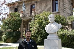 Gerasimos Chouliaras合作论文数Institute of Geodynamics, National Observatory of Athens8
 Ioannis F. Louis合作论文数Department of Geophysics & Geothermic;University of Athens;Department of Geophysics & Geothermic, University of Athens7
 Vassilios Karakostas合作论文数7G. Stavrakakis合作论文数6Pw Burton合作论文数6
 Andreas Tzanis合作论文数Department of Geophysics-Geothermy, University of Athens5
 Pierre Briole合作论文数5
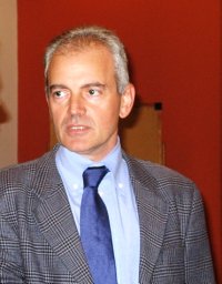 Athanassios Ganas合作论文数Institute of Geodynamics, Aristotelian University of Thessaloniki5
 Konstantinos Chousianitis合作论文数Institute of Geodynamics, National Observatory of Athens5Konstantinos Pavlou合作论文数5D. Panagiotopoulos合作论文数5
 Christos Papaioannou合作论文数5
 Kyriazis Pitilakis合作论文数School of Civil Engineering, Aristotle University of Thessaloniki5
 Dimitrios Raptakis合作论文数Department of Civil Engineering, Aristotle University of Thessaloniki5
 Eleftheria Papadimitriou合作论文数School of Geology, Aristotle University of Thessaloniki5
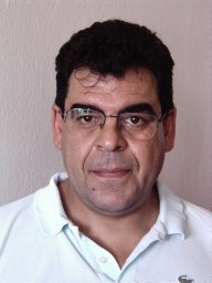 Panagiotis Hatzidimitriou合作论文数Aristotle University of Thessaloniki;School of Geology , Geophysical Laboratory;School of Geology, Aristotle University of Thessaloniki5Paul W. Burton合作论文数4Ga Tselentis合作论文数4
 Alexandra Moshou合作论文数Dept Elect Engn, Hellen Mediterranean Univ4Andreas Magganas合作论文数Department of Geology, University of Athens Panepistimio4
 Eleni Karagianni合作论文数Geophysical Laboratory, Aristotle University of Thessaloniki4Myrto Pirli合作论文数4Maria Ziazia合作论文数Seismological Laboratory, University of Athens4Genevieve Patau合作论文数3
 Olga-Joan Ktenidou合作论文数Institute of Geodynamics, National Observatory of Athens3
 Rolando Armijo合作论文数Laboratoire de tectonique;Institut de physique du Globe de Paris;Laboratoire de tectonique, Institut de physique du Globe de Paris3
 Panagiotis Argyrakis合作论文数Institute of Geodynamics, National Observatory of Athens3J. B. Latousakis合作论文数3Alexandre Nercessian合作论文数3
 Dimitris Papanastassiou合作论文数Institute of Geodynamics, National Observatory of Athens3G. Pedotti合作论文数3
 G. F. Karakaisis合作论文数School of Geology, Aristotle University of Thessaloniki3
 C. P. Evangelidis合作论文数Institute of Geodynamics, National Observatory of Athens3
 Filippos Vallianatos合作论文数Technological Educational Institute of Crete3




