The degradation of organic matter (OM) by microorganisms in thawing permafrost produces greenhouse gases. Terrestrial OM is transported into fjords through hydrological runoff, but it is unclear whether the microbial mechanisms of OM degradation on land persist after soils enter marine environments, which differ greatly in conditions and microbial communities. This question is particularly relevant for low-OM soils, which dominate Arctic landscapes and are more exposed to oxidants. Here, we compared OM-degrading capacity in permafrost-affected active layer soils and adjacent fjord sediments from Kongsfjorden, Svalbard, focusing on carbohydrate-active enzymes (CAZymes), which target some of the most abundant types of organic matter in soils. Using multi-omics approaches-metagenomics, metagenome-assembled genomes (MAGs), metabolomics, metatranscriptomics, and metaproteomics-we examined CAZyme presence, distribution, and activity. Despite environmental differences, both soils and sediments harbored diverse glycoside hydrolases and polysaccharide lyases, most of which showed evidence of activity. Verrucomicrobia expressed the highest number of CAZyme transcripts, indicating that they dominated active carbohydrate degradation in fjord sediments, while Acidobacteria and Actinobacteria were more active in soils. Notably, CAZymes in fjord sediments targeted primarily soil-derived OM, and the proportions of enzymes degrading terrestrial OM, marine OM, and microbial necromass-remnants of dead microbial cells were similar across both environments. These results suggest that microbial communities in both soils and fjord sediments are equipped to degrade carbohydrates, and that burial of terrestrial-derived OM in fjord sediments may not protect it from microbial breakdown under Arctic warming.IMPORTANCEPermafrost thaw may be a critical climate feedback because microbial degradation of organic matter (OM) can release greenhouse gases. While fjords serve as major carbon burial sites, our results show that burial of terrestrial-derived OM in these sediments does not ensure protection from microbial degradation. Microbial communities in both active layer soils and fjord sediments harbor a broad arsenal of carbohydrate-active enzymes, with evidence of activity across diverse taxa. This functional continuity indicates that once terrestrial material is washed into fjords, it remains vulnerable to microbial breakdown despite different environmental conditions. Understanding these cross-system continuities in microbial function is essential for predicting the fate of OM in a rapidly warming Arctic and highlights the importance of including fjord sediments in global carbon cycle models.
Abstract Active layer increase may contribute to greenhouse gas emissions, ecosystem change, and increased hazards. Here, we show the results of field measurements of active-layer thickness from 156 monitoring sites in Arctic, Antarctic and mountain permafrost regions. Active layer thickness increased significantly at 55% and 38% of sites in the Arctic and Antarctic regions, at more than 90% European mountain and high elevation Asian sites, and at sites in South America, demonstrating worldwide permafrost degradation during the first quarter of this century (2000–2024). The largest changes were observed in mountain regions where active layer doubled at several sites. The smallest changes were observed at sites with thick surficial organic horizons and high ground ice content. In continuous permafrost, sites generally exhibited smaller increases compared to sites in discontinuous permafrost. Regression analysis indicates Arctic active layer changes are attributable to increasing thawing degree-days, followed by increases in total rainfall. Other permafrost regions require more sites and longer time-series to draw conclusions regarding active layer change attribution.
This study investigates surface weathering and sediment preservation at Table Mountain, a high‐elevation, hyperarid, polar landscape in the Transantarctic Mountains. We report cosmogenic nuclide concentrations ( 10 Be and 26 Al) in quartz from bedrock surfaces, erratic boulder lag, and cobbles embedded within Sirius Group sediments to quantify erosion rates. In situ 10 Be and 26 Al depth profiles from a 2.95 m permafrost core in the Sirius Group further constrain surface erosion rates and elucidate landscape stability. Measured 10 Be and 26 Al concentrations from two sandstone bedrock surfaces adjacent to Sirius Group sediments give erosion rates of 0.18–0.28 m/Myr. An erratic sandstone boulder within the lag above the Sirius Group yields erosion rates of ∼0.42 ± 0.03 m/Myr, whereas two cobbles embedded within the Sirius Group yield higher rates of 0.81–1.12 m/Myr. Depth profiles of in situ 10 Be and 26 Al indicate no vertical mixing of Sirius Group permafrost since deposition. Depth profile models are best explained by erosion rates of 0.53 +0.13 / −0.12 m/Myr, and an exposure age of 0.78 +0.06 / −0.08 Ma. We view the model “age” to represent the ∼0.8‐million‐year time‐scale for surface lowering equivalent to one attenuation length of cosmic ray production to achieve steady‐state conditions. Continual exhumation of embedded clasts from within the Sirius Group results in an accumulation of clasts forming the observed erosional lag deposit covering the landscape. Our erosion rates of the Sirius Group surface based on in situ 10 Be and 26 Al depth profiles are an order‐of‐magnitude larger than those based on meteoric 10 Be infiltration and further clarification is required.
The McMurdo Dry Valleys may harbor diverse surface microbial communities, yet little is known about subsurface microorganisms in permafrost and their potential for paleoecological reconstruction. Here, we present microbial diversity and paleoecology from lower Wright Valley (7000- to 25,000-year-old) and Pearse Valley (>180,000-year-old) permafrost habitats in the McMurdo Dry Valleys. Using a new decontamination protocol, low-biomass extraction approaches, and 16S ribosomal RNA gene amplification sequencing, we assessed microbial community structure and diversity. The difference between surface and subsurface microbial communities at both lower Wright and Pearse valleys suggests the environmental conditions were different at the time of colonization. Microbial taxa identified in subsurface permafrost but not in the surface soil in both valleys indicate an ancient and isolated microbial community. In contrast, communities were not resolved at a high-elevation site in the stable upland zone, the Friis Hills (>6 Ma). The inability to identify DNA using amplicon sequencing in the Friis Hills is consistent with previous efforts to analyze high-elevation soils and permafrost, which suggests that microbial habitability is severely restricted in persistent cold, arid habitats. Therefore, utilizing other approaches may be necessary to analyze surface and subsurface permafrost on Earth, and perhaps Mars, where low-abundance microbial populations may be present.
Fumarole fields on active volcanoes are habitats that host unique microbial ecosystems. However, DNA extraction from them for further analysis is rather challenging. In this study, we compared two different ways of sample homogenization for DNA extraction to further profile the microbial communities of active fumarolic fields from Elbrus and Ushkovsky volcanoes and the frozen fumarole deposits of Fujiyama. Vertical homogenizer gave significantly higher DNA concentrations for the Elbrus samples, and more archaeal amplicon sequence variants for Elbrus and Ushkovsky samples compared to the horizontal one. This suggests that vertical homogenizer might be preferable for DNA extraction from sandy and rocky soils. Independent of the homogenizer type, the dominant phyla for Elbrus were Acidobacteriota and Pseudomonadota, and Crenarchaeota for Ushkovsky. The bacterial community of Fuji was less diverse, with Actinomycetota, Pseudomonadota and Bacillota being the dominant phyla. Thus, the studied fumaroles showed distinct microbial profiles, revealing unique adaptations to their respective extreme environments. Within the fungal community, Ascomycota, Basidiomycota and Chytridiomycota were the most dominant phyla for all three volcanoes, but their abundance varied. This study offers the first comprehensive analysis of microbial and fungal communities of active and frozen fumarolic fields, and demonstrates that the choice of methodology can significantly influence the understanding of microbial diversity in extreme environments.
Glaciers and glacierets of the Kuznetsky Alatau Mountains are distributed at altitudes of 1200–1500 m above sea level, which is not typical for continental areas. The main factor contributing to the persistence of glaciation here is abundant winter precipitation. According to ground surface temperature measurements, the negative annual values are typical for upper glacier boundaries only. Since intensive study during the compilation of the USSR Glacier Inventory (1965–1980), the glaciation of the region has undergone notable changes. To assess the current state of glaciation, Sentinel-2 satellite images were used; contours of the glaciers were traced on the basis of images from 2021 to 2023. In total, 78 glaciers and 57 glacierets were identified. UAV imagery and field inspection were used for validation. The total glaciated area has reduced from 8.5 to 3.1 km2, which is 50–75% for selected river basins, with slope morphological types decreasing the most. According to our opinion, the morphological classification requires clarification due to absence of hanging glaciers, described previously.
Ice-free areas occupy <0.5% of Antarctica and are unevenly distributed across the continent. Terrestrial ecosystem dynamics in ice free areas are strongly influenced by permafrost and the associated active layer. These features are the least studied component of the cryosphere in Antarctica, with sparse data from permanent study sites mainly providing information related to the ground thermal regime and active layer thickness (ALT). One of the most important results of the International Polar Year (IPY, 2007/08) was an increase in ground thermal regime monitoring sites, and consequently our knowledge of Antarctic permafrost dynamics. Now, 15 years after the IPY, we provide the first comprehensive summary of the state of permafrost across Antarctica, including the sub-Antarctic Islands, with analyses of spatial and temporal patterns of the dominant external factors (climate, lithology, biota, and hydric regime) on the ground thermal regime and active layer thickness. The mean annual ground temperatures of the active layer and uppermost part of the permafrost in Antarctica remain just below 0 °C in the warmest parts of the Antarctic Peninsula, and were below −20 °C in mountainous regions of the continent. The ALT varies between a few cm in the coldest, mountainous, parts of the Transantarctic Mountains up to >5 m in bedrock sites in the Antarctic Peninsula. The deepest and most variable ALTs (ca. 40 to >500 cm) were found in the Antarctic Peninsula, whereas the maximum ALT generally did not exceed 90 cm in Victoria Land and East Antarctica. Notably, found that the mean annual near-surface temperature follows the latitudinal gradient of −0.9 °C/deg. (R2 = 0.9) and the active layer thickness 3.7 cm/deg. (R2 = 0.64). The continuous permafrost occurs in the vast majority of the ice-free areas in Antarctica. The modelling of temperature on the top of the permafrost indicates also the permafrost presence in South Orkneys and South Georgia. The only areas where deep boreholes and geophysical surveys indicates discontinuous or sporadic permafrost are South Shetlands and Western Antarctic Peninsula.
Arctic soil microbial communities may shift with increasing temperatures and water availability from climate change. We examined temperature and volumetric liquid water content (VWC) in the upper 80 cm of permafrost-affected soil over 2 years (2018-2019) at the Bayelva monitoring station, Ny & Aring;lesund, Svalbard. We show VWC increases with depth, whereas in situ temperature is more stable vertically, ranging from -5 degrees C to 5 degrees C seasonally. Prokaryotic metagenome-assembled genomes (MAGs) were obtained at 2-4 cm vertical resolution collected while frozen in April 2018 and at 10 cm vertical resolution collected while thawed in September 2019. The most abundant MAGs were Acidobacteriota, Actinomycetota, and Chloroflexota. Actinomycetota and Chloroflexota increase with depth, while Acidobacteriota classes Thermoanaerobaculia Gp7-AA8, Blastocatellia UBA7656, and Vicinamibacteria Vicinamibacterales are found above 6 cm, below 6 cm, and below 20 cm, respectively. All MAGs have diverse carbon-degrading genes, and Actinomycetota and Chloroflexota have autotrophic genes. Genes encoding beta -glucosidase, N-acetyl-beta-D-glucosaminidase, and xylosidase increase with depth, indicating a greater potential for organic matter degradation with higher VWC. Acidobacteriota dominate the top 6 cm with their classes segregating by depth, whereas Actinomycetota and Chloroflexota dominate below similar to 6 cm. This suggests that Acidobacteriota classes adapt to lower VWC at the surface, while Actinomycetota and Chloroflexota persist below 6 cm with higher VWC. This indicates that VWC may be as important as temperature in microbial climate change responses in Arctic mineral soils. Here we describe MAG-based Seqcode type species in the Acidobacteriota, Onstottus arcticum, Onstottus frigus, and Gilichinskyi gelida and in the Actinobacteriota, Mayfieldus profundus.
Abstract. During the interglacial and interstadials of Marine Isotope Stage 5 (MIS 5e, 5c, 5a), outlet and alpine glaciers in the Dry Valleys region, Antarctica, appear to have advanced in response to increased precipitation from enhanced open ocean conditions in the Ross Sea. We provide further evidence of this antiphase behaviour through retreat of a peripheral lobe of Taylor Glacier in Pearse Valley, a region that was glaciated during MIS 5. We measured cosmogenic 10Be and 26Al in three granite cobbles from thin, patchy drift (Taylor 2 Drift) in Pearse Valley to constrain the timing of retreat of Taylor Glacier. Assuming simple continuous exposure, our minimum, zero erosion, exposure ages suggest Taylor Glacier partially retreated from Pearse Valley no later than 65–74 ka. Timing of retreat after 65 ka and until the Last Glacial Maximum (LGM) when Taylor Glacier was at a minimum position, remains unresolved. The depositional history of permafrost sediments buried below Taylor 2 Drift in Pearse Valley was obtained from 10Be and 26Al depth profiles to ~3 metres in permafrost in proximity to the cobble sampling sites. Depth profile modelling gives a depositional age for near-surface (< 1.65 m) permafrost at Pearse Valley of 180 ka +20/−40 ka, implying deposition of permafrost sediments predate MIS 5 advances of Taylor Glacier. Depth profile modelling of deeper permafrost sediments (> 2.09 m) indicates a depositional age of > 180 ka. The cobble and permafrost ages reveal Taylor Glacier advances during MIS 5 were non-erosive or mildly erosive, preserving the underlying permafrost sediments and peppering boulders and cobbles upon an older, relict surface. Our results are consistent with U/Th ages from central Taylor Valley, and suggest changes in moisture delivery over Taylor Dome during MIS 5e, 5c and 5a appear to be associated with the extent of the Ross Ice Shelf and sea ice in the Ross Sea. At a coastal, lower elevation site in neighbouring Lower Wright Valley, 10Be and 26Al depth profiles from a second permafrost core exhibit near-constant concentrations with depth, and indicate the sediments are either vertically mixed after deposition, or are sufficiently young and post-depositional nuclide production is negligible relative to inheritance. 26Al/10Be concentration ratios for both depth profiles range between 4.0 and 5.2 and are all lower than the nominal surface production rate ratio of 6.75 indicating that prior to deposition, these sediments experienced a complex exposure-burial history. Assuming a single cycle exposure-burial scenario, the observed 26Al/10Be ratios are equivalent to a total minimum exposure-burial history of ~1.2 Ma. Our new data corroborates antiphase behaviour between outlet and alpine glaciers in the Dry Valleys region and ice extent in the Ross Sea. We suggest a causal relationship of cold-based glacier advance and retreat that is controlled by an increase in moisture availability during retreat of sea ice and perhaps the Ross Ice Shelf, and conversely, a decrease during times of sea ice and Ross Ice Shelf expansion in the Ross Sea.
Soil and sediment mixing and associated permafrost processes are not widely studied or understood in the McMurdo Dry Valleys of Antarctica. In this study, we investigate the stability and depositional history of near-surface permafrost sediments to ∼ 3 m depth in the Pearse and lower Wright valleys using measured cosmogenic 10Be and 26Al depth profiles. In Pearse Valley, we estimate a minimum depositional age of ∼ 74 ka for the active layer and paleoactive-layer sediments (< 0.65 m). Combined depth profile modelling of 10Be and 26Al gives a depositional age for near-surface (< 1.65 m) permafrost in Pearse Valley of 180 +20/-40 ka, implying that the deposition of permafrost sediments predates MIS 5 advances of Taylor Glacier. Deeper permafrost sediments (> 2.09 m) in Pearse Valley are thus inferred to have a depositional age of > 180 ka. At a coastal, lower-elevation site in neighbouring lower Wright Valley, 10Be and 26Al depth profiles from a second permafrost core exhibit near-constant concentrations with depth and indicate the sediments are either vertically mixed after deposition or sufficiently young so that post-depositional nuclide production is negligible relative to inheritance. 26Al/10Be concentration ratios for both depth profiles range between 4.0 and 5.2 and are all lower than the nominal surface production rate ratio of 6.75, indicating that prior to deposition, these sediments experienced complex, yet similar, exposure–burial histories. Assuming a single-cycle exposure–burial scenario, the observed 26Al/10Be ratios are equivalent to a total minimum exposure–burial history of ∼ 1.2 Myr. In proximity to the depth profile core site, we measured cosmogenic 10Be and 26Al in three granite cobbles from thin, patchy drift (Taylor 2 Drift) in Pearse Valley to constrain the timing of retreat of Taylor Glacier. Assuming simple continuous exposure, our minimum, zero-erosion exposure ages suggest Taylor Glacier partially retreated from Pearse Valley no later than 65–74 ka. The timing of retreat after 65 ka and until the Last Glacial Maximum (LGM) when Taylor Glacier was at a minimum position remains unresolved. The surface cobble ages and permafrost processes reveal Taylor Glacier advances during MIS 5 were non-erosive or mildly erosive, preserving the underlying permafrost sediments and peppering boulders and cobbles upon an older, relict surface. Our results are consistent with U/Th ages from central Taylor Valley and suggest changes in moisture delivery over Taylor Dome during MIS 5e, 5c, and 5a appear to be associated with the extent of the Ross Ice Shelf and sea ice in the Ross Sea. These data provide further evidence of antiphase behaviour through retreat of a peripheral lobe of Taylor Glacier in Pearse Valley, a region that was glaciated during MIS 5. We suggest a causal relationship of cold-based glacier advance and retreat that is controlled by an increase in moisture availability during retreat of sea ice and perhaps the Ross Ice Shelf, as well as, conversely, a decrease during times of sea ice and Ross Ice Shelf expansion in the Ross Sea.
Permafrost is the term used to describe ground (soil or rock) that remains at or below 0 °C throughout the year for at least two consecutive years. In this chapter, we focus on distribution and physical characteristics of Arctic terrestrial permafrost. We discuss the constituents of permafrost (minerals, organic matter, water, ice, and gas) as well as the presence and importance of ice, leading to patterned ground formation. We explain cryo-pedogenetic processes, hydrology, energy, and water balances, snow-vegetation feedbacks, and gas transport in permafrost regions. Finally, we discuss permafrost degradation and its effects on the energy, water, and carbon balances of the Arctic.
This article describes a study of frozen volcanic deposits collected from volcanoes Tolbachik and Bezymianny on the Kamchatka Peninsula, Russia, and Deception Island volcano, Antarctica. In addition, we studied suprasnow ash layers deposited after the 2007 eruptions of volcanoes Shiveluch and Bezymianny on Kamchatka. The main objectives were to characterize the presence and survivability of thermophilic microorganisms in perennially frozen volcanic deposits. As opposed to permafrost from the polar regions, viable thermophiles were detected in volcanic permafrost by cultivation, microscopy, and sequencing. In the permafrost of Tolbachik volcano, we observed methane formation by both psychrophilic and thermophilic methanogenic archaea, while at 37°C, methane production was noticeably lower. Thermophilic bacteria isolated from volcanic permafrost from the Deception Island were 99.93% related to Geobacillus stearothermophilus. Our data showed biological sulfur reduction to sulfide at 85°C and even at 130°C, where hyperthermophilic archaea of the genus Thermoproteus were registered. Sequences of hyperthermophilic bacteria of the genus Caldicellulosiruptor were discovered in clone libraries from fresh volcanic ash deposited on snow. Microorganisms found in volcanic terrestrial permafrost may serve as a model for the alien inhabitants of Mars, a cryogenic planet with numerous volcanoes. Thermophiles and hyperthermophiles and their metabolic processes represent a guideline for the future exploration missions on Mars.
Meteorological regime and glacier surface heat balance, GPR measurements of the ice thickness and seasonal snow cover were investigated in the crater of the Eastern Summit of Mt. Elbrus In the period from 18 to 30 August 2020 at 560 m a.s.l. On the base of preliminary data analysis, the predominance of fluctuations in the synoptic scale over the diurnal ones was revealed; high values of the average and maximum wind speed associated with the influence of jet currents and with the effects of leeward storms were identified; extremely high temporal variability of relative humidity and its very high deficit in cloudless conditions, which contributes to intensive evaporation and sublimation from the snow surface, were explored. The maximum ice thickness in the crater reaches 100 m, with an average of 45 m. A new 96.01 m ice core from glacier surface to bedrock has been recovered. The drilling speed varied from 11 to 1 m / h, decreasing on average with depth from 4.5 to 4.0 m / h. The thickness of the snow-firn strata is about 20 m, which is three times less than on the Western Plateau. The borehole temperature was measured. The temperature on the glacier bedrock was -0.6 °С. The calculated heat flux was 0.39 W/m2. Air sampling was carried out in the crater of the Eastern Summit of Elbrus and on the Garabashi glacier. The repeated measurement of the soil temperature in the fumarole field on the Elbrus Eastern Summit outer crater rim suggests that the temperature regime is stable. The research was carried out on the territory of the Elbrus National Park with the financial support of the Russian Science Foundation (project 17-17-01270).
Permafrost describes the condition of earth material (sand, ground, organic matter, etc.) cemented by ice when its temperature remains at or below 0°C continuously for longer than 2 years. Evidently, permafrost is as old as the time passed from freezing of the earth material. Permafrost is a unique phenomenon and may preserve life forms it encloses. Therefore, in order to talk confidently about the preservation of paleo-objects in permafrost, knowledge about the geological age of sediments, i.e. when the sediments were formed, and permafrost age, when those sediments became permanently frozen, is essential. There are two types of permafrost-syngenetic and epigenetic. The age of syngenetic permafrost corresponds to the geological age of its sediments, whereas the age of epigenetic permafrost is less than the geological age of its sediments. Both of these formations preserve microorganisms and their metabolic products; however, the interpretations of the microbiological and molecular-biological data are inconsistent. This paper reviews the current knowledge of time-temperature history and age of permafrost in relation to available microbiological and metagenomic data.
During the field campaign in August 18–30, 2020 the meteorological regime and heat balance of the glacier surface were investigated in the crater of Mt Elbrus Eastern Summit (5600 m a.s.l.) together with the GPR measurements of the ice thickness and seasonal snow cover. Preliminary data analysis allowed the following features: the predominance of synoptic fluctuations over the diurnal ones; the high values of average and maximum wind speed associated with the impact of jet streams and with influence of leeward storms; extremely high temporal variability of relative humidity and its very high deficit in cloudless conditions conducive to intensive evaporation and sublimation from the snow surface. The maximum thickness of ice in the crater reaches 100 m, and the average is 34 m. A new ice core with a length of 96.01 m from the glacier surface to its bed had been obtained. The drilling speed varied from 11 to 1 m/h, decreasing with depth from 4.5 to 4.0 m/h on average. The thickness of the snow-firn mass is about 20 m, which is three times less than on the Western Plateau of Mt Elbrus. According to measurements in the borehole, temperature at the glacier bed is −0.6 °C. The calculated heat flux is 0.39 W/m2. Air sampling was carried out in the crater of the Eastern Summit of Elbrus and on the Garabashi glacier. Repeated measurements of the soil temperature in the fumarole field on the outer edge of the crater of the Elbrus Eastern Summit allow the conclusion that the temperature regime is stable.
During the field campaign in August 18-30, 2020 the meteorological regime and heat balance of the glacier surface were investigated in the crater of Mt Elbrus Eastern Summit (5600 m a.s.l.) together with the GPR measurements of the ice thickness and seasonal snow cover. Preliminary data analysis allowed the following features: the predominance of synoptic fluctuations over the diurnal ones; the high values of average and maximum wind speed associated with the impact of jet streams and with influence of leeward storms; extremely high temporal variability of relative humidity and its very high deficit in cloudless conditions conducive to intensive evaporation and sublimation from the snow surface. The maximum thickness of ice in the crater reaches 100 m, and the average is 34 m. A new ice core with a length of 96.01 m from the glacier surface to its bed had been obtained. The drilling speed varied from 11 to 1 m/h, decreasing with depth from 4.5 to 4.0 m/h on average. The thickness of the snow-firn mass is about 20 m, which is three times less than on the Western Plateau of Mt Elbrus. According to measurements in the borehole, temperature at the glacier bed is -0.6 degrees C. The calculated heat flux is 0.39 W/m(2). Air sampling was carried out in the crater of the Eastern Summit of Elbrus and on the Garabashi glacier. Repeated measurements of the soil temperature in the fumarole field on the outer edge of the crater of the Elbrus Eastern Summit allow the conclusion that the temperature regime is stable.
Permafrost is present within almost all of the Antarctic's ice-free areas, but little is known about spatial variations in permafrost temperatures except for a few areas with established ground temperature measurements. We modelled a temperature at the top of the permafrost (TTOP) for all the ice-free areas of the Antarctic mainland and Antarctic islands at 1 km2 resolution during 2000–2017. The model was driven by remotely sensed land surface temperatures and downscaled ERA-Interim climate reanalysis data, and subgrid permafrost variability was simulated by variable snow cover. The results were validated against in situ-measured ground temperatures from 40 permafrost boreholes, and the resulting root-mean-square error was 1.9 ∘C. The lowest near-surface permafrost temperature of −36 ∘C was modelled at Mount Markham in the Queen Elizabeth Range in the Transantarctic Mountains. This is the lowest permafrost temperature on Earth, according to global-scale modelling results. The temperatures were most commonly modelled between −23 and −18 ∘C for mountainous areas rising above the Antarctic Ice Sheet and between −14 and −8 ∘C for coastal areas. The model performance was good where snow conditions were modelled realistically, but errors of up to 4 ∘C occurred at sites with strong wind-driven redistribution of snow.
Permafrost warming has the potential to amplify global climate change, because when frozen sediments thaw it unlocks soil organic carbon. Yet to date, no globally consistent assessment of permafrost temperature change has been compiled. Here we use a global data set of permafrost temperature time series from the Global Terrestrial Network for Permafrost to evaluate temperature change across permafrost regions for the period since the International Polar Year (2007–2009). During the reference decade between 2007 and 2016, ground temperature near the depth of zero annual amplitude in the continuous permafrost zone increased by 0.39 ± 0.15 °C. Over the same period, discontinuous permafrost warmed by 0.20 ± 0.10 °C. Permafrost in mountains warmed by 0.19 ± 0.05 °C and in Antarctica by 0.37 ± 0.10 °C. Globally, permafrost temperature increased by 0.29 ± 0.12 °C. The observed trend follows the Arctic amplification of air temperature increase in the Northern Hemisphere. In the discontinuous zone, however, ground warming occurred due to increased snow thickness while air temperature remained statistically unchanged.
 Goncalo Vieira合作论文数Centro de Estudos Geograficos;Universidade de Lisboa;Faculdade de Letras;Centro de Estudos Geograficos, Universidade de Lisboa11
 Elizaveta Rivkina合作论文数Soil Cryology Laboratory, Institute of Physicochemical and Biological Problems in Soil Science, Russian Academy of Sciences10
 Miguel Ramos合作论文数Dept Fis & Matemat, Univ Alcala De Henares10
 Alexander Kholodov合作论文数Univ Alaska Fairbanks, Inst Geophys, Fairbanks, AK 99775 USA8
 David A. Gilichinsky合作论文数8
 Tatiana A Vishnivetskaya合作论文数BioSciences Division, Oak Ridge National Laboratory7
 Alexey V. Lupachev合作论文数7
 Miguel Angel de Pablo合作论文数6
 Stanislav Kutuzov合作论文数6
 Julia Boike合作论文数Alfred Wegener Institute6
 Mauro Guglielmin合作论文数DBSF, Insubria University6Nikita Demidov合作论文数5Marc Oliva合作论文数5
 Filip Hrbacek合作论文数5
 Megan R. Balks合作论文数5
 Gabriel Goyanes合作论文数CERENA IST, Univ Lisbon4
 Gary S Wilson合作论文数Department of Geology, University of Otago4
 Vladimir E. Romanovsky合作论文数Permafrost Laboratory, Geophysical Institute, University of Alaska Fairbanks4
 Viktoria Alexandrovna Shcherbakova合作论文数Skryabin Institute of Biochemistry and Physiology of Microorganisms, Russian Academy of Sciences4
 Pavel Toropov合作论文数4David Gilichinsky合作论文数4
 Joy Buongiorno合作论文数Division of Natural Sciences, Maryville College3
 Katie Sipes合作论文数Dept Microbiol, Univ Tennessee3
 Vladimir Mikhalenko合作论文数3I. I. Lavrentiev合作论文数3
 Sergei Davydov合作论文数3
 David Fink合作论文数Australian Nuclear Science and Technology Organization3
 Ian Meiklejohn合作论文数Department of Geography, Rhodes University3
 Alan J. Hidy合作论文数3Carlos Ernesto Gonçalves Reynaud Schaefer合作论文数3Sergey Goryachkin合作论文数3
 Toshiyuki Fujioka合作论文数Faculty of Pharmaceutical Science, Mukogawa Women's University3
 Robert L Hettich合作论文数Biosciences Division, Oak Ridge National Laboratory;Department of Microbiology, University of Tennessee, Knoxville;Genome Sciences Graduate School, University of Tennessee, Knoxville;The Bredesen Center for Interdisciplinary Research and Graduate Education, University of Tennessee, Knoxville3
 Nikita Mergelov合作论文数Institute of Geography, Russian Academy of Sciences3Klaus M. Wilcken合作论文数Scottish Universities Environmental Research Centre3Dmitry Zamolodchikov合作论文数2
 E. V. Abakumov合作论文数2
 Antonio Molina合作论文数2Lucia Kaplan Pastíriková合作论文数2
 Jacob T.H. Anderson合作论文数11Department of Marine Science, University of Otago2
 Diana Vladimirova合作论文数2
 Stefano Ponti合作论文数Department of Theoretical and Applied Sciences, Insubria University2
 Vladimir Matskovsky合作论文数RAS, Inst Geog, Moscow, Russia2
 Christel D. Hansen合作论文数Department of Geography, Geoinformatics and Meteorology, University of Pretoria2
 Alexey Maslakov合作论文数Fac Geog, Lomonosov Moscow State Univ2
 Anna Liljedahl合作论文数2
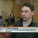 Gleb Kraev合作论文数2Sharon L. Smith合作论文数2
 Margareta Johansson合作论文数Department of Earth and Ecosystem Sciences, Lund University2




