Trucks, which primarily travel in the rightmost lane on freeways, are in direct conflict with on-ramp vehicles and constitute a key factor contributing to congestion in merging areas. To address this challenge, this study proposes an adaptive information-fusion and stability-driven deep reinforcement learning (ASR) model for connected and automated trucks (CATs) lane-changing decision-making. Specifically, a graph convolutional network (GCN) is employed to encode topological relationships and interaction strengths into the state space, capturing the dynamic interactions between CATs and other vehicles in the connected traffic environment. In addition, to improve traffic system stability, a reward function based on the Lyapunov stability principle is designed to suppress fluctuations in traffic flow speed and acceleration, thereby mitigating merging conflicts. Simulation experiments conducted in Simulation of Urban MObility (SUMO) at varying traffic volumes demonstrate that the proposed model outperforms all benchmark models in alleviating merging area congestion, improving traffic stability, and reducing total travel time, total delay time, fuel consumption, and NOx emissions on the studied freeway segment. Moreover, the effectiveness of the ASR model is further validated under different CAT penetration rates, different speed limits, and unseen traffic volumes. The proposed model is also shown to improve truck lane change safety based on time-to-collision (TTC) comparisons. The findings of this study may provide useful guidance for traffic operations in freeway merging areas.
The transition to new energy in the public transportation sector has become a critical strategy for achieving sustainable urban development and reducing carbon emissions. This study analyses the impact of bus fleet energy composition, specifically the proportions of battery electric buses (BEBs), liquefied natural gas (LNG) buses, and diesel buses, on operator costs and carbon emissions in urban transit networks. A multi-objective optimization model is proposed to minimize passenger travel costs, operator costs, and carbon emissions, while incorporating constraints on the minimum proportions of buses with different energy types to reflect the trend of transitioning to new energy in the public transportation industry. And the NSGA-II algorithm is employed to solve the model. A case study of Beijing’s central urban area is conducted to validate the model, which demonstrates that increasing the proportion of BEBs with conventional electricity from 75
The travel behavior of subway passengers has shown systematic differences with the onset and progression of the COVID-19 pandemic. This study focused on subway stations in Xi'an and systematically analyzed the spatiotemporal features of the average travel distance of passengers (ATDP) during the peri- and post-COVID-19 periods. Using the gradient boost regression tree analysis framework, the study explored the nonlinear relationship between various built environment factors and changes in ATDP during pandemic periods. The results indicated that the distance to the city center, land-use mix, and road network density contributed significantly more than other variables in different periods. Furthermore, the study found that the ATDP in subway stations does not vary significantly based on the structural characteristics of the station network. These findings hold significant value for operational organizers seeking to comprehend the station-level changes in travel distances under the influence of public health crises, offering effective scientific data support for the rational development of operational plans to balance the distribution of operational capacities.
Flexible transit is an alternative to fulfilling personalized and uncertain demand. This paper describes the design of a flexible transit system with multitype stations and a hybrid time window operating pattern to accommodate the spatiotemporal heterogeneity of passenger demand. After analyzing data from multiple sources, the fixed transit stations can be selected and classified into critical fixed stations that have strong punctuality requirements and uncritical fixed stations that do not have strong punctuality requirements. Additionally, potential request stations are identified using the density-based spatial clustering of applications with noise (DBSCAN) algorithm. Catering to the benefits to passengers and the operating agency, an optimization model for vehicle scheduling and routing is developed. Subsequently, a genetic algorithm to solve the proposed model is designed. Finally, a detailed application analysis based on real-world data is carried out to validate the proposed flexible transit system. Compared with the other two flexible transit services, the proposed flexible transit service with multitype stations is more effective in terms of reducing the total cost and average passenger waiting time significantly, while guaranteeing the number of passengers served by the flexible transit system. In addition, results indicate that the flexible transit system is able to adapt to varying demand. The flexible transit service proposed in this paper can be applied to most cities characterized by the spatiotemporal heterogeneity of passenger demand, subsequently promoting the development of diversified bus service in these cities.
To establish a model for estimating passenger walking time within high-speed railway stations and enhance station operational efficiency, this study utilizes WIFI probe technology to analyze and estimate the characteristics and walking time of passengers in different areas at railway stations. First, the process of passenger flow collection using WIFI probes is summarized, and passenger walking information is collected under various temporal and spatial scenarios. Subsequently, based on the spatial layout and passenger density of different areas within the station, walking time calculation models are proposed respectively using the Bureau of Public Roads (BPR) function and logarithmic function models. Finally, the Beijing south railway station is taken as a case study for model validation. The results indicate that the WIFI probes exhibit excellent detection performance, with the BPR and logarithmic function models fitted based on probe data achieving accuracies of 92.63
Several local governments are considering promoting the intermodal hub-and-spoke (IHS) strategy to reduce emissions from the road freight industry, which is one of the main contributors to carbon emissions. However, this strategy has primarily been applied to long-distance freight; it has not been fully explored for intercity freight in a small-scale area with a relatively short transportation distance. In intercity freight scenarios, sophisticated and short-range demands may make it difficult to exploit the scale effect of IHS. Therefore, possible methods of applying IHS in such scenarios must be explored. In this study, we conduct an analysis of intercity freight by designing and optimizing an IHS network that integrates point-to-point transportation and multiallocation patterns (i.e., composite IHS network) while considering carbon reduction policies and company attitudes. First, a mandatory carbon constraint policy (MP) and a flexible carbon trading policy (FP) are designed depending on whether carbon credits can be traded or not, respectively. Then, considering the differences in company attitudes toward the policies, we propose an MP-oriented network optimization model targeting economic cost and carbon emission and an FP-oriented network optimization model targeting comprehensive economic cost. Next, we develop a solution framework based on principal component analysis (PCA), a stepwise heuristic algorithm (SHA), and a genetic algorithm (GA). Finally, a case study is performed in Henan province, China. The results show that applying the composite IHS network can reduce carbon emissions by 20 % and economic costs by 18.1 % compared to the company's existing point-to-point networks. When the price of carbon credits is high (>= 0.65 CNY/kg), the FP is more effective than MP in advancing the company's freight network to reduce carbon emissions. This research can support local governments in designing feasible carbon reduction policies as well as transportation companies seeking to optimize their freight networks.
Dedicated left-turning and through lanes at traditional signalized intersections often result in a limited number of exit lanes available in each turning movement. In contrast, vehicles can exit the intersection through any available lane at tandem intersections. Therefore, this paper developed a tandem trajectory planning framework (TTPF) for traffic scenarios involving pure connected and autonomous vehicles (CAVs). Specifically, the optimal path and moving sequence for vehicles in a two-dimensional (2D) grid are planned to maximize the utilization of limited lane space and minimize the number of lane changes. Then, continuous longitudinal trajectories are generated to reduce sorting time. Simulation findings indicate that greater disparity between through and left-turning vehicles leads to more lane changes and longer platoon sorting time. The number of lane changes and sorting time is correlated positively with the total vehicle count. The runtime is related linearly to vehicle count, avoiding dimensionality explosion. In the signalized intersection scenario, the proposed framework increased the throughput and decreased vehicle travel time compared with the fixed-time control, adaptive signal control, and advanced variable guiding lane management strategy. Considering a scenario of communication interruptions, five offline control plans were designed and compared to maintain the robustness of intersection control.
Public transportation increasingly prioritizes cost reduction and energy-environmental efficiency (EEE). However, limited researches address entire-route trajectory optimization for autonomous buses (ABs), particularly hybrid electric buses (HEBs) with unique operating states. In this study, an improved Newell car-following model is proposed to generate initial bus trajectories, and a Vehicle Specific Power (VSP)-based EEE quantification model is developed to compute HEB energy consumption and emissions. A rolling-optimization model based on Nonlinear Model Predictive Control (NMPC) is then established, integrating dynamic and kinematic principles to enhance EEE and reduce operating time. Numerical simulations utilize real-world Bus Rapid Transit data from Chengdu, China. Results demonstrate that the optimized AB trajectories reduce CO2 emissions and energy consumption by 8.7% and 12.3%, respectively, compared with initial AB trajectories, and achieve 13.2% and 17.6% reductions compared with conventional buses. The proposed method also improves operating stability, underscoring the potential for sustainable and efficient urban transit.
The development of e-commerce logistics has driven the expansion of truck transportation. The application of cooperative adaptive cruise control (CACC) technology in truck platooning is considered as an effective way to improve safety and road capacity, as well as reduce fuel consumption and environmental pollution. However, the influence of surrounding vehicles on the safety and efficiency of truck platoons remains a challenge in mixed traffic. This study aims to evaluate the impact of surrounding vehicle behavior, such as car-following and cut-in, on the performance of autonomous truck platooning. Considering traffic flow stability and the impact of the actual road environment, the intelligent driver model is improved. The CACC system control algorithm is further designed. Meanwhile, human-driven vehicle behavior is described based on the full velocity difference model. A simulation platform integrating MATLAB/Simulink/PreScan is developed to replicate real-world vehicle interactions. The safety and efficiency of truck platooning are analyzed quantitatively considering multiple factors. The results show that two car-following events and two cut-in events reduce the fuel saving rate of the platoon by 0.52%–5.04% and 0.15%–2.00%, respectively. At high velocity, the collision risk reflected by inverse time-to-collision is higher for gaps in the front of the platoon as a result of car-following and cut-in. Shorter headway times can result in higher fuel consumption and lower safety. Four recommendations to reduce the impact of surrounding vehicles are presented based on the findings to support the successful deployment of truck platooning in mixed traffic.
Performing safe trajectory planning that matches perception capabilities is critical for autonomous vehicles (AV). It remains a challenge to handle uncertainty including the epistemic the aleatoric uncertainty in environmental perception in order to plan safe and accurate trajectories. We propose an integrated perception-prediction-planning algorithm for autonomous vehicles that quantifies and transfers DL-based perception uncertainties during prediction and performs prediction evaluation with uncertainty. The novelties of the approach are: 1) quantifying and transferring perceptual uncertainty to the downstream planning decision phase, which is partially extended using quantified uncertainty incorporated into a Rapidly-exploring Random Tree; 2) combining uncertainty analysis with an implicit scenario context-aware trajectory prediction framework that utilizes perceptual uncertainty as part of the implicit scenario context information; 3) integrating the proposed uncertainty-environment-aware trajectory predictor with a planning-based feasible candidate trajectory generator to capture dynamically changing perceptual states and output accurate predictions. Experimental results based on a driving behavioral dataset show that the proposed method further reduces the detour proportion of the path while ensuring safety.
The ability of a hub-and-spoke network to aggregate passenger flows at hub nodes has made it an emerging trend in bus transit network design. Autonomous bus platoons with larger vehicle capacities are well suited for serving dense passenger demand, thereby enhancing economies of scale. However, the design of hub-and-spoke transit networks with autonomous bus platoons have not been fully explored. This paper focuses on a two-stage hybrid hub-and-spoke bus transit network design problem with autonomous bus platoons, where only the lead vehicle requires a driver, while following vehicles operate autonomously. The proposed network integrates inter-hub routes and regular routes. The solution framework consists of two main steps. First, a customized K-medoids clustering algorithm is proposed to identify hub stations in the network. Second, a bi-level optimization model is formulated to design the hybrid hub-and-spoke transit network with autonomous bus platoons and determine the route set as well as service frequencies, aiming to minimize costs for both passengers and operators. To solve large-scale problems in the real world, an efficient genetic algorithm-based framework is proposed with a route generation algorithm to produce the initial route set. Experiments conducted on the Mandl benchmark demonstrate the effectiveness of the proposed method. A case study in Xiong'an, China shows that, compared with the existing network, the hybrid hub-and-spoke network with autonomous bus platoons achieves reductions in total cost and passenger travel time by 12.87% and 8.66%, respectively. Additionally, the contribution of autonomous bus platoons to enhancing economies of scale is observed especially under high-demand scenarios.
Platooning is an essential strategy for exploiting the benefits of connected and autonomous vehicles (CAV). Quantitative research is needed to understand the factors of influence, evaluation indicators, and analytical granularity of the environmental impacts of platooning fully. This study was performed to estimate the energy consumption and emissions impacts of platooning from an aerodynamics perspective under complex urban road conditions using low-cost methodology. Speed, acceleration, spacing, platoon composition, and vehicle position were analyzed. An aerodynamic analysis platform was established based on the lattice Boltzmann method (LBM). Energy and emissions models were developed based on vehicle specific power (VSP) to establish a mapping relationship between operating and environmental impacts. An impact estimation method based on the LBM and VSP is proposed. Vehicle test data were collected for a case study, and multiple scenarios were analyzed. The results show that high speed, low acceleration, and small spacing can improve the environmental benefits of platooning. The most significant benefits were achieved in the following vehicle position of the Bus-Car platoon scenario, with a maximum energy reduction rate of 61.26 % and a maximum emissions reduction of 56.23 %. The study contributes to designing management strategies and trajectory optimization considering the environmental benefits of platooning.
The swift advancement of urban motorization has resulted in a disparity between the supply and demand of traffic services. The conventional travel service framework has proven inadequate in facilitating a seamless integration of various transportation modes, thereby rendering travel inconvenient for urban residents. Mobility as a Service (MaaS) represents an innovative transportation solution that offers quicker, more efficient, and cost-effective travel alternatives. Nonetheless, the effectiveness of the MaaS system is contingent upon travelersu2019 acceptance and their perceived preferences regarding MaaS. Consequently, this study categorizes travel choice modes within the context of MaaS and develops multinomial logit (MNL) models. Acknowledging the limitations inherent in MNL models, this research proposes enhancements by incorporating random parameters to formulate a mixed logit (MXL) model. A comparative analysis of the parameter estimation outcomes from both the MNL and MXL models reveals an improved interpretative capacity when accounting for heterogeneity. Furthermore, the findings derived from the MXL model indicate that latent influencing factors, such as punctuality, significantly impact travel choices within the MaaS framework. Theoretically, this study offers a valuable reference for quantifying the potential perceptions associated with MaaS travel modes. Practically, the classification of potential travelers aids in identifying early adopters of MaaS and facilitates targeted promotion of MaaS to specific demographic groups, thereby mitigating resistance to its implementation.
During the gradual deployment of connected and autonomous vehicle (CAV) technology, lane management strategies are regarded as potential solutions in the complex traffic flow environment, which consists of connected and autonomous vehicles (CAVs) and human-driven vehicles (HDVs). In this paper, we specify the vehicles as cars and buses to simulate a more realistic mixed traffic flow environment, not limited to CAVs and HDVs. Considering the different driving behavior for various types of vehicles, the effects of lane management strategies considering the real mixed traffic flow environment are explored. First, the driving behaviors under mixed traffic flows are analyzed. Four lane management strategies utilizing the existing bus lane and high occupancy (HOV) lane are designed. A simulation platform is then built using Python and SUMO to obtain vehicle trajectory data. Finally, the emission and energy consumption calculation model based on vehicle-specific power (VSP) is used to quantify the environmental effects of various lane management strategies. The results show that when the penetration rate of CAVs is lower than 30%, four lane management strategies can reduce fuel consumption and emissions by up to 20%. Among them, the strategy of using bus lanes to grant priority to CAVs and buses yields the lowest fuel consumption and emissions. When the penetration rate is lower than 60%, vehicles with priority experience a significant decrease in energy consumption and emissions. (Abstract)
With the accelerated integration of connected and autonomous vehicles (CAVs) into transportation systems, such vehicles have evolved rapidly. Emerging studies have focused on the considerations influencing travelers' acceptance of CAVs and the factors contributing to travel choice intention. However, the different reasons for the diffusion of CAVs and the associated trends in relation to this are key questions that still require investigation. Therefore, this study establishes a structural equation modeling (SEM) framework to explore the impact of both external factors and internal subjective factors on travel choice. Based on the influencing factors identified by SEM, this study develops an agent-based model simulation approach to examine the diffusion trends in relation to CAV travelers from an individual perspective. To calibrate the model, a questionnaire survey is designed to obtain data from travelers in Shenzhen, Guangdong Province, China. The survey results show that CAV choice intention is influenced by individual (including innovativeness), travel-related, and social influence factors. The simulation experiments reveal that the diffusion of CAV travelers is a complex process. The lower cost of CAV travel has a positive impact initially and midway through the process of diffusion in relation to CAV users. For example, in situations in which CAVs are more cost-effective, during the simulation time (years) the number of CAV users fluctuates significantly between the 7th and 30th years. There is a notable increase of 10% in CAV users in the 15th year and, eventually, the total number of CAV users stabilizes at 71.8% of all travelers. The findings will assist agencies and CAV operators to implement effective promotion strategies.
Understanding the complex correlation between the built environment and subway passenger flow can provide unique insights for the development of transportation operations and urban coordination policies. Few studies have systematically analyzed the rationality of selecting built environment variables and further explored the non-linear relationships. In this study, we integrated various sources of built environmental factors and developed an interpretable machine learning analysis framework using backward elimination extreme gradient boosting and SHapley Additive exPlanations (SHAP) values analysis (BE-XGBoost-SHAP). The framework was validated by analyzing passenger flows during the morning peak, non-peak, and evening peak periods at the station level. The research results indicate that there are significant differences between built environment factors and the time-varying passenger flow. Land use characteristics significantly dominate across all three temporal periods. The importance of other variable types in relation to passenger flows varies significantly across the three time periods. It is worth noting that the relationships between all variables and passenger flow at different time periods are non-linear, with the majority displaying threshold effects. Compared with the gradient boosting decision tree (GBDT) and ordinary least squares (OLS) models, the proposed interpretive framework performs better as regards R-square, root mean square error (RMSE), and mean absolute error (MAE) metrics. This study offers valuable insights, elucidating the pivotal land use attributes that notably affect passenger flow, the significance of varied built environment factors across distinct time spans, and the acknowledgment of non-linearities and threshold effects within these relationships. These findings are imperative for urban planning and the enhancement of station area design.
: In order to reveal the complex network characteristics and evolution principle of China aviation network, the relationship between the node degree and the nearest neighbor average degree and its evolution trace of China aviation network in 1988, 1994, 2001, 2008 and 2015 were studied. According to the theory and method of complex network, the network system was constructed with the city where the airport was located as the network node and the airline as the edge of the network. According to the statistical data, the node nearest neighbor average degree of China aviation network in 1988, 1994, 2001, 2008 and 2015 was calculated. Through regression analysis, it was found that the node degree had a negative exponential relationship with the nearest neighbor average degree, and the two parameters of the negative exponential relationship had linear evolution trace.
This study evaluates details of a progressive transportation development model, wherein high occupancy vehicle (HOV) lanes are transformed into high-occupancy toll (HOT) lanes. Although the management strategy of HOT lanes has been implemented for many years, the implementation of HOT lanes is limited in many regions, and thus, many people remain unfamiliar with the concept. This study aims to evaluate travelers’ willingness to pay for HOT lanes based on a “low application” scenario in Shenzhen, China, wherein some HOV lanes are present and may potentially be transformed into HOT lanes, but not all area residents are aware of their intended purpose. According to the Diffusion of Innovation Theory, we leverage this situation to conduct a survey of perceptions and attitudes toward the HOT lanes and evaluate how these perspectives may translate to HOT lane utilization. We further proposed a hybrid utility and regret model considering the impacts of loss aversion caused by tolls or coordinated carpooling for single occupancy vehicles to explore relationships between travel behavior and surveyed demographic and socio-economic characteristics in the context of HOT lanes in places where they are unfamiliar. A sensitivity analysis is conducted to characterize any apparent changing influences. The results show that the model considering decision regret performs well, especially in the scenario with low tolls. Nearly 80% of travelers are willing to pay tolls for HOT lanes, even with limited prior exposure to the concept. The increased acceptance of HOT lanes can be expected to hurt total toll revenue, which may be triggered by easier access to carpool partners associated with the free pass. The study informs a deeper understanding of travelers’ willingness to pay for HOT lanes and helps policy-makers develop differentiated tolling strategies.
为了量化城市轨道交通(以下简称为“城轨”)车辆基地规模对列车运营的影响,在建设规划阶段合理决策车辆基地规模,研究了单一线路下多车辆基地、多交路、多折返站条件下的车辆基地规模分配问题。首先,以列车空驶里程为优化目标,综合考虑不同首发模式,并面向列车运行的不同阶段构建混合整数线性规划模型。其次,以广州13号线远期规划为例验证所提出方法的有效性。最后,探讨了不同首发模式下车辆基地收发车方向、发车能力与折返站开启方案对空驶里程及规模分配结果的影响。研究结果表明:所提出的模型可快速获得经济节约型的车辆基地规模分配结果;此外,车辆基地收发车方向与发车能力对规模分配存在一定影响,不同首发模式下影响程度存在差别,折返站开启方案仅在均匀首发条件下可影响规模分配结果。研究结果为车辆基地规模分配决策提供了一种新的方法,可作为城轨车辆基地规模实际决策的依据。
为探索人工驾驶车辆(human driven vehicle,HDV)与 自动驾驶车辆(connected and autonomous vehicle,CAV)构成的新型混合交通流的运行规律,研究不同管理车道设置策略对城市快速路新型混合交通流产生的影响.首先,基于不同种类车辆间跟驰与专用道选择概率间的耦合关系,定量描述了不同管理车道设置策略条件下快速路通行能力演变机理.基于此,利用SUMO仿真平台分析了新型混合交通流条件下车辆延误的变化规律.最后,通过对车辆换道类型与换道间隙分析,研究了不同管理车道设置策略对交通流车辆间碰撞风险的影响.结果表明:CAV渗透率低于30%或大于80%,且只限制HDV在普通车道通行时,通行能力最大;CAV渗透率介于30%~80%之间,应考虑设置公交和CAV专用车道;设置公交和CAV专用车道但不限制其通行路权时,路段平均延误最小且几乎不受CAV渗透率的影响;当只为CAV或多乘员车辆(high-occupancy vehi-cle,HOV)设置管理车道时,会增加车辆碰撞风险.这说明CAV渗透率是建立合理的管理车道设置策略的重要参考因素,CAV渗透率对设置管理车道路段的通行能力有很大影响,而路段平均延误和交通流车辆间碰撞风险则更受管理车道设置策略的影响.
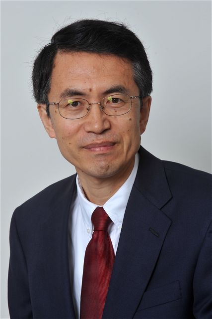 Lei Yu (于雷)合作论文数Texas Southern University85
 Guohua Song (宋国华)合作论文数School of Traffic and Transportation, Beijing Jiaotong University13
 shuxia guo合作论文数11Huibo Gong合作论文数11
 Jifu Guo (郭继孚)合作论文数Beijing Transport Institute11Jiaxin Ma (马嘉欣)合作论文数10Yixin Zhang合作论文数9
 Li Peikun合作论文数8
 Aihua Fan合作论文数Beijing Jiaotong Daxue(Beijing Jiaotong University,Northern Jiaotong University),Beijing,China8Weibin Kou合作论文数7Xiaofei Sun合作论文数7Chen-yang XIAN (羡晨阳)合作论文数6GuoXin Lin (林国鑫)合作论文数6Lin Zhu合作论文数Alibaba Cloud6
 Yi Qi合作论文数6Shenzhen Ding合作论文数5Xianchao Jia合作论文数5Xiao-mei ZHANG (张孝梅)合作论文数5YanBin Geng (耿彦斌)合作论文数中国交通运输部规划研究院5Changhai Wei合作论文数4youan wang合作论文数4XiangJun Cheng (承向军)合作论文数4Jinxuan Lai合作论文数4Shilian Gao (高世廉)合作论文数4
 Bruce Hellinga合作论文数Department of Civil and Environmental Engineering, University of Waterloo4Xiaomi Han合作论文数3Xian-lan WEI (韦献兰)合作论文数3chengzhi chang合作论文数3Aihui YU (于爱慧)合作论文数3GUO Pei (郭沛)合作论文数3Yong Gao (高永)合作论文数3
 Liping Fu合作论文数Department of Civil and Environmental Engineering, University of Waterloo3Liying Zhu (朱丽颖)合作论文数3Xi Zhang (张溪)合作论文数3Bo He (何波)合作论文数3Mingzheng Sun (孙明正)合作论文数3
 Ying Wang (王莹)合作论文数School of Traffic and Transportation, Beijing Jiaotong University3
 Tao Wan (万涛)合作论文数Chinese PLA General Hospital3Nale Zhao合作论文数3
 Yongshen Quan (全永燊)合作论文数Beijing Transportation Institute3juan miguel velasquez合作论文数2Yu Liu合作论文数2Jing-nan WANG (王景楠)合作论文数2hualei tong (童华磊)合作论文数2Ziwen Xing合作论文数2Guo Zhong合作论文数2lijuan wu合作论文数2
 Thet Hein Tun合作论文数Ross Ctr Sustainable Cities, World Resources Inst2




