Climate change and rapid urbanization have changed the urban eco-hydrological cycle. Understanding the carbon profit and loss correlation mechanism of sponge city construction life cycle helps identify the eco-environmental benefits. This study constructs a set of carbon accounting methods under the concept of sponge city, which mainly consists of basic database, carbon emission accounting, carbon neutralization, uncertainty and sensitivity analysis module. Taking a typical urban built-up area in Xi'an City as an example, the main sources of carbon emissions from sponge transformation projects are material production and construction, and the sponge transformation project created a carbon source of 95 kg CO2/m2 during the two phases. Carbon neutrality mainly includes building energy saving and green space carbon sequestration, and the latent capacity is 219.92 kg CO2/m2·year in 50-year accounting period, besides, the static investment payback period for carbon emissions is about 25 years in environmental economics. Based on the Analytic Hierarchy Process (AHP) + Data Quality Indicator (DQI) method combined with Monte Carlo simulation (MCs), the relative standard deviation (RSD)=0.17 is a relatively reliable result. The most significant influence on the results is the electricity factor in the parameters sensitivity analysis.
Restoration of complex river ecosystems requires an understanding of the availability of habitat for populations and multi-scale choices. Habitat unit (HU) mapping classifies river habitats, aiding in establishing the connection between the physical and biological conditions of rivers. Mid-scale HU classification can effectively predict fish habitat utilization patterns and has been developed and applied in numerous small to medium-sized river classifications. However, the delimitation of habitat units (HUs) for large rivers remains in its preliminary stages. This study used a two-dimensional (2D) hydrodynamic numerical model to calculate hydrodynamic data and forms ecological expert opinions based on the swimming abilities of typical fish species and geomorphic characteristics. A HU mapping procedure was constructed to describe the mesohabitat heterogeneity of HUs in the fluctuating backwater areas of the upper Yangtze River. Results indicated: (1) Rich diversity of habitats in the investigated river segment. HUs exhibit evident patterns in their planar, longitudinal, and lateral distribution. (2) Discharge magnitude influences the stability of HUs, leading to transitions between HU types. During the storage and falling periods, no dominant HU was observed, whereas the fast channel unit dominates during flood period, resulting in a reduction of the preferred habitat of fish. (3) Field monitoring of fish communities validates the potential of HU mapping in describing habitat utilization, which HUs such as pools and riffles were favoured by fish, while fast channel and slackwater unit were actively avoided, confirming the efficacy of the procedure. This research holds significant implications for habitat restoration in river management.
In the above article, there exists a citation error related to the core technical foundation of the proposed method. Reference [1] was incorrectly cited. The correct citation is reference [2].
Remote sensing images offer the opportunity to observe the Earth’s surface at multiple scales and from various angles. However, during acquisition, factors like blur, noise, haze, and low light can degrade the quality of optical remote sensing images. Deep learning-based image restoration methods are currently the most advanced approach for enhancing the usability of degraded remote sensing data. However, these methods are usually tailored to specific degradation types, which limits their effectiveness when faced with real-world degraded remote sensing data that may involve multiple, type-unknown degradation factors. In this paper, we model and derive solutions for four different types of remote sensing image degradation. With the integration of the novel prompt-injection-fusion block, the multi-level degradation information extraction capability of the multi-degradation-transformer block is further enhanced. Moreover, the model-driven prompt block in the 4D-fusion-transformer block enables adaptive recognition of different degradation types in remote sensing images and improves the physical interpretability of the restoration process. Finally, experimental results on three remote sensing image datasets and real-world multi-degradation image datasets demonstrate the advantages of the proposed network. The source code and pre-trained models are available at https://github.com/colacomo/Ada4DIR.
Urban flooding has emerged as a structural challenge that hinders the resilient transformation of cities in the context of intensifying global climate change and frequent extreme weather events. However, comprehensive and systematic comparative analyses at the urban agglomeration scale are relatively scarce. To address this gap, this study developed a multidimensional evaluation framework (EEISI) that integrates economic, ecological, infrastructural, social, and institutional resilience. Based on the CRITIC-TOPSIS weighted evaluation model and the Coupling Coordination Degree (CCD) model, this study measures urban flood resilience and the interactions among resilience subsystems in China’s three major urban agglomerations. Furthermore, this study employs the Standard Deviational Ellipse (SDE) model to explore their spatial–temporal evolution patterns and identify key constraints to resilience enhancement through an obstacle degree model. Key findings indicate: (1) UFR exhibits phased fluctuations with an upward trend, yet significant developmental disparities persist between core and peripheral cities, with the Pearl River Delta demonstrates systemic advantages through subsystem optimization; (2) Subsystem coordination has gradually improved but remains at a primary coordination level, reflecting imperfect cross-system governance mechanisms; (3) Structural fiscal allocation imbalances and fragmented institutional supply constitute the primary obstacles, manifested in constraints such as governmental governance capacity, municipal maintenance funding, and the adequacy of the social security system; This study enriches and refines the existing research indicator system, providing theoretical references for flood resilience capacity building and the practice of resilient city development in urban agglomerations.
Climate change and urbanization contribute to the increased frequency of short-duration intense rainstorms. Traditional solutions often involve multiple scenarios for cost-effectiveness comparison, neglecting the rationality of placement conditions. The effective coupling and coordination of the location, number, size, and cost of storage tanks are crucial to addressing this issue. A three-phase approach is proposed to enhance the dynamic link between drainage pipeline and storage tanks in urban high-density built-up areas, integrating Python language, SWMM, the Elitist Non-Dominated Sorting Genetic Algorithm (NSGA-III), and the Analytic Hierarchy Process (AHP) methods. In the first stage, each node within the pipeline network is considered as a potential storage tank location. In the second stage, factors such as the length and diameter of the upstream connecting pipeline, as well as the suitability of the storage tank location, are assessed. In the third stage, the length and diameter of the downstream connecting pipeline node are evaluated. The results show that the 90 overflow nodes (overflow time >0.5h) have been cleared using the three-phase approach with a 50a (duration = 3h) return period as the rainfall scenario, which meets the flooding limitations. After the completion of the three-phase method configuration, the total overflow and SS loads were reduced by 96.45% and 49.30%, respectively, compared to the status quo conditions. These two indicators have decreased by 48.16 and 9.05%, respectively, compared to the first phase (the traditional method of only replacing all overflow nodes with storage tanks). The proposed framework enables decision-makers to evaluate the acceptability and reliability of the optimal management plan, taking into account their preferences and uncertainties.
The accurate identification of the location and released mass of pollution sources using remote sensing technology is essential for emergency responses and environmental conservation. However, pollution source identification is still difficult to perform effectively when based on remote sensing technology because of the uncertainty of the inverse problem. Based on a physical mechanism, a point pollution source identification method combined with remote sensing inversion and water streamlines is proposed. This approach is designed to attempt to provide a deterministic solution for the uncertain inverse problem through clustering estimations along streamlines. The method is carried out based on the reverse flow field, which is simulated by a two-dimensional hydrodynamic model. The spatial distribution of the water quality parameters obtained from remote sensing inversion is transformed into estimates of released pollutant mass. Hypothetical cases and real-world cases are conducted to validate the proposed method. In hypothetical cases, the relative errors of the identified released mass for continuous release cases are less than 5%, and the relative error for the instantaneous release case is 1.54%. In the real-world case, the relative errors of identified pollution source locations are less than 3.5%. The relative errors of the identified released mass of the two pollution sources are 5.50% and 4.42%, respectively. The results show that this method can provide high-accuracy identification results for the location and released mass of pollution sources without requiring observed water quality data. It will help improve the water environment in areas where data of pollution sources are lacking.
Green development is one of the core elements of high-quality regional development. The Yangtze River Economic Belt stands as the primary area for China’s pursuit of sustainable development. This study analyzes the changes in water resource depletion values within the urban agglomeration of the Yangtze River Economic Belt, as well as the overall scale structure. A total of 44 indicators were selected from the three dimensions, namely green environment, green lifestyle, and green economy, to establish an evaluation index system aimed at assessing the level of green development. Through the application of the entropy-TOPSIS method, geographical detectors, and spatial autocorrelation analysis, the spatial and temporal differentiation variances in green development levels were examined, as well as the influencing factors across 73 cities situated within the three major city clusters from 2000 to 2020. The results show that: (1) The total value of water resource depletion in the three major urban agglomerations exhibits a fluctuating downward trajectory, reaching its lowest point in 2020. (2) City sizes within these three major urban agglomerations are relatively centralized, with high-ranking cities exhibiting limited prominence, showing weak leading advantages. (3) The green development level exhibits an overall upward trend from 2000 to 2020. Cities with higher levels of green development are mainly concentrated in the Yangtze River Delta and the capital cities are situated in the upper and middle reaches. (4) Key influencing factors of the green development level include carbon emissions per unit of GDP, length of drainage pipe per capita, gross domestic product per capita, disposable income of urban residents per capita, and water consumption per unit of GDP. The spatial variance in these indicators explains over 60% of the green development level. Based on the research results, this paper puts forward three policy recommendations: first, to grow the green industry. The second is to promote green municipal infrastructure planning. The third is to encourage regional synergistic cooperation and play the role of radiation leadership of core cities.
With the rapid economic development and continuous urbanization, the status of river ecosystems is undergoing profound changes. Therefore, quantitative assessment of the impact of urbanization on the water system is highly desirable. Considering Wuhan metropolitan area as the study area, this study constructed an indicator system and used the entropy technique for order preference similarity to ideal solution (TOPSIS) method to quantify the urbanization level of each city. The urbanization process was divided into four periods based on the results of the urbanization level measurement. Then, the theory of landscape ecology was used to establish the evaluation index system of the water system pattern. Finally, the study used the grey relational analysis model to analyze the relationship between urbanization and evolution of water patterns under different periods. The results indicate that (1) from 2000 to 2019, the urbanization level of Wuhan metropolitan area exhibited an increasing trend, while the four indicators of the quantitative attribute and the two indicators of complexity showed a decline. (2) A negative correlation was observed between urbanization level and water system pattern indicators, with the correlation ranging from 0.55 to 0.62 (maximum value is 1). The urbanization process shows the most significant impact on the quantitative characteristics of water systems. (3) After classifying the urbanization stages, the correlation further increased between 0.55 and 0.95. (4) The four indicators of water patterns with the highest correlation with urbanization in the given periods are class area, area-weighted mean patch fractal dimension, edge density, and number of patches. Management can judge the corresponding human activities in relation to the current stage of the urbanization process and targeted protection of the water systems.
三峡库区岸线承担多种功能,是港口码头、道路桥梁等国民经济设施建设的重要载体,科学合理利用岸线资源对地区经济发展尤为重要.通过分析明确了三峡库区岸线利用项目的主要类别,分别构建了三峡库区港口岸线利用项目、防洪护岸与生态整治岸线项目效益评价体系,并提出了相应的效益量化计算模型与估算方法,实现了三峡库区典型区县的港口岸线利用项目和防洪护岸与生态整治工程项目的效益量化评估分析.该方法体系可为库区岸线资源科学规划、优质高效开发利用、保障库区良好生态环境、促进库区社会经济可持续发展提供参考.
As an important measure used to balance the trade-offs of industrial, domestic, and ecological water use sectors, the low-impact optimal operation model of the cascade sluice-reservoir system (CSRS) has developed into an international concern. Limited by insufficient water storage and a deteriorating ecological environment, the actual operation ability (AOA) deviates from the originally planned ability and cannot function effectively as expected. However, the focus on the quantification of the AOA of the CSRS and its applications in water resources allocation have not received sufficient attention. This paper first constructed a multi-indicator evaluation system of the AOA consisting of water quantity, water quality, water ecology, engineering, and socioeconomic elements. Second, based on the quantified AOA, a multi-objective optimal operation model of the CSRS was proposed to lower water deficiency and pollutant loads and to reduce the negative impact on the social economy, water ecology and environment. The Shaying River basin (SRB), a human-altered basin with fierce water use competition, was selected as the study area. The results indicate that (1) the elements of water quality and water ecology are the main factors limiting the AOA. Moreover, the evaluation system is able to accurately demonstrate the evolution of the water management policies. (2) The low-impact optimal operation scheme has a stronger superiority with less water shortages in both city units and ecology, especially when the inflow is less and the benefits of agricultural, industrial and domestic water use are prioritized. The model contributes to the knowledge of water-society-ecology trade-offs.
The ecological carrying capacity (ECC) is a prerequisite for China’s regional and green developments. Since the Chengdu–Chongqing urban agglomeration (CCUA) is an important economic area, it is important to study the development of its ECC in order to establish its green development and to promote its regionally coordinated development in China. This paper first establishes the ECC evaluation index system based on the Pressure–State–Response (PSR) model and AHP-TOPSIS. Secondly, it estimates the ECC of the CCUA between 2000 and 2018. Thirdly, it constructs a system dynamics model of the ECC and, finally, it simulates and predicts the ECC from 2021 to 2050 based on shared socioeconomic pathways. The results show that the ECC indices of 16 cities in the CCUA have increased significantly in 18 years and the annual ECC indices from 2021 to 2050 all show significant growth trends. This paper will show that the CCUA should select the most suitable development mode to be adopted in the different periods. The development should follow SSP2 from 2021 to 2025, SSP1 from 2026 to 2035, and the development characteristics of SSP5 should be referred to at levels between 2036 and 2050, based on the CCUA’s overall development in accordance with SSP1.
Green development is a low-carbon, sustainable model for the achievement of the harmonious development of the economy and nature. Nowadays, the problems of resource scarcity and environmental pollution in the process of economic development are pressing, and the promotion of green development is the general trend. As one of the three growth poles of China’s Yangtze River economic belt, the Chengdu-Chongqing City Group is an important platform to lead toward green development in the western region of China. Based on the understanding of the connotation of green development, this study established a green development-level evaluation system, including 19 indicators in three dimensions: target level, criterion level, and indicator level, and used the entropy weight method to measure the green development level of the Chengdu-Chongqing City Group. In view of the dynamic nature of the green development process, this study constructed a system dynamics model of the green development level of the Chengdu-Chongqing City Group and simulated and compared it between 2022 and 2050 under five shared socio-economic pathway (SSP) scenarios so as to provide a reference basis for future development. The results show that the overall green development level of the Chengdu-Chongqing City Group is on an upward trend, with the highest green development level under the SSP1 path and the lowest under the SSP3 path, and the lagging distance tends to increase further. In the next 30 years, the Chengdu-Chongqing City Group should initially follow SSP2 as the basis for development and then gradually perform a transition to SSP1 by 2035 to achieve real sustainable development, after which it should continue to develop according to the SSP1 path until 2050.
Cartilage repair can greatly alleviate the symptoms of the patients with knee osteoarthritis (KOA). However, some imaging results suggest that the patients with obvious cartilage repair may receive insignificant or even no improvement in their symptoms. This study aims to explore the possible reasons based on the structural feature of the knee joint and construct the models used to predict the progression of knee joint symptoms. 551 subjects from Osteoarthritis Biomarkers Consortium FNIH Project in the Osteoarthritis Initiative (OAI) were included and divided into training and test sets. A total of 153 structural features from five quantitative structural feature sets were included to access the structural characteristics of the knee joints. The Western Ontario and McMaster Universities (WOMAC) Osteoarthritis Index was used to evaluate the symptoms of the knee joints. A three-step feature selection method were used to screen the structural features. Finally, Naive Bayes (NB), logistic regression (LR), [Formula: see text]-nearest neighbor (KNN), support vector machine (SVM) and random forest (RF) models were constructed based on the selected features, and then compared using the receiver operating characteristic (ROC) curve. The distribution in the demographics and WOMAC symptoms scores of the participants was consistent in the training and test sets. Two demographic features and several structural features were selected using the three-step feature selection method. Among the constructed models, the models used for the progression prediction of pain, stiffness and total scores were better than that of physical function. The performance of RF model was the best while SVM model was the second best, and the performance of the remaining three models in predicting the progression of knee symptoms is indistinguishable. Structural feature-based models for the prediction of knee joint symptoms’ progression were constructed and compared. The constructed model showed good feasibility and accuracy, and may assist clinicians to predict the occurrence or progression of the knee joints symptoms in the evaluation and prognosis of cartilage repair.
Reducing imperviousness connectivity by low impact developments or receiving pervious area (RPA) has been a regular strategy for runoff mitigation. However, the effects of RPA properties in combination with imperviousness connectivity on runoff have not been fully discussed. In this study, two kinds of RPA are defined according to ponding volume: retention-dominated and conveyance-dominated. Runoff for a small urban catchment was evaluated under scenarios with varying imperviousness connectivity, rainfall condition and initial soil saturation by the Storm Water Management Model. The results present significant runoff mitigation for imperviousness disconnecting by the retention-dominated RPA. However, imperviousness disconnecting by the conveyance-dominated RPA may conversely lead to higher peak runoff. Increased initial soil saturation weakens the effectiveness of runoff mitigation for the retention-dominated RPA, but has limited effects for the conveyance-dominated RPA. This study emphasizes the role of RPA properties in addition to indicators evaluating imperviousness only in urban planning.
This study builds upon the traditional ecological footprint model by adding two new accounts of resource flows and using two new calculating method. This first account concerns water resources and accounts for water consumption in cities. The second account tracks basic types of pollutant accounts. Energy theory and net primary productivity were used to calculate the ecological footprint. Aiming at the problem of application in city, a city hectare spatial scale was used and a regional carrying capacity correction parameter was referenced. This framework provides insight into calculations of the bearing capacity of certain areas. The Wuhan City Circle was used as a case study with the objectives of calculating the ecological footprint and regional carrying capacity and analyzing its spatiotemporal evolution and capacity for sustainable development. The results indicated that from 2000 to 2015, the average annual rate of decline of the carrying capacity of the Wuhan City Circle was 9.18%, and from 2015 to 2017, the average annual rate of increase was 38.91%. The ecological footprints of fossil energy and build-up land accounts increased over the years, exposing problems with land and energy utilization in the Wuhan City Circle. The continuous decline of the water resources carrying capacity reminds policy makers to pay attention to the protection of water areas. These results can help policy makers integrate historical data to adjust existing plans and make more specific future plans.
当下工科实践教学课程体系受到"新工科"、大类招生及进一步深化改革等内外驱动力的极大作用和影响,亟待把握全面提高人才培养能力的核心点,适应国家战略发展需要,对实践课程体系进行创新和重新构建.该文针对工科改革背景进行了深入分析,并给出了改革措施和工科大类培养模式的当前发展动态,基于对原工科专业实践课程体系的讨论,提出了"新工科"专业实践体系改革设计的四大模块,需以"引导、拓展、专业实践及综合实践"为阶段课程核心,平衡好扩展和进阶的关系,全面提升工科专业人才质量,适应行业发展和企业需要,以期对高等教育面临的"新工科"建设具有借鉴参考价值.
以长江中游城市群武汉城市圈为例,基于改进的生态足迹模型,计算得到3个时期(2000、2010、2017年)武汉城市圈的人均生态足迹及生态承载力,分析其不同阶段的承载力状况时空分布特征.结果 表明:2000~2017年,城市圈生态承载状况在不断恶化.在2000年城市圈雏形形成时,仅有潜江市和天门市的承载力状况处于生态赤字状态;在2010年城市圈迅猛发展后,武汉市进入生态赤字状态,承载状况与周围城市背离,产生吸聚效应,其他城市生态盈余也大幅下降;2017年城市圈正式进入初级阶段,武汉市影响逐渐向外辐射,产生发散效应,城市圈联合承载雏形形成,但4座城市的生态赤字状况未得到缓解,武汉市人均区域承载力为-2.056 hm2/人,潜江市为-1.7878 hm2/人,仙桃市为-1.1823 hm2/人,天门市为-0.6301 hm2/人.建议在武汉城市圈的可持续发展规划中聚焦生态赤字问题,加强核心区域的区域统筹,推进产业结构调整和迁移.
近几十年来国内外研究者针对全球气候变化与水文模拟相关的科学问题进行了大量的研究,因此有必要对其进行系统的回顾.首先以降水和气温为例,回顾了历史时期观测到的气候变化;然后结合最新的CMIP6计划,简要叙述了气候模式研究与水文模拟研究的关键技术方法,包含气候模式的研究进展、气候变化情景的构建技术、气候模式的评估与未来的预估、水文模型的选择和气候模式-水文模型的连接技术;同时拓展到气候变化影响评估的不确定性来源及量化方法;最后讨论了气候变化与水文模拟研究中存在的问题,并结合国家和行业发展需求提出了研究展望.
为了理清城市水系统中多因素间的复杂关系,对系统解决城市水问题提供帮助,基于水系统理论与城市水系统模拟相关研究,提出了城市水系统中水-经济社会-生态环境各因素之间相互作用和反馈的关联模型理论框架,建立了城市水系统演变过程中由针对经济发展的正反馈回路和针对可持续性的负反馈回路共同控制的新模式,构建了模拟城市水-经济社会-生态环境内在联系的城市水系统关联模型.以武汉市为例,应用建立的城市水系统关联模型,采用2001-2017年的历史统计数据,建立了武汉市城市水-经济社会-生态环境各要素之间互馈作用的模拟模型,预测了武汉市的城市发展轨迹,并与武汉市2030年的远期规划进行比较,验证了模型的有效性,表明城市水系统模型能够揭示城市水-经济社会-生态环境多要素的耦合驱动机制,体现了节水技术与绿色发展相关政策两大因子导向下的生态环境、经济社会协同发展的良好预期.
 Dongguo Shao (邵东国)合作论文数School of Water Resources and Hydropower Engineering, Faculty of Engineering, Wuhan University12
 Jun Xia (夏军)合作论文数School of Water Resources and Hydropower Engineering, Wuhan University11
 Liping Zhang (张利平)合作论文数School of Water Resources and Hydropower Engineering, Wuhan University9
 Xiang Zhang (张翔)合作论文数School of Water Resources and Hydropower Engineering, Wuhan University9
 YunQing Wu (吴运卿)合作论文数5
 Mingliang Shen (申明亮)合作论文数School of Water Resources and Hydropower Engineering, Wuhan University4
 Yanjun Zhang (张艳军)合作论文数School of Water Resources and Hydropower Engineering, Wuhan University;State Key Laboratory of Water Resources Engineering and Management, Wuhan University4Xiaoyang Qu (曲晓阳)合作论文数3
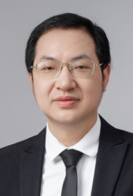 Pan Liu (刘攀)合作论文数Institute for Water-Carbon Cycles & Carbon Neutrality, School of Water Resources and Hydropower Engineering, Wuhan University3
 Haidong Yang (杨海东)合作论文数School of Economics and Management, Fuzhou University3
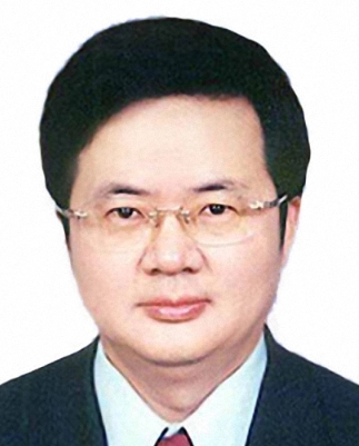 Shenglian Guo (郭生练)合作论文数Wuhan University3Yangxuan Zhang合作论文数2Yuqi Ou合作论文数2Fangliang Wei合作论文数2Lan Ge合作论文数2Xizhi Nong合作论文数State Key Laboratory of Featured Metal Materials and Life-cycle Safety for Composite Structures, School of Civil Engineering and Architecture, Guangxi University
Guangxi Provincial Engineering Research Center of Water Security and Intelligent Control for Karst Region, Guangxi University
State Key Laboratory of Hydroscience and Engineering, Tsinghua University2
Shenglian Guo (郭生练)合作论文数Wuhan University3Yangxuan Zhang合作论文数2Yuqi Ou合作论文数2Fangliang Wei合作论文数2Lan Ge合作论文数2Xizhi Nong合作论文数State Key Laboratory of Featured Metal Materials and Life-cycle Safety for Composite Structures, School of Civil Engineering and Architecture, Guangxi University
Guangxi Provincial Engineering Research Center of Water Security and Intelligent Control for Karst Region, Guangxi University
State Key Laboratory of Hydroscience and Engineering, Tsinghua University2 Chunbo Jiang合作论文数2Wei Yang合作论文数2Xiaohu CI (慈晓虎)合作论文数2ZongLi Li (李宗礼)合作论文数2
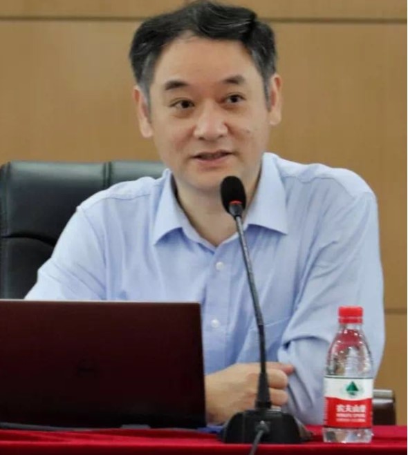 Tinghua Ai (艾廷华)合作论文数School of Resource and Environmental Sciences, Wuhan University2
 Zhigen Hu (胡志根)合作论文数School of Water Resources and Hydropower Engineering, Wuhan University2
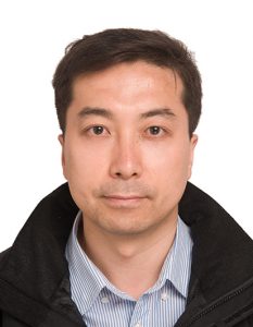 Qiangqiang Yuan (袁强强)合作论文数School of Geodesy and Geomatics, Wuhan University2Zhuomin Wang (王卓民)合作论文数2Rui Deng (邓锐)合作论文数2
 Dunxian She (佘敦先)合作论文数School of Water Resources and Hydropower Engineering, Wuhan University2Bin Fang合作论文数2Liangkun Deng (邓梁堃)合作论文数1
 Peng Zhang合作论文数1
 Xianyu Jin合作论文数1Changmei Liang合作论文数1Jianping Bing合作论文数1Zhang Huaxing合作论文数1Li Wang合作论文数1qiang yu (余樯)合作论文数1Bi Wu合作论文数1DONG Wen-xun (董文逊)合作论文数1SONG Simin (宋思敏)合作论文数1Jiang Hu合作论文数1
 Yao Wang合作论文数1Yue Liu (刘玥)合作论文数1Yang XIAO (肖洋)合作论文数1Jian LIU (刘健)合作论文数1Bi-lu XIONG (熊碧露)合作论文数1yongchao zhang (张勇超)合作论文数1Shuaishuai Zhang合作论文数1Shuxia Wang合作论文数1




