Travertine, a secondary calcite deposit formed in tectonically and geothermally active regions of the Tibetan Plateau, preserves diverse environmental signals, including evidence of past human activity. The Quesang site contains prehistoric human hand- and footprint impressions whose ages have long been debated. Here, we applied isothermal thermoluminescence dating to travertine samples, evaluating the reliability of the equivalent dose measurements and the influence of erosion on dose rate estimates. Electron spin resonance and U-Th dating were also used for cross-validation. Our results show that isothermal thermoluminescence dating provides robust and reliable ages, confirming the prehistoric origin of the hand- and footprints and resolving previous chronological controversies. Beyond Quesang, isothermal thermoluminescence dating offers a promising approach for dating human traces in travertine and other carbonate deposits, providing new insights into the timing and distribution of early human presence on the Tibetan Plateau.
The sediment source characteristics of cascading hazards are critical to understanding their formation mechanisms, evolutionary processes, and implications for regional risk assessment. On 18 December 2023, a shallow-focus Ms6.2 earthquake struck Jishishan County, Gansu Province, triggering a large-scalemodern secondary landslide-mudflow disaster within the eastern Guanting Basin, located in the Lajishan Fault Zone on the NE Tibetan Plateau. A multiproxy approach was applied, incorporating optically stimulated luminescence (OSL) dating, magnetic susceptibility, grain-size, geochemical elements, and soil micromorphology. The results indicate that: (1) The paleo-flashflood hazard deposits formed during 12.01 ± 0.78–9.26 ± 0.68 ka. During the late Pleistocene-early Holocene transition period, unstable climate and frequent intense rainstorms, coupled with fragmented terrain and significant relief, concurrently triggered this paleo-flashflood event. (2) The paleo-mudflow hazard deposits formed during 5.09 ± 0.33–4.68 ± 0.28 ka. Paleo-earthquake activity was a primary trigger for the large-scale paleo-mudflow event in this period. (3) The Malan loess, interbedded with paleo-flashflood and paleo-mudflow hazard deposits, collectively constitutes the source material for the modern secondary disaster. Paleo-hazard deposits within the eastern Guanting Basin provided abundant material sources for the modern secondary disaster, indicating a close linkage between paleo-hazard and modern disaster occurrences in this region. These findings are of significant scientific importance for understanding the temporal patterns and genetic mechanisms of cascading hazards in the transitional zone between the NE Tibetan Plateau and the Loess Plateau, as well as for regional hazard risk assessment, disaster prevention and mitigation.
Understanding the spatiotemporal variations of the South Asian summer monsoon (SASM) is fundamental for predicting regional water resource availability. On interannual and decadal timescales, precipitation variations in the northeastern Indian Peninsula exhibit an antiphase pattern compared to other SASM-influenced regions, such as the central-western Indian Peninsula, southern Tibetan Plateau and Yunnan-Guizhou Plateau. However, it is unclear whether such heterogeneity existed on the sub-orbital timescale. We synthesized a new Holocene hydroclimatic dataset comprising 88 records from across the SASM region. Contrary to the traditional view of a uniform early Holocene maximum in monsoon precipitation, our results are the first to reveal a pattern of spatial heterogeneity: the northeastern Indian Peninsula experienced a wetting trend, whereas most other SASM regions showed an overall drying trend during the Holocene. This spatial contrast suggests that hydroclimatic variations in the northeastern Indian Peninsula do not represent overall SASM intensity. Notably, stalagmite δ18O records show a consistent pattern of the most negative values in the early Holocene followed by a gradual positive shift, contradicting the spatial heterogeneity revealed by moisture-sensitive records. This new finding suggests that not all stalagmite δ18O records in the SASM region can be simply interpreted as local precipitation, but rather that they may reflect an integrated signal of precipitation, water vapor sources and transport pathways. PMIP4 simulations corroborate the dipole pattern from hydroclimatic records, capturing the precipitation contrast between the northeastern Indian Peninsula and other SASM-influenced regions. PMIP4 simulations reveal a possible mechanism where the enhanced mid-Holocene land-sea thermal contrast triggered a summer anticyclonic anomaly. This anticyclonic anomaly induced atmospheric subsidence and was accompanied by a reduction in water vapor over the central-eastern Indian Peninsula, thereby suppressing precipitation and driving spatial heterogeneity. However, as simulations provide an atmospheric context rather than precise reconstructions, discrepancies persist between models and records, necessitating future model refinements.
Long-term human-environment interactions are critical to understanding the processes and patterns of human evolution and societal development. The Dadiwan site, located in the western Loess Plateau, preserves abundant Neolithic cultural remains dating from the early to mid-Holocene. These materials provide important evidence for investigating the developmental trajectory of Neolithic cultures and their relationship with environmental changes. Based on the 2014 excavation at Dadiwan (DDW14), this study presents a comprehensive analysis of 53 AMS14C dates together with the typological classification of more than 4300 pottery sherds. By integrating all previously published radiocarbon dates and relevant research results of Neolithic remains at Dadiwan, a refined chronological framework with higher-resolution for the Neolithic remains at the site is established as follows: Phase I, 7700−7200 cal a BP; Phase II, 6000−5600 cal a BP; Phase III, 5600−5400 cal a BP; Phase IV, 5400–later than ca. 4800 cal a BP; and Phase V, later than ca. 4800 cal a BP and extending into the subsequent period. Within this new chronological framework, we found that the emergence, decline, flourishing, and subsequent decline of Neolithic culture at the site were closely associated with the development and westward diffusion of contemporaneous cultures on the central and eastern Loess Plateau, as well as with changes in hydrothermal conditions and vegetation in the western Loess Plateau. This study reveals the complex internal dynamics of Neolithic cultures at Dadiwan and its close linkages with external environmental changes, providing critical evidence for the understanding of the evolution and underlying mechanisms of past human-environment interactions.
The Tibetan Plateau (TP), often referred to as the “Asian Water Tower,” serves as the source of major rivers. The Dadu River, a significant tributary of the Yangtze River, is a vital fluvial system on the eastern TP and has historically functioned as an important migration corridor for prehistoric populations. Despite its significance, the fluvial evolution of the Dadu River remains poorly understood. This study identifies five fluvial terraces, with elevations reaching up to 100 m above the current river level, in the upper Dadu River valley. These terraces were dated using single-grain K-feldspar pIRIR dating. The study reconstructs the fluvial processes and explores the mechanisms behind them. The results show terrace formation at approximately 150 ka (T5), 120 ka (T4), 50 ka (T3/2), and 0.6 ka (T1). The river experienced aggradation during MIS 6 (>150 ka) and MIS 4 (70–50 ka), likely driven by increased sediment supply and reduced runoff during glaciations. A more recent aggradation around 2 ka may also be linked to increased sediment supply from human activity. River incision primarily began around 120 ka (transition from MIS 6 to MIS 5) and 50 ka (transition from MIS 4 to MIS 3), likely triggered by a shift from cold to warm climate conditions and the consequent rainfall and runoff increases. The tectonic activity of the eastern TP has resulted in a long-term river incision rate of 0.66 ± 0.08 mm/yr, which likely played a significant role in the incision phases during the glacial periods of 150–130 ka and since ∼50 ka, continuing into the late Holocene in the upper Dadu River. The fluvial terraces served as migration corridors for Neolithic populations moving from the middle to upper Yellow River region and provided ideal living and farming platforms for the inhabitants of the Konglongcun site, who occupied the T2 terrace from 5.5 to 4.8 ka. This study enhances the understanding of the influence of orbital climate changes and tectonics on fluvial evolution, as well as the human-environment interactions in the eastern TP during prehistory.
The Third Plague Pandemic claimed over 15 million lives, making it one of history's deadliest. However, the complex interplay of environmental and societal factors that triggered the spillover of Yersinia pestis from its natural reservoirs on the Tibetan Plateau into human populations in the 1850s remains unclear. Here, we use 35 moisture-sensitive tree-ring chronologies from the southeastern Tibetan Plateau to reconstruct interannual to multi-decadal hydroclimate variability back to 1564 CE. Our record reveals a prolonged drought from the 1850s to the 1880s, coinciding with the onset and establishment of the Third Plague Pandemic. The reconstructed hydroclimate anomaly was accompanied by sharp increases in famine, conflict and plague that claimed 2.41 million lives during the Panthay Rebellion. Troops, refugees, and opium traders accelerated the spread of the pandemic to and from Hong Kong. Our findings underline the need for plague prevention based on climate-related conflict in a warming, globalized world.
Classical paleoclimate reconstructions rely on a space-for-time substitution approach, but past environmental conditions may extend beyond modern analogs. This introduces biases in reconstructions, known as the edge effect, stemming from no-analog past conditions, statistical limitations, and eco-physiological effects. Quantification and partitioning of the sources of the edge effect remain limited. Here, we examined temperature reconstructions based on branched glycerol dialkyl glycerol tetraethers (brGDGTs) from global modern soils, and quantified the factors contributing to the edge effect. Our analysis shows that climate variables alone are the dominant contributors to the reconstruction bias, accounting for 46%, while soil properties (23%) and topography (13%) represent additional environmental controls. Biotic factors also contribute, with vegetation accounting for 11% and bacterial community structure for 7% of the total bias. We employed a Sparse Identification of Nonlinear Dynamics approach to dynamically simulate brGDGT-based temperature biases. Applying this simulation to loess deposits from the Chinese Loess Plateau, we demonstrate a previous overestimation of Last Glacial Maximum temperatures by 1.2-4.2 degrees C. These findings advance our understanding of edge effects in both modern and paleo-reconstructions, and highlight the need for caution when using proxies, especially under no-analog conditions.
Cattle,including taurine(Bos taurus tau-rus)and indicine(B.t.indicus)cattle,were independently domesticated in the Fertile Crescent(~10 500 years be-fore present,a BP)and the Indus Val-ley(~8500 a BP),respectively[1,2].
The Qinghai-Tibetan Plateau (QTP), Earth's "Third Pole", profoundly shapes the Asian monsoon and regional climate and exerts far-reaching influence on the global climate system. Yet its role in organizing planetary-scale climate interactions remains poorly quantified. Here we develop a climate network framework to explicitly resolve the planetary teleconnection architecture associated with the QTP across historical observations and future climate projections, with physical consistency assessed using Lagrangian trajectory diagnostics and targeted numerical experiments. We uncover a persistent and directional interaction structure linking the QTP with multiple major climate tipping elements. In particular, we identify a robust tripolar interaction mode coupling the QTP with both the Arctic and Antarctica through coherent atmospheric-oceanic pathways. Our findings establish the QTP as a critical planetary climate integrator, revealing a significant blind spot in current climate models and risk frameworks regarding cascading tipping dynamics in a warming world.
Global winter temperatures show pronounced interdecadal variability compared to other seasons, yet the main modulators at a global scale remain unclear. We strengthened the signal of interdecadal winter temperature variability by eliminating the high-frequency signal driven by the El Niño-Southern Oscillation (ENSO). Our analysis, using observations and simulations, identifies Sea Surface Temperature (SST) variability in the East China Sea as a key driver of global interdecadal winter temperature anomalies. We introduce the East China Sea Mode (ECSM), a winter-specific mode that significantly influences global winter temperatures. The East China Sea, adjacent to the East Asian Winter Monsoon (EAWM) area, is a critical region impacted by this monsoon system. The ECSM induces global winter temperature anomalies by modulating the dominant interdecadal atmospheric teleconnections, positioned within a crucial area of the teleconnection wave train. Notably, the influence of the ECSM extends beyond the typical range of influence of the Pacific Decadal Oscillation (PDO), with the combined effects of ECSM and PDO shaping temperature patterns across Eurasia, North America, and parts of the Southern Hemisphere. This study highlights the critical role of SSTs in the East China Sea in affecting winter temperature variability, which complements the traditional focus on the eastern part as represented by the PDO.
Jade had been the symbol of ritual and literati culture for millennia in China. China's prehistory witnessed a rapidly increasing consumption of jade, illustrating a rich diversity of quality, shapes and purposes. Jade mining typically occurred in environmentally marginal zones, demanded intensive labor, and left only ephemeral archaeological traces. How prehistoric communities organized and sustained such resource procurement under these constraints has therefore remained unclear. This issue is addressed in the current study through the first systematically excavated jade mining site in China (Mazongshan, 420-160 BC), revealing a distinct economic life that closely adapted to local geographic and social conditions. Multiple animal species (working cattle, domestic horses, donkeys and Bactrian camels) were coordinated to facilitate tedious jade-mining and related activities. Particularly significant is the identification of the earliest radiocarbon-dated donkey and camel remains thus far recovered from the Hexi Corridor. Beyond their subsistence value, these pack animals likely also facilitated local jade extraction and overland transport, linking the Hexi Corridor with major jade consumption centers in the Yellow and Yangtze River basins.
The Tibetan Plateau, with an average elevation exceeding 4000 m, presents one of the most challenging environments for human survival due to its extreme cold, hypoxia, and variable climate. Archaeological evidence demonstrates a deep history of human exploration and adaptation on the plateau, beginning with archaic hominins like the Denisovans in the Middle Pleistocene.The large-scale peopling of the high-altitude interior is mainly associated with the spread of Homo sapiens employing microblade technology, characterized by the production of standardized microblades from elaborately prepared cores like wedge-shaped and semi-conical forms. The advanced microblade technology facilitated human dispersal across the plateau after the Last Glacial Maximum. Currently, more than 110 microblade sites have been discovered, and the lithic technologies at these sitesshow strong typo-technological affinities with those from North China, suggesting a major dispersal route via the plateau's northeastern corridors. This paper reports new findings from Locality 3 of the Shanggangang site in the hinterland of the plateau, revealing a previously unrecognized lithic tradition during the terminal Pleistocene. Shanggagang Locality 3 is located in the Qiusang River Valley near Lhasa, Xizang, at an elevation of similar to 4140 m, and it was systematically excavated in 2024. Stratigraphic analysis and absolute dating of both charcoal (C-14) and sediment (optical dating) samples constrain human activity to approximately 13000-10000 years ago. The lithic assemblage, comprising 603 artifacts, reveals two distinct reduction systems. One is the bladelet technology centered on burin-core reduction strategy. A total of 35 burin-cores has been identified. The blank of these cores were primarily made on chert flakes or chunks, and the size of them is small (avg. 27.5 mmx19.5 mmx10.9 mm). The platforms of burin-cores were often prepared, and bladelets were serially detached along the acute intersection (ridge) of two surfaces of the blank using direct percussion. The resulting bladelets are less standardized in form and dimensions compared to typical microblades produced by pressure or indirect percussion. This system coexists with an expedient reduction strategy utilizing locally available cobbles (mainly igneous rocks) for producing flakes, and in some cases, elongated flakes were detached from discoidal and multifacial cores. The technological signature of Shanggagang Locality 3 is clearly different from contemporaneous microblade sites on the interior plateau, such as Nwya Devu Locality 3 (similar to 11-10 ka), and sites surrounding the Qinghai Lake. These sites are mainly featured by wedge-shaped and semi-conical microblade cores. Shanggagang Locality 3 constitutes the first securely dated and well-contextualized discovery of a burin-core based bladelet technology in the hinterland of the Tibetan Plateau. The emergence of this distinct technology during the Last Deglaciation, a period of significant climatic fluctuation including the Younger Dryas cold episode, underscores the ability and diversity of technological strategies employed by foraging groups navigating the high-altitude environment. While microblade technology on the plateau likely originated from North China, the origins of the burin-core bladelet technology at Shanggangang remain unclear. This discovery updates our understanding of late Pleistocene lithic technology on the Tibetan Plateau. It demonstrates that diverse technological traditions, which potentially represent distinct cultural or demographic dynamics, were present on the plateau during the early occupation phase by Homo sapiens. Future research, including detailed techno-functional analysis of the burin-cores and broader regional comparisons, is essential to trace the origins of this technology and to elucidate the intricate patterns of migration and interaction among late Pleistocene populations on the "Roof of the World".
The ecological environment of Asian drylands is fragile and highly sensitive to global climate change, underscoring the importance of understanding its climatic and ecological history. This study aims to fill the spatial and temporal gaps in climate and environmental records in the NE Iranian Plateau, along the Silk Road. Focusing on Lake Bazangan, we reconstruct the region's climatic history over the past 1500 years through high-resolution analyses of pollen, grain size, geochemical elements, and glycerol dialkyl glycerol tetraethers (GDGTs). The results show that during the Medieval Warm Period (MWP, 1000-1400 CE), pollen concentrations were low. Grain-size and end-member analyses indicate weakened lake hydrodynamics, while geochemical proxies indicate an oxidized, high-salinity lake environment, reflecting reduced precipitation and the driest conditions. In contrast, during the Little Ice Age (LIA, 1500-1900 CE), higher pollen concentrations, intensified lake hydrodynamics, and geochemical evidence of a more reducing, lower-salinity lake environment collectively suggest a relatively humid climate. These findings are further supported by the precipitation patterns simulated by the MPI-ESM-1-2-LR model. Model simulations indicate that precipitation variability in the NE Iranian Plateau was primarily driven by intensified mid-latitude westerlies and enhanced low-latitude moisture transport, likely modulated by the Interdecadal Pacific Oscillation (IPO). Overall, this study improves our understanding of past human-environment interactions and provide a climatic perspective for addressing contemporary environmental challenges along the Silk Road region.
The collapse of the Dzungar Khanate in the 1750s marked the end of the world's last nomadic empire and reshaped Eurasian geopolitics. However, whether environmental and societal factors interplayed and contributed to its collapse remains unclear. Here, we reconstructed steppe productivity variability across the Dzungar heartland since 1625 using 441 tree-ring series based on an extreme growth ratio. Our record shows that the Khanate's collapse coincided with the lowest steppe productivity in the past four centuries during 1751-1761. The weakening societal resilience approaching a tipping point intensified the effects of the rapid steppe productivity decline, which cascaded into famine, conflict, and trade breakdown. Smallpox then reemerged and escalated into a catastrophic epidemic, transforming the environmental crisis into the collapse of the Dzungar Khanate. Our findings underscore the urgent need to strengthen pastoral resilience and epidemic surveillance in steppe regions as climate stress intensifies and cross-border epidemic threats escalate.
Past temperature reconstructions offer valuable insights into the impact of climate change on the global climate-human-vegetation system. Branched glycerol dialkyl glycerol tetraethers (brGDGTs) are recognized as effective temperature proxies, particularly in lakes and peatlands, where they are well preserved. However, their reliability as palaeothermometers can be compromised by factors beyond air temperature, especially in drylands. This study investigates the recently compiled Arid Central Asian (ACA) brGDGT surface Data Base, a regional dataset consisting of 753 surface samples from the drylands of ACA. The distribution of brGDGTs in relation to climate and environmental variables was analysed to explore their potential as reliable temperature proxies, mainly focusing on brGDGTs methylation (MBT), cyclisation (CBT), and isomer (IR) indices. The brGDGT-based palaeothermometer is a promising tool for understanding past climates, but our comparison between an ACA-centred database and a worldwide continental surface sample database reveals several challenges. Drylands exhibit extreme climate and soil/lacustrine properties, amplifying the impact of confounding factors on brGDGT-based relationships with mean annual air temperature. Salinity emerges as the dominant factor influencing brGDGT variance, followed by sample type, pH, and aridity, all of which contribute significantly. These factors interact in complex ways, with the salinity effect varying between soil and lacustrine deposits. For sample physicochemical conditions, the IR6+7Me ' index is best for salinity, and IR6Me is most suitable for pH reconstruction. Thus, the MBT5Me '-temperature relationship is limited in ACA, particularly for lacustrine samples, and MBT6Me ' does not offer a better solution under hyper- to semi-arid conditions. Sub-calibrating models for specific environmental conditions such as salinity and aridity improves the accuracy of temperature reconstructions. Furthermore, the difference between MBT5Me ' and MBT6Me ' provides a promising proxy to assess aridity. Although the brGDGT signal in drylands is influenced by multiple controlling factors, it remains a valuable tool for understanding past climate and environmental conditions, especially when accounting for the complex interactions between these factors based on each study's unique physicochemical and bioclimatic context. Further research, incorporating a broader range of surface samples alongside comprehensive soil and climate data, holds the potential to enhance the accuracy of brGDGT-based climate reconstructions.
Geographical science bridges the natural and social sciences to study present-day and past coupled human–environment systems. Rooted in systems thinking and sustainability principles, it emphasizes the interactions and feedbacks between natural and societal processes. Grounded in this integrative approach, this perspective identifies nine cross-disciplinary frontier domains, including ecohydrological processes, earth system modeling, regional functional evolution, urban–rural coordination, smart cities, and big earth data, that collectively address the complexity of environmental and societal dynamics. Strategic priorities are outlined to strengthen fundamental research, advance integrative methodologies, enhance long-term observation and data-model sharing networks, foster the synergistic evolution of AI and geography, expand international collaboration, and lead global research initiatives. Together, these directions chart a pathway toward a holistic, data-rich, and globally engaged geographical science that supports sustainability transitions and planetary stewardship.
Northwest China’s arid climate and fragile ecosystems are becoming wetter and greener. However, the rapid expansion of photovoltaic (PV) infrastructure in this region alters land-atmosphere interactions, with potential consequences for local climate and water resources. Here, we use a combined climate and dynamic vegetation modeling approach to assess the effects of hypothetical PV deployment across the Tarim Basin, home to the world’s second-largest mobile desert. We find that large-scale PV installations may significantly reduce water resources in populated areas, with over 30% reductions in runoff, precipitation, and aridity index, alongside an 8.5% decline in soil moisture. High-efficiency PV panels increase surface albedo, leading to surface cooling and intensified anticyclonic circulation, which suppresses precipitation and triggers vegetation decline. This vegetation feedback amplifies aridity by modifying albedo and evapotranspiration. These results highlight the critical need to incorporate vegetation feedback in future studies to fully evaluate PV’s hydrological impacts and stress the importance of careful planning to mitigate environmental risks associated with large-scale solar projects in Northwest China.
Sophisticated millet-pig agriculture significantly influenced cultural expansion and early social complexity in the Yellow River Valley during the Neolithic period. However, tempo and role of millet-pig agriculture in shaping early social complexity on the Chinese Loess Plateau remain poorly constrained, largely due to the absence of an effective system for identifying and quantifying domestic pigs. Here we develop a comprehensive system for identifying domestic pigs that combines K-means clustering of pig collagen carbon and nitrogen isotope data, with the optimal number of clusters determined using Within-cluster Sum of Squares (WSS), newly obtained radiocarbon dates, systematic zooarchaeological evidence, and archaeological contextual information from four sites in the western Loess Plateau. By cross-checking the results of our improved identification method with multiple sources of evidence, we reconstruct a three-step intensification of the millet-pig agricultural system in the Neolithic western Loess Plateau, identified through changes in crop structure, pig management, and isotopic evidence. A synthesis of Neolithic sites across the Chinese Loess Plateau suggests that asynchronous cultural expansion and socially complex processes in the western and eastern Loess Plateau were likely influenced by differences in the timing at which sophisticated millet-pig agricultural system emerged, under contrasting regional natural and social conditions. This study elucidates the trajectory of the millet-pig agricultural system in the Chinese Loess Plateau and demonstrates its pivotal role as part of the cultural expansion witnessed during the Neolithic period.
The dispersal of prehistoric agricultural cultures onto the Tibetan Plateau and their adaptation to its extreme environments remain key scientific questions. The western Sichuan Plateau, located on the eastern margin of the Tibetan Plateau, served as a critical corridor for the spread of agriculture, yet the subsistence strategies together with the degree of sedentism among early Neolithic populations in this region remains unclear. The charcoal analysis from archaeological sites can well reveal the strategies of human wood gathering, indirectly reflecting the intensity of past human activities. The Konglongcun site ((sic) *4 +/- 1E) (ca. 5500-4800 cal. BP)-one of the earliest millet-farming Neolithic sites on the western Sichuan Plateau-provides an opportunity to investigate changes in wood exploitation and human activity through taxonomic identification, diameter estimation, and decay-index analysis of charcoal remains. The study findings indicated that Konglongcun inhabitants primarily adopted a local procurement strategy, exploiting dominant regional taxa, such as Abies sp., Pinus sp., and Acer sp. Climate reconstruction based on the coexistence approach suggested warmer and wetter conditions during the site's occupation than the present conditions, favoring thermophilic millet cultivation. The late phase showed a significant increase in the use of fresh wood, larger collected wood diameters, and a stronger preference for exploiting Pyrus sp. as fresh twigs than in the early phase, implying intensified agricultural activity and great sedentism. This study presents the first systematic evidence of wood exploitation by early Neolithic populations on the eastern Tibetan Plateau, offering new insights into how agricultural communities adapted to high-altitude environments during their expansion onto the plateau.
 Jianhui Chen (陈建徽)合作论文数College of Earth and Environmental Sciences, Lanzhou University111
 Guanghui Dong (董广辉)合作论文数College of Earth and Environmental Sciences, Lanzhou University;Institute of Earth Environment, Chinese Academy of Sciences;University of Chinese Academy of Sciences80
 Aifeng Zhou (周爱锋)合作论文数College of Earth and Environmental Sciences, Lanzhou University73
 Jiawu Zhang (张家武)合作论文数College of Earth and Environmental Sciences, Lanzhou University68
 Shengqian Chen (陈胜前)合作论文数School of History, Renmin University of China67
 Jianbao Liu (刘建宝)合作论文数Institute of Tibetan Plateau Research, Chinese Academy of Sciences;College of Urban and Environmental Sciences, Peking University64
 Xiaohua Gou (勾晓华)合作论文数College of Earth and Environmental Sciences, Lanzhou University64
 Dunsheng Xia (夏敦胜)合作论文数College of Earth and Environmental Sciences, Lanzhou University56
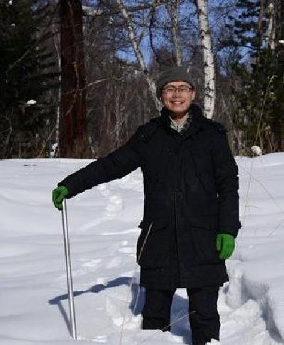 Xiaozhong Huang (黄小忠)合作论文数College of Earth and Environmental Sciences, Lanzhou University51
 Dongju Zhang (张东菊)合作论文数College of Earth and Environmental Sciences, Lanzhou Univerisity51
 Chengbang An (安成邦)合作论文数Institute of Chinese Historical Geography, Fudan University45
 Hui Zhao (赵晖)合作论文数Northwest Institute of Eco-Environment and Resources, Chinese Academy of Sciences;University of Chinese Academy of Sciences42
 Zhiguo Rao (饶志国)合作论文数College Of Geographic Science, Hunan Normal University41
 Duo Wu合作论文数38
 Jie Chen (陈杰)合作论文数School of Water Resources and Hydropower Engineering, Wuhan University36
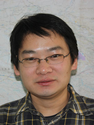 Juzhi Hou (侯居峙)合作论文数Institute of Tibetan Plateau Research, Chinese Academy of Sciences36
 Haitao Wei (魏海涛)合作论文数School of Philosophy and Sociology, Lanzhou University35
 Guoqiang Li (李国强)合作论文数College of Earth and Environmental Sciences, Lanzhou University34Ming Jin (金明)合作论文数School of Philosophy and Sociology, Lanzhou University34
 Jinbao Li (李金豹)合作论文数Department of Geography, Faculty of Social Science, The University of Hong Kong;College of Geographic Sciences, Faculty of Geographical Science and Engineering, Henan University33
 Keyan Fang (方克艳)合作论文数School of Geographical Sciences, Fujian Normal University32
 Yan Zhao (赵艳)合作论文数Institute of Geographic Sciences and Natural Resources Research, Chinese Academy of Sciences;University of Chinese Academy of Sciences32
 Liya Jin (靳立亚)合作论文数Key Laboratory of Western China's Environmental Systems, College of Earth and Environmental Sciences, Lanzhou University;School of Atmospheric Sciences, Chengdu University of Information Technology31
 Yuxin Fan (范育新)合作论文数College of Marine Science and Engineering, Nanjing Normal University29
 Wei Huang (黄巍)合作论文数College of Life Sciences, South China Agricultural University28
 Mingrui Qiang (强明瑞)合作论文数School of Geography, South China Normal University27
 Qinghai Xu (许清海)合作论文数Hebei Normal University27
 Xianyong Cao (曹现勇)合作论文数Institute of Tibetan Plateau Research, Chinese Academy of Sciences;University of Chinese Academy of Sciences25
 Huan Xia (夏欢)合作论文数College of Ecology, Lanzhou University25
 Jianying Ma (马剑英)合作论文数School of Geographical Sciences, Northeast Normal University24
 David Madsen合作论文数University of Nevada24
 Xiaojian Zhang (张肖剑)合作论文数School of Geography and Ocean Science, Nanjing University24
 Liping Yang (杨丽萍)合作论文数长安大学地质工程与测绘学院23Zongli Wang (王宗礼)合作论文数College of Earth and Environmental Sciences, Lanzhou University23Fei Wang (王飞)合作论文数College of Earth and Environmental Sciences, Lanzhou University23Yanwu Duan合作论文数21Jianfeng Peng合作论文数21
 Xin Wang (王鑫)合作论文数School of Environmental Science and Technology, Dalian University of Technology21
 Leibin Wang合作论文数20
 Xiaoyan Yang (杨晓燕)合作论文数College of Earth and Environmental Sciences, Lanzhou University20Xuemei Chen合作论文数19
 Zicheng Yu (于子成)合作论文数Department of Earth and Environmental Sciences, Lehigh University18
 Edward R. Cook合作论文数Lamont-Doherty Earth Observatory, Columbia Climate School, Columbia University17
 Song Feng合作论文数Fulbright College of Arts and Sciences Earth Sciences16
 Feng Chen (陈峰)合作论文数Institute of International Rivers and Eco-Security, Yunnan University16
 Hui Wang合作论文数16
 Donghuai Sun (孙东怀)合作论文数College of Earth and Environmental Sciences, Lanzhou Univerisity;Key Laboratory of Western China's Environmental Systems, Ministry of Education, Lanzhou Univerisity16




