This study addresses the uneven spatial distribution of China's 5A scenic spots, proposing a comprehensive approach for identifying and optimizing tourism gaps. By examining the relationship between the supply capacity of scenic spots and societal population demand, spatial patterns of tourism opportunities were evaluated under multiple threshold distance scenarios to identify tourism gaps, which are areas where the current supply of 5A scenic spots fails to meet population demand. To optimize the spatial layout of tourism resources, four machine learning algorithms, including eXtreme Gradient Boosting (XGBoost), random forest (RF), logistic regression (LR), and support vector machine (SVM), are employed to construct a scenic spot location optimization framework, enabling spatial compensation and efficient resource allocation in gap areas. The study indicates that 60.22 % of regions in China show tourism gaps, 15.25 % of which are classified as "triple tourism gap areas," meaning they lack tourism opportunities across all scenic spot types and are predominantly situated in the interior of the Qinghai-Tibet Plateau. In comparison to natural scenic spots, man-made and historical scenic spots exhibit more significant spatial disparities in tourism gaps. A decline in spatial unevenness of tourism opportunities across different threshold distances is observed in the optimized gap areas. By integrating machine learning to optimize the spatial layout of 5A scenic spots, this study provides scientific evidence and technical support for promoting regional coordinated development and achieving tourism spatial justice.
Rapid tourism development in ecologically fragile regions poses a risk of exceeding ecosystem self-regulation capabilities. To promote the coordination of conservation and development, this study aims to explore the nonlinear relationship between ecosystem health and tourism activities. This study established a tourism activity intensity index and employed a machine learning model to simulate ecological responses on the Qinghai-Tibet Plateau. The results reveal that the response of ecosystem health to tourism activity is characterized by distinct nonlinear features. While ecosystem health maintains relative stability under low-to-moderate disturbance, it suffers accelerated degradation once the intensity exceeds critical thresholds. Specifically, quantitative thresholds were identified at the kilometer-grid scale (0.134) and the trajectory-point scale (0.337), suggesting a scale-dependent resilience mechanism. Natural geographical conditions and tourism organization patterns jointly shape diverse nonlinear response patterns. These insights bridge the gap between theoretical carrying capacity and quantitative estimation, offering practical references for defining the safe operating space in high-altitude areas.
Global tourism policy and practice often promote rural community participation for its livelihood benefits, yet the environmental risks associated with such participation have received far less systematic attention in research. This study introduces community mal-participation to capture tourism-related forms of community participation that cause environmental harm or heighten the risk of ecological degradation. We develop a theoretical framework to explain its drivers and governance dynamics, and test it through an empirical investigation in the Qinghai Lake region that incorporates perspectives from local residents, tourists, and administrators. Data were collected via PPGIS, interviews, and questionnaire surveys, and analyzed using text network analysis, spatial statistics, PLS-SEM, and the Mann-Whitney U test. The results suggest that community mal-participation has been present around Qinghai Lake for more than a decade, contributing to environmental degradation and constraining sustainable tourism development. Its occurrence is associated with residents’ perceived unfairness in tourism development, perceived tourist demand, and lower environmental awareness. Stronger behavioral constraints are linked to lower reported mal-participation in the short term, but also to greater resident dissatisfaction and potential longer-term risks. The findings further indicate that improving the perceived fairness of tourism benefit distribution is central to reducing mal-participation and supporting more environmentally responsible participation over time. By conceptualizing community mal-participation and clarifying its governance trade-offs, this study broadens how community participation is theorized in sustainable tourism and provides evidence relevant to rural destinations experiencing rapid tourism growth alongside low resident incomes.
Understanding the differences in preferences among ecotourism stakeholders and the resulting landscape use conflicts is crucial for promoting the sustainable development of national parks. This study presents the LUCES framework for identifying key areas in managing landscape use conflicts between tourists, local residents and tour enterprises, using the Yellow-river-source National Park (YNP) as a case study. The results indicate that the potential conflict map corresponds to 74% of the actual conflict locations identified through public participation geographic information systems, confirming the effectiveness of the LUCES framework. The differences in preferences for ecosystem services among the three stakeholder groups significantly influence the formation of conflict patterns. The majority of conflicts (58%) in YNP occur between tourists and local residents, with tourism enterprises aligning with tourists. Only 0.02% of conflicts involve all three groups. Four villages (including Zhalinghu, Jiangpang, Aying, and Tanggema) were identified as key areas for managing landscape use conflicts. This study enhances the identification of landscape use conflicts among stakeholders, deepens the understanding of landscape use conflicts, and supports informed decision-making for effective conflict management and sustainable landscape practices.
The context of this analysis is that the tourism industry profits from public protected areas, and deploys a suite of political strategies to gain greater opportunities and control. A few tourism enterprises contribute significantly to conservation of threatened species, but these represent <0.01% of the sector worldwide. Most tourism enterprises aim only for profit, at the expense of biodiversity and environment, recreational park visitors and other taxpayers, and commercial competitors. Our aim here is to identify the main components of tourism industry political playbooks, used to promote expansion into public protected areas. We use interpretive thematic analysis of the lifetime experiences of park managers, tour guides, and recreation researchers, including historical documents and events. We find that tourism industry interests: run lobbying campaigns misrepresenting public protected areas as tourism assets; lobby for private tourism developments in national parks; adopt green-washing and social-washing to gain social licence; misuse ecotourism terminology and ecocertification functions; promote approaches based on individual responsibilities in order to conceal institutional changes; misrepresent conservation tourism as if it reflected the entire sector; promote privatisation of parks visitor services; gradually extend the rights associated with park tourism permits; lobby politically for land grabs; and infiltrate tourism interests into conservation organisations. We conclude that at global scale, contributions of tourism to conservation are overshadowed by threats to biodiversity from these political mechanisms, and especially from private tourism property developments inside public protected areas. We invite case studies of such developments, so future research can quantify how the playbook is deployed.
Nature is beneficial for mental health, but clinical healthcare does not provide it, and lifestyle medicine is not available to all. Here, therefore, we propose a public health approach, which involves education, transport, and parks agencies as well as health.
Tourism is increasingly recognized as a driver of habitat loss in protected areas ( PAs ); however, quantitative evidence on the spatial and temporal dimensions of its impact remains limited. This study employs linear regression models, propensity score matching, spatial lag models and dynamic panel models to evaluate the effects of tourism development on habitat loss across 765 PAs in China. The results indicate that: (1) habitat loss has occurred in the majority of the PAs studied (75%), and tourism development has significantly exacerbated this loss; (2) such intensification is particularly evident in PAs located in eastern China that are non‐national, recently established, and relatively small, which is attributable to China's institutional context; (3) the exacerbating effects of tourism extend beyond PA boundaries, threatening ecological connectivity; and (4) tourism‐induced habitat loss exhibits delayed effects, with a notable increase in intensity beginning in the second year following the establishment of tourist sites. Synthesis and applications. Based on these results, decision‐makers and implementers of PAs should adopt differentiated tourism impact controls that account for PAs ' management level, establishment time, area and regional development level, while also considering spatial spillovers and dynamic changes in tourism impacts. This study enhances the understanding of the spatial and temporal dynamics of tourism's impact on habitat loss and provides critical insights for optimizing strategies to achieve the 2030 biodiversity conservation targets.
Self-driving tourism (SDT) has emerged as a critical driver in reconfiguring the high-altitude socio-ecological system (SES). Prevailing studies remain constrained by fragmented analytical approaches that neglect the complex couplings between SDT expansion and high-altitude SES. To address this gap, this study adopts the SES framework and utilizes long-term Tourism Digital Footprint data to investigate the tourism–economy coupling dynamics of SDT and how it drives the SES transition. The results reveal three key findings: (1) The spatial pattern of SDT has evolved from dispersed to linearly concentrated, and finally to a networked distribution. Notably, the core radiation radius of SDT expanded from 2.5 to 5 km, indicating an intensified spatial spillover effect. (2) A co-evolutionary relationship exists between SDT and the regional economy. While SDT exerts a positive causal effect on GDP growth, this driving force is spatially differentiated by altitude gradients and distance decay. (3) The intervention of SDT has triggered a profound SES transformation, manifested physically as the conversion of ecological space to construction land, and socially as livelihood diversification. These findings provide a scientific basis for enhancing SES resilience and adaptive governance.
Contrary to recent suggestions, ecotourism and park visitor management cannot decarbonise the airline and hotel sectors at industry scale, though both can contribute to other environmental benefits under some circumstances. Industry-wide decarbonisation needs institutional changes, e.g. in relation to subsidies and fuel-tax exemptions. Frameworks relying only on individual choices are insufficient. They act as political pretences for further growth in carbon emissions, and tourism land grabs in public protected areas.
Big Tourism has co-opted the IUCN tourism subgroup to promote land grabs for private tourism development in public protected areas, detracting from IUCN’s conservation role. Recent political manoeuvres include a tourism-in-parks policy paper, proposed motions, and sessions at the World Conservation Congress 2025. We call upon IUCN to explicitly reject infiltration of industrial tourism into national parks, and recognise definitively that public protected areas are assets for conservation of biodiversity.
In the strategic expansion of protected areas, it is imperative to address sustainable development challenges by exploring innovative approaches to harmonize the conservation and utilization of ecological resources and landscape. Particularly, geological landscape category of national parks (GLNPs)in developing countries possess not only aesthetic value but also serve as productive resources that foster community prosperity. Adhering to the fundamental principles of protecting the authenticity and integrity of the landscape ecological system, this study proposes a novel methodology for delineating the national park (NP) boundary to balance the relationship between the landscape ecological resources protection and community development under the technical framework. We have delineated three national park schemes in Zanda Tulin, covering areas of 4597.04 km2, 8109.28 km2, and 4594.08 km2, respectively. We propose the concept of a "synergistic zone" and argue that,considering the effective supply of agricultural production space and the uncertain impacts of future climate change on landscape resources, the 'one park, two zones, and three lines' model can effectively address these challenges.
In order to make tourism in protected areas (PAs) more resilient and adaptable to external changes, we employed panarchy theory as an analytical framework to investigate the driving mechanisms and adaptive governance of the PA tourism system. Utilising Qinghai Lake Nature Reserve as a case study, our findings reveal: (1) Historical events combined with index value trends can serve as the foundation for adaptive cycle phase division; (2) Market demand, local development, and environmental policies emerge as the primary drivers; (3) Cross-scale interactions are frequent, with 'top-down' governmental forces prevailing over 'bottom-up' initiatives; (4) Benevolent policy interventions may involve trade-offs between social and ecological subsystem sustainability. Theoretically, this study advances the application of panarchy theory by examining phase division within adaptive cycle analysis and presenting an analytical framework for understanding nonlinear interactions and feedback mechanisms. Practically, the analysis offers valuable insights for the adaptive governance and management of PA tourism.
We analyse political manoeuvres by global tourism industry associations, and responses by conservation organisations, that create new risks to biodiversity. There are a few tourism enterprises that make net positive contributions to conservation. Nature positive terms, however, are being used for marketing greenwash, to delay and avoid environmental fees and regulations, and to lobby for land grabs in public protected areas.
Forestry resource-based cities facing resource depletion urgently require development transformation. Administrative policies, including administrative division adjustments and forest protection policies, play a crucial role through the strategic allocation and regulation of resources, fostering sustainable development models to balance ecological preservation with economic revitalization. However, the impact of these administrative policies on transformational forestry resource-based cities remains insufficiently explored. This paper employed the PLUS model to simulate and forecast landscape patterns under different policy scenarios, and explored the interactive mechanisms between administrative policies and landscape patterns during the transformation process. Our findings highlight a significant bidirectional relationship where administrative policies influence the sustainable development of forestry resource-based cities. The administrative division adjustment created space for ecological development in degraded areas, and emphasized intensive and efficient development in upgraded areas, which helps to enhance the aggregation of major landscape patches. This paper provides valuable insights into crafting effective policies to achieve sustainable development of transformational forestry resource-based city.
To achieve the sustainable development of nature reserves, the public welfare associated with these areas has been assessed based on ecological supply and social demand. The Public Welfare Index comprehensively incorporates ecological factors, such as landforms, resource endowment, and ecological quality, as well as socio-economic factors, including travel costs, economic base, and population distribution. This index reflects both the ecological supply capacity of nature reserves and the equity with which they provide welfare to different groups. The findings indicate that the Public Welfare Index is an effective measure of the rationality of welfare distribution. Currently, the public welfare of nature reserves in China exhibits a spatial pattern of high welfare in the west and low welfare in the east. This issue of welfare inequality in nature reserves is highly pronounced. The primary objective of this research is to identify the characteristics of welfare distribution and to offer novel perspectives and strategies for optimizing the spatial layout of nature reserves and informing policy decisions.
Integrated forest landscape management is indispensably crucial for forest utilization, conservation, poverty alleviation, and the attainment of social equity. Understanding the direct impact of local stakeholders' policy perceptions on forest co-management (FCM) behavior plays a significant role in the success of the Yarlung Tsangpo River Basin (YTRB) forest conservation efforts in Tibet, China. The study applied the extended theory of planned behavior and structural equation modeling to analyze this impact. A questionnaire and focus groups were administered among stakeholders to assess how their policy perceptions influenced FCM behavior. Results show that FCM intentions and behaviors are significantly influenced by FCM policy, attitudes, subjective norms, past behavior, and sense of belonging, with FCM policy being the most critical factor, affecting intentions and behaviors both directly and indirectly. Additionally, a sense of belonging positively mediates the relationships between attitudes, past behavior, intention, and behavior. The study further reveals that 67 % of stakeholders perceive policy effectiveness positively, while 45 % express concerns about implementation challenges. Independent t-test and ANOVA results show that women and older residents exhibit more skepticism toward FCM policy, negatively affecting their intentions. Enhancing awareness of FCM policy among stakeholders, strengthening their sense of belonging, and addressing the concerns of marginalized groups are crucial for promoting FCM. The study suggests an inclusive conservation governance model that prioritizes joint deliberations and decision-making among diverse stakeholders over externally developed programs. This research underscores the importance of FCM and an inclusive governance model in effective forest management and conservation, offering insights that can inform FCM initiatives.
Since ancient times, the Sichuan-Tibet Railway corridor has given birth to a wealth of cultural heritage. This study employs GSA, ESTDA, and OPGD to investigate the spatial patterns and influencing factors of cultural heritage in counties along the Sichuan-Tibet Railway. The results show that: (1) The quantity and spatial pattern of cultural heritage in counties along the Sichuan-Tibet Railway have dynamically changed over time, exhibiting a quasi-periodic characteristic of weak agglomeration—strong agglomeration—weak agglomeration. (2) The local spatial structure of cultural heritage quantity and the overall fluctuation amplitude of spatial dependency direction are small, indicating strong spatial integration. The local spatial autocorrelation structure is relatively stable, with evident transfer inertia and path dependency, and significant regional coordinated development relationships, especially in the areas at both ends of the railway. (3) The spatial pattern of cultural heritage along the route is the result of the interaction of multi-factor, especially historical and cultural factors. The research results have practical value for the excavation, protection and utilization of cultural heritage resources along the Sichuan-Tibet Railway.
Amid economic development and urbanization, tourism has emerged as a core anthropogenic disturbance factor in human-dominated landscapes, exerting a prominent threat to the stability of ecosystems especially in ecologically fragile regions. However, existing studies remain limited in three key aspects: they have not clearly defined the spatial scope of how tourism infrastructure and tourism-related human activities impact landscape ecological risk (LER); they lack quantitative analyses of the differential ecological risk mechanisms associated with tourism development units of varying types and grades; and no dynamic balance pathway between tourism development intensity and ecological resilience has been established to date. To address these research gaps, the present study focused on eastern Qinghai province as the study area. Guided by the "Nature-based Solutions (NbS)" framework, it integrated the theory of ecosystem services with the core principles of NbS, and further developed an optimized LER assessment model. This model incorporates multi-buffer gradient analysis, scenic area scenario simulation, a Tourism Activity Intensity (TAI) index, spatial autocorrelation analysis, and a response index, with the specific objectives of quantifying the characteristics of LER induced by tourism activities and providing scientific support for regional sustainable land management. The results show that: (1) From 2000 to 2020, LER in the study area exhibited a distinct gradient distribution pattern, with high values in the northeast, low values in the central-south, and high values in the southwest. The LER evolutionary trajectory was divided into two phases: a period of rapid change (2000-2010) and a phase of gradual adjustment (2010-2020). (2) The buffer zone analysis showed that risk growth slowed beyond the 9 km threshold, with a dynamic balance zone forming within the 11-15 km buffer. Risks remained consistently higher outside scenic areas compared to within them, and 5A-level scenic areas had a 35.6 % lower risk than 4A-level scenic areas. Cultural scenic areas exhibited a 163.2 % higher risk value than natural scenic areas, and road-influenced zones maintained an overall elevated risk level. (3) Scale-dependent variations characterized the relationship between TAI and LER. At the regional scale, the relationship shifted from a weak negative correlation to a positive one, whereas at the scenic area scale, a significant positive correlation persisted. Additionally, between 2010 and 2020, the spatial synergy displayed the dual characteristics of strengthening within core areas and regional differentiation across the broader landscape. By advancing the mainstreaming of NbS through a spatially explicit quantitative framework, this study provides decision-making support for balancing tourism development and ecological protection in human-dominated landscapes, facilitating the achievement of the Sustainable Development Goals (SDGs), and enhancing ecological resilience.
 Hu Yu (虞虎)合作论文数Institute of Geographic Sciences and Natural Resources Research, Chinese Academy of Sciences;University of Chinese Academy of Sciences37
 Chengcai Tang合作论文数30
 Shengkui Cheng (成升魁)合作论文数Key Laboratory for Resource Use and Environmental Remediation, Institute of Geographic Sciences and Natural Resources Research, Chinese Academy of Sciences23
 Lingen Wang (王灵恩)合作论文数20
 Tian Chen (陈田)合作论文数Institute of Geographic Sciences and Natural Resources Research, Chinese Academy of Sciences20Yuxi Zeng合作论文数15YuXi Ceng (曾瑜皙)合作论文数14
 Ralf Buckley合作论文数School of Environment and Science, Griffith University14
 Bin Zhou (周彬)合作论文数Ningbo University13周睿合作论文数中科院物理所12Dongjun Chen合作论文数11Kun Sun (孙琨)合作论文数10LianLian Xiao (肖练练)合作论文数9
 Qunming Zheng (郑群明)合作论文数College of Tourism, Hunan Normal University9Xiangju Zhang (张香菊)合作论文数8
 Qiang Shi (石强)合作论文数深圳职业技术学院管理学院(含创业学院)8Wang Pengwei (王朋薇)合作论文数7
 Chauvenet Aliénor L M合作论文数Institute of Zoology, Zoological Society of London7
 Shengrui Zhang (张生瑞)合作论文数Management College of Ocean University of China7
 Ting Ma (马廷)合作论文数State Key Laboratory of Resources and Environmental Information System, Institute of Geographic Sciences and Natural Resources Research, Chinese Academy of Sciences6BaoHui Xiang (向宝惠)合作论文数6
 Jing Wang (王婧)合作论文数College of Urban and Environmental Sciences, Central China Normal University6
 Duning Xiao (肖笃宁)合作论文数Xinjiang Institute of Ecology and Geography, Chinese Academy of Sciences;Institute of Applied Ecology, Chinese Academy of Sciences6Jiaming Liu (刘家明)合作论文数Institute of Geographic Sciences and Natural Resources Research, Chinese Academy of Sciences5
 Jie Fan (樊杰)合作论文数Institute of Geographic Sciences and Natural Resources Research, Chinese Academy of Sciences5Zengwen Song (宋增文)合作论文数5
 Viachaslau Filimonau合作论文数Centre for Sustainability and Wellbeing in the Visitor Economy, University of Surrey5Mary-Ann Cooper合作论文数4Lin-Lin Xu合作论文数4MA Xiangyuan (马向远)合作论文数4YuQing Shi (时雨晴)合作论文数4ChuCai Wu (吴楚材)合作论文数4WeiHua Zhan (詹卫华)合作论文数4
 Weiguo Sang (桑卫国)合作论文数College of Life and Environmental Sciences, Minzu University of China4
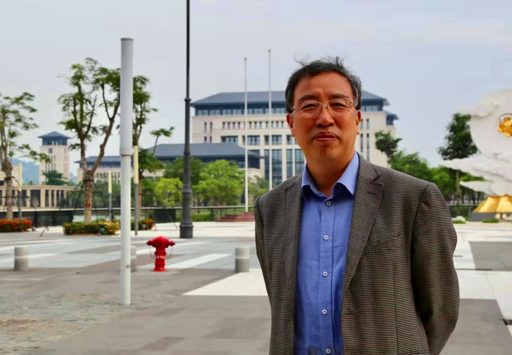 Yingjie Wang (王英杰)合作论文数Institute of Geographic Sciences and Natural Resources Research, Chinese Academy of Sciences4
 Jinyang Deng合作论文数Key Laboratory of Fiber Optic Sensing Technology and Information Processing(Ministry of Education, Wuhan University of Technology4Junhui QI (戚均慧)合作论文数3Dongfang Zhu合作论文数3Ding Yang合作论文数3ai ping zhang (张爱平)合作论文数3Yehong Sun合作论文数3
 Ting Xie (谢婷)合作论文数Oil Crops Research Institute, Chinese Academy of Agricultural Sciences3
 Qingwen Min (闵庆文)合作论文数Institute of Geographic Sciences and Natural Resources Research, Chinese Academy of Sciences3
 Marc Foggin合作论文数Qinghai Normal University, Qinghai Normal University3
 Yong Xu (徐勇)合作论文数Institute of Geographic Sciences and Natural Resources Research, Chinese Academy of Sciences3Lizhi Jia (贾立志)合作论文数College of Life and Environmental Sciences, Minzu University of China3Fengwei Ai (艾凤巍)合作论文数3
 Jia Li (李佳)合作论文数College of Business Administration, Capital University of Economics and Business3
 Brent Swallow合作论文数World Agroforestry Centre3




