Exposure to urban nature elements (e.g., water, greenery, and sky) has been well recognized as a key factor of public health for urban residents. Existing studies typically rely on top-down satellite imagery or street-view images to assess nature exposure in outdoor urban environments, though most urban residents allocate the majority of their everyday time indoors, especially in high-density cities. Large-scale assessment of indoor nature exposure remains limited, partly due to methodological constraints, hindering large-scale analyses of its association with human health. This study primarily assessed the relationship between indoor nature exposure and life expectancy in the urban area of Hong Kong using photorealistic three-dimensional (3D) models from Google Maps integrated with deep learning algorithms and territory-wide death registration records. To contextualize this association, indoor nature exposure was compared with conventional street-view and top-down exposure metrics in terms of spatial patterns and effect sizes. Our findings revealed that indoor nature exposure was significantly related to increased life expectancy; the life-expectancy benefits of indoor sky exposure were higher among residents with higher socioeconomic status. Notable spatial discrepancies among the three nature exposure metrics were observed, particularly in medium- to high-density areas with abundant nature resources, where top-down and street-view measures often exceeded the actual indoor nature exposure. Nevertheless, indoor nature exposure showed a larger effect size on life expectancy than street-view and top-down nature exposure measures. This study provides a novel quantification approach and new evidence to support the integration of indoor nature exposure into urban design, planning, and environmental health policy, especially in dense metropolitan regions.
An effective response to population ageing is crucial for ensuring global social sustainability. Improving the agefriendliness of neighbourhoods and maintaining the functional ability of older adults are key strategies in addressing the challenges posed by population ageing. However, the nonlinear effect of neighbourhood environments on the functional ability of older adults is largely unexplored. This study performed empirical analysis using multi-source geospatial data and questionnaire survey data from Guangzhou, China. Results of generalized additive mixed models revealed that the population density, branch road proportion, and street traffic volume exerted a positive influence on the older adults' functional ability, and when the values were outside the optimal range, the positive association became negative. In addition, the accessibility of facilities, street safety, visible sky features, and water areas exerted a positive impact on functional ability. Meanwhile, high-density urban environment characteristics, namely building density, road density, and the number of public transportation stops, exerted a negative impact. This study contributes to person-environment fit theory by revealing the optimal levels of environmental attributes for the functional ability among older adults, as well as by comprehensively examining impacts from two spatial scales - neighbourhood and streetscape environments - and by revealing the heterogeneous effects from income and age. Furthermore, it recommends evidence-based planning and targeted governance strategies for building age-friendly neighbourhoods in China and other high-density Asian cities.
Urban nature exposure is linked to better mental health and well-being and may support the equigenesis hypothesis that individuals from lower socioeconomic levels may gain more benefits from nature exposure. However, little is known about the effects of window-view distance, which refers to the visual distance from indoor spaces through building windows to surrounding natural or built elements, on mental health and well-being. This is partly due to technical limitations in quantifying window-view distance of buildings at a large scale. This study used photorealistic city information models (CIMs) and computer vision techniques to calculate window-view distance at a large scale in densely built urban environments. It then linked these measurements to the residential locations of participants, along with self-reported data on mental health and personal well-being. Our findings revealed that longer window-view distances were linked to improved mental health and personal well-being. Spatial inequalities were observed at the neighborhood level, with high-income areas typically clustering longer greenery, water, and building view distances, while low-income areas were associated with shorter, more constrained views. Individuals in the lowest income group (monthly household income ≤ 29,999 HKD) may experience greater mental health and personal well-being benefits from window-view greenery distances than individuals in the highest income group (monthly household income ≥ 90,000 HKD), providing partial evidence for the equigenesis hypothesis. The results underscore the necessity of adopting targeted urban planning and housing design strategies that prioritize equitable window-view distance to nature, extending health-oriented planning beyond outdoor provision to the everyday indoor environments where urban residents spend most of their time.
The impact of rail transit infrastructure on residents' travel satisfaction and subjective well-being has gained increasing attention among researchers and policymakers. However, few studies have used longitudinal data to analyze the causal effects of rail transit systems on travel satisfaction and its underlying mechanisms. This study employed a natural experiment approach, using two waves of survey data (2020 & 2021) from 422 participants in Wuhan, China, to assess the effects of a newly opened subway line on travel satisfaction. Applying a mixed-effects difference-in-differences (DID) method, we found that the new subway line significantly improved residents' travel satisfaction after accounting for socio-demographic and travel attitude covariates. Mediation analysis revealed that this improvement was primarily driven by increased perceived accessibility to downtown and transit stops or stations, as well as a reduction in the number of out-of-home activities on weekends. Heterogeneous analysis indicated that the subway's benefits are more pronounced among females, individuals under 60 years old, and those from middle-income households. These findings provide new causal evidence on the link between rail transit infrastructure and travel satisfaction, deepening our understanding of this complex relationship and offering practical insights for formulating strategies to improve urban residents' quality of life.
Urban expansion and renewal are two interacting pathways of urban growth, with their shifting dominance across urbanization stages profoundly reshaping urban land-use patterns and carbon emission dynamics. However, existing studies have largely overlooked the dynamic competition and co-evolution between these pathways during urbanization, leaving their implications for future land-use carbon emissions insufficiently explored. To address these gaps, this study proposes a vector cellular automata model considering the co-evolution of urban expansion and renewal (CUER-VCA) and integrates it with a parcel-level carbon accounting framework to simulate future land-use carbon emission dynamics under different pathway competition scenarios in Jiangyin City from 2018 to 2030.The results demonstrate that: (1) Compared with the null model, the CUER-VCA model improves simulation accuracy by 6% in the Figure of Merit (FoM) and more accurately reproduces the scales of outward expansion and internal renewal, as well as landscape patterns. (2) As urbanization progresses, structural shifts in the relative scales of urban expansion and renewal significantly influence carbon emission differences among scenarios, with industrial land consistently remaining the primary source of land-use carbon emissions in Jiangyin. (3) Under gradually declining industrial land carbon intensity, the dynamic pathway-competition scenario exhibits the greatest carbon emission-reduction potential among scenarios. Particularly during the later stages of urbanization, synergies between urban renewal and low-carbon transformation contribute to stabilizing land-use carbon emission trajectories and provide a viable pathway for Jiangyin to achieve its carbon target. These findings highlight the importance of incorporating the dynamic competition and co-evolution between urban expansion and renewal into low-carbon urban development.
Tree species play a crucial role in enhancing environmental sustainability, public health, and social equity beyond the quantity of urban trees. Previous studies have identified the luxury effect (socioeconomic status) and legacy effect (i.e., historical development) as two primary drivers of spatial inequality of street trees diversity. Nevertheless, there is a lack of research examining the driving factors of street tree diversity inequality in the cities in China, which follow a centralized top-down urban development strategy, distinct from that in many Western cities. This study examines which effect, i.e., the luxury effect (measured by housing price) or legacy effect (measured by building ages) can explain environmental inequality of urban street tree diversity in a typical northern city, Jinan China. Drawing on advanced computer vision technology and prevalent Street View Images, this study automatically examines not only the quantity but also the species and other individual features of street trees. The study area includes both the old town with dense, low-rise buildings and newly built urban districts characterized by high-rise developments. We utilized Pearson correlation analysis and Principal Component Analysis (PCA) to elucidate the link of tree abundance, diversity, and other metrics with housing price and building ages. Our findings indicate that housing price shows no significant association with tree metrics. Instead, building age and the interactive effect of building age and housing price are positive linked with both quantity and biodiversity of street trees. These results highlight the importance of legacy effect in shaping urban street trees, while the luxury effect on street tree diversity is heterogeneous across areas developed in different times. These results confirm our hypothesis regarding the unique influence of China's centralized greening policies on urban forest composition. Our findings contribute to the political ecology discourse on environmental inequality and urban greenery distribution both locally and globally.
Quantifying and assessing urban greenery is consequential for planning and development, reflecting the everlasting importance of green spaces for multiple climate and well-being dimensions of cities. Evaluation can be broadly grouped into objective (e.g., measuring the amount of greenery) and subjective (e.g., polling the perception of people) approaches, which may differ-what people see and feel about how green a place is might not match the measurements of the actual amount of vegetation. In this work, we advance the state of the art by measuring such differences and explaining them through human, geographic, and spatial dimensions. The experiments rely on contextual information extracted from street view imagery and a comprehensive urban visual perception survey collected from 1000 people across five countries with their extensive demographic and personality information. We analyze the discrepancies between objective measures (e.g., Green View Index (GVI)) and subjective scores (e.g., pairwise ratings), examining whether they can be explained by a variety of human and visual factors such as age group and spatial variation of greenery in the scene. The findings reveal that such discrepancies are comparable around the world and that demographics and personality do not play a significant role in perception. Further, while perceived and measured greenery correlate consistently across geographies (both where people and where imagery are from), where people live plays a significant role in explaining perceptual differences, with these two, as the top among seven, features that influences perceived greenery the most. This location influence suggests that cultural, environmental, and experiential factors substantially shape how individuals observe greenery in cities. We also found that the spatial arrangement of greenery in the sight, rather than its proximity to the person, influences perception. Our study provides a new understanding of the deep relationships between objective and subjective street-level greenery assessments, contributing to a more human-centric design of green urban environments.
Rapid urbanization and industrialization have resulted in significant environmental challenges in many cities worldwide, with pollution of particulate matter with a diameter of 2.5 mu m or smaller, notably PM2.5, being a major concern. Street trees, as an integral component of urban ecosystems, hold the potential to mitigate this issue through their capacity to absorb and disperse PM2.5. However, the current assessment of street trees' ability to remove PM2.5 is prohibitively costly for large-scale implementation. This study introduces and evaluates a novel computer vision methodology that automates street tree profiling using Street View Imagery, focusing on characteristics such as tree height, crown and trunk diameters, and species. We applied our approach to measure PM2.5 removal capacities of street trees in the urban area of Jinan, China. In total, 98,009 street trees were identified, with over 90% belonging to eight dominant species. By utilizing this detailed tree information and in conjunction with real meteorological data, we simulated the PM2.5 removal process by street trees, found that street trees can annually eliminate approximately 1.6 tons of PM2.5 in the 258.27 km2 study area with average 1.63 g per tree. The results underscore the profound capacity of street trees to alleviate the issue air pollution. This proposed research method is critical for informed urban planning and targeted environmental initiatives acorss global cities especially those in global south.
There is ongoing debate about whether residing in central urban areas reduce private vehicle use, given contrasting findings reported across various urban contexts. These inconsistencies are partly due to residential self-selection bias, which often distorts the observed association between built environment and travel behavior. Furthermore, the nonlinear relationship among residential location, travel attitude, and travel behavior is often overlooked. To address these gaps, we assess the actual effect of central-urban residence on private vehicle use while accounting for residential self-selection biases using travel survey data in 2020 from Wuhan, China. Furthermore, a double machine learning approach is employed to model nonlinear interactions among residential location, travel behavior, and travel attitudes. Results show that central-urban residence increases weekly driving distance by 4.5 km per household (p < 0.05), accounting for 32.4% of variation in vehicle use after adjusting for residential self-selection. This suggests that residing in central urban areas may increase private vehicle use in a high-density city in China. These findings underscore the need for targeted policies to promote sustainable transport in urban China.
Artificial light at night (ALAN) influences safety perceptions, public health, energy use, and biodiversity, yet its eye-level impacts remain difficult to quantify at city scale. Meanwhile, reducing outdoor lighting is especially contested because the widely held belief that "brighter is safer" sustains excessive ALAN even in low-crime cities such as Hong Kong. We assert that unveiling the threshold effect of brightness on perceived safety and human behavior is crucial for shifting the linear paradigm and informing acceptable lighting adjustments. However, auditing urban-scale nighttime perceived safety is challenging because nighttime street view imagery (SVI) is almost nonexistent. Most studies rely on limited nighttime samples, satellite radiance, or daytime SVI as proxies, ignoring the spatial heterogeneity of nightscapes and differences between day and night. Moreover, lighting intensity is often examined in silo; how it interacts with urban forms is underexplored. To address these gaps, we developed a multimodal diffusion model trained on 2600 paired day-night SVIs and conditioned on SDGSAT-1 radiance (40 m) and POI context to synthesize context-aware nighttime scenes from 58,500 daytime SVIs (50 m spacing) across Hong Kong. A validated vision-language model was used to score perceived nighttime safety from generated images, while semantic area, brightness, and depth (ABD) features were extracted to model their interactions. To characterize human behaviors, approximately 150,000 volunteered trajectories of physical activities were collected. The ABD interactions extracted from eye-level nightscapes alone explained 49.3% (36.5%) of the variation in day-night activity disparities (perceived nighttime safety), significantly outperforming satellite-based radiance. Near-field, line-of-sight lighting on facades, trees, and sidewalks is consistently associated with higher safety and stronger nighttime activity retention. Brightness shows diminishing gains beyond similar to 40-60 luma DN (similar to 19-40 lx as an interpretive reference from our DN-lux field cross-walk) on nighttime perception and physical activity across heterogeneous urban contexts, indicating significant potential for reduced light pollution in overlit areas. This study demonstrates the necessity and provides a scalable toolkit for auditing nighttime environments at eye level to support sustainable and healthy cities.
It is well established that nature exposure can improve both physical and mental health and wellbeing outcomes. However, in the context of rapid urbanization and high-density urban development, many urban residents face limited opportunities to visit natural environment, such as urban parks, greenways, and water bodies. In such situations, window view often serves as the primary means of people’s nature exposure. Traditional methods of assessing window-view nature exposure are time-consuming and labor-intensive, thus impractical for citywide evaluations. This study used a novel approach to quantify citywide assessment of window-view nature exposure, including the Window Greenery Index (WGI), Window Water Index (WWI), and Window Sky Index (WSI), using photorealistic 3D city models. We further analyzed the non-linear associations between window-view nature exposure with physical and mental health and wellbeing among 1,660 participants in Hong Kong for two periods: before and during the COVID-19 pandemic. For comparison, street-level nature exposure was also assessed. The result illustrates spatial mismatch between window-view and street-view nature exposure. Furthermore, window-view nature exposure had a greater influence than street-view nature exposure on physical and mental health and wellbeing. Furthermore, the effect of window-view nature exposure becomes more pronounced during the COVID-19 pandemic than before the pandemic. The results shed light on the link between window-view nature exposure and health and wellbeing outcomes, providing a new research front to understand the joint impacts of urban planning (i.e., provision of green space) and architectural design (i.e., location and orientation of windows) on public health.
Large language models (LLMs) can generate advisory text on modifying built environments to support health. This study examined the ethical properties of a recent LLM generating text on built environments to support health. The prompts covered six health-related pathways in higher-income, lower-income, and mixed-income neighbourhoods. Overall, 180 answers were coded against four ethical criteria. Non-maleficence was satisfied in all answers. Lower-income contexts were rarely offered weaker proposals than higher-income contexts. Reference to collective participation and transparent oversight appeared in 70-90% of answers without a budget constraint, but only 30-50% under one. The LLM more consistently met minimum expectations for harm avoidance and distributive justice than for collective participation and transparent oversight. These findings suggest that current LLM outputs may reproduce some baseline ethical conventions in urban design discourse but are less reliable on procedural concerns. LLM-generated outputs should therefore be interpreted cautiously within existing built environment decision-making processes.
Urban parks have long been regarded as vital public spaces for fostering social mixing. Yet existing evidence largely relies on small-scale case studies, constrained by challenges in measuring social mixing with a representative sample size. Using nationwide mobility data encompassing nearly 4 million visits to 74,991 parks across the contiguous United States, we quantify park-related social mixing using an income-based co-location indicator and examine its associations with park features (amenities and landscape elements) from both park and neighborhood perspectives. At the park level, parks with broader catchment areas show greater social mixing, and social mixing is positively associated with the provision levels of amenities and landscape elements for parks located in low-income and mixed income areas, but such association weakens or reverses for those in high income contexts. At the neighborhood level, residents from low-income neighborhoods experience higher levels of social mixing and greater park-residential differences when visiting amenity-equipped and landscape-rich parks, a pattern not evident among residents from high-income neighborhoods. These findings reveal that the role of parks in promoting social mixing opportunities depends on park features and the social context of park users. Park development with enhanced amenities in low-income neighborhoods may foster social mixing, but such benefits should be weighed against potential risks of green gentrification and displacement.
The COVID-19 pandemic has exacerbated pre-existing racial disparities in park usage. Although numerous studies have reported a widened racial inequity in park visitation during the pandemic, it remains unclear how this inequity has dynamically evolved in post-pandemic era. In this study, using nationwide location-based mobile data from SafeGraph's Monthly Patterns dataset and the linear mixed effects model, we analyzed fouryear longitudinal change (2018-2021) in park visitation behaviors among racially distinct neighborhoods and examined whether neighborhood greenness moderated these disparities in the United States. The results demonstrate that: (1) racial inequity in park visitation has continued to widen over the two-year pandemic period; (2) while park visitation across all groups has gradually returned to and even surpassed pre-pandemic levels, Black-majority groups consistently exhibited lower visit counts and fewer visited parks than Black-minority groups; and (3) neighborhood greenness significantly mitigates racial disparities in park visitation, with higher greenness levels associated with reduced inequity. These findings point out the potential impact of neighborhood greenness on alleviating racial inequity in park visits.
Rapid urbanization intensifies the urban heat island (UHI) effect and increases the frequency of extreme heat events, posing significant risks to urban environments and residents' well-being. While previous research has demonstrated that urban nature, particularly urban green spaces (UGS) and urban blue spaces (UBS), helps mitigate UHI, there is still a limited understanding of the spatiotemporal relationships between urban nature and land surface temperature (LST, an indicator of UHI) in cities with cloudy and foggy climates over many decades. This study leverages remote sensing data and applies the multiscale geographically weighted regression (MGWR) model to analyze the multiscale impacts of urban nature on LST in Chengdu, China, from 2000 to 2020. Our results show a consistent rise in LST levels over this period, alongside a reduction in UGS in both the city center and its surrounding areas. Additionally, urban nature consistently mitigates UHI at local scales over time. The mean coefficients of UGS were - 0.33, -0.28, -0.25, and -0.37 across four periods, while those of UBS were - 0.26, -0.30, -0.28, and - 0.21. These findings provide valuable insights into the multiscale role of urban nature in mitigating UHI, offering evidence to support policymakers in developing nature-based solutions to enhance thermal comfort.
The growing public desire for interaction with natural environments has highlighted the importance of equitable access to peri-urban parks (PUPs) across diverse income groups. However, previous studies largely overlook the role of public perceptions in assessing PUP quality and fail to address endogeneity issues, leading to biased explorations regarding environmental equality. This study introduced a novel comprehensive index that integrates sentiment responses and visual preferences to reflect public perceptions. Using Chengdu as a case study, we applied a multi-mode Huff-based two-step floating catchment area model to evaluate the accessibility of residential communities to PUPs, with housing prices serving as a proxy for urban residents' incomes. Additionally, a double machine learning approach was employed to estimate the treatment effect of housing prices on PUP accessibility, mitigating bias arising from endogeneity issues. The results reveal that (1) integrating social media text and image data comprehensively captures PUP quality. (2) Urban residents living outside the Outer Ring Road have better access to PUPs compared to those within the Outer Ring Road, with notable disparities in accessibility across the four cardinal directions. (3) A positive effect of housing prices on PUP accessibility is observed. Moreover, green gentrification occurs in certain regions, particularly in southern and eastern urban expansion zones, which often coincide with the focus points of urban development. These findings suggest that policymakers should enhance PUP equality by ensuring green spaces of affordable housing, allocating targeted funding for green space improvements in low-income areas, and enhancing transit access to underserved areas, thereby promoting a more equitable distribution of environmental benefits.
With the acceleration of urbanization, ensuring equitable access (or accessibility) to peri-urban parks for residents has become a key issue in landscape and urban planning. Traditional studies on peri-urban park accessibility often lack a comprehensive evaluation of the supply and demand for peri-urban parks and traffic conditions. Taking Chengdu as an example, this study develops an improved two-step floating catchment area method that integrates traffic conditions. It dynamically assesses accessibility to peri-urban parks at different times during weekends and spatial inequalities, as well as explores the relationship between these inequalities and traffic conditions. The results indicate that under a 60-minute time threshold, there is significant two-tier differentiation in accessibility to peri-urban parks in Chengdu, with significant differences between different time points. Particularly during periods of traffic congestion, the issue of accessibility inequality becomes more prominent. This phenomenon highlights a strong correlation between congestion levels on routes to parks and inequality in park accessibility. This study provides a novel perspective and methodology for dynamically evaluating and optimizing accessibility to peri-urban parks, providing empirical evidence for urban planners in the planning of peri-urban parks and the design of transportation systems. This study emphasizes the need for comprehensive and proactive measures in the planning process to alleviate the adverse effects of traffic congestion on accessibility to peri-urban parks.
Urban vibrancy research has largely focused on city-scale analysis, leaving urban agglomeration-level vibrancy underexplored. Using location-based service (LBS) data from the Pearl River Delta (PRD), China, this study quantified urban vibrancy through four indicators: density, variation intensity, day-night tide, and holiday-weekday tide. OLS and GWR models were employed to examine the relationships between built environment factors and urban vibrancy. The findings revealed distinct vibrancy patterns between core cities and fringe areas: core cities exhibited higher vibrancy density with lower temporal fluctuations than fringe areas. OLS results revealed that road density and distance to railway stations significantly influenced vibrancy density and variation intensity, while population density and GDP density were strongly linked to vibrancy density. Residential POI and NDVI significantly affected variation intensity. The GWR model highlighted spatial heterogeneity in how built environment factors impact vibrancy. This study provides insights into spatiotemporal vibrancy at the urban agglomeration scale, offering guidance for optimizing built environments to support balanced regional development.
Physical disorder in an urban area is characterized by visible damage, decay, and deterioration in its built environment, such as broken windows, graffiti, and litter. While its adverse effects on mental health, crime rates, and life satisfaction are well-documented, its impact on pedestrian volume-an essential indicator of urban vibrancy and livability-remains poorly discussed. Moreover, previous studies have predominantly relied on objective measures of physical disorder, overlooking subjective perceptions and potentially leading to biased interpretations. To address these crucial research gaps, we developed an online visual survey to evaluate the perceived physical disorder in Shanghai, China, across five dimensions: architectural disorder, commercial disorder, road disorder, greenery disorder, and infrastructure disorder. Then, we leveraged diverse machine learning algorithms to predict citywide spatial patterns of physical disorder based on both high-level street elements and low-level features. Finally, we examined the associations between urban physical disorder and pedestrian volumes, categorized by age and gender. Our findings reveal disparities in the influence of different types of subjective physical disorder on pedestrian volumes by demographic groups. Moreover, the subjective physical disorder provides a valuable supplement to existing built environment factors in explaining collective walking behavior. Notably, greenery disorder exhibits a significant negative association with walking behavior among female, adult, and elderly pedestrians, whereas infrastructure disorder predominantly impacts young pedestrians. Leveraging big data, this subjective measurement framework enables demographically sensitive evaluation systems of physical disorder as well as targeted interventions to reduce perceived physical disorder and improve walkability for different population groups.
 Linchuan Yang (杨林川)合作论文数Department of Urban and Rural Planning, School of Architecture, Southwest Jiaotong University33
 Ruoyu (George) Wang (王若宇)合作论文数Sun Yat Sen University;University of Essex24
 Ye Liu (刘晔)合作论文数School of Geography and Planning, Sun Yat-sen University19
 Long Chen合作论文数Dept Architecture & Civil Engn, City Univ Hong Kong15
 Xueying Wu合作论文数14
 Yiyang Yang (杨伊扬)合作论文数School of Architecture, Harbin Institute of Technology, Shenzhen14
 Bin Jiang (姜斌)合作论文数Division of Landscape Architecture, Faculty of Architecture, The University of Hong Kong12
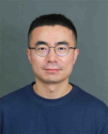 Zhonghua Gou (苟中华)合作论文数School of Urban Design, Wuhan University12
 Di Wei合作论文数11
 Dongwei Liu合作论文数11Jingjing Wang合作论文数10
 Yang Xiao (肖扬)合作论文数Department of Urban Planning, College of Architecture and Urban Planning, Tongji University10
 Yu Ye (叶宇)合作论文数College of Architecture and Urban Planning, Tongji University9
 George Grekousis合作论文数Department of Urban and Regional Planning, School of Geography and Planning, Sun Yat-sen University8
 Dongsheng He (何东升)合作论文数The Affiliated Hospital of Xuzhou Medical University8Jinglu Song (宋璟璐)合作论文数7
 Christopher Webster合作论文数Department of Land Economy, University of Cambridge7
 William C. Sullivan合作论文数The Environmental Council, University of Illinois7
 Penghua Liu合作论文数Tencent6
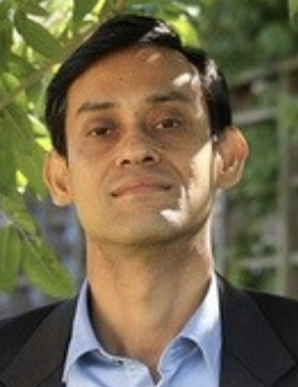 Chinmoy Sarkar合作论文数Department of Urban Planning and Design, Faculty of Architecture, The University of Hong Kong6
 Bo Xie (谢波)合作论文数School of Urban Design, Wuhan University6
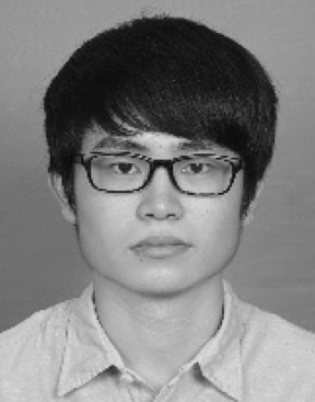 Jinbao Zhang (张金宝)合作论文数Guangdong Provincial Key Laboratory of Urbanization and Geosimulation, School of Geography and Planning, Sun Yat-sen University6
 Yuxiao Jiang合作论文数5
 Yuan Liang合作论文数School of Architecture, Southwest Jiaotong University5Xueming Liu合作论文数Faculty of Architecture, The University of Hong Kong5
 Chao Ren (任超)合作论文数Division of Landscape Architecture, Faculty of Architecture, The University of Hong Kong5
 Haoran Yang (杨浩然)合作论文数School of Geographic Sciences, East China Normal University5Yuxuan Zhou合作论文数4
 Yangwen Yu合作论文数4
 Wenyan Xu合作论文数4
 Kejia Hu (胡可嘉)合作论文数Department of Big Data in Health Science, School of Public Health, Zhejiang University4
 Hongtai Yang (杨鸿泰)合作论文数School of Transportation and Logistics, Southwest Jiaotong University4
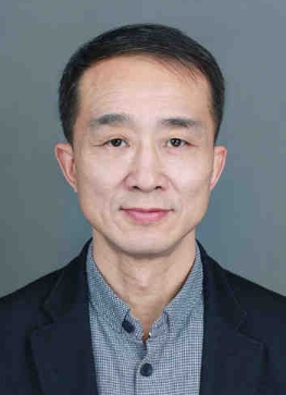 Jiandong Peng (彭建东)合作论文数School of Urban Design, Faculty of Engineering, Wuhan University4
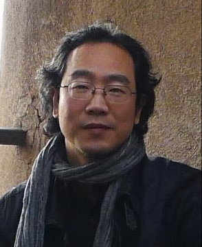 Yuan Wang (汪原)合作论文数School of Architecture and Urban Planning, Huazhong University of Science and Technology4Hong Yang合作论文数3
 Peng Zang合作论文数3
 Bingjie Yu合作论文数3
 Yuanyuan Guo合作论文数Dept Urban & Rural Planning, Tianjin Univ3
 Xiaohuan Xie (谢晓欢)合作论文数School of Architecture & Urban Planning, Shenzhen University3
 Derrick H. C. Ho合作论文数Department of Urban Planning and Design, Faculty of Architecture, The University of Hong Kong3
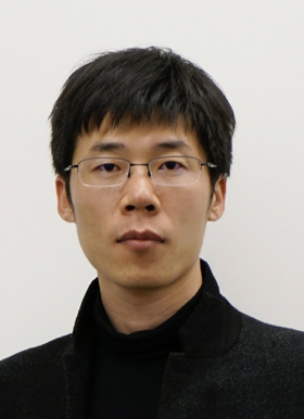 Guibo Sun (孫貴博)合作论文数Department of Urban Planning and Design, Faculty of Architecture, The University of Hong Kong3
 Christopher John Webster (偉仕達)合作论文数Department of Urban Planning and Design, Faculty of Architecture, The University of Hong Kong;Department of Land Economy, Cambridge University;University College London3
 Marco Helbich合作论文数Department of Human Geography and Spatial Planning, Utrecht University3
 Ying Zhou (周颖)合作论文数School of Architecture, Southeast University3
 Kai Zhang合作论文数Division of Epidemiology, Human Genetics and Environmental Sciences, University of Texas School of Public Health3
 Zhaowu Yu (余兆武)合作论文数Department of Environmental Science and Engineering, Fudan University3
 Rui Zhao (赵锐)合作论文数Faculty of Geosciences and Engineering, Southwest Jiaotong University3
 Erin M. Bell合作论文数Department of Epidemiology & Biostatistics, College of Integrated Health Sciences, University at Albany3
 Shao Lin合作论文数University at Albany, State University of New York3




