在交通强国战略视域下从爱国情怀和民族自豪感、辩证思维和创新精神、安全意识和环保理念、职业道德和奉献精神等多个维度深入挖掘海事管理专业"船载航行设备与系统"课程的思政元素,提出开展基于问题的导向式教学、基于案例的互动式教学、线上线下混合式教学以及注重过程的学习效果多元评价等课程思政实施举措,以提高课程思政的育人效果.
基于国家一流专业建设背景,结合行业发展趋势与需求以及专业特征等因素,分析海事管理专业的人才培养定位,针对该专业在国家一流专业建设过程中存在的面向海事系统人才出口量不足、专业类别归属不符、培养模式与课程体系设置不当、专业建设责任主体不明、学生专业认可度不高等诸多困境,提出海事管理国家一流专业建设的主要思路与具体措施.
为研究海港进出港航道的通过能力,探究航道服务水平,采用元胞自动机理论对海港进出港主航道进行离散化建模,对船舶在航道中的运动规则采用分段处理,重点考虑弯曲航段存在交通"警惕区",分别对顺直航段和弯曲航发的船舶运动规则进行条件约束,通过仿真实验得到航道的船舶流量和航道的最大船舶通过能力,计算出航道的饱和度并对航道服务水平进行评价.仿真实验结果验证了模型能够较为准确地反映航道船舶运行情况,并对目前和远期的航道服务水平进行了评价.
针对沿海船舶海上随意锚泊难以被识别和监管的情况,提出一种基于聚类算法船舶锚泊行为识别与锚泊聚集区挖掘方法.基于船舶锚泊行为特征构建船舶锚泊行为识别方法,结合DB-SCAN与K-medoide算法得到单船锚泊代表点,并进一步挖掘得到船舶锚泊聚集区.以闽江口水域为例进行验证,得到不同月份闽江口水域内的锚泊船识别结果和锚泊聚集区分布,挖掘出闽江口水域锚泊热点区域,并结合数据对主要聚集区时空变化进行分析,验证了提出方法和流程的可行性.
针对新文科背景下海事管理专业优化提升的迫切需求,对当前武汉理工大学海事管理专业在新文科建设中存在的主要问题进行深入剖析,从"应变、融合、创新、全人"四个层面提出海事管理专业新文科建设的主要思路和举措,具体包括新文科海事管理人才培养理念和目标、体现多学科深度交叉融合的智慧海事人才培养知识体系、面向未来发展适应力的智慧海事人才培养路径以及智慧海事人才培养课程思政建设等,以培养面向未来海事发展、满足国家和行业需要的高层次、高素质海事管理人才.
为避免城市光污染对航标发挥夜间指示航道和引导船舶航行作用的影响,通过分析光污染水域航标的实际需求,采用嵌入式控制和无线通信技术,设计并实现一种面向光污染的智能航标增强系统.智能航标增强系统分为系统终端和云管理平台2部分,可根据航标所在水域的光污染情况,分级调节和控制系统的增强照明灯光强度,以增强通航水域航标的显色显形能力.结果表明:智能航标增强系统的应用,能有效提高船舶驾驶员对航标的视觉识别能力和船舶在光污染影响水域的航行安全;航标管理部门亦能通过智能航标增强系统提高航标监管能力.
针对面向无人船的航海技术专业升级转型的需求,以国内某本科航海类高校为例,分析船舶导航类课程的教学现状,对新工科背景下船舶导航类课程"金课"建设的方法和内容进行探析,提出从教学内容、教学模式、内涵提升、创新训练实验平台等方面进行改革和建设.
为切实提升在校航海类本科生的专业英语水平,对学生基础英语课程成绩与航海专业英语课程成绩进行相关性分析,结合问卷调查,分析基础英语教学对专业英语的支撑性作用,利用定量的评价标准优化教学课时分配以期优化教学结构.研究表明,大学英语与专业英语学习存在相关性,航海类专业英语学习起始时间可以提前,有利于积累英语的课余学习时间,同时可以适当考虑将专业课程改为"双语教学"模式,以帮助学生适应未来国际化的工作环境.
根据不同情况下单锚泊船舶运动规律,提出相应的基于AIS信息的单锚泊船舶走锚监控预警方法.对于风、流较小时的船舶走锚监控,首先,采用一种基于相似度曲线且其Eps邻域阈值可调的改进密度空间聚类算法(DB-SCAN),对原始锚泊船舶位置信息进行去噪处理;然后,对去噪后的数据进行圆曲线拟合,求出轨迹圆心并视为锚位点;最后,将其位置变化以及船速变化一并作为走锚的判定依据来判断船舶是否走锚并报警.对于风、流较大时的锚泊船走锚监控,则先确定锚泊船"∞"型运动的两个极限点的位置;然后,基于该两个极限点位置求出锚位点;最后,根据船位距锚位点的距离变化及船速变化进行走锚分析和判断.实例和模拟分析证明了所提方法的有效性.
针对船舶交通流时间序列的非线性和非平稳性特点,设计一种结合集合经验模态分解(ensemble empirical mode decomposition,EEMD)和差分进化算法优化BP神经网络(back propagation neural network optimized with differ-ential evolution algorithm,DEBPNN)的船舶交通流组合预测模型(EEMD-DEBPNN).首先,利用EEMD算法降低船舶交通流时间序列的非平稳性;然后,对EEMD分解后获得的各非线性分量采用DEBPNN模型(先采用DE算法对BPNN的初始权值和阈值进行预寻优,再利用预寻优获得的初始权值和阈值训练BP神经网络得到最优的权值和阈值)进行预测;最后,再将各分量预测值进行叠加即得到最终预测结果.基于长江某港口航道船舶月交通流数据,将该组合模型与BPNN、DEBPNN模型进行实例对比分析.结果表明,EEMD-DEBPNN较DEBPNN、BPNN模型的预测精度更高.
To improve the predictive accuracy of vessel traffic flow and provide more reasonable deci-sion-making basis for maritime management ,port planning and development ,the combination forecast model (EEMD-GNN) for vessel traffic flow is estimated based on Grey Neural Network (GNN) model and Ensemble Empirical Mode Decomposition (EEMD) method .With Matlab software ,the example analysis is conducted based on the statistical data of the monthly flow of vessel traffic in Jingzhou Yan-gtze river highway bridge during January 2007-December 2015 .Firstly ,in order to reduce the non-stationary of vessel traffic flow time series ,the sample data is decomposed by the EEMD method and a set of decomposed components are obtained to predict the results by GNN model .Afterwards ,the predictive results of all components are added together to form the final results:the EEMD-GNN model .Finally ,the prediction results of EEMD-GNN model are compared with those of the tradition-al GNN model .The results show that the EEMD-GNN model has higher prediction accuracy com-pared with traditional GNN model ,which reflects the future trend of monthly vessel traffic flow more accurately .
To improve the predictive accuracy of vessel traffic flow and provide more reasonable decision-making basis for port planning and development, Seasonal Autoregressive Integrated Moving Average (SARIMA) model is put forward to predict the monthly traffic flow of vessel.Based on the software Eviewsis, empirical analysis is carried out for the vessel traffic flow monthly statistical data of Jingzhou port during January 2007-December 2015.Firstly, the sample data from the vessel traffic flow monthly statistics of Jingzhou port is executed stationary pre-process, in order to eliminate the trend component and seasonal factors of the statistical data.Afterwards, the SARIMA model based on the data through stationary pre-treatment is set up.Then the model parameters are test and the optimal model SARIMA(2,0,0) (1,1,1)12 is validated.Finally, the prediction of the vessel traffic flow during January 2008-March 2016 of Jingzhou port is made, and the prediction results are compared with the those using AR (1) model and seasonal exponential model.The comparison results show that the SARIMA prediction accuracy is higher, and can reflect the monthly change characteristics of vessel traffic flow more accurately.
结合武汉理工大学海事管理特色专业人才培养现状,针对“港口与航道工程”课程建设中面临的问题,从教材、课程结构体系、实验教学和教学模式四个方面展开分析,提出提升“港口与航道工程”课程教学质量的措施:建设具有海事管理专业特色的教材;针对课程特点,优化调整教学大纲和教学内容;基于学生参与科研项目构建多模式实践教学环境;将科研项目成果作为案例,在理论教学中加大案例教学等。
为更客观地确定船舶在港口水域中航迹带尺度,提出了一种利用AIS数据计算船舶航迹带尺度的方法.该方法采用实船观测到的AIS数据,运用最小二乘法原理及船舶航迹带理论模型,拟合得到直线与转弯船舶航迹段的方程,计算出航迹带主要尺度(航迹带宽度和转弯半径),并推算出船舶的漂移系数n的取值范围.将计算结果与现行的《海港总体设计规范规范》进行对比分析.结果表明,该计算方法是可行的.
In multi-radar network of VTS,to improve the reliability and quality of target tracking through multiple radar data fusion,it is necessary to register system errors of the radars.Since Square-root Unscented Kalman Filter(SRUKF),a modified filtering algorithm based on Unscented Kalman Filter(UKF),has higher estimation precision and better filtering stability Compared with UKF,it is introduced for error registration of VTS radar networks.Matlab simulation results validated the algorithm.
Aiming at solving the problem that the accuracy and stability will be affected if there are outliers in the observation values, this paper proposes an improved Unscented Kalman Filter(UKF) restraining outliers based on orthogonality of innovation in the filtering processing. This modified filter at first detects whether there are outliers in the observation values by judging whether the orthogonality of innovation is lost or not, and then assigns an activation function as the weight to each observation value, which can keep the orthogonal properties of the innovation sequence and the outliers can be detected and corrected. The Matlab simulation results about the GPS/DR integrated navigation system show that this modified filter is effectively resistant to outliers in the observation values and improves the filtering accuracy and stability.
Aiming at solving the problem that the accuracy and stability of Square-root Unscented Kalman Filter(SRUKF) will be affected if there are outliers in the observation values, this paper proposes an improved SRUKF restraining outliers based on orthogonality of innovation in the filtering processing. This modified filter at first detects whether there are outliers in the observation values by judging if the orthogonality of innovation is lost or not, and then assigns an activation function as the weight to each observation value, which can keep the orthogonal properties of the innovation sequence and the outliers can be detected and corrected. The Matlab simulation results about the GPS/DR integrated navigation system show that this modified filter is effectively resistant to outliers in the observation values and improves the filtering accuracy and stability.
In Vessel Traffic Services (VTS), multi-radar network cannot only expand service area of VTS, but also improves the reliability and quality of target tracking through data fusion from multiple radars. However, without registering system error of radar before beginning multi-radar data fusion in VTS, the quality of target tracking would not be credible. Currently, Extended Kalman Filter (EKF) is often used to solve error registration of radar system by online bias estimation, but because linearization error will reduce the accuracy of the model of EKF, its estimation accuracy will become worse with time. Unscented Kalman filter (UKF) is a filtering algorithm based on unscented transform, which directly uses the nonlinear model to avoid the linearization error and derivative calculation of Jacobian matrix. Compared with the EKF, UKF is much easier to be implemented and its estimation accuracy and convergence speed have been improved. Therefore, UKF is proposed to finish error registration of radar network system in VTS and the simulation results have verified the feasibility and effectiveness.
Currently, the general methods of measuring the distance between ship and waterway's boundary are using the navigator's eyes or radar to estimate, which cause easily traffic accidents because of judging mistake. So, automatic measurement of the distance between ship and waterway's boundary is very important. It first deduced the formula about calculating the distance between the ship and waterway's boundary. Then, one method based on electronic waterway map and another method based on intelligent navigation marks of automatically measuring the distance between ship and inland waterway's boundary were proposed, which were to help ships to choose the shipping routes reasonably and avoid the traffic accidents. Last, by analyzing and comparing the two methods, it concluded that the method based on electronic waterway map was more feasible and effective.
The UKF (Unscented Kalman Filter)is a new nonlinear filtering method. Compared with the EKF,the UKF has the characteristics of realization and higher state estimation accuracy. In this paper,the UKF is applied to the land vehicle GPS/INS integrated navigation system and the simulation results show that the UKF is superior to the EKF.
 Mingjun Liu (刘明俊)合作论文数School of Navigation, Wuhan University of Technology6
 Langxiong Gan (甘浪雄)合作论文数School of Navigation, Wuhan University of Technology4LIU Zongyang (刘宗杨)合作论文数3ZHAO Junnan (赵俊男)合作论文数3Xiaolei LI (李晓磊)合作论文数3
 Chunhui Zhou (周春辉)合作论文数School of Navigation, Wuhan University of Technology3
 Yanmin Xu (徐言民)合作论文数School of Navigation, Wuhan University of Technology3
 Kezhong Liu (刘克中)合作论文数School of Navigation, Wuhan University of Technology;School of Information Engineering, Wuhan University of Technology3Zhengfeng PAN (潘正风)合作论文数2
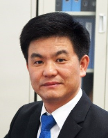 Jingxian Liu (刘敬贤)合作论文数School of Navigation, Wuhan University of Technology2Fangliang Xiao (肖方亮)合作论文数School of Navigation, Wuhan University of Technology2Yefeng Sun (孙业峰)合作论文数1TAN Linxu (谭林旭)合作论文数1zheng wang (王铮)合作论文数1Ke-wei HU (胡克伟)合作论文数1Tao CHENG (程涛)合作论文数1Li Xu (徐立)合作论文数1JunMin Mou (牟军敏)合作论文数1
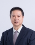 Jianhua Wu (吴建华)合作论文数School of Navigation, Wuhan University of Technology1
 Yuan Li (李媛)合作论文数School of Chemistry, Chemical Engineering and Life Sciences, Wuhan University of Technology1
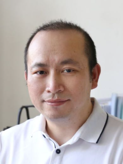 Yong Ma (马勇)合作论文数School of Navigation, Wuhan University of Technology1
 Chunming Zou (邹春明)合作论文数School of Navigation, Wuhan University of Technology1Yaofang Fu (付耀方)合作论文数School of Navigation, Wuhan University of Technology1Liu, Mingjiun合作论文数1Cui Zhou (周翠)合作论文数1
 Song Li (李松)合作论文数Electronic Information School, Wuhan University1
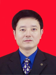 Shengxiang Huang (黄声享)合作论文数School of Geodesy and Geomatics, Wuhan University1




