This paper reports on an integrated inference and decision-making approach for autonomous driving that models vehicle behavior for both our vehicle and nearby vehicles as a discrete set of closed-loop policies. Each policy captures a distinct high-level behavior and intention, such as driving along a lane or turning at an intersection. We first employ Bayesian changepoint detection on the observed history of nearby cars to estimate the distribution over potential policies that each nearby car might be executing. We then sample policy assignments from these distributions to obtain high-likelihood actions for each participating vehicle, and perform closed-loop forward simulation to predict the outcome for each sampled policy assignment. After evaluating these predicted outcomes, we execute the policy with the maximum expected reward value. We validate behavioral prediction and decision-making using simulated and real-world experiments.
A system comprises a computer which is programmed by a first vehicle, a second or more vehicles within a specified distance from the first vehicle to identify. The computer is further programmed to receive data on operations of each of the second vehicles, including travel route data. The computer is programmed to identify a distribution of probabilities for each of a set of possible planned routes on the basis of the data for each of the second vehicles. The computer is further programmed to determine a planned route for the first vehicle on the basis of the respective distributions of probabilities of each of the set of possible planned routes for each of the second vehicles. The computer is further programmed to provide at least one control device in relation to the first vehicle on the basis of the determined planned route a command.
This paper reports on an underwater cooperative localization algorithm for faulty low-bandwidth communication channels based on a factor graph estimation framework. Vehicles measure the one-way-travel-time (OWTT) of acoustic broadcasts to obtain a relative range observation to the transmitting vehicle. We present a method to robustly share locally observed sensor data across the network by exploiting odometry factor composition. Our algorithm calls on approximate marginalization techniques to compute a compact set of informative factors that enable local navigation data to be shared efficiently. We provide results from a real-time implementation of our algorithm using two autonomous underwater vehicles and a surface vehicle.
We present an integrated behavioral inference and decision-making approach that models vehicle behavior for both our vehicle and nearby vehicles as a discrete set of closed-loop policies that react to the actions of other agents. Each policy captures a distinct high-level behavior and intention, such as driving along a lane or turning left or right at an intersection. We first employ Bayesian changepoint detection on the history of observed states of nearby cars to estimate the distribution over policy assignments for each car. We then sample from these distributions to obtain high-likelihood actions for each participating vehicle. Through closed-loop forward simulation of these samples, we evaluate the outcomes of the interaction of our vehicle with other participants. Our vehicle executes the policy that maximizes the expected reward over these samples. Thus, our system makes decisions incorporating the coupled interactions between cars in a tractable, online manner. We evaluate our approach using real-world traffic tracking data collected on our autonomous vehicle platform, and present decision-making results in simulation.
Real-world autonomous driving in city traffic must cope with dynamic environments including other agents with uncertain intentions. This poses a challenging decision-making problem, e.g., deciding when to perform a passing maneuver or how to safely merge into traffic. Previous work in the literature has typically approached the problem using ad-hoc solutions that do not consider the possible future states of other agents, and thus have difficulty scaling to complex traffic scenarios where the actions of participating agents are tightly conditioned on one another. In this paper we present multipolicy decision-making (MPDM), a decision-making algorithm that exploits knowledge from the autonomous driving domain to make decisions online for an autonomous vehicle navigating in traffic. By assuming the controlled vehicle and other traffic participants execute a policy from a set of plausible closed-loop policies at every timestep, the algorithm selects the best available policy for the controlled vehicle to execute. We perform policy election using forward simulation of both the controlled vehicle and other agents, efficiently sampling from the high-likelihood outcomes of their interactions. We then score the resulting outcomes using a user-defined cost function to accommodate different driving preferences, and select the policy with the highest score. We demonstrate the algorithm on a real-world autonomous vehicle performing passing maneuvers and in a simulated merging scenario.
This paper reports on a system for dynamic obstacle tracking for autonomous vehicles. In this work, we seek to simultaneously estimate both the trajectory of the obstacle and the obstacle's shape. These two tasks are inherently coupled-given only noisy partial views, one cannot accurately estimate the trajectory of an obstacle if its shape is unknown, nor can one estimate its shape without knowing its trajectory. To address this challenge, we note that simultaneous localization and mapping (SLAM), where a robot must build a map of the environment while localizing itself within the map, presents similar challenges. By treating the obstacle's shape as a “map” in the obstacle's moving reference frame, we can formulate the obstacle tracking and shape estimation similarly to SLAM. Additionally, we use a continuous time estimation framework to incorporate sensor data that is collected at a fast rate (e.g., light detection and ranging (LIDAR)). Using these methods, we are able to obtain smooth trajectories and crisp point clouds for tracked obstacles. We test our proposed tracker on real-world data collected by our autonomous vehicle platform and demonstrate that it produces improved results when compared to a standard centroid-based extended Kalman filter (EKF) tracker.
This paper presents an consistent decentralized data fusion approach for robust multi-robot SLAM in dangerous, unknown environments. The DDF-SAM 2.0 approach extends our previous work by combining local and neighborhood information in a single, consistent augmented local map, without the overly conservative approach to avoiding information double-counting in the previous DDF-SAM algorithm. We introduce the anti-factor as a means to subtract information in graphical SLAM systems, and illustrate its use to both replace information in an incremental solver and to cancel out neighborhood information from shared summarized maps. This paper presents and compares three summarization techniques, with two exact approaches and an approximation. We evaluated the proposed system in a synthetic example and show the augmented local system and the associated summarization technique do not double-count information, while keeping performance tractable.
This report presents our recent and ongoing work developing a consistent decentralized data fusion approach for robust multi-robot SLAM in dangerous, unknown environments. The DDF-SAM 2.0 approach extends our previous work by combining local and neighborhood information in a single, consistent augmented local map, without the overly conservative to avoiding information double-counting in the previous DDF-SAM approach. We introduce the anti-factor as a means to subtract information in graphical SLAM systems, and illustrate its use to both replace information in an incremental solver and to cancel out neighborhood information from shared summarized maps. Evaluations in a synthetic example environment demonstrate that we avoid double-counting information.
In this paper we present an algorithm for constructing nearly drift-free 3D occupancy grids of large indoor environments in an online manner. Our approach combines data from an odometry sensor with output from a visual registration algorithm, and it enforces a Manhattan world constraint by utilizing factor graphs to produce an accurate online estimate of the trajectory of a mobile robotic platform. We also examine the advantages and limitations of the octree data structure representation of a 3D environment. Through several experiments in environments with varying sizes and construction we show that our method reduces rotational and translational drift significantly without performing any loop closing techniques.
This paper presents an analysis of large scale decentralized SLAM under a variety of experimental conditions to illustrate design trade-offs relevant to multi-robot mapping in challenging environments. As a part of work through the MAST CTA, the focus of these robot teams is on the use of small-scale robots with limited sensing, communication and computational resources. To evaluate mapping algorithms with large numbers (50+) of robots, we developed a simulation incorporating sensing of unlabeled landmarks, line-of-sight blocking obstacles, and communication modeling. Scenarios are randomly generated with variable models for sensing, communication, and robot behavior. The underlying Decentralized Data Fusion (DDF) algorithm in these experiments enables robots to construct a map of their surroundings by fusing local sensor measurements with condensed map information from neighboring robots. Each robot maintains a cache of previously collected condensed maps from neighboring robots, and actively distributes these maps throughout the network to ensure resilience to communication and node failures. We bound the size of the robot neighborhoods to control the growth of the size of neighborhood maps. We present the results of experiments conducted in these simulated scenarios under varying measurement models and conditions while measuring mapping performance. We discuss the trade-offs between mapping performance and scenario design, including robot teams separating and joining, multi-robot data association, exploration bounding, and neighborhood sizes.
In this paper we focus on the multi-robot perception problem, and present an experimentally validated end-to-end multi-robot mapping framework, enabling individual robots in a team to see beyond their individual sensor horizons. The inference part of our system is the DDF-SAM algorithm [1], which provides a decentralized communication and inference scheme, but did not address the crucial issue of data association. One key contribution is a novel, RANSAC-based, approach for performing the between-robot data associations and initialization of relative frames of reference. We demonstrate this system with both data collected from real robot experiments, as well as in a large scale simulated experiment demonstrating the scalability of the proposed approach.
This paper describes the results of a Joint Experiment performed on behalf of the MAST CTA. The system developed for the Joint Experiment makes use of three robots which work together to explore and map an unknown environment. Each of the robots used in this experiment is equipped with a laser scanner for measuring walls and a camera for locating doorways. Information from both of these types of structures is concurrently incorporated into each robot's local map using a graph based SLAM technique. A Distributed-Data-Fusion algorithm is used to efficiently combine local maps from each robot into a shared global map. Each robot computes a compressed local feature map and transmits it to neighboring robots, which allows each robot to merge its map with the maps of its neighbors. Each robot caches the compressed maps from its neighbors, allowing it to maintain a coherent map with a common frame of reference. The robots utilize an exploration strategy to efficiently cover the unknown environment which allows collaboration on an unreliable communications channel. As each new branching point is discovered by a robot, it broadcasts the information about where this point is along with the robot's path from a known landmark to the other robots. When the next robot reaches a dead-end, new branching points are allocated by auction. In the event of communication interruption, the robot which observed the branching point will eventually explore it; therefore, the exploration is complete in the face of communication failure.
We present a novel paradigm for massively distributed, large-scale multi-robot mapping. Our goal is to explore techniques that can support continuous mapping over an indefinite amount of time. We argue that to scale to city or even global scales the concept of a single globally consistent map has to be abandoned, and present an infrastructure-supported solution where most of the inference and map-maintenance is done on local “map-servers”, rather than on the robot itself. The main technical contribution in the paper is a factor-graphbased scheme for making this possible, and a novel local map representation, local exponential maps, that enable indefinite map updates while remaining self-consistent over time. We present initial experimental results both in simulation and using real data, although a full-scale deployment and evaluation of the technique is left for future work.
This paper will explore the relationship between sensory accuracy and Simultaneous Localization and Mapping (SLAM) performance. As inexpensive robots are developed with commodity components, the relationship between performance level and accuracy will need to be determined. Experiments are presented in this paper which compare various aspects of sensor performance such as maximum range, noise, angular precision, and viewable angle. In addition, mapping results from three popular laser scanners (Hokuyo’s URG and UTM30, as well as SICK’s LMS291) are compared.
We address the problem of multi-robot distributed SLAM with an extended Smoothing and Mapping (SAM) approach to implement Decentralized Data Fusion (DDF). We present DDF-SAM, a novel method for efficiently and robustly distributing map information across a team of robots, to achieve scalability in computational cost and in communication bandwidth and robustness to node failure and to changes in network topology. DDF-SAM consists of three modules: (1) a local optimization module to execute single-robot SAM and condense the local graph; (2) a communication module to collect and propagate condensed local graphs to other robots, and (3) a neighborhood graph optimizer module to combine local graphs into maps describing the neighborhood of a robot. We demonstrate scalability and robustness through a simulated example, in which inference is consistently faster than a comparable naive approach.
Measurements of dry and lubricated sliding for a wide range of elastomers (natural and synthetic) have been carried out using a specially modified British Pendulum Skid Tester. This instrument incorporates an optical position sensor, a high-precision electronic timer, and a computer interface. It monitors the swing of a pendulum at angular intervals of 0.14° as it drives an elastomer slider across a horizontal surface at speeds of up to 3 m s−1. Profiles of kinetic energy loss can be measured with 1.4 mm spatial resolution and path-averaged forces of sliding friction derived with a precision of better than 1%. Adhesive terms, largely associated with the transfer of elastomer films from slider to substrate, are responsible for between 78% and 98% of the kinetic energy lost to sliding friction on smooth surfaces. For some elastomers, oscillations in the friction force appear above a critical sliding velocity. These oscillations can be simulated numerically by a model of stick–slip friction in which the adhesive bond between elastomer and substrate interacts with the elastic properties of the bulk material.
This paper describes a structurally modified British Pendulum Skid Tester fitted with an optical encoder (2500 pulses per revolution), pulse timing electronics ( resolution) and a computer interface (IBM compatible PIO card). A spring-loaded rectangular slider attached to the foot of the pendulum is driven across a horizontal surface at speeds of up to . By measuring changes in the angular velocity of the pendulum, it is possible to calculate the loss of energy due to friction with 1 mm linear resolution. Values for the path-averaged coefficient of friction for thermoplastic and elastomer sliders can be determined with a precision of around 1%, enabling highly reproducible studies of the influence of slider wear and surface condition on friction losses to be carried out. Energy loss profiles measured during the passage of the slider over the surface can reveal variations in surface roughness as well as details of the slider/substrate interaction. Force profiles for natural rubber sliders travelling over smooth surfaces at speeds in excess of show well-defined stick-slip oscillations in the force of sliding friction.
Individual algal cells and colonies were entrained in a fluid stream and passed through a tightly focused (200 × 10 μm) laser beam to generate chlorophyll-fluorescence pulses. Simple pulse-shape parameters (duration, height and integral) were extracted by analogue circuitry and the relationship between these parameters analysed digitaly. Pulse shape analysed in this way provided low-resolution morphological information at a throughput rate up to 1000 cells·s −1 : such information is particularly useful in the flow analysis of larger algal cells and colonial species. Successful implementation of the technique required that the flow regime oriented the cells uniformly and stably in the laser-beam waist and it worked best with a wide-bore (300 μm) hydrodynamic focusing nozzle which resisted clogging and avoided disrupting colonies by shearing. As a demonstration of feasibility, the technique was used to measure the length distribution of filaments of the cyanobacterium Anabaena solitaria and to discriminate between these filaments and globular colonies of the green alga Eudorina unicocca . Since a low power (100 mW) Ar laser was found to provide adequate illumination, the method can be implemented using low-cost cytometric equipment.
 Frank Dellaert合作论文数GVU Center, College of Computing, Georgia Institute of Technology;School of Interactive Computing, College of Computing, Georgia Institute of Technology;Verdant Robotics8
 Ryan M. Eustice合作论文数Department of Mechanical Engineering, University of Michigan;Department of Electrical Engineering & Computer Science, University of Michigan;Toyota Research Institute7
 Enric Galceran合作论文数university of michigan5
 Edwin Olson合作论文数Electrical Engineering and Computer Science Department, University of Michigan;May Mobility, Inc.4
 Nathan Michael合作论文数Shield AI2
 Henrik I Christensen合作论文数Department of Computer Science and Engineering, University of California, San Diego;Robust.AI2
 Manohar Paluri合作论文数Meta2
 K.R Andrew合作论文数2
 Jeffrey M. Walls合作论文数Toyota Research Institute Los Altos2
 Vadim Indelman合作论文数Department of Aerospace Engineering, Technion - Israel Institute of Technology;Autonomous Navigation and Perception Lab, Technion - Israel Institute of Technology2
 Vijay Kumar合作论文数Department of Mechanical Engineering and Applied Mechanics, School of Engineering and Applied Science, University of Pennsylvania;General Robotics, Automation, Sensing and Perception Lab, University of Pennsylvania;Exyn Technologies1
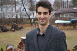 Ushani Arash合作论文数university of michigan1
 James R. Mcbride合作论文数1
 Alireza Fathi合作论文数Google DeepMind1
 Kai Ni合作论文数HoloMatic1
 Wolfram Burgard合作论文数Department of Computer Science & Artificial Intelligence, University of Technology Nuremberg1Brian Peasley合作论文数1
 Stan Birchfield合作论文数NVIDIA1
 Kai M. Wurm合作论文数Siemens AG1
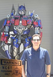 Carlos Nieto-Granda合作论文数ITESM-CEM) Mechatronics Research Center (CIMe) Atizapan, Tecnológico de Monterrey - Campus Estado de México (1
 Nicholas Carlevaris-Bianco合作论文数Dept Elect Engn & Comp Sci, Univ Michigan1Alexander J. B. Trevor合作论文数College of Computing, Georgia Institute of Technology1
 John Rogers合作论文数Army Research Laboratory1
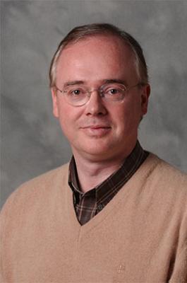 Juan D. Rogers (Juan Rogers)合作论文数School of Public Policy, Ivan Allen College of Liberal Arts, Georgia Institute of Technology1
 Larry Matthies合作论文数Jet Propulsion Laboratory, California Institute of Technology1




