This paper introduces a robust unsupervised SE(3) point cloud registration method that operates without requiring point correspondences. The method frames point clouds as functions in a reproducing kernel Hilbert space (RKHS), leveraging SE(3)-equivariant features for direct feature space registration. A novel RKHS distance metric is proposed, offering reliable performance amidst noise, outliers, and asymmetrical data. An unsupervised training approach is introduced to effectively handle limited ground truth data, facilitating adaptation to real datasets. The proposed method outperforms classical and supervised methods in terms of registration accuracy on both synthetic (ModelNet40) and real-world (ETH3D) noisy, outlier-rich datasets. To our best knowledge, this marks the first instance of successful real RGB-D odometry data registration using an equivariant method. The code is available at https://sites.google.com/view/eccv24-equivalign.
This work reports a novel multi-frame Bundle Adjustment (BA) framework called RKHS-BA. It uses continuous landmark representations that encode RGB-D/LiDAR and semantic observations in a Reproducing Kernel Hilbert Space (RKHS). With a correspondence-free pose graph formulation, the proposed system constructs a loss function that achieves more generalized convergence than classical point-wise convergence. We demonstrate its applications in multi-view point cloud registration, sliding-window odometry, and global LiDAR mapping on simulated and real data. It shows highly robust pose estimations in extremely noisy scenes and exhibits strong generalization with various types of semantic inputs. The open source implementation is released in https://github.com/UMich-CURLY/RKHS_BA.
The accuracy of RGB-D SLAM systems is sensitive to the image quality, and can be significantly compromised in adverse situations such as when input images are blurry, lacking in texture features, or overexposed. In this paper, based on Continuous Direct Sparse Visual Odometry (CVO), we present a novel Keyframe-based CVO (KF-CVO) with intrinsic keyframe selection mechanism that effectively reduces the tracking error. We then extend KF-CVO to a RGB-D SLAM system, CVO SLAM, equipped with place recognition via ORB features, and joint bundle adjustment & pose graph optimization. Comprehensive evaluations on publicly available benchmarks show that the proposed RGB-D SLAM system achieves a higher success rate than current state-of-the-art-methods. The proposed system is more robust to difficult benchmark sequences than current state-of-the-art methods, where adverse situations such as rapid camera motions, environments lacking in texture, and overexposed images when strong illumination exists.
In this article, we present a novel and flexible multitask multilayer Bayesian mapping framework with readily extendable attribute layers. The proposed framework goes beyond modern metric-semantic maps to provide even richer environmental information for robots in a single mapping formalism while exploiting intralayer and interlayer correlations. It removes the need for a robot to access and process information from many separate maps when performing a complex task, advancing the way robots interact with their environments. To this end, we design a multitask deep neural network with attention mechanisms as our front-end to provide heterogeneous observations for multiple map layers simultaneously. Our back-end runs a scalable closed-form Bayesian inference with only logarithmic time complexity. We apply the framework to build a dense robotic map, including metric-semantic occupancy and traversability layers. Traversability ground truth labels are automatically generated from exteroceptive sensory data in a self-supervised manner. We present extensive experimental results on publicly available datasets and data collected by a three-dimensional bipedal robot platform and show reliable mapping performance in different environments. Finally, we also discuss how the current framework can be extended to incorporate more information, such as friction, signal strength, temperature, and physical quantity concentration using Gaussian map layers. The software for reproducing the presented results or running on customized data is made publicly available.
This work reports ondeveloping a deep inverse reinforcement learning method for legged robots terrain traversability modeling that incorporates both exteroceptive and proprioceptive sensory data. Existing works use robot-agnostic exteroceptive environmental features or handcrafted kinematic features; instead, we propose to also learn robot-specific inertial features from proprioceptive sensory data for reward approximation in a single deep neural network. Incorporating the inertial features can improve the model fidelity and provide a reward that depends on the robot's state during deployment. We train the reward network using the Maximum Entropy Deep Inverse Reinforcement Learning (MEDIRL) algorithm and propose simultaneously minimizing a trajectory ranking loss to deal with the suboptimality of legged robot demonstrations. The demonstrated trajectories are ranked by locomotion energy consumption, in order to learn an energy-aware reward function and a more energy-efficient policy than demonstration. We evaluate our method using a dataset collected by an MIT Mini-Cheetah robot and a Mini-Cheetah simulator. The code is publicly available.(1)
A system and method for calibrating sensors may include one or more processors, a first sensor configured to obtain a two-dimensional image, a second sensor configured to obtain three-dimensional point cloud data, and a memory device. The memory device stores a data collection module and a calibration module. The data collection module has instructions that configure the one or more processors to obtain the two-dimensional image and the three-dimensional point cloud data. The calibration module has instructions that configure the one or more processors to determine and project a three-dimensional point cloud edge of the three-dimensional point cloud data onto the two-dimensional image edge, apply a branch-and-bound optimization algorithm to a plurality of rigid body transforms, determine a lowest cost transform of the plurality of rigid body transforms using the branch-and-bound optimization algorithm, and calibrate the first sensor with the second sensor using the lowest cost transform.
This paper reports on a novel nonparametric rigid point cloud registration framework, Semantic Continuous Visual Odometry (CVO), that jointly integrates geometric and semantic measurements such as color or semantic labels into the alignment process and does not require explicit data association. The point clouds are represented as nonparametric functions in a reproducible kernel Hilbert space. The alignment problem is formulated as maximizing the inner product between two functions, essentially a sum of weighted kernels, each of which exploits the local geometric and semantic features. As a result of the continuous models, analytical gradients can be computed, and a local solution can be obtained by optimization over the rigid body transformation group. Besides, we present a new point cloud alignment metric that is intrinsic to the proposed framework and takes into account geometric and semantic information. The evaluations using publicly available stereo and RGB-D datasets show that the proposed method outperforms state-of-the-art outdoor and indoor frame-to-frame registration methods. An open-source GPU implementation is also provided.
An accurate characterization of pose uncertainty is essential for safe autonomous navigation. Early pose uncertainty characterization methods proposed by Smith, Self, and Cheeseman (SCC) used coordinate-based first-order methods to propagate uncertainty through nonlinear functions such as pose composition (head-to-tail), pose inversion, and relative pose extraction (tail-to-tail). Characterizing uncertainty in the Lie algebra of the special Euclidean group results in better uncertainty estimates. However, existing Lie-group-based uncertainty propagation techniques assume that individual poses are independent. After solving a pose graph, however, the entire trajectory is jointly distributed as factors induce correlation. Hence, the independence assumption does not capture reality. In addition, prior work has focused primarily on the pose composition operation. This article develops a framework for modeling the uncertainty of jointly distributed poses and describes how to perform the equivalent of the SSC pose operations while characterizing uncertainty in the Lie algebra. Evaluation on simulated and open-source datasets shows that the proposed methods result in more accurate uncertainty estimates and thus more accurate filtering of potential loop closures. An accompanying C++ library implementation is also released.
This paper reports a new continuous 3D loss function for learning depth from monocular images. The dense depth prediction from a monocular image is supervised using sparse LIDAR points, which enables us to leverage available open source datasets with camera-LIDAR sensor suites during training. Currently, accurate and affordable range sensor is not readily available. Stereo cameras and LIDARs measure depth either inaccurately or sparsely/costly. In contrast to the current point-to-point loss evaluation approach, the proposed 3D loss treats point clouds as continuous objects; therefore, it compensates for the lack of dense ground truth depth due to LIDAR's sparsity measurements. We applied the proposed loss in three state-of-the-art monocular depth prediction approaches DORN, BTS, and Monodepth2. Experimental evaluation shows that the proposed loss improves the depth prediction accuracy and produces point-clouds with more consistent 3D geometric structures compared with all tested baselines, implying the benefit of the proposed loss on general depth prediction networks. A video demo of this work is available at https://youtu.be/5HL8BjSAY4Y.
This paper develops a Bayesian continuous 3D semantic occupancy map from noisy point clouds by generalizing the Bayesian kernel inference model for building occupancy maps, a binary problem, to semantic maps, a multi-class problem. The proposed method provides a unified probabilistic model for both occupancy and semantic probabilities and nicely reverts to the original occupancy mapping framework when only one occupied class exists in obtained measurements. The Bayesian spatial kernel inference relaxes the independent grid assumption and brings smoothness and continuity to the map inference, enabling to exploit local correlations present in the environment and increasing the performance. The accompanying software uses multi-threading and vectorization, and runs at about 2 Hz on a laptop CPU. Evaluations using multiple sequences of stereo camera and LiDAR datasets show that the proposed method consistently outperforms current baselines. We also present a qualitative evaluation using data collected with a bipedal robot platform on the University of Michigan - North Campus.
Determining the rigid-body transformation be-tween 2D image data and 3D point cloud data has applications for mobile robotics including sensor calibration and localizing into a prior map. Common approaches to 2D-3D registration use least-squares solvers assuming known associations often provided by heuristic front-ends, or iterative nearest-neighbor. We present a linear line-based 2D-3D registration algorithm formulated as a mixed-integer program to simultaneously solve for the correct transformation and data association. Our formulation is explicitly formulated to handle outliers, by modeling associations as integer variables. Additionally, we can constrain the registration to SE(2) to improve runtime and accuracy. We evaluate this search over multiple real-world data sets demonstrating adaptability to scene variation.
Autonomous navigation requires an accurate model or map of the environment. While dramatic progress in the prior two decades has enabled large-scale simultaneous localization and mapping (SLAM), the majority of existing methods rely on non-linear optimization techniques to find the maximum likelihood estimate (MLE) of the robot trajectory and surrounding environment. These methods are prone to local minima and are thus sensitive to initialization. Several recent papers have developed optimization algorithms for the Pose-Graph SLAM problem that can certify the optimality of a computed solution. Though this does not guarantee a priori that this approach generates an optimal solution, a recent extension has shown that when the noise lies within a critical threshold that the solution to the optimization algorithm is guaranteed to be optimal. To address the limitations of existing approaches, this paper illustrates that the Pose-Graph SLAM and Landmark SLAM can be formulated as polynomial optimization programs that are sum-of-squares (SOS) convex. This paper then describes how the Pose-Graph and Landmark SLAM problems can be solved to a global minimum without initialization regardless of noise level using the sparse bounded degree sum-of-squares (Sparse-BSOS) optimization method. Finally, the superior performance of the proposed approach when compared to existing SLAM methods is illustrated on graphs with several hundred nodes.
System, methods, and other embodiments described herein relate to identifying changes between models of a locality. In one embodiment, a method includes, in response to determining that a location model is available for a present environment of a vehicle, generating a current model of the present environment using at least one sensor of the vehicle. The method also includes isolating dynamic objects in the current model as a function of the location model. The method includes providing the dynamic objects to be identified and labeled.
System, methods, and other embodiments described herein relate to identifying surface properties of objects using a light detection and ranging (LIDAR) sensor. In one embodiment, a method includes, in response to scanning a surface of an object using the LIDAR sensor, receiving a reflected waveform as a function of attributes of the surface. The method includes analyzing the reflected waveform according to a surface property model to produce an estimate of the attributes. The surface property model characterizes relationships between reflected waveforms and different surface properties. The method includes providing the estimate as an indication of the surface of the scanned object.
This paper reports on a novel formulation and evaluation of visual odometry from RGB-D images. Assuming a static scene, the developed theoretical framework generalizes the widely used direct energy formulation (photometric error minimization) technique for obtaining a rigid body transformation that aligns two overlapping RGB-D images to a continuous formulation. The continuity is achieved through functional treatment of the problem and representing the process models over RGB-D images in a reproducing kernel Hilbert space; consequently, the registration is not limited to the specific image resolution and the framework is fully analytical with a closed-form derivation of the gradient. We solve the problem by maximizing the inner product between two functions defined over RGB-D images, while the continuous action of the rigid body motion Lie group is captured through the integration of the flow in the corresponding Lie algebra. Energy-based approaches have been extremely successful and the developed framework in this paper shares many of their desired properties such as the parallel structure on both CPUs and GPUs, sparsity, semi-dense tracking, avoiding explicit data association which is computationally expensive, and possible extensions to the simultaneous localization and mapping frameworks. The evaluations on experimental data and comparison with the equivalent energy-based formulation of the problem confirm the effectiveness of the proposed technique, especially, when the lack of structure and texture in the environment is evident.
This paper reports on a robust RGB-D SLAM system that performs well in scarcely textured and structured environments. We present a novel keyframe-based continuous visual odometry that builds on the recently developed continuous sensor registration framework. A joint geometric and appearance representation is the result of transforming the RGB-D images into functions that live in a Reproducing Kernel Hilbert Space (RKHS). We solve both registration and keyframe selection problems via the inner product structure available in the RKHS. We also extend the proposed keyframe-based odometry method to a SLAM system using indirect ORB loop-closure constraints. The experimental evaluations using publicly available RGB-D benchmarks show that the developed keyframe selection technique using continuous visual odometry outperforms its robust dense (and direct) visual odometry equivalent. In addition, the developed SLAM system has better generalization across different training and validation sequences; it is robust to the lack of texture and structure in the scene; and shows comparable performance with the state-of-the-art SLAM systems.
WiFi technology has been used pervasively in fine-grained indoor localization, gesture recognition, and adaptive communication. Achieving better performance in these tasks generally boils down to differentiating Line-Of-Sight (LOS) from Non-Line-Of-Sight (NLOS) signal propagation reliably which generally requires expensive/specialized hardware due to the complex nature of indoor environments. Hence, the development of low-cost accurate positioning systems that exploit available infrastructure is not entirely solved. In this paper, we develop a framework for indoor localization and tracking of ubiquitous mobile devices such as smartphones using on-board sensors. We present a novel deep LOS/NLOS classifier which uses the Received Signal Strength Indicator (RSSI), and can classify the input signal with an accuracy of 85%. The proposed algorithm can globally localize and track a smartphone (or robot) with a priori unknown location, and with a semi-accurate prior map (error within 0.8m) of the WiFi Access Points (AP). Through simultaneously solving for the trajectory and the map of access points, we recover a trajectory of the device and corrected locations for the access points. Experimental evaluations of the framework show that localization accuracy is increased by using the trained deep network; furthermore, the system becomes robust to any error in the map of APs.
The essence of most shape registration algorithms is to find correspondences between two point clouds and then to solve for a rigid body transformation that aligns the geometry. The main drawback is that the point clouds are obtained by placing the sensor at different views; consequently, the two matched points most likely do not correspond to the same physical point in the real environment. In other words, the point cloud is a discrete representation of the shape geometry. Alternatively, a point cloud measurement can be seen as samples from geometry, and a function can be learned for a continuous representation using regression techniques such as kernel methods. To boost registration algorithms, this work develops a novel class of regularizers modeled in the Reproducing Kernel Hilbert Space (RKHS) that ensures correspondences are also consistent in an abstract vector space of functions such as intensity surface. Furthermore, the proposed RKHS regularizer is agnostic to the choice of the registration cost function which is desirable. The evaluations on experimental data confirm the effectiveness of the proposed regularizer using RGB-D and LIDAR sensors.
This paper reports on WaterGAN, a generative adversarial network (GAN) for generating realistic underwater images from in-air image and depth pairings in an unsupervised pipeline used for color correction of monocular underwater images. Cameras onboard autonomous and remotely operated vehicles can capture high resolution images to map the seafloor, however, underwater image formation is subject to the complex process of light propagation through the water column. The raw images retrieved are characteristically different than images taken in air due to effects such as absorption and scattering, which cause attenuation of light at different rates for different wavelengths. While this physical process is well described theoretically, the model depends on many parameters intrinsic to the water column as well as the objects in the scene. These factors make recovery of these parameters difficult without simplifying assumptions or field calibration, hence, restoration of underwater images is a non-trivial problem. Deep learning has demonstrated great success in modeling complex nonlinear systems but requires a large amount of training data, which is difficult to compile in deep sea environments. Using WaterGAN, we generate a large training dataset of paired imagery, both raw underwater and true color in-air, as well as depth data. This data serves as input to a novel end-to-end network for color correction of monocular underwater images. Due to the depth-dependent water column effects inherent to underwater environments, we show that our end-to-end network implicitly learns a coarse depth estimate of the underwater scene from monocular underwater images. Our proposed pipeline is validated with testing on real data collected from both a pure water tank and from underwater surveys in field testing. Source code is made publicly available with sample datasets and pretrained models.
State-of-the-art robotic perception systems have achieved sufficiently good performance using Inertial Measurement Units (IMUs), cameras, and nonlinear optimization techniques, that they are now being deployed as technologies. However, many of these methods rely significantly on vision and often fail when visual tracking is lost due to lighting or scarcity of features. This paper presents a state-estimation technique for legged robots that takes into account the robot's kinematic model as well as its contact with the environment. We introduce forward kinematic factors and preintegrated contact factors into a factor graph framework that can be incrementally solved in real-time. The forward kinematic factor relates the robot's base pose to a contact frame through noisy encoder measurements. The preintegrated contact factor provides odometry measurements of this contact frame while accounting for possible foot slippage. Together, the two developed factors constrain the graph optimization problem allowing the robot's trajectory to be estimated. The paper evaluates the method using simulated and real sensory IMU and kinematic data from experiments with a Cassie-series robot designed by Agility Robotics. These preliminary experiments show that using the proposed method in addition to IMU decreases drift and improves localization accuracy, suggesting that its use can enable successful recovery from a loss of visual tracking.
 Hanumant Singh合作论文数Electrical and Computer Engineering, College of Engineering, Northeastern University38
 Jeffrey M. Walls合作论文数Toyota Research Institute Los Altos21
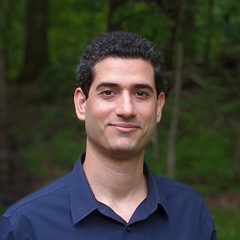 Maani Ghaffari合作论文数Computational Autonomy and Robotics Laboratory, University of Michigan;Department of Naval Architecture and Marine Engineering, College of Engineering, University of Michigan20
 Ayoung Kim合作论文数Department of Mechanical Engineering, Seoul National University;Department of Future Automotive Mobility, Seoul National University16
 Oscar Pizarro合作论文数Australian Centre for Field Robotics, The University of Sydney14
 Paul Ozog合作论文数13
 Enric Galceran合作论文数university of michigan13
 James R. Mcbride合作论文数12
 Nicholas Carlevaris-Bianco合作论文数Dept Elect Engn & Comp Sci, Univ Michigan12
 Christopher Roman合作论文数University of Rhode Island11
 Ryan W. Wolcott合作论文数Zipline11
 Edwin Olson合作论文数Electrical Engineering and Computer Science Department, University of Michigan;May Mobility, Inc.11
 Richard Camilli合作论文数Woods Hole Oceanographic Institution11
 Lu Gan合作论文数10
 John Leonard合作论文数Department of Mechanical Engineering, Massachusetts Institute of Technology;Schwarzman College of Computing Building, Massachusetts Institute of Technology10
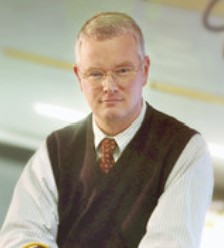 Louis Whitcomb合作论文数Laboratory for Computational Sensing and Robotics, Department of Mechanical Engineering, Whiting School of Engineering, Johns Hopkins University;Department of Computer Science, Whiting School of Engineering, Johns Hopkins University10
 Jessy Grizzle合作论文数Biped Robotics Laboratory, Department of Robotics, College of Engineering, University of Michigan9
 Gaurav Pandey合作论文数8
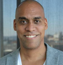 Matthew Johnson-Roberson合作论文数Vanderbilt University;Patients.app8
 Sarah E. Webster合作论文数Department of Mechanical Engineering, Johns Hopkins University8
 Joshua G Mangelson合作论文数Robotics Institute, Carnegie Mellon University7
 Stephen M. Chaves合作论文数7Alexander Cunningham合作论文数georgia institute of technology7
 Steven A. Parkison合作论文数Toyota Research Institute Los Altos7
 Brian Bingham合作论文数Deep Sea Archaeology Research Group;Massachusetts Institute of Technology;Deep Sea Archaeology Research Group, Massachusetts Institute of Technology7
 Silvio Savarese合作论文数Salesforce;Institute for Human-Centered Artificial Intelligence, Stanford University6
 Dimitris Sakellariou合作论文数5
 Ushani Arash合作论文数university of michigan5Brendan P. Foley合作论文数Program in Science, Technology, and Society, Massachusetts Institute of Technology5
 Christopher Murphy合作论文数Providence Veterans Affairs Medical Center, Brown Medical School5
 Ray (Rui) Zhang (张锐)合作论文数Toyota Research Institute4C. Roman合作论文数4
 Ross Hartley合作论文数College of Engineering and the Robotics Institute, University of Michigan4
 Jie Li合作论文数NVIDIA4
 Michael Kaess合作论文数Robot Perception Lab, Robotics Institute, School of Computer Science, Carnegie Mellon University;Field Robotics Center, Robotics Institute, School of Computer Science, Carnegie Mellon University;Aquatonomy4
 Angelos Mallios合作论文数Department of Computer Engineering, University of Girona4Hunter C. Brown合作论文数4
 Matthew Walter合作论文数Robot Intelligence through Perception Laboratory, Toyota Technological Institute at Chicago;Woods Hole Oceanographic Institution4
 Ram Vasudevan合作论文数3
 Tzu-Yuan (Justin) Lin合作论文数Computational Autonomy and Robotics Laboratory, University of Michigan3Evan Solomon合作论文数School of Oceanography, University of Washington3
 Michael Jakuba合作论文数Woods Hole Oceanographic Institution3
 Matthew Grund合作论文数Oceanographic Institution;Massachusetts Institute of Technology;Oceanographic Institution, Massachusetts Institute of Technology3
 Clayton Kunz合作论文数Department of Applied Ocean Physics and Engineering3Jeffrey K. Weissel合作论文数3
 Marie-Helene Cormier合作论文数Department of Geological Sciences, University of Missouri3Ali Can合作论文数Amazon Global Robotics3j goudreau合作论文数2john w bailey合作论文数2