The understanding of heterogenous driving conditions can be furthered through microscopic simulation model calibration. This study focused on the calibration of six (6) driving behaviour parameters (standstill distance, look-ahead distance, headway time, following variation, diamond-shape queuing, and look-back distance) for control and simulation of driving behaviour in VISSIM for the prediction of heterogeneous traffic when operating a contra-lane. Driving behaviour simulation at a contraflow operation system is more complicated than mainstream traffic simulation due to the heterogeneous traffic condition at peak hour. The calibrated results in this study were validated and compared to field results using Mean Absolute Percent Error (MAPE) and paired t-test analysis at 95% level of confidence. The validation process showed no observable difference at 98.5% confidence level. Furthermore, standstill distance, headway time, and following variation were found to govern driving behaviour variations. The look-ahead & look-back distances allow smooth and realistic driving manoeuvres in merging & diverging scenarios. Microscopic driving behaviour model enhancement in VISSIM at heterogeneous Asian highway has its benefits in terms of predicting various scenarios as an alternative solution in such traffic.
Many studies have been conducted to reduce carbon emission on the world. Large numbers of private vehicles help to increase greenhouse gas emissions, traffic congestion, physical inactivity, high temperature and air pollution. For these reasons, an urgent need to reduce carbon emission produced by private vehicles by switching to public transport. This study presents the effect of policies of reducing bus dwelling time, increasing parking fees and fuel cost private vehicles users. A survey was conducted at Kuala Lumpur city centre (KLCC) for respondents who uses private vehicles. Then, the data collected was analyzed by using logit model. The results showed that increasing fuel cost by 33%, 99.5% of respondents switch to public transports while increasing parking cost by 25%, 99.5% of respondents switch to public transport as well. Finally, 50% of respondents switch to public transport when decreasing bus dwelling time to 60%. These government policies contribute to reducing private vehicles by making private vehicles' users switch to public transport.
Prior studies showed that most evacuation contraflow designs have never been implemented. As a result, the effectiveness of these contraflow designs remains unknown. In this paper, VISSIM simulation has been used to achieve the possibility for predicting various scenarios at Kajang-Cheras highway contralane by using dynamic assignment model in order to establish best contraflow alternative path design operation. Method of Effectiveness (MOE) for dynamic assignment model (travel time, queue length, vehicles speed, delay time, fuel consumption, and CO emission) parameters has been analyzed first to assess the performance level of Contraflow operation. Seven alternative paths for the same contralane have been considered to achieve less travel time and queue length hence the reduction of fuel consumption and CO emissions that related to long queue length. Connector’s number 2 and 5 indicate the best alternative paths with the presence of the original connector (number 1) since contralane user realize that there are multi connectors to contralane ahead. Contraflow lane problems remain challenging for optimizing the best evacuation design system since the heterogeneous characteristics and no lane discipline domain on this highway at peak-hour. However, Contraflow freeway evacuation plan has been shown to be a successful remedy method to rapidly and efficiently move large numbers of vehicles during emergency situations.
Toll plazas are one of the critical components of a roadway system. At the same time, they are among the most complex road structures, as drivers are exposed to a large amount of information and have a short amount of time to make a decision to avoid any collision. VISSIM and SSAM are used to investigate the effect of various Malaysian toll plazas design and traffic conditions on drivers’ behaviour and level of safety. The study was made a well-calibrated and validated VISSIM simulation model and several scenarios were simulated to test their efficacy for improving toll plaza safety aspects by using SSAM afterwards. From the results it was observed that the VISSIM simulation model scenarios such as implementing booths orientation and segregating lanes for different vehicle types to improve the level of service have significant safety aspects improvement regarding conflict points and lane change accidents results while using Surrogate Safety As-sessment Model (SSAM) in order to give the need for remediation of either the roadway design or the flow-control strategy.
An algorithm program was developed to detect vehicles in traffic videos and get the vehicle count for the small time period as a tool that can assist researchers who seek vehicle counting. This system approach has been presented for extracting traffic data using video image processing. Meanwhile, an offline program focuses on extracting vehicles, tracking them and providing the vehicle count for a short period of time. It uses background subtraction, shadow removal, and pixel analysis for extracting moving objects. The results show that the algorithm is capable of counting 95% of the vehicles due to some shaking in the video feed. These data have been analysed by the paired samples t-test to show the credibility of the results which have been approved to be useful according to the values of correlation and P-value compared with the values of the observation method. Also, the classification of vehicles was performed using the improfile command in Matlab-Video Image Processing that computes the colours intensity values along a line or a multiline path in an image.
Due to the increased number of vehicles, shopping centers and rapid growth population of Al-Mansour city, daily trips have been increasing besides generating traffic congestion in major roundabouts in the city. Those will make developing an imperial delay model in roundabouts important due to the traffic and geometric influences. Therefore, two major roundabouts have been selected in the city to be taken as a case study. Geometric features for the selected roundabouts have been measured accurately by satellite images via ArcGIS. Traffic and geometric data analysis indicate that both are significantly important on delay models. The delay time produced by SIDRA and SYNCHRO has been compared with the delay time measured from the field. A significant difference in delay for roundabouts is noticed. This difference could be attributed to the difference in driver behaviour. Ideal saturation flow is the main factor related to driver behaviour, so it adjusted to be the average of the saturation flow measured from the field (2200 vphgpl).
An algorithm system approach has been presented for extracting traffic data using video image processing.While an offline program focuses on extracting vehicles, tracking them and provides the vehicle count for a short period of time.It uses background subtraction, shadow removal, and pixel analysis for extracting moving objects.The results show that the algorithm is capable of counting 95% of the vehicles due to some shaking in the video feed.These data have been analyzed by statistical regression to show the credibility of the results which been approved to be useful according to the value of R Square and Significance F compared with the value of the observation method.Also, the classification of vehicles was performed using the improfile command in Matlab-Video Image Processing that computes the intensity values along a line or a multiline path in an image.The algorithm program was developed to detect vehicles in traffic videos and get the vehicle count for the small time period as an assistance tool for a researcher who seeks vehicle counting.
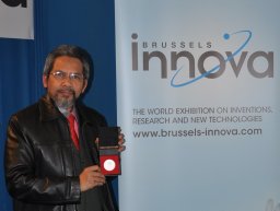 Amiruddin Ismail合作论文数Department of Civil and Structural Engineering;Faculty of Engineering;University Kebangsaan Malaysia;Faculty of Engineering, University Kebangsaan Malaysia4
 Haitham Al-Msari合作论文数2
 Siti Zaharah Ishak合作论文数2
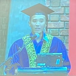 Muhamad Nazri Borhan合作论文数2
 Riza Atiq O. K. Rahmat合作论文数Department of Civil and Structural Engineering;Universiti Kebangsaan Malaysia;Department of Civil and Structural Engineering, Universiti Kebangsaan Malaysia2
 Alla Jaber Essa合作论文数1Ameer Abdul Adheem Hussein合作论文数1
 Hussin A.M. Yahia合作论文数Dept Civil Engn, Knowledge Oasis Muscat1Suhana Koting合作论文数1
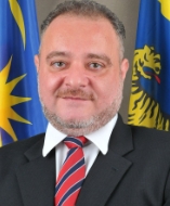 Ahmed Nasser合作论文数Department of Civil Engineering, College of Engineering, University of Malaya;National water and energy Center, United Arab Emirates University1




