Over the satellite period, Arctic and Antarctic sea ice extent seemed to follow opposite pathways. Arctic sea ice showed a strong and prolonged decrease until 2007 and then stalled in its rate of decline. Antarctic sea ice extent, on the other hand, displayed a small but significant increase until 2015. After 2015, Antarctic sea ice extent experienced a sharp decline, and has since been characterized by a lower mean state with enhanced variability, suggested as a new sea-ice regime. Arctic sea ice has continued transitioning towards a regime of substantially lower summertime coverage with reduced multiyear ice, increasingly resembling Antarctic sea ice in conditions and seasonality. We suggest that the parallel changes in Arctic and Antarctic sea-ice behavior share a common mechanism: the breakdown of ocean stratification sustaining sea-ice decline, whilst episodic atmospheric forcing increasingly influences high-frequency sea-ice variability. In both the Antarctic and the Eurasian Basin of the Arctic, positive sea surface salinity anomalies have caused a weakening of the ocean halocline. The associated erosion of stratification makes sea ice more vulnerable to subsurface heat, and appears to underpin recent sea-ice loss and elevated variability. The convergence of the two polar regions toward a seasonally dominated sea-ice regime leads us to call for enhanced knowledge transfer and coordination between polar communities to accelerate understanding of recent sea-ice changes. A better understanding of the mechanisms driving changes in the coupled atmosphere--ocean--sea-ice system is needed to improve projections of future sea-ice loss and assess the cascading risks it poses to global climate and regional ecosystems.
Since 2015, Antarctic sea ice has entered a period of persistent record-low extent after decades of strong regional variability and large swings. The speed and persistence of this decline point to a system that may be changing state, with implications for the Southern Ocean, Antarctic ecosystems, and the global climate system. What is driving this shift remains insufficiently understood. Atmospheric variability plays a role, but ocean processes, including subsurface heat release and changes in stratification, are increasingly recognized as key pieces of the puzzle, alongside feedbacks involving snow, ice shelves, clouds, and freshwater input. This white paper focuses on four areas where progress is needed. First, improved understanding is needed of sea ice mass balance and dynamics: how sea ice grows, melts, moves, and deforms. Second, exchanges of heat, mass, and momentum between ocean, atmosphere, sea ice, and ice shelves need to be quantified across seasons and regions. Third, the consequences for ecosystems and biogeochemistry are likely substantial. Sea ice supports productive microbial communities and carbon and nutrient cycling, so its decline will affect polar food webs and Southern Ocean carbon storage. Finally, climate feedbacks, from albedo changes to cloud and ocean interactions, remain poorly constrained but could amplify ongoing change. A recurring limitation is the lack of coordinated, year-round observations across Antarctica. Existing data are sparse and uneven in space and time. Antarctica InSync is designed to address this by bringing together satellite observations, autonomous platforms, field campaigns, coastal observatories, harmonized data products, and modelling across pack ice, the marginal ice zone, landfast ice, and polynyas. The white paper recommends standardized observations of essential sea ice, snow, ocean, atmospheric, ecosystem, and biogeochemical variables, integrated into interoperable data products and models. Addressing these gaps is essential to improve predictability and anticipate future Antarctic sea ice change.
The global ocean’s overturning circulation plays an important role in climate and climate variability through its transport of heat, freshwater and nutrients. As part of this three-dimensional overturning circulation, dense waters sink in narrow regions at high latitudes in the North Atlantic and along the Antarctic coast. To close this circulation, it is generally assumed that either intense interior mixing by winds and internal tides, or wind-driven upwelling is required to bring these water masses back to the surface. Nevertheless, more recent work questions this requirement for winds and tides, arguing that surface buoyancy forcing alone can drive such a circulation through a process known as rotating horizontal convection. In particular, it has been shown that the presence of a re-entrant channel, such as the Southern Ocean, is required for rotating horizontal convection to generate many features of the global ocean’s overturning circulation. Building on previous work in which rotating horizontal convection was forced by only thermal forcing, here we demonstrate, using an idealised eddying ocean model with both thermal and haline surface forcing, that rotating horizontal convection can produce many of the observed features of the global ocean’s overturning circulation. These results therefore suggest that a global “thermohaline circulation” can exist in the ocean in the absence of winds and in the limit of small vertical diffusion.
The Antarctic Circumpolar Current is the world’s strongest ocean current. This vast current system is linked to ocean overturning and is pivotal to the uptake of ocean heat and CO2. The strength of the Antarctic Circumpolar Current has varied across Earth’s past climates, but the exact drivers of this change remain elusive. Ocean models have not been able to adequately resolve eddies and dense shelf water formation processes that control current strength. Here, we assess a global ocean model which resolves such processes to diagnose the impact of future thermohaline and wind conditions on the Antarctic Circumpolar Current. This model suggests the strength of the Antarctic Circumpolar Current will decline by up to ∼ 20% by 2050. This decline is supported by simple scaling theory, and is driven by ice shelf melting, which weakens the density gradient historically supported by surface temperature. Such a decline in transport would have critical implications for the global ocean circulation, and hence, Earth’s climate system.
Large model spread and biases exist in simulating the Arctic Ocean water mass and circulations from the latest CMIP6 coupled and ocean-sea ice-only simulations. This can be at least partly attributed to large uncertainties due to unresolved key processes in this region, and it is hoped that high resolution can - to a certain extent - come to the rescue. In this work, we first examined two high-resolution simulations by two CMIP6-class models: 1) a multi-centennial integration of CESM (CESM-HR; ocean resolution 1/10-deg), and 2) a 50-year integration of NorESM (NorESM-MX; ocean resolution 1/8-deg). The two models show clear signs of improvements in simulating the Arctic Ocean compared to their standard 1-deg resolution counterparts, but certain biases remain, such as the incorrect pathway of the Atlantic Water and the too-deep mixed layer depth in NorESM-MX. We then performed and analysed a similar NorESM-MX simulation, but this time with a newly developed hybrid vertical coordinate (z-density) in the ocean model (the default is isopycnal/density coordinate). Experience from hybrid coordinate testing runs in standard 1-deg resolution shows e.g. much-improved water masses and sea ice extent in the Southern Ocean, mixed layer depths, and importantly more rapid equilibration to energy balance in coupled simulations. When applied in the high-resolution NorESM-MX configuration, the results with the new coordinate show a much-improved representation of the pathway of Atlantic water and the distribution of mixed layer depth in the Arctic Ocean.
Antarctic krill (Euphausia superba Dana) is a key species of the Southern Ocean ecosystem, immensely abundant and targeted by the krill fishery. For their sustainable management, krill distribution and biomass estimates are required, typically achieved through acoustic-trawl surveys. We explore how krill environmental DNA (eDNA) can contribute to our understanding or Antarctic krill habitat and distribution. We collected eDNA samples by filtering five liters of seawater per sample in the East Antarctic Southern Ocean from the surface (5 m depth) and seafloor (381–4422 m depth, total n = 110). We used quantitative PCR to measure Antarctic krill eDNA abundance and age, and eDNA metabarcoding to detect any krill species. This eDNA data was compared to acoustic, visual and trawl detections of Antarctic krill. Antarctic krill eDNA was common in surface samples and largely overlapped with visual and trawl detections. Highest eDNA concentrations were detected above krill swarms, with concentrations declining with increasing distance from swarms. Near recent eDNA sampling locations, krill swarms were more likely acoustically detected than near old eDNA sampling locations. Antarctic krill detections were less common in seafloor locations, and detections were concentrated in the continental slope area to the south of the survey area, both for visual detections and for recent eDNA detections. Both methods detected Antarctic krill at great depths (recent eDNA: 4300 m; visual: 3080 m). In both eDNA and trawl data, Antarctic krill was the dominant krill species, followed by Thysanoessa macrura G.O. Sars, which was particularly abundant in larval stages throughout the survey area, including at Antarctic krill swarm locations. We recommend the inclusion of eDNA data for Antarctic krill distribution estimates and understanding of habitat use, particularly in difficult-to-access areas, such as under ice or benthic habitats.
Southern Ocean phytoplankton form the base of the Antarctic food web, influencing higher trophic levels through biomass and community structure. We examined phytoplankton distribution and abundance in the Indian Sector of the Southern Ocean during austral summer as part a multidisciplinary ecosystem survey: Trends in Euphausiids off Mawson, Predators and Oceanography (TEMPO, 2021). Sampling covered six meridional transects from 55-80°E, and from 62°S or 63°S to the ice edge. To determine phytoplankton groups, CHEMTAX analysis was undertaken on pigments measured using HPLC. Diatoms were the dominant component of phytoplankton communities, explaining 56% of variation in chlorophyll a (Chl a), with haptophytes also being a major component. Prior to sampling the sea ice had retreated in a south-westerly direction, leading to shorter ice-free periods in the west (< 44 days, ≤65°E) compared to east (> 44 days, ≥70°E), inducing a strong seasonal effect. The east was nutrient limited, indicated by low-iron forms of haptophytes, and higher silicate:nitrate drawdown ratios (5.1 east vs 4.3 west), pheophytin a (phaeo) concentrations (30.0 vs 18.4 mg m-2) and phaeo:Chl a ratios (1.06 vs 0.53). Biological influences were evident at northern stations between 75-80°E, where krill “super-swarms” and feeding whales were observed. Here, diatoms were depleted from surface waters likely due to krill grazing, as indicated by high phaeo:Chl a ratios (> 0.75), and continued presence of haptophytes, associated with inefficient filtering or selective grazing by krill. Oceanographic influences included deeper mixed layers reducing diatom biomass, and a bloom to the north of the southern Antarctic Circumpolar Current Front in the western survey area thought to be sinking as waters flowed from west to east. Haptophytes were influenced by the Antarctic Slope Front with high-iron forms prevalent to the south only, showing limited iron transfer from coastal waters. Cryptophytes were associated with meltwater, and greens (chlorophytes + prasinophytes) were prevalent below the mixed layer. The interplay of seasonal, biological and oceanographic influences on phytoplankton populations during TEMPO had parallels with processes observed in the BROKE and BROKE-West voyages conducted 25 and 15 years earlier, respectively. Our research consolidates understanding of the krill ecosystem to ensure sustainable management in East Antarctic waters.
Circulation and water masses in the greater Prydz Bay region were surveyed in the austral summer 2021 (January-March) during the ‘Trends in Euphausiids off Mawson, Predators and Oceanography’ (TEMPO) experiment, and are described in this paper. The Southern Antarctic Circumpolar Current Front is found in the northern part of the survey area, generally near 63-64°S, whereas the Southern Boundary Front is located between 64 and 65.5°S. The westward flowing Antarctic Slope Front (ASF) is found in the southern part of the survey area near the continental slope on most transects. Highest concentrations of oxygen (> 300 µmol kg−1) are found in shelf waters at stations in Prydz Bay, south of 67°S along 75°E, whereas the lowest oxygen values are found in the Circumpolar Deep Water layer, with an average of roughly 215 µmol kg−1. North of the northern extension of the ASF, surface mixed layers are between 20 and 60 m deep. Mixed layers tend to deepen slightly in the northern part of the survey, generally increasing north of 64°S where the ocean has been ice-free the longest. We find evidence of upwelling of waters into the surface layers, based on temperature anomaly, particularly strong along 80°E. Enhanced variability of biogeochemical properties - nutrients, DIC, DO - in the AASW layer is driven by a combination of sea-ice and biological processes. Antarctic Bottom Water, defined as water with neutral density > 28.3 kg m-3, was sampled at all the offshore full-depth stations, with a colder/fresher variety along western transects and a warmer/saltier variety in the east. Newly formed Antarctic Bottom Water – the coldest, freshest, and most recently ventilated – is mostly found in the deep ocean along 65°E, in the base of the Daly Canyon.
Ambiguity over the Eocene opening times of the Tasman Gateway and Drake Passage makes it difficult to determine the initiation time of the Antarctic Circumpolar Current (ACC). If the Tasman Gateway opened later than Drake Passage, then Australia may have prevented the proto-ACC from forming. Recent modelling results have shown that only a relatively weak circumpolar transport results under Eocene surface forcing. This leads to warm and buoyant coastal water around Antarctica, which may impede the formation of deep waters and convective processes. This suggests that a change in deep water formation might be required to increase the density contrast across the Southern Ocean and increase circumpolar transport.Here we use a simple reduced gravity model with two basins, to represent the Atlantic and the Pacific. This fixes the density difference between surface and deep water and allows us to isolate the impact of deep water formation on circumpolar transport. With no obstacle on the southern boundary the circumpolar current increases its transport from 82.3 to 270.0 Sv with deep water formation. Placing an Antipodean landmass on the southern boundary reduces this transport as the landmass increases in size. However, circumpolar flow north of this landmass remains a possibility even without deep water formation. Weak circumpolar transport continues until the basin is completely blocked by the Antipodes. When the Antipodes is instead allowed to split from the southern boundary, circumpolar transport recovers to its unobstructed value. Flow rapidly switches to south of the Antipodes when the gateway is narrow.
The Antarctic Circumpolar Current plays a pivotal role in global climate through its strong influence on the global overturning circulation, ocean heat and CO 2 uptake. However, when and how the Antarctic Circumpolar Current reached its modern-like characteristics remains disputed. Here we present neodymium isotope and sortable silt records from sediment cores in the Southwest Pacific and South Indian oceans spanning the past 31 million years. Our data indicate that a circumpolar current like that of today did not exist before the late Miocene cooling. These findings suggest that the emergence of a homogeneous and deep-reaching strong Antarctic Circumpolar Current was not linked solely to the opening and deepening of Southern Ocean Gateways triggering continental-scale Antarctic Ice Sheet expansion during the Eocene–Oligocene Transition (∼34 Ma). Instead, we find that besides tectonic pre-conditioning, the expansion of the Antarctic Ice Sheet and sea ice since the middle Miocene Climate Transition (∼14 Ma) played a crucial role. This led to stronger density contrast and intensified Southern Westerly Winds across the Southern Ocean, establishing a vigorous deep-reaching circumpolar flow and an enhanced global overturning circulation, which amplified the late Cenozoic global cooling.
Research that combines fluid dynamics and climate science is uncovering the inner workings of the North Atlantic’s overturning circulation. Future changes to that circulation system could trigger major disruptions to global weather patterns.
In contrast with the atmosphere, which is heated from below by solar radiation, the ocean is both heated and cooled from above.To drive a deep-reaching overturning circulation in this context, it is generally assumed that either intense interior mixing by winds and internal tides, or wind-driven upwelling is required; in their absence, the circulation is thought to collapse to a shallow surface cell.We demonstrate, using a primitive equation model with an idealized domain and no wind forcing, that the surface temperature forcing can in fact drive an interhemispheric overturning provided that there is an open channel unblocked in the zonal direction, such as in the Southern Ocean.With this geometry, rotating horizontal convection, in combination with asymmetric surface cooling between the north and south, drives a deep-reaching two-cell overturning circulation.The resulting vertical mid-depth stratification closely resembles that of the real ocean, suggesting that wind-driven pumping is not necessary to produce a deep-reaching overturning circulation, and that buoyancy forcing plays a more important role than is usually assumed.
The ocean's internal pycnocline is a layer of elevated stratification that separates the well-ventilated upper ocean from the more slowly renewed deep ocean. Despite its pivotal role in organizing ocean circulation, the processes governing the formation of the internal pycnocline remain little understood. Classical theories on pycnocline formation have been couched in terms of temperature and it is not clear how the theory applies in the high-latitude Southern Ocean, where stratification is dominated by salinity. Here we assess the mechanisms generating the internal pycnocline at southern high latitudes through the analysis of a high-resolution, realistic, global sea ice-ocean model. We show evidence suggesting that the internal pycnocline's formation is associated with sea ice-ocean interactions in two distinct ice-covered regions, fringing the Antarctic continental slope and the winter sea-ice edge. In both areas, winter-persistent sea-ice melt creates strong, salinity-based stratification at the base of the winter mixed layer. The resulting sheets of high stratification subsequently descend into the ocean interior at fronts of the Antarctic Circumpolar Current, and connect seamlessly to the internal pycnocline in areas further north in which pycnocline stratification is determined by temperature. Our findings thus suggest an important role of localized sea ice-ocean interactions in configuring the vertical structure of the Southern Ocean.
Abstract From the Eocene (∼50 million years ago) to today, Southern Ocean circulation has evolved from the existence of two ocean gyres to the dominance of the Antarctic Circumpolar Current (ACC). It has generally been thought that the opening of Southern Ocean gateways in the late Eocene, in addition to the alignment of westerly winds with these gateways or the presence of the Antarctic ice sheet, was a sufficient requirement for the transition to an ACC of similar strength to its modern equivalent. Nevertheless, models representing these changes produce a much weaker ACC. Here we show, using an eddying ocean model, that the missing ingredient in the transition to a modern ACC is deep convection around the Antarctic continent. This deep convection is caused by cold temperatures and high salinities due to sea‐ice production around the Antarctic continent, leading to both the formation of Antarctic Bottom Water and a modern‐strength ACC.
Abstract Observed Antarctic sea ice trends up to 2015 have a distinct regional and seasonal pattern, with a loss during austral summer and autumn in the Bellingshausen and Amundsen Seas, and a year‐round increase in the Ross Sea. Global climate models generally failed to reproduce the magnitude of sea ice trends implying that the models miss relevant mechanisms. One possible mechanism is basal meltwater, which is generally not included in the current generation of climate models. Previous work on the effects of meltwater on sea ice has focused on thermodynamic processes. However, local freshening also leads to dynamic changes, affecting ocean currents through geostrophic balance. Using a coupled ocean/sea‐ice/ice‐shelf model, we demonstrate that basal melting can intensify coastal currents in West Antarctica and the westward transport of sea ice. This change in transport results in sea ice anomalies consistent with observations, and may explain the disparity between climate models and observations.
During the Eocene and the Eocene‐Oligocene transition, the lower cell of the meridional overturning circulation (MOC), associated with bottom water formation, underwent changes associated with the geological evolution of Southern Ocean gateways. These are important for the Cenozoic climate transition from Greenhouse to Icehouse, but their dynamics still remain elusive. We demonstrate, using an idealized eddying ocean model, that the opening of a gateway leads to the abrupt onset of a vigorous, deep‐reaching, MOC. This MOC has a maximum transport for a shallow gateway, and decreases with further deepening of the gateway. This abrupt change in the MOC can be explained through the ability with which standing meanders—turbulent features located downstream of the gateway—can induce deep vertical heat transport at high latitudes where bottom waters are produced. Our results demonstrate the crucial role of turbulent processes in setting the strength of the global ocean's deep‐reaching MOC.
Antarctic sea ice is a critical component of the climate system and a vital habitat for Southern Ocean ecosystems. Understanding the underlying physical processes and improving Antarctic sea ice prediction is of broad interest. Using the model data, we investigate sea ice and upper ocean predictability at interannual timescales in the Weddell Sea region. We find that oceanic predictability is largely confined to the Winter Water layer and responds to seasonal modifications of the water column, mainly driven by sea ice processes. Predictability depends not only on the depth of the Winter Water layer, but also on how strongly stratified its base is. Predictability is lost when warm Circumpolar Deep Water with no sea ice‐related memory entrains into the mixed layer. We show the strong dependence of sea ice predictability on the local upper ocean vertical structure, which suggests that both are likely to change in a warming climate.
Crossing a key atmospheric CO 2 threshold triggered a fundamental global climate reorganisation ~34 million years ago (Ma) establishing permanent Antarctic ice sheets. Curiously, a more dramatic CO 2 decline (~800–400 ppm by the Early Oligocene(~27 Ma)), postdates initial ice sheet expansion but the mechanisms driving this later, rapid drop in atmospheric carbon during the early Oligocene remains elusive and controversial. Here we use marine seismic reflection and borehole data to reveal an unprecedented accumulation of early Oligocene strata (up to 2.2 km thick over 1500 × 500 km) with a major biogenic component in the Australian Southern Ocean. High-resolution ocean simulations demonstrate that a tectonically-driven, one-off reorganisation of ocean currents, caused a unique period where current instability coincided with high nutrient input from the Antarctic continent. This unrepeated and short-lived environment favoured extreme bioproductivity and enhanced sediment burial. The size and rapid accumulation of this sediment package potentially holds ~1.067 × 10 15 kg of the ‘missing carbon’ sequestered during the decline from an Eocene high CO 2 -world to a mid-Oligocene medium CO 2 -world, highlighting the exceptional role of the Southern Ocean in modulating long-term climate.
 Simon J. Marsland合作论文数Ctr Australian Weather & Climate Res11
 David R. Munday合作论文数Atmospheric, Oceanic and Planetary Physics, University of Oxford8
 Guy D. Williams合作论文数Antarctic Climate and Ecosystems Cooperative Research Centre (ACECRC),, University of Tasmania8
 Joseph Henry Lacasce (J. H. LaCasce)合作论文数Woods Hole Oceanographic Institution;Department of Geosciences, The Faculty of Mathematics and Natural Sciences, University of Oslo8
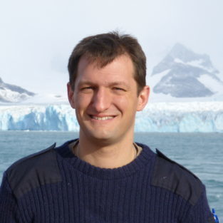 Andrew Meijers合作论文数British Antarctic Survey, Natural Environment Research Council7
 Joanne M Whittaker合作论文数School of Geosciences, University of Sydney7
 Nathan Bindoff合作论文数Institute for Marine and Antarctic Studies, University of Tasmania;Duke University;Antarctic Climate and Ecosystems Cooperative Research Centre7
 I. Sauermilch合作论文数Dept Earth Sci, Univ Utrecht6
 Maxim Nikurashin合作论文数Program in Atmospheric and Oceanic Sciences, Princeton University6
 Ryan P Abernathey合作论文数Earthmover6
 Trevor McDougall合作论文数School of Mathematics and Statistics, The University of New South Wales5
 Bishakhdatta Gayen合作论文数Department of Mechanical Engineering, School of Electrical, Mechanical and Infrastructure Engineering, Faculty of Engineering and Information Technology, The University of Melbourne4
 Andrew E. Kiss合作论文数University of New South Wales, University of New South Wales4
 Michael Schulz合作论文数Department of Geosciences, University of Bremen;MARUM - Center for Marine Environmental Sciences, University of Bremen4
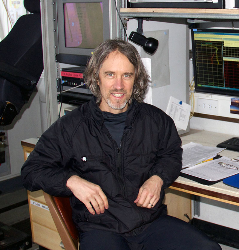 Stephen Matthew Griffies (Stephen M. Griffies)合作论文数Princeton University;Geophysical Fluid Dynamics Laboratory, National Oceanic and Atmospheric Administration4
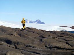 Sophie Bestley合作论文数4
 Raffaele Ferrari合作论文数Department of Earth, Atmospheric and Planetary Sciences, School of Science, Massachusetts Institute of Technology4
 Andrew Mcc. Hogg合作论文数4
 J. Melbourne-Thomas合作论文数School of Zoology, University of Tasmania4
 Stuart Corney合作论文数University of Tasmania School of Medicine4
 Matthias Prange合作论文数Faculty of Geosciences, University of Bremen4Stephen Nicol合作论文数4Kial D. Stewart合作论文数3Russell Fiedler合作论文数3Xihan Zhang合作论文数3
 Fabio Boeira Dias合作论文数3
 Qianjiang Xing合作论文数3Earl R. Duran合作论文数3Nicholas Hannah合作论文数3
 Abhishek Savita合作论文数GEOMAR Helmholtz Ctr Ocean Res Kiel3
 Oceane Richet合作论文数3Mao Mori合作论文数3Peter Dobrohotoff合作论文数3y iijima合作论文数3Fanghua Wu合作论文数3
 Gabriela S. Pilo合作论文数CSIRO3
 Katharina Hochmuth合作论文数Alfred Wegener Institute,Helmholtz-Centre for Polar and Marine Research, Bremerhaven, Germany3
 Christopher C. Chapman合作论文数CSIRO Oceans & Atmosphere, Hobart, Tas, Australia3Paul Spence合作论文数School of Geosciences, Faculty of Science, The University of Sydney3
 Andrew Stewart合作论文数Department of Atmospheric and Oceanic Sciences, College of Physical Sciences, University of California, Los Angeles3
 Ryan Holmes合作论文数Bureau of Meteorology3Matthew A. Chamberlain合作论文数3Sumner Michael合作论文数3
 Matthew England合作论文数Centre for Marine Science & Innovation, University of New South Wales3
 Shigeru Aoki合作论文数3
 Adele K. Morrison合作论文数Research School of Earth Sciences, Australian National University3Karen J. Westwood合作论文数Australian Antarctic Division3
 Peter R. Oke合作论文数Centre for Australian Weather and Climate Research3Aidan Heerdegen合作论文数Research School of Chemistry, Australian National University3




