Over the past fifteen years, the Turkish government has engaged in large-scale development programs targeting its politically and geographically peripheral southeast. The developments have resulted in significant land-use change and agricultural intensification, particularly along the fraught border with Syria. In this article, we argue that these state-led projects seek to domesticate the frontier through agriculture, engineer the demographics of borderland communities, and demarcate territorial limits through land-use change. Building on the observations from the Chinese, Israeli, and Egyptian military farm programs, this article analyzes the landscape patterns of another state-led agricultural border project: the Turkish Ceylanp & imath;nar State Farm on the Syrian border. In this article, we analyze the patterns and drivers of land-use change in the Ceylanp & imath;nar region of Turkey to better understand the logic of rapid, state-led agricultural expansion and intensification. We argue the rapid land-use changes, particularly on Turkish state farmland along the border, are a form of strategic land-use change with the aim of territorialization and border-making.
Recent advances in Earth observation and machine learning have significantly enhanced the capacity to monitor agricultural systems and terrestrial vegetation across spatial and temporal scales. This editorial synthesizes the contributions of eleven studies published in the Special Issue ‘Machine Learning for Applications in Agriculture and Vegetation Using Remote Sensing’. These contributions highlight emerging methodological trends, as well as persistent challenges in remote sensing for agriculture and vegetation measurement and monitoring, and reflect the growing dominance of deep learning in high-resolution mapping and segmentation. An increasing importance of multi-sensor data fusion, integrating multi- and hyperspectral satellites, UAV, and environmental data, is found. Deep learning is emerging as an effective approach for retrieving key biophysical parameters such as biomass, crop height, and yield. The collected studies also emphasize the critical role of sensor characteristics and scale, particularly the trade-offs between spectral, spatial, and temporal resolution in vegetation analysis. Despite notable progress, several limitations remain. Model transferability across regions and sensors is still constrained and multi-source data integration often lacks standardized frameworks. Empirical approaches still dominate the retrieval of biophysical variables, limiting robustness and physical interpretability. The contributions also reveal a persistent gap between high-resolution, small-scale analyses and their scalability to regional or global applications. Therefore, this editorial argues for a transition towards hybrid modeling approaches that combine physical knowledge with data-driven machine learning methods, the adoption of formal data assimilation frameworks for multi-source integration, and the development of scalable and uncertainty-aware workflows. The broader scientific context of the contributions is given by providing a critical perspective on the current state of the field and outlining the key research directions necessary to advance remote sensing in agriculture and ecosystem monitoring.
Experts have long associated West Africa’s drylands with extensive and severe land degradation. In fact, the term “desertification” was coined in reference to the great Sahelian droughts of the 1970s and 1980s. Thus, much research has focused on Sahelian countries where there have also been numerous large-scale projects to combat desertification. Wetter, southern Sudanian savannas have received less attention. At the same time, scientific experts and policymakers have seriously questioned desertification as a concept and advocate for a new paradigm of land degradation neutrality (LDN). This entails assessing both land degradation and rehabilitation. The northern Sudanian savannas of Togo had been previously identified as an area with widespread and increasing land degradation based on regional analyses with coarse satellite imagery. Little or no rehabilitation had been either studied or detected. This study sought to follow up on these previous works to investigate local-scale patterns of both land degradation and rehabilitation. Fieldwork entailed a place-based approach using unmanned aerial vehicles (UAVs or drones) and participatory exercises with local stakeholders across nine sites. The spatial analysis incorporated local perceptions to classify the drone imagery. Results indicate that LDN varies markedly among the communities and that patterns of LDN are highly heterogeneous at these local scales.
This article outlines the social, political, and environmental conditions under which states engage in strategic agricultural development along desert borders and what these developments achieve for the state. We focus on how national governments employ state-led agricultural reclamation, expansion, or intensification in deserts to produce and territorialize borders and discuss how these projects fall short. We apply theories of state power and legibility to analyze three military agricultural sites on the China-Kazakhstan, Egypt-Sudan, and Israel-Egypt-Gaza borders, each of which exemplifies strategic desert borderland agricultural development. These sites have geopolitical significance due to their history of territorial disputes, potential for ethnic conflict, and access to strategically important natural resources. By drawing on commonalities between these sites, we find that these developments achieve multiple goals for states, including demarcating territorial boundaries, increasing legibility of peripheral borderlands, and demonstrating control over difficult terrains. We also outline how these projects fall short of totally remaking borderlands due to social, political, and environmental limitations.
Conservation efforts under the nature-based solutions (NbS) framework aim at better management of ecosystems and improvement of human well-being. Policies targeting forest-based livelihoods align well with the NbS principles, but their social-ecological outcomes are often confounded by complex human-environment interactions. In this study, we identify one major feedback effect of the ecosystem dynamic on people’s livelihoods based on datasets collected from two study areas in China and Nepal. Our methodology integrates satellite remote sensing, household surveys, and statistical models to investigate households’ cropland abandonment decisions under the influence of crop-raiding by wildlife. Results show that cropland parcels that have experienced crop-raiding are more likely to be abandoned in the following years. The more damage the crops have suffered on a given parcel, the more likely it is that the parcel will be abandoned. Parcels in proximity to natural forests, farther away from the house location, and with poorer access to paved roads bear a higher risk of being abandoned. These effects are robust and consistent after controlling for multiple parcel features and household characteristics at different levels and using the dataset from each study area separately. We conclude that policymakers need to consider this undesirable feedback of the ecological system to the livelihoods of local people to better achieve co-benefits for ecosystems and human society.
Forests play a key role in the mitigation of global warming and provide many other vital ecosystem goods and services. However, as forest continues to vanish at an alarming rate from the surface of the planet, the world desperately needs knowledge on what contributes to forest preservation and restoration. Migration, a hallmark of globalization, is widely recognized as a main driver of forest recovery and poverty alleviation. Here, we show that remittance from migrants reinforces forest recovery that would otherwise be unlikely with mere migration, realizing the additionality of payments for ecosystem services for China's largest reforestation policy, the Conversion of Cropland to Forest Program (CCFP). Guided by the framework that integrates telecoupling and coupled natural and human systems, we investigate forest-livelihood dynamics under the CCFP through the lens of rural out-migration and remittance using both satellite remote sensing imagery and household survey data in two representative sites of rural China. Results show that payments from the CCFP significantly increases the probability of sending remittance by out-migrants to their origin households. We observe substantial forest regeneration and greening surrounding households receiving remittance but forest decline and browning in proximity to households with migrants but not receiving remittance, as measured by forest coverage and the Enhanced Vegetation Index derived from space-borne remotely sensed data. The primary mechanism is that remittance reduces the reliance of households on natural capital from forests, particularly fuelwood, allowing forests near the households to recover. The shares of the estimated ecological and economic additionality induced by remittance are 2.0% (1.4%∼3.8%) and 9.7% (5.0%∼15.2%), respectively, to the baseline of the reforested areas enrolled in CCFP and the payments received by the participating households. Remittance-facilitated forest regeneration amounts to 12.7% (6.0%∼18.0%) of the total new forest gained during the 2003-2013 in China. Our results demonstrate that remittance constitutes a telecoupling mechanism between rural areas and cities over long distances, influencing the local social-ecological gains that the forest policy intended to stimulate. Thus, supporting remittance-sending migrants in cities can be an effective global warming mitigation strategy.
Geographic information systems and remote sensing techniques may be used to test hypotheses regarding the structure and scale dependence of vegetation and environmental processes. Examination of scales of variation of forest productivity, for example, is an area where remotely sensed data can further our understanding of the scale dependence of vegetation, environment linkages. By assessing vegetation through remote sensing and spatial and statistical analyses, the analysis of scale dependence and landscape structure may be quantified. Specifically, this chapter examines relationships between the middle-infrared corrected version of the normalized difference vegetation index (NDVI) and mountain terrain in Glacier National Park. By varying the scale of empirical models, the authors seek to explain variation in NDVI relationships resulting from local to regional variation in environmental gradients. It is important to know the scale dependence of processes that determine landscape structure and how the degree and nature of the relationship between pattern and process change with variations in the scale of measurement.
Fieldwork is a hallmark of anthropology and the experience of being in the field features prominently in scholarly works. The processes by which anthropologists obtain permission to conduct fieldwork, however, are rarely described. The study presented here discusses in substantial detail how a research project in Togo, West Africa obtained official authorization to conduct un-crewed aerial vehicle (UAV or “drone”) fieldwork. Anthropologists are continually incorporating new technologies into their work and drones have the potential to become part of our methodological toolkit. For security reasons, however, drone importation and use is carefully controlled by governments. This article describes the processes and protocols by which a team of anthropologists obtained official permission for drone work in a West African country. As such, it provides a guide for how other researchers may obtain similar authorizations in other contexts and anticipate challenges in doing so.
Archival maps provide a valuable way to explore historical environmental data collected before the use of satellite imagery. Archival maps in their physical form cannot readily be used, however, beyond what the original cartographer intended. In this project, we describe a manual method to bring scanned archival maps into digital form using common tools in a geographic information systems (GIS) software platform. We rely on the important context of West Africa where a generation of geographers as part of the Terroir school worked with local agrarian communities to understand land use and land cover (LULC) dynamics. Specifically, we analyze archival maps of the Yatenga Province in Burkina Faso originally created by Jean-Yves Marchal, who used aerial photography from 1952 and 1973. This article describes the image processing steps to extract LULC data from scanned archival images using the graphical user interface of popular GIS tools. We compare our results to Marchal's original maps and provide an alternative analysis of LULC change in the region using the newly extracted LULC data.
Fieldwork is a hallmark of anthropology and the experience of being in the field features prominently in scholarly works. The processes by which anthropologists obtain permission to conduct fieldwork, however, are rarely described. The study presented here discusses in substantial detail how a research project in Togo, West Africa obtained official authorization to conduct un-crewed aerial vehicle (UAV or "drone") fieldwork. Anthropologists are continually incorporating new technologies into their work and drones have the potential to become part of our methodological toolkit. For security reasons, however, drone importation and use is carefully controlled by governments. This article describes the processes and protocols by which a team of anthropologists obtained official permission for drone work in a West African country. As such, it provides a guide for how other researchers may obtain similar authorizations in other contexts and anticipate challenges in doing so.
The Re-Greening of the West African Sahel has attracted great interdisciplinary interest since it was originally detected in the mid-2000s. Studies have investigated vegetation patterns at regional scales using a time series of coarse resolution remote sensing analyses. Fewer have attempted to explain the processes behind these patterns at local scales. This research investigates bottom-up processes driving Sahelian greening in the northern Central Plateau of Burkina Faso—a region recognized as a greening hot spot. The objective was to understand the relationship between soil and water conservation (SWC) measures and the presence of trees through a comparative case study of three village terroirs, which have been the site of long-term human ecology fieldwork. Research specifically tests the hypothesis that there is a positive relationship between SWC and tree cover. Methods include remote sensing of high-resolution satellite imagery and aerial photos; GIS procedures; and chi-square statistical tests. Results indicate that, across all sites, there is a significant association between SWC and trees (chi-square = 20.144, p ≤ 0.01). Decomposing this by site, however, points out that this is not uniform. Tree cover is strongly associated with SWC investments in only one village—the one with the most tree cover (chi-square = 39.098, p ≤ 0.01). This pilot study concludes that SWC promotes tree cover but this is heavily modified by local contexts.
Sahelian West Africa is a region that suffers from high population densities, frequent severe droughts, and enormous pressure on natural resources. Because of these challenges, it is the place where the term "desertification" was originally coined. Recently, however, experts have identified large zones of "greening" where the amount of vegetation exceeds what one would expect based on rainfall alone. This pattern is well documented, but its mechanisms remain poorly understood. This research employs participatory mapping linked with high-resolution satellite imagery to better understand the human role behind regional vegetation trends. Through a case study of three communities in northern Burkina Faso, this paper presents a pilot methodology for explicitly mapping perceived areas of both land degradation and rehabilitation. Combining participatory mapping exercises with standard image classification techniques allows areas of land degradation and rehabilitation to be precisely located and their extents measured for individual communities and their surrounding terroirs. Results of the spatial analysis show that the relative proportion of greening and browning varies among communities. In the case of Sakou, nearly 60 percent of its terroir is degraded. While in another, Kouka, this is 48 percent. This method also elicits perspectives of Burkinabè agro-pastoralists on the local land-use practices driving these twin environmental processes. Altogether, this case study demonstrates the analytical power of integrating ethnography and high-resolution satellite imagery to provide a bottom-up perspective on social-ecological dynamics.
The fast-paced conflicts in the Middle East can disrupt management and supply of water, particularly on dams and barrages along the Tigris and Euphrates rivers that have experienced threats or changes in sovereignty. Water supply is also under pressure from upstream water management, drought, and structural decline. In this research, we used a satellite-based algorithm, the normalized difference water index (NDWI), to monitor changes in the extent of surface reservoirs (1985-present). We compared the timeline of reservoir fluctuations with the timeline of events related to conflicts, droughts, and dam management. Our results show that the most sudden changes in water supply occurred during events related to conflict, but conflict was not often a cause of the greatest absolute changes to reservoir area. Though not as precise as on-the-ground information, satellite data can give insights to water supply when conflict has disrupted the flow of information or restricted on-the-ground data collection.
Historically, the Sahel of West Africa has been considered synonymous with desertification. In recent decades, however, satellite images reveal patterns of enhanced vegetation termed the “greening of the Sahel.” This greening is well-documented but its mechanisms remain poorly understood. The Sahel is also a region emerging from a 30 year period of reduced rainfall in which several severe droughts occurred. As a response to droughts and land degradation, farmers have rehabilitated thousands of hectares of degraded soils by constructing low barriers of rock through widespread soil and water conservation (SWC) development projects. Remote sensing analyses suggest that these extensive soil conservation projects may explain greening in northern Burkina Faso. This study combines ethnographic fieldwork with the analysis of Geographic Information System (GIS) and remote sensing (RS) data to test whether SWC investments contribute to greening. Ethnographic data reveal a tension between the perceptions of rural producers who feel that their SWC efforts contribute to greening and those of state officials who contend that SWC has only local impacts and that the regional landscape continues to degrade. Our analysis of GIS and RS data suggest that both perspectives are valid but contingent on the particular spatial and temporal scale used for analysis.
Significant work in ecology and economics has derived sophisticated frameworks for understanding system stability over time. Despite the potential of ecological methods to identify the processes underlying variation in stability, these methods have yet to be rigorously applied to economic systems. In this paper, a framework is presented for describing economic system stability as analogous to biological communities. As a proof of concept, this framework is applied to island export economies and demonstrates that economic stability increases with sectoral diversity. Furthermore, this relationship was driven not by the portfolio effect, as is commonly assumed, but by the mechanism of overyielding, whereby individual abundance (analogous to sector size or value) increases with diversity. The results suggest several means of managing export economies for stability. On a broader level, the results illustrate the importance of continued collaboration between the fields of economic development and ecology in facilitating our understanding of complex systems.
Fire exclusion in the United States over the last century has had major impacts on forest ecosystems and landscapes. Out of a desire to reverse or mitigate the impacts of fire exclusion, some managers conduct prescribed fires meant to mimic the historic ecological role of fire and restore ecosystem properties. In the Southern Appalachians, fire exclusion in pine- and oak-dominated xeric ridge forests has allowed fire-sensitive hardwood species to establish, filling in the canopy and creating shady, moist conditions that are unfavorable for reproduction of fire-dependent pines and oaks, Managers of natural areas use prescribed fire to restore pine and oak dominance, promote pine and oak regeneration, and reduce stand densities. Here, we use multivariate analysis of monitoring data collected before and after 21 fires over 16 years in fire-suppressed xeric pine-oak forests in the Great Smoky Mountains National Park to assess how community composition and structure change after prescribed fire, to what degree changes after fire persist over time, and how the impacts of prescribed fire vary with fire severity and site environment. Fire consistently reduces stand density and shifts plots towards lower shrub cover and higher herbaceous cover. On the other hand, compositional shifts, i.e. changes in relative abundances of species, were highly variable in both magnitude and direction. Fire severity, measured as total fuel reduction and litter and duff reduction, was important for predicting the magnitude of change after fire. The magnitude of fire effects also varied with elevation, likely reflecting variation in local moisture conditions. Our results indicate that while fires do reduce stand density, they have not yet been successful in consistently restoring pine and oak dominance in the canopy. Restoring pine- and oak-dominance in xeric ridge forests in the Southern Appalachians will thus require extended management focus with flexible, adaptive, long-term planning and continued monitoring and research. (C) 2016 Elsevier B.V. All rights reserved.
•NDVI and the wetness index are the best predictors of hemlock damage.•Utilizing multi-date remote sensing indices with MaxEnt improves model accuracy.•Utilizing multi-date RS indices with MaxEnt reduce commission errors by ∼50%.
Conserving or restoring landscape connectivity between patches of breeding habitat is a common strategy to protect threatened species from habitat fragmentation. By managing connectivity for some species, usually charismatic vertebrates, it is often assumed that these species will serve as conservation umbrellas for other species. We tested this assumption by developing a quantitative method to measure overlap in dispersal habitat of 3 threatened species—a bird (the umbrella), a butterfly, and a frog—inhabiting the same fragmented landscape. Dispersal habitat was determined with Circuitscape, which was parameterized with movement data collected for each species. Despite differences in natural history and breeding habitat, we found substantial overlap in the spatial distributions of areas important for dispersal of this suite of taxa. However, the intuitive umbrella species (the bird) did not have the highest overlap with other species in terms of the areas that supported connectivity. Nevertheless, we contend that when there are no irreconcilable differences between the dispersal habitats of species that cohabitate on the landscape, managing for umbrella species can help conserve or restore connectivity simultaneously for multiple threatened species with different habitat requirements.
Conversion of lands to agriculture and development within remaining natural habitats have fragmented ecosystems and reduced wildlife populations. The US Fish and Wildlife Service has adopted an incentive-based conservation strategy known as the Safe Harbor Program (SHP) to reduce the vulnerability of federally protected species located on private properties. In addition to protecting populations, the SHP also strives to enhance species viability by devising strategies to (re)connect populations among habitat patches. We empirically evaluated the effectiveness of the initial Safe Harbor agreement, developed for Red-cockaded Woodpeckers (Picoides borealis, hereafter RCW) in the North Carolina Sandhills, in enhancing connectivity for that species. According to our results, breeding territories located on private properties enrolled in the SHP promoted dispersal of RCWs and enhanced overall population connectivity relative to otherwise similar territories located on non-SHP properties. Moreover, the SHP created extensive stepping-stone corridors throughout the region. Our analysis also showed that RCW connectivity will be negatively impacted directly and indirectly by encroaching urban growth. By combining an urban growth model with estimated connectivity, managers and conservation planners can identify which properties critical for connectivity are most threatened by urban encroachment. These results can help conservation planners develop strategic actions on private land based on the species specific movement ability, current landscapes and projected urban growth.
 Colin Thor West合作论文数Department of Anthropology, College of Arts and Sciences, The University of North Carolina at Chapel Hill7
 Jingfeng Xiao合作论文数Earth Systems Research Center, Institute for the Study of Earth, Oceans, and Space, University of New Hampshire;Department of Sustainability & Environment, University of South Dakota6
 Ross K. Meentemeyer合作论文数5
 Devon Maloney合作论文数3
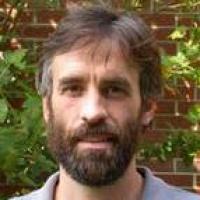 William F. Morris合作论文数Department of Biology, Trinity College of Arts & Sciences, Duke University3
 Conghe Song合作论文数Department of Geography, University of North Carolina at Chapel Hill3
 Jeffrey Walters合作论文数Department of Biological Sciences, College of Science, Virginia Tech3
 Anne M. Trainor合作论文数3
 Jennifer K. Costanza合作论文数Curriculum for the Environment and Ecology, University of North Carolina at Chapel Hill3
 Rajah Saparapa合作论文数2Qi Zhang合作论文数2
 Elisabeth Nebie合作论文数School of Human Evolution and Social Change, Arizona State University2
 David Elliot Tenenbaum合作论文数2
 Nick Haddad合作论文数W.K. Kellogg Biological Station, Michigan State University2
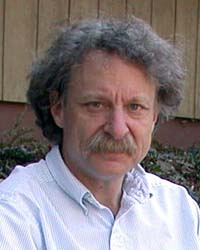 Peter S. White合作论文数Department of Biology, College of Arts and Sciences, The University of North Carolina at Chapel Hill2
 Eric Lambin合作论文数Department of Earth System Science, Doerr School of Sustainability, Stanford University;Woods Institute for the Environment, Stanford University;Université Catholique de Louvain2
 Janet Franklin合作论文数Vegetation and Landscape Ecology Lab, Center for Open Geospatial Sciences, Department of Geography, San Diego State University;Geospatial Sciences Center, University of California, Riverside2Mejs Hasan合作论文数2
 Richard E. Bilsborrow合作论文数Center for Middle East and Islamic Studies, College of Arts and Sciences, The University of North Carolina at Chapel Hill2
 Crystal Barker Schaaf合作论文数Department of Environmental, Earth, and Ocean Sciences, School for the Environment, University of Massachusetts Boston2Pamela Cashman合作论文数2R. Todd Jobe合作论文数2
 Dean L. Urban (Dean Urban)合作论文数Nicholas School of the Environment, Duke University2Thomas R. Allen合作论文数1robert n klein合作论文数1William R Fields合作论文数1Christy R Violin合作论文数1Jack Weiss合作论文数1Kristen A. Vitro合作论文数1Vishnu Ramachandran合作论文数1Natalie R. Gauger合作论文数1H. Mary合作论文数1Alfredo Rojas合作论文数Res Inst Dev1Julia Longo合作论文数1Shiqi Tao合作论文数Graduate School of Geography, Clark University1
 Daniel J Weiss合作论文数Univ Oxford, Dept Zool, Spatial Ecol & Epidemiol Grp, Oxford, England1
 Mary O'Connor合作论文数Department of Zoology, Faculty of Science, The University of British Columbia1
 Naomi Schwartz合作论文数Department of Geography, Faculty of Arts, The University of British Columbia1Qingfeng Huang (黄庆丰)合作论文数1
 Pamela Jagger合作论文数School for Environment and Sustainability, University of Michigan-Ann Arbor1
 Xuemei Shao (邵雪梅)合作论文数Institute of Geographic Sciences and Natural Resources Research, Chinese Academy of Sciences;University of Chinese Academy of Sciences1
 Robert Mcdonald合作论文数Nature Conservancy1
 Alfredo Huete合作论文数School of Life Science, University of Technology Sydney1
 Ian Breckheimer合作论文数Department of Biology, University of Washington1
 Steven Running合作论文数Numerical Terradynamic Simulation Group, University of Montana1McDaniel Philip M合作论文数1
 A. Dave McGuire合作论文数Institute of Arctic Biology, University of Alaska Fairbanks1
 Stephen J. Walsh合作论文数Carolina Population Center, University of North Carolina at Chapel Hill;Department of Geography, College of Arts and Sciences, University of North Carolina at Chapel Hill1
 Zhiqiang Zhang (张志强)合作论文数School of Soil and Water Conservation, Beijing Forestry University1




