Underwater 3D laser scanners are an essential type of sensor used by unmanned underwater vehicles (UUVs) for operations such as navigation, inspection and object recognition and manipulation. These sensors need to be able to provide highly accurate 3D data at fast refresh rates in order to accomplish these tasks. Usually, these scanners rely on a rotating mirror actuated by a galvanometer. However, the light planes steered by this type of mirrors are typically deformed into cones due to refraction. In order to produce accurate results, this distortion needs to be taken into account, which increases the computational cost of the 3D reconstruction. A novel approach consisting in using a biaxial MEMS mirror is proposed in this paper. The second rotational degree of freedom of the mirror can be used to project optimally curved light shapes, so that the refraction process transforms them into planes. Being able to model the light surfaces as planes rather than cones can significantly reduce the computation time of the 3D reconstruction. In order to do so, an exhaustive model of the complete light trajectories is presented. To the best of the authors' knowledge, this paper constitutes the first attempt to model and counteract the distortion in the scanning pattern introduced by a biaxial mirror and a double refraction process in the context of underwater robotics.
A key challenge in autonomous mobile manipulation is the ability to determine, in real time, how to safely execute complex tasks when placed in unknown or changing world. Addressing this issue for Intervention Autonomous Underwater Vehicles (I-AUVs), operating in potentially unstructured environment is becoming essential. Our research focuses on using motion planning to increase the I-AUVs autonomy, and on addressing three major challenges: (a) producing consistent deterministic trajectories, (b) addressing the high dimensionality of the system and its impact on the real-time response, and (c) coordinating the motion between the floating vehicle and the arm. The latter challenge is of high importance to achieve the accuracy required for manipulation, especially considering the floating nature of the AUV and the control challenges that come with it. In this study, for the first time, we demonstrate experimental results performing manipulation in unknown environment. The Multirepresentation, Multiheuristic A* (MR-MHA*) search-based planner, previously tested only in simulation and in a known a priori environment, is now extended to control Girona500 I-AUV performing a Valve-Turning intervention in a water tank. To this aim, the AUV was upgraded with an in-house-developed laser scanner to gather three-dimensional (3D) point clouds for building, in real time, an occupancy grid map (octomap) of the environment. The MR-MHA* motion planner used this octomap to plan, in real time, collision-free trajectories. To achieve the accuracy required to complete the task, a vision-based navigation method was employed. In addition, to reinforce the safety, accounting for the localization uncertainty, a cost function was introduced to keep minimum clearance in the planning. Moreover a visual-servoing method had to be implemented to complete the last step of the manipulation with the desired accuracy. Lastly, we further analyzed the approach performance from both loose-coupling and clearance perspectives. Our results show the success and efficiency of the approach to meet the desired behavior, as well as the ability to adapt to unknown environments.
Underwater 3-D perception is crucial for autonomous manipulation and mapping. Using a mirror-galvanometer system to steer a laser line projector and using triangulation with a camera it is possible to produce full 3-D perception, while avoiding moving the sensor with respect to the scene. This paper presents a ray-based model of a laser scanner and a calibration method for such a model. The model takes into account the distortion introduced to the system by the flat viewports used for both the laser and the camera. The paper also introduces the computation of elliptical cones as a way to synthesize the ray-based model and speed up the triangulation computation. The present study reports results obtained using the real sensor in a water tank to reconstruct objects and planes to assess the sensor's accuracy, as well as a comparison between the two triangulation methods (ray-based and elliptical cone).
This paper presents experimental results using a newly developed 3D underwater laser scanner mounted on an autonomous underwater vehicle (AUV) for real‐time simultaneous localization and mapping (SLAM). The algorithm consists of registering point clouds using a dual step procedure. First, a feature‐based coarse alignment is performed, which is then refined using iterative closest point. The robot position is estimated using an extended Kalman filter (EKF) that fuses the data coming from navigation sensors of the AUV. Moreover, the pose from where each point cloud was collected is also stored in the pose‐based EKF‐SLAM state vector. The results of the registration algorithm are used as constraint observations among the different poses within the state vector, solving the full‐SLAM problem. The method is demonstrated using the Girona 500 AUV, equipped with a laser scanner and inspecting a 3D sub‐sea infrastructure inside a water tank. Our results prove that it is possible to limit the navigation drift and deliver a consistent high‐accuracy 3D map of the inspected object.
Underwater inspection, maintenance and repair (IMR) operations are being increasingly robotized in order to reduce safety issues and costs. These robotic systems rely on vision sensors to perform fundamental tasks, such as navigation and object recognition and manipulation. Especially, active optical 3D scanners are commonly used due to the domain-specific challenges of underwater imaging. This paper presents an exhaustive survey on the state of the art of optical 3D underwater scanners. A literature review on light projection and light-sensing technologies is presented. Moreover, quantitative performance comparisons of underwater 3D scanners present in the literature and commercial products are carried out.
3D object recognition is an active research area in computer vision and robotics. The integration of spatial information with semantic knowledge has become an important task for robots in order to successfully perform autonomous intervention missions. This paper presents an approach for the recognition and pose estimation of underwater objects, with the goal of enabling autonomous underwater intervention in man-made structures. The methods are developed to be used with raw data consisting of 3D colorless point clouds collected by a fast laser scanner. The proposed approach contains two main phases: Object recognition from range data, and feature-based semantic SLAM. The first goal consists of recognizing different objects present in the scene. For this purpose, a recognition and pose estimation pipeline was developed enclosing different steps such as segmentation, identification, and estimation of the position and orientation for each targeted object. The second goal aims at improving the AUV navigation in an underwater environment by using the result of the recognition and pose estimation pipeline to feed a feature based SLAM algorithm. As the AUV moves along the trajectory, the SLAM algorithm builds a map, recognizes targeted objects and integrates them into this map, and localizes its position with respect to it. Compared to previous experimental results performed in a water tank, this paper emphasizes the importance of estimating the pose of the objects (namely the orientation), as a way of promoting the accuracy of the robot localization.
This paper presents a navigation and mapping system for an autonomous underwater vehicle (AUV) while operating near a man-made underwater environment. The objective is to recognize objects (or object parts) and use these as landmarks for simultaneous localization and mapping (SLAM). This approach is intended as the first step towards autonomous object manipulation, to be carried out at a later stage. The approach contains two main components: Object recognition from range data, and feature-based semantic SLAM. For the first component we propose an automatic method for the recognition and location of 3D objects using 3D point clouds as input, extracted from a laser scanner. Since it is common in inspection maintenance and repair (IMR) applications to have access to the 3D models of the objects of interest, the proposed method assumes a priori knowledge of the 3D models of these objects. In typical man-made environments, such objects can be distinct components of a structure, such as valves, pipes and wet-mateable connectors. The object recognition is based on recently proposed global descriptors for point clouds, that allow a compact description of the object shape, which is independent of the object view point. Once an object is recognized, its pose with respect to the AUV is determined using an ICP-based method. The second component of the approach is a feature based SLAM algorithm that uses the recognized objects as landmarks to improve the AUV navigation. The paper presents preliminary results obtained with the Girona 500 AUV, equipped with a fast laser scanner recently developed at the University of Girona. Tests conducted in a controlled environment (water tank) illustrate the suitability of the approach.
Nowadays, research in autonomous underwater manipulation has demonstrated simple applications like picking an object from the sea floor, turning a valve or plugging and unplugging a connector. These are fairly simple tasks compared with those already demonstrated by the mobile robotics community, which include, among others, safe arm motion within areas populated with a priori unknown obstacles or the recognition and location of objects based on their 3D model to grasp them. Kinect-like 3D sensors have contributed significantly to the advance of mobile manipulation providing 3D sensing capabilities in real-time at low cost. Unfortunately, the underwater robotics community is lacking a 3D sensor with similar capabilities to provide rich 3D information of the work space. In this paper, we present a new underwater 3D laser scanner and demonstrate its capabilities for underwater manipulation. In order to use this sensor in conjunction with manipulators, a calibration method to find the relative position between the manipulator and the 3D laser scanner is presented. Then, two different advanced underwater manipulation tasks beyond the state of the art are demonstrated using two different manipulation systems. First, an eight Degrees of Freedom (DoF) fixed-base manipulator system is used to demonstrate arm motion within a work space populated with a priori unknown fixed obstacles. Next, an eight DoF free floating Underwater Vehicle-Manipulator System (UVMS) is used to autonomously grasp an object from the bottom of a water tank.
This paper describes a pose-based underwater 3D Simultaneous Localization and Mapping (SLAM) using a multibeam echosounder to produce high consistency underwater maps. The proposed algorithm compounds swath profiles of the seafloor with dead reckoning localization to build surface patches (i.e., point clouds). An Iterative Closest Point (ICP) with a probabilistic implementation is then used to register the point clouds, taking into account their uncertainties. The registration process is divided in two steps: (1) point-to-point association for coarse registration and (2) point-to-plane association for fine registration. The point clouds of the surfaces to be registered are sub-sampled in order to decrease both the computation time and also the potential of falling into local minima during the registration. In addition, a heuristic is used to decrease the complexity of the association step of the ICP from O(n2) to O(n) . The performance of the SLAM framework is tested using two real world datasets: First, a 2.5D bathymetric dataset obtained with the usual down-looking multibeam sonar configuration, and second, a full 3D underwater dataset acquired with a multibeam sonar mounted on a pan and tilt unit.
Distributing the mapping problem over several vehicles provides the ability to survey an area in fewer time than with a single one. However, the communications required to maintain the vehicles in formation underwater are highly complex. We present a global alignment method for multi-AUV trajectory optimization. We take advantage of the acoustic messages passed between vehicles as well as of the further constraints posed by optical matches between images in some of the vehicles in the formation, both within a single robot and from different ones. By merging all these constraints, we can obtain both an optical georeferenced mosaic of the surveyed area and a joint optimization of the poses of the vehicles in the formation at each time. We present and discuss an application of the method on a real dataset collected within the MORPH EU-FP7 project.
Building accurate bathymetries of the seabed has been a focus of study in the last decade. For this purpose seabed point cloud registration has been a focus for some researchers. Some of this registration methods are based on gathering the points of the cloud that contain more information for the registration (i.e. the ones that flat or smooth, normally being the seabed) and using them as part of ICP-derived methods. For this point picking purpose, we present a segmentation technique that distinguish between objects (interesting for registration) and ground (smooth and not interesting for registration). The method proposed here uses difference of normals for object's border detection and a variation of the Density-Based Spatial Clustering of Application with Noise for object clustering. Once the objects boundaries are detected and the points are clustered the rest of the points are classified as object or ground. This classification is done by taking all the points that lie within the object's border and checking it's depth compare to its closes border point. The method is evaluated using a multi-beam dataset gathered on the La Lune shipwreck, a site of archaeological interest.
This paper presents a solution to the 3D Range-Only beacon localization problem using a Sum of Gaussians (SOG) filter together with an Active Localization method, which is based on the minimization of the beacon position uncertainty, in order to ensure the problem observability and a fast convergence. The method is applied to autonomously locate a subsea panel and home to it in order to establish visual contact to later launch a visual servoing based docking task. The method is demonstrated through field experiments in a harbor environment with an Autonomous Underwater Vehicle (AUV) including Ultra-Short Baseline (USBL) ground truth information.
This paper describes a Realtime Terrain Based Navigation algorithm designed for the Girona500 AUV and tested in a water tank. This paper seeks to establish the foundations for a future online SLAM and planning. Realtime TBN is achieved by means of a parallelized Particle Filter and a fast query and insertion map 3D Occupancy Grid representation using Octomap library. Particle Filter is implemented as a single ROS node in the vehicle's software architecture with a motion model based on AHRS-DVL and measurement model based on a multibeam sonar profiler sensor. Several parameters of the particle filter are studied as well as its realtime performance.
This paper describes a probabilistic surface matching method for pose-based bathymetry SLAM using a multibeam sonar profiler. The proposed algorithm compounds swath profiles of the seafloor with dead reckoning localization to build surface patches. Then, a probabilistic implementation of the ICP is used to deal with the uncertainty of the robot pose as well as the measured points in a two-stage process including point-to-point and point-to-plane metrics. A surface adaptation using octrees and difference of normals is proposed to have ICP-derived methods working in feature-poor or highly unstructured areas typical of bathymetric scenarios. Moreover, a heuristic based on the uncertainties of the surface points is used to improve the basic algorithm, decreasing the ICP complexity to O(n). The performance of the method is demonstrated with real data from a bathymetric survey with Girona 500 AUV.
We present a novel survey path planning technique which minimizes the robot's position uncertainty along the planned path while taking into account area coverage performance. The proposed technique especially targets bathymetric mapping applications and respects application constraints such as the desire to survey in parallel tracks and to avoid turns in the target area to maximize sonar measurements quality. While accounting for uncertainty in the survey planning process can lead to more accurate data products, existing survey planning tools typically ignore it. Our method bridges this gap using the saliency on an a priori map to predict how the terrain will affect the robot's belief at every point on the target area. Based on this magnitude, we provide an algorithm that computes the order in which to trace parallel tracks to cover the target area minimizing the overall uncertainty along the path. A particle filter keeps track of the robot's position uncertainty during the planning process and, in order to find useful loop-closures for mapping, crossing tracks that visit salient locations are added when the uncertainty surpasses a user-provided threshold. We test our method on real-world datasets collected off the coasts of Spain, Greece and Australia. We evaluate the expected robot's position uncertainty along the planned paths and assess their associated mapping performance using a bathymetric mapping algorithm. Results show that our method offers benefits over a standard lawnmower-type path both in terms of position uncertainty and map quality.
This paper describes the use of a research-driven, highly reconfigurable autonomous underwater vehicle for surveying the site of the historical shipwreck of La Lune. This wreck, from the XVII century, lies in 90m of water near the coast of Toulon in France. The goal of this survey was to create a fast but detailed map of the site, to serve as a base map for subsequent archaeological intervention. The paper overviews the survey setup and the methods used to generate a high resolution optical map. It also highlights some of the important advantages that lightweight AUVs present for archaeological survey missions in terms of operational costs, survey time, the quality of both the acquired data and the mapping outcome, and access to deep sites that are not reachable by traditional archaeological methods.
This paper describes a probabilistic surface matching method for pose-based bathymetry SLAM using a multibeam sonar profiler. The proposed algorithm compounds swath profiles of the seafloor with dead reckoning localization to build surface patches. Then, a probabilistic implementation of the ICP is used to deal with the uncertainty of the robot pose as well as the measured points in a two-stage process including point-to-point and point-to-plane metrics. A novel surface adaptation using octrees is proposed to have ICP-derived methods working in feature-poor or highly unstructured areas typical of bathymetric scenarios. Moreover, a heuristic based on the uncertainties of the surface points is used to improve the basic algorithm, decreasing the ICP complexity to O(n). The performance of the method is demonstrated with real data from a bathymetric survey.
This paper address the Simultaneous Localization and Mapping (SLAM) problem of an AUV using bathymetric maps. The algorithm compounds swath profiles of the seafloor with DVL navigation(dead-reckoning) to build surface patches (3D point clouds). An initial guess of the location of these point clouds is known a priori by means of the dead-reckoning solution. Whenever there is a significant overlap of two or more point clouds, the corresponding surface patches are registered among themselves using a probabilistic ICP algorithm. The outcome of the registration procedure is a set of constrains defining the relative position of the overlapping surface patches. Next, these constrains are used to optimize a pose graph using the G2o optimizer. The results are compared against our prior EKF-pose-based SLAM solution. Our results suggest that a better performance is achieved using EKF global optimization with respect to the G2o graph-SLAM solution.
 Antonio Guglietta合作论文数28
 Pedro Ridao Rodriguez合作论文数Department Arquitectura i Tecnologia de Computadors, Universitat de Girona;Computer Vision and Robotics Research Institute, University of Girona18David Mauleón合作论文数16luis anglada合作论文数12José L. Falcó合作论文数12
 David Ribas合作论文数12
 Francesc Cabre合作论文数8Germano Carganico合作论文数6
 Guillem Vallicrosa合作论文数6Jaume Pascual合作论文数5M. Cabré合作论文数5
 Nuno Gracias合作论文数Instituto Superior Tecnico;Instituto de Sistemas e Robotica Av;Instituto Superior Tecnico|Instituto de Sistemas e Robotica Av5montserrat cano合作论文数4marta princep合作论文数4Gabriel Germain合作论文数4G. S. D. King合作论文数4
 Josep Forest合作论文数Institut d'Informatica i Aplicacions, University of Girona4
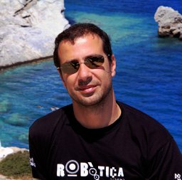 Angelos Mallios合作论文数Department of Computer Engineering, University of Girona4Francesco Canals合作论文数4Joan C. Ferrer合作论文数4Arsenio Iglesias合作论文数4P LUPON合作论文数4JJ BONET合作论文数3Irma Buira合作论文数3José Terencio合作论文数3Eva Méndez合作论文数3Gago F合作论文数3
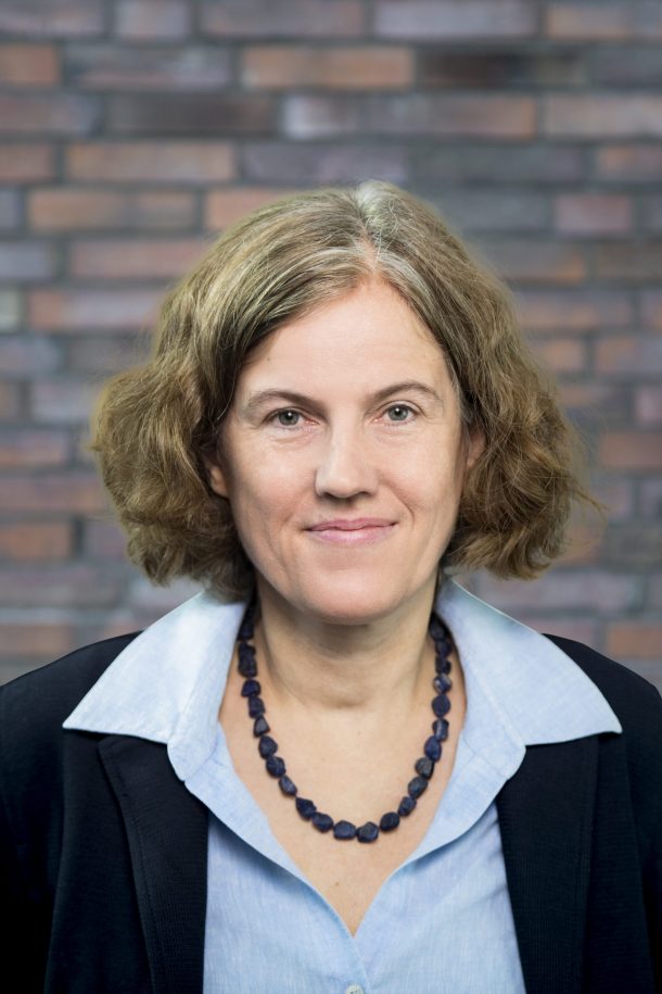 Rebecca Wade合作论文数Heidelberg Institute for Theoretical Studies;Interdisciplinary Center for Scientific Computing, Heidelberg University;Faculty of Biosciences, Heidelberg University3Juan Perez合作论文数Dept . d'Enginyeria Quimica, ETS d'Enginyers Industrials3M. L. Garcia合作论文数3Juan F. Piniella合作论文数3Oriol Llorens合作论文数3
 Narcís Palomeras合作论文数Computer Vision and Robotics Group, University of Girona3A Carabaza合作论文数2A.R. Ortiz合作论文数2J. A. Andreu合作论文数2G. González合作论文数2
 Jose I Borrell合作论文数2
 Miguel Castillon合作论文数Comp Vis & Robot Res Inst VICOROB, Univ Girona2
 Roger Pi合作论文数2Dina Youakim合作论文数Vision & Robotics, University Of Girona, Spain, Girona, 17003, Spain2Gabriele Cruciani合作论文数2Martin Demuth合作论文数2
 Mercedes Alvarez合作论文数2
 Manuel Pastor合作论文数ETSI Caminos, Canales y Puertos, Universidad Politéctnica de Madrid2L. Borras合作论文数2
 Jordi Teixidó合作论文数Institut Quı́mic de Sarrià, Universitat Ramon Llull2
 Rosa Griera合作论文数Faculty of Pharmacy, University of Barcelona2




