In South Greenland, public concerns have linked "black livers" in sheep to presumed environmental pollution from the Kvanefjeld mining exploration project. Elevated concentrations of metals and radionuclides in the area reflect natural geochemistry and weathering processes, not pollution from exploration activities. However, in response, we conducted a preliminary case-control study to diagnose the condition, investigate links between liver discoloration and environmental concentrations of metals and radionuclides, and to estimate the annual effective dose to the public from polonium-210 (210Po) ingestion via sheep and lamb liver consumption. We also evaluated the prevalence of acquired melanosis, grazing and herd effects, and their association with carcass quality and disease markers. Histological analysis confirmed acquired melanosis in affected liver samples. No statistically significant differences in concentrations of chemical elements or radionuclides (including ²¹⁰Po and ²¹⁰Pb) were found between case and control groups, across age groups, grazing areas, or farms. Except for the most exposed children (10% percentile), the estimated annual effective dose to adults and children from 210Po ingestion in black and healthy livers remained below the world average of 120 µSv due to the ingestion of naturally occurring radionuclides. The overall prevalence of ovine acquired melanosis based on a large sample size was 10.59%, with herd prevalence ranging from 0% to 51.79%. Age-specific prevalence was 10.38% in lambs and 13.40% in adult sheep. Acquired melanosis was negatively correlated with fat and muscle content in carcasses. Acquired melanosis in sheep from South Greenland does not pose a health risk to humans through liver consumption.
As the world’s need for raw materials increases, more mines are planned to be established in the Arctic. The Arctic provides a unique and challenging environment for mining operations and introduces concerns for the potential spread of pollution. Arctic environmental conditions linked to wind- and waterborne pollution transport such as hydrology, precipitation, temperature, windspeed and wind direction vary markedly throughout the year and the environment is sensitive to anthropogenic influence. In Greenland, several legacy mines provide testimony to how pollution still affects the sensitive Arctic environment. These legacy mines serve as valuable study sites that can improve future predictions on environmental consequences of mining operations in Greenland and other areas in the Arctic. Environmental studies at legacy mine sites in Greenland have previously focused on the leaching of pollutants into the marine environment and little is known about the spatial distribution of pollution in the terrestrial environment at these sites. In the current study, we present preliminary data from an environmental survey at the Blyklippen legacy mine. Blyklippen was a lead and zinc mine in East Greenland that operated between 1956-1963. Mining operations caused substantial pollution of lead (Pb), zinc (Zn), and other heavy minerals such as cadmium (Cd), barium (Ba) and copper (Cu), still measurable today. The primary sources of pollution today are the tailings storage facility and remains of ore concentrate spills along the haul road and at the quay areas at the harbor. Pollution is dispersed from these sites into the surrounding environment by wind and water. The aim of the current study is to investigate and map the spatial distribution of heavy metals in the environment surrounding the Blyklippen legacy mine using both field measurements by portable X-Ray Fluorescence spectrometry (pXRF) on depth specific sediment samples at in situ conditions and laboratory measurements on freeze-dried samples to investigate the effect of soil moisture on the accuracy of the field screening. Field measurements were conducted using short measurement times of 5-10 seconds, whereas laboratory measurement times were 180 seconds. A total number of 995 discrete sediment samples were collected over 10 days at the Blyklippen mine site and surrounding area of Mestersvig from 178 sampling locations at depth intervals of 5 cm. Our results demonstrate the effectiveness of pXRF as a field measurement tool for identifying the spatial delineation of soil pollution by comparing in situ measurements against pre-defined natural background values for heavy metals such as Pb and Zn. Comparison between Pb and Zn concentrations measured in the field versus in the laboratory on freeze-dried samples showed a good agreement for mineral soils. On organic and/or wet samples, field concentrations were underestimated for some elements. Overall, the approach shows that a fast and cost-effective large-scale field survey at legacy mines is obtainable using pXRF, enabling an effective identification of pollution ‘hotspots’ directly in the field. In combination with geostatistical mapping, the approach can improve the overall accuracy of environmental monitoring and mapping of pollution with enhanced environmental protection at both legacy, recent and future mines.
Northern common eider ducks (Somateria mollissima borealis, Linnaeus, 1758) are harvested throughout their range and represent an important resource of eggs, meat, and feather down. In the 1990s, there was growing Indigenous and international concern that eiders nesting in Arctic Canada were in decline. In response, Environment and Climate Change Canada (ECCC) established a field station on a small uninhabited island in East Bay, Southampton Island (64°01′N, 81°47′W), with the intention of developing a long-term study of eider demography that could inform harvest management. Throughout the nearly three-decade duration of the East Bay Island Field Station, field logistics revolved around regional sea ice conditions and how to maintain reliable transportation and access to the island. Despite these challenges, the gradual improvement of the field station facilitated a growing breadth of research as new issues emerged, many of which were unforeseen. Here, we provide an overview of the 28 years of research, including studies on the impacts of harvest, avian disease, contaminant levels and parasitology, details of bird migration, ecological trade-offs, and predator-prey dynamics. The breadth of these research topics reflects the diversity of expertise contributed by numerous university collaborators and graduate students, as well as Inuit ingenuity and Indigenous ecological knowledge that contributed to all stages of the research program.
Calanus finmarchicus is an important, extensively studied zooplankton species in the North Atlantic. Many studies have explored its abundance and life cycle, but basin-wide relationships between its vertical distribution and environment during the feeding season remain poorly known. We conducted a meta-analysis of stage-specific vertical distribution and its relationships with environmental variables (temperature, salinity, irradiance, chlorophyll-a) in the epipelagic layer (0–200 m) of the North Atlantic during spring and summer (21 March to 21 September). Fitting a GAM model, we analyzed data from 47 years (1971–2018) with the aim to discern common, stage-specific responses to environment across the area. Highest abundances were observed in the upper 50 m in spring (at 5°C) and summer (at 7.5°C). The timing of the phytoplankton bloom emerged as a key driver determining vertical distribution, with all stages found shallower during the seasonal surface Chl.-a maximum. Contrary to reports of mismatch with global warming, the data indicated a region-wide match of spring bloom and Calanus. In the coldest areas of its habitat (< 1°C), the copepods stayed closer to surface, potentially to fulfill development, while in warmest areas (>10°C), early stages stayed deeper likely to avoid warm surface waters.
We surgically implanted a 50 g PTT-100 (Platform Transmitter Terminal) in 21 Common Eiders (Somatria mollissima) and a 29 g PTT-100 in 10 Thick-billed Murres (Uria lomvia). After 2-4 months, one Common Eider implanted intracoelomically and two Thick-billed Murres implanted subcutaneously were harvested by local subsistence hunters and examined in the laboratory. External examination of the harvested birds did not reveal any morphological or pathological changes, while the surgical abdominal and cervical wounds seemed to have healed with granulation tissue in all three birds. Necropsy showed chronic inflammation and fatty necrosis in one of the murres, while the antenna Dacron cuffs were at skin level as originally attached for all three birds, with primary tissue healing and no signs of inflammation. In the eider, a few peritoneal adherences were found on the liver without additional signs of inflammation, while one murre had adherences and granulomatous tissue around the PTT with signs of severe inflammation and external rejection. These results indicate that birds can survive implantation of transmitters, even if inflammation develops around the implants. The study points to the importance of continuously refining the techniques for implanting devices in wild birds and performing necropsies on recovered birds.
Considering seabirds as indicators of environmental change, we compared thick-billed murre (Uria lomvia (Linnaeus, 1758)) adult and chick diet in the North Water polynya region, NW Greenland, during 1997 and 2023. In the adult murre diet, fish accounted for 86% and 42% of food items by number, and 99% by wet mass (WM) in both 1997 and 2023. Arctic cod (Boreogadus saida (Lepechin, 1774)) was the most important prey, contributing 90% and 99% of WM in 1997 and 2023, respectively. In 1997 the murres ate mostly small 1-year-old cod but in 2023 they mainly took larger 2- and 3-year-old Arctic cod. In the chick diet, gadids contributed 71% and 86% of prey items brought to the chicks in 1997 and 2023, respectively, supplemented by sculpins and eelpouts in 1997. Capelin (Mallotus villosus (Müller, 1776)) increasingly occur in the area but did not appear in the murre diet. The study highlights a consistent reliance on Arctic cod, although with differences between sampling years in size of ingested specimens. We recommend continued monitoring of top predator diets, coupled with local knowledge, to understand the impacts of ongoing changes in the region.
The child-like question of why birds sing in the morning is difficult to answer, especially in polar regions. There, in summer animals live without the time constraints of daylight, and little is known about the rhythmicity of their routines. Moreover, in situ monitoring of animal behavior in remote areas is challenging and rare. Here, we use audio data from Greenland to show that a colony of a key Arctic-breeding seabird, the little auk ( Alle alle ), erupts with acoustic excitement at night in August, under the midnight sun. We demonstrate that the acoustic activity cycle is consistent with previous direct observations of the feeding and attendance patterns of the little auk. We interpret this pattern as reflecting their foraging activities, but further investigation on fledging and predators is needed. The study demonstrates that acoustic monitoring is a promising alternative to otherwise demanding manual observations of bird colonies in remote Arctic areas.
Forestalling the decline of global biodiversity requires urgent and transformative action at all levels of government and society, particularly in the Arctic Ocean and adjacent seas where rapid changes are already underway. Amid growing scientific support and mounting pressure, the majority of nations have committed to the most ambitious conservation targets yet. However, without an approach that inclusively and equitably reconciles conservation and sustainable ocean use, these targets will likely go unmet. Here, we present ArcNet: a network design framework to help achieve ocean-scale, area-based marine conservation in the Arctic. The framework is centred around a suite of web-based tools and a ~ 5.9 million km2 network of 83 priority areas for conservation designed through expert-driven systematic conservation planning using conservation targets for over 800 features representing Arctic biodiversity. The ArcNet framework is intended to help adapt to new and emerging information, foster collaboration, and identify tailored conservation measures within a global context at different levels of planning and implementation.
The Environment & Oil Spill Response tool (EOS), supports oil spill response planning and decision making. This tool is developed on a research basis, and is an index based, generic and open-source analytic tool, which environmentally can optimise the choice of oil spill response methods for a given spill situation and for a given sea area with respect to environment and nature. The tool is not linked to a particular oil spill simulation model, although it is recommended using oil spill simulation models to have detailed data available for the analysis. The EOS tool consists of an Excel workbook with formulas for calculations and scores followed by screening through decision trees. As case for the EOS tool proof-of-concept, the area of Store Hellefiskebanke, West Greenland, is used. The tool can be downloaded from the Aarhus University home page as a free-of-charge application and is accompanied by a handbook for guidance.
AimEcologically similar species living in sympatry are expected to segregate to reduce the effects of competition where resources are limiting. Segregation from heterospecifics commonly occurs in space, but it is often unknown whether such segregation has underlying environmental causes. Indeed, species could segregate because of different fundamental environmental requirements (i.e., 'niche divergence'), because competitive exclusion at sympatric sites can force species to either change the habitat use they would have at allopatric sites (i.e., 'niche displacement') or to avoid certain areas, independently of habitat (i.e., 'spatial avoidance'). Testing these hypotheses requires the comparison between sympatric and allopatric sites. Understanding the competitive mechanisms that underlie patterns of spatial segregation could improve predictions of species responses to environmental change, as competition might exacerbate the effects of environmental change.LocationNorth Atlantic and Arctic.TaxaCommon guillemots Uria aalge and Br & uuml;nnich's guillemots Uria lomvia.MethodsHere, we examine support for these explanations for spatial segregation in two closely-related seabird species, common guillemots (Uria aalge) and Br & uuml;nnich's guillemots (U. lomvia). For this, we collated a pan-Atlantic data set of breeding season foraging tracks from 1046 individuals, collected from 20 colonies (8 sympatric and 12 allopatric). These were analysed with habitat models in a spatially transferable framework to compare habitat preferences between species at sympatric and allopatric sites.ResultsWe found no effect of the distribution of heterospecifics on local habitat preferences of the focal species. We found differences in habitat preferences between species, but these were not sufficient to explain the observed levels of spatial segregation at sympatric sites.Main ConclusionsAssuming we did not omit any relevant environmental variables, these results suggest a mix of niche divergence and spatial avoidance produces the observed patterns of spatial segregation.
Scheduling between mates in species with long-term pair bonds can be essential for positive fitness. The annual cycle in photoperiod is the primary environmental cue used by many animals to synchronize behavior and physiology among members of a population, and animals that migrate must have similar annual schedules to ensure successful breeding. However, we know little about whether members of mated pairs in migratory species experience similar photic environments across the year, which could allow for synchronization in annual phenology. Here, we used light-based geolocation to estimate positions of mated pairs of Thick-billed Murres (Uria lomvia, a seabird a.k.a. Brünnich’s Guillemot) which bred above the northern polar circle in Greenland. We tested the hypothesis that individuals in mated pairs occur in more similar locations and photic environments than randomly matched females and males. We found no difference in the amount of spatial separation or in the photic environment between mates and randomized heterosexual pairings. In general, the distance between females and males ranged from 1,198.5 km during August to 737.4 km during January. The sexes remained in photic environments with highly correlated photoperiods and moderately correlated times of solar noon in UTC. The spatial separation of, but similar photic environments experienced by, female and male murres regardless of pair status is probably adaptive by facilitating the synchronization of annual schedules between sexes, while allowing individuals in mated pairs the freedom to pursue the best foraging opportunities during migration and overwintering independent of their mate.
Climate change is impacting marine ecosystems throughout the circumpolar Arctic, altering seasonal habitats and the food bases for fishes, seabirds, and marine mammals. Arctic and Subarctic regions provide resources for resident species and for species that migrate to the north from more southerly regions. Changes in northerly latitudes thus impact endemic as well as non-endemic animals. Herein, we review what is known about climate-driven changes in the migration patterns of Arctic and Subarctic marine vertebrates, including: 1) Arctic residents with seasonal movements – those fishes, seabirds, and marine mammals that complete their entire life cycle within the Arctic but exhibit seasonal movements; 2) Breeding migrants – many seabirds enter the Arctic to breed and subsequently migrate south in the fall; and 3) Summer visitors for feeding – certain species of boreal fishes, seabirds and marine mammals arrive during the northern summer to feed on abundant prey though they breed elsewhere. Migratory movements are often driven by the timing and extent of sea ice, which defines suitable habitat for some animals and limits access to open water and prey for others. Longer open-water seasons, warmer ocean temperatures, and stronger winds have resulted in earlier production blooms in spring and often, extended open-ocean plankton blooms into late summer, resulting in altered prey types and distributions. A common thread among taxa is that shifts in distribution and timing of migrating animals indicate they are traveling farther north, or shifting longitudinally, and migrations are occurring over longer seasonal time frames. Species performing multiple lifetime migrations or long-distance migrants may need to adjust migration timing or routing iteratively to match changes in marine productivity. Altered animal distributions or phenology, and reduced sea ice, affects access to animals that are critical nutritional, economical, and cultural components of Indigenous people’s lives in the Arctic. Ongoing changes challenge the resilience and adaptability of Arctic people and ecosystems, and will require adaptive research and management approaches.
Mercury (Hg) is a metallic trace element toxic for humans and wildlife that can originate from natural and anthropic sources. Hg spatial gradients have been found in seabirds from the Arctic and other oceans, suggesting contrasting toxicity risks across regions. Selenium (Se) plays a protective role against Hg toxicity, but its spatial distribution has been much less investigated than that of Hg. From 2015 to 2017, we measured spatial co-exposure of Hg and Se in blood samples of two seabird species, the Brünnich's guillemot (Uria lomvia) and the black-legged kittiwake (Rissa tridactyla) from 17 colonies in the Arctic and subarctic regions, and we calculated their molar ratios (Se:Hg), as a measure of Hg sequestration by Se and, therefore, of Hg exposure risk. We also evaluated concentration differences between species and ocean basins (Pacific-Arctic and Atlantic-Arctic), and examined the influence of trophic ecology on Hg and Se concentrations using nitrogen and carbon stable isotopes. In the Atlantic-Arctic ocean, we found a negative west-to-east gradient of Hg and Se for guillemots, and a positive west-to-east gradient of Se for kittiwakes, suggesting that these species are better protected from Hg toxicity in the European Arctic. Differences in Se gradients between species suggest that they do not follow environmental Se spatial variations. This, together with the absence of a general pattern for isotopes influence on trace element concentrations, could be due to foraging ecology differences between species. In both oceans, the two species showed similar Hg concentrations, but guillemots showed lower Se concentrations and Se:Hg than kittiwakes, suggesting a higher Hg toxicity risk in guillemots. Within species, neither Hg, nor Se or Se:Hg differed between both oceans. Our study highlights the importance of considering Se together with Hg, along with different species and regions, when evaluating Hg toxic effects on marine predators in international monitoring programs.
Chemical dispersion is an oil spill response strategy where dispersants are sprayed onto the oil slick to enhance oil dispersion into the water. However, accidental application could expose seabirds to dispersants, thereby negatively affecting their plumage. To understand the possible impacts on seabirds, feathers from common eider (Somateria mollissima) and thick-billed murre (Uria lomvia) were exposed to different dosages of the dispersant Dasic Slickgone NS. For all exposure dosages the feathers increased in weight, and mostly for common eider. Analysing the feather microstructure, e.g., the Amalgamation Index, showed that larger damages were found on thick-billed murre than common eider. A no-sinking limit was established at 0.109 ml/m2. Relating this value to desktop simulations of potential sea-surface dosages in real-life situations, and to published accounts of response operations, showed that the limit is likely to be exceeded. Thus, our results show that chemical dispersants in realistic dosages could impact seabirds.
Dispersion and deposition of mineral dust from natural or anthropogenic sources can have both positive and negative effects on the environment depending on the geochemical and mineralogical composition of the dust. In Greenland, proglacial river systems draining the Greenland Ice Sheet occupy extensive areas of dust prone deposits, which are commonly mobilized and transported by winds of both katabatic and cyclonic origin and subsequently deposited as high latitude dust. The geochemical fingerprint of natural dust emitted along the latitudinal transect reflects the mineralogical and elemental composition of the bedrock underlying the Ice Sheet in the different geological provinces of Greenland. As dust emissions respond to changes in climate-sensitive drivers such as soil moisture, winds speed and precipitation, marked variations in natural dust emissions are present along the climatic gradient in Greenland, ranging from high latitude arctic deserts in North Greenland to low latitude shrub tundra in the South.With a changing climate, interest has increased to access and exploit the rich mineral resources located in the Arctic. In Greenland, development of large-scale mines range from rare earth element mines in the sub-arctic South to zinc-lead mines in the high-arctic North. While the mining sector provides society with essential raw materials for a wide range of industrial processes as well as forming the basis for the transition into a global green economy, it also has significant environmental pitfalls, which should be avoided or mitigated. Mobilization, transport, and deposition of mineral dust from mine sites is often significant in regions susceptible to wind erosion because of the dry climate and lack of vegetation. Once dispersed into the environment, this mineral dust may impair important ecosystem functions due to its potential content of heavy metals and other trace elements, as well as cause concerns for public health.To support the sustainable development of environmentally safe mining in sensitive Arctic land areas and reduce airborne environmental pollution, an improved understanding of processes leading to the dispersion of mineral dust in a changing Arctic is needed. This involves improved methods for monitoring dust emissions and dust deposition in a cold environment as well as analytical tools and methods to source trace and differentiate between natural and mining related dust. Accurate identification of individual dust sources subsequently makes it possible to mitigate emissions and target the regulation of mining activities towards these sources.In the following, we present a new high latitude dust sampling location in Kangerlussuaq, West Greenland, where dust is collected using a wide array of passive and active dust samplers, including a continuously operated high volume dust sampler, which will offer filter samples of large air volumes (13.000 m3) at a weekly sampling frequency over multiple years. In addition, we would like to present data from a study (1) in which we developed a fast and cost-effective surface screening methodology that is easily applicable for dust source characterization in remote Arctic areas such as Greenland, where dry conditions and high winds create a high natural dust generation potential.(1) Søndergaard, J. & Jørgensen, C.J. (2021) DOI: 10.1007/s11270-021-05095-2
Indoor radon and its decay products are the primary sources of the population's exposure to background ionizing radiation. Radon decay products are one of the leading causes of lung cancer, with a higher lung cancer risk for smokers due to the synergistic effects of radon decay products and cigarette smoking. A total of 459 year-long radon measurements in 257 detached and semi-detached residential homes in southwest and south Greenland were carried out, and a dose assessment for adults was performed. The annual arithmetic and geometric means of indoor radon concentrations was 10.5 +/- 0.2 Bq m- 3 and 8.0 +/- 2.3 Bq m- 3 in Nuuk, 139.0 +/- 1.0 Bq m- 3 and 97.3 +/- 2.1 Bq m- 3 in Narsaq, and 42.1 +/- 0.7 Bq m- 3 and 22.0 +/- 3.1 Bq m- 3 in Qaqortoq. Arithmetic and geometric mean radon concentration of 79.0 Bq m- 3 and 50.3 Bq m- 3 were estimated for adult, person-weighted living in south Greenland. The total number of detached and semi-detached residential homes where indoor radon is exceeding 100 Bq m- 3, 200 Bq m- 3, and 300 Bq m- 3 is 37 homes (15.0%), 13 homes (5.2%), and 8 homes (3.2%), respectively. A positive correlation between indoor air radon concentrations and underlying geology was observed.The indoor radon contribution to the annual inhalation effective dose to an average adult was 0.5 mSv in Nuuk, 6.5 mSv in Narsaq, 2.0 mSv in Qaqortoq, and 4.0 mSv for south Greenland adult person weighted. The estimated annual average effective dose to adults in Narsaq is higher than the world's average annual effective dose of 1.3 mSv due to inhalation of indoor radon. Cost-efficient mitigation methods exist to reduce radon in existing buildings, and to prevent radon entry into new buildings.
Arctic cod (Boreogadus saida) is the most abundant forage fish in the Arctic Ocean. Here we review Arctic cod habitats, distribution, ecology, and physiology to assess how climate change and other anthropogenic stressors are affecting this key species. This review identifies vulnerabilities for different life stages across the entire distribution range of Arctic cod. We explore the impact of environmental (abiotic and biotic) and anthropogenic stressors on Arctic cod with a regional perspective in a scenario up to the year 2050 and identify knowledge gaps constraining predictions. Epipelagic eggs and larvae are more vulnerable to climate change and stressors than adults. Increased water temperatures, sea-ice decline, altered freshwater input, acidification, changing prey field, increased interspecific competition, new predators, and pollution are the principal stressors that will affect Arctic cod populations. Detrimental effects are likely to be greater in regions characterized by the advection of warmer Atlantic and Pacific waters. In contrast, Arctic cod may benefit from ocean warming in colder areas of the High Arctic. The risk from fisheries is moderate and primarily limited to bycatch. Overall, a decrease in suitable habitat and an associated decline in total Arctic cod biomass are predicted. In most Arctic seas, the relative abundance of Arctic cod within the fish community will likely fluctuate in accordance with cold and warm periods. A reduced abundance of Arctic cod will negatively affect the abundance, distribution, and physiological condition of certain predators, whereas some predators will successfully adapt to a more boreal diet. Regional management measures that recognize the critical role of Arctic cod are required to ensure that increased anthropogenic activities do not exacerbate the impacts of climate change on Arctic marine ecosystems. Ultimately, the mitigation of habitat loss for Arctic cod will only be achieved through a global reduction in carbon emissions.
Density-dependent prey depletion around breeding colonies has long been considered an important factor controlling the population dynamics of colonial animals.1-4 Ashmole proposed that as seabird colony size increases, intraspecific competition leads to declines in reproductive success, as breeding adults must spend more time and energy to find prey farther from the colony.1 Seabird colony size often varies over several orders of magnitude within the same species and can include millions of individuals per colony.5,6 As such, colony size likely plays an important role in determining the individual behavior of its members and how the colony interacts with the surrounding environment.6 Using tracking data from murres (Uria spp.), the world's most densely breeding seabirds, we show that the distribution of foraging-trip distances scales to colony size0.33 during the chick-rearing stage, consistent with Ashmole's halo theory.1,2 This pattern occurred across colonies varying in size over three orders of magnitude and distributed throughout the North Atlantic region. The strong relationship between colony size and foraging range means that the foraging areas of some colonial species can be estimated from colony sizes, which is more practical to measure over a large geographic scale. Two-thirds of the North Atlantic murre population breed at the 16 largest colonies; by extrapolating the predicted foraging ranges to sites without tracking data, we show that only two of these large colonies have significant coverage as marine protected areas. Our results are an important example of how theoretical models, in this case, Ashmole's version of central-place-foraging theory, can be applied to inform conservation and management in colonial breeding species.
This review provides an overview of environmental studies and monitoring at mine sites in Greenland since the first environmental studies were conducted in the early 1970s. Mining at three legacy mine sites in Greenland (Ivittuut, Mestersvig and Maarmorilik) caused significant metal pollution, mostly with lead and zinc, due to lack of adequate environmental studies and regulation. These legacy mine sites have later served as study areas for development of methods for environmental monitoring, which can also be applied to other sites. The review describes the most significant mines in Greenland's mining history together with procedures for conducting the environmental monitoring work. A comprehensive description is provided on the research results and development of monitoring practices during the past 50 years for assessing dispersion, bioaccumulation and toxicological effects of pollutants in both the marine and terrestrial environment. Further, the current practices for sample preparation, chemical analyses and storage of samples and data are described. From the studies it is clear that monitoring needs to be site-and mine-specific, adaptive, diverse and take conditions unique to the Arctic into account, such as permafrost, seasonal drainage and fjord stratification dynamics. Based on the results, lessons learned for future monitoring programs are given. Moreover, spatial and temporal trends of the legacy pollution at the Greenland mine sites are discussed. Finally, it is shown how research and monitoring results have been applied to regulate mining activities in Greenland to minimise the environmental impact, and some future perspectives are presented. Many of the results and conclusions in the review are considered applicable to environmental monitoring of mining and other industrial activities in other areas than Greenland, both inside and outside of the Arctic.
The Arctic region is currently experiencing major modifications in sea ice extent and phenology due to global climate and anthropogenic changes. As Arctic marine ecosystems rely greatly on the presence of sea ice and its seasonal dynamics, these changes could have major impacts on Arctic biota. The ivory gull (Pagophila eburnea) is an endemic Arctic seabird whose populations are declining in Canada and Svalbard. Its affinity for sea ice makes it a good sentinel species of current changes in the high Arctic. We explored the influence of sea-ice-related features and anthropogenic subsidies on the foraging behaviour of ivory gulls during the breeding season. To this end, we analysed the movement of adult ivory gulls in north-east Greenland. We confirmed that ivory gulls use a dual foraging strategy, with birds faithful to their foraging areas at short distances from the colony, but used individual-specific areas during long-distance foraging trips. We highlight that ivory gulls are spatially specialised individuals within a generalist species. We demonstrated that human settlements attracted foraging birds, which shows that human presence in such a remote place may influence the seabird behaviour. Finally, by combining hidden Markov models and resource selection functions, we showed that ivory gulls selected highly concentrated sea ice for foraging during the breeding season. Our study provides key information on the use of space and foraging strategies of ivory gulls during the breeding season, and more broadly, how Arctic seabirds use ice features.
 David Boertmann合作论文数National Environmental Research Institute, Aarhus University42
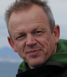 Flemming Merkel合作论文数Greenland Institute of Natural Resources35
 Morten Frederiksen合作论文数National Environmental Research Institute, Department of Arctic Environment, University of Aarhus30
 Kasper L. Johansen合作论文数27
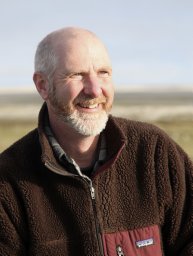 H. Grant Gilchrist合作论文数National Wildlife Research Centre, Carleton University24Strøm Hallvard合作论文数22
 Jannie Fries Linnebjerg合作论文数20
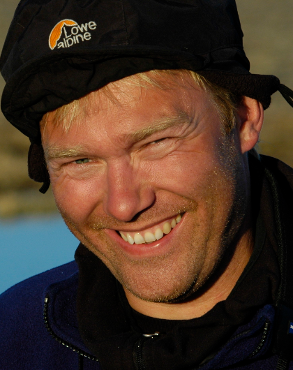 Christian Sonne合作论文数Department of Ecoscience, Aarhus University;Arctic Research Centre, Department of Bioscience, Faculty of Science and Technology, Aarhus University19
 Mark Mallory合作论文数Department of Biology, Acadia University18
 Maria Gavrilo合作论文数16
 Jerome Fort合作论文数Centre National de la Recherche Scientifique (CEFE),16Frank F. Riget合作论文数National Environmental Research Institute, University of Aarhus15
 Rune Dietz合作论文数Department of Ecoscience, Aarhus University;Department of Bioscience, Faculty of Science and Technology, Aarhus University15Bergur Olsen合作论文数14
 Kim Gustavson合作论文数C Determination, VKI13
 Jens Søndergaard合作论文数12Sébastien Descamps合作论文数12
 William Montevecchi合作论文数Department of Psychology, Biology and Ocean Sciences, Faculty of Science, Memorial University of Newfoundland12
 Igor Eulaers合作论文数Department of Biology and Toxicological Centre, University of Antwerp12
 Gregory J. Robertson合作论文数Wildlife Research Division, Environment Canada11Aevar Petersen合作论文数11
 David Gremillet合作论文数FitzPatrick Institute of African Ornithology, University of Cape Town;Center of Excellence at the FitzPatrick Institute, University of Cape Town;Centre D’Ecologie Fonctionnelle Et Evolutive, Universite De Montpellier11
 Knud Falk合作论文数11
 Thomas A Davidson合作论文数Department of Ecoscience, Aarhus University;Centre for Water Technology, Aarhus University;Arctic Research Center, Aarhus University11
 Kjell Einar Erikstad合作论文数The Polar Environmental Centre, Norwegian Institute for Nature Research10
 Erik Jeppesen合作论文数Department of Ecoscience - Freshwater Ecology, Aarhus University;Arctic Research Centre, Aarhus University10Nicholas Per Huffeldt合作论文数Greenland Inst Nat Resources9Peter Lyngs合作论文数9
 Þorkell Lindberg Þorarinsson合作论文数8
 Bjarne Grønnow合作论文数8
 Tycho Anker-Nilssen合作论文数Norwegian Institute for Nature Research8
 Susse Wegeberg合作论文数8
 Yann Kolbeinsson合作论文数7
 Tone Kristin Reiertsen合作论文数7
 Ivan Gonzalez-Bergonzoni合作论文数Dept Biosci, Aarhus Univ7
 Olivier Gilg合作论文数Department of Zoology;University of Helsinki;University of Montpellier II;University of Helsinki, University of Montpellier II7Yuri Krasnov合作论文数6
 Laura A. McFarlane Tranquilla合作论文数6
 Svend Erik Garbus合作论文数6
 Tom Christensen合作论文数6Janne K Flora合作论文数6
 Kyle B. Elliott合作论文数Department of Natural Resource Sciences, Faculty of Agricultural and Environmental Sciences, McGill University6
 Janne Fritt-Rasmussen合作论文数Department of Civil Engineering, Technical University of Denmark6
 Geir Helge Systad合作论文数The Polar Environmental Centre, Norwegian Institute for Nature Research6
 Glenn Yannic合作论文数Department of Ecology;Biology Building;University of Lausanne;Department of Ecology, University of Lausanne6Carsten Egevang合作论文数6Signe Christensen-Dalsgaard合作论文数6
 Frank Landkildehus合作论文数6
 Aili L. Labansen合作论文数6




