This study investigates how the seven core resilience principles are integrated into assessments of forest system resilience to natural or human-induced disturbances across engineering, ecological, and social-ecological resilience concepts. Following PRISMA guidelines, a literature search in the Web of Science database using the keywords "resilience", "forest" and "ecosystem services" yielded 1828 studies, of which 330 met the selection criteria. The most commonly used criterion was diversity, a sub-criterion of "diversity and redundancy", appearing in 50% of studies. The results indicate that social and governance-related principles, learning and experimentation (7%), participation (11%), and polycentric governance (9%) have not been frequently addressed. Although numerous studies have employed various principles for assessing forest resilience, none have considered all seven principles jointly. This highlights a significant research gap, emphasising the need to quantify these principles in forest systems. Understanding forest-community dynamics is essential for enhancing the long-term resilience and sustainability of both systems.
Global population growth, especially in developing countries, will most likely require an increase in agricultural production, but the sustainability of this production cannot be achieved without the preservation of ecosystem functions. Therefore, farmers need to know about, and deal with, the trade-offs between agricultural productivity and ecosystem functions and services. This review aims to assess practical science-based tools that can be used to make decisions for sustainable agricultural production. We reviewed 184 articles and divided them into categories depending on whether they describe tools, practices, ecosystem services, models, or other topics. Although many studies were global in scope, the approach to analyzing and assessing trade-offs appears to vary geographically. The review showed that trade-offs between agricultural productivity and ecosystem functions are most commonly studied in Europe and Asia, while few studies have been conducted in sub-Saharan Africa. Most tools in the review addressed only one or a bundle of ecosystem services, related to water, biodiversity, or climate regulation, and were designed for different types of land use and ecosystems and applicable at different scales. More practical tools for trade-off analysis have mainly been developed and applied by development organizations with support from science. Closer collaboration between practitioners, development organizations, and scientists is suggested to foster co-development of tools useful for identifying sustainable strategies for closing the yield gap, increasing productivity and for balancing ecosystem services, building on the Sustainable Development Goal's framework and its targets for agricultural productivity and ecosystem services for trade-off analysis. We recommend the development and fine-tuning of the identified tools to specific contexts and landscapes through innovation platforms bringing together farmers, extension workers, scientists, and local decision-makers.
For millennia, agriculture has been shaping landscapes on Earth. Technological change has increased agricultural productivity dramatically, especially in the past six decades, but also resulted in trade-offs such as land and soil degradation, emission of greenhouse gases (GHGs), and spreading of toxic substances. In this article we review the impacts of agriculture on the world's arable land. We start by synthesizing information on the extent of arable land and associated agricultural practices, followed by a review of the state of the art of soil health and soil carbon. We review processes of land degradation, emission of GHGs, and threats to biodiversity. To conclude, we review key social and economic aspects of arable land and identify some important concerns for the future. The article ends on a positive note describing a potential new pathway for agriculture—to gradually adopt polycultures of novel perennial grain crops.
The Great Green Wall (GGW) Initiative aims at combatting land degradation while achieving socio-economic development across the Sahel through a mosaic of sustainable land management (SLM) and restoration practices. As the Global Environment Facility (GEF) is the main funding mechanism for land degradation neutrality related projects, we have analyzed its previous SLM projects in four pilot countries in an effort to assess their capacity to foster scaling of interventions and fast track progress towards the GGW objectives. We developed a literature-based scaling evaluation framework and scoring methods to harmonize the GEF agency based project ratings in terms of performance and persistence along seven evaluation domains. We found that projects perform better over time particularly in terms of monitoring, financing and resilience to shocks but are overall only moderately likely to achieve benefits persistent over time, which is necessary to allow for the scaling of interventions. While these efforts should be maintained and further pursued, we also recommend special attention to be placed on a number of interventions that are often less successful or ignored by projects such as enforcing mechanisms for new SLM regulations, empowering vulnerable groups and ensuring sufficient capacity and finances for sustaining achievements even during periods of political or climatic instability.
The Great Green Wall Initiative (GGWI) is a pan-African program launched in 2007 to combat land degradation and bring about both ecological and socio-economic benefits in the Sahel. With projects in place on only one-fifth of the targeted land and uncertainty about the extent of positive impacts, there is a need for improved monitoring and evaluation of current projects to inform the design of future projects. In this paper, we focus on the evaluation of socio-economic impacts, drawing on development theory, to relate investments in sustainable land management (SLM) to outcomes in terms of human well-being. We deploy a conceptual model, which draws on both the capability approach to human development and the sustainable livelihood framework. To contextualize the framework to the Sahel, we undertook a literature review of scientific studies of the facilitative social conditions and socio-economic impacts of SLM interventions in four countries: Senegal, Burkina Faso, Niger and Ethiopia. We further refined the framework by examining project evaluation reports of Global Environmental Facility (GEF)-funded SLM projects. Our analysis of GEF projects shows that current monitoring and evaluation pays only limited attention to achieved outcomes in terms of well-being. We briefly discuss the application of the framework to SLM interventions and make recommendations for how it should be operationalized, including recommending more comprehensive measurement of the well-being impacts of these projects.
In African small-scale agriculture, sustainable land and water management (SLWM) is key to improving food production while coping with climate change. However, the rate of SLWM adoption remains low, suggesting a gap between generalized SLWM advantages for rural development across the literature, and the existence of context-dependent barriers to its effective implementation. Uganda is an example of this paradox: the SLWM adoption rate is low despite favorable ecological conditions for agriculture development and a large rural population. A systemic understanding of the barriers hindering the adoption of SLWM is therefore crucial to developing coherent policy interventions and enabling effective funding strategies. Here, we propose a cross-scale archetype approach to identify and link barriers to SLWM adoption in Uganda. We performed 80 interviews across the country to build cognitive archetypes, harvesting stakeholders’ perceptions of different types of barriers. We complemented this bottom-up perspective with a spatial archetype analysis to contextualize these results across different social-ecological regions. We found poverty trap, overpopulation, risk aversion, remoteness, and post-conflict patriarchal systems as cognitive archetypes that synthesize the different dynamics of barriers to SLWM adoption in Uganda. Our results reveal both specific and cross-cutting barriers. Ineffective extension services emerges as a ubiquitous barrier, whereas gender inequality is a priority barrier for large supported farms and farms in drier lowlands in northern Uganda. The combination of cognitive and spatial archetypes proposed here can help to overcome ineffective “one-size-fits-all” solutions and support context-specific policy plans to scale up SLWM, rationing resources to support sustainable intensification of agriculture.
Landscape-wide approaches integrating agriculture, forestry, energy, and water are considered key to address complex environmental problems and to avoid trade-offs. The objective of this paper is to analyse how knowledge production through multi-stakeholder dialogues on water, landscapes, forests, and agriculture can inform governance and the management of landscapes. Multi-stakeholder learning dialogues and platforms (MSPs) were established related to water and natural resources management, complemented by targeted reviews, to establish a shared understanding of the drivers of change and impacts on the hydrology of landscapes and ecosystem services. The MSP dialogues illustrate the need to address water as an integral part of landscape management and governance to achieve the wide range of the Sustainable Development Goals related to water and food security, climate action, life on land, as well as sustainable production and consumption, equality, and strong institutions. The co-production of knowledge through MSPs contributes to continuous learning that informs adaptive management of water flows in landscapes, above and below ground, as well as in the atmosphere. It helps to build a shared understanding of system dynamics and integrate knowledge about hydrology and water flows into policy recommendations. Co-production of knowledge also contributes to stakeholder participation at different levels, inclusiveness, and transparency, and to water stewardship.
This study was conducted in Lake Hawassa catchment, Ethiopia where policy programs are aiming to restore degraded lands with participation of local stakeholders. We assessed the system in relation to natural resource management and degradation using the Intergovernmental Platform on Biodiversity and Ecosystem Services (IPBES) conceptual framework and conducted a stakeholder analysis to understand stakeholder interest, influence and interactions amongst the different categories of stakeholders. Data were collected using key informant interviews, field observation and a literature review. Results indicate that the degradation of natural resources in the catchment is attributed to several interlinked socio-economic and biophysical factors. Identified stakeholders include government and non-governmental organizations, local administrative bodies, civil society, the private sector and farmers. Most of the stakeholders have a role in landscape restoration, have similar interests and strategic options, and are flexible and innovative. Moderate to pronounced trust exists among identified stakeholders and could provide an opportunity to achieve better coordination and collective action amongst the different stakeholders. However, considerable differences between stakeholders in power, power resources and influence were detected due to differences in access to information, communication and negotiation skills, practical relevance, and social relations. The costs for empowerment measures could be low, as many of the stakeholders have access to and control of resources and high level of basic competencies. Our findings could guide practitioners and policy makers on whom and how to engage when planning and implementing natural resources management and landscape restoration interventions at catchment level.
Changes in land use and land cover (LULC) are the leading contributors to the decline and loss of ecosystem services in the world. The present study covered the Central Rift Valley lakes basin in Ethiopia, focusing on the valley floor and the East and West escarpments, to analyze changes in LULC and to estimate associated losses in ecosystem service values (ESVs). Covering both upstream and downstream areas in the basin, the study addressed major gaps in existing studies by connecting the sources and sinks of material (e.g., sediment and water) in source-to-lake systems. Additionally, the study facilitated the identification of critical areas for conserving natural resources and reversing the decline of associated ESVs in the Central Rift Valley. A post-classification comparison approach was used to detect LULC changes between 1973 and 2020 using four Landsat images from 1973, 1990, 2005 and 2020. The value transfer valuation method was used to estimate the changes in ESVs due to LULC changes. Among the seven major identified LULC classes, farmlands, settlements, and bare lands showed positive changes, while forestlands, grasslands, shrublands and waterbodies showed negative changes over the last 47 years. The expansion of farmlands, for example, has occurred at the expense of grasslands, forestlands and shrublands. The changes in LULC over a period of 47 years resulted in a total loss of US $62,110.4 × 106 in ESVs. The contributors to the overall loss of ESVs in decreasing order are provisioning services (US $33,795.1 × 106), cultural services (US $28,981.5 × 106) and regulating services (US $652.9 × 10⁶). The results imply that addressing the degradation of land and water resources is crucial to reversing the loss of ecosystem services and achieving the national Sustainable Development Goals (SDGs) related to food and water security (SDGs 2 and 6) and life on land (SDG 15).
Es imperioso lograr un mayor conocimiento sobre la forma de implementar regimenes de gestion eficaces para el nexo bosque-agua.
To meet multiple environmental objectives, integrated programming is becoming increasingly important for the Global Environmental Facility, the financial mechanism of the Multilateral Environmental Agreements, including the UN Convention to Combat Desertification. However, integration is often not well defined. We therefore focus on identifying key aspects of integration and assessing their implementation in natural resources management projects. To that end, we draw on systems thinking literature and carry out an analysis of a random sample of Global Environmental Facility integrated projects and in-depth case studies demonstrating lessons learned and good practice. We highlight the need for projects to identify clearer system boundaries and main feedback mechanisms within those boundaries, in order to effectively address drivers of environmental change. We propose a theory of change for integrated natural resources management projects, where short-term environmental and socioeconomic benefits will first accrue at the local level. Implementation of improved integrated natural resources management technologies and practices at the local level can then be extended through spatial planning and strengthening of innovation systems. Financing and incentive mechanisms at the watershed and/or landscape/seascape level coupled with supporting policies could sustain and enhance ecosystem services at even larger scales and longer time spans. The evolving scientific understanding of factors influencing social, technical, and institutional innovations and transitions towards sustainable management of natural resources should be harnessed and integrated into influencing models and theory of change for complex social-environmental problems, such as land degradation, and be coupled with up-to-date approaches for learning, adaptive management, and scaling up.
A growing world population and rapid expansion of cities increase the pressure on basic resources such as water, food and energy. To safeguard the provision of these resources, restoration and sustainable management of landscapes is pivotal, including sustainable forest and water management. Sustainable forest management includes forest conservation, restoration, forestry and agroforestry practices. Interlinkages between forests and water are fundamental to moderate water budgets, stabilize runoff, reduce erosion and improve biodiversity and water quality. Sweden has gained substantial experience in sustainable forest management in the past century. Through significant restoration efforts, a largely depleted Swedish forest has transformed into a well-managed production forest within a century, leading to sustainable economic growth through the provision of forest products. More recently, ecosystem services are also included in management decisions. Such a transformation depends on broad stakeholder dialog, combined with an enabling institutional and policy environment. Based on seminars and workshops with a wide range of key stakeholders managing Sweden's forests and waters, this article draws lessons from the history of forest management in Sweden. These lessons are particularly relevant for countries in the Global South that currently experience similar challenges in forest and landscape management. The authors argue that an integrated landscape approach involving a broad array of sectors and stakeholders is needed to achieve sustainable forest and water management. Sustainable landscape management—integrating water, agriculture and forests—is imperative to achieving resilient socio-economic systems and landscapes.
The health and productivity of global land resources are declining, while demand for those resources is increasing. The aim of land degradation neutrality (LDN) is to maintain or enhance land-based natural capital and its associated ecosystem services. The Scientific Conceptual Framework for Land Degradation Neutrality has been developed to provide a scientific approach to planning, implementing and monitoring LDN. The Science-Policy Interface of the United Nations Convention to Combat Desertification (UNCCD) led the development of the conceptual framework, drawing in expertise from a diverse range of disciplines. The LDN conceptual framework focuses on the supporting processes required to deliver LDN, including biophysical and socio-economic aspects, and their interactions. Neutrality implies no net loss of the land-based natural capital relative to a reference state, or baseline. Planning for neutrality involves projecting the likely cumulative impacts of land use and land management decisions, then counterbalancing anticipated losses with measures to achieve equivalent gains. Counterbalancing should occur only within individual land types, distinguished by land potential, to ensure "like for like" exchanges. Actions to achieve LDN include sustainable land management (SLM) practices that avoid or reduce degradation, coupled with efforts to reverse degradation through restoration or rehabilitation of degraded land. The response hierarchy of Avoid > Reduce > Reverse land degradation articulates the priorities in planning LDN interventions. The implementation of LDN is managed at the landscape level through integrated land use planning, while achievement is assessed at national level. Monitoring LDN status involves quantifying the balance between the area of gains (significant positive changes in LDN indicators) and area of losses (significant negative changes in LDN indicators), within each land type across the landscape. The LDN indicators (and associated metrics) are land cover (physical land cover class), land productivity (net primary productivity, NPP) and carbon stocks (soil organic carbon (SOC) stocks). The LDN conceptual framework comprises five modules: A: Vision of LDN describes the intended outcome of LDN; B: Frame of Reference clarifies the LDN baseline; C: Mechanism for Neutrality explains the counterbalancing mechanism; D: Achieving Neutrality presents the theory of change (logic model) articulating the impact pathway; and E: Monitoring Neutrality presents the LDN indicators. Principles that govern application of the framework provide flexibility while reducing risk of unintended outcomes.
To meet multiple environmental objectives, integrated programming is becoming increasingly important for the Global Environmental Facility (GEF). Integration of multiple environmental, social and economic objectives also contributes to the achievement of the Sustainable Development Goals (SDGs) in a timely and cost-effective way. However, integration is often not well defined. This report therefore focuses on identifying key aspects of integration and assessing their implementation in natural resources management projects. To that end, we draw on systems thinking literature, and carry out an analysis of a random sample of GEF integrated projects and in-depth case studies demonstrating lessons learned and good practice. We identify numerous challenges and opportunities of integrated approaches that need to be addressed in order to maximise the catalytic impact of the GEF during problem diagnosis, project design, implementation and governance. We highlight the need for projects to identify clearer system boundaries and main feedback mechanisms within those boundaries, in order to effectively address drivers of environmental change. We propose a theory of change for Integrated Natural Resources Management (INRM) projects, where short-term environmental and socio-economic benefits will first accrue at the local level. Implementation of improved INRM technologies and practices at the local level can be extended through spatial planning, strengthening of innovation systems, and financing and incentive mechanisms at the watershed and/or landscape/seascape level to sustain and enhance ecosystem services at larger scales and longer time spans. The evolving scientific understanding of factors influencing social, technical and institutional innovations and transitions towards sustainable management of natural resources should be harnessed and integrated into GEF’s influencing models and theory of change, and be coupled with updated approaches for learning, adaptive management and scaling up. According to this study, key factors that merit further attention from GEF and its partners include: Understanding the system – Focusing on drivers to environmental degradation requires a clear system boundary as well as long-term commitment to be effective. Transformative change – A stronger focus on transformative change at the local level is needed, as it is at the local level where niches of innovation, experimentation and learning occur. Enable learning, innovation and adaptive management –The GEF should consider adding as part of its monitoring mechanisms an explicit participatory assessment of lessons learned. Communication strategy – Messages should be tailored to different target groups, including local communities, practitioners, and policy and decision makers across multiple sectors to influence learning and adaptive knowledge management and governance related to integration. Incorporate conflict-resolution mechanisms –Avoiding conflicts in complex systems should ideally build on existing institutions and collective action initiatives at the local level and the setting of clear rules. Processes of reaching consensus can also contribute to building social capital. Achieve short, medium and long-term environmental benefits and impact at scale –There is a need to understand how higher-level processes along the theory of change can influence agent behaviour at lower levels through scaling out, scaling up, nesting, and institutionalization. 1 Lund University Centre for Sustainability Studies (LUCSUS), Box 170, SE-22100, Lund, Sweden. Emails: Anna.Tengberg@lucsus.lu.se; sandra.valencia@lucsus.lu.se
In the late 1960s, several researchers began using red and near-infrared reflected light to study vegetation (Pearson and Miller 1972). In the late 1960s, ratios of red and near-infrared light were used to assess turf grass condition and tropical rain forest leaf area index (Birth and McVey 1968; Jordan 1969). Compton Tucker was the first to use it for determining total dry matter accumulation, first from hand-held instruments (Tucker 1979), and then from NOAA AVHRR satellite data (Tucker et al. 1981, 1985), demonstrating that the growing season integral of frequent NDVI measurements represented the summation of photosynthetic potential as total dry matter accumulation. Starting in July 1981, a continuous time series of global NDVI data at a spatial resolution of 8 km has been available from the AVHRR instrument mounted on NOAA weather satellites. Soon, researchers realized the value of NDVI time-series remote sensing (Goward et al. 1985; Justice et al. 1985; Townshend et al. 1985; Tucker et al. 1985). This early work was the spur for development of the higher-resolution Moderate-Resolution Imaging Spectroradiometer (MODIS) instrument. The application of satellite NDVI data has blossomed into many fields of natural resources investigation (see Annex 1). One particular appeal of remote sensing in the study of large geographic areas, or at multiple times over the year(s), is the potential for cost savings (Pettorelli 2013). We examine the use of NDVI in research on land-use and land-cover change, drought, desertification, soil erosion, vegetation fires, biodiversity monitoring and conservation, and soil organic carbon (SOC).
Coarse spatial resolution datasets are invaluable at the global scale, but they lack the thematic and spatial detail required for habitat assessments at the country level and for finer-resolution assessments such as vegetation species distribution or high-quality forest-change monitoring. Mapping, monitoring, and assessments at the national and subnational level are performed using moderate-resolution sensors such as Landsat, ASTER, SPOT HRV, and IRS with spatial resolutions from 15 to 60 m. Newer, high-resolution optical sensors (5 m or better) provide enough spatial and spectral detail to discriminate between individual trees and, in some cases, species, but high-resolution imagery is prohibitively costly (see Annex 7) for many national governments and research institutions (Strittholt and Steininger 2007).
August, the World Water Week (WWW), one of the world's most influential conferences on water was organized in Stockholm (Sweden).
Arresting land degradation, not to mention remediation, requires long-term investment. Budgetary constraints mean that we have to prioritise, so decision makers need know exactly where and how severe is the degradation, and they need early warning to act in good time. The first global assessment using actual measurements was based on 23 years of Advanced Very High Resolution Radiometer (AVHRR) Normalised Difference Vegetation Index (NDVI) data at 8km resolution. Its aim was to identify black spots that should be investigated in the field – but hardly anybody did. The dataset now extends to 33 years, revealing both long-term trends and many reversals of trend. The areas hardest hit are sub-equatorial Africa, with outliers in the Ethiopian highlands and the Sahel; the Gran Chaco, Pampas and Patagonia; southeast Asia; the steppes from Moldova eastwards into Central Asia; the Russian far east and northeast China; and swaths of high-latitude forest. Since 2000, it has been possible to seamlessly scale up the coarse-resolution picture to 250m resolution using data from the Moderate- Resolution Imaging Spectroradiometer (MODIS) and to 30m resolution with Landsat. Now, thanks to commercial satellite data, we can zoom in, anywhere in the world, with 5m-resolution.
Early assessments of land degradation like the Global Assessment of Soil Degradation (GLASOD) (Oldeman et al. 1990) were compilations of expert opinion. They are unrepeatable and systematic data show them to be unreliable (Sonneveld and Dent 2009). Under the FAO/UNEP program Land Degradation in Drylands (LADA), Bai et al. (2008) undertook a global assessment of land degradation and improvement (GLADA) by analysis of linear trends of climate-adjusted GIMMS NDVI data. GLADA, the first quantitative assessment of global land degradation, aimed to identify and delineate hot spots of land degradation, and their counterpoint—bright spots of land improvement (Bai et al. 2008). The study revealed that about 24 % of the global land area was affected by land degradation between 1981 and 2003. Humid areas accounted for 78 % of the global degraded land area, while arid and semiarid areas accounted for only 13 %. Cropland and rangelands accounted for 18 % and 43 %, respectively, of the 16 % of global land area where the NDVI increased. The authors observed a positive correlation between population density and NDVI but, also, a correlation between poverty and land degradation. They emphasized that NDVI cannot be other than a proxy for land degradation and that it reveals nothing about the kind of degradation or the drivers (Bai et al. 2008).
A substantial body of research has established the correlation between NDVI and aboveground biomass, and knowledge of the theoretical basis for using satellite-derived NDVI as a general proxy for vegetation conditions has advanced (Mbow et al. 2014; Pettorelli et al. 2005; Sellers et al. 1994). Reduction of primary productivity is a reliable indicator of the decrease or destruction of the biological productivity, particularly in drylands (Wessels et al. 2004; Li et al. 2004). NPP expressed in g of C m−2 years−1 and quantifies net carbon fixed by vegetation. According to Cao et al. (2003), NPP is “the beginning of the carbon biogeochemical cycle,” defined mathematically as in Eq. (5.1): $$ \mathrm{N}\mathrm{P}\mathrm{P}=f\left(\mathrm{NDVI,,,,PAR,,,,fPAR,,,,aPAR,,,,LAI}\right) $$ where fPAR is the fraction of absorbed photosynthetic active radiation, aPAR is the absorbed photosynthetic active radiation, and LAI is the leaf area index. Changes in NPP or, rather, its proxy NDVI induced by land degradation can be measured using a range of remote sensing techniques so remote sensing has become an essential tool for global, regional, and national studies of land degradation (Anyamba and Tucker 2012; Bai et al. 2008; Bajocco et al. 2012; de Jong et al. 2011b; Field et al. 1995; Horion et al. 2014; Le et al. 2014; Prince and Goward 1995). Many approaches have been developed to estimate NPP, notably the Global Production Efficiency Model (GLO‐PEM) (Prince and Goward 1995), the Light-Use Efficiency (LUE) Model (Monteith and Moss 1977), the Production Efficiency Approach (Goetz et al. 1999; Goward and Huemmrich 1992), and the Sim‐CYCLE (Ito and Oikawa 2002). And models have been developed to estimate NPP directly from remotely sensed NDVI at a global scale. Running et al. (2004) offered Eq. (5.2): $$ \mathrm{N}\mathrm{P}\mathrm{P}=\varSigma \left(\varepsilon \times \mathrm{N}\mathrm{DVI}\times \mathrm{P}\mathrm{A}\mathrm{R}-{\mathrm{R}}_{lr}\right)-{\mathrm{R}}_g-{\mathrm{R}}_m $$ where ε is the conversion efficiency; PAR is photosynthetically active radiation; R lr is 24-h maintenance respiration of leaves and fine roots; R g is annual growth respiration required to construct leaves, fine roots, and new woody tissues; and R m is the maintenance respiration of live cells in woody tissues. Drawing on this relationship, Bai et al. (2008) adopted an empirical relationship to translate NDVI trends to NPP trends for their proxy global assessment of land degradation (Eq. 5.3): $$ {\mathrm{NPP}}_{\mathrm{MOD}17}\left( kg\kern0.24em C\kern0.24em h{a}^{-1}{\mathrm{year}}^{-1}\right)=1106.37\times \varSigma \mathrm{NDVI}-564.55 $$ where NPPMOD17 is the annual mean NPP derived from MODIS MOD17 Collection four data and sum NDVI is the 4-year (2000–2003) mean annual sum NDVI derived from GIMMS.
 Lennart Olsson合作论文数14
 David Dent合作论文数11
 Genesis T. Yengoh合作论文数Department of Earth & Ecosystem Sciences, Lund University11
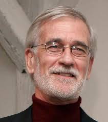 Compton J. Tucker合作论文数NASA Goddard Space Flight Center10Lotta Samuelson合作论文数3
 David O'Byrne合作论文数Ctr Sustainabil Studies, Lund Univ2
 Altaaf Mechiche-Alami合作论文数2
 Wolde Mekuria合作论文数Department of Land Resources Management and Environmental Protection, Mekelle University2
 Amare Haileslassie合作论文数Institute of Soil Science and Forest Nutrition, University of Goettingen2
 Sandra Valencia合作论文数2Linnéa Jägrud合作论文数1Elaine Springgay合作论文数1Joy Margaret Biteete Tukahirwa合作论文数1Cryton Zazu合作论文数1Shelley Welton合作论文数1
 Ola Wetterberg合作论文数1Thorsten Celander合作论文数1Nicolai Schaaf合作论文数1Sara Minelli合作论文数1Alexander Erlewein合作论文数1
 Elisie Karesdotter合作论文数Dept Phys Geog, Stockholm Univ1
 Murray W. Scown合作论文数Lund Univ, Ctr Sustainabil Studies, SE-22362 Lund, Sweden1
 H. R. Bazié合作论文数Unité de Formation et Recherche en Sciences de la Vie et de la Terre, Université Ouaga I Pr Joseph Ki-Zerbo1
 Mohammad J. Emami Skardi合作论文数Faculty of Engineering and Technology, University of Mazandaran1
 Luigi Piemontese合作论文数Stockholm Resilience Ctr, Stockholm Univ1
 Simona Pedde合作论文数Centre for Ecology &, UK;Hydrology, Lancaster Environment Centre;Department of Environmental Sciences, Wageningen University;Research;Lancaster Environment Centre, Wageningen University & Research1
 Susanne Fredholm合作论文数1
 Sebastian Horacio Villarino合作论文数GEAP Grp Estudio Agroecosistemas & Paisajes Rurale1V. Castillo合作论文数Dept Soil & Water Conservat, Ctr Edafol & Biol Aplicada Segura CEBAS CSIC1
 Martine Maron合作论文数Centre for Policy Futures, Faculty of Humanities and Social Sciences, The University of Queensland1
 Fernando Jaramillo合作论文数Department of Physical Geography, Stockholm University;Bolin Centre for Climate Research, Stockholm University;Stockholm University, Stockholm University1
 Zahra Kalantari合作论文数Division for Water and Environmental Engineering, Department of Sustainable Development, Environmental Science and Engineering, School of Architecture and the Built Environment, KTH Royal Institute of Technology1
 Knez Igor合作论文数Department of Social Work and Psychology, University of Gävle1
 Lan Wang-Erlandsson合作论文数Stockholm Resilience Centre, Delft University of Technology1
 M. Francesca Cotrufo合作论文数Department of Soil and Crop Sciences, College of Agricultural Sciences, Colorado State University1
 Georgia Destouni合作论文数Department of Physical Geography, Faculty of Science, Stockholm University1Yafei Wang (王亚飞)合作论文数1
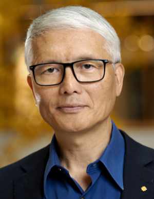 Deliang Chen (陈德亮)合作论文数Department of Earth System Science, Tsinghua University1
 Janet Franklin合作论文数Vegetation and Landscape Ecology Lab, Center for Open Geospatial Sciences, Department of Geography, San Diego State University;Geospatial Sciences Center, University of California, Riverside1
 Neville D. Crossman合作论文数CSIRO Sustainable Ecosystems1
 Barron J. Orr合作论文数Arizona Remote Sensing Center, University of Arizona1
 Graciela Isabel Metternicht合作论文数Department of Environmental Geography, School of Biological Earth and Environmental Sciences, University of New South Wales1
 Eskil Mattsson合作论文数1
 Alisher Mirzabaev合作论文数university of bonn1
 Madelene Ostwald合作论文数Centre for Environment and Sustainability, University of Gothenburg1
 Pamela S. Chasek合作论文数Manhattan College, Manhattan College1Geertrui Louwagie合作论文数1
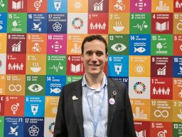 Nathanial Matthews合作论文数1
 Rick Kamugisha合作论文数International Centre for Tropical Agriculture;Kawanda Agricultural Research Institute;International Centre for Tropical Agriculture, Kawanda Agricultural Research Institute1




