This study investigates how the seven core resilience principles are integrated into assessments of forest system resilience to natural or human-induced disturbances across engineering, ecological, and social-ecological resilience concepts. Following PRISMA guidelines, a literature search in the Web of Science database using the keywords "resilience", "forest" and "ecosystem services" yielded 1828 studies, of which 330 met the selection criteria. The most commonly used criterion was diversity, a sub-criterion of "diversity and redundancy", appearing in 50% of studies. The results indicate that social and governance-related principles, learning and experimentation (7%), participation (11%), and polycentric governance (9%) have not been frequently addressed. Although numerous studies have employed various principles for assessing forest resilience, none have considered all seven principles jointly. This highlights a significant research gap, emphasising the need to quantify these principles in forest systems. Understanding forest-community dynamics is essential for enhancing the long-term resilience and sustainability of both systems.
Over the past decade, water conflicts have risen, and cooperation has declined. Research highlights multiple factors driving this change, with climate change acting as a threat multiplier. Human activities, like dam construction and irrigation, and climate-induced hydro-climatic shifts, including extreme precipitation and prolonged droughts, contribute to the risk of increased water conflicts. To guide interventions and reverse this trend, our focus is on enhancing the understanding of factors that facilitate successful cooperation and mitigate water conflicts effectively. In this study, we investigate cooperation and conflict events worldwide in the last 70 years, together with climatic and socioeconomic factors, such as wealth, export dependency, demographics, water use, and hydro-climate trends. The dataset on cooperation and conflict events used is based on the Transboundary Freshwater Dispute Database and Water Conflict Chronology in combination with more current cooperation events extracted from media news reports. Relationships between investigated factors and cooperation are analyzed by combining panel data analysis and qualitative text content analysis of events. The results provide a deeper understanding of the factors behind why certain events are more successful in achieving conflict mitigation than others. We found that cooperation between countries struggling with water-related challenges can reduce expected conflicts over the next five years. The economic benefits of cooperation show a positive correlation between water-related cooperation and improved wealth (measured by GDP growth), particularly in countries with high export dependency. As such, economic collaboration can be an effective tool for enhancing resilience in high-water stress areas, where collaboration in these areas can contribute to a substantial reduction in future conflicts while simultaneously improving economic prosperity. Engaging in cooperation with other countries can therefore contribute to economic growth and resilience, as well as decreasing conflict risk. Understanding successful conflict mitigation factors can provide helpful insights to global policymakers and leaders in water management to avoid future conflict based on current and projected water availability. Keywords: water conflict; collaboration; conflict mitigation; mixed methods; socioeconomic factors
Climate change is known to worsen conflicts, but its combination with other factors affecting water-related conflicts remains less explored. Using a scoping review, this study examined research in the climate–water–conflict nexus. Using semi-automatic text mining approaches, key research gaps and differences in conflict factors and themes across different regions and conflict types were analyzed. Studies focused on Asia and Africa, with few exploring other regions. Governance and livelihoods emerged as significant factors in water-related conflict responses worldwide, with differences across regions. For instance, farmer–herder conflicts were common in Africa, while agriculture was more related to governance and water management in Asia. Research priorities forward should diversify the range of water-related conflict subjects and regions and give special focus to regions vulnerable to hydroclimatic change. More focus on cooperation and non-violent conflicts is also vital for understanding and being able to project and mitigate future water-related conflict responses to climate change.
This paper provides an update on the 2017 status of Arctic protected areas.It provides an overview of the status and trends of the extent of protected areas in the Arctic and an overview of area-based conservation measures including World Heritage Sites and wetlands.This paper uses the International Union for Conservation of Nature (IUCN) definition for protected areas which includes a wide range of Management Categories -from strict nature reserve to protection with sustainable use.Consequently, the level of protection and governance of these areas varies throughout the circumpolar region.As of 2021, 20.77 per cent of the Arctic's terrestrial area and 5.24 per cent of its marine areas are protected.Protected area coverage of the Arctic's terrestrial ecosystems exceeded Aichi Biodiversity Target 11 which aimed for at least 17 per cent of terrestrial and inland water to be protected by 2020.The protected area coverage of marine areas fell short of the Aichi Target for 10 per cent of coastal and marine areas to be protected.
<p>Despite agreement that climate change is increasingly recognized as a threat multiplier in conflict pathways, connections between water flows and conflicts remain unclear. This is affected by incomplete datasets on water-related conflict-cooperation events and poor understanding of socioeconomic and biophysical causes of such conflicts. Disentangling various drivers of water-related cooperation and conflict pathways, with more complete datasets on water-related conflict-cooperation events and a detailed understanding of socio-economic and biophysical causes of such conflicts, is necessary for resolving conflicts and building peace As part of this study we have complied a new global dataset on water-related conflict-cooperation events that extends to 2019, updating previous datasets that covered only up to 2008, yielding important new insights on cooperation-conflict trends. Correlations between events and aspects such as changes in precipitation and socioeconomic variables were then calculated for different change scenarios. Analysis of events shows that cooperation can significantly reduce future conflicts in all tested change scenarios. In addition, cooperation positively affects countries&#8217; socioeconomic development, further reducing the risk of conflict. The new dataset revealed a worrying trend with a shift in the cooperation-conflict balance in the 2000s, with conflict events increasing and outnumbering cooperation events in 2017. Regional analysis shows that changes towards more conflict and fewer cooperation events in Africa could be related to long periods of drought, while changes in Asia are related to irrigation and dam construction. This study shows that water cooperation can be effective for peacekeeping while simultaneously creating positive socio-economic development. The trend towards less cooperation and more conflict in current years highlights the need for effective water management adapted to local and regional drivers of change (climate or anthropogenic) focusing on forming collaborations based on current and projected water availability. Utilizing our newly created and openly available water-related conflict and cooperation database can provide a good opportunity for further research into actions required to change this trend and promote future water cooperation.</p> <p>Keywords: conflict; cooperation; peacekeeping; climate change; hydrology;</p>
Despite strong interest and conflict research spanning multiple disciplines, connections between water flows and conflicts remain unclear, due to incomplete datasets on water-related conflict-cooperation events and poor understanding of socioeconomic and biophysical causes of such conflicts. The dataset on water-related conflict-cooperation events compiled in this study extends to 2019, updating previous datasets that covered only up to 2008, yielding important new insights on cooperation-conflict trends. Global and regional trends were analyzed using the new events dataset, together with changes in hydroclimatic variables and population density. The analysis revealed that water-related cooperation was far more common than conflicts across all regions, in both drier and wetter climates, indicating that abundance and lack of water can both promote cooperation. However, conflict events were more common in drier climates where water is scarcer. This cooperation-conflict balance shifted in the 2000s, with conflict events increasing, to outnumber cooperation events in 2017. The main shift occurred in Africa and Asia, where increased conflicts in Africa coincided with a prolonged period of below-average precipitation and severe drought, while the shift in Asia coincided with increased evapotranspiration caused by human activities and increased population density. Differences between regions were confirmed by event descriptions, with events in Africa relating to water access and farmer-herder conflicts, and events in Asia relating to irrigation and dam construction. These differences highlight the need for regional-scale analysis of water-related conflict-cooperation trends and pathways. With climate change and human activities expected to increase, the increasing trend in conflict events could persist, with water resources becoming a more frequent cause of future conflict. Identifying these complex cooperation-conflict changes is vital in determining future actions required to reduce conflict events and promote cooperation on water.
A scoping review was performed to quantify concepts covered in the scientific literature relating to water conflict in a changing climate. The uploaded file consists of: A list of all studies found using the search terms, and All meta categories and concept categories, with all search strings used All searches were using EBSCO Discovery Service. Search terms used were: (“climate change” OR “global warming”) AND conflict AND (water OR hydrology), January 2023 (conflict OR dispute) AND hydroclimat*, May 2023 (“water conflict” OR “water dispute”) AND (precipitation OR temperature), May 2023 (“climate change” OR “global warming”) AND dispute AND (water OR hydrology), May 2023 The final publication selection for the scoping review was made based on four criteria, all of which needed to be fulfilled for each selected study: i) considering conflicts in a climate change context (directly or indirectly related to hydroclimate); ii) considering water-related conflicts (directly or indirectly related to water aspects); iii) not only considering conflicts of interest but also including some actual conflict act (violent or non-violent); iv) contributing to understanding or including a discussion about underlying causes of conflict or evaluating such causes of potential future conflict (i.e., studies involving some assessment of the drivers of conflict and not focusing solely on conflict resolution). Relevance based on these criteria was first evaluated by reading the abstracts and the full text was examined only when further clarification on the relevance of a study was needed. For our analysis, we created so-called concept categories that bring together several similar words around the same broader concepts. For example, the concept category ‘governance’ includes the words policy, politic\w*, polici\w*, democra\w*, govern\w*, supreme court, minist\w*, and federal (for all concept categories, see the Zenodo file). The different concept categories were further grouped together into so-called meta-categories (political, livelihoods and industry, climate change, conflict, cooperation, scale). Results will be found in the open source article after publication and then the DOI to that article will be added here.
Population growth is increasing the pressure on water resource availability. For useful assessment and planning for societal water availability impacts, it is imperative to disentangle the direct influences of human activities in the landscape from external climate-driven influences on water flows and their variation and change. In this study we used the water balance model, a gridded global hydrological model, to quantify and distinguish human-driven change components, modified by interventions such as dams, reservoirs, and water withdrawals for irrigation, industry, and households, from climate-driven change components on four key water balance variables in the terrestrial hydrological system (evapotranspiration, runoff, soil moisture, storage change). We also analyzed emergent effect patterns in and across different parts of the world, facilitating exploration of spatial variability and regional patterns on multiple spatial scales, from pixel to global, including previously uninvestigated parts of the world. Our results show that human activities drive changes in all hydrological variables, with different magnitudes and directions depending on geographical location. The differences between model scenarios with and without human activities were largest in regions with the highest population densities. In such regions, which also have relatively large numbers of dams for irrigation, water largely tends to be removed from storage and go to feed increased runoff and evapotranspiration fluxes. Our analysis considers a more complete set of hydrological variables than previous studies and can guide further research and management planning for future hydrological and water availability trends, including in relatively data-poor parts of the world.
Global sustainability challenges associated with increasing resource demands from a growing population call for resource-efficient land-use strategies that address multiple sustainability issues. Multifunctional agroforestry-based phytoremediation (MAP) is one such strategy that can simultaneously capture carbon, decontaminate soils, and provide diverse incomes for local farmers. Chinandega, Nicaragua, is a densely populated agricultural region with heavily polluted soils. Four different MAP systems scenarios relevant to Chinandega were created and carbon sequestration potentials were calculated using CO2FIX. All scenarios showed the potential to store significantly more carbon than conventional farming practices, ranging from 2.5 to 8.0 Mg CO2eq ha−1 yr−1. Overall, carbon sequestration in crops is relatively small, but results in increased soil organic carbon (SOC), especially in perennials, and the combination of crops and trees provide higher carbon sequestration rates than monoculture. Changes in SOC are crucial for long-term carbon sequestration, here ranging between 0.4 and 0.9 Mg C ha−1 yr−1, with the most given in scenario 4, an alley cropping system with pollarded trees with prunings used as green mulch. The adoption rate of multifunctional strategies providing both commodity and non-commodity outputs, such as carbon sequestration, would likely increase if phytoremediation is included. Well-designed MAP systems could help reduce land-use conflicts, provide healthier soil, act as climate change mitigation, and have positive impacts on local health and economies.
The first mile/last mile (FM/LM) problem in public transport refers to the spatial accessibility of public transport and is the most important factor determining whether an individual will choose public transport. The FM/LM problem in Stockholm County, Sweden, was evaluated using a Geographic Information System estimating distances to public transport for the years 2019 and 2035. Overall, the population in Stockholm County, have good access to public transport. However, access varies with abilities, with elderly having 50 percent and elderly impaired 15 percent of their area within walking distance to public transport compared with the average citizen. Planned developments can provide good access to public transport, with extensive improvements for the elderly. However, inadequate planning for population increase will likely decrease the perceived public transport accessibility. Apartments and commercial buildings in the study area have high access to public transport. Elderly people have good access within city and regional centers, while access could be improved in other areas. Inclusion of FM/LM in the planning support system used in Stockholm could help mitigate FM/LM problems and extend access to public transport to all people of different abilities. This is vital in creating sustainable mobility networks and achieving sustainable development in smart cities.
Wetlands as large-scale nature-based solutions (NBS) provide multiple ecosystem services of local, regional, and global importance. Knowledge concerning location and vulnerability of wetlands, specifically in the Arctic, is vital to understand and assess the current status and future potential changes in the Arctic. Using available high-resolution wetland databases together with datasets on soil wetness and soil types, we created the first high-resolution map with full coverage of Arctic wetlands. Arctic wetlands' vulnerability is assessed for the years 2050, 2075, and 2100 by utilizing datasets of permafrost extent and projected mean annual average temperature from HadGEM2-ES climate model outputs for three change scenarios (RCP2.6, 4.5, and 8.5). With approximately 25% of Arctic landmass covered with wetlands and 99% being in permafrost areas, Arctic wetlands are highly vulnerable to changes in all scenarios, apart from RCP2.6 where wetlands remain largely stable. Climate change threatens Arctic wetlands and can impact wetland functions and services. These changes can adversely affect the multiple services this sort of NBS can provide in terms of great social, economic, and environmental benefits to human beings. Consequently, negative changes in Arctic wetland ecosystems can escalate land-use conflicts resulting from natural capital exploitation when new areas become more accessible for use. Limiting changes to Arctic wetlands can help maintain their ecosystem services and limit societal challenges arising from thawing permafrost wetlands, especially for indigenous populations dependent on their ecosystem services. This study highlights areas subject to changes and provides useful information to better plan for a sustainable and social-ecological resilient Arctic.Keywords: Arctic wetlands, permafrost thaw, regime shift vulnerability, climate projection
Wetlands provide multiple ecosystem services of local and global importance, but currently there exists no comprehensive, high-quality wetland map for the Arctic region. Improved information about Arctic wetland extents and their vulnerability to climate change is essential for adaptation and mitigation efforts, including for indigenous people dependent on the ecosystem services that wetlands provide, as inadequate planning could result in dire consequences for societies and ecosystems alike. Synthesizing high-resolution wetland databases and datasets on soil wetness and soil types from multiple sources, we created the first high-resolution map with full coverage of Arctic wetlands. We assess the vulnerability of Arctic wetlands for the years 2050, 2075, and 2100, using datasets on permafrost extent, soil types, and projected mean annual air temperature from the HadGEM2-ES climate model for three change scenarios (RCP2.6, RCP4.5, and RCP8.5). Our mapping shows that wetlands cover approximately 3.5 million km(2) or roughly 25% of Arctic landmass and 99% of these wetlands are in permafrost areas, indicating considerable vulnerability to future climate change. Unless global warming is limited to scenario RCP2.6, robust results show that large areas of Arctic wetlands are vulnerable to ecosystem regime shifts. If scenario RCP8.5 becomes a reality, at least 50% of the Arctic wetland area would be highly vulnerable to regime shifts with considerable adverse impacts on human health, infrastructure, economics, ecosystems, and biodiversity. The developed wetland and vulnerability maps can aid planning and prioritization of the most vulnerable areas for protection and mitigation of change.
Understanding interactions between complex human and natural systems involved in urban carbon cycling is important when balancing the dual goals of urban development to accommodate a growing population, while also achieving urban carbon neutrality. This study develops a systems breakdown accounting method to assess the urban carbon cycle. The method facilitates greater understanding of the complex interactions within and between systems involved in this cycle, in order to identify ways in which humans can adapt their interactions to reduce net greenhouse gas emissions from urban regions. Testing the systems breakdown accounting method in Stockholm County, Sweden, we find that it provides new insights into the carbon interactions with urban green-blue areas in the region. Results show how Stockholm County can reduce its emissions and achieve its goal of local carbon net-neutrality, if the green areas protect its carbon sequestration potential and maintain it to offset projected remaining active emissions. Results also show that the inland surface waters and inner archipelago waters within Stockholm County are a considerable source of greenhouse gases to the atmosphere. A better understanding of these water emissions is necessary to formulate effective planning and policy measures that can reduce urban emissions. The insights gained from this study can also be applied in other regions. In particular, water bodies could play a significant role in the urban carbon cycle and using this knowledge for more complete carbon accounting, and a better understanding of green-blue interactions could help to reduce net urban emissions in many places.
 Zahra Kalantari合作论文数Division for Water and Environmental Engineering, Department of Sustainable Development, Environmental Science and Engineering, School of Architecture and the Built Environment, KTH Royal Institute of Technology11
 Haozhi Pan合作论文数China Inst Urban Governance, Shanghai Jiao Tong Univ6
 Georgia Destouni合作论文数Department of Physical Geography, Faculty of Science, Stockholm University6
 Jessica Page合作论文数3
 Richard B. Lammers合作论文数Water Systems Analysis Group, University of New Hampshire3
 Navid Ghajarnia合作论文数Department of Physical Geography and Bolin Centre for Climate Research, Stockholm University2
 Marko Keskinen合作论文数Water Resources Laboratory;Helsinki University of Technology;Water Resources Laboratory, Helsinki University of Technology2
 Anna Tengberg合作论文数1Lisa Bergqvist合作论文数1Helena Nasstrom合作论文数1
 Anders Jonsson合作论文数1
 Ginnette Flores Carmenate合作论文数1
 Zipan Cai (蔡子攀)合作论文数School of Architecture, Southeast University1
 Mohammad J. Emami Skardi合作论文数Faculty of Engineering and Technology, University of Mazandaran1
 Henrik Haller合作论文数1Tom Barry合作论文数CAFF Secretariat, Akureyri, Iceland1
 Lan Wang-Erlandsson合作论文数Stockholm Resilience Centre, Delft University of Technology1
 Reza Kerachian合作论文数Center of Excellence for Engineering and Management of Infrastructures, School of Civil Engineering, University of Tehran, Tehran, Iran1
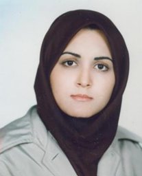 Najmeh Mahjouri合作论文数Graduate Faculty of Environment, University of Tehran1
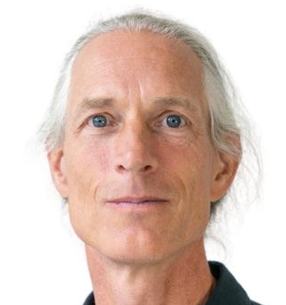 Ingo Fetzer合作论文数Stockholm Resilience Centre, Stockholm University1
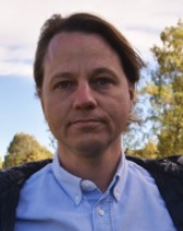 Gustaf Hugelius合作论文数Department of Physical Geography, Stockholm University1
 Ulla Mörtberg合作论文数Division of Sustainability Assessment and Management, Department of Sustainable Development, Environmental Science and Engineering, School of Architecture and the Built Environment, KTH Royal Institute of Technology1




