The use and control of fire is arguably one of the most important technological advancements of the Homo genus. Prehistoric populations exploit the combustion properties of fires (light, heat and smoke) for daily tasks such as food preparation, insect repellent, extension of daylight hours and modification of technology. The habitual use of fire can however lead to significant health implications through sustained exposure to smoke which can affect air quality resulting in respiratory complications. While smoke is often an important tool in hunter-gatherer activities such as smoking meats, curing hides, accessing highly prized food items’ such as honey and as an insect repellent, to date, little research has been conducted on the actual levels of exposure to harmful toxins contained in smoke that Palaeolithic hunter-gatherers would have been exposed to during their daily lives. In this paper, we present a new methodological protocol for future studies wishing to examine the effects of smoke from open fires on air quality, human health and habitability in the Palaeolithic using environmental monitoring systems. We present the first systematic study of concentration levels of harmful particulate matter (PM2.5) in smoke relative to the use of other combustion properties of fires (light, smoke and radiative heat) from a wide range of fuels used in Palaeolithic fireplaces, recording different types of fires (smoking, glowing and flaming) and activity types (smoking food items, sleeping and cooking). Our empirical findings highlight significant variability in light and heat output, as well as concentrations of harmful particulate matter in smoke (PM2.5). We argue that this variation and the aim to minimise exposure to the harmful elements of smoke, likely influenced the placement of fixed fire features in habitation spaces whether open, semi-open and closed (outdoors, rock shelters, caves, huts and houses) relative to the use of combustion properties. Our results also show how human-environment interactions around fire, fuel and habitability (air quality) may have changed over time in some living structures from the Palaeolithic through to later time periods (Neolithic and Iron Age).
Abstract The Osteodontokeratic (ODK for short) is a technological and cultural hypothesis first proposed by Raymond A. Dart in 1957, based on fossils recovered from the South African cave site of Makapansgat. Dart proposed that the extinct hominin species Australopithecus prometheus were predatory, cannibalistic meat eaters, and specialized hunters. He suggested that they manufactured and used a toolkit based on the bones (osteo), teeth (donto), and horns (keratic) of prey animals, and that these first tools were evidence for the “predatory transition from ape to man” as a distinct stage in human evolutionary development. Dart based his hypothesis on the analysis of bones of fossil ungulates and other prey species found at Makapansgat. The parts of the skeleton recovered from the cave were biased toward the skull and limb bones, whilst the thorax, pelvis, and tail were largely absent, indicating a selection agent at work. The bones also exhibited evidence of damage, which Dart suggested could only have been caused by intentional violence. Many of the bones were blackened, which he suggested was due to burning or charring in a controlled fire. In his mind, the hominins of Makapansgat were prodigious hunters who used organic tools to kill their prey, whereupon they cooked and ate the meat, discarding waste bone but utilizing some of the skeletal material to make new tools. Dart developed a detailed typology of complete or modified bones that he indicated could be used as clubs, projectiles, daggers, picks, saws, scoops, and cups—in doing so, he confused form with function. Dart and the ODK were championed by the American playwright Robert Ardrey across four hugely successful popular science books starting with African Genesis in 1961. Following Dart, these books portrayed our early ancestors as aggressive hunters killing prey and each other, driven by a need to protect their territory. This concept infiltrated popular culture through the opening sequence of Stanley Kubrick’s 2001: A Space Odyssey released in 1968, making the ODK perhaps the most famous scientific claim for an original form of human technology. Dart’s hypothesis was not widely accepted by contemporary scientists such as Kenneth Oakley, Sherburn Washburn, John Robinson, and C. K. “Bob” Brain, and led Brain to conduct his own field research on the agents of fossil accumulation and site formation processes in South Africa. Brain later demonstrated that the pattern of bone damage and skeletal part representation recorded by Dart at Makapansgat was the result of nonhuman modification, particularly accumulation and dietary processing of ungulate carcasses by large carnivores such as leopard or hyena. Furthermore, the blackening of bone was caused by manganese mineral staining. In testing and falsifying the ODK hypothesis, Brain and fellow researchers laid the experimental groundwork for the discipline of vertebrate taphonomy (the laws of burial and postmortem processes) which is now a cornerstone in paleolithic archaeology and the study of early human origins. It is debatable whether this scientific specialism would exist in its present form without Dart’s claims for the ODK.
A series of six science maps have been created visualising the shape of archaeological research between 2014 and 2021, using metadata from more than 50,000 academic documents. These maps present the intellectual base of the discipline as co-citation networks of sources and of authors, the language of archaeological research as both terms extracted from titles and abstracts and as author keywords, and, lastly, the networks of collaboration created by co-authorship between individuals and institutions. Comparison is made between 2014-2021 and an earlier study examining archaeological research between 2004 and 2013. Archaeology is revealed as a consistently broad and developing subject drawing extensively on methods and approaches from the sciences, social sciences, arts and humanities. It is intrinsically international in practice. Archaeological research is growing at a rate faster than the average for academic research. While there has been progress towards a more diverse community of researchers among those most highly cited, there remain significant issues in the observable diversity between different research areas within the same discipline and sometimes between similar research specialties. Classifications of archaeology by external bodies fail to grasp this diversity of archaeological research. Finally, diversity in terms variants suggests that there is a pressing need for the discipline to take control of its terminology.
Little is known about the tufa deposits within the volcanic Harrats of western Saudi Arabia. This research aims to characterise the fossil tufa system and examine its utility as a palaeoenvironmental archive. This requires us to understand the conditions under which the tufa was deposited. In particular, to ascertain whether they are cool, freshwater tufa, or geothermal travertine. In this presentation we show the extent of the tufa within the basin, describe the stratigraphy and settings, as well as their composition and petrology, alongside U-Th chronological control for a selection of suitable subsamplesThe samples are composed of low-Mg calcium-carbonate and their 87Sr/86Sr composition shows there has been water-rock interaction with the mafic metavolcanic Neoproterzoic bedrock as well as metamorphosed marine carbonates from the Arabian Escarpment at the head of the Wadi Dabsa catchment. Their δ13C composition (-6.3 to -12.9 ‰) is indicative of a meteoric water and soil signature, rather than a geothermal source.The tufa deposits are widespread within the Wadi Dabsa Basin, with at least three phases of deposition, recorded at the basin surface, within incised wadi channels and in a downstream fan region. In some locations, the size of tufa-cemented fluvial bedload represents very high magnitude events, whilst the lacustrine to paludal facies indicate more quiescent phases of increased moisture availability. The U-Th dating indicates that the basin was wet during interglacial stages (Marine Oxygen Isotope Stags [MIS] 7 and 5) with some indication, given the error ranges on dates from multiple-subsamples, that deposition occurred primarily during interstadials (e.g. MIS 5e, 5c and 5a). The MIS 7 age is from a vug-fill tufa deposits within an extensive tufa cascade, which indicates the cascade itself pre-dates MIS 7.The major concentration of artefacts (> 3000) in this basin make it one of the richest Palaeolithic assemblages so far recorded in southwest Saudi Arabia (Foulds et al., 2015; Inglis et al., 2019). This site is ~ 6 km from the current coastline, which is inland from the MIS 5e shorelines in this region (Inglis, pers comm), and these sites with freshwater mean it is important to continue to consider coastal sites as corridors with habitable landscapes for hominins.ReferencesFoulds, F., A. Shuttleworth, A. Sinclair, A. M. Alsharekh, S. Al Ghamdi, R. H. Inglis, G.N. Bailey (2017) A large handaxe from Wadi Dabsa and early hominin adaptations within the Arabian Peninsula. Antiquity. 91:1421–1434.Inglis, R. H., Fanning, P. C., Stone, A., Barford, D. N., Sinclair, A., Hsing-Chung, C., Alsharekh, A., Bailey, G. (2019). Palaeolithic artefact deposits at Wadi Dabsa, Saudi Arabia: A multi-scalar geoarchaeological approach to building an interpretive framework. Geoarchaeology 34(3), 272-294.
A citation analysis of the discipline of evolutionary anthropology and its subfield Palaeolithic Archaeology, with a final ego-based citation analysis of the published research of John Gowlett
Surface artifacts dominate the archaeological record of arid landscapes, particularly the Saharo-Arabian belt, a pivotal region in dispersals out of Africa. Discarded by hominins, these artifacts are key to understanding past landscape use and dispersals, yet behavioral interpretation of present-day artifact distributions cannot be carried out without understanding how geomorphological processes have controlled, and continue to control, artifact preservation, exposure and visibility at multiple scales. We employ a geoarchaeological approach to unraveling the formation of a surface assemblage of 2,970 Palaeolithic and later lithic artifacts at Wadi Dabsa, Saudi Arabia, the richest locality recorded to date in the southwestern Red Sea coastal region. Wadi Dabsa basin, within the volcanic Harrat Al Birk, contains extensive tufa deposits formed during wetter conditions. We employ regional landscape mapping and automatic classification of surface conditions using satellite imagery, field observations, local landform mapping, archaeological survey, excavation, and sedimentological analyses to develop a multiscalar model of landscape evolution and geomorphological controls acting on artifact distributions in the basin. The main artifact assemblage is identified as a palimpsest of activity, actively forming on a deflating surface, a model with significant implications for future study and interpretation of this, and other, surface artifact assemblages.
Robots must cost less and be force-controlled to enable widespread, safe deployment in unconstrained human environments. We propose Quasi-Direct Drive actuation as a capable paradigm for robotic force-controlled manipulation in human environments at low-cost. Our prototype - Blue - is a human scale 7 Degree of Freedom arm with 2kg payload. Blue can cost less than 5000. We show that Blue has dynamic properties that meet or exceed the needs of human operators: the robot has a nominal position-control bandwidth of 7.5Hz and repeatability within 4mm. We demonstrate a Virtual Reality based interface that can be used as a method for telepresence and collecting robot training demonstrations. Manufacturability, scaling, and potential use-cases for the Blue system are also addressed. Videos and additional information can be found online at berkeleyopenarms.github.io
Surface artefacts dominate the archaeological record of arid landscapes, particularly the Saharo-Arabian belt, a pivotal region in dispersals out of Africa. Discarded by hominins, these artefacts are key to understanding past landscape use and dispersals, yet behavioural interpretation of present-day artefact distributions cannot be carried out without understanding how geomorphological processes have controlled, and continue to control, artefact preservation, exposure and visibility at multiple scales. We employ a geoarchaeological approach to unravelling the formation of a surface assemblage of 2,970 Early and Middle Stone Age lithic artefacts at Wadi Dabsa, Saudi Arabia, the richest locality recorded to date in the southwestern Red Sea coastal region. Wadi Dabsa basin, within the volcanic Harrat Al Birk, contains extensive tufa deposits formed during wetter conditions. We employ regional landscape mapping and automatic classification of surface conditions using satellite imagery, field observations, local landform mapping, archaeological survey, excavation, and sedimentological analyses to develop a multi-scalar model of landscape evolution and geomorphological controls acting on artefact distributions in the basin. The main artefact assemblage is identified as a palimpsest of activity, actively forming on a deflating surface, a model with significant implications for future study and interpretation of this, and other, artefact surface assemblages.
The role played by the Arabian Peninsula in hominin dispersals out of Africa has long been debated. The DISPERSE Project has focused on south-western Arabia as a possible centre of hominin settlement and a primary stepping-stone for such dispersals. This work has led to the recent discovery, at Wadi Dabsa, of an exceptional assemblage of over 1000 lithic artefacts, including the first known giant handaxe from the Arabian Peninsula. The site and its associated artefacts provide important new evidence for hominin dispersals out of Africa, and give further insight into the giant handaxe phenomenon present within the Acheulean stone tool industry.
An exponential growth in research outputs, the great diversity of sources used, and the number of active researchers in archaeology make it impossible for any individual to present an overview of the discipline using reading and narrative alone. It is suggested that archaeologists might instead take a lead from scientometric studies and develop visualisations of their discipline as a research domain using data extracted from the citation indices. Three visualisations of the intellectual base of archaeology are presented, in the form of network maps of sources used, authors and terms. These maps, with their clustering of nodes, reveal the extreme multidisciplinary nature of archaeological research, patterns of overlapping and divergent communication networks among archaeological researchers, and the language and conceptual knowledge of archaeology. They also show marked variation in the gendered structure of academic reputations as created through citation practices across a series of specialisms of archaeology. Finally, these maps also suggest that archaeology as a discipline might be characterised by a process of fractal division into subgroups of practitioners following distinct but repeated forms of engagement in their archaeological enquiry.
Hand stencils are some of the most enduring images in Upper Palaeolithic rock art sites across the world; the earliest have been dated to over 40 Kya in Sulawesi and 37 Kya in Europe. The analysis of these marks may permit us to know more about who was involved in the making the of prehistoric images as well as expanding the literature on the evolution of human behaviour. A number of researchers have previously attempted to identify the sex of the makers of Upper Palaeolithic hand stencils using methods based on hand size and digit length ratios obtained from digital or photo-based images of modern reference samples. Some analyses report that it was males who were responsible fot the majority of hand stencils, whilst the most recent analysis determined that females produced the majority of hand stencils. Taken together, however, these studies generate contrasting and incompatible interpretations. In this study we critically review where we currently stand with methods of sexing the makers of hand stencils and the problems for the interpretation of hand markings of Palaeolithic age. We then present the results of a new method of predicting the sex of individuals from their hand stencils using a geometric morphometric approach that detects sexual differences in hand shape and hand form (size and shape). The method has the additional advantage of being able to detect these differences in both complete, as well as partial hand stencils. Finally we urge researchers to test this method on other ethnic groups and populations and consider ways of combining efforts towards a common goal of developing a robust, predictive methodology based on diverse modern samples before it is applied to Upper Palaeolithic hand stencils. (C) 2016 The Authors. Published by Elsevier Ltd. This is an open access article under the CC BY-NC-ND
 Loretta Malintoppi合作论文数86Christoph H. Schreuer合作论文数85
 Abdullah M. Alsharekh合作论文数Department of Archaeology and Museology, King Saud University14
 Robyn Helen Inglis合作论文数Department of Archaeology, University of York12
 Geoff Bailey合作论文数University of York9Andrew Shuttleworth合作论文数6
 Emma Nelson合作论文数5Christoph Schreuer合作论文数4
 Abi Stone合作论文数School of Environment, Education and Development, Faculty of Humanities, The University of Manchester4
 John Mcnabb合作论文数School of Humanities, Faculty of Arts and Humanities, University of Southampton4
 Patricia C. Fanning合作论文数Graduate School of the Environment, Macquarie University4Saud Al Ghamdi合作论文数3
 Frederick Foulds合作论文数Dept Archaeol, Univ Durham3
 Dan N. Barfod合作论文数Isotope Geosciences Unit, Scottish Universities Environmental Research Center3August Reinisch合作论文数3
 Hsing-Chung Chang合作论文数School of Surveying & Spatial Information Systems;University of New South Wales;School of Surveying & Spatial Information Systems, University of New South Wales3Asya Engovatova合作论文数2
 Jason Hall合作论文数2
 Michał Pawleta合作论文数Fac Archaeol, Adam Mickiewicz Univ2Nathan Schlanger合作论文数2
 Eva Parga-Dans合作论文数Instituto de Productos Naturales y Agrobiología, IPNA-CSIC2
 Pál Raczky合作论文数Inst Archaeol Sci, Eotvos Lorand Univ2
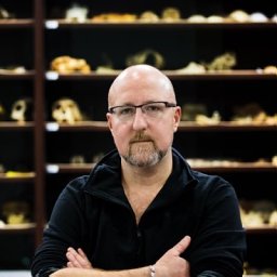 Patrick S Randolph-Quinney合作论文数Faculty of Health and Life Sciences, Northumbria University2
 Garry Momber合作论文数2Claudio Vita-Finzi合作论文数2
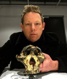 Andy I R Herries合作论文数School of Medical Sciences, The University of New South Wales2
 Kevin Kuykendall合作论文数Department of Archaeology, Faculty of Arts and Humanities, The University of Sheffield2
 Kurt Lambeck合作论文数Institute for Climate, Energy & Disaster Solutions, College of Science, Australian National University;Research School of Earth Sciences, College of Science, Australian National University;Australian Academy of Science2Kai Salas Rossenbach合作论文数2
 Arkadiusz Marciniak合作论文数Institute of Prehistory;University of Poznan2
 Nicholas Flemming合作论文数Southampton Oceanography Centre2
 Diana Sahy合作论文数Institute of Applied Geology;Department of Civil Engineering;University of Natural Resources and Applied Life Sciences;Peter Jordan Strasse;Institute of Applied Geology, University of Natural Resources and Applied Life Sciences2Ian Candy合作论文数2Kenneth Aitchison合作论文数Assumpcio Tolido i Mur2
 Eszter Banffy合作论文数HUN-REN RCH Institute of Archaeology, Centre of Excellence, Hungarian Academy of Sc.iences;European Association of Archaeologists2Brent Yi合作论文数1Sally Hoare合作论文数1
 Philipp Wu合作论文数University of California, Berkeley;Robot Learning Lab1Concepción Torres Navas合作论文数1Peter Cuellar合作论文数Univ Calif Berkeley, Mech Engn, Berkeley, CA 94720 USA1Greg Balke合作论文数Univ Calif Berkeley, Elect Engn & Comp Sci, Berkeley, CA 94720 USA1Phillip R. Downey合作论文数Univ Calif Berkeley, Mech Engn, Berkeley, CA 94720 USA1
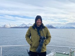 Harry Kenneth Robson合作论文数Univ York, Dept Archaeol, BioArCh, York YO10 5YW, N Yorkshire, England1
 Rachel Thomasson合作论文数Biomimetics and Dextrous Manipulation Lab, Stanford University1Monique H. van den Dries合作论文数1
 Matthew Meredith-Williams合作论文数Dept. Archaeology and History, La Trobe University1
 Menglong Guo合作论文数Mechanical Engineering, University of California Berkeleym1Allan Zhao合作论文数1




