Across the world, changing ocean conditions are altering the productivity and distribution of fish stocks. These impacts can be observed in coastal and estuarine systems where multiple environmental drivers can shape the population dynamics of fish and invertebrates. Consequently, understanding how key environmental drivers affect fisheries is of the utmost importance. Here, we investigate environment-recruitment relationships of a recreational fish species, spotted seatrout (Cynoscion nebulosus), in Alabama, USA. To accomplish this, we first conducted an integrated stock assessment of spotted seatrout to derive recruitment deviations from the assumed stock-recruit relationship. Next, we compared biologically relevant environmental (temperature and salinity) and habitat area (areas meeting salinity and temperature conditions) variables derived from a regional hydrodynamic model to investigate possible linkages with recruitment deviations. We demonstrate how poor recruitment of spotted seatrout is strongly associated with negative salinity anomalies at multiple temporal scales (annual and settlement season), and to a lesser extent, negative temperature anomalies, suggesting that fresher and cooler conditions result in poor recruitment. The environmentally-informed habitat area variables revealed a strong association between poor recruitment and cooler temperatures in oligohaline areas. However, low salinity areas appear to serve as important nursery grounds, likely due to the limited submerged aquatic vegetation (SAV) in meso- and polyhaline areas across the study region. We recommend the use of salinity anomalies as a forecasting tool and future explorations into the relevance of oligohaline SAV to early life history processes of spotted seatrout. The stock assessment results highlight the positive impacts of recent management actions despite environmental variables driving poor recruitment. As changes in coastal waters proceed, the establishment of environment-recruitment relationships could be valuable for monitoring and forecasting changes in recruitment and population productivity of economically relevant species.
Marine heatwaves (MHWs), extended periods of higher-than-normal ocean temperatures, have a myriad of impacts on coastal and marine ecosystems, communities and industries. As they increase in frequency and intensity globally, there have been dire consequences for sensitive species and ecosystems. In this paper, we summarize a literature review on the potential impacts of MHWs or otherwise extreme high temperatures in the Caribbean, Gulf of America and Southeastern U.S., where thousands of marine species reside in these tropical and subtropical waters, and local communities rely on healthy ecosystems. The review is focused on impacts to weather, including coastal temperature and humidity, severe thunderstorms and hurricanes; and marine species, including corals, micro- and macro-algae, seagrasses, oysters, clams, urchins, crabs, finfish, seabirds, sea turtles and marine mammals. MHWs are associated with more severe (and potentially rapidly intensifying) hurricanes alongside widespread coral bleaching in the warmer months. However, the extent of MHW impacts is otherwise poorly understood in the region especially for more mobile species (e.g. finfish, seabirds). Given the relationship between temperature and species growth, reproduction, and survival, MHW impacts are likely and likely to be negative for especially local sessile species (e.g. corals, oysters), though impacts on mobile species may be more varied.
Disturbances are important drivers of seafloor community structure and diversity, especially in sediment infaunal communities with limited mobility. Shallow coastal sediment communities contribute to global nutrient cycling and carbon storage but also experience large-scale disturbances, including storms. Tropical cyclones and other extreme storms can dramatically restructure shallow sedimentary fabrics and disrupt infauna through resuspension and sediment transport and deposition. However, whether persisting storm-induced physical changes to sedimentary habitats affect post-storm infaunal community development is poorly studied or understood. Here we assess the relationship between relatively immediate (10 days) and more gradual (6 weeks to 8 months) changes to surficial sediment properties (grain size distribution, porosity, organic content) and infaunal community structure in Alabama, USA, coastal sediments following two consecutive tropical cyclone impacts in the fall of 2020: Hurricane Sally, where the storm's inner core passed directly over the study sites, and Hurricane Zeta, where the storm passed to the west of the sites. We hypothesized that infaunal communities at sites exhibiting drastic and persistent post-storm sedimentary changes (i.e., thick sand deposition over mud) would have greater losses of abundance and diversity and larger differences between pre- and post-storm community structure compared to communities at less physically restructured sites. However, almost all sites did not experience significant post-hurricane reductions in infaunal abundance or diversity or changes to community composition corresponding with the degree of sedimentary change. The lack of storm effects on infauna likely resulted from a combination of pre-Sally disturbances, seasonal recruitment, and opportunistic taxa adapted to dynamic coastal sediments. Our results indicate that infauna in frequently disturbed areas such as nearshore sediments adjacent to estuarine outflow may be resistant to physical habitat disturbance but also emphasize the importance of seasonal dynamics and disturbance history in shaping infaunal communities. These relationships will be especially important to understand as storm intensity is predicted to increase with climate change.
Sediment dynamics are fundamental to understanding coastal resiliency to climate change in the coming decades. Tropical cyclones can radically alter shallow sediment properties; however, the uncertain and destructive nature of tropical cyclones make understanding and predicting their impacts on sediments challenging. Here, grain size sampling in conjunction with continuous hydrodynamic data provided an unprecedented perspective of the impacts of two tropical cyclones, including Hurricane Sally (2020), in which the inner core of the storm passed directly over the field sites, on shallow coastal sediments in Alabama (USA). Sampling directly before and after Sally as well as out to similar to 7 months after the second storm event, Hurricane Zeta, showed that the changes in sediments following storm events exhibited notable site-to-site variability. This variability during the first storm event was consistent with low sand supply and flow interactions driven by local bathymetry that led to sand transport and deposition at some previously-muddy sites, near-surface mud loss at some sandy sites, or little change at others. Post-Sally impacts to grain size were well preserved 8 months after the storm, despite passage of Zeta as well as seasonal winds and riverine inputs during winter and spring. Overall, high temporal-resolution sampling over a relatively large area (<500 km2) revealed relatively small-scale spatial variability (on the order of 5-10 km) of hurricane impacts to sediment structure. These observations demonstrate a critical limitation for accurately predicting changes to coastal sediment dynamics in the face of a changing climate and its impact on tropical cyclones.
Marine heatwaves (MHWs) during peak hurricane season can impact storm intensification, posing a significant threat to coasts and ecosystems. However, understanding of salinity stratification in the evolution of MHWs in river-dominated, hurricane-prone coastal regions is limited. Here, the event sequence leading to a large-scale coastal MHW in the Gulf of Mexico during the 2019 hurricane season was investigated. Both atmospheric and oceanic events coupled to drive the shelf-wide evolution of this full water-column MHW with surface heat fluxes, vertical mixing, and advection all contributing. In particular, several tropical cyclone events modified the vertical structuring of the MHW, and none intensified over the study region. During the decay phase, low salinity from freshwater discharge resulted in temperature inversions, leaving the bottom layer MHW preserved for an extended period. This study highlights the importance of salinity dynamics on MHWs and nearshore environmental conditions in intensity forecasting of landfalling storms.
Vibrio is a genus of halophilic, gram-negative bacteria found in estuaries around the globe. Integral parts of coastal cultures often involve contact with vectors of pathogenic Vibrio spp. (e.g., consuming raw shellfish). High rates of mortality from certain Vibrio spp. infections demonstrate the need for an improved understanding of Vibrio spp. dynamics in estuarine regions. Our study assessed meteorological, hydrographic, and biological correlates of Vibrio parahaemolyticus and V. vulnificus at 10 sites in the Eastern Mississippi Sound System (EMSS) from April to October 2019. During the sampling period, median abundances of V. parahaemolyticus and V. vulnificus were 2.31 log MPN/L and 2.90 log MPN/L, respectively. Vibrio spp. dynamics were largely driven by site-based variation, with sites closest to freshwater inputs having the highest abundances. The E-W wind scalar, which affects Ekman transport, was a novel Vibrio spp. correlate observed. A potential salinity effect on bacterial-particle associations was identified, where V. vulnificus was associated with larger particles in conditions outside of their optimal salinity. Additionally, V. vulnificus abundances were correlated to those of harmful algal species that did not dominate community chlorophyll. Correlates from this study may be used to inform the next iteration of regionally predictive Vibrio models and may lend additional insight to Vibrio spp. ecology in similar systems. IMPORTANCE:Vibrio spp. are bacteria found in estuaries worldwide; some species can cause illness and infections in humans. Relationships between Vibrio spp. abundance, salinity, and temperature are well documented, but correlations to other environmental parameters are less understood. This study identifies unique correlates (e.g., E-W wind scalar and harmful algal species) that could potentially inform the next iteration of predictive Vibrio models for the EMSS region. Additionally, these correlates may allow existing environmental monitoring efforts to be leveraged in providing data inputs for future Vibrio risk models. An observed correlation between salinity and V. vulnificus/particle-size associations suggests that predicted environmental changes may affect the abundance of Vibrio spp. in certain reservoirs, which may alter which vectors present the greatest vibrio risk.
Accurate estimation of water column temperature is vital for modeling physical and biogeochemical processes. A key process in the thermal dynamics of the upper ocean is the attenuation of solar radiation. In shallow-turbid coastal systems, spatially and temporally varying optical characteristics present challenges for commonly used attenuation parameterization schemes. This study investigates the dependency of temperature with a ROMS model of Mobile Bay, a shallow, turbid estuary, using six different attenuation approaches including three base cases: Conventional approach PS77 based on water type-9; Novel approach SAL relating in situ PAR attenuation to salinity; and Surface trapped irradiance method ST. In addition, these base cases are also tested with surface atmospheric heat flux correction (QC). Simulations were validated against observations from various sources to identify the optimal approach at annual and synoptic scales. While all simulations showed effective temperature performance over an annual cycle, monthly analysis revealed some seasonality, with winter months typically performing better than summer months. The influence of QC notably enhanced temperature performance in both annual and synoptic scales, given that surface heat flux primarily drove temperature changes in this shallow system. The best overall performance was determined to be the ST approach incorporating QC. Conversely, PS77 without QC demonstrated the poorest performance. The SAL model with QC, notably improved performance over PS77 with QC, yet demonstrated comparable yet weaker performance compared to the ST model with QC. The study also implies that neglecting subseasonal validation in long-term regional climate modeling could introduce uncertainty into analyzing events tied to subseasonal temperatures.
The dispersal of large river plumes in the coastal ocean depends on multiple factors, and in some cases, can be categorized into distinct dynamical regimes: a tidally dominated near-field, a rotational mid-field, and a coastal current far-field. In this study, observations and modeling are used to evaluate the factors controlling the variability in the buoyant plume from Mobile Bay. Rather than distinct dynamical regimes, the Mobile Bay plume depends on forcings that act at overlapping temporal and spatial scales: diurnal tides, river discharge events, and winds. Satellite synthetic aperture radar images along with shipboard in-situ sampling and marine radar are used to observe plume fronts in spring 2021. Hydrodynamic model simulations are compared with observations and used to characterize a large coastal plume at consistent tidal phase across a range of forcing conditions. The along-shore position of the plume depends primarily on advection by wind-driven surface currents. The cross-shore extent and plume area depend primarily on the tidal amplitude and river discharge, and secondarily on northerly (seaward) winds. Along-shore winds influence the buoyancy anomaly by altering salinity in the estuary and offshore. Upwelling winds increase the buoyancy anomaly and advect previous plumes away from the mouth. Downwelling winds reduce the buoyancy anomaly by trapping previous plumes near the coast and directing freshwater discharge toward a secondary outlet. Thus, the combined, overlapping influences of the tide, wind, and discharge dominate the variability in freshwater delivery to the shelf at time scales of days and distances of tens of km. Buoyant river plumes discharge into the coastal ocean and alter the distribution of freshwater and material like sediment and nutrients. This study examines the factors affecting the plume from Mobile Bay in the Gulf of Mexico. The research integrates shipboard measurements, satellite imagery, and numerical modeling to capture the variability in the plume in spring 2021. Plumes are often characterized with distinct regions where particular physical processes dominate-the tide or river discharge close to the mouth, and the earth's rotation and wind as the plume spreads and transitions into a coastal current. However, for Mobile Bay the winds, tides, and river discharge all contribute significantly to the size and position of the plume. Along-shore winds drive coastal currents that transport the plume, upwelling or downwelling winds move the plume offshore or trap it near the coast, and shallow stratification increases the direct influence of the wind. Diurnal tides drive outflows that are much larger than the scale of influence of the earth's rotation, and river discharge varies substantially with meteorological events. The influences of the wind, tides and discharge cannot be cleanly separated in determining the fate of outflow from Mobile Bay and similar systems. Diurnal tides, river discharge, and winds all contribute substantially to determining the size and location of the Mobile Bay plume Along-shore winds advect the plume and influence the buoyancy anomaly through upwelling/downwelling and the freshwater outflow distribution Response of the plume to forcing at tidal-to-meteorological time scales inhibits formation of a bulge and geostrophic coastal current
Mixing and transport in the estuaries and coastal waters must be informed by advanced and up-to-date research to consider the underlying natural and anthropogenic effects on physical and biogeochemical processes. To that end a session was organized during the 2021 Coastal and Estuarine Research Federation conference entitled “Mixing and Transport in Estuaries and Coastal Waters”. The focus of this session was to improve understanding through comprehensive studies associated with mixing and transport processes in estuaries and coastal waters based on observations, analytical models, laboratory experiments, and numerical models. This Special Issue (SI) ‘Mixing and Transport in Estuaries and Coastal Waters’ in ‘Estuarine Coastal and Shelf Science’ is an outcome of the talks presented at the conference session. The key research interests covered comprise of five themes: Estuarine dynamics, Wave-current-surge processes, Sediment dynamics, Plume dynamics, and Estuarine physical-biogeochemical processes. The articles contained in the SI represent the latest advances in mixing and transport in estuaries and coastal seas all over the world, as well as common methods including observations, remote sensing, and numerical modelling, a data framework is also used, which is the methodological highlight of this SI. While continued progress is still being made on understanding estuarine and coastal sea dynamics, the effects of these physical processes on biological and biogeochemical issues (i.e., larval transport and water quality dynamics) should also be considered in future studies.
Sea level studies in the Mississippi Bight (MSB) are less abundant than in other coastal waters of USA. This study investigates the subinertial (time scales > 2 days) sea level anomalies in the MSB shelf. The diagnostics of the terms in the invariant form of the momentum equation were computed to determine which terms have the most influence on the anomalies in sea level. It was determined that at subinertial scales the geostrophic balance is the dominant balance in the MSB while the non-linear and time derivative terms are insignificant relative to the Coriolis term. A Least Squares procedure was applied to the subinertial surface currents data from high frequency radar surface currents (filtered with a window of 2-day Butterworth filter) to extract subinertial sea level anomalies in the MSB shelf using both geostrophic balance and the invariant form of Reynolds' averaged momentum equations. The resulting subinertial sea level anomalies were validated using sea level observations from an offshore buoy and Sentinel-3 along-track satellite altimeter data. The estimated sea level anomalies were reasonably close to observations (more than half had root mean square difference of < 0.04 m) and mostly influenced by geostrophic balance. Analysis of the empirical orthogonal functions showed that the first two modes explained the majority (85%) of the variance in the sea level anomalies estimated using the geostrophic approximation. Absolute sea level could be estimated if Global Navigation Satellite System buoys are deployed in the radar footprint.
Wind forcing plays an important role in determining spatial patterns of estuarine bottom water hypoxia, defined as dissolved oxygen (DO) concentration< 2 mg L -1 , by driving coastal circulation patterns and by intensifying mixing of the water column. However, the importance of these wind-driven mixing processes varies with space and time and are dynamically intermingled with biological processes like photosynthesis and respiration making it difficult to tease apart wind impacts on DO dynamics in estuarine systems. Using a high-resolution, three-dimensional numerical model, we studied the effect of a non-extreme southeast wind event on the DO dynamics of Mobile Bay during a hypoxic event in April-May of 2019. A new approach, called ‘vertical dissolved oxygen variance’ (VDOV) was developed to quantitatively separate all the physical and biogeochemical factors in the water column that control the development and dissipation of hypoxia events. The system-wide volume integrated values of VDOV tracked the changes in hypoxic area in the bay and the VDOV tendency term was dominated by contributions from sediment oxygen demand (DO loss via respiration) and vertical dissipation (DO gain via mixing). There was a notable inverse relationship between hypoxia area and wind speed. Further analysis of the local VDOV during a non-extreme southeast wind event showed the wind-induced vertical dissipation was the main factor in eliminating hypoxia from the bay. This enhanced dissipation accounted for both turbulent mixing from wind stress and negative straining of the vertical density gradient from wind induced circulation. The response of DO to the wind forcing prompted the development of two non-dimensional numbers, an advection-diffusion time-scale ratio and a demand-diffusion flux ratio, to better generalize the expected DO dynamics. Overall, this work showed that wind effects are critical for understanding hypoxia variability in a shallow stratified estuary.
Abstract As tides propagate inland, they become distorted by channel geometry and river discharge. Tidal dynamics in fluvial‐marine transitions are commonly observed in high‐energy tidal environments with relatively steady river conditions, leaving the effects of variable river discharge on tides and longitudinal changes poorly understood. To study the effects of variable river discharge on tide‐river interactions, we studied a low‐energy tidal environment where river discharge ranges several orders of magnitude, the diurnal microtidal Tombigbee River‐Mobile Bay fluvial‐marine transition, using water level and velocity observations from 21 stations. Results showed that diurnal tidal attenuation was reduced by the width convergence in seaward reaches and height convergence of the landward backwater reaches, with the channel convergence change location ∼40–50 km inland of the bayhead and seaward of the largest bifurcation. River events amplified tides in seaward regions and attenuated tides in landward regions. This created a region of river‐induced peak amplitude seaward of the flood limit (i.e., bidirectional‐unidirectional current transition), allowing more tidal energy to propagate inland. Tidal currents were attenuated and delayed more by river discharge than water levels, making the phase lag dynamic. The river impacts on the tides were delineated longitudinally and shifted seaward as river discharge increased, ranging up to ∼180 km. Results indicated the longitudinal shifts of river impacts on tides in alluvial systems can be estimated analytically using the ratio of river discharge to tidal discharge and the geometric convergence of the system. Our simple analytical theory provides a pathway for understanding the tide‐river‐geomorphic equilibrium along increasingly dynamic coasts.
Estuarine and coastal geomorphology, biogeochemistry, water quality, and coastal food webs in river-dominated shelves of the Gulf of Mexico (GoM) are modulated by transport processes associated with river inputs, winds, waves, tides, and deep-ocean/continental shelf interactions. For instance, transport processes control the fate of river-borne sediments, which in turn affect coastal land loss. Similarly, transport of freshwater, nutrients, and carbon control the dynamics of eutrophication, hypoxia, harmful algal blooms, and coastal acidification. Further, freshwater inflow transports pesticides, herbicides, heavy metals, and oil into receiving estuaries and coastal systems. Lastly, transport processes along the continuum from the rivers and estuaries to coastal and shelf areas and adjacent open ocean (abbreviated herein as “river-estuary-shelf-ocean”) regulate the movements of organisms, including the spatial distributions of individuals and the exchange of genetic information between distinct subpopulations. The Gulf of Mexico Research Initiative (GoMRI) provided unprecedented opportunities to study transport processes along the river-estuary-shelf-ocean continuum in the GoM. The understanding of transport at multiple spatial and temporal scales in this topographically and dynamically complex marginal sea was improved, allowing for more accurate forecasting of the fate of oil and other constituents. For this review, we focus on five specific transport themes: (i) wetland, estuary, and shelf exchanges; (ii) river-estuary coupling; (iii) nearshore and inlet processes; (iv) open ocean transport processes; and (v) river-induced fronts and cross-basin transport. We then discuss the relevancy of GoMRI findings on the transport processes for ecological connectivity and oil transport and fate. We also examine the implications of new findings for informing the response to future oil spills, and the management of coastal resources and ecosystems. Lastly, we summarize the research gaps identified in the many studies and offer recommendations for continuing the momentum of the research provided by the GoMRI effort. A number of uncertainties were identified that occurred in multiple settings. These include the quantification of sediment, carbon, dissolved gasses and nutrient fluxes during storms, consistent specification of the various external forcings used in analyses, methods for smooth integration of multiscale advection mechanisms across different flow regimes, dynamic coupling of the atmosphere with sub-mesoscale and mesoscale phenomena, and methods for simulating finer-scale dynamics over long time periods. Addressing these uncertainties would allow the scientific community to be better prepared to predict the fate of hydrocarbons and their impacts to the coastal ocean, rivers, and marshes in the event of another spill in the GoM.
Changes in tropical cyclone intensity prior to landfall represent a significant risk to human life and coastal infrastructure. Such changes can be influenced by shelf water temperatures through the...
Destructive coastal floods are commonly increasing in frequency and may be caused by global precipitation intensification. Such connections through climate, watershed, and river processes are poorly understood because of complex interactions in transitional fluvial‐marine environments where flooding is caused by rivers, marine storm surge, or both in compound events. To better understand river floods along the fluvial‐marine transition, we study watersheds of the northeastern Gulf of Mexico using long‐term observations. Results show intensifying precipitation decreased precipitation‐discharge lag times, increasing river‐flood frequency and the likelihood of compound events in fluvial‐marine transitions. This reduction in lag time occurred when the Atlantic Multidecadal Oscillation and El Niño Southern Oscillation began strongly affecting river discharge through the advection of moist air, intensifying precipitation. Along the fluvial‐marine transition, compound events were largest in inland reaches. However, for inland reaches, compound event water levels did not exceed the floods caused solely by river flooding, the largest flood hazard in these systems. Our results demonstrate precipitation and river discharge play critical roles in coastal flooding and will likely escalate flooding as the climate continues to warm and intensify precipitation.
Prediction of rapid intensification in tropical cyclones prior to landfall is a major societal issue. While air-sea interactions are clearly linked to storm intensity, the connections between the underlying thermal conditions over continental shelves and rapid intensification are limited. Here, an exceptional set of in situ and satellite data are used to identify spatial heterogeneity in sea surface temperatures across the inner core of Hurricane Sally (2020), a storm that rapidly intensified over the shelf. A leftward shift in the region of maximum cooling was observed as the hurricane transited from the open gulf to the shelf. This shift was generated, in part, by the surface heat flux in conjunction with the along- and across-shelf transport of heat from storm-generated coastal circulation. The spatial differences in the sea surface temperatures were large enough to potentially influence rapid intensification processes suggesting that coastal thermal features need to be accounted for to improve storm forecasting as well as to better understand how climate change will modify interactions between tropical cyclones and the coastal ocean. Significance StatementThe connections between the underlying thermal energy in the ocean that powers tropical cyclones and rapid intensification of storms over continental shelves are limited. An exceptional set of data collected in the field as well as from space with satellites was used to identify spatial variations in sea surface temperatures across the inner core of Hurricane Sally (2020), a storm that rapidly intensified over the shelf. The spatial differences were due to the heat loss from the surface of the ocean as well as heat transport by shelf currents. The spatial differences were large enough to potentially influence how quickly storms can intensify, suggesting that coastal thermal features need to be accounted for to improve storm forecasting.
 Steven L. Dykstra合作论文数Dauphin Isl Sea Lab, Univ S Alabama19
 Kyeong Park合作论文数Dauphin Island Sea Lab, University of South Alabama19
 Coogan Jeffrey S合作论文数12
 Grant Lockridge合作论文数Dauphin Island Sea Lab8
 Severine Fournier合作论文数Jet Prop Lab, CALTECH8
 Mustafa Kemal Cambazoglu合作论文数8Patrick J. Fitzpatrick合作论文数Mathematics Department8
 stephan o brien合作论文数Sch Life & Environm Sci, Deakin Univ6
 Xiao-Hai Yan (严晓海)合作论文数School of Marine Science & Policy, College of Earth, Ocean & Environment, University of Delaware;Center for Remote Sensing, University of Delaware6Yee Lau合作论文数6
 Zhilong Liu合作论文数University of South Alabama5
 Sean P. Powers合作论文数Department of Marine Science;University of South Alabama;Department of Marine Science, University of South Alabama5
 Frank J. Hernandez合作论文数Dauphin Island Sea Lab5
 Kelly M. Dorgan合作论文数Scripps Institution of Oceanography, UCSD5
 I. Soto合作论文数College of Marine Science, University of South Florida5
 Jerry D. Wiggert合作论文数Center for Coastal Physical Oceanography, Old Dominion University5
 John Christopher Lehrter合作论文数and Dauphin Island Sea Lab, The University of Alabama5
 Gregg Jacobs合作论文数Stennis Space Center Oceanography Division, Naval Research Laboratory5
 Stephan Howden合作论文数Earth System Science Interdisciplinary Center, University of Maryland5Jeremy David Wiggert合作论文数4
 W. Cyrus Clemo合作论文数Dauphin Island Sea Lab, Dauphin Island, AL4
 Adam T. Greer合作论文数Skidaway Institute of Oceanography, University of Georgia4
 Christian Briseno-Avena合作论文数Dept Environm & Ocean Sci, Univ San Diego4
 Bret Webb合作论文数4
 JT Reager合作论文数Jet Propulsion Laboratory, California Institute of Technology;Joint Institute for Regional Earth System Sciences, University of California, Los Angeles4
 Arnoldo Valle-Levinson合作论文数Department of Civil & Coastal Engineering, Engineering School of Sustainable Infrastructure & Environment, University of Florida4
 I. Church合作论文数Ocean Mapping Group, University of New Brunswick4
 William Graham合作论文数University of California Merced4
 Alan M. Shiller合作论文数School of Ocean Science and Engineering, College of Arts and Sciences, University of Southern Mississippi4Michael S. Dinniman合作论文数Center for Coastal Physical Oceanography, Old Dominion University4Adam D. Boyette合作论文数3
 Chudong Pan合作论文数Stennis Space Center, Univ. of Southern Mississippi;c;Stennis Space Center, Univ. of Southern Mississippi3Robert K. Cowen合作论文数Oregon State University3
 Jiabi Du合作论文数3
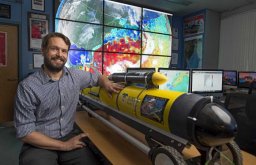 Travis N. Miles合作论文数Department of Marine, Earth & Atmospheric Sciences, North Carolina State University3
 Jeffrey W. Krause合作论文数Dauphin Island Sea Lab;School of Marine & Environmental Science, University of South Alabama;Department of Biological Sciences, University of Alabama3
 Robert Arnone合作论文数3
 Josh Kohut合作论文数3Courtney Bouchard合作论文数2john dindo合作论文数2Laura Hode合作论文数2J. Marcus Drymon合作论文数2Uchenna Nwankwo合作论文数2Renee C. Collini合作论文数Sch Human Sci, Mississippi State Univ2Luciano M. Chiaverano合作论文数Instituto Nacional de Investigación y Desarrollo Pesquero (INIDEP), Paseo Victoria Ocampo No.1, 7602, Mar Del Plata, Buenos Aires, Argentina2Jian Shen (沈健)合作论文数2Xin Yu合作论文数2
 Sabrina M. Parra合作论文数Applied Physics Laboratory2
 Virginie Sanial合作论文数Lab Etud Geophys & Oceanog Spatiales CNRS CNES IR, Observ Midi Pyrenees, Toulouse, France2




