This paper presents the design of a web-based decision co-creation platform to showcase water treatment technologies connected via industrial symbiosis for a circular economy approach. The platform is developed as part of the EU H2020-funded ULTIMATE project. This system initially investigates three case studies focusing respectively on: water and nutrient recovery in greenhouses, pre-treatment of wastewater from olive mills before integration into communal wastewater systems, and value-added compound recovery from wastewater in a juice factory. These cases are then merged into one abstract composite example showing all three aspects of the problem, connecting greenhouses, juice factories, and olive mills, describing a pioneering form of industrial 'metabolic network' of the circular economy. This work describes the modelling framework, the online platform and the interactive visualisations that allow users to explore the industrial symbiosis configurations enabled by the metabolic pathway. The platform thus serves as a decision support tool that merges circular economy and industrial symbiosis, as well as a pedagogical tool.
With the intensity and frequency of climate driven disasters increasing as result of climate change, there is ever more need to plan for such events and develop means to mitigate against them (UNDRR, 2015). Traditionally, the assessment of risks and impacts to regions posed by climate extreme events have been carried out in a “one at a time” approach, where the effects of each hazard, are assessed individually (Russo et al., 2023). However, it is recognised that a transition to a more multi-hazard and multisectoral approach is needed to be more efficient and effective in mitigating the risks/impacts posed to society, infrastructures, or the environment (Sendai Framework, 2015), (Russo et al. 2023). Whilst risk/impact assessment modelling can be complex, the derivation of risk/impacts is complicated further within a multi-hazard assessment due to the interdependent relationships between hazard, exposure and vulnerability, and that these vary over time in response to a preceding hazard (Gill et al. 2021).The European Funded ICARIA project seeks to create an asset level modelling framework for understanding the potential risks/impacts posed by multi-hazard climate driven hazards, whilst also providing insight into cost-effective means of mitigating against them through the application of suitable adaptation measures. Two of the key challenges when transitioning from a single to a multi-hazard modelling approach are that (1) hazards are not directly comparable due differences in their processes and metrics, and (2) the effects of one hazard can influence the behaviour/characteristics of another hazard (Forzieri et al., 2016). To simulate the potential risks/impacts that could result from the modelled range of compound and consecutive hazards, a two-stage approach is being adopted that consists of (1) a deterministic physical modelling approach for quantifying the risks/impacts that can arise through simulation of various compound and consecutive hazard scenarios, along with (2) a stochastic Bayesian Network (BN) method for defining the probability distribution of such events. The BN will consider historical data for defining the probability distribution of modelled, multi-hazard scenarios for both current and future scenarios whilst data from the physical modelling will be used for defining the distribution of parameters relating to exposure, vulnerability, and impacts for the business as usual (no adaptation) and future adaptation scenarios. AcknowledgementThe ICARIA project (Improving Climate Resilience of Critical Assets) is funded by the European Commission through the Horizon Europe Programme, grant number 101093806. https://cordis.europa.eu/project/id/101093806. ReferencesForzieri, G., Feyen, L., Russo, S., Vousdoukas, M., Alfieri, L., Outten, S., Migliavacca, M., Bianchi, A., Rojas, R., & Cid, A. (2016). Multi-hazard assessment in Europe under climate change. Climatic Change, 137(1), 105–119. https://doi.org/10.1007/s10584-016-1661-xGill, J. C., Hussain, E., & Malamud, B. D. (2021). Workshop Report: Multi-Hazard Risk Scenarios for Tomorrow’s Cities.Russo, B., de la Cruz Coronas, À., Leone, M., Evans, B., Brito, R. S., Havlik, D., Bügelmayer-Blaschek, M., Pacheco, D., & Sfetsos, A. (2023). Improving Climate Resilience of Critical Assets: The ICARIA Project. Sustainability, 15(19). https://doi.org/10.3390/su151914090“United Nations - Headquarters United Nations Office for Disaster Risk Reduction.” (2015). Sendai Framework for Disaster Risk Reduction 2015-2030.
Planning for Emergency Response is crucial to a region’s preparedness for climate resilience. It involves multiple government sectors and necessitates effective cooperation between them. Collective management of emergency response resources can improve resource allocation at a regional scale and overcome local constraints. However, prioritising resources is challenging when a collective sharing strategy is applied. When emergency events are still evolving, another challenge is the estimation of future demands and resource shortages, which trigger further requests for external support. In modelling resource flow dynamics, we are implementing an emergency response Digital Twin that combines a Resource Allocation Model with short-term predictions concerning weather-related emergency events and real-time updates. This paper focuses on the resource allocation model for hybrid simulation. It is applied to a flooding case study from the city of Torbay (UK). It enables a holistic assessment of emergency response, considering the cascading effects of the failure of critical infrastructures for better addressing regional resilience.
Frequent and intense multi-hazard events are occurring more frequently, making it crucial to prepare in advance and build resilience. Tsunamis, which are massive waves triggered by earthquakes or volcanic eruptions, are particularly devastating and pose significant risks to coastal areas and human life. Therefore, it is essential to be well-prepared for such events. Once the appropriate response to tsunamis is determined, it becomes important to anticipate different scenarios and take proactive measures. The study of evacuation process resilience is considered vital for effective disaster management, with current research and practice placing significant emphasis on the use of simulation models to evaluate tsunami responses. This chapter focuses on the development of an evacuation simulation tool known as MSEM (Micro-Simulation Evacuation Model), which aims to assess the resilience of the evacuation process by considering different evacuation scenarios in the case of tsunami risk. The tool provides insights into long-term planning and suggests improvements for infrastructure and land use. By analysing the simulation outputs, such as survival rates, indicating the number of people who would be safe when the tsunami reaches the shore, the tool helps identify the resiliency level of a city in the face of tsunamis. Napier City, New Zealand, which is vulnerable to various natural hazards, including liquefaction, earthquakes, flooding, volcanoes, and tsunamis, has been chosen as the case study. Based on the city's spatial characteristics and built environment, recommendations are made regarding land use planning and infrastructure upgrades to boost the resiliency level. MSEM can assist decision-makers underscore the need to enhance the transportation system to accommodate mass evacuations effectively. Additionally, it emphasises the importance of educating individuals on the optimal course of action to take during such situations.
With the increase of the frequency and severity of flooding events, coupled with population growth, the risks posed to people from flooding is ever more apparent. This paper proposes a methodology to examine the risks posed to vehicles' occupants and pedestrians simultaneously in an urban context. Through considering stability functions of a range of vehicle types and pedestrian, a risk assessment profile for a vehicle occupant was derived. Using a historical 1-in-20-year rainfall flood event that took place in the city of Exeter (UK) in 2014, and a synthetic 1 in 100-year rainfall flood event, the potential risks posed to vehicle occupants were analysed. The results showed that for these events the potential risks posed to people travelling by car and caught in flood waters were likely to be more severe if they were to remain within their vehicles than if they were to exit said vehicles. Analysis of the changes in risk over time further revealed that if a vehicle was to become immobilised in flood water, they would only have a short timeframe (~10 min) before the level of risk increases. This is a critical finding, highlighting that remaining inside an immobilised vehicle during flood event and waiting for assistance may increase the level the risk the individual is exposed to, with the results showing the significance of such studies in reducing the risk of flooding to people.
As we move from 5G to 6G, we anticipate that satellite communications and Non-Terrestrial-Networks (NTN) will, in general, converge with terrestrial networks to form a unified network service provision. We describe this pathway herein by providing results from todays 5G satellite backhaul using Eutelsat-OneWeb (EOW) current generation Low Earth Orbit (LEO) constellation and tomorrow’s 5G+ using EOW’s ‘JoeySat’ regenerative demonstrator satellite. Finally we describe the challenges faced in moving further towards a fully converged and integrated 6G network.
With the rapid development of very high-speed inter-satellite links, effective and intelligent routing strategy has become a hot topic in the next generation (6G) mega-constellations. However, constrained by the high dynamic time-varying topology and limited on-board processing capability, the existed routing schemes incur excessive control overhead, huge latency, and packet loss rate caused by the congestion. In this paper, an intelligent area-segmentation enabled hybrid routing method is proposed, combining centralized and distributed methods and adapting to the congested area dynamically. Specifically, with software-defined features, only the Low Earth Orbit (LEO) satellites with congested links report the state information to the controllers, consisting of both Geostationary Earth Orbit (GEO) satellites and Ground Computing Center (GCC), to periodically calculate the accurate congested areas using Deep Q- Network (DQN) algorithm. Numerical simulation results indicate that, the proposed method reduces control overhead by orders of magni-tude and decreases the packet loss rate by approximately 40% in mega-constellations, toward the future resilient and scalable 6G communication networks compared with the traditional schemes.
Climate change poses significant challenges in terms of water scarcity, environmental crisis, and economic uncertainty. This situation drives an increasing need to pursue more sustainable futures and to conserve and maximise the use of resources whenever possible. The EU-funded H2020 NextGen project aimed to boost sustainability using new and novel technologies and approaches implemented within the water cycle, and to maximise the efficient use of water and water-embedded resources. To facilitate and communicate the potential benefits of such technologies, NextGen developed Serious Games (SGs), enabled by underlying System Dynamic Models (SDMs), for demonstrating how interactions between water, energy, and materials/embedded resources within the urban water cycle can be utilised in the context of the Circular Economy of water. As part of a fasttrack development process, a testbed dubbed "Toy Town" was developed that encompasses a range of technologies and options that provides a demonstrable framework that can later be refined and modified accordingly for other case studies. The underlying SDM driving the SG is built using the Julia programming language. The testbed incorporates a range of components, including water-saving and water-reuse technologies, stormwater management, and wastewater treatment systems. The SDM acts fundamentally as a mass-balance model tracking over time volumetric flows of water/wastewater and the concentrations/dilution of pollutants/material within the urban water cycle. A variety of water use, water reuse and wastewater treatment components can be tested within this model to maximise the resource potential of the water and material moving through the cycle. The paper focuses on an extreme drought scenario and highlights the benefits of a modelling testbed for exploring potential technological solutions for managing the urban water cycle and how such solutions can be employed in the context of the circular economy of water. The NextGen SG thus has the potential to improve stakeholders' understanding of the implementation of novel technologies in the water cycle and the benefits that could be accrued by such stakeholder groups.
The number of climate-related disasters has progressively increased in the last two decades and this trend will drastically exacerbate in the medium- and long-term horizons according to climate change projections. In this framework, through a multi-disciplinary team and a strong background acquired in recent projects, ICARIA aims to promote the use of asset-level modeling to achieve a better understanding of climate related tangible direct and indirect impacts on critical assets due to complex, cascading, and compound disasters. Furthermore, it takes into account the related risk reduction provided by suitable, sustainable, and cost-effective adaptation solutions. ICARIA focuses on both (i) critical assets and services that were not designed for potential climate change-related impacts that can increase the unplanned outages and failures, and (ii) on housing, natural areas, and population. Cutting edge methods regarding climate scenario building, asset-level-coupled models, and multi-risk assessment approaches will be implemented and replicated in three EU regions to understand how future climate scenarios might affect critical assets and to provide decision-making support tools to private and public risk owners to assess the costs and benefits of various adaptation solutions.
Floods are one of the most damaging natural hazards in human history, claiming lives and economic losses. While flood risk can be reduced by structural and non-structural flood protection measures, the need for evacuation in floods is not eliminated in disaster-resilient cities. Walking in flood water can be dangerous, and pedestrian stability models have been developed to evaluate the risk to a pedestrian walking in flood water. This paper evaluates an empirical and a mechanics-based pedestrian stability model. The incipient velocity (beyond which the pedestrian is unstable) for the models under different flood water depths were compared. Results showed that under high water depths, the empirical model gives lower incipient velocity compared to the mechanics-based model. Given the same flow velocity, the empirical model produces higher flood hazard ratings (FHRs), an indicator of risk levels. This point is confirmed by computing the FHRs for a simulated flood event in Keighley, Bradford, UK, in which the flood water depths were relatively high (beyond 0.6 m for an extended area) and the flow velocities were relatively low (generally about 0.1 m/s with small number of points reaching around 1 m/s). The mechanics-based model produced very low risk levels that did not justify an evacuation, while the empirical model produced significant risk levels for the flooded area. This paper shows that the stability model that gives more conservative risk levels is scenario dependent. Urban planners are recommended to choose pedestrian stability models to suit their intended applications.
Many people in the world live in hazardous environments and are susceptible to disasters. In the time of a destructive event, a resilient community must be prepared to mitigate the event and quickly respond. An effective mitigation plan can lead to fewer fatalities and damages. One of the most critical tasks for mitigation is the evacuation process. Wherein short notice time, overcrowding, bottlenecks in infrastructure and challenging terrain and topography may worsen the situation. Amongst other things, the evacuation process encompasses transportation infrastructures referred to as corridors, signs, pedestrian footpaths, and/or shelter infrastructures for keeping people safe. Evacuation infrastructure can also become damaged after the event; therefore, it’s imperative to have a robust assessment of different evacuation infrastructures. This study will investigate the characteristics of the available evacuation infrastructure and outline the general drawbacks. A systematic methodology for reviewing articles has been implemented to understand how vulnerable cities can be more prepared, especially for pedestrian evacuation. An evacuation scoring system for pedestrians will be developed to investigate evacuation infrastructure in terms of different resilience features, such as redundancy, safe to fail, readiness, capacity. The most practical evacuation system will be estimated, with a final output being to provide the features of a successful pedestrian evacuation system for future policy use.
In the coming era of telecommunication, the integration of satellite capabilities with emerging 5G technologies has been considered as a promising solution to achieve assured user experiences in bandwidth-hungry content applications. In this paper, we present our design for emerging Multi-access Edge Computing (MEC) based Video on Demand (VoD) services, which efficiently utilizes satellite and terrestrial integrated 5G network. Based on this framework, we propose and analyse the Video-segment Scheduling Network Function (VSNF), which is able to deliver enhanced quality of video consumption experiences to end-users. We specifically consider the layer video scenario, where it is possible to intelligently schedule layers of video segments via parallel satellite and terrestrial backhaul links in 5G. The key technical challenge is to optimally schedule the layered video segment over the two network link which are having distinct characteristics while attempting to enhance the Quality of Experience (QoE) for all the end-users in fair manner. We have conducted extensive set of experiments using real 5G testing framework in which gNB is integrated with core network using Geostationary Earth Orbit (GEO) satellite and terrestrial backhaul links. The results highlights the capability of our proposed content delivery framework for holistically delivering assured QoE, fairness among multiple video sessions, as well as optimised network resource efficiency.
As we move from 5G to 6G networks satellites will play an increasingly key part in providing coverage and resilience. Here we outline the timescales and some of the issues facing satellites in the 6G world.
Summary This special issue of the journal on ‘constellations’ comes at a critical time in their development as a second wave of such non‐geostationary satellite orbit (NGSO) systems is being planned and deployed. These mega‐constellations as they have become known are, with a few exceptions, very much larger than those in the first wave and are focused on broadband and 5G applications rather than speech and narrow band data as those deployed in the first wave during the 1990s. However, as we explain in this editorial, there are many similarities in the design and business plans to the first wave and, perhaps, many similar lessons to be learned.
In this article, we evaluate property flood resilience (PFR) to manage pluvial and combined tidal/ fluvial flood risks. We achieve this by evaluating flood risk and intervention targeting strategies across a case study in Bristol (UK) using data types generally available for preliminary option assessment. We investigate opportunities for mitigating flood damages within catchments using PFR and evaluate two targeting strategies: Installing PFR across strategic areas of a catchment and targeting interventions at specific high‐risk properties. We find that individually targeting PFR is more effective than focusing resources on specific high‐risk areas. Targeting pluvial flood measures at individual properties across our case study provides an average annual benefit per property of approximately £750 more than applying zonal targeting, supporting use of high‐resolution modelling in surface water management, and highlighting the applicability of PFR to manage damages at specific high‐risk properties which may not fall under the protection of community level defences. A similar approach provides the best outcomes for fluvial targeting; however, the hazard is more concentrated and so a zonal targeting approach may be more acceptable. Overall, we find resistance based PFR an effective intervention to mitigate damages, however complementary strategies are required when managing extreme flooding.
The global telecommunication market aims to fulfil future ubiquitous coverage and rate requirements by integrating terrestrial communications with multiple spot beam high throughput satellites (HTS). In this paper a new scheme is proposed to connect multiple Low Earth Orbit (LEO) satellites in a constellation to a single gateway to support integrated-satellite-terrestrial networks. A single gateway with multiple steerable antenna arrays is proposed for reduction in gateway numbers and cost. Using a power allocation strategy, the target is to maximize the gateway link capacity of the HTS-LEO satellites for operation including feasible used cases studies of 3GPP for necessary adaptations in a 5G system. Firstly, an objective function is established to find the optimal power levels required. Secondly the interference from neighbouring satellite beams is considered to achieve maximum capacity. Mathematical formulations are developed for this non-convex problem. Simulation results show that the proposed system architecture improves capacity and meets the dynamic demand better than traditional methods.
As such, the 5G ecosystem opens up an opportunity to integrate terrestrial and satellite systems in order to achieve the goal of the attributes mentioned above (i.e., global seamless connectivity, ubiquity, coverage, security, and resiliency) across the family of 5G use cases—eMBB, URLLC, and mMTC. It is not only throughput and ubiquity that are crucial; latency and reliability are now becoming important metrics in future systems to provide acceptable quality of experience (QoE) across use cases. To this end, the Third Generation Partnership Project (3GPP), as part of the 5G set of standardizations, has started working on Non-Terrestrial Networks (NTN) from Release 16 of the 5G standards, which includes satellites as well as high-altitude platform systems (HAPS) and unmanned aerial systems/vehicles (UASs/UAVs). In addition, various pre-commercial pilot deployments and over-the-air tests for satellite integration into 5G are being conducted worldwide. Moreover, several recent research, development, and innovation projects have been investigating the integration of satellites in 5G and have conducted several successful over-the-air demonstrations and validation campaigns paving the way for the seamless satellite integration into 5G. These recent activities—with the active involvement of the satellite and terrestrial mobile industry stakeholders—have resulted in inclusion of 5G features in satellite and non-terrestrial networks and their necessary integration and validation tests. Large-scale 5G testbeds have been developed to validate the end-to-end terrestrial-satellite 5G integrated system and their network performance and to demonstrate the seamless service delivery. The ability to achieve full network convergence is predicated on software-defined network (SDN) design and network function virtualized (NFV) elements which can be orchestrated to form an end-to-end virtualized network, including both terrestrial and satellite elements. Moreover, new networking paradigms can now allow more efficient resource allocation schemes on an end-to-end basis with clear implications on the implementations and orchestration in both ground segment (e.g., radio access network [RAN], satellite hub stations, and core network) and space segment (e.g., onboard satellite payloads, HAPS, and UAS). In parallel, progress is being made to enhance the physical layer performance with novel interference mitigation/management and multiple access techniques coupled with the design of smarter antennas and multi-antenna signal processing. The aim of this special issue has been to solicit and present advances in satellite and terrestrial networking technologies illustrating the many areas where 5G and satellites can be suitably and efficiently integrated in a unique system platform. As such, the papers presented in this special issue bring a sound balance between academic research and industrial development in order to provide a reference point for the know-how in this sector. In particular, this special issue includes nine original innovative papers which are overviewed hereinafter. In Paper 1—“Techno-economic analysis of inflight connectivity using an integrated satellite-5G network”, the authors present a techno-economic analysis conducted within the EU H2020 5GPPP project “SaT5G” (Satellite and Terrestrial network for 5G) for in-flight connectivity using an integrated satellite–5G network. The demand for mobile broadband services is increasing exponentially alongside with user expectations regarding the reachability of these services and their prices. This paper presents an integrated satellite and 5G network for providing in-flight connectivity and evaluates the economic viability of offering broadband connectivity to passengers on commercial airplanes by the development of a techno-economic framework. Results show that satellite bandwidth usage leads to high operational costs. Therefore, caching popular content on the network onboard is beneficial to reduce the traffic carried over the satellite link. Furthermore, the framework is used to compare the identified business models for in-flight connectivity and their pricing strategies. Finally, a sensitivity analysis is elaborated in order to mitigate the uncertainty of inputs (e.g., rate of caching) used to feed the total cost of ownership (TCO) model. The following concrete recommendations are the main result of this research: (i) providing in-flight broadband services with a 2- to 5-Mbps throughput per user is feasible with a satellite and 5G integrated network; (ii) caching popular data reduces the operational costs and the average cost per user (from 25% to 32% depending on the caching rate adopted); and (iii) this framework allows to provide recommendations on the best suited business models and related pricing schemes. In Paper 2—“An extensible network slicing framework for satellite integration into 5G”, the authors address an extensible network slicing framework for satellite integration into 5G. With the imminent deployment of 5G in the non-standalone version, some researches focus on network slicing to fully exploit the 5G infrastructure and achieve a high level of flexibility in the network. This level of flexibility offered by the network slicing paradigm also fits the need of satellite networks in which satellite network operators want to offer 5G connectivity services additionally to the traditional satellite connectivity. However, the work that has been done so far for network slicing in 5G does not directly apply to satellite networks due to satellite architecture specificities and thus needs to be extended. In this paper, the work on network slicing is extended and a novel satellite slicing framework is proposed in order to fully exploit the satellite infrastructure and to facilitate the integration of satellite services into 5G. Such framework includes definition, modeling, orchestration, and deployment of multiple satellite network slices and their associated network services on top of mutualized satellite infrastructures. In Paper 3—“An integrated satellite–terrestrial 5G network and its use to demonstrate 5G use cases”, the authors address an integrated satellite–terrestrial 5G network and its use to demonstrate 5G use cases developed within the EU H2020 5GPPP project “SaT5G” (Satellite and Terrestrial network for 5G). The testbed's 3GPP Rel 15/6-compliant mobile core and RAN are first presented. It is then detailed how satellite NTN UE and gateway elements were integrated into the testbed using virtualization and software-defined orchestration. The satellite element provides 5G backhaul, which in concert with the terrestrial/mobile segment of the testbed forms a fully integrated end-to-end 5G network. The resulting hybrid 5G network is then used to validate the four major use cases defined within the SaT5G project: cellular backhaul, edge delivery of multimedia content, multicast and caching for media delivery, and multilinking using satellite and terrestrial. The multi-access edge computing (MEC) implementations developed to address each of the aforementioned use cases are described, and it is explored how each MEC system integrates into the 5G network. Measurements from trials of the use cases over a live GEO satellite system are also provided, and in each case, the improvements that result from the use of satellite in the 5G network are indicated. In Paper 4—“Satellite integration into 5G: accent on testbed implementation and demonstration results for 5G Aero platform backhauling use case”, the authors address the testbed implementation and present demonstration results of tests conducted within the EU H2020 5GPPP project “SaT5G” (Satellite and Terrestrial network for 5G) for a 5G aeronautical platform backhauling use case. The SaT5G project addressed the plug-and-play integration of satellite communication into 5G. One of the SaT5G use cases corresponds to the delivery of 5G connectivity services to moving platforms such as aircraft via geostationary (GEO) and medium Earth orbit (MEO) satellite backhauling. With focus on this use case, this paper elaborates on the practical implementation and measurement results obtained within the 5G Aero testbed developed as part of the SaT5G project. The 5G Aero testbed activities focus on the next generation of connectivity and content distribution services to airplanes through satellite and terrestrial integration in 5G at the user, control, and management planes. SDN and NFV are key enablers to develop a powerful end-to-end testbed that can accelerate the adoption of MEC for the next-generation In-Flight Entertainment and Connectivity (IFEC) services, which use GEO and MEO satellite backhauling technologies. Hence, measurement results obtained from both over-the-air demonstration over the O3b MEO satellite constellation and in-lab validation over an emulated GEO satellite link are presented, towards the next-generation 5G-enabled IFEC services. In Paper 5—“5G-VINNI use cases and testbed solutions for 5G cellular backhauling via satellite”, the authors address the use cases and testbed solutions developed within the EU H2020 5GPPP project “5G-VINNI” (5G Verticals Innovation Infrastructure) for 5G cellular backhauling via satellite. It presents the end-to-end design of the 5G-VINNI Norway and Luxembourg Facility Sites, which are currently under development and aim to showcase the satellite integration into 5G with focus on satellite backhauling solutions. It elaborates on the satellite transport network between the 5G RAN and the 5G Core Network (5GC), where design aspects on the satellite network integration into the standard 3GPP 5GC architecture are detailed. It also addresses the split of the 5GC between the central node and the edge node, where the edge node can be fixed and nomadic. The paper describes also the management and orchestration (MANO) and network functions virtualization infrastructure (NFVI) features of the 5G-VINNI Norway and Luxembourg Facility Sites. In Paper 6—“Emergency 5G communications on-the-move: concept and field trial of a mobile satellite backhaul for public protection and disaster relief”, the authors address a concept and field trial of a 5G-enabled satellite communications on-the-move solution for the Public Protection and Disaster Relief (PPDR) vertical market. A secure and flexible communication infrastructure for the use of broadband and IP-based services is becoming more and more important in the context of PPDR. Government agencies and emergency responders need to be able to react quickly to emergencies across the globe. In particular, satellite-based 5G mobile networks can support government agencies during their critical tasks. In order to support the standardization committees and the industry, it is required to evaluate new architectures for such networks by utilizing testbeds and field trials. In this article, the authors propose and investigate architectures for mobile PPDR networks with satellite backhaul to ensure Communication on-the-Move (COTM). The flexibility within the architectures comes with the distribution of the core network nodes at the edge of the network applying the Core-Edge Split concept. The presented results show that existing interfaces of the Evolved Packet Core 3GPP standard allow satellite-based 5G networks to be tailored to the needs of government authorities. In Paper 7—“5G satellite networks for IoT: backhauling and offloading”, the authors focus on the use of low-Earth orbit (LEO) satellite constellations for two specific purposes towards Internet of things (IoT): offloading and backhauling. The connection of IoT devices is one of the main drivers of 5G cellular networks. To achieve anytime, anywhere IoT connectivity, the next leap is to integrate NTN into 5G terrestrial systems to extend the coverage and complement the terrestrial service. Offloading allows offloading IoT traffic from a congested terrestrial network, usually in a very dense area. With respect backhauling, the constellation provides a multi-hop backhaul that connects a remote terrestrial gNB to the 5G core network. After providing an overview of the status of the 3GPP standardization process, the user data performance is modeled and analyzed in both cases, specifically in the uplink access and the satellite multi-hop constellation path. The evaluation of the collisions, the delay and the Age of Information, and the comparison of the terrestrial and the satellite access networks provide useful insights to understand the potential of LEO constellations for offloading and backhauling. In Paper 8—“Integrating the 5G NR and satellite systems: main features, needed changes, and performance results”, the authors address the recent developments conducted within the EU H2020 5GPPP project “SaT5G” (Satellite and Terrestrial network for 5G) towards integrating the air interface of satellite communications into the upcoming 5G new radio (NR) systems. In particular, the focus is on harmonizing the physical (PHY) and medium access control (MAC) layers of both satellite and 5G NR systems by first identifying key features and incompatible procedures and then proposing suitable solutions to successfully integrate satellite and terrestrial networks. Moreover, proper use cases are defined and evaluated by means of computer simulations, as well as analytical models. In Paper 9—“Licensed shared access (LSA) field trial and a testbed for 5G and beyond satellite-terrestrial communications”, the authors address a licensed shared access (LSA) field trial using live 5G networks in the spectrum sharing scenario between satellite and cellular networks. The trial focuses on 5G pioneer bands 3.4–3.8 and 24.25–27.5 GHz where the satellite system is operating in the downlink direction and a cellular system is accessing the same band. The performance evaluation in the trial concerns evacuation and frequency change times using different types of base stations, that is, how fast the system relinquishes the shared band to the primary user and continues transmission using other bands. It is shown that the proposed LSA system is scalable and able to support large number of base stations. In addition, it is investigated how satellite systems could reuse International Mobile Telecommunication (IMT) bands to offer enhanced satellite communication services for land, maritime, and aeronautical applications. Preliminary simulations and analysis confirm the possibility to reuse IMT spectrum for satellite systems without causing harmful interference, both with a satellite band allocation in the same and in the opposite direction from the terrestrial system. The above papers have already produced results and recommendations which have been contributed to the 3GPP Rel 16 study work on NTN. Most of the existing work has concentrated on satellite backhaul applications and on eMBB use cases. 3GPP Rel 17 extends this work to mMTC (NB-IoT) and URLLC use cases. In addition, the direct satellite access to terminals via 5G NR air interface, which is addressed in one of the papers in this special issue, is receiving attention in 3GPP. This is perhaps particularly relevant to the non-GEO satellite constellations that are now starting to appear. The emphasis thus far has been on research and demonstration of key techniques and technologies to demonstrate that an integrated satellite–terrestrial 5G solution is feasible. Progress will continue to be made via 3GPP Rel 17 onwards, towards standards for commercial availability in the next couple of years.
The integration of the space information network (SIN) with terrestrial infrastructures has been attracting significant attention in the context of 5G, where satellite communications can be leveraged as additional capabilities such as backhauling between the core network and remote mobile edge sites. However, simple addition of SIN capabilities to terrestrial 5G does not automatically lead to enhanced service performance without systematic scheduling of coexisting resources. In this article, we focus on the scenario of multi-link video streaming over both parallel geostationary Earth orbit (GEO) satellite and terrestrial 5G backhaul links for enhancing user quality of experience and network efficiency. The distinct challenge is the complex optimization of scheduling video segment delivery via two parallel channels with very different characteristics while striving to enhance the video quality and resource optimality. We carried out systematic experiments based on a real-life 5G testing framework with integrated GEO satellite and terrestrial backhaul links. The experimental results demonstrate the effectiveness of our proposed 5G edge-computing-based solution for holistically achieving assured user experiences and optimized network resource efficiency in terms of video traffic offloading.
In this paper, we present a satellite-integrated 5G testbed that was produced for the EU-commissioned Satellite and Terrestrial Networks for 5G (SaT5G) project. We first describe the testbed's 3GPP Rel. 15/6-compliant mobile core and radio access network (RAN) that have been established at the University of Surrey. We then detail how satellite NTN UE and gateway components were integrated into the testbed using virtualization and software-defined orchestration. The satellite element provides 5G backhaul, which in concert with the terrestrial/mobile segment of the testbed forms a fully integrated end-to-end (E2E) 5G network. This hybrid 5G network exercised and validated the four major use cases defined within the SaT5G project: cell backhaul, edge delivery of multimedia content, multicast and caching for media delivery and multilinking using satellite and terrestrial. In this document, we describe the MEC implementations developed to address each of the aforementioned use cases and explore how each MEC system integrates into the 5G network. We also provide measurements from trials of the use cases over a live GEO satellite system and indicate in each case the improvements that result from the use of satellite in the 5G network.
This paper evaluates diversity statistics between two satellite gateway sites in the United Kingdom, using beacon data from the Aldo-Paraboni experimental payload onboard Inmarsat's Alphasat at Q/V band. Rain fade measurements for the two gateway sites were analysed and diversity statistics were computed for the whole year 2017. Results demonstrate that significant spectral efficiency gains can be achieved during rain events depending on the switching thresholds. A lower switching threshold will achieve a higher probability of wide-ranging gains. However, this comes at the cost of shorter switch durations and higher number of switches. It is noted that the higher spectral efficiency gains which occur less frequently are achievable irrespective of whatever switching threshold in used. Therefore, the optimum switching threshold should be determined by the minimum switch duration that justifies the cost of switching in the specific satellite system.
 Rahim Tafazolli合作论文数Institute for Communication Systems, School of Computer Science and Electronic Engineering, University of Surrey123
 Ahmet M. Kondoz合作论文数Institute for Digital Technologies, Loughborough University53
 Adegbenga B. Awoseyila合作论文数37
 Merkourios Karaliopoulos合作论文数Athens University of Economics and Business28
 Paul T. Thompson合作论文数23
 Anthony R. Holt合作论文数21
 Coakley, F.P.合作论文数20
 Argyrios Kyrgiazos合作论文数20
 Christos Kasparis合作论文数20Zhili Sun (孙志利)合作论文数19
 Alessandro Vanelli-Coralli合作论文数18
 Muhammad Imran合作论文数James Watt School of Engineering, University of Glasgow;University of Oklahoma16Ghazala Yasmeen Butt合作论文数14Ioannis Mertzanis合作论文数14Kanagasabapathy Narenthiran合作论文数14
 Payam Taaghol合作论文数Surrey Univ.13
 Brown, T.W.C.合作论文数Ctr Commun Syst Res, Univ Surrey12
 Simon Saunders合作论文数Faculty of Philosophy, University of Oxford12
 Svilen Dimitrov合作论文数11M. A. N. Parks合作论文数11
 Hongfei Du (杜洪飞)合作论文数Faculty of Arts and Sciences, Beijing Normal University11
 Güray Açar合作论文数11Kueh, V.Y.H.合作论文数10Linghang Fan合作论文数10Peter Sweeney合作论文数10
 Slobodan Djordjevic合作论文数University of Exeter, Centre for Water Systems10
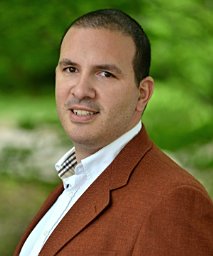 Konstantinos P. Liolis合作论文数School of Electrical and Computer Engineering, National Technical University of Athens9Ilias Andrikopoulos合作论文数R&D Department, Division of IT, Space Hellas9
 Pantelis Monogioudis合作论文数Wireless Chief Technology Office, Alcatel-Lucent9
 Samuel Atungsiri合作论文数9
 Tolga Ors合作论文数8Acar, G.合作论文数8
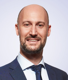 Symeon Chatzinotas合作论文数Interdisciplinary Centre for Security, Reliability and Trust, University of Luxembourg8
 Niccolo Privitera合作论文数8
 Pei Xiao合作论文数Institute for Communication Systems, School of Computer Science and Electronic Engineering, University of Surrey8
 Stephan Jaeckel合作论文数8
 Ning Wang合作论文数Centre for Communication Systems Research (CCSR)
Faculty of Engineering and Physical Science
University of Surrey8
Ning Wang合作论文数Centre for Communication Systems Research (CCSR)
Faculty of Engineering and Physical Science
University of Surrey8 Rosalba Suffritti合作论文数8
 Atta Ul Quddus合作论文数Centre for Communication Systems Research, University of Surrey8Stylianos Papaharalabos合作论文数8Madhavendra Richharia合作论文数8c valadon合作论文数7Gabriele Boccolini合作论文数7Oriol Vidal合作论文数7Meenan, C.合作论文数7
 Beniamino Russo合作论文数7
 Alessandro Guidotti合作论文数7
 Giovanni Emanuele Corazza合作论文数Dipartimento Di Ingegneria Dell'Energia Elettrica E Dell'Informazione, Alma Mater Studiorum Universita Di Bologna7
 Michael Dieudonne合作论文数7




