Abstract Nature-based solutions (NbS) are increasingly recognized as effective tools for climate adaptation, yet their implementation remains limited by the perception that engineering guidance is lacking. This paper examines the existing spectrum of available guidance, ranging from informal case studies to peer-reviewed literature and state-level manuals, highlighting the need to clarify which types of standards are most useful across project types and contexts. Drawing on historical precedents, current practices, and recent advances in evaluating performance, we argue that a body of data and design knowledge exists but is decentralized and underutilized. We propose the creation of a Natural Infrastructure Engineering Hub (HUB) to centralize NbS resources, support adaptive learning, and promote the development of NbS-specific guidance that can evolve as more projects are designed, built, and monitored. Through cross-sector collaboration and phased implementation, the HUB offers a pathway to scale NbS with confidence, rigor, and transparency.
The practice of green stormwater infrastructure (GI) is rapidly advancing. However, there remain complex challenges to upscaling its practice from localized installations to city-scale distributed systems. The purpose of this work is to address technical challenges associated with upscaling GI by demonstrating a practitioner-friendly modeling approach for quantifying hydrologic benefits that is sensitive to GI placement within a cityscape and actionable with the common tools of practice. The approach is demonstrated for an urban coastal community in Georgia, USA, with a distributed hydrodynamic model (StormWise) that simulates multiple flood hazards, the services of conventional stormwater infrastructure, and expansions of the urban canopy cover (UCC) along roadways and in residential areas. Hydrologic benefits are quantified at the site and city spatial scales during design storms (4-100% AEP), and results suggest approximately linear relationships, for example, 0.17-0.54% reductions in runoff for every 1% of land use converted to UCC and 0.98-1.34% reductions in runoff for every 1% reduction in aggregate imperviousness. In addition, the results suggest the potential for city-wide reductions in runoff (up to 54%), reductions in the service demand on conventional infrastructure (up to 57%), and reductions in flood depths on buildings (up to 33%), as well as the greatest efficiency on a per-km2 basis from UCC expansion along roadways. Despite the challenges of distributed modeling, the proposed approach is tailored to the types of geospatial datasets available to practitioners and demonstrates an efficient, repeatable approach for quantifying GI services with the common tools of practice.
Lake Erie, one of the 5 Laurentian Great Lakes, suffers from harmful algal blooms in its western basin that are associated with phosphorus (P) loading from the Maumee River Watershed (MRW), United States. Additionally, certain waterfowl populations in the MRW have declined significantly in recent decades. Wetlands provide ecosystem services such as reducing P pollution and providing habitat for waterbirds, but these objectives are often treated separately. Simple tools are needed in this region for improved wetland restoration for meeting the dual goals of providing waterfowl habitat and improving water quality through P retention via design and management. This research identified 2 main objectives in support of these goals: 1) create a parsimonious model that assesses wetland P retention and waterfowl habitat suitability simultaneously, and 2) create a spreadsheet tool to implement the model to identify water management and design approaches that improve P retention and waterfowl habitat suitability. A total of 249 observations of wetland P fluxes, with agricultural runoff as the primary pollutant of interest, were input into a first-order pollutant removal model to generate P retention estimates. Waterbird habitat suitability was assessed based on preferred foraging depths. Results show that active, dynamic management of water depth can help reduce tradeoffs between wetland objectives and that larger wetlands (at least 2% – 7% of subbasin area) tend to outperform smaller wetlands in meeting both objectives.
This study presents an approach for deriving stream geometry from watershed morphometric characteristics, addressing data scarcity for hydrologic and hydraulic modeling. The approach was tested in Puerto Rico and involves subdividing the study area into homogeneous regions and developing region-specific stream geometry predictive equations using ordinary least squares regression to correlate morphometric characteristics with the stream width and depth for a 2-year return period flow. The resulting equations were verified and validated by applying them to generate cross-sections for eight Storm Water Management Models. Results showed a correlation between drainage area and channel morphology, attributed to the presence of areal/shape characteristics in all the specific-region equations. Verification with an independent watershed sample demonstrated the predictive equations' robustness and reliability. The study found that subdividing homogeneous regions improved accuracy compared to previous studies. Validation demonstrated up to 45.9 % (similar to 1.29 m(3) s(-1)) differences in peak flow modeling, corroborating their applicability for modeling purposes.
Urban streams are often managed in ways that contribute to societal inequities. Members of marginalized groups are frequently exposed to elevated flood risk and impaired water quality, with reduced access to essential water infrastructure and greenspace within stream corridors. The freshwater science research community has traditionally argued for stream management that improves ecological integrity, which can have the unintended consequence of steering investments away from the most degraded streams, which are often in low-income neighborhoods. We argue that it is time to reorient municipal stream management programs towards the objective of equitable delivery of benefits, which can take many forms, and to de-emphasize the goal of restoring streams to the pre-development ecological condition. To meet the objective of equitable delivery of benefits, municipalities will need to establish systems of collaborative governance, in which community organizations are empowered to participate as equal partners in urban stream management decision-making. We recognize the many practical challenges municipalities face in making these transitions, which will vary by country and region. Here, we identify some opportunities and highlight case studies illustrating how some communities are taking steps toward more equitable urban stream management.
Nature-based solutions (NbS, and related concepts like natural infrastructure, Ecosystem-based Adaptation, and green infrastructure) are increasingly recognized as multi-benefit strategies for addressing the critical sustainability challenges of the Anthropocene, including the climate emergency and biodiversity crisis. Mainstreaming NbS in professional practice requires strategic, landscape-level planning integrating multiple sources of benefits and their synergies and trade-offs. Levee setbacks (LS) are among the best-studied riverine NbS with recognized benefits for flood risk management, drought resilience, water quality management, recreational opportunities, and ecological restoration for biodiversity. Although awareness of the multifarious benefits of LS as forms of Natural Capital is growing, implementation remains ad-hoc and opportunistic. To address this critical implementation gap for one major example of NbS, we review and synthesize literature across diverse disciplines to provide an overview of the primary social, economic, and ecological mechanisms that affect the co-benefit delivery of LS projects. Next, to make this information relevant to NbS practitioners, we link these mechanisms to spatial metrics that can be used to approximate the relative magnitude of project benefits and costs across these mechanisms. Finally, we highlight examples of key synergies and trade-offs among benefits that should be considered for LS planning. This synthetic approach is intended to familiarize readers with the diverse potential benefits of LS, and provide an understanding of how to select and prioritize potential sites for further study and implementation. Synergies and trade-offs among important benefit drivers abound, and social equity concerns will be paramount in ensuring the successful implementation of LS and other NbS in the future. This article is categorized under: Engineering Water > Sustainable Engineering of Water Engineering Water > Planning Water Water and Life > Nature of Freshwater Ecosystems
Levee setbacks are an intuitive nature-based solution that can improve the flood protection services provided by levees and help rehabilitate levee-stressed ecosystems. Their application in professional practice is in part limited by a lack of guidance on how to size setbacks to balance different interests in floodplain land use. To help address this application barrier, we demonstrate how flood hazard and levee failure risk reduction may be modeled with a numerical hydraulic model of a leveed river in the Midwestern USA, as well as how to calculate scaling relationships between levee failure risk reduction and setback size. Our results suggest setbacks can greatly reduce the severity of flood hazards, for example, by alleviating flow bottlenecks and lowering flood heights. Our results also suggest that improvements in levee reliability scale non-linearly with setback size and exhibit diminishing returns. We conclude with a discussion of design insights and cautions to support the application of setbacks in practice.
Proactive and transparent decision-making about the long-term management of dams, including rehabilitation, retrofit, and removal, is critical for successfully managing this aging infrastructure and presents an opportunity to weigh the many services and disservices dams provide. Existing tools to support dam removal decisions often constrain decision processes by considering only a limited set of user objectives. We identified 18 dam removal objectives in the literature and found that most of the 41 dam removal decision-support tools we evaluated included only two or three objectives. Common objectives of previous dam removals like reducing safety hazard and expanding recreational opportunities were included in few decision-support tools. To facilitate dam removal decisions with diverse objectives, we created a new web application, which supports decisions with the 18 objectives that we identified in the literature. The application guides users to select appropriate objectives, choose metrics and methods to evaluate management alternatives, and identify additional decision-support tools to weigh alternatives relative to selected objectives. We demonstrate this web application as a resource for the dam management community of practice with a case study of a dam removal decision in Athens, Georgia, USA. More broadly, we propose the process outlined here as a model for aligning diverse objectives in other types of river infrastructure decisions. Given the contribution of this infrastructure to declining biodiversity, intensifying climate, and development needs, failing to align multiple objectives in river infrastructure decisions can represent consequential, missed opportunities.
Abstract Relocating levees further back from river channels to increase river–floodplain connection can reduce flood stages and provide a host of co‐benefits. Modeling case studies show the significant potential of large levee setbacks for reducing flood stages; however, the difficulty of comparing between these case studies limits our understanding of how the hydraulic effects of setbacks vary in different settings. We filled this research gap by systematically modeling the hydraulic effects of setbacks across a range of river and flood conditions. We used unsteady, 1D Hydrologic Engineering Center‐River Analysis System models to quantify changes in flood stage, channel velocity, and sediment transport capacity for various setback sizes with different river slopes, widths, floodplain roughness, and flood sizes (peak flows) and durations. Setbacks reduce flood stages within the setback, as well as up‐ and downstream. Channel velocity and sediment transport capacity both increased upstream and decreased within the setback. Channel slope, flood size, and flood duration had the largest influence on hydraulic changes. There are diminishing returns in hydraulic effects with increasing setback size. These results can help guide the design and prioritization of levee setback projects and help set reasonable expectations for the scale of changes to flood hydraulics relative to the size of the reconnected floodplain.
Civil infrastructure will be essential to face the interlinked existential threats of climate change and rising resource demands while ensuring a livable Anthropocene for all. However, conventional infrastructure planning largely neglects the contributions and maintenance of Earth’s ecological life support systems, which provide irreplaceable services supporting human well-being. The stability and performance of these services depend on biodiversity, but conventional infrastructure practices, narrowly focused on controlling natural capital, have inadvertently degraded biodiversity while perpetuating social inequities. Here, we envision a new infrastructure paradigm wherein biodiversity and ecosystem services are a central objective of civil engineering. In particular, we reimagine infrastructure practice such that 1) ecosystem integrity and species conservation are explicit objectives from the outset of project planning; 2) infrastructure practices integrate biodiversity into diverse project portfolios along a spectrum from conventional to nature-based solutions and natural habitats; 3) ecosystem functions reinforce and enhance the performance and lifespan of infrastructure assets; and 4) civil engineering promotes environmental justice by counteracting legacies of social inequity in infrastructure development and nature conservation. This vision calls for a fundamental rethinking of the standards, practices, and mission of infrastructure development agencies and a broadening of scope for conservation science. We critically examine the legal and professional precedents for this paradigm shift, as well as the moral and economic imperatives for manifesting equitable infrastructure planning that mainstreams biodiversity and nature’s benefits to people. Finally, we set an applied research agenda for supporting this vision and highlight financial, professional, and policy pathways for achieving it.
Urban flooding is a growing threat due to land use and climate change. Vulnerable populations tend to have greater exposure to flooding as a result of historical societal and institutional processes. Most flood vulnerability studies focus on a single large flood, neglecting the impact of small, frequent floods. Therefore, there is a need to investigate inequitable flood exposure across a range of event magnitudes and frequencies. To explore this question, we develop a novel score of inequitable flood risk by defining risk as a function of frequency, exposure, and vulnerability. This analysis combines high-resolution, parcel-scale compounded fluvial and pluvial flood data with census data at the census block group scale. We focus on six census tracts within Athens-Clarke County, Georgia that are highly developed with diverse populations. We define vulnerable populations as non-Hispanic Black, Hispanic, and households under the poverty level and use dasymetric mapping techniques to calculate the over-representation of these populations in flood zones. Inequitable risks at each census tract (approximately neighborhood scale) were estimated for multiple (e.g., 5-, 10-, 20-, 50-, and 100-year) flood return periods. Results show that the relatively greatest flood risk inequities occur for the 10-year flood and not at the largest event. We also found that the size of inequity is dynamic, depending on the flood magnitude. Therefore, addressing a range of events including smaller, more frequent floods can increase equity and reveal opportunities that may be missed if only one event is considered.
Abstract Natural infrastructure (NI) and nature-based solutions in urban riverscapes can provide a spectrum of environmental, societal, and economic benefits, but widespread implementation of NI strategies remain limited because of their context-dependent nature. Windows of opportunity have opened through legislation and funding to expand NI solutions that address flooding, water quality, air pollution, extreme heat, and environmental equity. System-level approaches may offer these projects a framework that is flexible yet holistic enough to streamline implementation. In fact, a systems approach is essential to realize the potential of NI for equitably achieving these goals, and a critical step includes identification of vulnerabilities (e.g., exposure to environmental harm). The purpose of this study was to support decision makers and managers in prioritizing their urban riverscapes with multiple vulnerabilities: flood risk, water quality, ecosystem function, and environmental inequity. We conducted an urban stream spatial multicriteria decision analysis (MCDA) case study with Charlotte–Mecklenburg Storm Water Services to support equitable and efficient stream reach, floodplain, and watershed planning. Our study assessed the social and ecological characteristics of the system and prioritized vulnerable watersheds and subbasins using a spatial MCDA. We developed an urban stream prioritization framework that could be tailored to complement existing management strategies and also more broadly implemented in other social–ecological systems.
Abstract. Environmental streamflow management can improve the ecological health of streams by returning modified flows to more natural conditions. The Ecological Limits of Hydrologic Alteration (ELOHA) framework for developing regional environmental flow criteria has been implemented to reverse hydromodification across the heterogenous region of coastal southern California (So. CA) by focusing on two elements of the flow regime: streamflow permanence and flashiness. Within ELOHA, classification groups streams by hydrologic and geomorphic similarity to stratify flow-ecology relationships. Analogous grouping techniques are used by hydrologic modelers to facilitate streamflow prediction in ungaged basins (PUB) through regionalization. Most watersheds, including those needed for stream classification and environmental flow development, are ungaged. Furthermore, So. CA is a highly heterogeneous region spanning a gradient of urbanization, which presents a challenge for regionalizing ungaged basins. In this study, we develop a novel classification technique for PUB modeling that uses an inductive approach to group regional streams by modeled hydrologic similarity followed by deductively determining class membership with hydrologic model errors and watershed metrics. As a new type of classification, this “Hydrologic Model-based Classification” (HMC) prioritizes modeling accuracy, which in turn provides a means to improve model predictions in ungaged basins, while complementing traditional classifications and improving environmental flow management. HMC is developed by calibrating a regional catalog of process-based rainfall-runoff models, quantifying the hydrologic reciprocity of calibrated parameters that would be unknown in ungaged basins, and grouping sites according to hydrologic and physical similarity. HMC was applied to 25 USGS streamflow gages in the south coast region of California and was compared to other hybrid PUB approaches combining inductive and deductive classification. Using an Average Cluster Error metric, results show HMC provided the most hydrologically similar groups according to calibrated parameter reciprocity. Hydrologic Model-based Classification is relatively complex and time-consuming to implement, but it shows potential for advancing ungaged basin management. This study demonstrates the benefits of thorough stream classification using multiple approaches, and suggests that Hydrologic Model-based Classification has advantages for PUB and building the hydrologic foundation for environmental flow management.
Natural channel design (NCD) and analytical channel design (ACD) are two competing approaches to stable channel design that share fundamental similarities in accounting for sediment transport processes with designs based on hybrid fluvial geomorphology and hydraulic engineering methods. In this paper, we highlight the linkage between ACD's capacity/supply ratio (CSR) and NCD's sediment capacity models (FLOWSED/POWERSED), illustrating how ACD and NCD have reached a point of convergent evolution within the stream restoration toolbox. We modified an existing CSR analytical spreadsheet tool which enabled us to predict relative channel stability using both conventional bed load transport equations and regional sediment regression curves. The stable channel design solutions based on measured data most closely matched the Parker (ACD) and/or Pagosa good/fair (NCD) relationships, which also showed the greatest CSR sensitivity in response to channel alterations. We found that CSR differences among the transport relationships became more extreme the further the design width deviated from the supply reach, suggesting that a stable upstream supply reach may serve as the best design analog. With this paper, we take a step toward resolving lingering controversy in the field of stream restoration, advancing the science and practice by reconciling key differences between ACD and NCD in the context of reach scale morphodynamics.
Rapidly growing cities along the Interstate‐85 corridor from Atlanta, GA, to Raleigh, NC, rely on small rivers for water supply and waste assimilation. These rivers share commonalities including water supply stress during droughts, seasonally low flows for wastewater dilution, increasing drought and precipitation extremes, downstream eutrophication issues, and high regional aquatic diversity. Further challenges include rapid growth; sprawl that exacerbates water quality and infrastructure issues; water infrastructure that spans numerous counties and municipalities; and large numbers of septic systems. Holistic multi‐jurisdiction cooperative water resource planning along with policy and infrastructure modifications is necessary to adapt to population growth and climate. We propose six actions to improve water infrastructure resilience: increase water‐use efficiency by municipal, industrial, agricultural, and thermoelectric power sectors; adopt indirect potable reuse or closed loop systems; allow for water sharing during droughts but regulate inter‐basin transfers to protect aquatic ecosystems; increase nutrient recovery and reduce discharges of carbon and nutrients in effluents; employ green infrastructure and better stormwater management to reduce nonpoint pollutant loadings and mitigate urban heat island effects; and apply the CRIDA framework to incorporate climate and hydrologic uncertainty into water planning.
The conceptual framework for nature-based solutions (NbS) is well developed, however realizing the potential of NbS at scale and in widespread professional practice in infrastructure systems depends on overcoming operational challenges rooted in the historical policies and engineering practices of the action agencies capable of implementation. In this article, we explore levee setbacks as a NbS for improving the sustainability of leveed river corridors within the context of the United States (US) and its primary action agency of flood risk management, the Army Corps of Engineers (USACE). By identifying the social and environmental consequences of historical levee management and linking these consequences with historical policies and engineering practices, we highlight knowledge gaps, challenges and opportunities for progress with NbS. We also briefly discuss USACE’s decision-making processes for infrastructure investments and the valuation of ecosystem services as it pertains to operationalizing setbacks in practice. We then develop a case study of a recent setback on the Missouri River to showcase how USACE overcame implementation challenges. Lessons from past levee corridor management in the US, and USACE’s current corrective actions, may help foster understanding of how to overcome operational challenges in the implementation of setbacks in other social and political contexts.
Infrastructure development and biodiversity conservation are often planned and executed in isolation. However, outcomes from these efforts are interlinked, with coordinated actions required to jointly address sustainability challenges. Natural infrastructure — encompassing a spectrum of natural to conventional solutions — is key to the infrastructure–biodiversity connection and should be brought into large-scale application.
Recent catastrophic flood events, increasing flood losses, and climate change challenge current reliability estimates defined by the probability that flood levels will not exceed protection measures over a planning horizon. These estimates depict an expected reliability that mask uncertainty in streamflow and the capacity of river channels and floodplains. We described reliability as a random variable whose distribution depends on uncertainty and nonstationarity in annual maximum flood (AMF) distributions and flow capacity uncertainty. Numerical experiments quantified the impacts of nonstationarity and variance in AMFs and flow capacity uncertainty on estimates of flood protection reliability, thereby providing the first examination of their interacting effects. The distribution of reliability along a regulatory floodplain boundary was quantified through a bootstrap scheme that accounts for nonstationarity and uncertainty in AMFs and flow capacity uncertainty. Results indicated that accounting for uncertainty in flow capacity substantially reduces reliability compared to estimates based solely on flood likelihood; the divergence is greater in the presence of nonstationary AMFs. The distribution of reliability along the regulatory floodplain boundary was spatially heterogeneous due to within‐reach variation in flow capacity uncertainty. Quantifying the distribution of reliability for flood protection measures enables transparent communication and selection of a desired confidence level that is commensurate with a contextually appropriate risk tolerance. Similarly, we show that a desired level of confidence in reliability can be specified to estimate a design flood protection level. These results reveal how the combined impacts of uncertainty and nonstationarity can impact reliability estimates and confidence in those estimates.
Natural disasters interact to affect the resilience and prosperity of communities and disproportionately affect low income families and communities of colour. However, due to lack of a common theoretical framework, these are rarely quantified. Observing severe weather events (e.g. hurricanes and tornadoes) and epidemics (e.g. COVID-19) unfolding in southeastern US communities led us to conjecture that interactions among catastrophic disturbances might be much more considerable than previously recognized. For instance, hurricane evacuations increase human aggregation, a factor that affects the transmission of acute infections like SARS-CoV-2. Similarly, weather damage to health infrastructure can reduce a community's ability to provide services to people who are ill. As globalization and human population and movement continue to increase and weather events are becoming more intense, such complex interactions are expected to magnify and significantly impact environmental and human health.
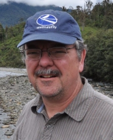 N. LeRoy Poff合作论文数Department of Biology, College of Natural Sciences, Colorado State University;Institute for Applied Ecology, University of Canberra24
 Ellen Wohl合作论文数Department of Geosciences, Warner College of Natural Resources, Colorado State University20
 Roderick W. Lammers合作论文数Department of Civil & Environmental Engineering, Colorado State University15
 Robert J. Hawley合作论文数14
 Daniel Baker合作论文数14Steven E. Yochum合作论文数14
 Gabrielle David合作论文数Department of Geosciences, Colorado State University13Timothy A. Stephens合作论文数Inst Resilient Infrastruct Syst, Univ Georgia12
 Eric D. Stein合作论文数Water Research Project12Jennifer Mueller Price合作论文数10Chester C. Watson合作论文数COLORADO STATE UNIV10
 Joel Sholtes合作论文数9Christine M. Albano合作论文数John Muir Institute of the Environment, University of California-Davis8
 Steve Sanborn合作论文数7
 Hoghooghi N合作论文数7
 Peter A. Nelson合作论文数H.T. Harvey and Associates 983 University Ave Los Gatos CA 95032 USA7
 Matt C. Kondratieff合作论文数7Christopher O. Cuhaciyan合作论文数7c o cuhaciyan合作论文数6j mueller price合作论文数6Matthew Chambers合作论文数6Tyler T. Rosburg合作论文数6
 Julian Olden合作论文数School of Aquatic and Fishery Sciences, University of Washington6
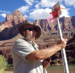 David M. Merritt合作论文数Natural Resource;Ecology Lab;Colorado State University;Ecology Lab, Colorado State University6Stephen Adams合作论文数5
 Charles van Rees合作论文数Odum School of Ecology & River Basin Center, University of Georgia5
 John S Sanderson合作论文数5
 Seth J. Wenger合作论文数University of Georgia;River Basin Center;River Basin Center, University of Georgia5
 Donald R. Nelson合作论文数School of Dentistry, University of North Carolina5
 Wilding Thomas K合作论文数National Institute of Water and Atmospheric Research (NIWA), P.O. Box 11 115, Hamilton 3251, New Zealand. twilding@rams.colostate.edu4McKay S Kyle合作论文数4
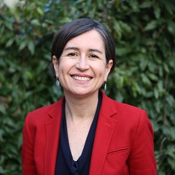 Susana Ferreira合作论文数Department of Planning and Environmental Policy, University College Dublin4
 Raphael D Mazor合作论文数Department of Environmental Science, Policy, & Management, University of California4
 Kevin Bestgen合作论文数Larval Fish Laboratory;Department of Fishery and Wildlife Biology;Colorado State University;Larval Fish Laboratory, Colorado State University4
 Christopher Myrick合作论文数Department of Fish, Wildlife, & Conservation Biology, Colorado State University4Ashmita Sengupta合作论文数Dept of Civil and Environmental Eng, Univ of Massachusetts4d w dust合作论文数3dennis j baker合作论文数3russell j anderson合作论文数3Julian Scott合作论文数3Amy Birtwistle合作论文数3
 Matthew V. Bilskie合作论文数Sch Environm Civil Agr & Mech Engn, Univ Georgia3
 Derek Booth合作论文数Bren School of Environmental Science & Management, University of California, Santa Barbara3J. Marshall Shepherd合作论文数3
 Melinda Laituri合作论文数Department of Ecosystem Science and Sustainability, School of Global Environmental Sustainability, Colorado State University3
 Alejandro N. Flores合作论文数Dept Geosci, Boise State Univ3Shaun K. Carney合作论文数3
 Burton C Suedel合作论文数3




