Abstract. Atmospheric gas products obtained from remote sensing observational networks operating groundbased FTIR interferometers such as COCCON, NDACC and TCCON are known to be sensitive to nonlinear detector response. Existing methods to correct interferograms for nonlinear detector response showed that the effect of the correction on the retrieved atmospheric gas concentrations can exceed the reported uncertainties on these data products. Several methods to correct the recorded interferograms or spectra exist but turned out to have only a limited applicability mainly due to underlying assumptions. A new nonlinearity characterization method is presented which builds upon previous methods and overcomes most assumptions on the underlying measurement setup. The method is demonstrated on five distinct nonlinearity episodes for measurements obtained from two TCCON instruments, one COCCON low-spectral-resolution instrument and one NDACC instrument and includes a study on the effect of the nonlinearity correction on the atmospheric trace gas products derived from these measurements. For the TCCON instruments the new method is compared to the standardized TCCON nonlinearity correction method. New diagnostic metrics that quantify nonlinearity strength are introduced and these are shown to have the potential to characterize the cause of the underlying detector nonlinearity response, being either saturation or optical misalignment.
The Aerosol, Clouds and Trace Gases Research Infrastructure (ACTRIS) officially became the 33rd European Research Infrastructure Consortium (ERIC) on 25 April 2023 with the support of 17 founding member and observer countries. As a pan-European legal organization, ACTRIS ERIC will coordinate the provision of data and data products on short-lived atmospheric constituents and clouds relevant to climate and air pollution over the next 15-20 years. ACTRIS was designed more than a decade ago, and its development was funded at national and European levels. It was included in the European Strategy Forum on Research Infrastructures (ESFRI) roadmap in 2016 and, subsequently, in the national infrastructure roadmaps of European countries. It became a landmark of the ESFRI roadmap in 2021. The purpose of this paper is to describe the mission of ACTRIS, its added value to the community of atmospheric scientists, providing services to academia as well as the public and private sectors, and to summarize its main achievements. The present publication serves as a reference document for ACTRIS, its users, and the scientific community as a whole. It provides the reader with relevant information and an overview on ACTRIS governance and services, as well as a summary of the main scientific achievements of the last 20 years. The paper concludes with an outlook on the upcoming challenges for ACTRIS and the strategy for its future evolution. SIGNIFICANCE STATEMENT: The Aerosol, Clouds and Trace Gases Research Infrastructure (ACTRIS) is the new European Research Infrastructure Consortium for short-lived atmospheric constituents and clouds, supporting fundamental research and excellence in Earth system observation. The primary objective of ACTRIS is to produce high-quality integrated datasets in the field of atmospheric sciences and to provide services, including access to instrumented platforms, tailored for scientific and technological use. Established with a long-term perspective, with financial commitments from 17 European countries and the European Commission, ACTRIS services are open to the global community of scientists involved in atmospheric research and beyond. It is expected that ACTRIS will have a strong impact enhancing excellence in Earth system observation and research, providing information and knowledge for the development of sustainable solutions to societal needs.
Propane (C3H8) is an important trace gas in the atmosphere, as it is a proxy for oil and gas production and has a significant impact on atmospheric chemical reactions related to the hydroxyl radical and tropospheric ozone formation. In this study, solar direct absorption spectra near 2967 cm-1 recorded by a ground-based Fourier transform infrared spectrometer (FTIR) were applied to retrieve C3H8 total columns between June 2018 and July 2022 in Xianghe in north China. The systematic and random uncertainties of the C3H8 column retrieval are estimated to be 18.4 % and 18.1 %, respectively. The mean and standard deviation of the C3H8 columns derived from the FTIR spectra in Xianghe are 1.80 +/- 0.81 (1 sigma) x 1015 molec. cm-2. Good correlations are found between C3H8 and other non-methane hydrocarbons, such as C2H6 (R=0.84) and C2H2 (R=0.79), as well as between C3H8 and CO (R=0.72). However, the correlation between C3H8 and CH4 is relatively weak (R=0.45). Moreover, the FTIR C3H8 measurements in Xianghe are also compared against MkIV measurements at several sites around the world. The new FTIR measurements in Xianghe provide us with insight into C3H8 column variations and the underlying processes in north China.
In this study, we carried out an independent validation of two methane retrieval algorithms using spectra from the Infrared Atmospheric Sounding Interferometer (IASI) that has been aboard the Meteorological Operational Satellite A (MetOp-A) since 2006. Both algorithms, one developed by the Laboratoire de M & eacute;t & eacute;orologie Dynamique (LMD), called the non-linear inference scheme (NLISv8.3), and the other by the Rutherford Appleton Laboratory (RAL), referred to as RALv2.0, provide long-term global CH4 concentrations using distinctively different retrieval approaches (neural network vs. optimal estimation, respectively). They also differ with respect to the vertical range covered, where LMD provides mid-tropospheric dry-air mole fractions (mtCH(4)), and RAL provides mixing ratio profiles from which we can derive total column-averaged dry-air mole fractions (XCH4) and potentially two partial column layers (qCH(4)). We compared both CH4 products using the Copernicus Atmospheric Monitoring Service (CAMS) model, in situ profiles (range extended using CAMS model data), and ground-based Fourier transform infrared (FTIR) remote-sensing measurements. The average difference (in mtCH(4)) with respect to in situ profiles for LMD ranges between -0.3 and 10.9 ppb, while for RAL the XCH(4 )difference ranges between -4.6 and -1.6 ppb. The standard deviation (SD) of the observed differences between in situ measurements and RAL retrievals is 14.1-21.9 ppb, which is consistently smaller than that between LMD retrievals and in situ measurements (15.2-30.6 ppb). By comparing with ground-based FTIR sites, the mean differences are within +/- 10 ppb for both RAL and LMD retrievals. However, the SD of the differences at the ground-based FTIR stations shows significantly lower values for RAL (11-15 ppb) than for LMD (about 25 ppb). The long-term trend and seasonal cycles of CH4 derived from the LMD and RAL products are further investigated and discussed. The seasonal variation in XCH4 derived from RAL is consistent with the seasonal variation observed by the ground-based FTIR measurements. However, the overall 2007-2015 XCH4 trend derived from RAL measurements is underestimated, if not adjusted, for an anomaly occurring on 16 May 2013 due to a L1 calibration change. For LMD, we see very good agreement at the (sub)tropics (<35 degrees N-35 degrees S) but notice deviations in the seasonal cycle (both in the amplitude and phase) and an underestimation of the long-term trend with respect to the RAL and reference data at higher-latitude sites.
Carbon monoxide (CO), acetylene (C2H2), ethane (C2H6), formaldehyde (H2CO), and hydrogen cyanide (HCN) are important trace gases in the atmosphere. They are highly related to biomass burning, fossil fuel combustion, and biogenic emissions globally, affecting air quality and climate change. However, the variations and correlations among these species are not well known in northern China due to limited measurements. In June 2018, we installed a new ground-based Fourier transform infrared (FTIR) spectrometer (Bruker IFS 125HR) recording mid-infrared high spectral resolution solar-absorption spectra at Xianghe (39.75∘ N, 116.96∘ E), China. In this study, we use the latest SFIT4 code, together with advanced a priori profiling and spectroscopy, to retrieve these five species from the FTIR spectra measured between June 2018 and November 2021. The retrieval strategies, retrieval information and retrieval uncertainties are presented and discussed. For the first time, the time series, variations, and correlations of these five species are analyzed at a typical polluted site in northern China. The seasonal variations in C2H2 and C2H6 total columns show a maximum in winter–spring and a minimum in autumn, whereas the seasonal variations in H2CO and HCN show a maximum in summer and a minimum in winter. Unlike the other four species, the FTIR measurements show that there is almost no seasonal variation in the CO column. The correlation coefficients (R) between the synoptic variations in CO and the other four species (C2H2, C2H6, H2CO, and HCN) are between 0.68 and 0.80, indicating that they are affected by common sources. Using the FLEXPART model backward simulations and satellite fire measurements, we find that the variations in CO, C2H2, C2H6, and H2CO columns are mainly dominated by the local anthropogenic emissions, while HCN column observed at Xianghe is a good tracer to identify fire emissions.
Carbon monoxide (CO), acetylene (C2H2), ethane (C2H6), formaldehyde (H2CO), and hydrogen cyanide (HCN) are important trace gases in the atmosphere. They are highly related to biomass burning, fossil fuel combustion, and biogenic emissions, affecting air quality and climate change. Mid-infrared high spectral resolution solar-absorption spectra are continuously recorded by a Fourier-transform infrared (FTIR) spectrometer (Bruker IFS 125HR) at Xianghe (39.75° N, 116.96° E), China. In this study, we use the SFIT4 code to retrieve these five species from the FTIR spectra measured between June 2018 and November 2021. The retrieval strategies, retrieval information, and uncertainties are presented and discussed. For the first time, the time series, variations, and correlations of these five species are analyzed in North China. The seasonal variations of C2H2 and C2H6 total columns show a maximum in winter-spring and a minimum in autumn, whereas the seasonal variations of H2CO and HCN show a maximum in summer and a minimum in winter. Unlike the other four species, there is almost no seasonal variation of the CO total column. Using the monthly means as the background, the synoptic variations of these species are investigated as well. The FTIR measurements at Xianghe reveal high correlations among these species, indicating that they are affected by common sources. The correlation coefficients (R) between CO and the other four species (C2H2, C2H6, H2CO, and HCN) are between 0.68 and 0.80. The FLEXible PARTicle dispersion model (FLEXPART) v10.4 backward simulations are used to understand the airmass sources observed at Xianghe, and it is found that the high column abundances are coming mainly from local anthropogenic emissions. Using satellite measurements, we show that the boreal forest fire emissions in Russia can lead to enhanced HCN total columns at Xianghe.
Abstract. Carbon monoxide (CO), acetylene (C2H2), ethane (C2H6), formaldehyde (H2CO), and hydrogen cyanide (HCN) are important trace gases in the atmosphere. They are highly related to biomass burning, fossil fuel combustion, and biogenic emissions, affecting air quality and climate change. Mid-infrared high spectral resolution solar-absorption spectra are continuously recorded by a Fourier-transform infrared (FTIR) spectrometer (Bruker IFS 125HR) at Xianghe (39.75° N, 116.96° E), China. In this study, we use the SFIT4 code to retrieve these five species from the FTIR spectra measured between June 2018 and November 2021. The retrieval strategies, retrieval information, and uncertainties are presented and discussed. For the first time, the time series, variations, and correlations of these five species are analyzed in North China. The seasonal variations of C2H2 and C2H6 total columns show a maximum in winter-spring and a minimum in autumn, whereas the seasonal variations of H2CO and HCN show a maximum in summer and a minimum in winter. Unlike the other four species, there is almost no seasonal variation of the CO total column. Using the monthly means as the background, the synoptic variations of these species are investigated as well. The FTIR measurements at Xianghe reveal high correlations among these species, indicating that they are affected by common sources. The correlation coefficients (R) between CO and the other four species (C2H2, C2H6, H2CO, and HCN) are between 0.68 and 0.80. The FLEXible PARTicle dispersion model (FLEXPART) v10.4 backward simulations are used to understand the airmass sources observed at Xianghe, and it is found that the high column abundances are coming mainly from local anthropogenic emissions. Using satellite measurements, we show that the boreal forest fire emissions in Russia can lead to enhanced HCN total columns at Xianghe.
Abstract. Carbon monoxide (CO), acetylene (C2H2), ethane (C2H6), formaldehyde (H2CO), and hydrogen cyanide (HCN) are important trace gases in the atmosphere. They are highly related to biomass burning, fossil fuel combustion, and biogenic emissions globally, affecting air quality and climate change. However, the variations and correlations among these species are not well known in North China, due to limited measurements. In June 2018, we installed a new ground-based Fourier-transform infrared (FTIR) spectrometer (Bruker IFS 125HR) recording mid-infrared high spectral resolution solar-absorption spectra at Xianghe (39.75° N, 116.96° E), China. In this study, we use the latest SFIT4 code, together with advanced a priori profile and spectroscopy, to retrieve these five species from the FTIR spectra measured between June 2018 and November 2021. The retrieval strategies, retrieval information, and retrieval uncertainties are presented and discussed. For the first time, the time series, variations, and correlations of these five species are analyzed at a typical polluted site in North China. The seasonal variations of C2H2 and C2H6 total columns show a maximum in winter-spring and a minimum in autumn, whereas the seasonal variations of H2CO and HCN show a maximum in summer and a minimum in winter. Unlike the other four species, the FTIR measurements show that there is almost no seasonal variation in the CO column. The correlation coefficients (R) between the synoptic variations of CO and the other four species (C2H2, C2H6, H2CO, and HCN) are between 0.68 and 0.80, indicating that they are affected by common sources. Using the FLEXPART model backward simulations and satellite fire measurements, we find that the variations of CO, C2H2, C2H6, and H2CO columns are mainly dominated by the local anthropogenic emissions, while HCN column observed at Xianghe is a good tracer to identify fire emissions.
Nitric oxide (NO) is a key active trace gas in the atmosphere, which contributes to form harmful ozone in the troposphere and to the destruction of ozone in the stratosphere. In this study, we present the NO retrieval from ground-based Fourier-transform infrared (FTIR) solar absorption spectrometry measurements at a polluted site (Xianghe, China) and a background site (Maïdo, Reunion Island). The degree of freedom (DOF) of the NO retrieval is 2.3±0.4 (1σ) at Xianghe and 1.3±0.1 at Maïdo. By looking at the FTIR NO retrievals at Xianghe and Maïdo, we find that the stratospheric NO partial column is large in summer as compared to winter at both sites, and the seasonal variation in the FTIR stratospheric NO partial columns is consistent with that observed by the co-located Michelson Interferometer for Passive Atmospheric Sounding (MIPAS) satellite measurements. A large diurnal variation in the stratospheric NO partial column is observed by the FTIR measurements at Maïdo, with an increase from the early morning to about 14:00 local time and a decrease thereafter. Due to the low NO concentration near the surface, the FTIR NO retrieval is only sensitive to the stratosphere at Maïdo. The high NO mole fraction near the surface at Xianghe allows us to derive tropospheric and stratospheric NO partial columns separately, although the tropospheric column is very difficult to retrieve in summer (June–August) because of the high water vapor abundance. A good correlation is found between the NO observed by the FTIR measurements and other air pollutants (NO2 and CO) in the troposphere at Xianghe. It is the first study of a successful analysis of NO in the troposphere from a ground-based FTIR site. The tropospheric and stratospheric NO retrieval might be possible at other potential FTIR sites inside or near large cities with enhanced levels of NO near the surface.
The nationwide lockdown due to the COVID-19 pandemic in 2020 reduced industrial and human activities in China. In this study, we investigate atmospheric carbon monoxide (CO) concentration changes during the lockdown from observations at the surface and from two satellites (TROPOspheric Monitoring Instrument (TROPOMI) and Infrared Atmospheric Sounding Interferometer (IASI)). It is found that the average CO surface concentration in 2020 was close to that in 2019 before the lockdown, and became 18.7% lower as compared to 2019 during the lockdown. The spatial variation of the change in the CO surface concentration is high, with an 8–27% reduction observed for Beijing, Shanghai, Chengdu, Zhengzhou, and Guangzhou, and almost no change in Wuhan. The TROPOMI and IASI satellite observations show that the CO columns decreased by 2–13% during the lockdown in most regions in China. However in South China, there was an 8.8% increase in the CO columns observed by TROPOMI and a 36.7% increase observed by IASI, which is contrary to the 23% decrease in the surface CO concentration. The enhancement of the CO column in South China is strongly affected by the fire emissions transported from Southeast Asia. This study provides an insight into the impact of COVID-19 on CO concentrations both at the surface and in the columns in China, and it can be extended to evaluate other areas using the same approach.
Robust calibration and validation (Cal and Val) should guarantee the accuracy of the retrieved information, make the remote sensing data consistent and traceable, and maintain the sensor performance during the operational phase. The DRAGON program has set up many remote sensing research topics on various application domains. In order to promote the effectiveness of data modeling and interpretation, it is necessary to solve various challenges in Cal and Val for quantitative RS applications. This project in the DRAGON 4 program aims to promote the cooperation of the Cal and Val experts from European and Chinese institutes in Cal and Val activities, and several achievements have been obtained in the advanced on-orbit optical sensor calibration, as well as microwave remote sensor calibration and product generation. The outcomes of the project have benefited the related remote sensing modeling and product retrieval, and promoted the radiometric calibration network (RadCalNet) as an international operational network for calibration, intercalibration, and validation. Moreover, this project provided local governments with a more accurate OMI NO2 data in China, which were used to study the air quality control during APEC period, Parade period and G20 period. This will be of ongoing be value for monitoring atmospheric environmental quality and formulating pollution control strategies.
Isentropic mixing properties in the stratosphere modeled by the forward calculation of an inverse model (TM5-4DVAR) are evaluated against Michelson Interferometer for Passive Atmospheric Sounding (MIPAS) and Microwave Limb Sounder (MLS) observations. The isentropic mixing processes are separated into large-scale stirring described by the "equivalent length" and small-scale diffusion described by the diffusivity. Compared to the measurements, we find that the modeled stirring is not strong enough and that the small-scale diffusivity is too large. TM5-4DVAR produces excessive mixing-induced poleward flux for stratospheric CH4. The flux convergence presents negative biases in the tropics and positive biases in the polar regions. The biases cannot be reduced by improving the horizontal resolution only. Modeled isentropic mixing depends on the horizontal as well as the vertical resolution of the model. An increase in vertical resolution reduces numerical diffusion of the model in the vertical. The decreased vertical diffusion leads to reduction in the modeled isentropic diffusivity. Biases in modeled total column-averaged mixing ratios of CH4 are significant for both models with a coarse vertical resolution of 4 degrees x 6 degrees x 25 (and 2 degrees x 3 degrees x 25, 1 degrees x 1 degrees x 25) and an improved one of 1 degrees x 1 degrees x 40. They are estimated to be 7-14 and 3-7 ppb in the winter extratropics under the assumption that isentropic mixing is dominant over vertical transport on a time scale of 3 days. Correspondingly, resulted biases in inverted CH4 surface emissions are estimated to be 0.5-1 and 0.2-0.5 mg/m(2)/hr, respectively, in the extratropics.
Programme, H2020-INFRADEV-2016-2017, Grant Agreement number: 739530 Deliverable D5.1: Documentation on technical concepts and requirements for ACTRIS Observational Platforms Authors: Ulla Wandinger, Arnoud Apituley, Thomas Blumenstock, Nicolas Bukowiecki, Jean-Pierre Cammas, Paul Connolly, Martine De Mazière, Bart Dils, Markus Fiebig, Evelyn Freney, Martin Gallagher, Sophie Godin-Beekmann, Philippe Goloub, Martin Gysel, Martial Haeffelin, Frank Hase, Markus Hermann, Hartmut Herrmann, Tuija Jokinen, Mika Komppula, Dagmar Kubistin, Bavo Langerock, Heikki Lihavainen, Nikos Mihalopoulos, Paolo Laj, Cathrine Lund Myhre, Emmanuel Mahieu, Stephan Mertes, Ottmar Möhler, Lucia Mona, Doina Nicolae, Ewan O’Connor, Mathias Palm, Gelsomina Pappalardo, Andrea Pazmino, Tuukka Petäjä, Sabine Philippin, Christian Plass-Duelmer, Bernhard Pospichal, Jean-Philippe Putaud, Stefan Reimann, Franz Rohrer, Herman Russchenberg, Stéphane Sauvage, Karine Sellegri, Rainer Steinbrecher, Frank Stratmann, Ralf Sussmann, Dominik van Pinxteren, Michel Van Roozendael, Corinne Vigouroux, Chris Walden, Robert Wegener, Alfred Wiedensohler Work package no. WP5 Deliverable no. D5.1 Lead beneficiary TROPOS Deliverable type X R (Document, report)
Abstract. The equivalent length, a measure for mixing strength in the atmosphere, in meridional direction in the current application, is used here to investigate the causes of the atmospheric chemistry model (TM3, TM5-4DVAR and LMDz-PYVAR) biases in the stratosphere. Compared to measurements, we find that the modeled surf zone (a strongly stirred region caused by planetary wave breaking in mid-latitude stratosphere in the winter hemisphere), especially in the southern hemisphere, is not strong enough. We assume that this is due to an underestimation of the planetary wave breaking magnitude in the models. Consequently, the region with meridional uniform stratospheric CH4 concentrations has smaller latitudinal coverages in the models than the measurements, especially in the southern hemisphere between June and September. During the southern winter, a region with both vertically and horizontally well mixed CH4 concentrations occur between 450 and 850 K (~ 18 and 30 km) in surf zone latitudes. Such a region is absent in the models, and underestimations of CH4 concentrations within it are visible in comparisons with measured CH4 profiles. The modeled polar vortex breaks too fast and during the vortex period CH4 concentration differences across its barrier are underestimated compared to the measurements.
The thermal And near infrared sensor for carbon observations Fourier transform spectrometer (TANSO-FTS) on board the Greenhouse Gases Observing Satellite (GOSAT) applies the normal nadir mode above the land (“land data”) and sun glint mode over the ocean (“ocean data”) to provide global distributions of column-averaged dry-air mole fractions of CO2 and CH4, or XCO2 and XCH4. Several algorithms have been developed to obtain highly accurate greenhouse gas concentrations from TANSO-FTS/GOSAT spectra. So far, all the retrieval algorithms have been validated with the measurements from ground-based Fourier transform spectrometers from the Total Carbon Column Observing Network (TCCON), but limited to the land data. In this paper, the ocean data of the SRPR, SRFP (the proxy and full-physics versions 2.3.5 of SRON/KIT's RemoTeC algorithm), NIES (National Institute for Environmental Studies operational algorithm version 02.21) and ACOS (NASA's Atmospheric CO2 Observations from Space version 3.5) are compared with FTIR measurements from five TCCON sites and nearby GOSAT land data.For XCO2, both land and ocean data of NIES, SRFP and ACOS show good agreement with TCCON measurements. Averaged over all TCCON sites, the relative biases of ocean data and land data are −0.33 and −0.13 % for NIES, 0.03 and 0.04 % for SRFP, 0.06 and −0.03 % for ACOS, respectively. The relative scatter ranges between 0.31 and 0.49 %. For XCH4, the relative bias of ocean data is even less than that of the land data for the NIES (0.02 vs. −0.35 %), SRFP (0.04 vs. 0.20 %) and SRPR (−0.02 vs. 0.06 %) algorithms. Compared to the results for XCO2, the XCH4 retrievals show larger relative scatter (0.65–0.81 %).
The goal of the GHG-CCI project (http://www.esa-ghg-cci.org/) of ESA's Climate Change Initiative (CCI) is to generate global atmospheric satellite-derived carbon dioxide (CO2) and methane (CH4) data sets as needed to improve our understanding of the regional sources and sinks of these important greenhouse gases (GHG). Here we present an overview about the latest data set called Climate Research Data Package No. 3 (CRDP3). We focus on the GHG-CCI project core data products, which are near-surface-sensitive column-averaged dry air mole fractions of CO2 and CH4, denoted XCO2 (in ppm) and XCH4 (in ppb) retrieved from SCIAMACHY/ENVISAT (2002-2012) and TANSO-FTS/GOSAT (2009-today) nadir mode radiance observations in the near-infrared/shortwave-infrared spectral region. The GHG-CCI products are primarily individual sensor Level 2 products. However, we also generate merged Level 2 products (EMMA products). Here we also present a first GHG-CCI Level 3 product, namely XCO2 and XCH4 in Obs4MIPs format (monthly, 5°×5°).
 Martine De Mazière合作论文数16Corinne Vigouroux合作论文数Royal Belgian Inst Space Aeron BIRA IASB15
 Justus Notholt合作论文数Department of Physics, University of Bremen14Christian Hermans合作论文数Belgian Institute for Space Aeronomy, Brussels, Belgium12Emmanuel Mahieu合作论文数11
 Michael Buchwitz合作论文数Institute of Environmental Physics, University of Bremen10Bavo Langerock合作论文数9
 Minqiang Zhou (周敏强)合作论文数State Key Laboratory of Atmospheric Environment and Extreme Meteorology, Institute of Atmospheric Physics, Chinese Academy of Sciences;University of Chinese Academy of Sciences9Nicolas Kumps合作论文数9
 Pucai Wang (王普才)合作论文数Institute of Atmospheric Physics, Chinese Academy of Sciences;University of Chinese Academy of Sciences8Thomas Blumenstock合作论文数Institute of Meteorology and Climate Research, Karlsruhe Institute of Technology8Pierre Duchatelet合作论文数8
 Heinrich Bovensmann合作论文数7
 John P. Burrows合作论文数Institutes of Environmental Physics and Remote Sensing, University of Bremen7Oliver Schneising合作论文数7Weidong Nan合作论文数6
 Philippe Demoulin合作论文数6
 Hartmut Bösch合作论文数Institute for Environmental Physics, FB1, University of Bremen6
 Ralf Sussmann合作论文数6
 Thorsten Warneke合作论文数6
 Christian Frankenberg合作论文数Division of Geological and Planetary Sciences, California Institute of Technology;Jet Propulsion Laboratory6
 m reuter合作论文数5
 Michel Van Roozendael合作论文数UV-Visible DOAS Research Group, Belgian Institute for Space Aeronomy5
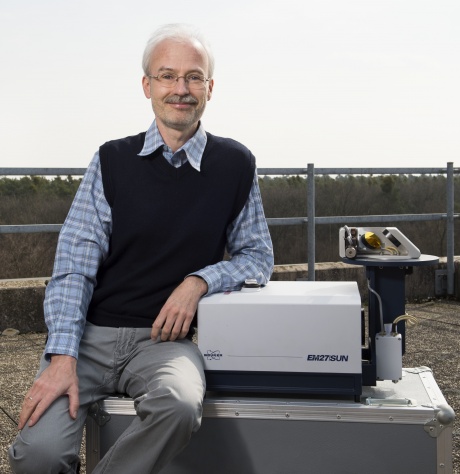 Frank Hase合作论文数Forschungszentrum Karlsruhe5
 Otto Hasekamp合作论文数SRON Netherlands Institute for Space Research5Claus Zehner合作论文数5P. Bergamaschi合作论文数5Robert Parker合作论文数Space Research Centre, University of Leicester5Stefan Noel合作论文数4
 Dominik Brunner合作论文数4Qichen Ni合作论文数4
 Zhiting Wang (王治厅)合作论文数 4M. Kruglanski合作论文数4
 Frédéric Chevallier合作论文数Laboratoire des Sciences du Climat et de I'Environnement4C. Senten合作论文数4
 Andre Butz合作论文数Institute of Environmental Physics, Heidelberg University;Department of Physics and Astronomy, Heidelberg University;Heidelberg Center for the Environment, Heidelberg University4
 Gauthier Vanhaelewyn合作论文数4
 Sophie Fally合作论文数Laboratoire de Chimie Quantique et Photophysique, Université Libre de Bruxelles4I. Kramer合作论文数3
 M. Saunois合作论文数3a strandberg合作论文数3a laeng合作论文数3
 Jean-Marc Metzger合作论文数University of Reunion Island3I. Aben合作论文数3
 Johannes Orphal合作论文数Karlsruhe Institute of Technology3Gunter Lichtenberg合作论文数3Michel Carleer合作论文数3Alexis Merlaud合作论文数3




