Rocky coasts evolve under the combined actions of rock uplift and erosive processes. These processes are mostly related to the sea-land interface but have varied mechanisms, ranging from wave-driven rock fatigue and cliff collapse to efficient salt weathering in the intertidal zone. The relative importance of these processes remains poorly quantified and is rarely addressed directly in modeling efforts. In particular, widely used coastal-erosion models are rarely subjected to systematic, field-informed testing that explicitly separates the contributing processes, limiting confidence in their transferability across sites.Here we present a modelling framework that evaluates and extends wave-driven cliff–platform models by separating process regimes and representing coastal erosion as a modular combination of mechanisms. We implement the framework in xarray-simlab (Xsimlab) which facilitates modular model construction and systematic comparison of process combinations. We implement and compare formulations for (i) talus production and removal at cliffs, (ii) intertidal weathering that drives vertical downwearing of the intertidal platform, and (iii) subaqueous wave-driven horizontal backwearing with nearshore energy dissipation.Our results show that different combinations of these processes—and their relative contributions—produce markedly different styles of erosional topographic evolution, leading to divergent long-term trajectories and contrasting marine-terrace preservation. This highlights the need to reconsider which model components are appropriate for different geomorphic settings. By exploring combinations of these modules across representative wave and tectonic, and lithological scenarios on the Noto Peninsula and Sado Island (Japan), we assess how shifts in process dominance generate distinct modern shoreline configurations and, ultimately, different coastal morphologies.
The combined record of past sea levels and crustal deformation can be found in the landscapes of tectonically active coastlines. Marine terraces, sea cliffs, or intertidal platforms all reflect the work of multiple geomorphic processes sculpting the coast. Researchers have investigated the key erosional mechanisms responsible for shaping the coasts. Field observations suggest that platform formation is driven by three primary processes: (1) mechanical erosion from the kinetic energy of marine waves, (2) physical or chemical weathering driven by wetting-drying cycles, and (3) biochemical weathering, which may amplify or even sometimes dominate the other two processes. However, determining the dominant process remains challenging, as each mechanism is interacting with other processes, making it is hard to disentangle their relative contribution. Numerical models for coastal evolution exist but we are not able to properly evaluate their accuracy, or to convincingly simulate the respective roles of different processes over 100s of kyr.In this study, we compare and assess the outputs of models that emphasize different processes by simulating the shoreline evolution trajectories under identical (or varying) wave conditions and sea level scenarios. The results reveal that the shape of coastal topography, including intertidal platform, varies significantly depending on the dominant process or assumptions, such as the rate of debris removal from failed cliffs. Notably, these differences become more pronounced when considering the direction of sea level change. Additionally, we build a framework that enables the simulation of process combinations by selectively activating or deactivating specific modules within the system. By systematically comparing models and their combinations, we aim to develop a comprehensive framework for coastal erosion that can be adapted to specific sites and conditions.Looking ahead, we seek to link these distinct platform development trends to long-term coastal morphological features, such as marine terraces. Over geological timescales characterized by glacial sea level fluctuations, prolonged platform formation may produce distinct marine terraces. Understanding these trends in coastal erosion can provide valuable insights into the generation and preservation of coastal geomorphology.
Traditional geospatial representations of the globe on a 2-dimensional plane often introduce distortions in area, distance, and angles. Discrete Global Grid Systems (DGGS) mitigate these distortions and introduce a hierarchical structure of global grids. Defined by ISO standards, DGGSs serve as spatial reference systems facilitating data cube construction, enabling integration and aggregation of multi-resolution data sources. Various tessellation schemes such as hexagons and triangles cater to different needs - equal area, optimal neighborhoods, congruent parent-child relationships, ease of use, or vector field representation in modeling flows.The fusion of Discrete Global Grid Systems (DGGS) and Datacubes represents a promising synergy for integrated handling of planetary-scale data.The recent Pangeo community initiative at the ESA BiDS'23 conference has led to significant advancements in supporting Discrete Global Grid Systems (DGGS) within the widely used Xarray package. This collaboration resulted in the development of the Xarray extension XDGGS (https://github.com/xarray-contrib/xdggs). The aim of xdggs is to provide a unified, high-level, and user-friendly API that simplifies working with various DGGS types and their respective backend libraries, seamlessly integrating with Xarray and the Pangeo scientific computing ecosystem. Executable notebooks demonstrating the use of the xdggs package are also developed to showcase its capabilities.This development represents a significant step forward, though continuous efforts are necessary to broaden the accessibility of DGGS for scientific and operational applications, especially in handling gridded data such as global climate and ocean modeling, satellite imagery, raster data, and maps.Keywords: Discrete Global Grid Systems, Xarray Extension, Geospatial Data Integration, Earth Observation, Data Cube, Scientific Collaboration
The field of Geomorphology covers the essential link between climate and geological processes such as tectonics. Because both of these processes operate on planetary scales, and over million year periods, landscape evolution models must, by necessity, do the same. With the advent of modern computing and the reduction in computational complexity of the Stream Power Law algorithm (SPL), it has become much easier to conduct investigations of landscape evolution on these scales. By doing so we can test model interactions between Earth system processes such as geodynamics, weathering, sediment flux, and erosion. In this work we aim to conduct landscape evolution modelling with the SPL algorithm on pre-industrial Earth, using high resolution climate models (CMIP – Coupled Model Intercomparison Project) and topographic maps with uplift histories as input. This model has already been used for planetary scale modelling on ancient Mars, and now we aim to use it to conduct a broad sensitivity analysis of the landscape evolution of pre-industrial Earth. We will compare the model outputs to established datasets and to other landscape evolution studies to best constrain the input parameters of the model (e.g., incision coefficient) to reproduce known water and sediment fluxes for the period. Once the model is calibrated, we aim to use it to look at periods of deep time where landscape evolution was perturbed by tectonic and climate excursions such as supercontinent assembly, and transitions to and from icehouse climate states. As with the pre-industrial study, this work would also include coupling to climate models but furthermore would be coupled to a global geodynamic model to produce topography, reducing reliance on paleo-topographical maps and allowing for comparison to previous studies that used those maps as topographic input.
The interplay between tectonics and climate is known to impact the evolution and distribution of life forms, leading to present-day patterns of biodiversity. Numerical models that integrate the co-evolution of life and landforms are ideal tools to investigate the causal links between these earth system components. Here, we present a tool that couples an ecological–evolutionary model with a landscape evolution model (LEM). The former is based on the adaptive speciation of functional traits, where these traits can mediate ecological competition for resources, and includes dispersal and mutation processes. The latter is a computationally efficient LEM (FastScape) that predicts topographic relief based on the stream power law, hillslope diffusion, and orographic precipitation equations. We integrate these two models to illustrate the coupled behaviour between tectonic uplift and eco-evolutionary processes. Particularly, we investigate how changes in tectonic uplift rate and eco-evolutionary parameters (i.e. competition, dispersal, and mutation) influence speciation and thus the temporal and spatial patterns of biodiversity.
Source to sink systems involve processes happening at very large timescales and the current state of the earth only represents a brief snapshot of it through space and time. These processes encompass any of those involved in the removal, transport and deposition of material from sources to sinks. The relatively stable incising valleys of the upland source landscapes allow for very efficient mathematical expressions to model their evolution over geological timescales. The transport part of the system is more challenging to study and resists radical simplification. Softer and lower-relief compared to their upstream counterparts, they are much more dynamics and undergo convoluted cycles of erosion/deposition/remobilisation only leaving sparse clues. The presence (or absence) of materials from identified provenance in the transport zone is commonly used to interpret landscapes connectivity through time. However, recent studies suggest that the dynamic nature of the transport section can make apparent provenance data ambiguous and misleading. In this contribution, we leverage the ability of a newly developed cellular automata landscape evolution modelling framework, CHONK, to investigate the transport zone. CHONK is a landscape evolution modelling framework combining advantages of cellular-automata methods with common eulerian ones. Equations are implemented in a cell referential and cells are processed in a lake-aware multiple flow topological order. Because everything happens within a cell before communicating with downstream landscape, this framework allows fine tracking of sediment provenance through space and time, unconditionally to which law is implemented, or how complex the landscape structure. We set up a basic mountain range with its foreland, exhume a discrete pluton of different rock type and track the pathways of the sediments through time, including in a stratigraphy allowing remobilisation. We show how, even in this simplistic setting, complex and stochastic patterns of sediment pathways arise. We explore at which degree these patterns are predictable and at extents they are stochastic – in other word we track the variability of the proportion of sediment coming from the pluton at given locations through time. Finally, adding more complexity to the settings with variable tectonic and climatic cycles, intermediate sink (lakes) and heterogeneous lithologies, we offer a perspective on the framework’s potential to study the role of sediment flux in shaping the landscape and its record in novel ways.
The name “FastScape” has been used to describe a landscape evolution model as well as a set of efficient algorithms to simulate various processes of erosion, transport and deposition (e.g., fluvial, hillslope and marine). We also use this name for a set of software components (https://github.com/fastscape-lem) aimed at making those models and algorithms readily accessible to a wide range of users, from experts in landscape evolution modelling to scientists, researchers and teachers in the broader Earth science community. Those software components are organised as a stack where each level has a distinct scope. At the bottom of this stack, “fastscapelib-fortran” is the original, full-featured implementation of the FastScape model, which provides a Fortran API as well as Python bindings. Its successor “fastscapelib” is a library written in modem C++ that directly exposes the FastScape algorithms (e.g., flow-routing, depression-resolving, channel erosion, hillslope diffusion) through basic APIs in C++, Python and potentially other languages such as R or Julia in the future. Built on top of those core libraries, “fastscape” is a high-level yet flexible tool that helps anyone who wants to quickly build, extend or simply run FastScape model variants in a user-friendly, interactive environment. Through its xarray-centric interface, it is deeply integrated with the rest of the Python scientific ecosystem, therefore offering great capabilities at user’s fingertips for pre/post-processing, visualisation and simulation management. One of our primary concern is following good practices (API design, testing, documentation, distribution...) while developing each of these tools. We show through a gallery of examples how the FastScape software stack has been used in research and outreach projects. We plan to provide better integration with other tools for topographic analysis/modelling (e.g., Landlab, LSDTopotools) in the future and we also greatly encourage contributions from the broader community.
We present a new algorithm for solving the common problem of flow trapped in closed depressions within digital elevation models, as encountered in many applications relying on flow routing. Unlike other approaches (e.g., the Priority-Flood depression filling algorithm), this solution is based on the explicit computation of the flow paths both within and across the depressions through the construction of a graph connecting together all adjacent drainage basins. Although this represents many operations, a linear time complexity can be reached for the whole computation, making it very efficient. Compared to the most optimized solutions proposed so far, we show that this algorithm of flow path enforcement yields the best performance when used in landscape evolution models. In addition to its efficiency, our proposed method also has the advantage of letting the user choose among different strategies of flow path enforcement within the depressions (i.e., filling vs. carving). Furthermore, the computed graph of basins is a generic structure that has the potential to be reused for solving other problems as well, such as the simulation of erosion. This sequential algorithm may be helpful for those who need to, e.g., process digital elevation models of moderate size on single computers or run batches of simulations as part of an inference study.
The marine sedimentary record contains unique information about the history of erosion, uplift and climate of the adjacent continent. Inverting this record has been the purpose of many numerical studies. However, limited attention has been given to linking continental erosion to marine sediment transport and deposition in large-scale surface process evolution models. Here we present a new numerical method for marine sediment transport and deposition that is directly coupled to a landscape evolution algorithm solving for the continental fluvial and hillslope erosion equations using implicit and O(N) algorithms. The new method takes into account the sorting of grain sizes (e.g., silt and sand) in the marine domain using a non-linear multiple grain-size diffusion equation and assumes that the sediment flux exported from the continental domain is proportional to the bathymetric slope. Specific transport coefficients and compaction factors are assumed for the two different grain sizes to simulate the stratigraphic architecture. The resulting set of equations is solved using an efficient (O(N) and implicit) algorithm. It can thus be used to invert stratigraphic geometries using a Bayesian approach that requires a large number of simulations. This new method is used to invert the sedimentary geometry of a natural example, the Ogooué Delta (Gabon), over the last ∼5 Myr. The objective is to unravel the set of erosional histories of the adjacent continental domain compatible with the observed geometry of the offshore delta. For this, we use a Bayesian inversion scheme in which the misfit function is constructed by comparing four geometrical parameters between the natural and the simulated delta: the volume of sediments stored in the delta, the surface slope, the initial and the final shelf lengths. We find that the best-fit values of the transport coefficients for silt in the marine domain are in the range of 300−500 m2/yr, in agreement with previous studies on offshore diffusion. We also show that, in order to fit the sedimentary geometry, erosion rate on the continental domain must have increased by a factor of 6 to 8 since 5.3 Ma.
C’est au debut des annees 1950 que des chercheurs de l’Universite de Liege ont entrepris de caracteriser l’atmosphere terrestre depuis la station scientifique du Jungfraujoch, dans les Alpes suisses, a une epoque ou les inquietudes liees a l’evolution de la composition atmospherique etaient inexistantes. Depuis, une spectrotheque infrarouge unique au monde a ete soigneusement constituee. L’exploitation de ces observations a permis de determiner des series temporelles multi-decennales indispensables a la caracterisation des changements subis par l’atmosphere et a l’identification de leurs causes. Apres un bref historique rappelant les etapes qui ont jalonne la mise en place du programme observationnel liegeois et les decouvertes qui ont justifie sa poursuite, nous passons en revue quelques resultats-clefs recemment acquis, en lien avec les Protocoles de Montreal et de Kyoto ou la surveillance de la qualite de l’air.
We have developed an approach for retrieving HCFC-142b (CH3CClF2) from ground-based high-resolution infrared solar spectra, using its ν7 band Q branch in the 900–906cm−1 interval. Interferences by HNO3, CO2 and H2O have to be accounted for. Application of this approach to observations recorded within the framework of long-term monitoring activities carried out at the northern mid-latitude, high-altitude Jungfraujoch station in Switzerland (46.5°N, 8.0°E, 3580m above sea level) has provided a total column times series spanning the 1989 to mid-2015 time period. A fit to the HCFC-142b daily mean total column time series shows a statistically-significant long-term trend of (1.23±0.08×10¹³moleccm−2) per year from 2000 to 2010, at the 2-σ confidence level. This corresponds to a significant atmospheric accumulation of (0.94±0.06) ppt (1ppt=1/1012) per year for the mean tropospheric mixing ratio, at the 2−σ confidence level. Over the subsequent time period (2010–2014), we note a significant slowing down in the HCFC-142b buildup. Our ground-based FTIR (Fourier Transform Infrared) results are compared with relevant data sets derived from surface in situ measurements at the Mace Head and Jungfraujoch sites of the AGAGE (Advanced Global Atmospheric Gases Experiment) network and from occultation measurements by the ACE-FTS (Atmospheric Chemistry Experiment-Fourier Transform Spectrometer) instrument on-board the SCISAT satellite.
Changes of atmospheric methane total columns (CH4) since 2005 have been evaluated using Fourier transform infrared (FTIR) solar observations carried out at 10 ground-based sites, affiliated to the Network for Detection of Atmospheric Composition Change (NDACC). From this, we find an increase of atmospheric methane total columns of 0.31 ± 0.03 % year−1 (2σ level of uncertainty) for the 2005–2014 period. Comparisons with in situ methane measurements at both local and global scales show good agreement. We used the GEOS-Chem chemical transport model tagged simulation, which accounts for the contribution of each emission source and one sink in the total methane, simulated over 2005–2012. After regridding according to NDACC vertical layering using a conservative regridding scheme and smoothing by convolving with respective FTIR seasonal averaging kernels, the GEOS-Chem simulation shows an increase of atmospheric methane total columns of 0.35 ± 0.03 % year−1 between 2005 and 2012, which is in agreement with NDACC measurements over the same time period (0.30 ± 0.04 % year−1, averaged over 10 stations). Analysis of the GEOS-Chem-tagged simulation allows us to quantify the contribution of each tracer to the global methane change since 2005. We find that natural sources such as wetlands and biomass burning contribute to the interannual variability of methane. However, anthropogenic emissions, such as coal mining, and gas and oil transport and exploration, which are mainly emitted in the Northern Hemisphere and act as secondary contributors to the global budget of methane, have played a major role in the increase of atmospheric methane observed since 2005. Based on the GEOS-Chem-tagged simulation, we discuss possible cause(s) for the increase of methane since 2005, which is still unexplained.
The relative efficiency of various hillslope processes through Quaternary glacial-interglacial cycles in the mid-latitudes is not yet well constrained. Based on a unique set of topographic and soil thickness data in the Ardennes (Belgium), we combine the new CLICHE model of climate-dependent hillslope evolution with an inversion algorithm in order to get deeper insight into the ways and timing of hillslope dynamics under one such climatic cycle. We simulate the evolution of a synthetic hill reproducing the slope, curvature, and contributing area distributions of the hillslopes of a similar to 2500km(2) real area under a simple two-stage 120-kyr-long climatic scenario with linear transitions between cold and warm stages. The inversion method samples a misfit function in the model parameter space, based on estimates of the fit of topographic derivative distributions in classes of soil thickness and of the relative frequencies of the predicted soil thickness classes. Though the inversion results show remarkable convergence patterns for most parameters, no unique solution emerges. We obtain five clusters of good fits, whose centroids are taken as acceptable model solutions. Based on the predicted time series of average denudation rate and soil thickness, plus snapshots of the soil distribution at characteristic times, we discuss these solutions and, comparing them with independent data not involved in the misfit function, we identify the most realistic scenario. Beyond providing first-order estimates of several parameters that compare well with published data, our results show that denudation rates increase dramatically for a short time at both warm-cold and cold-warm transitions, when the mean annual temperature passes through the [0, -5 degrees C] range. We also point to the overwhelming importance of solifluction in shaping hillslopes and transporting soil, and the role of depth-dependent creep (including frost creep) throughout the climatic cycle, whereas the contributions of simple creep and overland flow are minor. Copyright (c) 2016 John Wiley & Sons, Ltd.
 Emmanuel Mahieu合作论文数31
 Whitney Bader合作论文数Institut d'Astrophysique et de Géophysique, Université de Liège27
 Bernard Lejeune合作论文数24
 Bruno Franco合作论文数Institute of Geography, University of Liège22
 Christian Servais合作论文数20
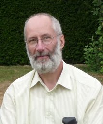 Alain Demoulin合作论文数Laboratoire de Géomorphologie et Géologie du Quaternaire, Université de Liège15
 Jean Braun合作论文数GFZ German Research Centre for Geosciences, Helmholtz Centre Potsdam, University of Potsdam14
 Kimberly Strong合作论文数Department of Physics, Faculty of Arts and Science, University of Toronto12
 Philippe Demoulin合作论文数10Stephanie Conway合作论文数Dept Phys, Univ Toronto9
 Peter Bernath合作论文数Department of Chemistry, University of Waterloo;Department of Chemistry and Biochemistry, Old Dominion University9Chris Boone合作论文数Department of Chemistry, University of Waterloo8
 Kaley Walker合作论文数Department of Physics, University of Toronto7
 Stefan Reimann合作论文数Laboratory for Air Pollution / Environmental Technology,;Department of Energy, Mobility & Environment, Swiss Federal Laboratories for Materials Science and Technology6Rodolphe Zander合作论文数6Emily V. Fischer合作论文数Mount Washington Observatory6Alexander Turner合作论文数5Dan Smale合作论文数Natl Inst Water & Atmospher Res5
 Simon O'Doherty合作论文数School of Chemistry, University of Bristol5
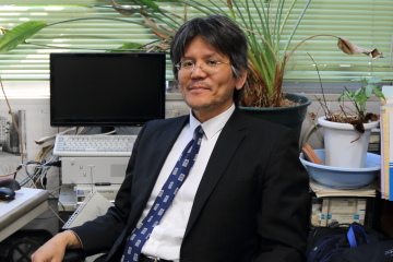 Isao Murata合作论文数Division of Sustainable Energy and Environmental Engineering,Graduate School of Engineering,Osaka University5
 Martin K. Vollmer合作论文数Swiss Federal Laboratories for Materials Science and Technology5Eric Buzan合作论文数4
 Guillaume Cordonnier合作论文数Grenoble Alpes University4
 Eloise Marais合作论文数Department of Geography, University College London4Corinne Vigouroux合作论文数Royal Belgian Inst Space Aeron BIRA IASB4
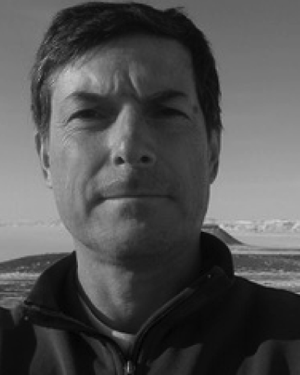 James W. Hannigan合作论文数4E. Nussbaumer合作论文数3ginette roland合作论文数3
 Zitely A. Tzompa-Sosa合作论文数Lab Sci Climat & Environm, Univ Paris Saclay3
 Xiaoping Yuan (袁小平)合作论文数School of Earth Sciences, China University of Geosciences3
 Michel Van Roozendael合作论文数UV-Visible DOAS Research Group, Belgian Institute for Space Aeronomy3
 François Hendrick合作论文数Belgium Institute for Space Aeronomy3
 Geoffrey Toon合作论文数Division of Geological and Planetary Sciences, California Institute of Technology;Laboratory Studies and Atmospheric Observations, Jet Propulsion Laboratory, National Aeronautics and Space Administration3
 Gaia Pinardi合作论文数Faculty of Medicine, University of Chile3Gilles Rixhon合作论文数3K. Sudo合作论文数2
 Didier L Bourles合作论文数2J. W. Hannigan合作论文数2olivier flock合作论文数2Katherine Kravitz合作论文数2jenny stavrakou合作论文数2
 Arnaud Beckers合作论文数Department of Geography, University of Liège2Debora Griffin合作论文数Air Qual Res Div, Environm & Climate Change Canada2Geoffrey C. Toon合作论文数2G. Roland合作论文数2Trissevgeni Stavrakou合作论文数2
 Kengo Sudo合作论文数Center for Global Change;Agency for Marine-Earth Science and Technology;Agency for Marine-Earth Science and Technology, Center for Global Change2
 Yves Cornet合作论文数2
 Regis Braucher合作论文数UMR 6635, Université Paul Cézanne CNRS-Aix Marseille Université BP802




