Brain-computer interface (BCI) is a rapidly evolving technology that has the potential to widely influence research, clinical and recreational use. Non-invasive BCI approaches are particularly common as they can impact a large number of participants safely and at a relatively low cost. Where traditional non-invasive BCIs were used for simple computer cursor tasks, it is now increasingly common for these systems to control robotic devices for complex tasks that may be useful in daily life. In this review, we provide an overview of the general BCI framework as well as the various methods that can be used to record neural activity, extract signals of interest, and decode brain states. In this context, we summarize the current state-of-the-art of non-invasive BCI research, focusing on trends in both the application of BCIs for controlling external devices and algorithm development to optimize their use. We also discuss various open-source BCI toolboxes and software, and describe their impact on the field at large.
OBJECTIVE:EEG-based brain-computer interfaces (BCI) are non-invasive approaches for replacing or restoring motor functions in impaired patients, and direct brain-to-device communication in the general population. Motor imagery (MI) is one of the most used BCI paradigms, but its performance varies across individuals and certain users require substantial training to develop control. In this study, we propose to integrate a MI paradigm simultaneously with a recently proposed Overt Spatial Attention (OSA) paradigm, to accomplish BCI control. METHODS:We evaluated a cohort of 25 human subjects' ability to control a virtual cursor in one- and two-dimensions over 5 BCI sessions. The subjects used 5 different BCI paradigms: MI alone, OSA alone, MI and OSA simultaneously towards the same target (MI+OSA), and MI for one axis while OSA controls the other (MI/OSA and OSA/MI). RESULTS:Our results show that MI+OSA reached the highest average online performance in 2D tasks at 49% Percent Valid Correct (PVC), statistically outperforms MI alone (42%), and was higher, but not statistically significant, than OSA alone (45%). MI+OSA had a similar performance to each subject's best individual method between MI alone and OSA alone (50%) and 9 subjects reached their highest average BCI performance using MI+OSA. CONCLUSION:Integrating MI and OSA leads to improved performance over MI alone at the group level and is the best BCI paradigm option for some subjects. SIGNIFICANCE:This work proposes a new BCI control paradigm that integrates two existing paradigms and demonstrates its value by showing that it can improve users' BCI performance.
The objective of this study is to extract pathological brain networks from interictal period of E/MEG recordings to localize epileptic foci for presurgical evaluation. We proposed here a resting state E/MEG analysis framework, to disentangle brain functional networks represented by neural oscillations. By using an Embedded Hidden Markov Model, we constructed a state space for resting state recordings consisting of brain states with different spatiotemporal patterns. Functional connectivity analysis along with graph theory was applied on the extracted brain states to quantify the network features of the extracted brain states, based on which the source location of pathological states is determined. The method is evaluated by computer simulations and our simulation results revealed the proposed framework can extract brain states with high accuracy regarding both spatial and temporal profiles. We further evaluated the framework as compared with intracranial EEG defined seizure onset zone in 10 patients with drug-resistant focal epilepsy who underwent MEG recordings and were seizure free after surgical resection. The real patient data analysis showed very good localization results using the extracted pathological brain states in 6/10 patients, with localization error of about 15 mm as compared to the seizure onset zone. We show that the pathological brain networks can be disentangled from the resting-state electromagnetic recording and could be identified based on the connectivity features. The framework can serve as a useful tool in extracting brain functional networks from noninvasive resting state electromagnetic recordings, and promises to offer an alternative to aid presurgical evaluation guiding intracranial EEG electrodes implantation.
With the increasingly serious global climate problem, the low-carbon design of products has gradually become an important direction of sustainable manufacturing. The optimization design of product structure is one of the important means to realize the low-carbon operation of product structure. Therefore, how to carry out the low-carbon optimization design of the product is the focus of this paper. In this paper, a new framework of low-carbon manufacturing is constructed, the load on the crane of the offshore wind power installation platform is analyzed, and the dynamic load generated by the crane during lifting, rotating, and luffing is analyzed in detail. The simulation results are compared with the empirical formula provided by the crane design specification and the dynamic analysis results of the crane, which proves the rationality of the simulation results and the dynamic theoretical analysis. And the wind load on the crane is calculated, which provides support for the rigid-flexible coupling dynamic analysis of other parts of the solution. Based on the dynamic simulation and load analysis of the offshore platform crane, the low-carbon optimization design of the offshore platform pile leg is carried out, the carbon emission of the whole life cycle is optimized, and the feasibility of the scheme is verified.
EDITORIAL article Front. Hum. Neurosci., 12 April 2023Sec. Brain-Computer Interfaces Volume 17 - 2023 | https://doi.org/10.3389/fnhum.2023.1179166
Shrub encroachment has been a worldwide phenomenon, but the interactions between the surface hydrological cycle and the shrub-encroached landscape at different hillslope positions remain poorly investigated. The present study was undertaken to explore the interactions between the water infiltration patterns affected by shrub encroachment. At four slope positions of a hillslope encroached by Caragana microphylla Lam, soil water content and temperature were continuously measured at 10-min intervals at four or five depths in both the presence (shrub patches) and absence (grass matrix) of shrubs. Then, the infiltration of rainfall and meltwater was estimated based on analyses of the above data. The rainfall infiltration ratios (IRs) of grass matrix were as high as 0.78 +/- 0.08, except at the lower site, which had a value of only 0.47. The IRs of shrub patches increased from 0.38 at the top site to 0.77 at the lower site. In snowy years, snow and ice were blown upward by wind and accumulated in the shrub patches and their leeward areas, which resulted in higher water input for the shrub patches than for the grass matrix. Shrub encroachment changed the microtopography and soil properties of the hillslope and further affected the surface hydrological processes. The feedbacks between shrub encroachment and water infiltration varied among sites of the hillslope, which may in turn have affected the development of shrub patches.
In this study, a localisation system without cumulative errors is proposed. First, depth odometry is achieved only by using the depth information from the depth camera. Then the point cloud cross‐source map registration is realised by 3D particle filtering to obtain the pose of the point cloud relative to the map. Furthermore, we fuse the odometry results with the point cloud to map registration results, so the system can operate effectively even if the map is incomplete. The effectiveness of the system for long‐term localisation, localisation in the incomplete map, and localisation in low light through multiple experiments on the self‐recorded dataset is demonstrated. Compared with other methods, the results are better than theirs and achieve high indoor localisation accuracy.
Although many concerns have been put into photocatalytic hydrogen peroxide (H2O2) production, multifunctional catalysis suitable for continuously in-situ H2O2 consumption in the field has rarely been investigated. Herein, Cu0@CuOx@nitrogen-doped graphitic carbon (Cu0@CuOx-NC) decorated Zn2In2S5 was successfully prepared for in-situ production and activation H2O2, which could achieve effectively photocatalytic self-Fenton degradation of tetracycline (TC). Under visible light irradiation, 5 wt% Cu0@CuOx-NC/Zn2In2S5 (CuZS-5) efficiently generated a high yield of H2O2 (0.13 mmol L-1), and Cu0@CuOx-NC could in-situ consume H2O2 to generate hydroxyl radicals (•OH), accelerating the oxidation of TC. As a result, the 5 wt% Cu0@CuOx-NC/Zn2In2S5 degraded about 89.3% of TC within 60 min, and the cycle experiments also exhibited sufficient stability. This study achieves a delicate combination of in-situ production and activation of H2O2, which is regarded as a promising strategy to eco-friendly promote pollutant degradation in wastewater.
Traditional Visual Odometry (VO) methods that utilize visible cameras frequently degrade in challenging illumination environments. Alternative vision sensors such as thermal cameras are promising for all-day navigation since the delivered thermal images are invariant to ambient illumination. However, traditional VO techniques cannot be directly translated to the thermal domain due to poor thermal image quality. Besides, the thermal cameras stop image capture during the unique imaging mechanism (e.g., Non-Uniformity Correction (NUC)), making the thermal VO easily lose tracking. In this letter, we propose a thermal-depth odometry method that can fuse information from both types of sensors, thermal and depth cameras. The system front-end estimates 6-DoF camera motion via a semi-direct framework, fully exploiting thermographic data cues from raw thermal images. The depth information is aligned with the thermal images by extrinsic parameters to enhance the robustness of motion estimation. To overcome the challenge from the NUC, the proposed method introduces an NUC handling module, which can conduct pose estimation by registering multiple point clouds generated from depth images. The proposed method is evaluated on public datasets. The results demonstrate that the proposed method can provide competitive localization performance under different illumination.
Recent advances in computing and information science such as artificial intelligence (AI), machine learning (ML), edge computing, cloud computing, metacomputing, and quantum computing are creating new computing paradigms. These advances are providing new opportunities for new research and application development. For instance, the adoption of Industry 4.0 enabled by AI/ML is fundamentally changing how products are designed, manufactured, maintained, and recycled. It enables consideration of all aspects of the product life cycle and realizing sustainable designs and helps us in achieving carbon neutrality. Intelligent machines such as robots and autonomous vehicles are revolutionizing human–machine interactions and increasing digitalization in the manufacturing and transportation industries. It is important for the Journal of Computing and Information Science in Engineering (JCISE) community to identify challenges and opportunities in these emerging areas and inspire new researchers to join the field and become a part of the community. This Special Issue consists of 19 position papers that span a wide variety of topics of interest to the JCISE community. These position papers identify challenges and opportunities, outline new areas of research, and point out new applications that will be enabled by advances in this field.
The introduction of the idea of "carbon neutrality" gives the development of low carbon and decarbonization a defined path. Climate change is a significant worldwide concern. To offer a theoretical foundation for the implementation of carbon reduction, this research first analyzes the idea of carbon footprinting, accounting techniques, and supporting technologies. The next section examines carbon emission reduction technologies in terms of lowering emissions and raising carbon sequestration. Digital intelligence technologies like the Internet of Things, big data, and artificial intelligence will be crucial throughout the process of reducing carbon emissions. The implementation pathways for increasing carbon sequestration primarily include ecological and technological carbon sequestration. Nevertheless, proving carbon neutrality requires measuring and monitoring greenhouse gas emissions from several industries, which makes it a challenging undertaking. Intending to increase the effectiveness of carbon footprint measurement, this study created a web-based program for computing and analyzing the whole life cycle carbon footprint of items. The practical applications and difficulties of digital technologies, such as blockchain, the Internet of Things, and artificial intelligence in achieving a transition to carbon neutrality are also reviewed, and additional encouraging research ideas and recommendations are made to support the development of carbon neutrality.
Electromagnetic source imaging (ESI) offers unique capability of imaging brain dynamics for studying brain functions and aiding the clinical management of brain disorders. Challenges exist in ESI due to the ill-posedness of the inverse problem and thus the need of modeling the underlying brain dynamics for regularizations. Advances in generative models provide opportunities for more accurate and realistic source modeling that could offer an alternative approach to ESI for modeling the underlying brain dynamics beyond equivalent physical source models. However, it is not straightforward to explicitly formulate the knowledge arising from these generative models within the conventional ESI framework. Here we investigate a novel source imaging framework based on mesoscale neuronal modeling and deep learning (DL) that can learn the sensor-source mapping relationship directly from MEG data for ESI. Two DL-based ESI models were trained based on data generated by neural mass models and either generic or personalized head models. The robustness of the two DL models was evaluated by systematic computer simulations and clinical validation in a cohort of 29 drug-resistant focal epilepsy patients who underwent intracranial EEG (iEEG) evaluation or surgical resection. Results estimated from pre-operative MEG interictal spikes were quantified using the overlap with resection regions and the distance to the seizure-onset zone (SOZ) defined by iEEG recordings. The DL-based ESI provided robust results when no personalized head geometry is considered, reaching a spatial dispersion of 21.90 ± 19.03 mm, sublobar concordance of 83 %, and sublobar sensitivity and specificity of 66 and 97 % respectively. When using personalized head geometry derived from individual patients’ MRI in the training data, personalized DL-based ESI model can further improve the performance and reached a spatial dispersion of 8.19 ± 8.14 mm, sublobar concordance of 93 %, and sublobar sensitivity and specificity of 77 and 99 % respectively. When compared to the SOZ, the localization error of the personalized approach is 15.78 ± 5.54 mm, outperforming the conventional benchmarks. This work demonstrates that combining generative models and deep learning enables an accurate and robust imaging of epileptogenic zone from MEG recordings with strong sublobar precision, suggesting its added value to enhancing MEG source localization and imaging, and to epilepsy source localization and other clinical applications.
Large-scale 3-D lidar maps are widely used in mobile robot localization because they can provide excellent constraints. However, the enormous number of point clouds imposes constraints on communication, storage, and computation, which brings a massive demand for localization-oriented point cloud map compression. This article proposes an efficient localization-oriented 3-D lidar map compression algorithm. First, we construct a multipose lidar sampling model based on feasible regions so that the compressed map includes observation data on multiple trajectories. Then, a localization error sensitivity analysis is introduced to score the map points, and their localization contribution is calculated according to the 6-DOF scores and observability of the map points. Finally, according to the localization contribution of map points, multiresolution map compression units and a specific line-to-plane ratio are used to compress the map. We have conducted multiple sets of comparative experiments with our self-recorded multitrajectory dataset to demonstrate the effectiveness and efficiency of our algorithm. Compared with different map compression algorithms, the final results show that when the compression ratio drops to 0.1%, although other algorithms fail, our algorithm can still provide high localization accuracy, which reaches map compression for efficient localization.
Colored glass, which is commonly seen in modern city life, often degrades images taken through it with co-occurring reflection and color bias due to its optical property of simultaneous transmission, reflection, and wavelength-selective absorption. Recovering the clean background behind colored glass is inherently challenging due to the mutual interference of two degradations within a single mixture observation, and has barely been specifically considered by existing image restoration methods. In this paper, we aim at realizing faithful background scene recovery for an image taken in front of colored glass. We first analyze the formation model of mixed degradations caused by colored glass, and propose a cooperative framework to address the mutual interference problem, featuring a novel glass color invariant loss and progressive refinement. Besides, we propose a data synthesis strategy for network training. Experimental results on our newly collected real-world dataset show that our proposed method achieves state-of-the-art performance.
Removing the undesired moiré patterns from images capturing the contents displayed on screens is of increasing research interest, as the need for recording and sharing the instant information conveyed by the screens is growing. Previous demoiréing methods provide limited investigations into the formation process of moiré patterns to exploit moiré-specific priors for guiding the learning of demoiréing models. In this paper, we investigate the moiré pattern formation process from the perspective of signal aliasing, and correspondingly propose a coarse-to-fine disentangling demoiréing framework. In this framework, we first disentangle the moiré pattern layer and the clean image with alleviated ill-posedness based on the derivation of our moiré image formation model. Then we refine the demoiréing results exploiting both the frequency domain features and edge attention, considering moiré patterns' property on spectrum distribution and edge intensity revealed in our aliasing based analysis. Experiments on several datasets show that the proposed method performs favorably against state-of-the-art methods. Besides, the proposed method is validated to adapt well to different data sources and scales, especially on the high-resolution moiré images.
In this paper, we propose a continuous-time-based LiDAR-inertial-vehicle odometry method, which can tightly fuse the data from Light Detection And Ranging (LiDAR), inertial measurement units (IMU), and vehicle measurements. The lateral acceleration constraint is further added to trajectory estimation to make the estimated trajectory follow the motion characteristics of vehicles. In addition, since vehicle model parameters vary with different motion conditions and tyre pressure, we estimate vehicle correction factors that rectify changes in vehicle model parameters online, and also analyze the observability of these vehicle correction factors. In experiments, the proposed method is evaluated and compared with state-of-the-art methods in the public dataset. The experimental results show that the proposed method achieves more accurate results in all sequences since we add additional sensor measurements and utilize the characteristic of vehicle motion to restrict the trajectory estimation. The ablation study also proved the effectiveness of continuous-time representation, online correction factor estimation, and incorporation of lateral acceleration constraint.
The initial corrosion evolution process of X80 steel exposed to silty soil mixed with NaCl at increasing salinities and temperatures was investigated. Based on the electrochemical testing and microscopic observations, the analysis results indicate dissolution rate is limited by cathodic processes in moist soil. The migration and accumulation of Cl- ions on the oxide film surface are driven by soil water potential after soil freezing, resulting in the decomposition of the film. The release of Fe2+ accelerates the passiva-tion rate. The growth of salt and ice water crystals on the steel-soil interface expands the void between the soil particles, thereby further increasing the diameter of the corrosion pit. (c) 2023 Elsevier Ltd. All rights reserved.
AbstractStereotactic-electroencephalography (SEEG) is a common neurosurgical method to localize epileptogenic zone in drug resistant epilepsy patients and inform treatment recommendations. In the current clinical practice, localization of epileptogenic zone typically requires prolonged recordings to capture seizure, which may take days to weeks. Although epilepsy surgery has been proven to be effective in general, the percentage of unsatisfactory seizure outcomes is still concerning. We developed a method to identify the seizure onset zone (SOZ) and predict seizure outcome using short-time resting-state SEEG data. In a cohort of 43 drug resistant epilepsy patients, we estimated the information flow via directional connectivity and inferred the excitation-inhibition ratio from the 1/f power slope. We hypothesized that the antagonism of information flow at multiple frequencies between SOZ and non-SOZ underlying the relatively stable epilepsy resting state could be related to the disrupted excitation-inhibition balance. We found higher excitability in non-SOZ regions compared to the SOZ, with dominant information flow from non-SOZ to SOZ regions, probably reflecting inhibitory input from non-SOZ to prevent seizure initiation. Greater differences in information flow between SOZ and non-SOZ regions were associated with favorable seizure outcome. By integrating a balanced random forest model with resting-state connectivity, our method localized the SOZ with an accuracy of 85% and predicted the seizure outcome with an accuracy of 77% using clinically determined SOZ. Overall, our study suggests that brief resting-state SEEG data can significantly facilitate the identification of SOZ and may eventually predict seizure outcomes without requiring long-term ictal recordings.
Climate change and urbanization are causing increasingly frequent urban flooding in countries around the world. Various innovative approaches have emerged to address this challenge. In China, the Sponge City was first proposed in 2012 to achieve an urban hydrological balance through natural storage, natural infiltration and natural purification. This article presents a comparative investigation (using a survey method) of new and old communities in Xixian New District and Xi'an in September 2021 to investigate public awareness of the Sponge City and understand levels of satisfaction and acceptance. Individuals of the same age or education residing in the Sponge City generally know more about the Sponge City and were more willing to accept it than those in traditional cities. Moreover, the residents of Sponge City understand the Sponge City concept well, with a majority of the respondents (71.82%) expressing clear understanding on the conception of Sponge City. However, residents in a traditional city exhibited much less understanding of the concept (44.24%). Furthermore, for those living in the same area, people who are younger or have higher education exhibited a clearer understanding of and acceptance of the Sponge City and local government. In this survey, the average scores (assign values to the different responses, then average and percent it) of respondents in Xixian New District with master's degrees, bachelor's degrees and high school degrees or below were evaluated at 76.88, 67.94 and 62.15, respectively, compared to 62.07, 50.18 and 50.78 in Xi'an. Lastly, we found that differences in living environment have a significant influence on residents' perceptions. Residents living in the Sponge City are generally satisfied with the travel and living conditions and greatly support the local government. Meanwhile, this study will help relevant authorities pay more attention to residents' opinions and help them to formulate policies to spread the concept of Sponge City and encourage residents' participation.
Electromagnetic source imaging (ESI) has been widely used to image brain activities for research and clinical applications from MEG and EEG. It is a challenging task due to the ill-posedness of the problem and the complexity of modeling the underlying brain dynamics. Deep learning has gained attention in the ESI field for its ability to model complex distributions and has successfully demonstrated improved imaging performance for ESI. In this work, we investigated the capability of imaging epileptic sources from MEG interictal spikes using deep learning-based source imaging framework (DeepSIF). A generic DeepSIF model was first trained with a generic head model using a template MRI. A fine-tuning procedure was proposed to introduce personalized head model information into the neural network for a personalized DeepSIF model. Two models were evaluated and compared in extensive computer simulations. The MEG-DeepSIF approach was further rigorously validated for imaging epileptogenic regions from interictal spike recordings in focal epilepsy patients. We demonstrated that DeepSIF can be successfully applied to MEG recordings and the additional fine-tuning step for personalized DeepSIF can alleviate the impact of head model variations and further improve the performance significantly. In a cohort of 29 drug-resistant focal epilepsy patients, the personalized DeepSIF model provided a sublobar concordance of 93%, sublobar sensitivity of 77% and specificity of 99%, respectively. When compared to the seizure-onset-zone defined by intracranial recordings, the localization error is 15.78 ± 5.54 mm; and when compared with resection volume in seizure free patients, the spatial dispersion is 8.19 ± 8.14 mm. DeepSIF enables an accurate and robust imaging of spatiotemporal brain dynamics from MEG recordings, suggesting its unique value to neuroscience research and clinical applications.
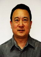 Shanan Zhu (朱善安)合作论文数浙大电气工程学院工业自动化专业27
 J Lian合作论文数25
 Lei Ding合作论文数Department of Biomedical Engineering;University of Minnesota;Department of Biomedical Engineering, University of Minnesota24
 Zhongming Liu合作论文数Department of Biomedical Engineering, College of Engineering, University of Michigan;Laboratory of Integrated Brain Imaging, University of Michigan19
 Xu Li合作论文数Department of Otolaryngology-Head and Neck Surgery, School of Medicine, Johns Hopkins University15
 Wim van Drongelen合作论文数14Wu, D.合作论文数13
 Guanglin Li (李光林)合作论文数Research Center for Neural Engineering, Shenzhen Institute of Advanced Technology, Chinese Academy of Sciences;School of Artificial Intelligence, University of Chinese Academy of Sciences12Christopher Wilke合作论文数12
 Vernon L. Towle合作论文数Departments of Neurology and Surgery and the Brain Research Institute, University of Chicago Medical Center11DN Wu合作论文数10
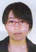 Dandan Yan (闫丹丹)合作论文数China Jiliang University10
 Abbas Sohrabpour合作论文数10Chengzong Han合作论文数10Han Yuan合作论文数9
 Xiaotong Zhang (张晓彤)合作论文数School of Software, Dalian University of Technology;International School of Information Science and Engineering, Dalian University of Technology - Ritsumeikan University9
 Gregory A. Worrell合作论文数Department of Neurology, Mayo Clinic;Department of Physiology & Biomedical Engineering, Mayo Clinic9
 Steven Pogwizd合作论文数University of Alabama at Birmingham9
 Boaz Avitall合作论文数9Hosaka H合作论文数8
 Dezhong Yao (尧德中)合作论文数School of Life Science and Technology, University of Electronic Science and Technology of China;Center for Information in Medicine, University of Electronic Science and Technology of China8Jun-Ichi Hori合作论文数Research Reactor Institute, Kyoto University , Kumatori, Sennan, Osaka , 590-0494 , Japan8
 David Frim合作论文数8H Tsai合作论文数7Lin Yang合作论文数7
 Kai Yu合作论文数Zhejiang Univ, Dept Biomed Engn, Biosensor Natl Special Lab, Key Lab Biomed Engn,Minist Educ, Hangzhou 310003, Zhejiang, Peoples R China7Zhaoye Zhou合作论文数7高诺合作论文数6
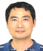 Sheng He (何生)合作论文数Institute of Biophysics, Chinese Academy of Sciences;Department of Psychology, University of Minnesota6
 Yingchun Zhang (张迎春)合作论文数Department of Biomedical Engineering, College of Engineering, University of Miami6Engel Stephen A合作论文数6
 Astolfi Laura合作论文数Bioacoustics Research Laboratory, University of Padua6
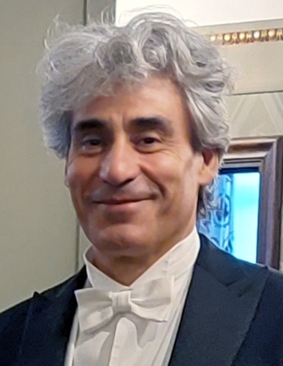 Fabio Babiloni合作论文数Department of Molecular Medicine, Sapienza University of Rome;The Industrial Neuroscience Laboratory, Sapienza University of Rome6Yunfeng Lu合作论文数6I Ramachandra合作论文数6
 Rongmin Xia合作论文数5Ono, K.合作论文数5
 Jie Lian合作论文数5
 Pingping Luo (罗平平)合作论文数School of Water and Environment, Chang'an University5Ceccoli, H.合作论文数5
 Ni Ying合作论文数5
 Edelman Bradley合作论文数5
 Bryan Baxter合作论文数5
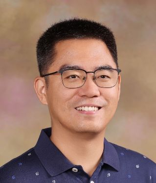 Boxin Shi (施柏鑫)合作论文数Institute for Artificial Intelligence, Peking University5Y. Lai合作论文数5H. Sasaki合作论文数5
 Ling-Yu Duan (段凌宇)合作论文数School of Computer Science, Peking University;Institute of Digital Media, School of Electronics Engineering and Computer Science, Peking University5
 Kurt E Hecox合作论文数5




