Nearshore environments on all continents are being transformed by rapid urbanization, which is projected to intensify in future decades. Landscape ecologists working in terrestrial and freshwater systems have developed several quantitative tools to help identify generalizable ecological patterns and responses to urbanization. These have yet to be fully utilized in the marine realm, though they require standardized measures of urbanization intensity that can be easily derived across cities and regions and at multiple spatial scales that reflect the varied nature of urban stressors and biotic response across functional groups. We developed an open-source resource in R that produces standardized measures of urbanization intensity based on a single spatial data layer of population density that is available at high resolution for all parts of the world. The tool was then employed to a case study evaluating urban-related gradients in the structural complexity of benthic macroalgal assemblages in the Salish Sea. Data from benthic photographic quadrat surveys at 22 sites distributed across ~90 km supported prior evidence from other regions that understory and canopy cover, kelp occurrence, kelp thallus density, and overall biogenic structural complexity decrease with increasing levels of land-based urbanization intensity. The standardized proxy of urbanization calculated for each site outperformed a suite of natural environmental variables, including temperature and water flow, in predicting abundances of kelp and other structurally complex macroalgae. These findings underscore the importance of urban stressors for habitat-forming macrophytes while providing a novel, open-source resource for performing urban-rural gradient analysis in urbanized seascapes.
The West Coast of the U.S. has a vast offshore wind energy (OWE) electricity generation potential with value on the order of billions of USD, and pressure is mounting to develop large OWE projects. However, this seascape has numerous existing resource extraction uses, including a multi-billion dollar commercial fishing industry, which create the potential for conflict. To date, spatially explicit comparisons of OWE and commercial fisheries value have not been done, but are essential for marine spatial planning and for investigating the tradeoffs of OWE development on existing marine uses. In this analysis, we generate maps of OWE levelized cost of energy and of total economic activity generated by the top eight commercial fishing targets that account for the vast majority (~84%) of landed revenue off the U.S. West Coast. We quantify spatial overlap between these two ocean uses and use multiobjective optimization to develop tradeoff frontiers to investigate implications for both sectors from established state goals or mandates for OWE power generation capacity. There are clear differences in the exposure of each fishery in their traditional fishing grounds as a function of differing OWE capacity goals and outcomes vary depending on whether OWE development goals are achieved at a state-by-state level or a region-wide level. Responsible siting of OWE projects includes careful consideration of existing commercial fishing activities, and responsible transition to renewable energies on the West Coast and elsewhere accounts for the socio-economic consequences of the total economic activity associated with each fishery.
From fishers to farmers, people across the planet who rely directly upon natural resources for their livelihoods and well-being face extensive impacts from climate change. However, local- and regional-scale impacts and associated risks can vary geographically, and the implications for development of adaptation pathways that will be most effective for specific communities are underexplored. To improve this understanding at relevant local scales, we developed a coupled social-ecological approach to assess the risk posed to fishing fleets by climate change, applying it to a case study of bottom trawl groundfish fleets that are a cornerstone of fisheries along the U.S. West Coast. Based on the mean of three high-resolution climate projections, we found that more poleward fleets may experience twice as much local temperature change as equatorward fleets, and 3-4 times as much depth displacement of historical environmental conditions in their fishing grounds. Not only are they more highly exposed to climate change, but more poleward fleets can be >10x more economically-dependent on groundfish. While we show clear regional differences in fleets’ flexibility to shift to new fisheries (‘adapt in-place’) or shift their fishing grounds in response to future change (‘adapt on-the-move’), these differences do not completely mitigate the greater exposure and economic dependence of poleward fleets. Therefore, on the U.S. West Coast more poleward fishing fleets may be at greater overall risk due to climate change, in contrast to expectations for greater equatorward risk in other parts of the world. Through integration of climatic, ecological, and socio-economic data, this case study illustrates the potential for widespread implementation of risk assessment at scales relevant to fishers, communities, and decision makers. Such applications will help identify the greatest opportunities to mitigate climate risks through adaptation that enhances mobility and diversification in fisheries.
Understanding and characterizing the spatiotemporal dynamics of fishing fleets is crucial for ecosystem-based fisheries management (EBFM). EBFM must not only account for the sustainability of target species catches, but also for the collateral impacts of fishing operations on habitats and non-target species. Increased rates of large whale entanglements in commercial Dungeness crab fishing gear have made reducing whale-fishery interactions a current and pressing challenge on the U.S. West Coast. While several habitat models exist for different large whale species along the West Coast, less is known about the crab fishery and the degree to which different factors influence the intensity and distribution of aggregate fishing effort. Here, we modeled the spatiotemporal patterns of Dungeness crab fishing effort in Oregon and Washington as a function of environmental, economic, temporal, social, and management related predictor variables using generalized linear mixed effects models. We then assessed the predictive performance of such models and discussed their usefulness in informing fishery management. Our models revealed low between-year variability and consistent spatial and temporal patterns in commercial Dungeness crab fishing effort. However, fishing effort was also responsive to multiple environmental, economic and management cues, which influenced the baseline effort distribution pattern. The best predictive model, chosen through out-of-sample cross-validation, showed moderate predictive performance and relied upon environmental, economic, and social covariates. Our results help fill the current knowledge gap around Dungeness crab fleet dynamics, and support growing calls to integrate fisheries behavioral data into fisheries management and marine spatial planning.
Pacific herring (Clupea pallasii) is a foundational species in Puget Sound (Washington State, U.S.A.) and is subject to many anthropogenic threats. We assessed the overall status of the Puget Sound Pacific herring sub-stock complex and asked whether watersheds with less urban or agricultural land cover, less impervious surface, and lower human density were associated with better stock status. To this end, we developed multiple metrics of sub-stock population status; characterized watershed properties with respect to land use/land cover, percent impervious surfaces, and human density; and used statistical model selection to evaluate the weight of evidence in support of our hypotheses. Overall, the status of sub-stocks was poor; metrics for most sub-stocks indicate a decline from 1996–2021. However, the status metrics of sub-stocks were not related to recent (2016) watershed characteristics or the rate of change in watershed characteristics from the mid-1990s to 2016. While the cumulative effects of local human land use throughout Puget Sound may be contributing to the deterioration of spawning biomass, these results also suggest that other drivers that operate at larger scales (e.g., predation, disease, climate) are likely important.
Vast resources are allocated across the US and elsewhere for flood control in floodplains. Increasingly, these efforts involve restoring the function of natural floodplains to attenuate flood risk and provide a range of other ecosystem services. We investigated the capitalization of reduced flood risk from floodplain restoration into housing values in the city of Orting, Washington, USA. Our identification strategy exploits the occurrence of a major high-flow event directly following project construction, which demonstrated the ability of the widened floodplains to attenuate flooding. The prices of homes located within established 100-year or 500-year floodplains were discounted by 3%. Reduced flood risk associated with the floodplain restoration led to a 5% increase in the prices of homes in the 500-year floodplain on average. No evidence of reduced flood risk capitalization was found for homes the 100-year floodplain, where flood insurance rate maps and mandatory insurance requirements remained unchanged across the study period. The results suggest that reduced flood risk associated with floodplain restoration can capitalize into homes outside of designated high-risk zones.
Sustainable management of ecosystem services requires knowledge of both natural and human systems, but the adaptive behaviors of human harvesters in response to management changes and environmental variability are poorly understood. Given the specter of accelerating climate change, it is especially critical to understand how human harvesters may respond to environmental perturbation. In this study, we identify characteristics that promoted resilience of one the most valuable fisheries on the west coast of the United States to a record marine heatwave. Using movement telemetry linked to Dungeness crab fishery landings records from more than 500 fishing vessels, encompassing 2.2 million geolocations and more than USD two billion in revenue, we found that commercial fishing vessels employed two, non-mutually exclusive strategies to cope with the anomalous environmental and management conditions imposed by the heatwave: increasing spatial mobility and diversifying fishery participation. The combination of these strategies appeared to be the most adaptive, as it produced the greatest increase in Dungeness crab profits. In contrast, participants that specialized in a single fishery and concentrated fishing effort in small spatial areas did not perform as well. Our data-driven approach reveals behaviors that can be promoted to improve the adaptive capacity of human harvesters in an era of unprecedented environmental perturbation.
Recovering marine animal populations and climate-driven shifts in their distributions are colliding with growing ocean use by humans. One such example is the bycatch of whales in commercial fishing, which poses a significant threat to the conservation and continued recovery of these protected animals and is a major barrier to sustainable fisheries. Long-lasting solutions to this problem need to be robust to variability in ecological dynamics while also addressing socio-cultural and economic concerns. We assessed the efficacy of gear reductions as an entanglement mitigation strategy during 2019 and 2020 in the highly valuable Dungeness crab fishery (Washington State, USA) in terms of changes in the entanglement risk to protected blue and humpback whales, and in terms of economic consequences for the fishery. Using a combination of fishery logbooks, landings data, and whale habitat models, we found that in the two seasons with mandatory crab pot reductions, entanglement risk was reduced by up to 20 % for blue whales, and 78 % for humpback whales, compared to seasons with no regulations. Spatio-temporal variability in the distribution of each whale species was a key factor in determining risk. Importantly, the conservation measure did not have a substantial negative effect on fleet-level fishery performance metrics, despite a reduction in fishing effort. Results indicated that a simple, fixed management strategy achieved the desired conservation goals in an economically sustainable way. Our findings underscore the value of carefully considering the dynamic nature of species' spatial distributions and key social and economic impacts that together determine conservation efficacy.
Habitat restoration efforts are often conducted under limited budgets and information. Explicitly incorporating data on project costs can improve the effectiveness of restoration investments but gathering precise data for future projects is often infeasible at the planning stage. We demonstrate econometric and machine learning methods for improving the accessibility of cost information for restoration planning. Using geospatial matching methods, we combine 15 years of spatially explicit project records for over 1200 culvert fish passage barrier restoration worksites across the Pacific Northwest of the United States with data layers of hypothesized drivers of construction costs. We distinguish between two objectives in analyzing cost data: inference to identify cost drivers and prediction of future project costs. For inference, we multiple linear regression and find that the variables channel bankfull width and slope, road speed class, developed and agricultural land covers, and proximity to privately managed industrial land are associated with culvert restoration costs and may serve as strong proxies in a planning setting. For prediction, we use boosted regression trees to make out-of-sample projections of restoration costs for over 27,000 barrier culverts documented in state inventories. The distribution of these cost projections over space and across jurisdictions reveal higher, and more heterogeneous, culvert restoration costs in the Puget Sound region than in other nearby areas. Our results are directly applicable for resource managers making fish passage restoration decisions and serve as a template for the use of econometrics and machine learning to analyze costs recorded in restoration project databases in other contexts.
A huge proportion of the world’s population resides in urban areas along the coast. As cities expand, the ability of coastal ecosystems to provide the benefits people derive from nature, ranging from food from fisheries to coastal defense to maritime transportation and beyond, is in question. While it is well understood that coastal development changes ecosystems, quantitative insights about how terrestrial urbanization fundamentally alters ecosystem structure and function in adjacent freshwater and downstream coastal marine habitats remain rare, though a general expectation is that impacts of terrestrial urbanization will attenuate from land to freshwater to coastal marine habitats. Empirical assessments of these phenomena are especially important for species that rely on freshwater and coastal marine habitats at multiple points in their life cycles, including endangered and threatened Pacific salmon (Oncorhynchus spp.). We investigated associations between landscape-scale urbanization and ecosystem structure (biodiversity of epibenthic invertebrate taxa) and function (benthic net primary productivity and decomposition) in freshwater and coastal marine habitats across six pairs of more and less urbanized, coastal watersheds in Puget Sound, WA, USA, using principal components analysis, analysis of covariance, and Mantel tests. Greater upland urbanization was associated with greater reductions in freshwater biodiversity, measured as the density and evenness of epibenthic invertebrate families. In contrast and surprisingly, however, coastal marine biodiversity (measured as the density and evenness of epibenthic invertebrate families) tended to be higher at more urbanized sites, suggesting the potential role of low to moderate levels of urbanization-related disturbance in determining coastal marine biodiversity patterns. We found no statistical association between urbanization and freshwater and coastal marine ecosystem functions, estimated from changes in accumulated algal biomass on tiles (benthic net primary productivity) and loss of biomass from litter bags (decomposition). In addition, there was no evidence that changes in ecosystem structure and function with urbanization were more severe in freshwater than coastal marine habitats, as might be expected if the land-sea boundary diminished effects of landscape-scale urbanization. Our results suggest that the effects of urbanization can be complex and that attention to terrestrial, freshwater, and coastal marine systems in concert will produce more effective, ecosystem-based management.
Canopy-forming kelps are foundation species in many coastal ecosystems, but kelp-forest communities are subject to abrupt state changes caused by environmental drivers and trophic dynamics. We examined changes in kelp communities at 5 sites along the Olympic Coast of Washington State, USA, during and following the recent perturbations of anomalous warm-water events and sea star wasting syndrome (SSWS). Anomalously warm water in 2013 and 2014 corresponded with a loss of approximately 50% of Macrocystis pyrifera and Nereocystis luetkeana canopy. However, the canopy quickly recovered, and stipe density increased after 2015. Purple sea urchins Strongylocentrotus purpuratus increased in density 164-fold, largely at one site, but this increase was first observed in 2017 and peaked in 2019, after the warm period. Sea stars did not show recovery from SSWS, with several species including Pycnopodia helianthoides continuing to decline. The majority of variation in assemblage structure occurred at the site level for kelps, macroinvertebrates, and fishes, while year explained most of the variability for juvenile rockfishes Sebastes spp. We did not see strong top-down effects of urchins on kelp, suggesting that top-down impacts were not dominant regionally during this period. In contrast, we found evidence for a bottom-up influence of kelp habitat on juvenile rockfishes, as rockfish recruits occurred with higher probability where kelp stipe density was higher. Our analyses highlight the importance of spatial variation in structuring changes in kelp forest communities associated with disturbance and suggest that it is essential to ensure the protection of a diversity of kelp forests.
All species inevitably leave genetic traces in their environments, and the resulting environmental DNA (eDNA) reflects the species present in a given habitat. It remains unclear whether eDNA signals can provide quantitative metrics of abundance on which human livelihoods or conservation successes depend. Here, we report the results of a large eDNA ocean survey (spanning 86 000 km2 to depths of 500 m) to understand the abundance and distribution of Pacific hake (Merluccius productus), the target of the largest finfish fishery along the west coast of the USA. We sampled eDNA in parallel with a traditional acoustic-trawl survey to assess the value of eDNA surveys at a scale relevant to fisheries management. Despite local differences, the two methods yield comparable information about the broad-scale spatial distribution and abundance. Furthermore, we find depth and spatial patterns of eDNA closely correspond to acoustic-trawl estimates for hake. We demonstrate the power and efficacy of eDNA sampling for estimating abundance and distribution and move the analysis eDNA data beyond sample-to-sample comparisons to management relevant scales. We posit that eDNA methods are capable of providing general quantitative applications that will prove especially valuable in data- or resource-limited contexts.
Chemical contamination is an increasingly important conservation issue in urban runoff-impacted watersheds. Regulatory and restoration efforts typically evaluate limited conventional parameters and pollutants. However, complex urban chemical mixtures contain hundreds to thousands of organic contaminants that remain unidentified, unregulated, and poorly understood. This study aimed to develop broadly representative metrics of water quality impairment corresponding to previously documented biological degradation along gradients of human impacts. Stream samples (n = 65, baseflow/rainfall conditions, 2017-2018) were collected from 15 regional watersheds (Puget Sound, WA, USA) across an urbanization gradient defined by landscape characteristics. Surface water chemical composition characterized via non-targeted high-resolution mass spectrometry (7068 detections) was highly correlated with landscape-based urbanization gradient (p < 0.01) and season (p < 0.01). Landscape-scale changes in chemical composition closely aligned with two anchors of biological decline: coho salmon (Oncorhynchus kisutch) mortality risk (p < 0.001) and loss of stream macroinvertebrate diversity and abundance (p < 0.001). We isolated and identified 32 indicators for urban runoff impacts and corresponding receiving water ecological health, including well-known anthropogenic contaminants (e.g., caffeine, organophosphates, vehicle-derived chemicals), two related environmental transformation products, and a novel (methoxymethyl)melamine compound. Outcomes support data-directed selection of next-generation water quality indicators for prioritization and evaluation of watershed management efforts intended to protect aquatic ecosystems.
Restoration of degraded coastal and estuarine habitats owing to human activities is a major global concern. In Puget Sound, Washington, U.S.A., removal of hard armor from beaches and intertidal zones has become a priority for state and local agencies. However, the effectiveness of these shoreline restoration programs for subtidal habitats and fish is unknown. We surveyed six restoration sites in Puget Sound over 2 years to evaluate associations between shoreline restoration and subtidal fish abundance. We measured the abundance of juvenile salmonids and forage fishes along armored, restored, and reference shorelines. Bayesian generalized linear models showed limited support for associations between shoreline restoration and these fishes in the 3-7 years since armor removal. Pacific herring were more abundant at reference shorelines; the shoreline effect for surf smelt varied by survey site. Shoreline restoration was not an important predictor of salmonid abundance; the best models for Chinook and chum salmon included predictors for survey site and eelgrass, respectively. The retention of survey site in several species' top models reveals the influence of the broader landscape context. We also found seasonal variation in abundance for chum salmon and surf smelt. Our results suggest that juvenile forage fish and salmonids in estuaries likely have unique responses to shoreline features, and that the positive effects of armor removal either do not extend into subtidal areas or are not detectable at local scales. To be most effective, coastal restoration programs should consider broader landscape patterns as well as species-specific habitat needs when prioritizing investments.
Protected species bycatch can be rare, making it difficult for fishery managers to develop unbiased estimates of fishing-induced mortality. To address this problem, we use Bayesian time-series models to estimate the bycatch of humpback whales ( Megaptera novaeangliae ), which have been documented only twice since 2002 by fishery observers in the United States West Coast sablefish pot fishery, once in 2014 and once in 2016. This model-based approach minimizes under- and over-estimation associated with using ratio estimators based only on intra-annual data. Other opportunistic observations of humpback whale entanglements have been reported in United States waters, but, because of spatio-temporal biases in these observations, they cannot be directly incorporated into the models. Notably, the Bayesian framework generates posterior predictive distributions for unobserved entanglements in addition to estimates and associated uncertainty for observed entanglements. The United States National Marine Fisheries Service began using Bayesian time-series to estimate humpback whale bycatch in the United States West Coast sablefish pot fishery in 2019. That analysis resulted in estimates of humpback whale bycatch in the fishery that exceeded the previously anticipated bycatch limits. Those results, in part, contributed to a review of humpback whale entanglements in this fishery under the United States Endangered Species Act. Building on the humpback whale example, we illustrate how the Bayesian framework allows for a wide range of commonly used distributions for generalized linear models, making it applicable to a variety of data and problems. We present sensitivity analyses to test model assumptions, and we report on covariate approaches that could be used when sample sizes are larger. Fishery managers anywhere can use these models to analyze potential outcomes for management actions, develop bycatch estimates in data-limited contexts, and guide mitigation strategies.
On the U.S. West Coast, reports of whales entangled in fishing gear increased dramatically in 2014. In this study, a time series of fishing activity maps was developed from 2009 to 2016 for the four fixed-gear fisheries most commonly implicated in entanglements. Maps were generated using vessel monitoring system (VMS) data linked to port-level landings databases, which were related to entangled whale reports over the same time period and with modelled distributions of humpback whales Megaptera novaeangliae Borowski. Over the full study period, neither marked increases in fishing activity nor changes in fisheries footprints within regions with high whale densities were detected. By contrast, a delayed fishery opening in California due to a harmful algal bloom in spring of 2016 led to similar to 5-7 times average levels of Dungeness crab Metacarcinus magister (Dana) fishing activity, which was consistent with a high rate of entanglement in that year. These results are consistent with current hypotheses that habitat compression caused by a marine heatwave increased the overlap of whales with fishing activity, despite minimal changes in the fisheries themselves. This study adds to literature on bycatch of protected species in otherwise sustainable fisheries, highlighting the value of using VMS data for reducing human-wildlife conflict in the ocean.
Despite the increasing frequency and magnitude of extreme climate events, little is known about how their impacts flow through social and ecological systems or whether management actions can dampen deleterious effects. We examined how the record 2014-2016 Northeast Pacific marine heatwave influenced trade-offs in managing conflict between conservation goals and human activities using a case study on large whale entanglements in the U.S. west coast's most lucrative fishery (the Dungeness crab fishery). We showed that this extreme climate event diminished the power of multiple management strategies to resolve trade-offs between entanglement risk and fishery revenue, transforming near win-win to clear win-lose outcomes (for whales and fishers, respectively). While some actions were more cost-effective than others, there was no silver-bullet strategy to reduce the severity of these trade-offs. Our study highlights how extreme climate events can exacerbate human-wildlife conflict, and emphasizes the need for innovative management and policy interventions that provide ecologically and socially sustainable solutions in an era of rapid environmental change.
Species that migrate long distances or between distinct habitats- for example, anadromous or catadromous fish-experience the consequences of climate change in each habitat and are therefore particularly at risk in a changing world. Studies of anadromous species often focus on freshwater despite the ocean's disproportionate influence on survival and growth. To understand a prominent anadromous species' response to ocean climate, we use a new spatio-temporal model jointly estimating the ocean distribution of all major fall-run Chinook salmon (Oncorhynchus tshawytscha, Salmonidae) stocks from California to British Columbia over 40 years. We model hundreds of millions of tagged individuals, finding that different stocks have fundamentally different ocean distributions, distinct associations with sea surface temperature (SST), and contrasting distributional responses to historical ocean SST variation. We show species-level estimates of ocean distribution that ignore among-stock variation will lead to errant predictions of spatial distribution. Using future (2030-2090) SST projections to model focal stocks of fisheries importance we predict substantial ocean redistribution in response to SST change. Predicted aggregate distributional changes do not follow a simple, poleward shift. Instead, we predict net movement into some ocean regions (British Columbia, central California) but net movement out of others (northern California, Washington). Distribution shifts have implications for both major fisheries and marine mammal predators of Chinook salmon. We focus on the consequences of spatial changes in ocean distribution, but our approach provides a general structure to link marine and freshwater components of anadromous species under climate change.
 Andrew Olaf Shelton合作论文数NOAA, Natl Marine Fisheries Serv20
 Jameal F. Samhouri合作论文数Northwest Fisheries Science Center17
 E. Ashley Steel合作论文数Department of Statistics, University of Washington11
 Gregory D. Williams合作论文数Batelle Marine Sciences Laboratory11
 Phillip Levin合作论文数School of Marine and Environmental Affairs, College of the Environment, University of Washington10
 Eric J Ward合作论文数Wetland and Aquatic Research Center9
 Eric R. Buhle合作论文数8
 Owen R. Liu合作论文数Northwest Fisheries Science Center National Marine Fisheries Service, National Oceanic and Atmospheric Administration7
 Nathaniel L Scholz合作论文数Environmental Conservation Division, Northwest Fisheries Science Center7Nick Tolimieri合作论文数6
 George R. Pess合作论文数Northwest Fisheries Science;Center National Marine Fisheries Service;Northwest Fisheries Science|Center National Marine Fisheries Service6
 Tessa B Francis合作论文数Department of Biology, and School of Aquatic and Fishery Sciences, University of Washington5
 James J, Anderson合作论文数School of Fisheries;University of Washington;School of Fisheries, University of Washington5Julann A. Spromberg合作论文数5Ryan Kelly合作论文数4Steven E Damm合作论文数4Kinsey E. Frick合作论文数4
 Shannon M. Hennessey合作论文数Dept Integrat Biol, Oregon State Univ4
 Dan S. Holland合作论文数NOAA Northwest Fisheries Science Center4David H. Baldwin合作论文数4Karin A. Forney合作论文数Southwest Fisheries Sci Ctr, Natl Marine Fisheries Serv4
 Ray Hilborn合作论文数School of Aquatic and Fishery Sciences, University of Washington4
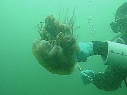 Kelly S. Andrews合作论文数Northwest Fisheries Science Center4k m burnett合作论文数3Kelly R. Christiansen合作论文数3David W. Jensen合作论文数3
 kara anlaufdunn合作论文数Oregon Dept Fish & Wildlife3Robert Fonner合作论文数National Marine Fisheries Service, Northwest Fisheries Science Center3
 Genoa Sullaway合作论文数College of Fisheries and Ocean Sciences, University of Alaska Fairbanks3
 Eliza C. Heery合作论文数Expt Marine Ecol Lab, Natl Univ Singapore3
 Leena Riekkola合作论文数University of Auckland – Waipapa Taumata Rau3
 Briana Abrahms合作论文数Department of Biology, College of Arts & Sciences, University of Washington;Center for Ecosystem Sentinels, University of Washington3
 David Hebbelstrup Jensen合作论文数Rigshospitalet, University of Copenhagen3
 Norman Karma C合作论文数3Plummer Mark L合作论文数3
 Chris J. Harvey合作论文数3
 Aimee Fullerton合作论文数Department of Biological Sciences, University of Notre Dame3
 Greg Hood合作论文数Skagit River System3David P. Larsen合作论文数3
 Jim Thorson合作论文数Habitat and Ecosystem Process Research, Alaska Fisheries Science Center, National Marine Fisheries Service3
 Charles A. Simenstad合作论文数Fisheries Research Institute, University of Washington3Helen D. Berry合作论文数2Lauren E. Saez合作论文数2Victor Simon合作论文数2J W Davis合作论文数2
 Adam Lindquist合作论文数2
 Braeden Van Deynze合作论文数Sch Marine & Environm Affairs, Univ Washington2
 Kayleigh Somers合作论文数Natl Marine Fisheries Serv, Northwest Fisheries Sci Ctr2Mary Fisher合作论文数Northwest Fisheries Science Center, National Oceanic and Atmospheric Administration2




