We present a parallelized differentiable traffic simulator based on the Intelligent Driver Model (IDM), a car-following framework that incorporates driver behavior as key variables. Our vehicle simulator efficiently models vehicle motion, generating trajectories that can be supervised to fit real-world data. By leveraging its differentiable nature, IDM parameters are optimized using gradient-based methods. With the capability to simulate up to 2 million vehicles in real time, the system is scalable for large-scale trajectory optimization. We show that we can use the simulator to filter noise in the input trajectories (trajectory filtering), reconstruct dense trajectories from sparse ones (trajectory reconstruction), and predict future trajectories (trajectory prediction), with all generated trajectories adhering to physical laws. We validate our simulator and algorithm on several datasets including NGSIM and Waymo Open Dataset. The code is publicly available at: https://github.com/SonSang/diffidm.
A continuing fundamental issue with training infrared and red-green-blue thermal machine learning models is a scarcity of curated training data. The time and financial cost of collecting and expertly annotating high-quality infrared datasets is substantial. The problem is compounded with video datasets, due to the ease of collecting terabytes/petabytes of video data, but the challenge of locating and extracting useable informational content from the vast multitude of frames. Many modern collection systems acquire video in multiple wavebands simultaneously, e.g., visible, near-, and longwave-infrared. This is both a plague and boon-a plague as it further exacerbates the amount of data to be processed, a boon as the data contain valuable complementary multiband information, which can be leveraged. In this work, we present results from an ongoing effort to develop a tool, which produces automated detection, classification, bounding box generation, segmentation, and tracking annotation data for raw infrared and visible video inputs. (c) 2025 Society of Photo-Optical Instrumentation Engineers (SPIE) [DOI:10.1117/1.OE.64.9.092205]
Synthetically-generated imagery holds the promise of being a panacea for the challenges of real world datasets. Yet it continues to be frequently observed that deep learning model performance is not as good when trained with synthetic data versus real measured imagery. In this study we present analyses and illustration of the use of several statistical metrics, measures, and visualization tools based on the distance and similarity between real and synthetic data empirical distributions in the latent feature embedding space, which provide a quantitative understanding of the relevant image-domain distribution discrepancy issues hampering the generation of performant simulated datasets. We also demonstrate the practical applications of these tools and techniques in a novel study comparing latent space embedding vector distributions of real, pristine synthetic, and synthetic modified by physics-based degradation models. The results may assist deep learning practitioners and synthetic imagery modelers with evaluating latent space embedding distributional dissimilarity and improving model performance when using simulation tools to generate synthetic imagery training data.
In trajectory forecasting tasks for traffic, future output trajectories can be computed by advancing the ego vehicle’s state with predicted actions according to a kinematics model. By unrolling predicted trajectories via time integration and models of kinematic dynamics, predicted trajectories should not only be kinematically feasible but also relate uncertainty from one timestep to the next. While current works in probabilistic prediction do incorporate kinematic priors for mean trajectory prediction, variance is often left as a learnable parameter, despite uncertainty in one time step being inextricably tied to uncertainty in the previous time step. In this paper, we show simple and differentiable analytical approximations describing the relationship between variance at one timestep and that at the next with the kinematic bicycle model. In our results, we find that encoding the relationship between variance across timesteps works especially well in unoptimal settings, such as with small or noisy datasets. We observe up to a 50% performance boost in partial dataset settings and up to an 8% performance boost in large-scale learning compared to previous kinematic prediction methods on SOTA trajectory forecasting architectures out-of-the-box, with no fine-tuning.
We identify a bias in a commonly used dataset for building damage detection, evaluate its effects on existing deep learning models, and devise mitigation strategies to overcome it. We find that the data contains significantly more groups of damaged buildings than single ones leading to skewed machine learning evaluations. Consequently, deep learning models heavily rely on surrounding context rather than individual building damage when classifying supporting our claim. Specifically, the dataset includes extraneous damage surrounding buildings such as debris, fallen trees, and other damaged buildings which results in deep neural networks overfitting to these features. We analyze the top-5 solutions of the xView2 challenge, which focuses on building damage classification using satellite imagery as provided by the xBD dataset. Our experiments reveal that these models struggle to accurately identify isolated damaged buildings, potentially causing oversights in critical disaster scenarios and delaying humanitarian aid. Finally, we devise a new augmentation strategy to reduce this bias in disaster datasets and show it improves real-world outcomes.
Autonomous navigation has become increasingly popular in recent years; However, most existing methods focus on on-road navigation and utilize active sensors, such as LiDAR. This paper instead focuses on autonomous off-road navigation using traversability estimation from passive sensors, specifically long-wave (LW) hyperspectral imagery (HSI). We present a method for selecting a subset of hyperspectral bands that are most useful for traversability estimation by designing a band selection module that designs a minimal sensor that measures sparsely-sampled spectral bands while jointly training a semantic segmentation network for traversability estimation. The effectiveness of our method is demonstrated using our dataset of LW HSI from diverse off-road scenes including forest, desert, snow, ponds, and open fields. Our dataset includes imagery collected both during the daytime and nighttime during various weather conditions, including challenging scenes with a wide range of obstacles. Using our method, we learn a small subset (2%) of all the HSI bands that can achieve competitive or better traversability estimation accuracy to that achieved when utilizing all hyperspectral bands. Using only 5 bands, our method is able to achieve a mean class accuracy that is only 1.3% less than that achieved using full 256-band HSI and only 0.1% less than that achieved using 250-band HSI, demonstrating the success of our method.
Large, pretrained models are commonly finetuned with imagery that is heavily augmented to mimic different conditions and scales, with the resulting models used for various tasks with imagery from a range of spatial scales. Such models overlook scale-specific information in the data for scale-dependent domains, such as remote sensing. In this paper, we present Scale-MAE, a pretraining method that explicitly learns relationships between data at different, known scales throughout the pretraining process. Scale-MAE pretrains a network by masking an input image at a known input scale, where the area of the Earth covered by the image determines the scale of the ViT positional encoding, not the image resolution. Scale-MAE encodes the masked image with a standard ViT backbone, and then decodes the masked image through a bandpass filter to reconstruct low/high frequency images at lower/higher scales. We find that tasking the network with reconstructing both low/high frequency images leads to robust multiscale representations for remote sensing imagery. Scale-MAE achieves an average of a 2.4 - 5.6% non-parametric kNN classification improvement across eight remote sensing datasets compared to current state-of-the-art and obtains a 0.9 mIoU to 1.7 mIoU improvement on the SpaceNet building segmentation transfer task for a range of evaluation scales.
In this paper, we present the Multi-view Extended Videos with Identities (MEVID) dataset for large-scale, video person re-identification (ReID) in the wild. To our knowledge, MEVID represents the most-varied video person ReID dataset, spanning an extensive indoor and outdoor environment across nine unique dates in a 73-day window, various camera viewpoints, and entity clothing changes. Specifically, we label the identities of 158 unique people wearing 598 outfits taken from 8, 092 tracklets, average length of about 590 frames, seen in 33 camera views from the very large-scale MEVA person activities dataset. While other datasets have more unique identities, MEVID emphasizes a richer set of information about each individual, such as: 4 outfits/identity vs. 2 outfits/identity in CCVID, 33 viewpoints across 17 locations vs. 6 in 5 simulated locations for MTA, and 10 million frames vs. 3 million for LS-VID. Being based on the MEVA video dataset, we also inherit data that is intentionally demographically balanced to the continental United States. To accelerate the annotation process, we developed a semi-automatic annotation framework and GUI that combines state-of-the-art real-time models for object detection, pose estimation, person ReID, and multi-object tracking. We evaluate several state-of-the-art methods on MEVID challenge problems and comprehensively quantify their robustness in terms of changes of outfit, scale, and background location. Our quantitative analysis on the realistic, unique aspects of MEVID shows that there are significant remaining challenges in video person ReID and indicates important directions for future research.
The goal of person search is to localize a target person from a gallery set of scene images, which is extremely challenging due to large scale variations, pose/viewpoint changes, and occlusions. In this paper, we propose the Cascade Occluded Attention Transformer (COAT) for end-to-end person search. Our three-stage cascade design focuses on detecting people in the first stage, while later stages simultaneously and progressively refine the representation for person detection and re-identification. At each stage the occluded attention transformer applies tighter intersection over union thresholds, forcing the network to learn coarse-to-fine pose/scale invariant features. Meanwhile, we calculate each detection's occluded attention to differentiate a person's tokens from other people or the background. In this way, we simulate the effect of other objects occluding a person of interest at the token-level. Through comprehensive experiments, we demonstrate the benefits of our method by achieving state-of-the-art performance on two benchmark datasets.
The xView2 competition and xBD dataset spurred significant advancements in overhead building damage detection, but the competition's pixel level scoring can lead to reduced solution performance in areas with tight clusters of buildings or uninformative context. We seek to advance automatic building damage assessment for disaster relief by proposing an auxiliary challenge to the original xView2 competition. This new challenge involves a new dataset and metrics indicating solution performance when damage is more local and limited than in xBD. Our challenge measures a network's ability to identify individual buildings and their damage level without excessive reliance on the buildings' surroundings. Methods that succeed on this challenge will provide more fine-grained, precise damage information than original xView2 solutions. The best-performing xView2 networks' performances dropped noticeably in our new limited/local damage detection task. The common causes of failure observed are that (1) building objects and their classifications are not separated well, and (2) when they are, the classification is strongly biased by surrounding buildings and other damage context. Thus, we release our augmented version of the dataset with additional object-level scoring metrics (https://drive.google.com/drive/folders/1VuQZuAg6-Yo8r5J4OCx3ZRpa_fv9aaDX?usp=sharing) to test independence and separability of building objects, alongside the pixel-level performance metrics of the original competition. We also experiment with new baseline models which improve independence and separability of building damage predictions. Our results indicate that building damage detection is not a fully-solved problem, and we invite others to use and build on our dataset augmentations and metrics.
This paper describes the development of vision-aided navigation (i.e., pose estimation) for a wearable augmented reality system operating in natural outdoor environments. This system combines a novel pose estimation capability, a helmet-mounted see-through display, and a wearable processing unit to accurately overlay geo-registered graphics on the user's view of reality. Accurate pose estimation is achieved through integration of inertial, magnetic, GPS, terrain elevation data, and computervision inputs. Specifically, a helmet-mounted forward-looking camera and custom computer vision algorithms are used to provide measurements of absolute orientation (i.e., orientation of the helmet with respect to the Earth). These orientation measurements, which leverage mountainous terrain horizon geometry and/or known landmarks, enable the system to achieve significant improvements in accuracy compared to GPS/INS solutions of similar size, weight, and power, and to operate robustly in the presence of magnetic disturbances. Recent field testing activities, across a variety of environments where these vision-based signals of opportunity are available, indicate that high accuracy (less than 10 mrad) in graphics geo-registration can be achieved. This paper presents the pose estimation process, the methods behind the generation of vision-based measurements, and representative experimental results.
This paper describes the development and demonstration of a soldier-worn augmented reality system testbed that provides intuitive 'heads-up' visualization of tactically-relevant geo-registered icons. Our system combines a robust soldier pose estimation capability with a helmet mounted see-through display to accurately overlay geo-registered iconography (i.e., navigation waypoints, blue forces, aircraft) on the soldier's view of reality. Applied Research Associates (ARA), in partnership with BAE Systems and the University of North Carolina - Chapel Hill (UNC-CH), has developed this testbed system in Phase 2 of the DARPA ULTRA-Vis (Urban Leader Tactical, Response, Awareness, and Visualization) program. The ULTRA-Vis testbed system functions in unprepared outdoor environments and is robust to numerous magnetic disturbances. We achieve accurate and robust pose estimation through fusion of inertial, magnetic, GPS, and computer vision data acquired from helmet kit sensors. Icons are rendered on a high-brightness, 40°×30° field of view see-through display. The system incorporates an information management engine to convert CoT (Cursor-on-Target) external data feeds into mil-standard icons for visualization. The user interface provides intuitive information display to support soldier navigation and situational awareness of mission-critical tactical information.
This paper introduces a novel geometrical solution for the pose estimation of a stereo camera system as commonly used in robotics, where the camera system balances between coverage and overlap. The proposed approach considers a set of features observed, respectively, in four, three and two views. In contrast to most algebraic solutions our constraints are geometrically meaningful. Initially, we use a four view feature to restrict our translation vector to lie on the surface of a sphere while setting orientation as a function of translation up to a single rotational degree of freedom. Next, we use a three view feature to restrict the translation vector to lie on a circle on the sphere, while completely defining orientation as a function of translation. Finally, we use a two view feature to determine the translation vector lying on the intersection of the circle and one of the generator lines of a doubly ruled quadric. We show how for this final step, the problem can be reduced to the intersection of two coplanar circles. We also analyze the degenerate configurations of the proposed solver and perform an experimental evaluation.
The topic of this paper is large-scale mapping and localization from images. We first describe recent progress in obtaining large-scale 3D visual maps from images only. Our approach consists of a multi-stage processing pipeline, which can process a recorded video stream in real-time on standard PC hardware by leveraging the computational power of the graphics processor. The output of this pipeline is a detailed textured 3D model of the recorded area. The approach is demonstrated on video data recorded in Chapel Hill containing more than a million frames. While for these results GPS and inertial sensor data was used, we further explore the possibility to extract the necessary information for consistent 3D mapping over larger areas from images only. In particular, we discuss our recent work focusing on estimating the absolute scale of motion from images as well as finding intersections where the camera path crosses itself to effectively close loops in the mapping process. For this purpose we introduce viewpoint-invariant patches (VIP) as a new 3D feature that we extract from 3D models locally computed from the video sequence. These 3D features have important advantages with respect to traditional 2D SIFT features such as much stronger viewpoint-invariance, a relative pose hypothesis from a single match and a hierarchical matching scheme robust to repetitive structures. In addition, we also briefly discuss some additional work related to absolute scale estimation and multi-camera calibration.
In this paper we present a novel system for realtime, six degree of freedom visual simultaneous localization and mapping using a stereo camera as the only sensor. The system makes extensive use of parallelism both on the graphics processor and through multiple CPU threads. Working together these threads achieve real-time feature tracking, visual odometry, loop detection and global map correction using bundle adjustment. The resulting corrections are fed back into to the visual odometry system to limit its drift over long sequences. We demonstrate our system on a series videos from challenging indoor environments with moving occluders, visually homogenous regions with few features, scene parts with large changes in lighting and fast camera motion. The total system performs its task of global map building in real time including loop detection and bundle adjustment on typical office building scale scenes.
This paper introduces an approach for dense 3D reconstruction from unregistered Internet-scale photo collections with about 3 million images within the span of a day on a single PC ("cloudless"). Our method advances image clustering, stereo, stereo fusion and structure from motion to achieve high computational performance. We leverage geometric and appearance constraints to obtain a highly parallel implementation on modern graphics processors and multi-core architectures. This leads to two orders of magnitude higher performance on an order of magnitude larger dataset than competing state-of-the-art approaches.
The topic of this paper is wide area structure from motion. We first describe recent progress in obtaining large-scale 3D visual models from images. Our approach consists of a multi-stage processing pipeline, which can process a recorded video stream in real-time on standard PC hardware by leveraging the computational power of the graphics processor. The output of this pipeline is a detailed textured 3D model of the recorded area. The approach is demonstrated on video data recorded in Chapel Hill containing more than a million frames. While for these results GPS and inertial sensor data was used, we further explore the possibility to extract the necessary information for consistent 3D mapping over larger areas from images only. In particular, we discuss our recent work focusing on estimating the absolute scale of motion from images as well as finding intersections where the camera path crosses itself to effectively close loops in the mapping process. For this purpose we introduce viewpoint-invariant patches (VIP) as a new 3D feature that we extract from 3D models locally computed from the video sequence. These 3D features have important advantages with respect to traditional 2D SIFT features such as much stronger viewpoint-invariance, a relative pose hypothesis from a single match and a hierarchical matching scheme naturally robust to repetitive structures. In addition, we also briefly discuss some additional work related to absolute scale estimation and multi-camera calibration.
In this thesis, we study two aspects of simultaneous localization and mapping (SLAM) for multi-camera systems: minimal solution methods for the scaled motion of non-overlapping and partially overlapping two camera systems and enabling online, real-time mapping of large areas using the parallelism inherent in the visual simultaneous localization and mapping (VSLAM) problem. We present the only existing minimal solution method for six degree of freedom structure and motion estimation using a non-overlapping, rigid two camera system with known intrinsic and extrinsic calibration. One example application of our method is the three-dimensional reconstruction of urban scenes from video. Because our method does not require the cameras' fields-of-view to overlap, we are able to maximize coverage of the scene and avoid processing redundant, overlapping imagery. Additionally, we developed a minimal solution method for partially overlapping stereo camera systems to overcome degeneracies inherent to non-overlapping two-camera systems but still have a wide total field of view. The method takes two stereo images as its input. It uses one feature visible in all four views and three features visible across two temporal view pairs to constrain the system camera's motion. We show in synthetic experiments that our method creates rotation and translation estimates that are more accurate than the perspective three-point method as the overlap in the stereo camera's fields-of-view is reduced. A final part of this thesis is the development of an online, real-time visual SLAM system that achieves real-time speed by exploiting the parallelism inherent in the VSLAM problem. We show that feature tracking, relative pose estimation, and global mapping operations such as loop detection and loop correction can be effectively parallelized. Additionally, we demonstrate that a combination of short baseline, differentially tracked corner features, which can be tracked at high frame rates and wide baseline matchable but slower to compute features such as the scale-invariant feature transform can facilitate high speed visual odometry and at the same time support location recognition for loop detection and global geometric error correction.
BRIAN SANDERSON CLIPP: Multi-Camera Simultaneous Localization and Mapping (Under the direction of Marc Pollefeys and Jan-Michael Frahm) In this thesis, we study two aspects of simultaneous localization and mapping (SLAM) for multi-camera systems: minimal solution methods for the scaled motion of non-overlapping and partially overlapping two camera systems and enabling online, real-time mapping of large areas using the parallelism inherent in the visual simultaneous localization and mapping (VSLAM) problem. We present the only existing minimal solution method for six degree of freedom structure and motion estimation using a non-overlapping, rigid two camera system with known intrinsic and extrinsic calibration. One example application of our method is the three-dimensional reconstruction of urban scenes from video. Because our method does not require the cameras' fields-of-view to overlap, we are able to maximize coverage of the scene and avoid processing redundant, overlapping imagery. Additionally, we developed a minimal solution method for partially overlapping stereo camera systems to overcome degeneracies inherent to non-overlapping two-camera systems but still have a wide total field of view. The method takes two stereo images as its input. It uses one feature visible in all four views and three features visible across two temporal view pairs to constrain the system camera's motion. We show in synthetic experiments that our method creates rotation and translation estimates that are more accurate than the perspective three-point method as the overlap in the stereo camera's fields-of-view is reduced. A final part of this thesis is the development of an online, real-time visual SLAM system that achieves real-time speed by exploiting the parallelism inherent in the VSLAM iii problem. We show that feature tracking, relative pose estimation, and global mapping operations such as loop detection and loop correction can be effectively parallelized. Additionally , we demonstrate that a combination of short baseline, differentially tracked corner features, which can be tracked at high frame rates and wide baseline matchable but slower to compute features such as the scale-invariant feature transform (SIFT) (Lowe, 2004) can facilitate high speed visual odometry and at the same time support location recognition for loop detection and global geometric error correction. iv To Rachel. v ACKNOWLEDGEMENTS I would like to thank my advisor Marc Pollefeys and co-advisor Jan-Michael Frahm for their support of this work. There were times, particularly close to conference deadlines, that it seemed like some of the methods developed in this dissertation might not succeed. I am particularly …
We demonstrate a novel method for large-scale dense 3D reconstruction from unregistered Internet-scale photo collections of several million photos on a single PC in the span of a day. It advances image clustering, stereo, stereo fusion and structure from motion to achieve high computational performance. We leverage geometric and appearance constraints to obtain a highly parallel implementation on modern graphics processors and multi-core architectures. This leads to two orders of magnitude higher performance on an order of magnitude larger dataset than competing state-ofthe-art approaches.
 Jan-Michael Frahm合作论文数Department of Computer Science, College of Arts and Sciences, University of North Carolina at Chapel Hill;Facebook;Reality Labs, Meta23
 Marc Pollefeys合作论文数Computer Vision and Geometry Lab, Institute of Visual Computing, Department of Computer Science, ETH Zurich;Mixed Reality and AI Lab, Microsoft18
 David Gallup合作论文数Google11
 Changchang Wu合作论文数Google7
 Christopher Zach合作论文数Electrical Engineering Department, Chalmers University of Technology6
 G. Welch合作论文数University of North Carolina at Chapel Hill
Department of Computer Science6
G. Welch合作论文数University of North Carolina at Chapel Hill
Department of Computer Science6 Chris Engels合作论文数ESAT PSI IBBT, Katholieke Univ Leuven5
 Ruigang Yang (杨睿刚)合作论文数Global Institute of Future Technology, Shanghai Jiao Tong University5
 Anthony Hoogs合作论文数Kitware, Inc.5
 Philippos Mordohai合作论文数Department of Computer Science, Charles V. Schaefer, Jr. School of Engineering and Science, Stevens Institute of Technology5
 Qingxiong Yang (杨庆雄)合作论文数WeRide.AI5
 Benjamin a Talton合作论文数5
 Rahul Raguram合作论文数Apple, Inc.5
 Herman Towles合作论文数Applied Research Associates5
 Liang Wang合作论文数Baidu, Inc.4
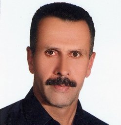 Ayshin Akbarzadeh合作论文数Materials Science and Engineering Department, Sharif University of Technology4
 Svetlana Lazebnik合作论文数Department of Computer Science, The Grainger College of Engineering, University of Illinois at Urbana-Champaign4
 Enrique Dunn合作论文数Department of Computer Science, Charles V. Schaefer, Jr. School of Engineering and Science, Stevens Institute of Technology4
 Henrik Stewénius合作论文数Google4
 Sudipta N. Sinha合作论文数Microsoft4Tim Johnson合作论文数3
 Christopher Funk合作论文数Pennsylvania State University3Philip H Merrell合作论文数3David Nistér合作论文数3Chanaz Salmi合作论文数3Sarah Brockman合作论文数2Yi-Hung Jen合作论文数2
 Sanghyun Son合作论文数Department of Computer Science, University of Maryland;GAMMA Lab, University of Maryland;Genesis AI2Philip Morrone合作论文数2
 Chen Zhao (赵辰)合作论文数Department of Computer Sciences, School of Engineering and Computer Science, Baylor University2
 Daniel Davila合作论文数2
 Laura Zheng合作论文数Department of Environmental Medicine and Public Health, Icahn School of Medicine at Mount Sinai2M. Phelps合作论文数2
 Ming C. Lin合作论文数Department of Computer Science, University of Maryland;Amazon2
 Scott Mccloskey合作论文数Honeywell Labs, Golden Valley, MN2
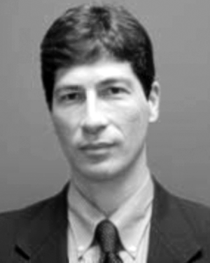 Alberico Menozzi合作论文数2
 Pierre Fite Georgel合作论文数TU München2
 Dawei Du合作论文数ByteDance, Inc.2
 Jongwoo Lim合作论文数Robot Vision Lab, Department of Mechanical Engineering, Seoul National University2Paul Merrell合作论文数Luminary Cloud2
 Jared Heinly合作论文数UNC Chapel Hill2
 Friedrich Fraundorfer合作论文数Institute of Computer Graphics and Vision, Graz University of Technology2Philip, Sujin合作论文数1Greenwell, Connor合作论文数1Amir Akbarzadeh合作论文数1Jae-Hak Kim合作论文数1
 Shufan Li合作论文数Henry Samueli School of Engineering and Applied Science, University of California, Los Angeles;NVIDIA1
 Ritwik Gupta合作论文数University of California, Berkeley;Defense Innovation Unit1
 Jing Liang合作论文数1




