Glacial mountain watersheds are among the most climate-sensitive hydrological systems, where even minor shifts in temperature or precipitation can trigger significant changes in water availability, flood potential, and ecosystem stability. This study quantifies the projected impacts of climate change on the hydrology of the Shigar River Basin, Central Karakoram, Pakistan, using the Soil and Water Assessment Tool (SWAT) coupled with CMIP6 climate scenarios. Historical hydro-meteorological data from 1985 to 1994 were used for model calibration and validation, yielding robust performance indicators (R² = 0.78, NSE = 0.70, and PBIAS = 20.1
Paleoclimate evidence suggests that high-latitude ocean-atmosphere processes impact tropical South American temperature and precipitation dynamics during glacial cycles. Although variability in the North Atlantic has been implicated in tropical climate shifts during the latest Pleistocene, the links between high- and low-latitude ocean-atmosphere dynamics during late Marine Isotope Stage 3 (MIS 3) remain poorly resolved. Here, we use the Community Earth System Model (CESM2) to investigate how evolving boundary conditions, combined with meltwater events in the North Atlantic, may have affected South American climate at 30 ka BP, near the timing of Heinrich Event 3. Simulations without increased meltwater flux produce near-surface tropical cooling of similar to 1.7 degrees C and mid-tropospheric (524 hPa) cooling of similar to 2.4 degrees C relative to pre-industrial (PI) conditions, yielding temperatures similar to 0.2-0.4 degrees C warmer than those simulated for the Last Glacial Maximum. Increasing meltwater flux across regions of the North Atlantic perturbs Atlantic Meridional Overturning Circulation, and leads to tropical near-surface cooling (relative to PI) of similar to 1.9-2.4 degrees C and cooling of 2.5-3.2 degrees C near the alpine glacial limit. In addition, most meltwater experiments produce an intensified Intertropical Convergence Zone and a strengthened South American Summer Monsoon. While orbital forcing emerges as the dominant driver of latest Pleistocene tropical climate conditions, our results suggest that high-latitude processes can amplify low-latitude temperature and hydroclimate responses during meltwater events. As such, some tropical glaciers at similar to 30 ka BP were likely more extensive than during the LGM due to enhanced precipitation and modest alpine temperature changes.
Collecting reliable meteorological data in mountain environments is difficult because harsh conditions, complex terrain, and limited access disrupt long-term observations. In the Snake Range, Nevada, snow cover of low-cost temperature and humidity sensors creates winter gaps in near-surface air temperature records. To address this challenge, we developed three Random Forest Regression models to predict 2-m daily maximum, mean, and minimum air temperatures from snow covered sensors using temperature and humidity inputs. We trained the model with data from two well instrumented sites and deployed it at 27 additional sites, spanning 1639–3976 m elevation. The model achieved mean absolute errors of 0.49 °C to 1.52 °C and reproduced daily temperature patterns well despite predictable biases in maximum and minimum temperatures. It also preserved long-term temperature trends, allowing reconstructed values to fill winter gaps without distorting multi-decadal warming rates. Applying the model across the network showed that previously developed snow-free methods, which removed all snow-covered days from the analysis, overstated warming by excluding many of the coldest days. The model-adjusted dataset produced a park-wide temperature increase of 0.79 °C from 2006 to 2025. This is substantially lower than the nearly 3 °C suggested by the snow-free approach. Snow-covered sensors paired with a validated temperature adjustment model can reliably recover near-surface air temperature records across complex terrain. Using only low-cost temperature and humidity inputs, the method supports denser and more accessible climate monitoring in mountain regions where instrumentation remains difficult to deploy and maintain.
The loss of mountain glaciers has accelerated in recent decades, linked to global warming, which in Peru alone has caused the loss of more than half of its glaciated area in fifty years. The Cordillera Blanca is the highest and most extensively glacierized tropical mountain range in the world, and glacier-fed streams provide water for hundreds of thousands of people living downstream. Previous inventories and glacier-specific mass balance studies have documented persistent and sustained mass loss. Yet the range-wide resilience of glaciers - the capacity to accumulate annual snowfall to offset area loss - remains an unquantified variable that is important to understand the evolution and climate response of glaciers over time and better project future mass changes for the coming decades. Therefore, we analyze the relationship between the annually clean glacier area and snow cover fluctuations and climate variability throughout the entire glacierized Cordillera Blanca between 1984 and 2023. To this end, we used multispectral Landsat imagery to identify clean glaciers and distinguish accumulation areas by calculating the Normalized Water Differential Index. The results show a 44 % reduction in glacier area, reflected in a decrease from the pre-2013 annual average of 54,469 ha to 42,700 ha in subsequent years. Our results suggest glaciers have passed a significant mass balance threshold, such that since 2012, glaciers have lost their ability to regain mass. We also document a strong inverse correlation of glacier area with the increase in global mean temperature, with the greatest loss occurring during the lasts strong El Nino-Southern Oscillation (ENSO) phases. We conclude that glaciers have become less resilient over the past decade, that the deglaciation of the Cordillera Blanca is primarily driven by increasing average temperatures and that the glaciers with the greatest retreat are those with perimeters proportionally more exposed to other types of surfaces (i.e., bedrock or lakes),.
The snow cover in the Teesta River basin (TRB), located in eastern Himalaya, plays crucial role in regional hydrology by influencing water availability, ecological processes, and socio-economic activities. This study assesses the spatio-temporal distribution of snow cover in the TRB for both the present (2000–2021) and future periods (2021–2040: early-century; 2041–2060: mid-century; 2081–2100: late-century). The analysis of spatio-temporal snow cover distribution was conducted using daily moderate resolution imaging spectroradiometer (MODIS) snow cover products (Terra and Aqua), which revealed a decreasing mean annual SCA trend at a rate of − 0.03
Mountain communities globally are experiencing increasing challenges as climate-induced glacier changes disrupt water resources and agricultural systems. The Hindukush-Karakoram-Himalayan region of Pakistan has been witnessing environmental changes over the last few decades with widespread impacts on different sectors of life. In the Shigar Valley of the Karakoram region, communities face socio-economic challenges partly attributed to changes in glacier dynamics, which directly affect water availability and agricultural productivity. This study investigates the impacts of glacial changes on community livelihoods by integrating glacier modeling with a comprehensive socioeconomic survey. Glaciological change was analyzed from 1970 to 2020 using the Open Global Glacier Model, with projections under SSP-126, SSP-370, and SSP-585 scenarios for 2020–2100. Glacier mass balance simulations driven by historical climatological data from 1970 to 2020 reveal an overall negative trend, despite shorter periods of glacier growth driven by regional hydroclimatic anomalies. Future projections indicate glacier volume could decline by over 60
Located in Peru's Cordillera Blanca, the Queshque Glacier (similar to 9.8 degrees S) has experienced nearly continuous retreat since the mid-20th century. More recently, this trend has accelerated after the glacier transitioned from land to lake terminating. We use observations of glacier surface height change (1962-2008), bed topography, and climatology to evaluate the relative drivers of Queshque's evolution from 1962-2020. Six Open Global Glacier Model ensemble members differing in climatic sensitivity are calibrated to fit the mass balance rate of -442 +/- 16 mm w.e. a-1 calculated over the 2008 glacier area between 1962-2008. The models are then used to simulate monthly glacier mass balance over the entire study period and dynamic glacier evolution from 2008 to 2020. The models reproduce a typical outer-tropical glacier mass balance regime, showing continuous ablation throughout the year that increases during the pronounced wet season. Climatological trend analyses along with coupled mass balance and ice flow simulations indicate that temperature has been the predominant driver of mass loss since 2008 and that recent precipitation amounts have caused minor dampening of this trend. The strongest negative correlation between temperature and mass balance occurs during the wet season, while a positive correlation between precipitation and annual mass balance is most pronounced during the dry season. The influence of ENSO over mass balance trends appears to decline throughout the study period except during the wettest months, suggesting that wet season Pacific sea-surface temperatures are strong predictors of outer-tropical glacier mass balance variability. Finally, frontal ablation into the newly formed lake began in 2010. This caused ice acceleration at the glacier front, an average mass loss increase of 4 %, and a significant narrowing of the model ensemble mass loss spread. We conclude that while Queshque's trajectory remained coupled to climatic forcings, the new proglacial lake exacerbated and modified the retreat pattern regardless of the model climate sensitivity.
The Hindukush-Himalayan (HKH) region, known for its eco-environmental importance, has been witnessing transformations in recent years governed by factors such as climate variability, land use shifts, and population growth. These changes have profound implications for regional sustainability, water resources, and livelihood. This study attempts to explore the spatial and temporal variability in selected environmental parameters including land surface temperature (LST), normalized difference vegetation index (NDVI), precipitation patterns, and normalized difference snow index (NDSI), and land use land cover (LULC) from 1990 to 2022 using Landsat imageries (30 m spatial resolution), CHIRPS precipitation data at 0.05° spatial resolution. The study area spans 32,000 km2 covering two major political/administrative divisions (Malakand and Hazara) in the HKH region of Pakistan. The study area was selected primarily because of the unprecedented changes over the last three decades. For detailed spatial analysis, the area was divided into five elevation zones and LST, NDVI, NDSI, and LULC analyses were conducted utilizing primarily the Google Earth Engine (GEE) platform and climate engine. The study results revealed a notable rise in LST in the lowest elevation zone. The NDVI and LULC analyses revealed a noticeable decline in vegetation cover from 5988 km2 in 1990, to 4225 km2 by 2010, followed by a growth to 7669 km2 in 2022, since 2010 after the launching of the Billion Tree Tsunami Afforestation Project (BTTAP) in 2013. Likewise, the precipitation patterns exhibit transitioning from low to high precipitation levels. However, the most notable finding of the study is the marked decline in snow covered area 7000 km2 to 3800 km2 between 1990 and 2022.
This study investigates urban warming in Rajshahi City, Bangladesh, by examining changes in land surface temperature (LST) from 1990 to 2023 and exploring its relationship with key biophysical factors. LST was derived from Landsat thermal imagery, and both spatial and temporal variations were analyzed using Geographic Information Systems (GIS). Key biophysical indices, including Normalized Difference Vegetation Index (NDVI), Normalized Difference Built-up Index (NDBI), Normalized Difference Water Index (NDWI), Normalized Difference Moisture Index (NDMI), and Normalized Difference Bareness Soil Index (NDBSI), were calculated using corresponding Landsat satellite sensors, and they evaluated the impact of LULC types (vegetation, water, soil, and built-up areas) on thermal variations. LULC was derived following the Support Vector Machine classification technique. The Urban Thermal Field Variance Index (UTFVI) was employed to assess surface urban heat island (SUHI) effects, warming conditions, ecological stress, and thermal comfort zones. Spatial trend and hotspot analyses of LST change were performed using spatial trend analysis and the Getis-Ord Gi* statistic, respectively. Linear regression analysis examined the relationship between LST and biophysical indices. Results show that winter mean LST increased by 2.66 °C during the 33-year period, with maximum LST rising by 4.29 °C. The most significant warming occurred in central-northern, central-western, and south-eastern zones. The rise in LST and the growing intensity of SUHI effects are largely due to urban growth, especially where green spaces and water bodies have been replaced by impervious surfaces. Hotspot analysis identified clusters of high-temperature zones, while UTFVI analysis confirmed a marked expansion of strong heat island conditions, especially in central urban areas. Linear regression results showed notable links between LST and key biophysical variables, where higher LST values were commonly linked to greater built-up density and declines in vegetation cover and surface water. Overall, the results highlight the need for better urban planning approaches such as increasing green cover, using permeable materials, and adopting strategies that can adapt to climate impacts. This study presents a framework for analyzing urban climate dynamics that can be adapted to other rapidly growing cities, aiding efforts to promote sustainable development and build urban resilience.
Abstract. Tropical glaciers are essential water resources in the central Andes as vital water resources and crucial climate indicators, currently undergoing rapid retreat. However, understanding their vulnerability to the combined effects of persistent warming, short-term climate phenomena, and interannual fluctuations remains limited. Here we automate mapping of key mass balance parameters on the Quelccaya Ice Cap (QIC), the world’s largest tropical ice cap. Using Landsat's near-infrared (NIR) band, we analyze snow cover area (SCA) and total area (TA) and calculate the Accumulation Area Ratio (AAR) and Equilibrium Line Altitude (ELA) over nearly 40 years (1985–2023). Between 1985 and 2022, the QIC lost ~46 % and ~34 % of its SCA and TA, respectively. We show that the QIC’s loss in SCA and rise in ELA are exacerbated by El Niño events, which are strongly correlated to the preceding wet season’s Ocean Niño Index (ONI). We observe lower levels of correlation to more recent El Niño events as anthropogenic climatic impacts overwhelm the natural forcing and continue to exacerbate loss at the QIC.
The history of forest cover dynamics in Pakistan reveals an unsatisfactory environmental situation. In the past 5 decades, particularly during the period between 1990 and 2010, the country lost an average of 41,100 hectares of green cover with a deforestation rate of 1.6% per year. The factors behind that this high deforestation rate is numerous including socio-economic transformation after the major political change during the 1970s in the mountainous areas of Pakistan, demographic changes, accessibility improvements, and land use changes. Several social forestry campaigns have been launched over time to cope with this socioecological and environmental issue. However, most of them have not been very effective due to certain shortcomings. This study aims to evaluate the effectiveness of the most recent and history’s biggest forest restoration program initiated by the government of the Khyber Pakhtunkhwa Province called the Billion Trees Tsunami Afforestation Project (BTTAP). This project was announced in 2013 when a new political party, Pakistan Tehreek-e-Insaf, came into power. The study is focused on one of the main forest hubs of the country in the Hindukush Mountains spanning five districts. Forest cover in this study area decreased from 20 to 2% between 1990 and 2010. After the launch of the BTTAP, the forest cover increased considerably from 2 to 35% by the year 2021. This growth was achieved through planting new trees, banning forest cutting, practicing surveillance, and enhancing community participation. If the project continues and the protection measures are not suspended, it can play a historical role in forest restoration.
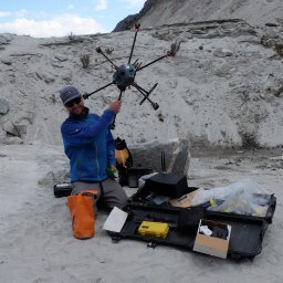
The steep and unstable terrain found on debris-covered glaciers, rock glaciers, talus slopes, moraines and other proglacial features often make terrestrial ground-penetrating radar (GPR) surveys unsafe or cost-prohibitive. To address these challenges, this research introduces a novel approach for studying buried ice using multi-low-frequency drone-based GPR. Monostatic antennas of 50, 100, and 200 MHz were flown along a transect spanning a debris-covered glacier and an ice–debris complex at Shár Shaw Tagà (Grizzly Creek) in southwest Yukon, Canada. The drone-based results were compared to manual GPR at two locations along the transect. The two manual segments were conducted using the same radar system in a bi-static mode and included common mid-point (CMP) surveys. Overall, the drone-based radar successfully identified buried ice and enabled estimation of ice body thickness. Notably, CMP results confirmed layer characteristics and enabled depths to be measured across the entire drone-based transect. Discrimination of detail across a range of depths was made possible by comparing the three low frequencies, highlighting the possibility of using this method for future investigations of debris thickness in addition to quantifying buried ice. This study confirms the effectiveness of drone-based GPR combined with manual CMP for surveying ice beneath previously inaccessible terrain.
Tropical glaciers have retreated over recent decades, but whether the magnitude of this retreat exceeds the bounds of Holocene fluctuations is unclear. We measured cosmogenic beryllium-10 and carbon-14 concentrations in recently exposed bedrock at the margin of four glaciers spanning the tropical Andes to reconstruct their past extents relative to today. Nuclide concentrations are near zero in almost all samples, suggesting that these locations were never exposed during the Holocene. Our data imply that many glaciers in the tropics are probably now smaller than they have been in at least 11,700 years, making the tropics the first large region where this milestone has been documented.
The Mountain Research Initiative (MRI) promotes basic and applied research to understand how drivers and processes of global change present challenges and opportunities in mountain social-ecological systems. It convenes a global network that collectively generates and synthesizes knowledge on global change in mountains that also supports decisions and actions to enable sustainable development. Building on the considerable social and intellectual wealth fostered by the MRI over its past 20-plus years of existence, we outline future directions aimed at supporting and further developing the network as well as our flagship and community-led activities aimed at linking and scaling interdisciplinary and transdisciplinary research efforts within and across mountain regions worldwide.
The rapid deglaciation in the Upper Indus Basin (UIB) significantly impacts local landscapes, watersheds, and basin-wide hydrology. While creating new opportunities, such as emerging landscapes and hydrological changes, deglaciation simultaneously heightens the risk of glacio-hydrological hazards in adjacent and downstream regions. With limited available land for agriculture and settlements, communities around glaciers expand human activities toward newly formed floodplains and deglaciating valleys, necessitating a comprehensive understanding of associated risks and vulnerabilities. This study employs Geographical Information System (GIS) and Remote Sensing products for a multicriteria hazards susceptibility assessment in the Shigar Valley, located in the downstream of major Himalayan glaciers – the Baltoro (63 km) and Biafo (67 km) glaciers. The research reveals that 28.3% of the valley is highly susceptible to multiple hazards, emphasizing the urgency of informed decision-making in the region. Only 0.03% area lies in the very low susceptible category, 9.7% in the low susceptible, 60.6% in the moderately susceptible, and 1.04% in the very highly susceptible categories. These findings highlight the need for proactive measures, adaptive strategies, and sustainable development in the Shigar Valley to mitigate the escalating risks posed by deglaciation and changing hydrological patterns.
Tropical glaciers in the central Andes are vital water resources and crucial climate indicators, currently undergoing rapid retreat. However, understanding their vulnerability to the combined effects of persistent warming, the El Ni & ntilde;o and La Ni & ntilde;a climate phenomena, and interannual fluctuations remains limited. Here, we automate the mapping of key mass balance parameters on the Quelccaya Ice Cap (QIC) in Peru, one of the largest tropical ice caps. Using Landsat's near-infrared (NIR) band, we analyze snow cover area (SCA) and total area (TA) and calculate the accumulation area ratio (AAR) and equilibrium-line altitude (ELA) over nearly 40 years (1985-2023). Between 1985 and 2022, the QIC lost similar to 58 % and similar to 37 % of its SCA and TA, respectively. We show that the QIC's reduction in SCA and rise in ELA are exacerbated by El Ni & ntilde;o events, which are strongly correlated with the preceding wet season's Oceanic Ni & ntilde;o Index (ONI). Further, expansion in the QIC's SCA is observed during all La Ni & ntilde;a years, except during the 2021-2022 La Ni & ntilde;a. Although this is a singular event, it could indicate a weakened ability for SCA recovery and an accelerated decline in the future, primarily driven by anthropogenic warming.
 Jeffrey McKenzie合作论文数Department of Earth and Planetary Sciences, Faculty of Science, McGill University67
 Michel Baraer合作论文数Earth and Planetary Science, McGill University62
 Oliver Wigmore合作论文数Ohio State Univ, Dept Geog, Columbus, OH 43210 USA23
 Laura K. Lautz合作论文数Department of Forest and Natural Resources Management, SUNY College of Environmental Science and Forestry22
 Alfonso Fernandez合作论文数20Donald T. Rodbell合作论文数19Jeffrey Bury合作论文数University of Colorado-Boulder17
 Lauren D. Somers合作论文数Dept Civil & Environm Engn, MIT16
 Nathan D. Stansell合作论文数16
 Caroline Aubry-Wake合作论文数Ctr Hydrol, Univ Saskatchewan12
 Mark Carey合作论文数Robert D. Clark Honors College, University of Oregon12
 Scott Alan Reinemann合作论文数12
 David Porinchu合作论文数Department of Geography, The Ohio State University12Kyung In Huh合作论文数11
 Robin Glas合作论文数U.S. Geological Survey, New York Water Science Center10
 robert hellstrom合作论文数Dept Geog, Bridgewater State Univ10
 Sui Chian Phang合作论文数Sch Hlth & Care Profess, Univ Portsmouth10
 Ian Hamilton合作论文数Energy Institute, The Bartlett Faculty of the Built Environment, University College London10
 Sarah Laborde合作论文数Center for Water Research;Anthropology and Sociology, University of Western Australia;Center for Water Research;Anthropology and Sociology, University of Western Australia10
 Geoffrey O. Seltzer (Geoffrey Seltzer)合作论文数Department of Earth Sciences, Syracuse University10Adam French合作论文数10Pablo Lagos合作论文数9
 Apoorva Shastry合作论文数School of Earth Sciences, The Ohio State University9Michael Durand合作论文数8
 Kenneth R. Young合作论文数Department of Geography and the Environment, College of Liberal Arts, University of Texas at Austin8
 Mark Moritz合作论文数Department of Anthropology, Western Oregon University8daniel chavez合作论文数7
 Jeff La Frenierre合作论文数7
 Mathias Vuille合作论文数Department of Atmospheric and Environmental Sciences, University at Albany7
 Jeffrey Neal合作论文数School of Geographical Sciences, University of Bristol;Cabot Institute, University of Bristol;Hydrology Group, University of Bristol6
 Mark B Abbott合作论文数Department of Geology and Planetary Science, University of Pittsburgh6
 Jesus Gomez-Lopez合作论文数6Joseph M. Licciardi合作论文数Department of Earth Sciences;University of New Hampshire;Department of Earth Sciences, University of New Hampshire6James Q. DeGrand合作论文数5
 alexandre guittard合作论文数Hydrol Climate & Climate Change Lab, Univ Quebec5Ryan P. Gordon合作论文数5
 Emily A Baker合作论文数Department of Mathematics, University of Pavia5
 Fazlul Haq合作论文数Govt Coll Univ Faisalabad5
 Lonnie Thompson (郎尼·汤姆森)合作论文数School of Earth Sciences, The Ohio State University5
 Thomas Condom合作论文数Joint Research Unit Hydrosciences, Universities Montpellier 1 and 25
 Hahn Chul Jung合作论文数The Ohio State University, The Ohio State University5
 Saidou Kari合作论文数5
 Molly H. Polk合作论文数Department of Geography and the Environment, College of Liberal Arts, University of Texas at Austin4
 Mohammad Reza Najafi合作论文数Department of Civil and Environmental Engineering, Western University, London, Ontario, Canada4
 Paul Scholte合作论文数Institute of Environmental Sciences, Leiden University4Rolf Weingartner合作论文数4
 Christian Huggel合作论文数Department of Geography, University of Zurich4Daniel A. Slayback合作论文数4




