The Greater Swan Region is an archaeological study area on the Indian Ocean coast in south-western Australia. It covers the central Swan Coastal Plain and the adjacent part of the formerly emergent Rottnest Shelf. Assessment of Aboriginal hunter-gatherer activity throughout this late Quaternary coastal landscape is based on dated records of open-air sites within their environmental settings, informed by historical accounts of mainland subsistence activities. Artefacts flaked from Eocene fossiliferous chert and other stone, identified, in situ, in dated dune soils on the mainland and in palaeosols and Tamala Limestone successions on Rottnest Island, show that during regressive sea levels human groups were distributed across a sand plain reaching from the Darling Scarp 70 km westward across the emergent Rottnest Shelf. On the mainland, open-air site settings near freshwater sources and terrestrial and estuarine habitats give insight into adaptive strategies of Aboriginal occupiers. A similar occupation pattern is proposed for the emergent shelf. Early Holocene records of terrestrial plant species and freshwater microfauna from Barker Swamp on Rottnest Island imply that freshwater sources and terrestrial habitats were comparable to those of the mainland. Further archaeological investigations on the Rottnest Shelf should include extant and former freshwater swamps on Rottnest Island.
A lower, largely re-worked zone of the cave deposit at Devil's Lair, Western Australia, radiocarbon dated about 33,000 BP, contains very sparse archaeological assemblages consisting of flakes and other artifacts, including some apparent tools, made of calcrete; a few artifacts of quartz and other stone; and at least three bone artifacts. These assemblages and other small finds of definite or possible archaeological significance are described, and various natural sources of stone and bone fracture within the cave which. may have produced pseudo artifacts are assessed. Carbonate encrusted stone and bone artifacts, including two encrusted probable artifacts of bone, both of which may be made on bones of extinct macropodines, are tentatively regarded as re-deposited from an older part of the cave deposit, evidence which may mean that human occupation of this part of southwestern Australia substantially predates 33,000 BP. The scarcity of artifacts and the absence of occupational features in the lower part of the deposit suggest that people seldom or never entered the cave before 27,700 BP, the radiocarbon age of the oldest known Devil's Lair occupation feature. All artifacts stratigraphically below this feature could have washed or fallen into the cave from occupation sites immediately outside.
Traditional Aboriginal land use and subsistence in the Northcliffe district, Western Australia was probably similar to that recorded in other south western coastal districts during the 19th century. Examination of prehistoric Aboriginal campsites in the vicinity of Northcliffe and on the coastal plain reveals that Aboriginal stone workers used local chert, silcrete, quartz, and other stone. They quarried silcrete extensively at an outcrop near Northcliffe from before 6780 years BP until at least 3000 years BP. Area stone artifact assemblages contain diverse retouched tools made on flakes and blades, notably geometric microliths. A wooden fish trap on a freshwater creek near Point d'Entrecasteaux suggests that traditional freshwater fishing methods were highly developed. Marine mollusc shells at archaeological sites in coastal dunes around Malimup are tentatively interpreted as food remains. The scarcity of biotic material in known archaeological deposits at present prevents definitive assessment of prehistoric Aboriginal subsistence and land use.
Abstract Several stone structures on the northern foreshore of Oyster Harbour, King George Sound, Western Australia, are documented in ethnohistorical accounts and traditionally regarded as ‘fish traps’ maintained and used by resident Aboriginal groups, around the late eighteenth-early nineteenth century. Test excavation at one structure (‘Trap 7’), undertaken at the request of the local Aboriginal community, did show the structure’s mode of construction, though failed to uncover datable materials in incontestable primary position whose radiocarbon age would show when the structure was built. The age of this structure’s original construction and fi rst use remains unknown, though it and other structures at this site presumably post-date mid-Holocene sea-level rise to present height, as is the case with other stone weir or trap complexes on the Southern Ocean coast.
The paper presents the initial results of a project that aims to investigate the antiquity of human occupation of Australian tropical rainforests and the role that toxic plants played in the adaptation process. International research suggests that people only permanently occupied rainforests in the last 5000 years with access to agriculture. The fact that Australian rainforest Aborigines were hunter-gatherers using specialised processing technology to exploit toxic plant foods and living at high population densities suggests a more complex situation. These groups differed significantly from their neighbours in the semi-arid and arid zones who have until recently, provided ethno-archaeological models for explaining past Aboriginal behaviour and the bases for regional archaeology. On the other hand almost nothing is known archaeologically about the adjacent rainforest groups because little work has been undertaken to investigate the temporal and spatial nature of these societies and the affect of changing rainforest ecology over the past 35,000 years. This research begins this process.
The relative and absolute ages of Aboriginal sites 8, 9 and 5 submerged in Lake Jasper, located on the Scott Coastal Plain in Western Australia's lower South-west, are evaluated through different lines of evidence. H y d r o g e o l o g i c a l investigations by CSIRO investigators suggest that the 4 km- freshwater lake has probably stayed at much its present size since formation. The lake's filling is estimated as having taken place ca. 3800 BP, as suggested by the mean pooled age of four of five radiocarbon dates (Series A) for individual tree stumps at a wide range of depths and occurring among hundreds of other stumps in growth position on the lake floor. This age estimate for the lake's formation is no more than 200-700 years younger than the earliest radiocarbon dates for the proliferation of geometric microliths in Australian stone artefact assemblages. This being the case, geometric microliths/microIithic debitage present at the most deeply submerged sites 8 and 9 (depth range 7- 10.3 m) probably do not pre-date these sites' inundation by more than a few centuries. Equally likely. these microlithic assemblages could be closely contemporaneous with lake filling. The same proposition may be true for the microlithic assemblage at site 5, situated on a shoal in the lake centre. Proposed test excavation and radiocarbon dating of buried wood or other sub-surface organic remains at sites 5 and 8 should indicate whether surface artefacts are contemporaneous with dated tree stumps in growth position at each site. Determining this would show that palaeo-environmental evidence, as provided by species identification of tree stumps, is indisputably associated with Aboriginal occupation of the pre-lake wooded landscape. Â
Aboriginal hunter-gatherer economy and territorial organisation in Western Australia's lower South-west is assessed through review of ethnohistoric and archaeological records, taking into account regional climatic and environmental evidence dating from Late Pleistocene times to the modern era. The informally named 'lower South-west' study area encompasses coastal and adjacent inland districts running from King George Sound westward to Cape Leeuwin, and then northward to the Swan Region. Ethnohistoric accounts of socio-economic and territorial organisation of Nyungar-speaking groups at King George Sound and elsewhere in the lower South-west show close parallels to Stanner's cultural ecological model of local group socio-economic reciprocity within the arrangement of owned estates and interpenetrative foraging ranges. A territorial and socio-economic organisational model covering this study area is based on five 'tribal' or 'dialect group' territories, which are among the 13 synthesised by Tindale mainly from ethnohistoric accounts for the whole south-western cultural bloc. In each of these five territories the proximity of archaeological sites to a similarly wide range of productive coastal and hinterland habitats is interpreted as evidence for broad-scale adaptive strategies. From this record it is proposed that under physical conditions similar to those of the present-day these five territories were sustainable living spaces for small, mobile, foraging populations. Organised as 'middle-tier' socioeconomic units, the populations occupying these territories were intermediate in size and structure between estate-owning local groups (i.e. affiliated families or clans) and the entire population of the South-western cultural bloc. This territorial and socioeconomic modelling is defined by concepts of spatial, demographic and social behaviour as defined by Gamble for the European Palaeolithic. This provides the systemic framework for Aboriginal hunter-gatherer adaptation in the study area at the outset of British settlement and for an unknown, though probably lengthy period in the earlier past. Â The study area archaeological record is dominated by relatively uninformative type 1 sites, essentially stone artifact scatters in heavily weathered dune soils or colluvial sediments. More informative sites, categorised type 2, are mostly cave or rock shelter floor deposits yielding artifacts, fauna1 remains and other material deriving from human economic activities. Most known type 2 sites are located in the Tamala Limestone of the Leeuwin-Naturaliste Region, the longest occupied and most important being Devil's Lair and Tunnel Cave. Also categorised type 2 are fish weirs and other sites providing direct evidence for past subsistence. The distribution of all sites of whatever age relative to exploitable habitats suggests adaptive strategies similar to those of historic hunter-gatherers. Many site locations give insight into the effects on past human populations of eustatic sea level rise and other Late Quaternary environmental changes. Sites on offshore islands thus reflect large-scale occupation of now drowned landscapes on the continental shelf, as does the long-term usage of Eocene chert artifacts quarried from outcrops on the emergent shelf. Submerged sites on the floors of Broke Inlet and Lake Jasper also evince the effects of environmental change on occupation patterns. The formation regionally of 40 large estuaries, 6000 - 7000 bp, presumably altered fishing strategies, which must also have been adapted to marked changes in estuarine conditions ca 4 000 bp. Late Holocene lake and wetland formation or expansion on the coastal plains probably also affected Aboriginal economy. Sites occupied when sea level was much lower and when other environmental conditions in other ways may have been significantly different from those of the present day do not necessarily reflect different adaptive modes from late prehistoric and historic sites. Late Quaternary floral records in the Swan Region suggest lateral shifts in the mosaic of modern-type vegetative associations rather than alteration of regional landscapes. Abundantly present in the long cultural sequences in the Leeuwin-Naturaliste Region cave sites of Devil's Lair and Tunnel cave are vertebrate remains and charcoal samples identified as to tree species that are indicative of more open and varied forest and woodland habitats locally than those of the present day. These radiocarbon-dated records imply that subsistence strategies were adapted to these habitats during the Late Pleistocene. Problems in the archaeological reconstruction of hunter-gatherer adaptive systems are reviewed, as are regional palaeodemographic models, and the idea of socio-economic 'intensification'. Coastal hunter-gatherer adaptation to changing sea levels and other changes in physical conditions here is compared with that from elsewhere in southern, temperate Australia. Discussed is regional archaeological evidence reflecting territorial and socioeconomic organisation. Local group socio-economic reciprocity is seen as a key factor in the adaptive strategies developed in regional foraging systems.
Past Aboriginal hunter-gatherer adaptation is modelled in Western Australia's ‘lower South-west’ — an informally named archaeological study area incorporating coastal and immediate hinterland districts from the Swan Region southward to Cape Leeuwin and then eastward to King George Sound. The modelling is principally based on Stanner's concepts of estate ownership and interpenetrative ranges, and is developed regionally through review of ethnohistoric records describing the mobile systems of land usage practiced by Nyungar-speaking groups in this most south-westerly part of the South-western cultural bloc. These records show that the ecological and demographic viability of these contiguously distributed open systems was sustained through reciprocal arrangements between families, local descent groups and bands, at times interacting in larger groupings provisionally termed ‘middle-tier’ socio-economic units. Five ethnologically recorded ‘tribal’ or ‘dialect’ group territories reaching across the study area provide the biogeographical and topographical framework for this systemic model, framed within parameters of spatial, demographic and social behaviour formulated for the European Palaeolithic. The regional record of archaeological sites classifiable as congregative or dispersive supports the territorial and socio-economic modelling. Site complexes in the Leeuwin-Naturaliste Region and the Swan Region reflect adaptive systems existing through a broad span of Late Quaternary time.
New dating confirms that people occupied the Australian continent before the earliest time inferred from conventional radiocarbon analysis. Many of the new ages were obtained by accelerator mass spectrometry 14C dating after an acid–base–acid pretreatment with bulk combustion (ABA-BC) or after a newly developed acid–base–wet oxidation pretreatment with stepped combustion (ABOX-SC). The samples (charcoal) came from the earliest occupation levels of the Devil's Lair site in southwestern Western Australia. Initial occupation of this site was previously dated 35,000 14C yr B.P. Whereas the ABA-BC ages are indistinguishable from background beyond 42,000 14C yr B.P., the ABOX-SC ages are in stratigraphic order to ∼55,000 14C yr B.P. The ABOX-SC chronology suggests that people were in the area by 48,000 cal yr B.P. Optically stimulated luminescence (OSL), electron spin resonance (ESR) ages, U-series dating of flowstones, and 14C dating of emu eggshell carbonate are in agreement with the ABOX-SC 14C chronology. These results, based on four independent techniques, reinforce arguments for early colonization of the Australian continent.
Appraised are two palaeodemographic models proposed for Late Quaternary Aboriginal cultural history in Western Australia's South-west. Both are grounded on two ideas: (1) wetter conditions regionally lead to replacement of open vegetative associations by forest unsuited for foraging populations; (2) large-scale shifts in stone artefact 'discard rates' recorded in occupation deposits indicate regional population changes. The original model proposes regional Middle Holocene depopulation. The second model, partly based on the same archaeological evidence, is a large-scale construct calling for variations in population sizes in the South-west and elsewhere before and after the last glacial maximum, followed by Holocene population rise. In this construct, population fluctuations are caused by changes in Late Quaternary physical conditions outlined in a global climatic model, though this model disagrees with more generally accepted continental palaeoclimatic modelling, and with regional faunistic and vegetative records. Interpretation of artefact discard rates in the stone industrial sequences of three of four principal occupation sites on which both models are based disregards relevant stratigraphic, chronological and other site-specific factors. Proposed is an alternative regional model of population mobility and fluctuating occupation patterns explaining variations in amounts of archaeological material discarded in occupation sites as well as variations in these sites' distributions.
The generally accepted age for the earliest human occupation of Australia is about 60,000 years (e.g. Chappell et al. 1996), with many dates centred around 30,000 to 40,000 years (e.g. Pearce and Barbetti 1981; Dortch 1984; Allen and Holdaway 1995; Dortch and Dortch 1996). Recent, but disputed, archaeological evidence at Jinmium in the Northern Territory indicates a much earlier date of occupation of 116,000 years (FuUagar et al. 1996; Spooner 1998) in line with palaeoecological evidence (e.g. White 1994; Roberts and Jones 1994; Thome etal. 1999). We present independent evidence from Rottnest Island, Western Australia, which provisionally suggests a Late Pleistocene (and possibly Last Interglacial?) age for Aboriginal occupation in Western Australia.
Issues covered include cultural sensibilities and archaeological actualities, a new website for the Department of Archaeology and Natural History, and National Archaeology Students' Conference.
Assessing erosion of submerged occupation sites by high energy water flow is of paramount importance in underwater prehistoric investigations. Surge, waves, currents and tidal action in marine waters generally have far more destructive power than water flow and waves in estuaries and rivers. Fresh-water lakes provide still gentler conditions favouring the preservation of underwater sites, e.g. the series of former open air sites preserved on the floor of Lake Jasper (34°25'S, 115°40'E) in the far south-west of Western Australia (Dortch 1997a). Yet even there investigators had to take into account the possibility of stone artefacts being redeposited by wind-generated waves (Dortch and Godfrey 1990:30-1).
Aboriginal fishing in south-western Australia was significantly affected by Late Holocene physical and biological changes along this region's 1,600km-long littoral. About 4000 sp sedimentological processes, in part generated by climatic factors, altered coastal configurations and estuarine hydrologies, blocking marine lagoons from the sea and causing partial filling and seasonal barring of estuary floors and entrances. These geomorphological changes affected most of the region's estuaries, and intensified seasonal differences in their salinity levels, which, combined viith seasonal barring, restricted movements of school fish populations, thus compelling shifts in fishing strategies. Review of palaeogeographical and palaeontological data and investigation of former tidal weirs, on the shores of now nearly tideless estuaries and relict marine bodies, gives insight into the chronology of fishing and into the ways this key subsistence activity may have been adapted to changes in estuarine and coastal conditions. The Late Holocene may be the period when south-western Aboriginal fishing gained the economic and socio-political importance that it had regionally during the period of European settlement.
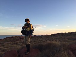 Joe Dortch合作论文数University of Western Australia, University of Western Australia7
 j e glover合作论文数2kate morse合作论文数2
 Keith Fifield合作论文数Department of Nuclear Physics, Research School of Physics, College of Science, The Australian National University2
 Gifford H. Miller合作论文数Center for the Geochemical Analysis of the Global Environment, Institute of Arctic and Alpine Research, University of Colorado Boulder2
 Michael Bird合作论文数Centre for Tropical Environmental and Sustainability Science, College of Science & Engineering, James Cook University2
 Rainer Grun合作论文数Research School of Earth Sciences, College of Science, Australian National University2
 Christian S. M. Turney(Chris Turney)合作论文数Earth and Sustainability Science Research Centre, School of Biological, Earth and Environmental Sciences, Faculty of Science, The University of New South Wales2
 Jean-Paul Raynal合作论文数2
 Mike A. Smith合作论文数College of Humanities, Arts and Social Sciences, Flinders University2J Dortch合作论文数1Peter Bindon合作论文数1Ewan Lawson合作论文数1Ingrid Ward合作论文数1
 Richard Cresswell合作论文数Sinclair Knight Merz1
 Richard W. Roberts合作论文数Department of Chemistry, Dornsife College of Letters, Arts and Sciences, University of Southern California;Viterbi School of Engineering, University of Southern California;ReoLab1Colin V. Murray-Wallace合作论文数School of Earth and Environmental Sciences, University of Wollongong1
 Edward J. Rhodes (Edward Rhodes)合作论文数Department of Geography, The University of Sheffield1Joseph Glover合作论文数1
 Patrick Hesp合作论文数School of the Environment, College of Science and Engineering, Flinders University1Linda K Ayliffe合作论文数1George W. Kendrick合作论文数1Linda K. Ayliffe合作论文数1
 Tim Pietsch合作论文数Black Mountain Laboratories, CSIRO Land and Water1
 John Hellstrom合作论文数School of Earth Sciences, The University of Melbourne1




