Under varying flow rate conditions, the transport and retention of polydisperse microplastics (MPls), with an average particle size of 16 ± 6 µm, were investigated in saturated porous media. First-order reversible and irreversible kinetic sorption models were used to describe the sorption kinetics. Sensitivity analyses provided insight into the effects of each sorption parameter. Both numerical modeling and experimental measurements were utilized to evaluate the retention rates of sand filters. The influence of flow rate on sorption was reflected in variations in the distribution coefficient (Kd), the mass transfer coefficient (β), and the irreversible sorption rate (K1). Lower flow rates were associated with higher Kd and β values, indicating increased sorption and reduced mass transfer rates. An increase in Kd resulted in a more gradual sorption process, with a decrease in peak concentration, whereas changes in β had a comparatively smaller impact on sorption rate and peak concentration. Lower K1 values were linked to higher peak concentrations and decreased retention efficiency. Numerical modeling revealed retention rates of 28 ± 1% at a flow rate of 31 mL min−1 and 17 ± 1% at 65 mL min−1. The introduction of MPls into saturated sand environments modifies the transport dynamics within the medium. Consequently, these alterations affect the hydrological characteristics of porous media, impacting groundwater quality and agricultural output. The mean absolute error (MAE) of 6% between the modeled and observed retention rates indicated a high level of accuracy. This study underscores the importance of examining retention efficiency and the accuracy of numerical models in understanding MPl transport in porous media.
This study concerns the transport and retention of polydisperse micron-sized (16 ± 6 µm) of microplastics (MPls) in porous media under varying flow rate conditions. Sorption kinetics were modeled using first-order reversible and irreversible kinetic sorption models, with sensitivity analyses providing insights into each sorption parameter's effect. Both numerical modeling and experimental measurements were employed to assess sand filter retention rates. The impact of flow rate on sorption reveals variations in distribution coefficient (Kd), mass transfer coefficient (β), and irreversible sorption rate (K1). Lower flow rates are correlated with higher Kd and β values, indicating an increase in sorption and diminished mass transfer rates. The findings revealed that an increase in Kd resulted in a more gradual sorption process with a decrease in peak concentration, whereas changes in β influenced the rate of sorption and peak concentration to a lesser extent compared to Kd. Lower K1 values are associated with higher peak concentrations and decreased retention efficiency. Retention rates were evaluated by a numerical model and found as 28 ± 1% at a flow rate of 31 ml min⁻¹ and 17 ± 1% at 65 ml min⁻¹. The introduction of MPls into soil environments has been noted to modify transport dynamics into soil. As a result, these alterations effects hydrological characteristics of soil, thereby impacting quality of groundwater and agricultural output. The mean absolute error (MAE) of 6% between modeled and observed retention rates suggests minor discrepancies. This study highlights the importance of examining retention efficiency and the accuracy of numerical models in porous media during MPl transport.
This paper presents a new and innovative methodology for the investigation of karst systems using spring discharge. The behaviour of springs in phase space is investigated by plotting the measurements of spring discharge versus the measurements of the water level at the spring’s outlet. Such a diagram reveals new features of the function of the karst system and the discharge pattern of the spring that are not captured by common research methods. The application of this method to the Azmak Spring in southwestern Türkiye revealed the existence of five distinct discharge subsystems that operate alternately and never simultaneously. They have a specific connection between them, while the transition from one to another is not random but follows a pattern. An attempt was made to interpret these features using concepts from percolation theory.
Plastics are widely used in every part of life. Microplastics (MPs) are classified as emerging contaminants in nature. Yet, microplastic transportation parameters in groundwater are not characterized well. In this study, microplastic transport in saturated homogeneous media was investigated. For this purpose, one-dimensional column tests were performed using the fluorescent and microplastic tracers to figure out the hydrodynamic conditions for the microplastic transport. Large silica, small silica, sand, and coarse gravel were the tested media. The hydrodynamic transport parameters were calculated by inverse solution methodology using the experimental and the analytical solution results. Only the coarse gravel medium with a minimum 1 mm and maximum 20 mm (5 mm of median) pore sizes and kinematic porosity 40.2% were found to be suitable for the transport of the used polyethylene (PE) whose particle size was between 200 and 500 µm. It is not possible to transport PE particles of selected size from fine-grained media. Transportation occurred in coarse-grained media such as coarse gravel. The calculated dispersivity values for the coarse gravel were 2.58 and 3.02 cm by using fluorescent and PE tracers, respectively. The experiments showed that the used PE particles cannot be transported if the mean flow velocity is lower than 2.02 cm/min in the coarse gravel medium. The microplastic accumulation might be an issue for an actual aquifer rather than the transportation of it considering the actual groundwater flow velocity is generally much lower.
The MODKARST mathematical code is used to simulate both brackish and non-brackish karst springs and provides useful information on the hydrological and hydrogeological characteristics of their aquifers. Next to this, MODKARST can also explain the often peculiar behavior of these springs, inherited from the complexity of the structures that most of the times form fractures, cavities, and conduits in carbonate formations in tectonically complex areas. The simulation focuses on explaining the complex behavior of the Azmak spring. Azmak is a large brackish karst spring in SW Turkey, which displays peculiarities both in terms of its hydrograph and seawater intrusion mechanism. In particular, during the recession period, contrary to the chloride concentrations of its water which appears more or less stable, its hydrograph shows fluctuations. The MODKARST simulation showed that the discharge fluctuation during the recession period is due to the operation of a siphon, while the abnormal variation of its chloride content is due to its predominant seawater intrusion mechanism which is the Venturi effect.
Karst aquifers have been an important research topic for hydrologists for years. Due to their high storage capacity, karst aquifers are an important source of water for the environment. On the other hand, it is safety-critical because of its role in floods. Mugla Karst Aquifer (SW, Turkey) is the only major water-bearing formation in the close environs of Mugla city. Flooding in the wet season occurs every year in the recharge plains. The aquifer discharges by the seaside springs in the Akyaka district which is the main touristic point of interest in the area. Non-porous irregular internal structures make the karsts more difficult to study. Therefore, many different methodologies have been developed over the years. In this study, unit hydrograph analysis, correlation and spectral analyses were applied on the rainfall and spring water-level time series data. Although advanced karst formations can be seen on the surface like the sinkholes, it has been revealed that the interior structure is not highly karstified. 100–130 days of regulation time was found. This shows that the Mugla Karst has quite inertial behavior. Yet, the storage of the aquifer system is quite high, and the late infiltration effect caused by alluvium plains was detected. This characterization of the hydrodynamic properties of the Mugla karst system represents an important step to consider the rational exploitation of its water resources in the near future.
The electrical resistivity tomography method has been widely used in geophysics for many purposes such as determining geological structures, water movement, saltwater intrusion, and tectonic regime modeling. Karstic springs are important for water basin management since the karst systems are highly complex and vulnerable to exploitation and contamination. An accurate geophysical model of the subsurface is needed to reveal the spring structure. In this study, several karst springs in the Gökova Bay (SW, Turkey) were investigated to create a 3D subsurface model of the nearby karstic cavities utilizing electrical resistivity measurements. For this approach, 2D resistivity profiles were acquired and interpreted. Stratigraphically, colluvium, conglomerate, and dolomitic-limestone units were located in the field. The resistivity values of these formations were determined considering both the literature and field survey. Then, 2D profiles were interpolated to create a 3D resistivity model of the study area. Medium-large sized cavities were identified as well as their locations relative to the springs. The measured resistivities were also correlated with the corresponding geological units. The results were then used to construct a 3D model that aids to reveal the cavity geometry in the subsurface. Additionally, several faults are detected and their effect on the cavities is interpreted.
This study has investigated metal(loid) contamination in Asartepe Dam Lake, which is used for irrigation in Ankara, Turkey. Contamination Factor and Degree of Contamination were applied to evaluate contamination in the lake sediment. The contamination was shown to be moderate according to a modified Degree of Contamination analysis. Chromium was found to be the highest calculated metal on the Geoaccumulation Index, and the lake was found to be moderate-to-strongly contaminated according to the same method. The Pollution Load Index for the lake sediment varied between 3.11 and 3.5. Enrichment Factors suggest a minor anthropogenic origin for metal(loid) pollution; various statistical techniques were implemented. The greatest correlation among water-borne metal(loid)s was shown by analysis to be between iron and titanium. No strong correlation was observed for sediment samples. The results show that the lake water is relatively free of metal(loid)s. However, this is not the case for the lake sediment.
In this study, hydraulic head and Cd-111 interpolations based on the geo-adaptive neuro-fuzzy inference system (Geo-ANFIS) and empirical Bayesian kriging (EBK) were performed for the alluvium unit of Karabaglar Polje in Mugla, Turkey. Hydraulic head measurements and 111Cd analyses were done for 42 water wells during a snapshot campaign in April 2013. The main objective of this study was to compare Geo-ANFIS and EBK to interpolate hydraulic head and Cd-111 content of groundwater. Both models were applied on the same case study: alluvium of Karabaglar Polje, which covers an area of 25 km(2) in Mugla basin, in the southwest of Turkey. The ANFIS method (called ANFISXY) uses two reduced centred pre-processed inputs, which are cartesian coordinates (XY). Geo-ANFIS is tested on a 100-random-data subset of 8 data among 42, with the remaining data used to train and validate the models. ANFISXY and EBK were then used to interpolate hydraulic head and heavy metal distribution, on a 50 m(2) grid covering the study area for ANFISXY, while a 100 m(2) grid was used for EBK. Both EBK- and ANFISXY-simulated hydraulic head and Cd-111 distributions exhibit realistic patterns, with RMSE < 9 m and RMSE < 8 mu g/L, respectively. In conclusion, EBK can be considered as a better interpolation method than ANFISXY for both parameters.
In this research, heavy metals (Ti, Cr, Mn, Fe, Co, Ni, Cu, Zn, Mo, Cd, Ba, Pb) and a metalloid (As) sampled from 84 wells used for drinking water and irrigation in Karabaglar Karstic Polje (Mugla, Turkey) were analyzed. The results were evaluated by different statistical methods in order to investigate the interaction between elements. Ti, Mn, Fe, Zn, Mo and Pb were detected in many wells. According to findings, the strongest correlation is between As and Cu (R=0.832). As-Ni (R=0.789) and Cu-Ni (R=0.776) are the other strong correlations. The relationship between these elements were also shown by Cluster Analysis (CA). With respect to CA, the closest proximity distance matrix are found for these three elements. Also, elements exemined composed 3 main clusters in dendrogram created from CA result matrix. These clusters match up with the findings of Principal Component Analysis (PCA) too. PCA gathers all elements up in 3 components: As, Cu and Ni at the first component; Mo and Cd at the second; Cr and Ba at the third. The accumulation of the elements studied were investigated by Kruskal-Wallis and Mann-Whitney U tests. According to the results, the least and the most common elements are Cu and Ba, respectively. The differences in the amount of all elements except Ni and Mo were statistically significant (p<0.05). In addition, both the amount of the elements and some water quality parameters were compared with EPA (U. S. Environmental Protection Agency) and Turkish inland water quality classes and no hazardous situation has been found.
Bu calismada Karabaglar Polyesinde (Mugla, Turkiye) bulunan, icme ve sulamada kullanilan 84 su kuyusunun agir metal (Ti, Cr, Mn, Fe, Co, Ni, Cu, Zn, Mo, Cd, Ba, Pb) ve metaloit (As) analizleri gerceklestirilmis, sonuclar istatistiksel yontemlerle degerlendirilerek, elementler arasindaki etkilesimler arastirilmistir. Bu elementlerden Ti, Mn, Fe, Zn, Mo, Pb pek cok kuyuda bulunmamaktadir. Bulgulara gore en guclu korelasyon As-Cu arasindadir (R=0.832). As-Ni (R=0.789) ve Cu-Ni (R=0.776) guclu diger korelasyonlardir. Bu elementler arasindaki iliski Kumeleme Analizinde (KA) de gorulmektedir. KA verilerine gore yakinlik matrisinde en yakin mesafeler bu 3 element icin saptanmistir. Ayrica, KA sonuc matrisinden olusturulan dendrogramda elementler 3 temel kume olusturmustur. Bu kumeler, temel bilesenler analizi (TBA) bulgulari ile de ortusmektedir. TBA da tum elementleri 3 farkli kumede toplamistir. Bu kumelerden birincisinde As, Cu, Ni; ikincisinde Mo ve Cd; ucuncusunde Cr ve Ba yer almaktadir. Bolgede calisilan elementlerin birikimleri de Kruskal Wallis ve Mann-Whitney U testleri kullanilarak ortaya konulmustur. Sonuclara gore bolgede calisilan elementler arasinda en az rastlanilani Cu, en fazla rastlanilani ise Ba’dir (p<0.05). Ni ve Mo haric diger tum elementlerin miktarlari arasindaki farklar istatistiksel olarak anlamlidir (p<0.05). Ayrica hem elementler hem de bazi su kalite parametreleri, EPA (U. S. Environmental Protection Agency) ve Turk kita ici su kaynaklari siniflandirmasi ile karsilastirilmis ve tehlike arz eden bir duruma rastlanmamistir.
 Bedri Kurtulus合作论文数Geosciences Department, France and Muğla University11
 Moumtaz Razack合作论文数6
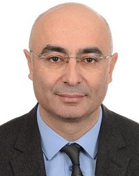 Ozgur Avsar合作论文数General Directorate of Disaster Affairs3
 Emrah Pekkan合作论文数Department of Civil Engineering, Anadolu University3
 Philippe Le Coustumer合作论文数Université de Bordeaux3
 Nicolaos Lambrakis合作论文数2Hande Okutan合作论文数2
 Gunseli Erdem合作论文数2
 Mustafa Can Canoglu合作论文数Environm Engn Dept, Sinop Univ2
 Tunca Evren合作论文数UNAM-Institute of Materials Science and Nanotechnology, Bilkent University;Department of Geological Engineering, University of Muğla;Faculty of Marine Sciences, Ordu University;University of Muğla, Ordu University2
 Katsanou K合作论文数Laboratory of Hydrogeology, University of Patras2Athanasios J. Maramathas合作论文数2
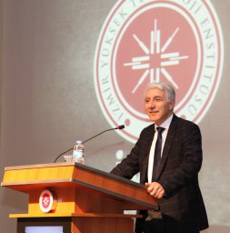 Alper Baba合作论文数Engineering and Architecture Faculty, Canakkale Onsekiz Mart University2
 Benoit Nauleau合作论文数1
 Pantelis Soupios合作论文数1Mathieu Le Coz合作论文数1Claude Fontaine合作论文数1
 Korhan Ayranci合作论文数Department of Earth Sciences, Simon Fraser University1
 Sanlinn I. Kaka合作论文数1
 Murat Ersen Aksoy合作论文数Ministry of Health Istanbul Division, Istanbul, Turkey1




