Spatial heterogeneity of snow and firn properties on glaciers introduces uncertainty in interpretation of point and profile observations and complicates modelling of meltwater percolation and runoff. Here we present a study of the temporal and spatial dynamics of firn density and stratigraphy at the plot-scale (≈10 m × 10 m × 10 m) repeated annually during 2012–14 at the Lomonosovfonna icefield, Svalbard. Results from cores, video inspections in boreholes and radar grid surveys are compared. Ice layers 0.1–50 cm thick comprised ≈8% of the borehole length. Most of them are 1–3 cm thick and could not be traced between boreholes separated by 3 m. Large lateral variability of firn structure affects representativeness of observations in single holes and calls for repeated studies in multiple points to derive a representative stratigraphy signal. Radar reflections are poorly correlated with ice layers in individual boreholes. However, the match between the high amplitude peaks in the grid-averaged radar signal and horizons of preferential ice layer formation revealed by averaging the video surveys over multiple boreholes is higher. These horizons are interpreted as buried firn layers previously exposed to melt-freeze or wind-driven densification and several of them are consistently recovered throughout three field campaigns.
The repeat acquisition of high-resolution snow depth measurements has important research and civil applications in the Arctic. Currently the surveying methods for capturing the high spatial and temporal variability of the snowpack are expensive, in particular for small areal extents. An alternative methodology based on Unmanned Aerial Systems (UASs) and digital photogrammetry was tested over varying surveying conditions in the Arctic employing two diverse and low-cost UAS-camera combinations (500 and 1700 USD, respectively). Six areas, two in Svalbard and four in Greenland, were mapped covering from 1386 to 38,410 m(2). The sites presented diverse snow surface types, underlying topography and light conditions in order to test the method under potentially limiting conditions. The resulting snow depth maps achieved spatial resolutions between 0.06 and 0.09 m. The average difference between UAS-estimated and measured snow depth, checked with conventional snow probing, ranged from 0.015 to 0.16 m. The impact of image pre-processing was explored, improving point cloud density and accuracy for different image qualities and snow/light conditions. Our UAS photogrammetry results are expected to be scalable to larger areal extents. While further validation is needed, with the inclusion of extra validation points, the study showcases the potential of this cost-effective methodology for high-resolution monitoring of snow dynamics in the Arctic and beyond.
ABSTRACT Surface melt in the ablation zone is dominated by atmospheric temperature and surface albedo. We developed a surface mass-balance model with a dynamic component of glacier ice albedo which includes surface properties, clouds and the angle of the sun. The ice albedo reduction is mainly caused by impurity accumulation of non-biological origin such as dust and black carbon (BC), which is currently not included in other surface mass-balance models. Simulations show that dust from meltout is the main source of impurity mass at the melting glacier ice surface, and current rates of atmospheric deposition of dust play only a minor role. However, for BC the atmospheric deposition is the main source where ice melt rates are below 1 m, and atmospheric deposition is most likely from intercontinental transport due to the scarce population and lack of forests in Greenland.
Physical and chemical properties of four different ice cores (LF-97, LF-08, LF-09 and LF-11) drilled at Lomonosovfonna, Svalbard, were compared to investigate the effects of meltwater percolation on the chemical and physical stratigraphy of these records. A synthetic ice core approach was employed as reference record to estimate the ionic relocation and meltwater percolation length at this site during the period 2007–2010. Using this method, a partial ion elution sequence obtained for Lomonosovfonna was NO3− > SO42−, Mg2+, Cl−, K+, Na+ with nitrate being the most mobile within the snowpack. The relocation length of most of the ions was on the order of 1 m during this period. In addition, by using both a positive degree day (PDD) and a snow–energy model approaches to estimate the percentage of melt at Lomonosovfonna, we have calculated a melt percentage (MP) of the total annual accumulation within the range between 48 and 70 %, for the period between 2007 and 2010, which is above the MP range suggested by the ion relocation evidenced in the LF-syn core (i.e., MP = 30 %). Using a firn-densification model to constrain the melt range, a MP of 30 % was found over the same period, which is consistent with the results of the synthetic ice core approach, and a 45 % of melt for the last 60 years. Considering the ionic relocation lengths and annual melt percentages, we estimate that the atmospheric ionic signal remains preserved in recently drilled Lomonosovfonna ice cores at an annual or bi-annual resolution when weather conditions were similar to those during the 2007–2010 period.
ABSTRACT Glacier surface mass-balance measurements on Greenland started more than a century ago, but no compilation exists of the observations from the ablation area of the ice sheet and local glaciers. Such data could be used in the evaluation of modelled surface mass balance, or to document changes in glacier melt independently from model output. Here, we present a comprehensive database of Greenland glacier surface mass-balance observations from the ablation area of the ice sheet and local glaciers. The database spans the 123 a from 1892 to 2015, contains a total of ~3000 measurements from 46 sites, and is openly accessible through the PROMICE web portal (http://www.promice.dk). For each measurement we provide X, Y and Z coordinates, starting and ending dates as well as quality flags. We give sources for each entry and for all metadata. Two thirds of the data were collected from grey literature and unpublished archive documents. Roughly 60% of the measurements were performed by the Geological Survey of Denmark and Greenland (GEUS, previously GGU). The data cover all regions of Greenland except for the southernmost part of the east coast, but also emphasize the importance of long-term time series of which there are only two exceeding 20 a. We use the data to analyse uncertainties in point measurements of surface mass balance, as well as to estimate surface mass-balance profiles for most regions of Greenland.
Increasing atmospheric reactive nitrogen (Nr), as consequence of human activities, has generated accumulation of nitrate (NO3-) in Arctic regions. The Arctic has fragile nitrogen limited ecosystems that can be altered by increases of dry or wet deposition of Nr. Ice cores have shown increments of twofold in nitrogen deposition over Greenland and Svalbard during the 20th century. Ice core NO3- stable isotopes, (δ15N-NO3- and δ18O-NO3-), have the potential to serve as proxy of nitrogen oxides (NOx) sources and atmospheric oxidation pathways. NO3- is difficult to interpret in ice since it has several sources and experiences post-depositional processes, e.g. photolysis, relocation, evaporation and diffusion. The present work shows the results of NO3- and NO3- stable isotopes analyses of ice cores, snow and precipitation from Svalbard, in order to obtain records of natural and anthropogenic sources of NO3-. In addition, meltwater percolation effects on the snowpack ion content were also studied. A comparison between NO3- records from different Svalbard ice cores and NOx and SOx emission profiles from different regions shows that the major source regions affecting Svalbard are Western Europe and North America, followed by Central Europe and former USSR. Post-1950s δ15N-NO3- measured at Lomonosovfonna is influenced mainly by fossil fuel combustion, soil emissions, and forest fires. There is an east-west gradient in snow NO3- stable isotopes during 2010/2011, with lower δ15N-NO3- and higher δ18O-NO3- values at eastern sites; the results evidence differences in the origin of air masses arriving at Svalbard sites, mainly Eurasia, to the eastern sites, and Northern Europe to the western sites. The effects of post-depositional change on the ice core chemistry were studied, finding that 45% of annual snowpack suffers melt at Lomonosovfonna during the last 60 years. Percolation lengths were estimated as ≈1 m for most of ions; therefore, it is expected that the atmospheric ionic signal is preserved at annual or bi-annual resolution within the last 60 years at the Lomonosovfonna summit. The results presented here suggest that NO3- stable isotopes from Svalbard ice cores are useful to describe different sources and source regions of NOx, contributing to the assessment of nitrogen enrichment for this region.
AbstractWe assess the runoff and surface mass balance (SMB) of the Greenland ice sheet in the Nuuk region (southwest) using output of two regional climate models (RCMs) evaluated by observations. The region encompasses six glaciers that drain into Godthåbsfjord. RCM data (1960–2012) are resampled to a high spatial resolution to include the narrow (relative to the native grid spacing) glacier trunks in the ice mask. Comparing RCM gridded results with automatic weather station (AWS) point measurements reveals that locally models can underestimate ablation and overestimate accumulation by up to tens of per cent. However, comparison with lake discharge indicates that modelled regional runoff totals are more accurate. Model results show that melt and runoff in the Nuuk region have doubled over the past two decades. Regional SMB attained negative values in recent high-melt years. Taking into account frontal ablation of the marine-terminating glaciers, the region lost 10–20 km3 w.e. a–1 in 2010–12. If 2010 melting prevails during the remainder of this century, a low-end estimate of sea-level rise of 5 mm is expected by 2100 from this relatively small section (2.6%) of the ice sheet alone.
A pilot study is presented evaluating selected chlorinated pesticides as chemical tracers for water masses in a sub-Arctic fjord system (Godthåbsfjord, western Greenland). Polyoxymethylene (POM) based passive water samplers were deployed during summer-autumn 2010. The levels of the analysed chlorinated pesticides in the fjord surface waters were found to be low compared to earlier studies. α-Hexachlorocyclohexane (α-HCH) and hexachlorobenzene (HCB) were the predominant contaminants. However, these two compounds have higher levels in oceanic water compared to freshwater influenced fjord waters. These chemicals can thus be considered as indicators for direct atmospheric long-range transport, while the organochlorine pesticides like trans-, cis-chlordane, trans-nonachlor and oxychlordane that are detected in the inner parts of the fjord are indicators for potential freshwater sources such as rivers and glacial meltwater runoff (secondary sources). The average values were 50 pg L(-1) for HCB and 11 pg L(-1) for α-HCH. These concentrations are comparable to levels in fjords in Svalbard (Norwegian Arctic), but lower than in open and/or ice covered oceans in the Canadian Arctic. Two air samplers were deployed for the identification of direct atmospheric contributions. Local contamination sources do not contribute significantly. The study demonstrated the value of passive water sampling devices for comprehensive hydrological characterization of Arctic coastal waters.
The impact on snow pack albedo from local elemental carbon (EC) sources in Svalbard has been investigated for the winter of 2008. Highly elevated EC concentrations in the snow are observed around the settlements of Longyearbyen and Svea (locally > 1000 ng g(-1), about 200 times over the background level), while EC concentrations similar to the background level are seen around Ny-Alesund. Near Longyearbyen and Svea, darkened snow influenced by wind transported coal dust from open coal stockpiles is clearly visible from satellite images and by eye at the ground. As a first estimate, the reduction in snow albedo caused by local EC pollution from the Norwegian settlements has been compared to the estimated reduction caused by long-range transported EC for entire Svalbard. The effect of local EC from Longyearbyen, Svea and all Norwegian settlements are estimated to 2.1%, 7.9% and 10% of the total impact of EC, respectively. The EC particles tend to stay on the surface during melting, and elevated EC concentrations due to the spring melt was observed. This accumulation of EC enhances the positive albedo feedbacks. The EC concentrations were observed to be larger in metamorphosed snow than in fresh snow, and especially around ice lenses.
AbstractThis paper presents an assessment of biological activity associated with ice surface debris (cryoconite) at the ice-sheet scale. Estimates of the mass distribution of cryoconite over the Greenland ice sheet (GIS) and the biological activity associated with it are presented and then coupled with a surface mass-balance model to estimate total carbon fluxes due to respiration and photosynthesis. We find an average loading of 66gm−2 at Kangerlussuaq, southwest Greenland, which compares well with recent estimates from Kronprins Christians Land (17–440 gm−2: Bøggild and others, 2010) in northeast Greenland. We also report a significant microbial biomass in cryoconite at both these places (103–104 cells mg−1) and carbon fluxes of the order of 1–3 μM C g−1d−1 for both respiration and photosynthesis. The modelling indicates that total respiration and photosynthesis fluxes are likely to be ∼101–102 GgCa−1 and thus far from trivial. However, estimation of the net ecosystem impact across the entire ice sheet on atmospheric CO2 concentrations is problematic because photosynthesis rates were almost certainly low during our field campaign. Therefore, like its water balance, the carbon balance of the GIS is now known to be important, but its accurate quantification will remain elusive until more data are forthcoming.
In the last IPCC report the black carbon (BC) impact of the Arctic was recognized as an independent and recognizable contribution to global climate change. The overall objective of the project behind the work presented here is to determine whether the black carbon content in snow and glacier ice surfaces can be retrieved from satellite data. Preliminary analysis of satellite measurements shows that high concentrations of BC (from local sources) are clearly detectable in the satellite signal, both over snow and glacier ice surfaces. Chemical BC analysis of snow and ice samples taken in the field show values consistent with the satellite data. Even if the general low BC level in the snow due to long-transported aerosols might be hard to measure in the cold, dry season, we have seen a significant increase in the signal during the melting which may make BC retrieval possible during the summer months.
AbstractIce types, albedos and impurity content are characterized for the ablation zone of the Greenland ice sheet in Kronprinz Christians Land (80° N, 24° W). Along this ice margin the width of the ablation zone is only about 8 km. The emergence and melting of old ice in the ablation zone creates a surface layer of dust that was originally deposited with snowfall high on the ice sheet. This debris cover is augmented by locally derived wind-blown sediment. Subsequently, the surface dust particles often aggregate together to form centimetre-scale clumps that melt into the ice, creating cryoconite holes. The debris in the cryoconite holes becomes hidden from sunlight, raising the area-averaged albedo relative to surfaces with uniform debris cover. Spectral and broadband albedos were obtained for snow, ice hummocks, debris-covered ice, cryoconite-studded ice and barren tundra surfaces. Broadband ice albedos varied from 0.2 (for ice with heavy loading of uniform debris) to 0.6 (for ice hummocks with cryoconite holes). The cryoconite material itself has albedo 0.1 when wet. Areal distribution of the major surface types was estimated visually from a transect video as a function of distance from the ice edge (330 m a.s.l.). Ablation rates were measured along a transect from the ice margin to the slush zone 8 km from the margin (550 m a.s.l.), traversing both Pleistocene and Holocene ice. Ablation rates in early August averaged 2 cm d−1. Impurity concentrations were typically 4.3 mg L−1 in the subsurface ice. Surface concentrations were about 16 g m−2 on surfaces with low impurity loading, and heavily loaded surfaces had concentrations as high as 1.4 kg m−2. The mineralogical composition of the cryoconite material is comparable with that of the surrounding soils and with dust on a snowdrift in front of the ice margin, implying that much of the material is derived from local sources. A fine mode (clay) is present in the oldest ice but not in the nearby soil, suggesting that its origin is from wind deposition during Pleistocene glaciation.
AbstractGlacier surfaces support unique microbial food webs dominated by organic and inorganic debris called ‘cryoconite’. Observations from Longyearbreen, Spitsbergen, show how these aggregate particles can develop an internal structure following the cementation of mineral grains (mostly quartz and dolomite) by filamentous microorganisms. Measurements of carbon and dissolved O2show that these microorganisms, mostly cyanobacteria, promote significant rates of photosynthesis (average 17 μgC g−1d−1) which assist aggregate growth by increasing the biomass and producing glue-like extracellular polymeric substances. The primary production takes place not only upon the surface of the aggregates but also just beneath, due to the translucence of the quartz particles. However, since total photosynthesis is matched by respiration (average 19 μgC g−1d−1), primary production does not contribute directly to cryoconite accumulation upon the glacier surface. The microorganisms therefore influence the surface albedo most by cementing dark particles and organic debris together, rather than simply growing over it. Time-lapse photographs show that cryoconite is likely to reside upon the glacier for years as a result of this aggregation. These observations therefore show that a better understanding of the relationship between supraglacial debris and ablation upon glaciers requires an appreciation of the biological processes that take place during summer.
A cryoconite granule is a biologically active aggregation of microorganisms, mineral particles and organic matter found on glacier surfaces, often within shallow pools or cryoconite holes. Observations of the microstructure of a range of cryoconite granules from locations in Svalbard and Greenland reveal their structure and composition. Whereas bulk analyses show that the mineralogy and geochemistry of these granules are broadly similar, analyses of their microstructure, using optical, epifluorescence and confocal microscopy, indicate differences in the location and quantity of photosynthetic microorganisms, heterotrophic bacteria and organic matter. Using these findings, a hypothesis on the aggregation of cryoconite is presented, centred upon multilevel aggregation by bioflocculation and filamentous binding.
Near-surface air temperature (2 m) over the Greenland ice sheet (GrIS) is parameterized using data from automatic weather stations located on land and on the ice sheet. The parameterization is expressed in terms of mean annual temperatures and mean July temperatures, both depending linearly on altitude, latitude and longitude. The temperature parameterization is compared to a previous study and is shown to be in better agreement with observations. The temperature parameterization is tested in a positive degree-day model to simulate the present (1996-2006) mean melt area extent of the GrIS. The model accounts for firn warming, rainfall and refreezing of meltwater, with different degree-day factors for ice and snow under warm and cold climate conditions. The simulated melt area extent is found to have reasonable agreement with satellite-derived observations.
Observations from the Arctic basin has proven Black Carbon to be present in sufficient concentrations to be detected. This black carbon can only originate from anthropogenic emissions further south. On land at Svalbard both local manmade emissions and weathering of the coal containing sediments can be a source.
In cold Arctic snowpacks, meltwater retention is a significant factor controlling the timing and magnitude of runoff. Meltwater percolates vertically through the snowpack until it reaches an impermeable horizon, whereupon a saturated zone is established. If the underlying media is below the freezing point, accretive ice formation takes place. This process has previously been crudely parameterized or modelled numerically. Such ice is called either superimposed ice on glaciers or basal ice on bare land.Using theory derived from sea-ice formation, an analytical solution to basal ice growth is proposed. Results are compared against growth rates derived from numerical modelling. In addition, model results are compared to field observations of ice temperatures. The analytical solution is further extended to account for the temperature gradient inside the underlying media and the variable thermal properties of the underlying media.In the analysis, observations and references have predominantly relied on knowledge from glaciers. However, the process of accretive ice growth is equally important in seasonal snow packs with a cold snow-ground interface and on Arctic sea ice where the ice-snow interface is well below freezing point. The simplification of this accretive ice growth problem makes the solution attractive for incorporation in large-scale cryospheric models. Copyright (C) 2007 John Wiley & Sons, Ltd.
 Andreas Peter Ahlstrøm合作论文数Geol Survey Denmark & Greenland6
 Hans Oerter合作论文数5
 carmen p vega合作论文数Direcc Gen Aeronaut Civil, Direcc Meteorol Chile4
 Ole Bent Olesen合作论文数4
 Andy Hodson合作论文数The University Centre in Svalbard4Veijo Pohjola合作论文数Department of Earth Sciences, Uppsala University4Elisabeth Isaksson合作论文数4
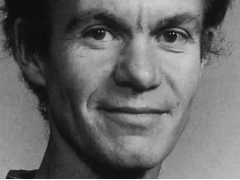 Niels Reeh合作论文数De Nationale Geologiske Undersøgelser for Danmark og Grønland;Danmarks Tekniske Universitet4
 Steffen Podlech合作论文数4
 Émilie Beaudon合作论文数Rovaniemi, University of Lapland3
 Bjorn Claremar合作论文数3
 Margit Schwikowski合作论文数Paul Scherrer Institut3
 Christoph Mayer合作论文数Kommission für Glaziologie, Bayerische Akademie der Wissenschaften3
 Robert S. Fausto合作论文数Geol Survey Denmark & Greenland3
 Harry Langford合作论文数3Dirk van As合作论文数3Rickard Pettersson合作论文数3Andrea Taurisano合作论文数3
 Ward J. J. van Pelt合作论文数Dept Earth Sci, Uppsala Univ2Søren Nielsen合作论文数Hospital, Aarhus University2
 Aamaas Borgar合作论文数2
 Stephen G. Warren合作论文数Department of Atmospheric Sciences, University of Washington;Department of Earth & Space Sciences, University of Washington2
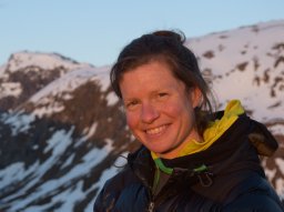 Cameron Karen A合作论文数2
 Konrad Steffen合作论文数Department of Geography, College of Arts and Sciences, University of Colorado Boulder2
 Steven Banwart合作论文数Global Food and Environment Institute, School of Earth and Environment, Faculty of Environment, University of Leeds2Horst Machguth合作论文数Department of Geography;University of Zurich-Irchel;Department of Geography, University of Zurich-Irchel2Henrik Højmark Thomsen合作论文数2
 Michiel van den Broeke合作论文数Faculty of Science, Utrecht University;Institute for Marine and Atmospheric Research Utrecht, Utrecht University2
 Richard Everett Brandt合作论文数2Morten L. Andersen合作论文数2b u hansen合作论文数1Manfred Stober合作论文数1Signe B. Andersen合作论文数1
 Paul Smeets合作论文数1Wolfgang Starzer合作论文数1m plougmann hag合作论文数1
 Anders Anker Bjørk合作论文数Department of Geosciences and Natural Resource Management, Faculty of Science, University of Copenhagen1
 Thomas Goelles合作论文数Department of Automotive Electronics and Software, Virtual Vehicle Research GmbH1Bernhard Hynek合作论文数1
 Bent Hasholt合作论文数1
 Signe Hillerup Larsen合作论文数Dept Glaciol & Climate, Geol Survey Denmark & Greenland1Shin Sugiyama合作论文数1
 Baptiste Vandecrux合作论文数Geological Survey Denmark & Greenland GEUS1
 Marco Marcer合作论文数1
 Emiliano Cimoli合作论文数Discipline Geog & Spatial Sci, Univ Tasmania1
 James M. Lea合作论文数School of Environmental Sciences, University of Liverpool, Liverpool, UK1
 Tonu Martma合作论文数Dept Geol, Tallinn Univ Technol1
 Kendrick J. Brown合作论文数Canadian Forest Service;Canadian Forest Service1
 Xavier Fettweis合作论文数Department of Geography 2, University of Liège;Department of Geography 2, University of Liège1




