In this paper, we address the problem of generating and enhancing Passive Gamma Emission Tomography (PGET) data from a deep learning perspective. The PGET instrument has been developed for the verification of spent nuclear fuel and relies on image reconstruction and analysis algorithms to detect missing or substituted fuel pins. Such techniques are sensitive to the quality of the input data: noisy or incomplete sinograms yield to poor reconstructions and, consequently, to low-confidence results. The development and validation of these algorithms is based on complex Monte Carlo simulations that are time-consuming and computationally-demanding.We propose the use of Convolutional Neural Networks (CNNs) for enhancing PGET data. Our technique learns the mapping between incomplete or noisy sinograms and their corresponding full representation. It effectively exploits the high degree of redundancy of the measurements, i.e. the contribution of a single pin can be observed from many different directions, to learn the underlying model of the data and to make informed predictions. The two main applications of our approach are: (1) accelerating Monte Carlo simulations and (2) pre-processing real measurements to enhance them before running the standard image reconstruction and analysis techniques.The experimental evaluation was performed with both, simulated and real measurements. Results show how effectively CNNs can learn and exploit the structure of the data. For the two use cases evaluated, denoising sinograms and inpainting incomplete ones, our technique achieved state-of-the-art performance with execution times in the order of milliseconds.
We introduce an active learning framework for content-based image retrieval for video surveillance that can be trained ad-hoc for a single camera in a matter of minutes. This technique allows searching for both, known and unknown objects, given a region of interest. The process does not require prior labelled data and treats image retrieval as a binary classification task, in which frames can be similar or different from a query image. The technique is compatible with any pre-trained deep feature extractor. In addition, we propose a novel label propagation algorithm that benefits from (1) visual similarity of image pairs and (2) the semantic representation of the feature vectors from a pre-trained deep feature extractor. This approach allows to reduce the amount of labels needed, while avoiding the propagation of errors. Our experiments with three use-cases from a nuclear facility show the validity of the proposed method, which achieves high precision and recall while requiring minimal amounts of labelled data.
In this paper, we face the point-cloud segmentation problem for spinning laser sensors from a deep-learning (DL) perspective. Since the sensors natively provide their measurements in a 2D grid, we directly use state-of-the-art models designed for visual information for the segmentation task and then exploit the range information to ensure 3D accuracy. This allows us to effectively address the main challenges of applying DL techniques to point clouds, i.e., lack of structure and increased dimensionality. To the best of our knowledge, this is the first work that faces the 3D segmentation problem from a 2D perspective without explicitly re-projecting 3D point clouds. Moreover, our approach exploits multiple channels available in modern sensors, i.e., range, reflectivity, and ambient illumination. We also introduce a novel data-mining pipeline that enables the annotation of 3D scans without human intervention. Together with this paper, we present a new public dataset with all the data collected for training and evaluating our approach, where point clouds preserve their native sensor structure and where every single measurement contains range, reflectivity, and ambient information, together with its associated 3D point. As experimental results show, our approach achieves state-of-the-art results both in terms of performance and inference time. Additionally, we provide a novel ablation test that analyses the individual and combined contributions of the different channels provided by modern laser sensors.
This paper addresses the challenges of rendering massive indoor point clouds in Virtual Reality. In these kind of visualizations the point of view is never static, imposing the need of a one-shot (i.e. non-iterative) rendering strategy, in contrast with progressive refinement approaches that assume that the camera position does not change between most consecutive frames. Our approach benefits from the static nature of indoor environments to pre-compute a visibility map that enables us to boost real-time rendering performance. The key idea behind our visibility map is to exploit the cluttered topology of buildings in order to effectively cull the regions of the space that are occluded by structural elements such as walls. This does not only improve performance but also the visual quality of the final render, allowing us to display in full detail the space and preventing the user to see the contiguous spaces through the walls. Additionally, we introduce a novel hierarchical data structure that enables us to display the point cloud with a continuous level of detail with a minimal impact on performance. Experimental results show that our approach outperforms state-of-the-art techniques in complex indoor environments and achieves comparable results in outdoor ones, proving the generality of our method.
In this paper we introduce a novel public dataset for developing and benchmarking indoor localization systems. We have selected and 3D mapped a set of representative indoor environments including a large office building, a conference room, a workshop, an exhibition area and a restaurant. Our acquisition pipeline is based on a portable LiDAR SLAM backpack to map the buildings and to accurately track the pose of the user as it moves freely inside them. We introduce the calibration procedures that enable us to acquire and geo-reference live data coming from different independent sensors rigidly attached to the backpack. This has allowed us to collect long sequences of spherical and stereo images, together with all the sensor readings coming from a consumer smartphone and locate them inside the map with centimetre accuracy. The dataset addresses many of the limitations of existing indoor localization datasets regarding the scale and diversity of the mapped buildings; the number of acquired sequences under varying conditions; the accuracy of the ground-truth trajectory; the availability of a detailed 3D model and the availability of different sensor types. It enables the benchmarking of existing and the development of new indoor localization approaches, in particular for deep learning based systems that require large amounts of labeled training data.
This paper presents a new technique to solve the Indoor Visual Place Recognition problem from the Deep Learning perspective. It consists on an image retrieval approach supported by a novel image similarity metric. Our work uses a 3D laser sensor mounted on a backpack with a calibrated spherical camera i) to generate the data for training the deep neural network and ii) to build a database of geo-referenced images for an environment. The data collection stage is fully automatic and requires no user intervention for labelling. Thanks to the 3D laser measurements and the spherical panoramas, we can efficiently survey large indoor areas in a very short time. The underlying 3D data associated to the map allows us to define the similarity between two training images as the geometric overlap between the observed pixels. We exploit this similarity metric to effectively train a CNN that maps images into compact embeddings. The goal of the training is to ensure that the L2 distance between the embeddings associated to two images is small when they are observing the same place and large when they are observing different places. After the training, similarities between a query image and the geo-referenced images in the database are efficiently retrieved by performing a nearest neighbour search in the embeddings space.
We present a robust Global Matching technique focused on 3D mapping applications using laser range-finders. Our approach works under the assumption that places can be recognized by analyzing the projection of the observed points along the gravity direction. Relative poses between pairs of 3D point clouds are estimated by aligning their 2D projective representations and benefiting from the corresponding dimensional reduction. We present the complete processing pipeline for two different applications that use the global matcher as a core component: First, the global matcher is used for the registration of static scan sets where no a-priori information of the relative poses is available. It is combined with an effective procedure for validating the matches that exploits the implicit empty space information associated to single acquisitions. In the second use case, the global matcher is used for the loop detection required for 3D SLAM applications. We use an Extended Kalman Filter to obtain a belief of the map poses, which allows to validate matches and to execute hierarchical overlap tests, which reduce the number of potential matches to be evaluated. Additionally, the global matcher is combined with a fast local technique. In both use cases, the global reconstruction problem is modeled as a sparse graph, where scan poses (nodes) are connected through matches (edges). The graph structure allows formulating a sparse global optimization problem that optimizes scan poses, considering simultaneously all accepted matches. Our approach is being used in production systems and has been successfully evaluated on several real and publicly available datasets.
We present a portable system for tracking and mapping using a real time 3D sensor. In particular our current implementation is composed by a spinning laser sensor mounted on a portable backpack that sends positioning and acquisition data to an hand-held tablet. The system can be directly employed as a real time odometer system if no information on the environment are available or may take advantage of the known map. In the latter case an initial automatic off-line stage builds a 3D map of an unknown environment (either using high definition laser scanner acquisitions or our system alone). A second off-line stage extracts useful information from the generated map that are used in the subsequent on-line tracking stage. Finally, real-time pose tracking is performed using a robust ICP implementation that efficiently selects potentially descriptive points, removes outliers and that fuses a local odometer to allow the user to navigate through non-mapped areas. Our system provides accurate real time positioning information in large indoor environments and, optionally, overlays the current real time 3D acquisition on the original map assisting the user in accurately identifying regions of the environment that undergone changes.
Indoor localisation in GPS-denied areas is a subject that currently receives a lot of attention in research and industry. There are many potential applications for indoor localization based on small and affordable consumer devices. However, it is often difficult to evaluate the localization accuracy due to the unavailability of accurate ground-truth information. Over the last years, JRC has developed the Mobile Laser Scanning Platform (MLSP) for 3D mapping and indoor localization, which has been demonstrated to be significantly more accurate than what can be achieved with other (consumer) technologies. Since 2014, Microsoft has organized an Indoor Localization Competition to evaluate the current state of the art in indoor localization. JRC participated in the 2015 edition and won the first prize using the MLSP. In the following years, JRC co-organised the event and was responsible for evaluating the accuracy of the competing devices. In 2018, the evaluation was based on the average distance between the positions reported by the devices and the ground-truth trajectory generated by MLSP. This report describes the evaluation process and the activities that JRC carried out in preparation and during the event.
3D laser scanning is an established verification technology in nuclear safeguards, applied inter alia for Design Information/Basic Technical Characteristics Verification (DIV/BTC) and change monitoring in nuclear facilities. Current systems are based on high-accuracy, high-resolution 3D laser scanners which require one minute or more to acquire a single scan. Therefore, the scanners need to be immobile during data acquisition. In order to cover the complete scene, several scans are acquired in a so-called ‘stop-and-go’ mode, which are then registered into a single coordinate frame in an offline post-processing phase. Recently, new 3D laser scanners with a significantly increased acquisition speed have emerged. They acquire 3D scans at a frame rate of 10Hz and more at the cost of reduced accuracy and resolution – and thus enable the scanner to be mobile during acquisition, i.e. the data can be acquired while walking or driving. Mobile laser scanning can significantly increase the efficiency of existing safeguards applications for 3D laser scanning, i.e. DIV/BTC and change monitoring. Furthermore, by registering each scan with a reference model (which can either be generated a priori or while scanning), it is possible to compute the current position and track the movement of the scanner. Hence, mobile laser scanning with real-time data processing provides indoor positioning capability to nuclear inspectors during their field work. It enables all observations and measurements to be connected with their respective location and time stamps and to retrieve location-based information as required. The paper presents the Mobile Laser Scanning Platform (MLSP) developed at the JRC, which consists of a commercial mobile scanner, the processing unit and the proprietary software for real-time processing and visualization. The system will be illustrated using two test cases: a DIV/BTC scenario for the future Finnish underground repository (ONKALO) and indoor localization. URI: https://esarda.jrc.ec.europa.eu/images/Bulletin/Files/B_2015_053.pdf [1] Authors: WOLFART Erik CERIANI Simone PUIG ALCORIZA David SANCHEZ BELENGUER Carlos TADDEI Pierluigi SEQUEIRA Vitor MURTEZI M. TURZAK Peter ZEIN A. ENKHJIN Luvsantseren INGEGNENI M. ROCCHI Simone YUDIN Y. Publication Year: 2015 Science Areas: Nuclear safety and security [2]
 Erik Wolfart合作论文数11
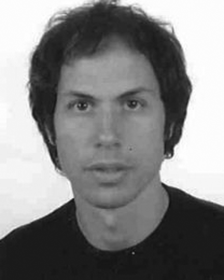 Vítor Sequeira合作论文数8Alvaro Casado-Coscolla合作论文数5
 Pierluigi Taddei合作论文数European Commission, Joint Research Centre (JRC),4
 Simone Ceriani合作论文数Politecnico di Milano;Department of Electronics and Information -;IIT Unit;Department of Electronics and Information -|IIT Unit, Politecnico di Milano2M. Murtezi合作论文数1Jiří Hradec合作论文数1Momchil Yordanov合作论文数1Melisande Cardona合作论文数1Antonio Puertas Gallardo合作论文数1
 Michail Papazoglou合作论文数1
 Valerio Lorini合作论文数Directorate Space Secur & Migrat1
 Riccardo Righi合作论文数European CommissionJoint Research Centre (JRC)SevilleSpain1
 Sofia Samoili合作论文数Disclaimer: The views expressed are purely those of the author and may not under any circumstances be regarded as stating an official position of the European1Montserrat López Cobo合作论文数1
 Luca Barbaglia合作论文数Corresponding author.1
 Raphael d'Andrimont合作论文数European Commiss Joint Res Ctr JRC1
 Filip Sabo合作论文数Arhs Dev SA, L-4370 Belvaux, Luxembourg1
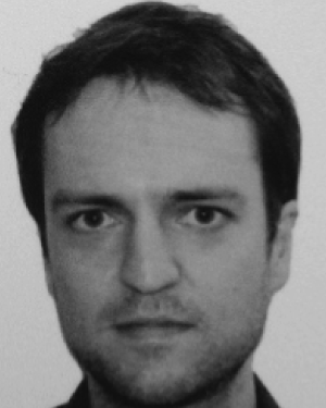 Ronan Hamon合作论文数1
 Laurent Beslay合作论文数1
 Clemens Wittwehr合作论文数1
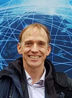 Pierre Soille合作论文数Joint Research Centre, European Commission1
 Carlos Castillo (ChaTo)合作论文数Departament d'Enginyeria, Universitat Pompeu Fabra;Institució Catalana de Recerca i Estudis Avançats1
 Pasquale Ferrara合作论文数CNR INO1
 Igor Nai Fovino合作论文数Joint Research Centre1Elisa Tosetti合作论文数Brunel University1
 Sergio Consoli合作论文数School of Information Systems, Computing and Mathematics, Brunel University1Sebastiano Manzan合作论文数Department of Economics, University of Leicester1
 Vasileios Syrris合作论文数1
 Emilia Gómez合作论文数SHE, Fundación1Giuditta De Prato合作论文数1
 Songül Tolan合作论文数Joint Research Centre, European Commission1
 Henrik Junklewitz合作论文数Institute for Astrophysics1
 Guido Lemoine合作论文数1
 Blagoj Delipetrev合作论文数1Susanne Bremer合作论文数1
 Milan Kalas合作论文数Institute for Environment and Sustainability, European Commission DG Joint Research Centre1
 Francesco Dottori合作论文数Dipartimento di Scienze1
 Peter Salamon合作论文数1
 Nativi Stefano合作论文数Ministry of Foreign Affairs and Foreign Trade;CNR - Institute of Atmospheric Pollution Research1
 Fernando Martínez Plumed合作论文数Joint Research Centre;Technical University of Valencia1
 Mauro Petrillo合作论文数CEINGE Biotecnologie Avanzate scarl, Via Comunale Margherita 482, 80145 Napoli, Italy;DBBM Dipartimento di Biochimica e Biotecnologie Mediche, Universita' di Napoli FEDERICO II;Dipartimento di Biochimica e Biotecnologie Mediche, Universita' di Napoli FEDERICO II1
 Marijn van der Velde合作论文数IIASA1




