We present a robust Global Matching technique focused on 3D mapping applications using laser range-finders. Our approach works under the assumption that places can be recognized by analyzing the projection of the observed points along the gravity direction. Relative poses between pairs of 3D point clouds are estimated by aligning their 2D projective representations and benefiting from the corresponding dimensional reduction. We present the complete processing pipeline for two different applications that use the global matcher as a core component: First, the global matcher is used for the registration of static scan sets where no a-priori information of the relative poses is available. It is combined with an effective procedure for validating the matches that exploits the implicit empty space information associated to single acquisitions. In the second use case, the global matcher is used for the loop detection required for 3D SLAM applications. We use an Extended Kalman Filter to obtain a belief of the map poses, which allows to validate matches and to execute hierarchical overlap tests, which reduce the number of potential matches to be evaluated. Additionally, the global matcher is combined with a fast local technique. In both use cases, the global reconstruction problem is modeled as a sparse graph, where scan poses (nodes) are connected through matches (edges). The graph structure allows formulating a sparse global optimization problem that optimizes scan poses, considering simultaneously all accepted matches. Our approach is being used in production systems and has been successfully evaluated on several real and publicly available datasets.
We present a robust Global Registration technique focused on environment survey applications using laser range-finders. Our approach works under the assumption that places can be recognized by analyzing the projection of the observed points along the gravity direction. Candidate 3D matches are estimated by aligning the 2D projective representations of the acquired scans, and benefiting from the corresponding dimensional reduction. Each single candidate match is then validated exploiting the implicit empty space information associated to scans. The global reconstruction problem is modeled as a directed graph, where scan poses (nodes) are connected through matches (edges). This is exploited to compute local matches (instead of global ones) between pairs of scans that are in the same reference frame. As a consequence, both performance and recall ratio increase w.r.t. using only global matches. Additionally, the graph structure allows formulating a sparse global optimization problem that optimizes scan poses, considering simultaneously all accepted matches. Our approach is being used in production systems and has been successfully evaluated on several real datasets.
•We face the ego-motion estimation and localization in known large environments.•A portable 3D sensor is used to solve the place recognition and tracking problems.•An efficient search space reduction technique is proposed.•Global localization is addressed using a robust place recognizer.•A tracking algorithm is introduced to update the sensor pose as it moves.
Precise 3D mapping and 6DOF trajectory estimation using exteroceptive sensors are key problems in many fields. Real-time moving laser sensors gained popularity due to their precise depth measurements, high frame rate and large field of view. We propose an optimization framework for Simultaneous Localization And Mapping that properly models the acquisition process in a scanning-while-moving scenario. Each measurement is correctly reprojected in the map reference frame by considering a continuous time trajectory which is defined as the linear interpolation of a discrete set of control poses in SE3. The trajectory estimation is performed using the sensor readings only, i.e., no external motion measurement units are used. An efficient data structure that makes use of a hybrid sparse voxelized representation for large map management allows to perform global optimization over trajectories, resetting the accumulated drift when loops are detected. We experimentally show that such framework improves localization and mapping w.r.t. solutions that compensate the distortion effects without including them in the optimization step. Moreover, we show that the proposed map structure provides linear or constant time operations w.r.t. the map size in order to perform real time SLAM and it can handle very large maps.
Simultaneous Localization and Mapping (SLAM) has received quite a lot of attention in the last decades because of its relevance for many applications centered on a mobile observer, such as service robotics and intelligent transportation systems. This paper focuses on the use of recursive Bayesian filtering, as implemented by the Extendend Kalman Filter (EKF), to face the Visual SLAM problem, i.e., when using data from visual sources. In Monocular SLAM, which uses a single camera as unique source of information, it is not possible to directly estimate the depth of a feature from a single image. To handle the severely non-normal distribution representing such uncertainty, inverse parametrizations were developed, capable to deal with such uncertainty and still relying on Gaussian variables. In the paper, after an introduction to EKF-SLAM, we provide a review of different inverse parametrizations, and we introduce a novel proposal, the Framed Inverse Depth (FID) parametrization, which, in terms of consistency, performs similarly to state of the art Monocular SLAM parametrizations, but at a reduced computational cost. All these parametrizations can be used in a stereo and multi camera setting too. An extensive analysis is presented for both Monocular and stereo SLAM, for a simulated environment widely used in the literature as well as on a widely used real dataset.
We describe a method to identify ambiguous poses during tracking and localization based on depth sensors. In particular we distinguish between ambiguities related to specific acquisitions (track ambiguities) that hinder a good registration of the current pose with previous acquisitions and ambiguities related to repetitive elements observed in a particular (known) environment visited (map ambiguities). We propose a measure of both types of ambiguities to scale tracking and localization problems to large environments and to obtain more accurate results. We also propose a two level classifier that firstly labels an input observation as ambiguous or not, and then provides a prediction of candidate poses from the subset of unambiguous ones. We show that by identifying such poses, real time SLAM systems can reduce processing time in the real-time relocalization step. Furthermore, it permits the generation of more compact, highly-discriminative relocalization classifiers. We combine these proposals and use them as a proof of concept. Our preliminary results on real datasets justify the integration in SLAM or Ego-Motion pipelines of such concepts.
The purpose of this chapter is twofold: on one hand, it aims at defining a clear framework for the design and implementation of autonomous wheelchairs, highlighting the main challenges; on the other hand, it presents a complete and working system of such type, called LURCH. This incorporates technology from autonomous robotics, and interacts with its user through a multi-modal user interface, including joystick, touch screen, electromyographic control, or brain-computer interface. If required, other input methods and controllers can be seamlessly integrated. The result is an autonomous wheelchair capable of supporting user mobility while adapting its level of autonomy both to the abilities and to the requirements of the user. Moreover, the capabilities of such a system (in terms of perception, data processing, user interface, communication) open the way to novel modes of interaction between environment and wheelchair users, really making the latter differently able, i.e., endowing them with abilities that walking people cannot access without special equipment.
The LURCH project aims at the development of an autonomous wheelchair capable of avoiding obstacles, selflocalize and explore indoor environments in a safe way. To meet disabled people requirements, we have designed the user interface to the autonomous wheelchair in such a way that it can be simply modified and adapted to the users needs. In particular, the user has the opportunity to choose among several autonomy levels (from simple obstacle avoidance to complete autonomous navigation) and different interfaces: a classical joystick, a touch-screen, an electro miographic interface, and a brain-computer interface (BCI), i.e., a system that allows the user to convey intentions by analyzing brain signals.
In the last years, the Monocular SLAM problem was widely studied, to allow the simultaneous reconstruction of the environment and the localization of the observer, by using a single camera. As for other SLAM problems, a frequently used feature for the representation of the world, is the 3D point. Differently from other SLAM problems, because of the perspective model of the camera, in Monocular SLAM, features cannot be completely perceived and initialized from a single measurement. To solve this issue, different parameterizations have been proposed in the literature, which try to solve also another problem in Monocular SLAM, i.e., the distortion of the Gaussian uncertainty in depth estimation that takes place because of the nonlinear measurement model. In this paper, we start from recent results in consistency analysis for these parameterizations to propose a novel approach to improve EKF-based Monocular SLAM even further. Our claims are sustained by an extended validation on simulated and real data.
Robotic systems require significant interaction and coordination of hardware and software elements. In the context of software engineering, the concept of middleware earned a very strong role in the entire software development process. In robotic applications the use of a middleware can help improving the organization, the maintainability and the efficiency of the code that controls the robot. In this work we want to give an overview of the most used middleware frameworks for robotics, identifying the common basic concepts and goals and highlighting the lacks, in our opinion, of the current projects. We also propose a different view of a robotic system, as a distributed system of cooperating devices, that needs an approach different from the one used in computer science, from which the concept of middleware
The aim of this research consists in the development of an autonomous wheelchair capable to avoid obstacles, self-localize and explore indoor environments in a safe way. To meet disabled people requirements, we have designed the user interface to the autonomous wheelchair in such a way that it can be simply modified and adapted to the users needs. In particular, the user has the opportunity to choose among several autonomy levels (from simple obstacle avoidance to complete autonomous navigation) and different interfaces: a classical joystick, a touch-screen, an electro miographic interface, and a brain-computer interface (BCI), i.e. a system that allows the user to convey her intention by analyzing her brain signals.
A trustable and accurate ground truth is a key requirement for benchmarking self-localization and mapping algorithms; on the other hand, collection of ground truth is a complex and daunting task, and its validation is a challenging issue. In this paper we propose two techniques for indoor ground truth collection, developed in the framework of the European project Rawseeds, which are mutually independent and also independent on the sensors onboard the robot. These techniques are based, respectively, on a network of fixed cameras, and on a network of fixed laser scanners. We show how these systems are implemented and deployed, and, most importantly, we evaluate their performance; moreover, we investigate the possible fusion of their outputs.
This paper makes a contribution to the field of autonomous vehicles, especially for use on assistive wheelchairs. The aim of our work consists in the development of a low-cost autonomous wheelchair able to avoid obstacles, selflocalize and explore closed environments in a safe way. In order to meet disabled people’s requirements, we have designed our system in such a way that it can be simply modified and adapted to the users’ needs. In particular, the user has the opportunity to choose among several autonomy levels and three different interfaces: a joystick, a touch-screen and a brain-computer interface (BCI). A BCI is a system that allows users to convey their intention by analyzing their brain signals.
3D laser scanning is an established verification technology in nuclear safeguards, applied inter alia for Design Information/Basic Technical Characteristics Verification (DIV/BTC) and change monitoring in nuclear facilities. Current systems are based on high-accuracy, high-resolution 3D laser scanners which require one minute or more to acquire a single scan. Therefore, the scanners need to be immobile during data acquisition. In order to cover the complete scene, several scans are acquired in a so-called ‘stop-and-go’ mode, which are then registered into a single coordinate frame in an offline post-processing phase. Recently, new 3D laser scanners with a significantly increased acquisition speed have emerged. They acquire 3D scans at a frame rate of 10Hz and more at the cost of reduced accuracy and resolution – and thus enable the scanner to be mobile during acquisition, i.e. the data can be acquired while walking or driving. Mobile laser scanning can significantly increase the efficiency of existing safeguards applications for 3D laser scanning, i.e. DIV/BTC and change monitoring. Furthermore, by registering each scan with a reference model (which can either be generated a priori or while scanning), it is possible to compute the current position and track the movement of the scanner. Hence, mobile laser scanning with real-time data processing provides indoor positioning capability to nuclear inspectors during their field work. It enables all observations and measurements to be connected with their respective location and time stamps and to retrieve location-based information as required. The paper presents the Mobile Laser Scanning Platform (MLSP) developed at the JRC, which consists of a commercial mobile scanner, the processing unit and the proprietary software for real-time processing and visualization. The system will be illustrated using two test cases: a DIV/BTC scenario for the future Finnish underground repository (ONKALO) and indoor localization. URI: https://esarda.jrc.ec.europa.eu/images/Bulletin/Files/B_2015_053.pdf [1] Authors: WOLFART Erik CERIANI Simone PUIG ALCORIZA David SANCHEZ BELENGUER Carlos TADDEI Pierluigi SEQUEIRA Vitor MURTEZI M. TURZAK Peter ZEIN A. ENKHJIN Luvsantseren INGEGNENI M. ROCCHI Simone YUDIN Y. Publication Year: 2015 Science Areas: Nuclear safety and security [2]
 Pierluigi Taddei合作论文数European Commission, Joint Research Centre (JRC),8
 Matteo Matteucci合作论文数Department of Electronics Information and Bioengineering, Politecnico di Milano7
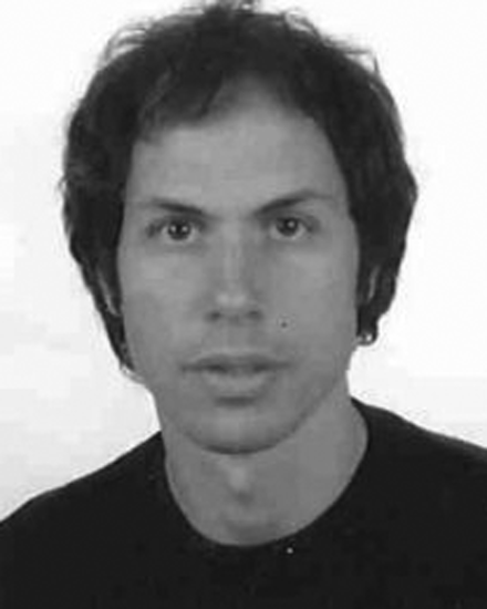 Vítor Sequeira合作论文数7
 Erik Wolfart合作论文数6
 Carlos Zorro Sánchez合作论文数4
 Giulio Fontana合作论文数Politecnico di Milano;Department of Electronics and Information -;IIT Unit;Department of Electronics and Information -|IIT Unit, Politecnico di Milano4
 Davide Migliore合作论文数Tempo Sense3Daniele Marzorati合作论文数3
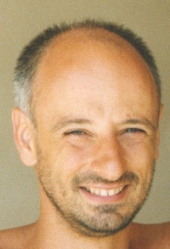 Domenico G. Sorrenti合作论文数Dip. Informatica, Sistemistica e Comunicazione of Universita di Milano - Bicocca3
 Andrea Bonarini合作论文数Polytechnic University of Milan,Department of Electronics, Information and Bioengineering3Carlos Sánchez Belenguer合作论文数Joint Research Centre (JRC),European Commission,Ispra (VA),Italy,27492M. Murtezi合作论文数1Antonio L. Rodriguez合作论文数1
 Alessandro Giusti合作论文数Dipartimento Tecnologie Innovative, University of Applied Sciences and Arts of Southern Switzerland;Dalle Molle Institute for Artificial Intelligence, USI-SUPSI1
 Mainardi Luca合作论文数Department of Electronics, Information and Bioengineering, Politecnico di Milano1Rossella Blatt合作论文数IIT Unit Artificial Intelligence and Robotics Laboratory AIRLab, Politecnico di Milano1
 Martino Migliavacca合作论文数1Davide Rizzi合作论文数1Bernardo Dal Seno合作论文数1




