Symmetrical wave ripples identified with NASA’s Curiosity rover in ancient lake deposits at Gale crater provide a key paleoclimate constraint for early Mars: At the time of ripple formation, climate conditions must have supported ice-free liquid water on the surface of Mars. These features are the most definitive examples of wave ripples on another planet. The ripples occur in two stratigraphic intervals within the orbitally defined Layered Sulfate Unit: a thin but laterally extensive unit at the base of the Amapari member of the Mirador formation, and a sandstone lens within the Contigo member of the Mirador formation. In both locations, the ripples have an average wavelength of ~4.5 centimeters. Internal laminae and ripple morphology show an architecture common in wave-influenced environments where wind-generated surface gravity waves mobilize bottom sediment in oscillatory flows. Their presence suggests formation in a shallow-water (<2 meters) setting that was open to the atmosphere, which requires atmospheric conditions that allow stable surface water.
Sulfate minerals are an integral component of the martian surface and understanding the formation and alteration of these minerals provides clues about their geochemical environment. One sulfate phase in particular has been intriguing Mars scientists for over 15 years. An unusual spectral band at 2.236 µm was discovered in CRISM spectra of Mars at the plateau bordering Juventae Chasma [1] and in Aram Chaos [2]. This spectral band does not line up with any known minerals, but is observed for FeSO4OH, a new mineral formed by heating hydrated iron sulfates [3]. Crystal structure diagrams indicate that FeSO4OH has a structure similar to that of szomolnokite (FeSO4•H2O), but with OH replacing H2O [4]. Experiments heating szomolnokite, rozenite, and melanterite in the lab resulted in production of some FeSO4OH at 150 °C from rozenite and melanterite after 30 minutes and complete transformation at 200 °C after 30 minutes, while reaction of szomolnokite required longer heating at 200 °C and/or elevated temperatures for transformation to FeSO4OH. Additional lab experiments also demonstrate that oxygen is required for reaction of these hydrated ferrous sulfates to form FeSO4OH [4].Application of FeSO4OH spectra to Mars has benefitted from improved processing techniques [5] and mapping algorithms [6] for CRISM images that has enabled characterization of smaller spot sizes with cleaner spectra. Exposures of this unusual ferric sulfate phase with spectral features near 2.23 µm at Aram Chaos closely resemble pure FeSO4OH formed in the lab, while the thinner units on the Juventae plateau are either mixed with other components or represent incompletely formed FeSO4OH phases. This Fe hydroxysulfate is currently associated with monohydrated sulfate (MHS) outcrops at Aram Chaos, although polyhydrated sulfate (PHS) outcrops are also present nearby. In contrast, only PHS outcrops are currently observed on the Juventae plateau.CRISM spectra with a spectral band at 2.225-2.238 µm were observed at several locations at Aram Chaos. The spectra of these units also contain accompanying features at 1.48, 1.82, 2.19, and 2.37 µm (Fig. 1). Small variations in the ~2.23 µm band are attributed to changes in the Fe-Mg chemistry. Pure FeSO4OH has a band at 2.236 µm, while heated FeMg-MHS has a band at 2.226 µm. The FeSO4OH units at Aram Chaos are typically found adjacent to MHS outcrops (Fig. 2), including both Fe-rich MHS (similar to szomolnokite) with bands near 2.11-2.12 and 2.40 µm and kieserite (MgSO4•H20) with spectral bands near 2.14 and 2.41 µm. Spectra of szomolnokite and kieserite measured at colder, Mars-like temperatures have bands at ~2.11 and 2.14 µm [7], similar to these observations. The MHS spectral units more consistent with kieserite are darker than the szomolnokite-like MHS units and are covered by debris and ripples (Fig. 2C). Some of the MHS units at Aram Chaos may have formerly been mixtures of szomolnokite and kieserite, where the szomolnokite transformed to FeSO4OH and the kieserite remained. Alternatively, polyhydrated Fe and Mg sulfates may have been present that altered to form FeSO4OH, szomolnokite, and kieserite, depending on variations in the geochemistry. The reaction to form FeSO4OH proceeds as Fe2+ in szomolnokite is oxidized to Fe3+ while the H2O loses a proton to form OH. Some of the MHS outcrops include weak bands near 2.23 µm, indicating partial alteration to form a mixed phase containing some MHS and some FeSO4OH (Fig. 3). The PHS spectra contain bands near 1.44 and 1.93-1.95 µm and a drop in reflectance near 2.42 µm (Fig. 3), similar to spectra of rozenite (FeSO4•4H20) and starkeyite (MgSO4•4H20).Spectra at the Juventae plateau were collected from thin light-toned layered deposits, including spectral signatures due to PHS and FeSO4OH, and pyroxene-bearing units (Figs. 3-4). The stratigraphy of the outcrops shows a pyroxene-bearing substrate below the light-toned layered materials and a different pyroxene-bearing caprock unit covering the Fe sulfates (Fig. 4). Thin units containing spectral features consistent with PHS (blue) and FeSO4OH (red) are observed, and some of these thin units include spectral features due to both materials. Morphologies of these primary four units are displayed in Fig. 5. The pyroxene bearing substrate (dark cyan) is flatter with extensive polygonal fracturing, whereas the pyroxene-bearing caprock (green) is partially covered by ripples and appears hilly and uneven in topography due to differential erosion. The textures of the PHS- and FeSO4OH-bearing units are distinct from those of the pyroxene-bearing units, but appear related to each other with fine-scale layering that varies in brightness, color, and fracturing.The presence of highly pure FeSO4OH outcrops neighboring MHS at Aram Chaos and less pure outcrops of FeSO4OH neighboring PHS on the plateau NW of Juventae Chasma indicate an active geochemical history in Mars’ past. The hydrated sulfates likely formed in evaporative environments, while the FeSO4OH likely formed through heating. The FeSO4OH-bearing units at the Juventaue plateau could be mixed with spectrally neutral components that dilute the FeSO4OH spectral features. Coordinated characterization of the near-infrared (NIR) and mid-IR spectral features of Fe sulfates (Fig. 6) is enabling a better understanding of the spectral features due to FeSO4OH in these intriguing outcrops on Mars.Acknowledgements: The authors are grateful for support from NASA MDAP #80NSSC21K1103, NASA SSW #80NSSC23K0032, Austrian Science Fund FWF #P34227-N, and Europlanet Transnational Access funds.References: [1] Bishop J.L. et al. (2009) Mineralogy of Juventae Chasma…, JGR, 114, doi:10.1029/2009JE003352. [2] Lichtenberg K. A. et al. (2010) Stratigraphy of hydrated sulfates in the sedimentary deposits of Aram Chaos, Mars, JGR, 115, doi:10.1029/2009JE003353. [3] Bishop J. L. et al. (2024) Characterizing the spectral properties of a new FeSO4OH phase observed on Mars, LPSC, #1880. [4] Meusburger J. M. et al. (2024) Ferric hydroxysulfate on Mars and its formation from ferrous sulfate hydrates, 10th Mars Conference. [5] Itoh Y. & M. Parente (2021) A new method for atmospheric correction and de-noising of CRISM data, Icarus, 354, 114024. [6] Saranathan A.M. & M. Parente (2021) Adversarial feature learning for improved mineral mapping of CRISM data, Icarus, 355, 114107. [7] Yeşilbaş M. et al. (2024) Low-temperature reflectance spectra of szomolnokite and applications for their detection on Mars, LPSC, #2035.
First posted January 5, 2023 For additional information, contact: Astrogeology Science CenterU.S. Geological Survey2255 N. Gemini Dr.Flagstaff, AZ 86001 Xanthe Terra is a high-standing cratered plain located southeast of Lunae Planum and south of Chryse Planitia in the western equatorial region of Mars. It contains landforms shaped by diverse geologic processes, including various scales of channels and valleys, chaotic terrains, delta fan deposits, and landslides. An extensive outflow channel system is located within Xanthe Terra and the surrounding circum-Chryse region, including Shalbatana and Ravi Valles, thought to have formed by catastrophic flooding during the Hesperian to Amazonian Periods. The study region within Xanthe Terra is defined by Mars Transverse Mercator (MTM) quadrangles 00042 and 00047 (2.5° to −2.5° N, 310° to 320° E) and includes Orson Welles crater (124.5 km diameter, the source region for Shalbatana Vallis), the southernmost portion of Shalbatana Vallis, Aromatum Chaos (the source region for Ravi Vallis), the westernmost portion of Ravi Vallis, and the source area of Nanedi Valles. The Mars Odyssey Thermal Emission Image System (THEMIS) IR daytime mosaic (100 m/pixel) was used as the primary base map. We constructed the geologic map of the source region of Shalbatana Vallis at 1:750,000 scale. We defined 16 geologic units in the map area, which we divided into the following groups: plains units, channel units, crater units, chaos units, flow units, and surficial units. Mapped linear features include ridge crests, scarp crests, channels, crests of crater rims, crests of buried or degraded crater rims, graben traces, grooves, troughs, and faults. Surface features include secondary crater chains and dark ejecta material. The geologic history of the map region can be summarized as follows. During the Noachian Period, ancient highland materials in the Xanthe Terra region, including lava and any ancient sedimentary units present, were reworked by impacts during the heavy bombardment. In particular, the impact that formed a basin that later underwent widespread resurfacing, likely as a combination of lava flows, reworked crater materials, and sedimentary deposits resulting in the flat-lying, smooth plains of Chryse Planitia. The Hesperian Period was characterized by the impact that formed Orson Welles crater and the subsequent formation of Shalbatana Vallis, as well as Aromatum Chaos and Ravi Vallis. During this period, depressions were filled with smooth material that was subsequently modified by collapse, subsidence, and flooding. Water filled and overflowed the tops of Orson Welles crater and other depressions. The Amazonian Period was characterized by ongoing collapse, as well as the formation of flow and surficial materials, including a lava flow that extends from Aromatum Chaos.
Earth and Space Science Open Archive This preprint has been submitted to and is under consideration at Journal of Geophysical Research - Planets. ESSOAr is a venue for early communication or feedback before peer review. Data may be preliminary.Learn more about preprints preprintOpen AccessYou are viewing the latest version by default [v1]Orbital and In-Situ Investigation of the Bagnold Dunes and Sands of Forvie, Gale Crater, MarsAuthorsEleanor LouiseMorelandRaymond E.ArvidsonRichard V.MorrisThomasCondusMadison NicoleHughesCatherine M.WeitziDScott J.VanBommelSee all authors Eleanor Louise MorelandCorresponding Author• Submitting AuthorRice Universityview email addressThe email was not providedcopy email addressRaymond E. ArvidsonWashington University in St. Louisview email addressThe email was not providedcopy email addressRichard V. MorrisNASA Johnson Space Centerview email addressThe email was not providedcopy email addressThomas CondusWashington University in St. Louisview email addressThe email was not providedcopy email addressMadison Nicole HughesWashington University in St. Louisview email addressThe email was not providedcopy email addressCatherine M. WeitziDPlanetary Science InstituteiDhttps://orcid.org/0000-0002-4646-0825view email addressThe email was not providedcopy email addressScott J. VanBommelWashington University in St. Louisview email addressThe email was not providedcopy email address
A dark‐toned, indurated, smooth horizon, and (or) bed (herein called “marker horizon”) is exposed across much of the northwestern, southwestern, and southeastern portions of Mount Sharp in Gale crater. Compact Reconnaissance Imaging Spectrometer for Mars spectra taken from the marker horizon exhibit evidence for the presence of high calcium pyroxene and other basaltic minerals in contrast to the hydrated sulfate signatures associated with strata above and below it. Mean dips for the marker horizon and sulfate‐bearing strata are 1–5° with almost all azimuths radially away from the center of Mount Sharp. The marker horizon thickness varies between <1 and 3 m and its elevation changes by 1.6 km across the mound. Surface slopes along the sulfate‐bearing strata above and below the marker horizon are typically 20°–40° compared to <5° surface slopes on the marker horizon. Features observed on the marker horizon include ridges, fractures, faults, layering, oval depressions, small craters, and possible yardangs/indurated bedforms. We interpret the marker horizon to be a single unit that formed contemporaneously across Mount Sharp during the same depositional sequence that created the sulfate‐bearing strata. Plausible formation mechanisms for the marker horizon include (1) emplacement of a more indurated sulfate unit, either from (a) primary deposition or (b) secondary diagenesis; (2) deposition of a more resistant sandstone unit during a brief drier period; (3) emplacement of a volcanic ash deposit laid down in the midst of the sulfate formation period; or (4) a lag deposit created during a drier period. Based on our observations, origins (1a) and (3) are the most plausible.
How to build a legacy of scientific leadership: the HR formula PROF. JULIA HAMMER, PHD1, LESLIE BAKER2, JENNI BARCLAY3, MICHAEL R. CARROLL4, MICHELLE COOMBS5, ELIZABETH COTTRELL6, NICHOLAS J DYGERT7, LINDA ELKINS-TANTON8, EMILY FIRST9, JAMES GARDNER10, DAVID GOLDSBY11, JAMES GREENWOOD12, MARIE JOHNSON13, MIKE KRAWCZYNSKI14, CHARLES MANDEVILLE15, MOLLY MCCANTA16, MICHELLE E. MINITTI17, WILLIAM NELSON18, TABB PRISSEL19, DINA VENEZKY20, CATHERINE WEITZ21 AND DIANE WOODRUFF22 1University of Hawaiʻi 2University of Idaho 3University of East Anglia 4Camerino University 5U.S. Geological Survey 6National Museum of Natural History, Smithsonian Institution 7University of Tennessee, Knoxville 8Arizona State University 9Cornell University 10University of Texas at Austin 11University of Pennsylvania 12Wesleyan University 13Cal State Fullerton 14Washington University in St. Louis 15US Geological Survey 16University of Tennessee at Knoxville 17Framework, Silver Spring 18University of Hawaii at Manoa 19NASA 20Smith College 21Planetary Science Institute 22Anadarko Petroleum Company Presenting Author: jhammer@hawaii.edu
Aeolian features on Venus include dune fields, eroded hills (yardangs), wind streaks, (miniature dunes of 10 to 30 cm wavelength). Although and possibly microdunes (in repetitive imaging by Magellan did show changes in the appearance of the surface, these changes are attributed to radar artifacts as a consequence of look direction rather than to physical changes of the surface. Nonetheless, measurements of wind speeds near the surface of Venus and wind tunnel simulations suggest that aeolian processes could be currently active on Venus. Study of radar images of terrestrial analogs shows that radar wavelength, polarization, and viewing geometry, including look direction and incidence angle, all influence the detection of dunes, yardangs, and wind streaks. For best detection, dune crests and yardangs should be oriented perpendicular to look direction. Longer wavelength systems can penetrate sand sheets a meter or more thick, rendering them invisible, especially in arid regions. For wind streaks to be visible, there must be a contrast in surface properties between the streak and the background on which it occurs. Nonetheless, more than 6000 aeolian features have been found on Magellan images of Venus, the most common of which are various wind streaks. Mapping wind streak orientations enables near-surface wind patterns to be inferred for the time of their formation. Type P streaks are associated with parabolic ejecta crater deposits and are considered to have formed in association with the impact event. Most Type P streaks are oriented westward, indicative of the upper altitude superrotation winds of Venus. Non Type P streaks have occurrences and orientations consistent with Hadley circulation. Some streaks in the southern hemisphere are oriented to the northeast, suggesting a Coriolis effect.
This study reports on the physical properties and geochemistry of aeolian bedform grains along the Curiosity rover traverse in Gale crater from Vera Rubin Ridge to the Sands of Forvie (Sols 1902–2995), and includes comparisons to results made earlier in the mission. Volumetrically, <150 μm grains dominate active aeolian bedforms in the study area, similar to previous findings elsewhere at Gale crater and at other locations on Mars. Coarser grains, up to 2.9 mm long, are present on larger active bedforms. The larger 1–3 mm active grains commonly are reddish or whitish in color and irregular in shape, suggesting erosion of local bedrock as sources. One inactive megaripple had a surface of dust‐covered 2–15 mm grains, with smaller <150 μm grains between and within the bedform interior. Geochemical measurements show element concentrations vary according to position on the bedform, sand activity, and grain contributions from local bedrock. A strong positive correlation between Mg and Ni is identified on active bedform surfaces, with the highest Ni always corresponding to ripple crests where the coarsest gray and clear grains were commonly found. There is also a correlation between Ti and Cr for the majority of active sands, with the finer active sands in ripple troughs and sand patches having the greatest number of red grains and highest Cr concentrations. These results show the smaller scale physical properties and geochemistry of several types of aeolian bedforms on Mars formed under current and ancient environments.
 John A. Grant合作论文数Center for Earth and Planetary Studies;National Air and Space;Smithsonian Institution;Center for Earth and Planetary Studies, Smithsonian Institution48
 Raymond E. Arvidson合作论文数Department of Earth, Environmental, and Planetary Sciences, College of Arts & Sciences, Washington University in St. Louis;NASA36
 Matthew P Golombek合作论文数34
 Janice Bishop合作论文数Carl Sagan Center, SETI Institute27
 John Grotzinger合作论文数Division of Geological and Planetary Sciences, California Institute of Technology24
 Ronald Greeley合作论文数Ronald Greeley Center for Planetary Studies, Arizona State University;School of Earth and Space Exploration, Arizona State University22
 Steven W Squyres合作论文数Blue Origin21
 Ralph E Milliken合作论文数Department of Earth, Environmental & Planetary Sciences, Brown University;NASA Reflectance Experiment Laboratory21
 Constantinos Charalambous合作论文数Imperial Coll London, Dept Elect & Elect Engn, London, England18
 Nicholas H. Warner合作论文数Department of Geological, Environmental, and Planetary Sciences, State University of New York at Geneseo;National Aeronautics and Space Administration18
 Sharon A. Wilson合作论文数Center for Earth and Planetary Studies, Smithsonian Institution18
 Jim Bell合作论文数School Of Earth and Space Exploration, Arizona State University;MILO Space Science Institute;Department of Astronomy, Cornell University17
 James W Head合作论文数Department of Earth, Environmental and Planetary Sciences, Brown University17
 Rebecca Williams合作论文数Malin Space Science Systems, Inc.17
 Ernst Hauber合作论文数17
 Nathan Williams合作论文数Cytiva16
 Scott Murchie合作论文数Applied Physics Laboratory, The Johns Hopkins University16
 Kevin Lewis合作论文数Department of Earth and Planetary Sciencesm, Krieger School of Arts & Sciences, Johns Hopkins University15
 R. Aileen Yingst合作论文数Planetary Science Institute15
 Nathan Bridges合作论文数Applied Physics Laboratory, Johns Hopkins University;Department of Earth and Planetary Sciences, Johns Hopkins University15t j parker合作论文数14Alyssa DeMott合作论文数14
 A. R. Vasavada合作论文数14
 Alfred McEwen合作论文数Lunar & Planetary Laboratory, College of Science, The University of Arizona14
 William Farrand合作论文数Space Science Institute14
 Michael P. Lamb合作论文数Division of Geological and Planetary Sciences, California Institute of Technology13
 Tom Pike合作论文数Optical and Semiconductor Devices, Department of Electrical and Electronic Engineering, Faculty of Engineering, Imperial College London13
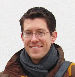 Bradley James Thomson合作论文数Johns Hopkins University Applied Physics Laboratory13v ansan合作论文数12Megan Kopp合作论文数12
 John Mustard合作论文数Department of Earth, Environmental & Planetary Sciences, Brown University12
 Bethany Ehlmann合作论文数Division of Geological and Planetary Sciences, California Institute of Technology;College of Arts and Sciences, University of Colorado Boulder12
 Wendy M Calvin合作论文数Department of Geological Sciences and Engineering, College of Science, University of Nevada, Reno12Mariah R. Baker合作论文数Department of Molecular Physiology and Biophysics, Baylor College of Medicine12Leah H. Roach合作论文数11
 R. Stephen Saunders合作论文数Jea Prcp sian Laborctorr11Maria E. Banks合作论文数11David M Rubin合作论文数Department of Earth & Planetary Sciences, Division of Physical & Biological Sciences, University of California, Santa Cruz11Michelle E. Minitti合作论文数10J. M. Davis合作论文数10
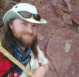 Alexander B. Bryk合作论文数University of BerkeleyCalifornia10
 Edwin Kite合作论文数Department of the Geophysical Sciences, The University of Chicago;Astera Institute10
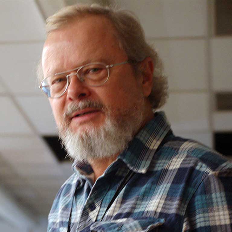 Juergen Schieber合作论文数Department of Geological Sciences, Indiana University;Department of Earth and Atmospheric Sciences, College of Arts & Sciences, Indiana University Bloomington10
 William Dietrich合作论文数Department of Earth and Planetary Science, University of California, Berkeley10Jeffrey J. Plaut合作论文数10
 Frank Seelos合作论文数Applied Physics Laboratory, The Johns Hopkins University10
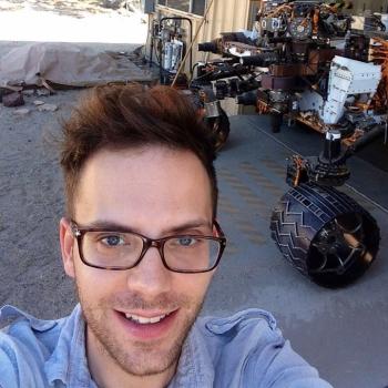 Mathieu Lapôtre合作论文数Department of Earth and Planetary Sciences, Doerr School of Sustainability, Stanford University;Earth and Planetary Surface Processes Lab, Doerr School of Sustainability, Stanford University9Sanjeev Gupta合作论文数Department of Earth Science and Engineering, Faculty of Engineering, Imperial College London9
 Kenneth E. Herkenhoff合作论文数9




