We present the scientific highlights and status from years 9-12 of NASA’s Mars Science Laboratory mission, with its Curiosity rover. A thermochemolysis-based sample analysis revealed a variety of organic molecules preserved in clay mineral-rich lake/lake margin deposits of the Glen Torridon region. The stratigraphically higher clay-sulfate mineral transition on Aeolis Mons was found to be associated with a lithological change from lacustrine to dry aeolian depositional environments. Water intermittently returned to the surface after the increase in aridity, including during the deposition of wave ripple strata which indicate a climate capable of sustaining an ice-free lake in the early Hesperian. The overlying Mg sulfate-bearing unit has both poly- and monohydrated Mg sulfates and is also enriched in iron carbonate of a purity consistent with chemical sedimentation and therefore atmospheric sequestration. A channel-incised canyon within Gediz Vallis and distal alluvial deposits recorded numerous fluvial and debris flow events after the deposition, lithification, and erosion of the clay- and sulfate-bearing units. Bright clasts found in Gediz Vallis canyon are composed of native sulfur. The investigation of the modern atmosphere and environment focused on the influence of the crater and mountain topography and captured high-altitude noctilucent and iridescent clouds. Radiation monitoring now spans an 11-year solar cycle. Rover systems and science instruments remain capable of addressing mission scientific objectives. All ten scientific instruments continue to return high-value data despite degradation of the Chemistry and Camera instrument’s high-voltage system, loss of multispectral imaging capability, and loss of active neutron spectroscopy. The mission has mitigated the loss of redundant brakes on two arm joints, additional wheel wear, and highly reduced capability of the redundant flight computer. Efficiency improvements in rover energy utilization and operations staffing have allowed the mission team to maintain a high level of productivity despite declining rover power generation and funding.
How the ancient climate of Mars transitioned to its current cold, hyperarid state is recorded by the sedimentary rocks preserved on its surface. Gale crater, the Curiosity rover landing site, is one such location, where the central mountain, Aeolis Mons, preserves an extensive sedimentary record. Curiosity has demonstrated that the Aeolis Mons succession comprises older, fluvio-lacustrine facies overlain by younger, aeolian facies, inferred to reflect a broad aridification trend. From orbit, multiple canyons and sediment fans are observed originating from Gale's crater rim and Aeolis Mons itself, suggesting regional, intermittent returns to wet conditions, late in the crater's history. Curiosity recently investigated Gediz Vallis, a canyon incised into Aeolis Mons, which contains a central ridge hypothesized to be a degraded alluvial fan. We use Curiosity's remote sensing suite to test this orbital hypothesis, by investigating the characterizing these canyon-filling, sedimentary deposits in an upslope region of Gediz Vallis, Arc Pass. Here, the rover conducted an extensive campaign and was able to resolve fine-scale sedimentary facies and textures. We find these deposits consist of transported breccias and conglomerates, and record multiple sediment transport processes, including debris flows and landslides, separated by episodes of aeolian erosion and in-situ alteration. The debris flow deposits, preserved as levees and channels, require the continued, but likely intermittent, surface water availability, during the exhumation phase of Aeolis Mons, late in the history of both Gale crater and Mars. The processes recorded here are likely to be representative of regional, paleoclimatic conditions across Gale crater.
Fractures in sedimentary rocks preserved within Gale crater record the deformational and burial history of the sediment infill. Fracture geometries and morphology can be used to time other geologic events, such as: compaction, diagenesis, fluid migration, geochemistry, and broader tectonic stresses within a basin. The rover Curiosity acquired images to construct 3D digital outcrop models used for characterization of fracture sets exposed in aeolian strata of the Mirador formation at Maria Gordon notch, identifying four distinct fracture sets. Three fracture sets formed during burial, and one during exhumation. The first group (Sets 1 and 2) consisted of bedding‐parallel and bedding‐bounded vertical fractures associated with early lithification and hydraulic fracturing of the rock as water escaped from isolated pores. Fracture Set 3—Vertical sulfate‐filled fractures—formed after a second episode of diagenesis, as water escaped from deeper within the sedimentary succession. The final fracture set is barren and associated with exhumation of the crater fill. Modeling burial stress suggests that Sets 1 and 2 would form at depths greater than 1 km. The tensile strength of the rocks is generally higher than anticipated due to the absence of shear fractures (faults). Fracture Sets 1–3 demonstrate dewatering of the strata during burial, which continued up until maximum burial at ∼4.7 km. This water was driven toward the surface, providing water for diagenesis and alteration reactions and could have reasonably extended the habitability window within Gale crater.
Gale crater, the landing site of NASA's Curiosity rover, and the mountain at its center, Aeolis Mons, hosts an extensive record of sedimentary rocks, which provide a window into the climate history of Mars. Curiosity has demonstrated that Gale hosted long-lived lakes early in its history, indicating warm, quiescent surface conditions, before transitioning into a period of heightened aridity. Recent investigations using orbital data have suggested that the surface of Mars was intermittently wet late in its history. However, an ongoing challenge is linking these orbital observations to on-ground investigations by rovers. Here we use combined orbital image and topographic data sets to investigate a series of sediment fans and related catchment regions within the wider Gale crater, and regional to Curiosity's exploration zone. These systems can be stratigraphically linked to the sedimentary rocks that Curiosity has investigated. We find that most of the sediment fans are likely alluvial fans, recording intermittent flow conditions, with deposition concentrated near the base of Aeolis Mons. The sediment fans are intermixed with landslide deposits and source canyons have been significantly backfilled. We find that these systems formed after regional geological units which Curiosity has shown to record periods of prolonged aridity. Our study demonstrates that intermittent surface water was likely to be present regionally with Gale crater during or after the exhumation of Aeolis Mons. Curiosity may be able to constrain the source and duration of these late-stage flow events as it ascends Aeolis Mons.
Wind abrasion is the dominant erosive process inferred from observations by Curiosity during its traverse in Gale crater, but how and how fast wind scours Mount Sharp is unclear. Here, we infer formative wind direction from ventifacts (wind-eroded rock fragments) measured from Curiosity's recent traverse. We compare these measurements to previous ones and to wind model predictions, and attempt to estimate the current rate of wind erosion near Curiosity's location on Mount Sharp. Ventifacts in this study indicate winds blowing south-southeast, agreeing with previous studies on the floor of Gale crater, but differing from studies at the base of the mountain slope. Upslope abrasive wind flows predominate, consistent with idealized models. At some sites, ventifacts are oriented both upslope and downslope on Mount Sharp, suggesting bimodal wind direction at the mountain, agreeing with circulation models that predict diurnal reversals. Using crater-retention age statistics at one site, we estimate a - 3.5 +/- 0.8 mu m/Earth year (yr) upslope horizontal erosion rate at Mount Sharp. We suggest the observed ventifacts formed when Mars' obliquity and climate regime were similar to those in the present day.
Relatively pristine valley segments along medial-to-distal Samara Valles in Margaritifer Terra likely originate within the continuous ejecta west of the Late-Hesperian Jones impact crater. Valley expression between a - 46 km3 upper basin and a - 7 km3 lower basin is typically well-incised with smooth walls and a relatively uniform width-to-depth, but elsewhere varies from well-incised to diffuse and some segments appear anastomosing or truncate one another. Many are more than a kilometer across and 100 s of meters deep and display interior terraces and depositional forms. More pristine segments continue north and are associated with finely layered, alternating dark- and light-toned deposits well beyond Jones ejecta. Basins are approximately bound by the -1275 m MOLA contour and the upper basin displays benches and partially filled craters near and below that elevation. Lower interior surfaces of the upper basin are not incised, expose relatively light-toned discontinuous deposits, include polygonal fractures, and are locally Mg/Fe phyllosilicate-bearing. We interpret the formation of the relatively pristine segments as the result of water from impact-melted ice in and under the Jones ejecta draining westward, with some filling the upper basin. Water accumulated over a period of months to years before overtopping the divide and draining at rates perhaps on order of 104 m3s- 1 before filling and overwhelming the lower basin and breaching two additional local divides. Drainage persisted for a period of years at most and then ceased. If correct, our model indicates a geologically brief interval of transient potentially habitable environments relatively late in Mars history that was likely unrelated to global climate.
The Mars Reconnaissance Orbiter has been orbiting Mars since 2006 and has acquired >80,000 HiRISE images with sub-meter resolution, contributing to over 2000 peer-reviewed publications, and has provided the data needed to enable safe surface landings in key locations by several rovers or landers. This paper describes the changes to science planning, data processing, and analysis tools since the initial Primary Science Phase in 2006-2008. These changes affect the data used or requested by the community and how they should interpret the data. There have been a variety of complications to the dataset over the years, such as gaps in monitoring due to spacecraft and instrument issues and special events like the arrival of new landers or rovers on Mars or global dust storms. The HiRISE optics have performed well except for a period when temperature uniformity was perturbed, reducing the resolution of some images. The focal plane system now has 12 rather than 14 operational detectors. The first failure (2011) was a unit at the edge of the swath width, reducing image width by 10% rather than creating a gap. The recent (2023) failure was in the middle of the swath. An unusual problem with the analog-to-digital conversion of the signal (resulting in erroneous data) has worsened over time; mitigation steps so far have preserved full-resolution imaging over all functional detectors. Soon, full-resolution imaging will be narrowed to a subset of the detectors and there will be more 2 x 2 binned data. We describe lessons received for future very high-resolution orbital imaging. We continue to invite all interested people to suggest HiRISE targets on Mars via HiWish, and to explore the easy-to-use publicly available images.
The InSight lander carried an Instrument Deployment System (IDS) that included an Instrument Deployment Arm (IDA), scoop, five finger “claw” grapple, forearm-mounted Instrument Deployment Camera (IDC) requiring arm motion to image a target, and lander-mounted Instrument Context Camera (ICC), designed to image the workspace, and to place the instruments onto the surface. As originally proposed, the IDS included a previously built arm and flight spare black and white cameras and had no science objectives or requirements, or expectation to be used after instrument deployment (90 sols). During project development the detectors were upgraded to color, and it was recognized that the arm could be used to carry out a wide variety of activities that would enable both geology and physical properties investigations. During surface operations for two martian years, the IDA was used during major campaigns to image the surface around the lander, to deploy the instruments, to assist the mole in penetrating beneath the surface, to bury a portion of the seismometer tether, to clean dust from the solar arrays to increase power, and to conduct a surface geology investigation including soil mechanics and physical properties experiments. No other surface mission has engaged in such a sustained and varied campaign of arm and scoop activities directed at such a diverse suite of objectives. Images close to the surface and continuous meteorology measurements provided important constraints on the threshold friction wind speed needed to initiate aeolian saltation and surface creep. The IDA was used extensively for almost 22 months to assist the mole in penetrating into the subsurface. Soil was scraped into piles and dumped onto the seismometer tether six times in an attempt to bury the tether and ∼30% was entrained in the wind and dispersed downwind 1-2 m, darkening the surface. Seven solar array cleaning experiments were conducted by dumping scoops of soil from 35 cm above the lander deck during periods of high wind that dispersed the sand onto the panels that kicked dust off of the panels into suspension in the atmosphere, thereby increasing the power by ∼15
 Matthew P Golombek合作论文数76
 Raymond E. Arvidson合作论文数Department of Earth, Environmental, and Planetary Sciences, College of Arts & Sciences, Washington University in St. Louis;NASA65
 Sharon A. Wilson合作论文数Center for Earth and Planetary Studies, Smithsonian Institution61
 L. S. Crumpler合作论文数49
 Catherine Weitz合作论文数48
 Steven W Squyres合作论文数Blue Origin38
 John Grotzinger合作论文数Division of Geological and Planetary Sciences, California Institute of Technology32
 t j parker合作论文数31
 Douglas Ming合作论文数Johnson Space Center, National Aeronautics and Space Administration31
 Nicholas H. Warner合作论文数Department of Geological, Environmental, and Planetary Sciences, State University of New York at Geneseo;National Aeronautics and Space Administration28
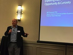 William Farrand合作论文数Space Science Institute28
 Jim Bell合作论文数School Of Earth and Space Exploration, Arizona State University;MILO Space Science Institute;Department of Astronomy, Cornell University27Ralf Gellert合作论文数Department of Physics, University of Guelph26
 Kevin Lewis合作论文数Department of Earth and Planetary Sciencesm, Krieger School of Arts & Sciences, Johns Hopkins University25
 Alfred McEwen合作论文数Lunar & Planetary Laboratory, College of Science, The University of Arizona24
 A. R. Vasavada合作论文数23
 Constantinos Charalambous合作论文数Imperial Coll London, Dept Elect & Elect Engn, London, England23
 Nathan Williams合作论文数Cytiva22Sanjeev Gupta合作论文数Department of Earth Science and Engineering, Faculty of Engineering, Imperial College London22Kenneth E Herkenhoff合作论文数22
 Scott M. McLennan合作论文数Department of Geosciences, College of Arts and Sciences, Stony Brook University21
 Ralph E Milliken合作论文数Department of Earth, Environmental & Planetary Sciences, Brown University;NASA Reflectance Experiment Laboratory21
 Fred J. Calef合作论文数MSL20
 Ernst Hauber合作论文数20
 David W. Mittlefehldt合作论文数NASA Johnson Space Center19
 Rebecca Williams合作论文数Malin Space Science Systems, Inc.19RV Morris合作论文数18
 Ronald Greeley合作论文数Ronald Greeley Center for Planetary Studies, Arizona State University;School of Earth and Space Exploration, Arizona State University18
 Horton Newsom合作论文数17
 Philip Christensen合作论文数School of Earth and Space Exploration, Arizona State University16
 Roger Wiens合作论文数Department of Earth, Atmospheric, and Planetary Sciences, College of Science, Purdue University16
 Jack D. Farmer合作论文数School Of Earth and Space Exploration, Arizona State University16v ansan合作论文数15R. Li合作论文数15
 Des Marais合作论文数NASA Ames Research Center;NASA Astrobiology Institute15
 R. Aileen Yingst合作论文数Planetary Science Institute15B. C. Clark合作论文数15
 Nicolas Mangold合作论文数Laboratory of Planetology and Geodynamics;Universite de Nantes15
 Bethany Ehlmann合作论文数Division of Geological and Planetary Sciences, California Institute of Technology;College of Arts and Sciences, University of Colorado Boulder15
 Steven Ruff合作论文数School of Earth and Space Exploration, Arizona State University15Alyssa DeMott合作论文数14
 Peter H Schultz合作论文数Department of Earth, Environmental, and Planetary Sciences, Brown University14Rossman P. Irwin合作论文数Planetary Science Institute14
 Abigail Fraeman合作论文数Jet Propulsion Laboratory, California Institute Of Technology14
 A. F. C. Haldemann合作论文数14Megan Kopp合作论文数13
 Michael P. Lamb合作论文数Division of Geological and Planetary Sciences, California Institute of Technology13
 Harry Y. McSween合作论文数Department of Earth, Environmental, and Planetary Sciences, College of Arts and Sciences, The University of Tennessee, Knoxville13
 William Dietrich合作论文数Department of Earth and Planetary Science, University of California, Berkeley13




