In Romania, excessive fragmentation of croplands remains persistent in areas of significant agricultural potential as a consequence of combined factors involving both land governance and farms’ characteristics. This paper examines the fragmentation of agricultural land use in the Romanian Plain, focusing on the impact of land policies implemented in Romania during the past three decades. The analysis relies on a survey of local policies that helps to distinguish three phases that marked the evolution of the fragmentation of agricultural land during 1990–2020. Additionally, metrics derived from remote sensing time series further assist in capturing the fragmentation levels during the identified phases and the spatial differences for the analyzed period. The fragmentation levels appear strikingly contrasting between the western part of the Romanian Plain and the Danube alluvial areas; this has been attributed as being the joint result of various land governance components which both enabled and constrained proper utilization of agricultural land, and concurrent factors related to economic and sociodemographic changes. We find excessive fragmentation emerged in plain field areas, triggered by the high overall rates of institutional change. The findings underscore the importance of jointly considering the fragmentation phenomenon in its evolution, intensity and spatial differences for effective land use policy formulation, emphasizing the need for proactive governance to support the efficient use of agricultural resources.
Aim: To estimate the effects of environmental and human drivers on upper forest-cover upward shift over the period 1945-2018.Location: Romanian Carpathians.Methods: Using historical topographic maps and high-resolution Sentinel-2A satellite images, we delineated the location of the upper forest-cover limit in 1945 and 2018 to obtain a binary raster with the "forest gains " and "no-forest gains " for 1945-2018. The maps were overlapped over 12 independent variables to estimate how they affected the recent upper forest-cover upward shift, and to predict its probability of expansion in the near future. To achieve this, logistic regression models were applied and then integrated into the GIS spatial analysis.Results: Forest gains of almost 35,000 ha have been detected at the upper forest limit in the study sites, leading to an average upward movement of 30 m (0.5 m per year), mainly at the altitudinal bands between 1,400 and 1,800 m a.s.l. (72%); only 9.7% of the gain was detected above the estimated potential climatic limit. The process was significantly inversely related to elevation (-17.3 <= beta <=-5.7, p < 0.01), slope aspect (-1.5 <= beta <=-0.4, p < 0.01), sheepfold numbers (-18.1 & LE; beta & LE; -0.7, p < 0.01), and sheep (-18.3 <= beta <= -0.6, p < 0.01) and cattle (-16.4 <= beta <=-0.8, p < 0.01) populations. Strong direct effects were found for the slope angle (1.3 <= beta <= 10.6, p < 0.01) and distance to sheepfolds (0.5 <= beta <= 12.8, p < 0.01). A low contribution was indicated for the trend in mean air temperature (-1.1 <=beta <= 4.3, p < 0.01), growing season length (-2.1 <= beta <= 5.1, p < 0.01) and protective measures (-1.1 <= beta <= 2.4, p < 0.01, for national parks; -1.8 <=beta <= 1.2, p < 0.01, for natural parks).Conclusions: The analysis demonstrated that decreased land-use intensity and, in particular, declining traditional practices were the foremost mechanisms of the recent upper forest-cover upward shift, whereas the effect of climate warming remains not so obvious.
The dataset represents the estimated probability for the upper forest-cover across 11 selected mountain units in the Romanian Carpathians, merged into a single map to show the regional differences induced by several biophysical and anthropogenic factors.
Studies exploring campus greening in Romania and Bulgaria are limited. Overall, sustainability-related topics and actions are more theory-, rather than practice-oriented in both countries, being particularly addressed by universities dealing with Earth (e.g., geography, ecology) and technical sciences (e.g., environmental engineering). Using literature review and an on-line questionnaire survey, the paper aims to analyse in a comparative manner how campus greening initiatives are integrated into the universities of Romania and Bulgaria, which are the main gaps and needs in terms of campus greening initiatives as well as the similarities vs. differences in implementing campus greening initiatives in both countries, with a view to outline the national specificity. The main findings suggest that universities in both countries have made a significant progress to address sustainability aspects in theory, and practice. However, a delay may be noticed in terms of framing a whole institution approach to the sustainability concept, with more singular and disparate initiatives being identified. Although the level of awareness in terms of the need for and importance of carrying out greening activities in their universities is relatively high for the respondents in both countries, more initiatives have been identified by the respondents in Romania than by the ones in Bulgaria. The main measures and initiatives associated with greening actions at university level are related to green infrastructure and waste management, which mainly contributed to increasing the aesthetic aspect of campuses and to cost reduction. There is a general top-down approach in undertaking green campus initiatives, with less or little involvement on the side of teachers and students (especially in Bulgaria), and more importance being attributed to the management body. The results of the survey can have practical implications and can be used by the universities in both countries to better understand the campus greening concept and to use examples and suggestions provided by the involved stakeholders as best practices to further integrate or promote campus greening practices in universities.
Landslide susceptibility maps are useful tools for risk analysis and assessment with practical implications because they provide relevant information for territorial planning, land use sustainable management or even forecast and early warning systems. Achievement of accurate assessments of landslide susceptibility for large regions (i.e. including national territories) is still a challenge, mainly because of the lack of proper landslide inventory and monitoring data. Romania represents one of the most landslide-affected countries in Europe. The current study presents an approach for drawing the landslide susceptibility map at a national scale for the Romanian territory, in agreement with the European methodological framework promoted for small-scale evaluations of landslide susceptibility. The methodological approach was adapted to the specific mophostructural, climatic and landuse conditions of the country, as well as to the quantity and quality of the available data, in order to achieve a susceptibility zonation for slides and flows for the national territory. It follows a mixed statistical-heuristic approach based on a Spatial Multi-Criteria Evaluation (SMCE) procedure integrating both landslide information and expert knowledge. The national landslide susceptibility map outlines large areas ranked as having high and very high susceptibility throughout the Subcarpathian chain, the Moldavian and Transylvanian Plateaux and the Getic Piedmont. The prediction performance was examined quantitatively and qualitatively, by making use of regional geomorphical knowledge. The evaluations suggest that, despite uncertainties inherent at this analysis scale, spatially-differentiated models are able to better capture landslide conditioning frameworks and reproduce inter- and, especially, intraregional variability of landslide distribution as compared to a previous version of the national susceptibility map. The study proves that combining statistical and heuristic approaches, calibrated and later on validated for distinct homogeneous morpho-litho-structural units allows to increase the prediction capacity of the national-scale model. The results are useful to public authorities at national, regional, county and municipality levels, providing knowledge for the enhancement of disaster prevention and response plans.
The Romanian Carpathians are an important part of Europe’s mountain areas, the actual pattern of forest cover reflecting a long history of land-use practices and management. In the present work, we analyse the recent changes (1945–2018) in the upper forest cover along the 37 mountain units using old topographic maps and Sentinel-2A high-resolution satellite images in order to quantify several spatial indicators related to the upper forest cover and upper forest limit changes. In order to understand the regional variation, we have tested the correlations between the location of the upper forest limit, the local topography and the geographical position. Furthermore, with a view to evaluate the upper forest limit change according to its potential climatic limit, the 10 °C July isotherm was estimated based on WorldClim climate data. In addition, the situations inside and outside the major protected areas were also analysed and discussed so as to assess the possible regional differences as related to human effects. The results revealed a continued downward shift in the mountain areas located below the 1600 m a.l.s., but significant advancement above these values, indicating regional differences in land-use intensity and land management. This study is aimed to increase further knowledge as to the upper forest limit in the European mountains and to provide a baseline for modelling future potential change according to the environmental and anthropogenic variability in the area.
Purpose This paper aims to identify campus greening initiatives on a sample of universities in Romania reflected in the university curricula, the behavioral patterns of students and teachers, the administrative actions that carry out empirical investigation of students/teachers/management staff perception on campus greening (based on self-administered questionnaires); detect the way campus greening initiatives are promoted/made visible; and identify the gaps and needs of the universities under scrutiny in terms of campus greening initiatives. Design/methodology/approach The current research relies on two major components reviewing campus greening-related activities and initiatives, as reflected in the scientific literature and university curricula (empirical and quantitative assessment) and inquiring selected universities’ about the campus greening programs they unfold through questionnaire surveys (qualitative assessment). Findings Generally, sustainability topics (e.g. environmental protection, waste management and sustainable development) are largely addressed and, to some extent, applied in faculties dealing with earth sciences (e.g. geography, ecology) and technical sciences (e.g. environmental engineering). This can be explained by the traditional theoretical background of the first, and the experimental-oriented profile of the latter, which supports the development of innovative technologies (green technologies). However, there is a need to better undertake and promote greening initiatives for most of the higher education institutions in Romania. Some spatial (between institutions throughout Romania) and structural (according to the profile of the institutions) disparities are visible. Research limitations/implications The limitations of the study might be the small number of universities providing a positive feedback to the questionnaire survey and the degree of subjectivity of some of the answers, directly linked with the professional background and issue awareness of the persons who answered the questions. Practical implications The findings can be useful to the university managers to better orient their actions toward campus greening, increasing their knowledge and awareness toward sustainability-related actions. Originality/value This is the first attempt reporting in the literature to analyze the campus greening initiatives to a large number of universities in Romania based on a common approach, identifying the main gaps and challenges in this process.
Forest-cover dynamics is of wide concern due to its role in climate change, biodiversity losses, water balance and land degradation, as well as social and economic development. Hence, exploring land-use/cover dynamic is important in order to improve our understanding of the causes of forest-cover change and to detect the future trend. Furthermore, projecting a future land-use/cover pattern can help identifying potential areas where forest-cover change will occur in the future and the potential consequences of these processes in order to improve land-use planning and policies. Similar to other East European countries, Romania is experiencing rapid land-use/cover changes after the breakdown of socialism; a clear trend was registered by deforestation, which reflects the consequences of a continuous forests dynamics and little environmental care. Consequently, this study, carried out in order to analyse the potential future cover-change, resulted in the land-use/cover scenario (2007–2050) simulated using CLUE-S (the Conversion of Land Use and its Effects at Small regional extent) modelling framework, applied to development regions in Romania. Overall, the model results in different spatial patterns of land-use/cover change, projecting a slight increase in the forest-cover area of about 82,000 ha. Furthermore, the model simulated widespread deforestation, mainly in relation to agricultural land expansion. The area under the curve (AUC) for the relative operating characteristic (ROC) and the Kappa simulation ( K Simulation ) were used to assess the predictive power of the determinant factors included and to evaluate the spatial performance of the model. The obtained ROC/AUC values (0.83–0.88) indicate the great power of the determinant factors to explain the forest-cover pattern in the area. Furthermore, the K Simulation scores (0.69–0.79) highlight the potential of the CLUE-S model to simulate future forest-cover change in relation to the other land-use/cover categories. The results can provide useful inputs for effective forest resource management and environmental policies. Moreover, the spatial data obtained can contribute to exploring future potential environmental implications (e.g. assessing landslide and flood hazard scenarios, forest biomass dynamics and their impact on carbon allocation, or the impact of forest-cover change on ecosystem services).
In this paper we assess the irrigation water use in the Danube Basin, highlight its complexity, identify future challenges and show the relevance for a basin-wide integrative irrigation management plan as part of a more holistic and coherent resource policy. In this sense, we base our integrative regional assessments of the water-food-energy nexus on insights from an extensive review and scientific synthesis of the Danube Basin and region, experimental field studies on irrigation and agricultural water consumption, current irrigation related policies and strategies in most of the Danube countries, and regulatory frameworks on resources at European Union level. We show that a basin-wide integrative approach to water use calls for the evaluation of resource use trade-offs, resonates with the need for transdisciplinary research in addressing nexus challenges and supports integrative resource management policies within which irrigation water use represents an inherent part. In this respect, we propose a transdisciplinary research framework on sustainable irrigation water use in the Danube Basin. The findings were summarized into four interconnected problem areas in the Danube Basin, which directly or indirectly relate to irrigation strategies and resource policies: prospective water scarcity and Danube water connectedness, agricultural droughts, present and future level of potential yields, and science based proactive decision-making.
Since 1990, a series of fundamental political and socioeconomic transformations in Romania have led to important structural and functional changes in the land use/cover system. This paper aims to assess the past land use/cover dynamics during the period 1990–2006 and to simulate future changes (2007–2050) to identify the main land use/cover change processes and their potential environmental and land management implications. The simulation was carried out using the Conversion of Land Use and its Effects at Small regional extent (CLUE-S) model with the CORINE Land Cover (CLC) database and several biophysical and socioeconomic explanatory variables associated with the current land use/cover pattern. Using the receiver operating characteristic (ROC) method and cross-classification maps, statistical and spatial validation was assessed to evaluate the performance of the predicted data. The predicted map could represent a useful tool for monitoring and quantifying spatial and temporal land use/cover changes at national and particularly regional level, in order to adopt appropriate land use planning and environmental policy in line with sustainable development principles. In addition, the results could be used for further analyses to examine the consequences of land use/cover changes on landscape diversity and biodiversity, the interaction between land use/cover changes and natural hazards, or the implications for ecosystem services.
The current paper aims to provide a regional-level (Development Regions) assessment of the past changes in the agricultural land use pattern during the 1990-2006 period and to simulate future changes (2007-2050) in order to detect the main potential agricultural flows and their regional differences. The simulation was carried out through the CLUE-S model (the Conversion of Land Use and its Effects at Small regional extent) using CORINE Land Cover (CLC) database and several biophysical and socio-economic explanatory variables associated with the current land use/cover pattern. Because of the political and socio-economic changes that took place after 1990 and their relevance for the resulted spatial transformations in land use/cover pattern, two scenarios based on the annual change rate of the 1990-2000 and 2000-2006 were used in order to explore potential future land use/cover changes. Thus, the predicted maps indicate significant changes in the agricultural land use pattern mainly in relation to the local-level conversion processes. Two change flows stand out, i.e. intensification and extensification of agriculture. The first flow is more likely to occur in the Banat and Criana Plains and Hills, the Transylvanian Tableland and west of the Romanian Plain, while the second will mainly occur in the Moldavian Plateau, the Dobrogea Plateau, the central part of the Romanian Plain and the Subcarpathians. Furthermore, a significant increase in the agricultural lands related to forest losses and decrease related to forest gains are expected in the plain regions, Transylvanian Tableland, Getic Piedmont, Moldavian Plateau and Subcarpathians. The results of the current research provide important information on the future spatial distribution of the agricultural land use classes in order to improve the general understanding on the causes and consequences of change. Therewith, it can be utilized as reference study for further sustainable land use strategies and policy-making to ensure the effective management and use of agricultural land resources.
A high dynamic environment is typically interested by changes affecting the natural processes and their related consequences. Landslides do not only alter the landscape, but substantially affect human activities. When it comes to natural hazards, landslides have been acknowledged as one of the main causes of human casualties or damage to assets. Furthermore, economic losses to rural lands are also significant, despite often being underestimated, especially in rural areas. In territories not densely populated, the main productive activities are in fact often based on the agricultural and pastoral resources. We intend to propose a methodology that helps to investigate the potential loss of value (expressed in EUR) of lands usually exploited for economic profit in rural areas. We test the method on two case studies, belonging to different European Countries with very different economical assets and geological, geomorphological and other environmental conditions. The first study area is situated in the Southern Italian Apennines, in the Molise region, while the second area is located in Buzau County, a region belonging to the Romanian Curvature Carpathians and Subcarpathians Our analysis is focused not only on the actual situation, represented by the past and present landslides, but also on potential future scenarios for 2050. The scenarios foresee future similar socio-economical and technological activities, with no major changes expected. The loss estimation is based on the presence of landslides affecting the rural lands, but it also considers both a present and future landslide susceptibility scenario. This procedure allowed the estimation of the economic losses in the two case-study areas, highlighting how the same natural processes might result in different economic consequences. Following our approach, the results highlight that for the Italian case study there is a loss of 10,45% for 2007 and 9,90% for 2050 of the total land value as concerns landslides susceptibility. In the Romanian case study, on the other hand, the loss corresponds to 29,60% and 29,81% for 2010 and 2050, respectively. In addition, the proposed procedure could be considered a valuable methodological approach to assess landslide-induced economic losses, and be effectively used during spatial planning activities, aimed at supporting decision
The Romanian Plain, covering a surface area of about 52 600 sq. km and stretching along the Danube, is one of the largest agricultural regions in the European Union. It presents diverse ecological conditions in four major zonal units, steppe, silvo-steppe, forest zone and its large Danube floodplain. In this context, the assessments of climate change, specifically of those climatic elements like temperature and precipitation which may have an important impact on various economic sectors, represent a necessary scientific support for end-users to envisage sustainable development strategies. This paper presents 1) the evaluation of the regional climatic model RCA4 driven by the ERA-Interim reanalysis and five general climatic models under historical forcing, 2) the adjustment of the bias identified in the simulations compared to the observation data using the Delta Change method, and 3) the projected changes of seasonal mean temperature and precipitation in the Romanian Plain for the mid-term period 2021-2050 under the RCP4.5 scenario compared with the reference period 1971-2000 of ROCADA observations.
It is widely recognized that climate change is affecting slope stability.However, there is still a great knowledge gap on landslide-climate interaction, while in data-scarce regions, like Romania, it is even less clear how landslide occurrence probability will evolve in response to climate change.The present study proposes a methodological framework for assessing the potential effects of climate change on landslide hazard at a national scale, under current (1961-2015) and future climate (2021-2050).The research approach for developing landslide hazard scenarios relies on the historical landslide inventory of the General Inspectorate for Emergency Situations (IGSU) (2005-2015), updated observational meteorological data and EURO-CORDEX projections of six GCM-RCM runs under two new IPCC scenarios (RCP4.5 and RCP8.5).Precipitation observation and projection data are analyzed in close relation to the landslide events reported within the historical landslide inventory, in order to develop national rainfall-induced landslide hazard scenarios.Maps displaying projected climate change impacts upon landslide hazard patterns and levels are constructed.Future climate-driven evolution trends on landslide occurrences are identified and discussed.Their understanding is expected to support landslide risk management at both national and regional scales.The study was conducted in the framework of the RO-RISK "Disaster Risk Evaluation at National Level" project, aimed to support the fulfillment of the EU ex-ante conditionality 5.1, co-financed under the European Social Fund through the Operational Program Administrative Capacity 2014 -2020 and coordinated by IGSU.
Earthquakes are representing across Earth's seismically-active regions a major trigger of small-to-large size landslides.Occurred in form of coseismic or postseismic failures, these processes are controlling the slope denudation, inducing in the mean time significant impacts on fluvial morphology through intense slope-channel coupling.Relict, dormant or active forms resembling like earthquake-induced ones are numerous in the Vrancea seismic region (Curvature sector of the South-Eastern Carpathians), at least from a morphological point of view.The purpose of this paper is to outline the morphogenetic framework of such high magnitude and low frequency processes on the basis of several case-studies.The Slon, Zăbala, Zâmbroaia and Mlăjet landslides are known as being triggered by the 1940 and 1977 earthquakes.Two other landslides are showing a very high potential of being as well caused (immediate or delayed) by earthquakes: the deep-seated Balta rock slump (92 ha, 60-80 m thick), a potential co-seismic landslide and the Paltineni debris flow (22 ha, 30-40 m thick), highly likely the result of postseismic evolution of a seismically-triggered slump.The two processes are discussed in terms of morphology (assessed through digital stereographic interpretation of aerial photos and LiDAR-derived hillshade DEM) and internal structure (based on ERT and V/R soundings).The Factor of Safety calculation (Bishop method) analysis showed that, at least for the Balta landslide, an additional driving moment from seismic acceleration was necessary to trigger the movement.Such an approach is important within a multi-hazard risk preparedness and prevention framework, allowing us to define different levels of seismic shaking (in combination with variable climatic background conditions) and the related return periods.
 Mihaela Sima合作论文数Institute of Geography, Romanian Academy34
 Mihai Micu合作论文数26
 Ines Grigorescu合作论文数Institute of Geography17
 Gheorghe Kucsicsa合作论文数15
 Diana Dogaru合作论文数Inst Geog, Romanian Acad12
 Marta C. Jurchescu合作论文数Institute of Geography, Romanian Academy12
 Dana Micu合作论文数Romanian Academy Institute of Geography12Veronica Zumpano合作论文数11
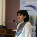 Monica Dumitrascu合作论文数Institute of Geography11
 Viorel Chendeş合作论文数9Mihaela Serban合作论文数8
 Andra Costache合作论文数Department of Geography St. Lt. Stancu Ion, Valahia University of Târgovişte7
 Ursanu Popovici Elena Ana合作论文数7Carmen Dragotă合作论文数6Carmen-Sofia Dragota合作论文数6Basarab Driga合作论文数6Sorin Zaharia合作论文数5Graham Bird合作论文数5
 Mark Macklin合作论文数Lincoln Centre for Water and Planetary Health, Department of Geography, School of Life and Environmental Sciences, College of Health and Science, University of Lincoln5Jürg Zobrist合作论文数5PA Brewer合作论文数4Kazuko Urushibara-Yoshino合作论文数4
 Petru Enciu合作论文数4
 Bernhard Dold合作论文数Centre d'Analyse Minérale;Bâtiment Humense;Institute of Mineralogy and Geochemistry;University of Lausanne4
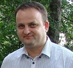 Marin Senila合作论文数National Institute for Research and Development of Optoelectronics Bucharest – Research Institute of Analytical Instrumentation4Shigeru Shirasaka合作论文数3
 Haydar Yousif Hussin合作论文数3
 Mihaela Rodica Persu合作论文数3Cristina Dumitrică合作论文数Phys Geog Dept, Romanian Acad3
 Bianca Mitrică合作论文数Corresponding author.3
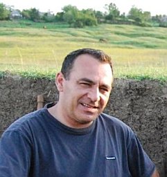 Mihai Ciprian Margarint合作论文数Faculty of Geography and Geology, Alexandru Ioan Cuza University of Iasi3Kazuki Mori合作论文数3
 Wolfram Mauser合作论文数Department für Geographie, Ludwig-Maximilians-Universität München;Rachel Carson Center for Environment and Society, Ludwig-Maximilians-Universität München3
 Erika-Andrea Levei合作论文数Research Institute of Analytical Instrumentation, National Institute for Research and Development of Optoelectronics Bucharest3Linda Frei合作论文数3Abraham Bela合作论文数3Paola Reichenbach合作论文数IRPI CNR, via della Madonna Alta 126, Perugia 06128, Italy3LAURA LUPU合作论文数2răzvan zarea合作论文数2
 Ziga Malek合作论文数2Luca Pisano合作论文数Consiglio Nazionale delle Ricerche Istituto di Ricerca per la Protezione Idrogeologica Sede di Bari2Stefan Bilasco合作论文数2
 Jente Broeckx合作论文数Department of Earth and Environmental Sciences, KU Leuven2
 Danut Petrea合作论文数Fac Geog, Babes Bolyai Univ2
 Thomas Glade合作论文数Department of Geography and Regional Research, University of Vienna2
 Hong Yang合作论文数Swiss Federal Institute of Aquatic Science and Technology2
 Jean Poesen合作论文数Faculty of Science, Katholieke Universiteit Leuven;Division of Geography and Tourism, Department of Earth and Environmental Sciences, Katholieke Universiteit Leuven;Department of Geology, Soil Science and Geoinformation, Institute of Earth and Environmental Sciences, Maria Curie-Skłodowska University2
 Carmen Rosskopf合作论文数2
 Jean-Philippe Malet合作论文数Ecole et Observatoire des Sciences de la Terre, University of Strasbourg;Institut de Physique du Globe de Strasbourg, University of Strasbourg;Ecole et Observatoire des Sciences de la Terre, French National Centre for Scientific Research;Institut de Physique du Globe de Strasbourg, French National Centre for Scientific Research2




