The use of camera traps in ecology and conservation has expanded rapidly, but the time spent to accurately identify species in camera trap images remains a fundamental challenge that limits project scope and impact. Although artificial intelligence (AI) is often used to speed up image processing, a human review step is still standard practice to arrive at final species identifications. A potentially transformative next step is thus to remove humans entirely from the analysis chain and still produce accurate statistical models for subsequent inference across a wide diversity of species and regions. Here, we compare the output of Bayesian multi-species occupancy models derived from a complete AI workflow (no human review of images) with a general species classifier (SpeciesNet) to those from an expert (human) workflow, using large-scale camera datasets from three study areas and two distinct and diverse mid-large mammal assemblages. We apply several pre- and post-processing steps to the AI workflow to improve model agreement. We perform a comprehensive model comparison, assessing agreement in identified species-environment relationships and rates of occupancy and detection, and similarity of spatial projections of occupancy. We found that for most species of mammal, AI based models were remarkably similar to expert-based models, with some variability based on post-processing decisions. This agreement was robust, holding across multiple metrics of comparison (e.g. parameter estimates, precision, occupancy and detection rates), multiple study sites and at species and community levels. Similarity in model output occurred even in the presence of misclassification errors, suggesting our approach was resilient to some level of false negatives and positives. Substantial divergence in model output and subsequent inference, while rare, was most prevalent for rarely detected species. Synthesis and applications. The use of a global AI classifier to identify species and reproducible pre- and post-processing decisions makes our approach broadly applicable and particularly beneficial for national and international monitoring programs that collect large amounts of photo data on threatened, at risk, or management sensitive species and wildlife communities. A fully automated workflow will allow such programs to progress more rapidly from photo collection to analysis, inference and decision-making.Read the free Plain Language Summary for this article on the journal's .
Scientific problem-solving involves synthesizing information while applying expert knowledge. We introduce CURIE, a scientific long-Context Understanding, Reasoning, and Information Extraction benchmark to measure the potential of Large Language Models (LLMs) in scientific problem-solving and assisting scientists in realistic workflows. This benchmark introduces ten challenging tasks with a total of 580 problems and solution pairs curated by experts in six disciplines - materials science, condensed matter physics, quantum computing, geo-spatial analysis, biodiversity, and proteins - covering both experimental and theoretical work-flows in science. We evaluate a range of closed and open LLMs on tasks in CURIE which requires domain expertise, comprehension of long in-context information,and multi-step reasoning. While Gemini Flash 2.0 and Claude-3 show consistent high comprehension across domains, the popular GPT-4o and command-R+ fail dramatically on protein sequencing tasks. With the best performance at 32% there is much room for improvement for all models. We hope that insights gained from CURIE can guide the future development of LLMs in sciences. Links to the data and evaluation code are in https://github.com/google/curie
AbstractCamera traps facilitate non‐invasive wildlife monitoring, but their widespread adoption has created a data processing bottleneck: a camera trap survey can create millions of images, and the labour required to review those images strains the resources of conservation organisations. AI is a promising approach for accelerating image review, but AI tools for camera trap data are imperfect; in particular, classifying small animals remains difficult, and accuracy falls off outside the ecosystems in which a model was trained. It has been proposed that incorporating an object detector into an image analysis pipeline may help address these challenges, but the benefit of object detection has not been systematically evaluated in the literature. In this work, the authors assess the hypothesis that classifying animals cropped from camera trap images using a species‐agnostic detector yields better accuracy than classifying whole images. We find that incorporating an object detection stage into an image classification pipeline yields a macro‐average F1 improvement of around 25% on a large, long‐tailed dataset; this improvement is reproducible on a large public dataset and a smaller public benchmark dataset. The authors describe a classification architecture that performs well for both whole and detector‐cropped images, and demonstrate that this architecture yields state‐of‐the‐art benchmark accuracy.
The sustainable management of fisheries and aquaculture requires an understanding of how these activities interact with natural fish populations. GoPro cameras were used to collect an underwater video data set on and around shellfish aquaculture farms in an estuary in the NE Pacific from June to August 2017 and June to August 2018 to better understand habitat use by the local fish and crab communities. Images extracted from these videos were labeled to produce a data set that is suitable for use in training computer vision models. The labeled data set contains 77,739 images sampled from the collected video; 67,990 objects (fishes and crustaceans) have been annotated in 30,384 images (the remainder have been annotated as “empty”). The metadata of the data set also indicates whether a physical magenta filter was used during video collection to counteract reduced visibility. These data have the potential to help researchers address system-level and in-depth regional shellfish aquaculture questions related to ecosystem services and shellfish aquaculture interactions.
Objective: While non-invasive, cuffless blood pressure (BP) measurement has demonstrated relevancy in controlled environments, ambulatory measurement is important for hypertension diagnosis and control. We present both in-lab and ambulatory BP estimation results from a diverse cohort of participants. Methods: Participants (N=1125, aged 21-85, 49.2% female, multiple hypertensive categories) had BP measured in-lab over a 24-hour period with a subset also receiving ambulatory measurements. Radial tonometry, photoplethysmography (PPG), electrocardiography (ECG), and accelerometry signals were collected simultaneously with auscultatory or oscillometric references for systolic (SBP) and diastolic blood pressure (DBP). Predictive models to estimate BP using a variety of sensor-based feature groups were evaluated against challenging baselines. Results: Despite limited availability, tonometry-derived features showed superior performance compared to other feature groups and baselines, yieldingprediction errors of 0.32$\pm$9.8 mmHg SBP and 0.54$\pm$7.7 mmHg DBP in-lab, and 0.86$\pm$8.7 mmHg SBP and 0.75$\pm$5.9 mmHg DBP for 24-hour averages. SBP error standard deviation (SD) was reduced in normotensive (in-lab: 8.1 mmHg, 24-hr: 7.2 mmHg) and younger (in-lab: 7.8 mmHg, 24-hr: 6.7 mmHg) subpopulations. SBP SD was further reduced 15–20% when constrained to the calibration posture alone. Conclusion: Performance for normotensive and younger participants was superior to the general population across all feature groups. Reference type, posture relative to calibration, and controlled vs. ambulatory setting all impacted BP errors. Significance: Results highlight the need for demographically diverse populations and challenging evaluation settings for BP estimation studies. We present the first public dataset of ambulatory tonometry and cuffless BP over a 24-hour period to aid in future cardiovascular research.
Biodiversity conservation depends on accurate, up-to-date information about wildlife population distributions. Motion-activated cameras, also known as camera traps, are a critical tool for population surveys, as they are cheap and non-intrusive. However, extracting useful information from camera trap images is a cumbersome process: a typical camera trap survey may produce millions of images that require slow, expensive manual review. Consequently, critical information is often lost due to resource limitations, and critical conservation questions may be answered too slowly to support decision-making. Computer vision is poised to dramatically increase efficiency in image-based biodiversity surveys, and recent studies have harnessed deep learning techniques for automatic information extraction from camera trap images. However, the accuracy of results depends on the amount, quality, and diversity of the data available to train models, and the literature has focused on projects with millions of relevant, labeled training images. Many camera trap projects do not have a large set of labeled images and hence cannot benefit from existing machine learning techniques. Furthermore, even projects that do have labeled data from similar ecosystems have struggled to adopt deep learning methods because image classification models overfit to specific image backgrounds (i.e., camera locations). In this paper, we focus not on automating the labeling of camera trap images, but on accelerating this process. We combine the power of machine intelligence and human intelligence to build a scalable, fast, and accurate active learning system to minimize the manual work required to identify and count animals in camera trap images. Our proposed scheme can match the state of the art accuracy on a 3.2 million image dataset with as few as 14,100 manual labels, which means decreasing manual labeling effort by over 99.5%.
Predicting all applicable labels for a given image is known as multi-label classification. Compared to the standard multi-class case (where each image has only one label), it is considerably more challenging to annotate training data for multi-label classification. When the number of potential labels is large, human annotators find it difficult to mention all applicable labels for each training image. Furthermore, in some settings detection is intrinsically difficult e.g. finding small object instances in high resolution images. As a result, multi-label training data is often plagued by false negatives. We consider the hardest version of this problem, where annotators provide only one relevant label for each image. As a result, training sets will have only one positive label per image and no confirmed negatives. We explore this special case of learning from missing labels across four different multi-label image classification datasets for both linear classifiers and end-to-end fine-tuned deep networks. We extend existing multi-label losses to this setting and propose novel variants that constrain the number of expected positive labels during training. Surprisingly, we show that in some cases it is possible to approach the performance of fully labeled classifiers despite training with significantly fewer confirmed labels.
Ecological research like wildlife censuses increasingly relies on data on the scale of Terabytes. For example, modern camera trap datasets contain millions of images that require prohibitive amounts of manual labour to be annotated with species, bounding boxes, and the like. Machine learning, especially deep learning [3], could greatly accelerate this task through automated predictions, but involves expansive coding and expert knowledge. In this abstract we present AIDE, the Annotation Interface for Data-driven Ecology [2]. In a first instance, AIDE is a web-based annotation suite for image labelling with support for concurrent access and scalability, up to the cloud. In a second instance, it tightly integrates deep learning models into the annotation process through active learning [7], where models learn from user-provided labels and in turn select the most relevant images for review from the large pool of unlabelled ones (Fig. 1). The result is a system where users only need to label what is required, which saves time and decreases errors due to fatigue. Fig. 1: AIDE offers concurrent web image labelling support and uses annotations and deep learning models in an active learning loop. AIDE includes a comprehensive set of built-in models, such as ResNet [1] for image classification, Faster R-CNN [5] and RetinaNet [4] for object detection, and U-Net [6] for semantic segmentation. All models can be customised and used without having to write a single line of code. Furthermore, AIDE accepts any third-party model with minimal implementation requirements. To complete the package, AIDE offers both user annotation and model prediction evaluation, access control, customisable model training, and more, all through the web browser. AIDE is fully open source and available under https://github.com/microsoft/aerial_wildlife_detection. References
Computer vision (CV) is rapidly advancing as a tool to make conservation science more efficient, for example, by accelerating the annotation of images from camera traps and aerial surveys. However, before CV can become a widely used approach, several core technology challenges need to be addressed by the CV community. Taking into consideration several case studies in CV where tremendous progress has been made since the emergence of deep learning, this chapter will introduce core concepts in CV, survey several areas where CV is already contributing to conservation, and outline key challenges for the CV community that will facilitate the adoption of CV in mainstream conservation practice.
Camera Traps are extensively used to observe wildlife in their natural habitat without disturbing the ecosystem. This could help in the early detection of natural or human threats to animals, and help towards ecological conservation. Currently, a massive number of such camera traps have been deployed at various ecological conservation areas around the world, collecting data for decades, thereby requiring automation to detect images containing animals. Existing systems perform classification to detect if images contain animals by considering a single image. However, due to challenging scenes with animals camouflaged in their natural habitat, it sometimes becomes difficult to identify the presence of animals from merely a single image. We hypothesize that a short burst of images instead of a single image, assuming that the animal moves, makes it much easier for a human as well as a machine to detect the presence of animals. In this work, we explore a variety of approaches, and measure the impact of using short image sequences (burst of 3 images) on improving the camera trap image classification. We show that concatenating masks containing sequence information and the images from the 3-image-burst across channels, improves the ROC AUC by 20% on a test-set from unseen camera-sites, as compared to an equivalent model that learns from a single image.
Normalization layers have been shown to improve convergence in deep neural networks, and even add useful inductive biases. In many vision applications the local spatial context of the features is important, but most common normalization schemes including Group Normalization (GN), Instance Normalization (IN), and Layer Normalization (LN) normalize over the entire spatial dimension of a feature. This can wash out important signals and degrade performance. For example, in applications that use satellite imagery, input images can be arbitrarily large; consequently, it is nonsensical to normalize over the entire area. Positional Normalization (PN), on the other hand, only normalizes over a single spatial position at a time. A natural compromise is to normalize features by local context, while also taking into account group level information. In this pa- per, we propose Local Context Normalization (LCN): a normalization layer where every feature is normalized based on a window around it and the filters in its group. We propose an algorithmic solution to make LCN efficient for arbitrary window sizes, even if every point in the image has a unique window. LCN outperforms its Batch Normalization (BN), GN, IN, and LN counterparts for object detection, semantic segmentation, and instance segmentation applications in several benchmark datasets, while keeping performance in- dependent of the batch size and facilitating transfer learning.
Ecological surveys increasingly rely on large‐scale image datasets, typically terabytes of imagery for a single survey. The ability to collect this volume of data allows surveys of unprecedented scale, at the cost of expansive volumes of photo‐interpretation labour. We present Annotation Interface for Data‐driven Ecology (AIDE), an open‐source web framework designed to alleviate the task of image annotation for ecological surveys. AIDE employs an easy‐to‐use and customisable labelling interface that supports multiple users, database storage and scalability to the cloud and/or multiple machines. Moreover, AIDE closely integrates users and machine learning models into a feedback loop, where user‐provided annotations are employed to re‐train the model, and the latter is applied over unlabelled images to e.g. identify wildlife. These predictions are then presented to the users in optimised order, according to a customisable active learning criterion. AIDE has a number of deep learning models built‐in, but also accepts custom model implementations. Annotation Interface for Data‐driven Ecology has the potential to greatly accelerate annotation tasks for a wide range of researches employing image data. AIDE is open‐source and can be downloaded for free at https://github.com/microsoft/aerial_wildlife_detection.
Understanding the geographic distribution of species is a key concern in conservation. By pairing species occurrences with environmental features, researchers can model the relationship between an environment and the species which may be found there. To facilitate research in this area, we present the GeoLifeCLEF 2020 dataset, which consists of 1.9 million species observations paired with high-resolution remote sensing imagery, land cover data, and altitude, in addition to traditional low-resolution climate and soil variables. We also discuss the GeoLifeCLEF 2020 competition, which aims to use this dataset to advance the state-of-the-art in location-based species recommendation.
The ability to detect and classify rare occurrences in images has important applications - for example, counting rare and endangered species when studying biodiversity, or detecting infrequent traffic scenarios that pose a danger to self-driving cars. Few-shot learning is an open problem: current computer vision systems struggle to categorize objects they have seen only rarely during training, and collecting a sufficient number of training examples of rare events is often challenging and expensive, and sometimes outright impossible. We explore in depth an approach to this problem: complementing the few available training images with ad-hoc simulated data. Our testbed is animal species classification, which has a real-world long-tailed distribution. We analyze the effect of different axes of variation in simulation, such as pose, lighting, model, and simulation method, and we prescribe best practices for efficiently incorporating simulated data for real-world performance gain. Our experiments reveal that synthetic data can considerably reduce error rates for classes that are rare, that as the amount of simulated data is increased, accuracy on the target class improves, and that high variation of simulated data provides maximum performance gain.
We propose incorporating human labelers in a model fine-tuning system that provides immediate user feedback. In our framework, human labelers can interactively query model predictions on unlabeled data, choose which data to label, and see the resulting effect on the model's predictions. This bi-directional feedback loop allows humans to learn how the model responds to new data. Our hypothesis is that this rich feedback allows human labelers to create mental models that enable them to better choose which biases to introduce to the model. We compare human-selected points to points selected using standard active learning methods. We further investigate how the fine-tuning methodology impacts the human labelers' performance. We implement this framework for fine-tuning high-resolution land cover segmentation models. Specifically, we fine-tune a deep neural network -- trained to segment high-resolution aerial imagery into different land cover classes in Maryland, USA -- to a new spatial area in New York, USA. The tight loop turns the algorithm and the human operator into a hybrid system that can produce land cover maps of a large area much more efficiently than the traditional workflows. Our framework has applications in geospatial machine learning settings where there is a practically limitless supply of unlabeled data, of which only a small fraction can feasibly be labeled through human efforts.
Camera Traps (or Wild Cams) enable the automatic collection of large quantities of image data. Biologists all over the world use camera traps to monitor biodiversity and population density of animal species. The computer vision community has been making strides towards automating the species classification challenge in camera traps, but as we try to expand the scope of these models from specific regions where we have collected training data to different areas we are faced with an interesting problem: how do you classify a species in a new region that you may not have seen in previous training data? In order to tackle this problem, we have prepared a dataset and challenge where the training data and test data are from different regions, namely The American Southwest and the American Northwest. We use the Caltech Camera Traps dataset, collected from the American Southwest, as training data. We add a new dataset from the American Northwest, curated from data provided by the Idaho Department of Fish and Game (IDFG), as our test dataset. The test data has some class overlap with the training data, some species are found in both datasets, but there are both species seen during training that are not seen during test and vice versa. To help fill the gaps in the training species, we allow competitors to utilize transfer learning from two alternate domains: human-curated images from iNaturalist and synthetic images from Microsoft's TrapCam-AirSim simulation environment.
The ability to collect, aggregate, and process “big data”, particularly with artificial intelligence (AI) tools, has the potential to facilitate breakthrough research in conservation. As institutions develop and deploy such systems at scale, it is critical that they be designed with ethics, fairness, and transparency best practices in mind. In this short paper, we outline potential ethical concerns around AI for conservation as a starting point for further work to advance.
Camera traps are heat- or motion-activated cameras placed in the wild to monitor and investigate animal populations and behavior. They are used to locate threatened species, identify important habitats, monitor sites of interest, and analyze wildlife activity patterns. At present, the time required to manually review images severely limits productivity. Additionally, ~70% of camera trap images are empty, due to a high rate of false triggers. Previous work has shown good results on automated species classification in camera trap data (Norouzzadeh et al. 2018), but further analysis has shown that these results do not generalize to new cameras or new geographic regions (Beery et al. 2018). Additionally, these models will fail to recognize any species they were not trained on. In theory, it is possible to re-train an existing model in order to add missing species, but in practice, this is quite difficult and requires just as much machine learning expertise as training models from scratch. Consequently, very few organizations have successfully deployed machine learning tools for accelerating camera trap image annotation. We propose a different approach to applying machine learning to camera trap projects, combining a generalizable detector with project-specific classifiers. We have trained an animal detector that is able to find and localize (but not identify) animals, even species not seen during training, in diverse ecosystems worldwide. See Fig. 1 for examples of the detector run over camera trap data covering a diverse set of regions and species, unseen at training time. By first finding and localizing animals, we are able to: drastically reduce the time spent filtering empty images, and dramatically simplify the process of training species classifiers, because we can crop images to individual animals (and thus classifiers need only worry about animal pixels, not background pixels). drastically reduce the time spent filtering empty images, and dramatically simplify the process of training species classifiers, because we can crop images to individual animals (and thus classifiers need only worry about animal pixels, not background pixels). With this detector model as a powerful new tool, we have established a modular pipeline for on-boarding new organizations and building project-specific image processing systems. We break our pipeline into four stages: 1. Data ingestion First we transfer images to the cloud, either by uploading to a drop point or by mailing an external hard drive. Data comes in a variety of formats; we convert each data set to the COCO-Camera Traps format, i.e. we create a Javascript Object Notation (JSON) file that encodes the annotations and the image locations within the organization’s file structure. 2. Animal detection We next run our (generic) animal detector on all the images to locate animals. We have developed an infrastructure for efficiently running this detector on millions of images, dividing the load over multiple nodes. We find that a single detector works for a broad range of regions and species. If the detection results (as validated by the organization) are not sufficiently accurate, it is possible to collect annotations for a small set of their images and fine-tune the detector. Typically these annotations would be fed back into a new version of the general detector, improving results for subsequent projects. 3. Species classification Using species labels provided by the organization, we train a (project-specific) classifier on the cropped-out animals. 4. Applying the system to new data We use the general detector and the project-specific classifier to power tools facilitating accelerated verification and image review, e.g. visualizing the detections, selecting images for review based on model confidence, etc. The aim of this presentation is to present a new approach to structuring camera trap projects, and to formalize discussion around the steps that are required to successfully apply machine learning to camera trap images. The work we present is available at http://github.com/microsoft/cameratraps, and we welcome new collaborating organizations.
Biologists all over the world use camera traps to monitor biodiversity and wildlife population density. The computer vision community has been making strides towards automating the species classification challenge in camera traps, but it has proven difficult to to apply models trained in one region to images collected in different geographic areas. In some cases, accuracy falls off catastrophically in new region, due to both changes in background and the presence of previously-unseen species. We propose a pipeline that takes advantage of a pre-trained general animal detector and a smaller set of labeled images to train a classification model that can efficiently achieve accurate results in a new region.
 Desney Tan合作论文数Microsoft53
 Scott Saponas合作论文数Microsoft Research34
 Federico Barbagli合作论文数Stanford University20
 J. Kenneth Salisbury合作论文数Department of Computer Science, School of Engineering;Department of Surgery, School of Medicine, Stanford University;Department of Mechanical Engineering, Stanford University16
 Christopher Sewell合作论文数14
 Nikolas Blevins合作论文数Neurosurgery Department, Stanford University;Otolaryngology (Head and Neck Surgery) Department, Stanford University13
 Shwetak Patel合作论文数Paul G. Allen School of Computer Science & Engineering, University of Washington12
 Meredith Ringel Morris合作论文数Google DeepMind;The Paul G. Allen School of Computer Science & Engineering, University of Washington9
 Jim Turner合作论文数9
 Andrew Wilson合作论文数Microsoft Research8
 Sumit Basu合作论文数Microsoft Research8
 Neel Joshi合作论文数Microsoft Research8
 Sidhant Gupta合作论文数CloudWerx;Department of Electrical & Computer Engineering, University of Washington7
 Greg Smith合作论文数Microsoft Research, Redmond, WA6
 Gina Venolia合作论文数Microsoft Corporation6
 Sara Beery合作论文数Faculty of Artificial Intelligence and Decision Making, Massachusetts Institute of Technology;Department of Electrical Engineering & Computer Science, School of Engineering, Massachusetts Institute of Technology;College of Computing, Massachusetts Institute of Technology6
 Nebojsa Jojic合作论文数Microsoft6
 Lauren G. Wilcox合作论文数Apple6
 Sabine Girod合作论文数School of Medicine, Stanford University6Justin Gatewood合作论文数6
 Ravin Balakrishnan合作论文数Department of Computer Science, Faculty of Arts & Science, University of Toronto5Andrew Guillory合作论文数5
 Ryen W. White合作论文数School of Computer Science & Engineering, University of Washington;Data Science Team, Microsoft Research5
 Maryam Saleh合作论文数Committee on Computational Neuroscience, University of Chicago5Abraham H. Caplan合作论文数Neurotechnology Systems , Inc .;Cyberkinetics Neurotechnology Systems , Inc;Department of Physical Medicine and Rehabilitation;Rehabilitation Institute of Chicago;Department of Neurosurgery;University of Chicago Hospitals;Program in Computational Neuroscience;University of Chicago5j christopher flaherty合作论文数4meredith june morris合作论文数4Ilya Kelner合作论文数Microsoft Research, Redmond, WA, USA4
 Yong Rui (芮勇)合作论文数Lenovo4
 Chris Harrison合作论文数Human-Computer Interaction Institute, School of Computer Science, Carnegie Mellon University;TDK Qeexo4
 Eric Horvitz合作论文数Microsoft4
 Nicholas Villar合作论文数Sensors and Devices Group, part of the Computer Mediated Living Group of Microsoft Research4
 Jeannette M. Wing合作论文数Department of Computer Science, Columbia University;Fu Foundation School of Engineering and Applied Science, Columbia University;Data Science Institute, Columbia University4
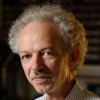 Kenneth Salisbury合作论文数Department of Computer Science, Stanford University;Department of Surgery, Stanford University4
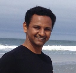 Nikunj Raghuvanshi合作论文数Microsoft Corporation4
 Ian Simon合作论文数Google Brain4dennis tom合作论文数3farah shariff合作论文数3
 Benjamin Kellenberger合作论文数Laboratory of Geo Information Science and Remote Sensing, Wageningen University3
 Caleb Robinson合作论文数AI for Good Research Lab, Microsoft;Geospatial ML Center, Microsoft3
 John P. Donoghue合作论文数Department of Neuroscience, Brown University;School of Engineering, Brown University3
 Devis Tuia合作论文数Environmental Computational Science and Earth Observation Laboratory, Environmental Engineering Institute, School of Architecture, Civil and Environmental Engineering, Ecole Polytechnique Fédérale de Lausanne3
 James Landay合作论文数Department of Computer Science, School of Engineering, Stanford University3
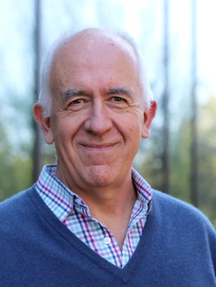 Pietro Perona合作论文数Department of Computing & Mathematical Sciences, Division of Engineering and Applied Science, California Institute of Technology3Amy K. Karlson合作论文数Microsoft Research3
 Paul H. Dietz合作论文数Computer Science Department, University of Toronto;IP Rodeo, LLC3
 Siddharth Khullar合作论文数Media Lab, MIT3
 Hrvoje Benko合作论文数Information School, University of Washington3
 Gabe Cohn合作论文数Microsoft Research Cambridge United Kingdom Redmond WA USA3




