Les auteurs utilisent une combinaison de microdonnées nationales tirées des séries IPUMS ( Integrated Public Use Microdata Series) et de microdonnées sur la population et la santé au niveau régional, spatialisées à l’échelon des ménages, et ils se servent d’un SIG historique (SIGH) pour suivre la transmission de l’infection grippale entre les enfants des écoles publiques de la péninsule nord du Michigan durant la pandémie de 1918. Les microdonnées sont des données non agrégées d’un extrême degré de précision. Les auteurs décrivent trois avantages importants de l’utilisation de microdonnées historiques dans le contexte du SIGH : la contextualisation des données dans l’espace et le temps en correspondance avec la période, l’esquive de l’erreur écologique et la capacité de naviguer librement entre les échelles micro et macro. Ils montrent le potentiel qu’offre l’étude historique des pandémies au moyen de microdonnées historiques en procédant à une analyse spatiotemporelle de cette maladie respiratoire infectieuse dans trois écoles, d’avril à juin 1918.
Building historical geographic information system (HGIS) datasets is time consuming and very expensive, especially when built at the scales that permit analysis of the lived experiences of individuals or the morphology of buildings or streets. Further, these datasets are often built exclusively in the academy, with little input from the contemporary communities they represent. In this paper, we review the use of the public in crowdsourcing historical data creation, and using the Keweenaw Time Traveler set in Michigan's Copper Country as a case study, we call for a new approach to HGIS scholarship that includes a robust public partnership to building HGIS datasets. The creation of a public participatory HGIS approach to HGIS scholarship can increase efficiencies of, public relevance in, and extend the reach of, HGIS projects beyond the academy. We have established a set of best practices that include, incorporating the public in the HGIS interface design, providing immediate public data access, contextualization of spatial data in space-time, comprehensive public history outreach in person and online, and creating affordances for the public to contribute their own historical spatial knowledge through spatial storytelling. Together, these activities can promote the long-term sustainability and success of historical data crowdsourcing projects.
Engaging Community and Spatial Humanities for Postindustrial Heritage:The Keweenaw Time Traveler Sarah Fayen Scarlett (bio), Don Lafreniere (bio), Daniel J. Trepal (bio), John D. M. Arnold (bio), and Robert Pastel (bio) The Keweenaw Time Traveler www.keweenawhistory.com The Keweenaw Time Traveler is an interactive, online historical atlas that creates a comprehensive spatial representation of the social and built environments of one of the country's first and largest extractive landscapes. Launched to the public in the summer of 2017, it combines deep mapping with digital public humanities to create a mutually beneficial online tool for researchers and community stakeholders alike. On Michigan's southern shore of Lake Superior, the Keweenaw Peninsula has an abundant built heritage that includes abandoned mine shaft buildings, former company towns, and ethnic community halls. Such sites recall the region's copper mining industry, active between 1860 and 1950, and demonstrate to tourists and residents alike the need to address the social and environmental impacts of deindustrialization. Our interdisciplinary team of researchers at Michigan Technological University is building the Keweenaw Time Traveler to empower citizens, municipal officials, and tourists, as well as academic researchers, to gain and share knowledge about this region's changing built and social environments, and to help a postindustrial community leverage its own past toward a healthier, more prosperous future. The Keweenaw Time Traveler project combines approaches from the spatial humanities, public history, and American studies. It answers the call of scholars such as David Bodenhamer to leverage the power of geospatial technologies and information to investigate the contingent and discursive relationships between people through space and time that drive American studies scholarship today.1 The project builds on foundational work in digital spatial humanities and facilitates what Anne Kelly Knowles has called "inductive visualization," [End Page 619] which promotes the discovery and interpretation of new spatial relationships.2 These relationships, analyzed using GIS technologies and methods, can drive critical inquiry about immigration, technological change, ethnic and class identities, environmental degradation, and more.3 Moreover, the Keweenaw Time Traveler's community-engaged process of development promotes access, inclusivity, and empowerment for diverse heritage constituencies.4 Following Sheila Brennan's call for public humanities projects to foster grassroots collaboration, the Keweenaw Time Traveler's platform and in situ public programming encourage a reflexive discussion about the impacts of deindustrialization and about the opportunities that the rich heritage landscape offers visitors and residents alike.5 To integrate contemporary humanities research with community-engaged practice, this project uses the concept of deep mapping, which is defined by five core principles. The map must be flexible, inviting exploration; open to accepting new sources or data; user-centric, supporting different pathways or views; and immersive, evoking experiences. The final principle, path-traceable, or supporting spatial storytelling, will be the focus of later platform developments.6 To build a deep map, the foundation of the Keweenaw Time Traveler is hundreds of georeferenced and digitized historical maps whose individual buildings and landscape features are represented in a spatiotemporal geodata-base.7 The maps and data reveal details about the region's built environments including the location, size, construction material, ownership, occupants, and civic address of over 125,000 residential, commercial, civic, and industrial structures over seventy years. The back end of this deep map is a historical spatial data infrastructure that allows for the rapid geolocation and relational linking of historical records to facilitate longitudinal research.8 Researchers have just begun using the Keweenaw Time Traveler to investigate connections between the region's built environment and children's health, to explore the role of neighborhood development in changing social power, and to model how urban watersheds and the built environment change over time.9 Public participatory initiatives at the core of this deep map facilitate the co-production of knowledge and dialogue that are vital to our public humanities goals. Three "Citizen Historian" apps offer a game-like setting where users transcribe handwritten notations on maps, categorize buildings by use, and identify building materials by matching colors. These apps were developed using open design charrettes in the winter of 2017, and draw on research in crowd-sourced heritage projects and public participatory GIS practices.10 Users have...
 Don Lafreniere合作论文数4
 Sarah Fayen Scarlett合作论文数3
 Robert Pastel合作论文数Michigan Technological University3John D. M. Arnold合作论文数2
 Ryan K. Williams合作论文数Dept Comp Sci, Stanford Univ2Rose Hildebrandt合作论文数1Gary Spikberg合作论文数1Michael Madison合作论文数1Timothy Stone合作论文数Dept Social Sci, Michigan Technol Univ1
 Luke Weidner合作论文数BGC Engn1
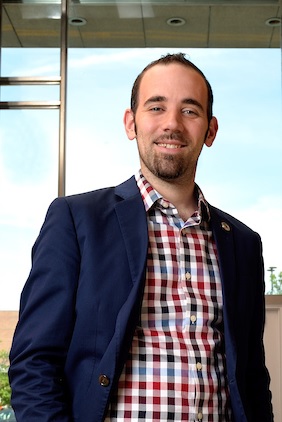 Richard Sadler合作论文数Injury Prevention Center, Medical School, University of Michigan-Ann Arbor1




